Water availability, use and trends in the srepok river catchment (vietnam)
•Télécharger en tant que PPTX, PDF•
1 j'aime•960 vues

3rd Mekong Forum on Water, Food & Energy 2013. Presentation from Session 9: Managing the impacts of dams across cascades.

Recommandé
Recommandé
Contenu connexe
Tendances
Tendances (20)
Similaire à Water availability, use and trends in the srepok river catchment (vietnam)
Similaire à Water availability, use and trends in the srepok river catchment (vietnam) (20)
Plus de CPWF Mekong
Plus de CPWF Mekong (20)
Dernier
Dernier (20)
Water availability, use and trends in the srepok river catchment (vietnam)
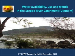
- 1. CPWF MK17 Water availability, use and trends in the Srepok River Catchment (Vietnam) 3rd Water availability, use and trends CPWF Forum, Ha Noi 20 Catchment (Vietnam) in the Srepok River November 2013
- 2. GENERAL INFOMATION Project name: Water availability, use and trends in the Srepok River Catchment (Vietnam) Duration: 10 months Commencing: 1/3/2013 Ending: 30/12/2013 Water availability, use and trends in the Srepok River Catchment (Vietnam) CPWF MK17
- 3. CPWF MK17 COLLABORATION Water availability, use and trends in the Srepok River Catchment (Vietnam)
- 4. CPWF MK17 SREPOK RIVER BASIN • Basin area: 29,500 km2 (18.264 km2 in Vietnam) • Administrative boundary: 4 provinces of Gia Lai, Dak Nong, Dak Lak and Lam Dong • Population: 1.8 million inhabitants. • Mean annual precipitation: 1560- 2528mm Water availability, use and trends in the Srepok River Catchment (Vietnam)
- 5. SREPOK RIVER BASIN: Economical Activities Agriculture Perennial plants Fishery Tourism Water availability, use and trends in the Srepok River Catchment (Vietnam) CPWF MK17
- 6. CPWF MK17 ISSUES: DROUGHT Aridity Index 1.20 1.00 Aridity Index Dry season lasts from January to August in Krong Ana, from December to June in Krong Kno and January to June in Srepok Mainstream. Buôn Ma Thuột Buôn Hồ 0.80 0.60 0.40 0.20 0.00 I II III IV V VI VII VIII IX X XI XII Month Station Giang Sơn Đức Xuyên Bridge no.14 Bản Đôn River Krông Ana Krông Knô Srepok Srepok Minimum of monthly Minimum of daily Area catchment Discharge Discharge Time Date 2 (Km ) (m3/s) (m3/s) 3180 4.67 Apr-05 3.40 21-Apr-05 3080 13.8 Apr-05 0.89 28-Dec-09 8670 18.3 Apr-05 13.4 10-Apr-98 10700 27.1 Apr-05 8.24 21-Apr-05 Water availability, use and trends in the Srepok River Catchment (Vietnam)
- 7. CPWF MK17 ISSUES: FLOOD Flooding in Krong Ana: Oct, Nov (70%) Flooding in Krong Kno: Sep, Oct (73%). Most serious flooding in Lak-Buon Trap • Historical floods o Krong Ana: Qmax=1620 m3/s (22/11/1998) o Krong Kno: Qmax=4020 m3/s (10/10/2000) o Dòng chính Srepok: Qmax=3600 m3/s (12/10/2000) Water availability, use and trends in the Srepok River Catchment (Vietnam)
- 8. CPWF MK17 RISING ISSUES: Less rainfall Rainfall decreasing year by year in dry season Drought in Krong Buk (2010) Water availability, use and trends in the Srepok River Catchment (Vietnam)
- 9. Th ỜI GIAN Water availability, use and trends in the Srepok River Catchment (Vietnam) 2013/6 2012/11 2012/4 2011/9 2011/2 2010/7 2009/12 2009/5 2008/10 2008/3 2007/8 2007/1 2006/6 2005/11 2005/4 2004/9 2004/2 2003/7 2002/12 2002/5 2001/10 2001/3 2000/8 2000/1 1999/6 1998/11 1998/4 1997/9 1997/2 1996/7 1995/12 1995/5 1994/10 1994/3 1993/8 1993/1 ĐỘ CAO TUYỆT ĐỐI MỰC NƯỚC (m) RISING ISSUES: Groundwater level decreasing CPWF MK17 ĐỒ THỊ QUAN TRẮC MỰC NƯỚC TRẠM C8a EAPHÊ - KRÔNGPACH - ĐĂK LĂK 470.000 469.000 468.000 467.000 466.000 465.000 464.000 463.000
- 10. CPWF MK17 RISING ISSUES: Groundwater level decreasing Pilot study in bazan area in Buon Ma Thuot – Ea Tul BIẾN ĐỘNG MỰC NƯỚC NGẦM VỊ TRÍ LK71T NĂM 2005 VÀ 2010 774 LK71T-2005 772 LK71T-2010 770 Mực nước (m) 768 766 764 762 760 758 12/3/2009 1/22/2010 3/13/2010 5/2/2010 6/21/2010 8/10/2010 9/29/2010 11/18/2010 1/7/2011 2/26/2011 Thời gian BIẾN ĐỘNG MỰC NƯỚC NGẦM VỊ TRÍ LK75T NĂM 2005 VÀ 2010 429 428 Mực nước (m) 427 426 425 LK75T-2005 424 LK75T-2010 423 422 421 420 12/3/2009 1/22/2010 3/13/2010 5/2/2010 6/21/2010 8/10/2010 9/29/2010 11/18/2010 1/7/2011 Thời gian Groundwater level comparison in 2005 and 2010 Water availability, use and trends in the Srepok River Catchment (Vietnam) 2/26/2011
- 11. RISING ISSUES: Flood increasing Water availability, use and trends in the Srepok River Catchment (Vietnam) CPWF MK17
- 12. RISING ISSUES: Water pollution Water availability, use and trends in the Srepok River Catchment (Vietnam) CPWF MK17
- 13. RISING ISSUES: Environmental flow Water availability, use and trends in the Srepok River Catchment (Vietnam) CPWF MK17
- 14. RISING ISSUES: River erosion Krong Kno River at downstream of Buon Tua Srah Hydropower plant (photo taken on 5/5/2013) Water availability, use and trends in the Srepok River Catchment (Vietnam) CPWF MK17
- 15. RESEARCH QUESTIONS CPWF MK17 1) What is the land use within the Srepok Catchment, and how much water is used by each land use category? 2) How do water use changes in one sector affect water uses in other sectors? 3) How many dams and reservoirs are there in the Srepok Catchment? 4) How much water is needed to sustain the catchment’s environment? 5) In what ways are the Srepok River’s flows, and surface water-groundwater interaction, affected by changes in land use within the catchment, and the construction of WSI (both existing and planned)? 6) How does/will these changes affect flows of water and sediment into Cambodia? 7) If current water use trends remain the same, how will water use in the catchment look in the future (2020 and 2050)? 8) What are the various costs and benefits of management interventions both now and in the future? Water availability, use and trends in the Srepok River Catchment (Vietnam)
- 16. RIVER SYSTEM PROPERTIES River Area (km2) Length (m) Elevation (m) Srepok 12.133 315 570 Krong Ana 3.960 215 720 - Krong Buk 478 130 590 - Krong Pach 692 74 622 - Krong Bong 809 73 950 Krông No 4620 156 683 Ia Hleo 4760 128 381 Ea Drang 977 78 391 Water availability, use and trends in the Srepok River Catchment (Vietnam) CPWF MK17
- 17. WATER RESOURCES DISTRIBUTION Water availability, use and trends in the Srepok River Catchment (Vietnam) CPWF MK17
- 18. CPWF MK17 GROUND WATER Water availability, use and trends in the Srepok River Catchment (Vietnam)
- 19. CPWF MK17 LAND USE Type of land Total Agricultural land Forestry land Specialized land Residential land Unused land Area (HA) 1,826,430 452,864 1,048,725 53,922 10,364 257,687 Water availability, use and trends in the Srepok River Catchment (Vietnam)
- 20. IRRIGATION STRUCTURE Four main irrigation subareas Ia Muer- Ea Hleo Krong Ana. Krong No. Srepok. Water availability, use and trends in the Srepok River Catchment (Vietnam) CPWF MK17
- 21. CPWF MK17 HYDROPOWER Water availability, use and trends in the Srepok River Catchment (Vietnam)
- 22. SURFACE WATER MODELLING: MIKE BASIN Water availability, use and trends in the Srepok River Catchment (Vietnam) CPWF MK17
- 23. SURFACE WATER MODELLING: MIKE BASIN Water availability, use and trends in the Srepok River Catchment (Vietnam) CPWF MK17
- 24. GROUND WATER MODELING: MIKE SHE Water availability, use and trends in the Srepok River Catchment (Vietnam) CPWF MK17
- 25. CPWF MK17 MIKE SHE: Land use map 2005 2010 2020 Water availability, use and trends in the Srepok River Catchment (Vietnam)
- 26. CPWF MK17 MIKE SHE: Results Water balance model in MIKE SHE Total Error 4 Precipitation 18809 Evapotranspiration 11751 Snow -Storage change 0 OL-Storage change 24 Irrigation 642 769 Canopy-Storage change 0 OL->river/MOUSE 2713 Boundary flow 1794 UZ-Storage change 230 Pumping 506 7194 Infilt. incl. Evap 3484 8 Base flow to River 367 Drain to river 2911 SZ-Storage change -63 Accumulated w aterbalance from 1/1/1995 to 12/24/2005. Data type : Storage depth [millimeter]. Flow Result File : H:MIKESHE_NCKHSrepok_LU2005(95_05)bom2005Srepok_LU2005(95_05)bom2005 Title : Srepok model Text : for groundw ater field northeast BMT 2005 2010 2020 Water availability, use and trends in the Srepok River Catchment (Vietnam)
- 27. FINDING: CHANGE OF WATER SOURCES CPWF MK17 Hydrological extremes occur more frequently following by reduction in rainfall during dry season and increase in flood season. Drought is more severe in recent years. River erosion, water level is reduced in many places Reduction in groundwater flow in term of volume and WL Hydropower plants store water in dry seasons and release in flood seasons leading to alteration of natural flow. Inappropriate operation could result in severe negative impacts. Water quality is degrading Water availability, use and trends in the Srepok River Catchment (Vietnam)
- 28. FINDING: CHANGE OF WATER REQUIREMENTS CPWF MK17 − Water requirement from all sectors increased since 2005 until now and in the future. − Agriculture production: As planning, total coffee area will be reduced until 2020 and 2030 together with sustainable agricultural practices including constructing a number of reservoirs. However, actual coffee area is now increasing. − Industry: Further industrialization increases demand for water. Requirement from hydropower increased from 2005 and is stable in the future. − Population increase in the area: Enlarged urban area results in higher demand Water availability, use and trends in the Srepok River Catchment (Vietnam)
- 29. FINDING: MANAGEMENT AND EXPLOITATION CPWF MK17 Water resources planning is fragmented – lacking of integrated water resources planning for the whole river. Reduction in forestry area. Lacking of throughout management of reservoir operation. Water use conflicts between sectors and upstream/downstream and within a single water supply structure Water storage is reduced. Waste in water use. Water availability, use and trends in the Srepok River Catchment (Vietnam)
- 30. FINDING: MANAGEMENT AND EXPLOITATION Too much ground water was extracted by deep wells, especially with high density in areas of coffee Wells are drilled by the farmer or private group without professional knowledge. Water availability, use and trends in the Srepok River Catchment (Vietnam) CPWF MK17
- 31. CPWF MK17 RECOMMENDATIONS Making integrated water resources planning in the Srepok river catchments. Reforesting and protecting forestry area. Complying with agricultural development plan. Developing sustainable agriculture, irrigation and choosing suitable crops. applying micro Repairing the old or less effective reservoirs and building new hydraulic works. Improving management effectiveness. between different stake holders. Negotiating Establishing Srepok RBO. Water availability, use and trends in the Srepok River Catchment (Vietnam)
- 32. CPWF MK17 THANK YOU FOR YOUR ATTENTION! Water availability, use and trends in the Srepok River Catchment (Vietnam)