SlideShare une entreprise Scribd logo
1  sur  52
Télécharger pour lire hors ligne
In-field optimization of seismic data acquisition
         by real-time subsurface imaging
 using a remote GRID computing environment

 Zeno Heilmann*, Ana M. Vallenilla*, Guido Satta*,
             and Ernesto Bonomi*
    *Centro di Ricerca, Sviluppo e Studi Superiori in Sardegna
Overview

     The Grida3 project

The basic concept of EIAGRID

    The EIAGRID portal

       Data Examples

        Conclusions
Grida3, Shared Resources Manager for
         Environmental Data Analysis and Applications

The Grida3 portal aims at
supporting problem solving and             APPLICATIONS
decision making by integrating
 resources for
      communication                          GIS Tools
      computation                                               Site
      data storage          Meteorology
                                                              Remediation
 software for
      simulation
      inversion                                                Geophysical
      visualization        Hydrology
 and human know how                                              Imaging

into a grid computing platform
for Environmental Sciences

                           Secure access     Infrastructure    User Interfaces


                                           TECHNOLOGIES
Grida3, Shared Resources Manager for
         Environmental Data Analysis and Applications

The Grida3 portal aims at
supporting problem solving and             APPLICATIONS
decision making by integrating
 resources for
      communication                          GIS Tools
      computation                                               Site
      data storage          Meteorology
                                                              Remediation
 software for
      simulation
      inversion                                                Geophysical
      visualization        Hydrology
 and human know how                                          EIAGRID
                                                                  Imaging

into a grid computing platform                                 Service
for Environmental Sciences

                           Secure access     Infrastructure    User Interfaces


                                           TECHNOLOGIES
The EIAGRID Portal
                       Main Objectives
Creating a grid computing environment for in-field QC and
Optimization of SR/GPR data acquisition by:
The EIAGRID Portal
                       Main Objectives
Creating a grid computing environment for in-field QC and
Optimization of SR/GPR data acquisition by:

                           1.   Providing a web-browser-based user
                                interface easily accessible from the field

                           2.   On-the-fly processing of the seismic field
                                data using a remote GRID environment

                           3.   Fast optimization of data analysis and
                                imaging parameters by parallel processing
                                of alternative workflows
The EIAGRID Portal
                       Main Objectives
Creating a data grid environment to facilitate analysis &
decision making in integrated multi-disciplinary studies by:

                                 1.   Providing a flexible and customizable
                                      data grid management architecture
                                      using iRODS

                                 2.   Georeferencing the data using Geo
                                      Information     System       (GIS)
                                      technologies

                                 3.   Interconnecting the different types of
                                      data by mesh-generators and data
                                      crossing techniques
Seismic reflection data acquisition
Seismic reflection data processing
     Input
Seismic Records
Seismic reflection data processing
     Input                  System
Seismic Records         Processing Phases
Seismic reflection data processing
     Input                  System
Seismic Records         Processing Phases
Seismic reflection data processing
     Input                  System
Seismic Records         Processing Phases
Seismic reflection data processing
     Input                  System
Seismic Records         Processing Phases
Seismic reflection data processing
     Input                  System                Output
Seismic Records         Processing Phases   Subsurface Image
Seismic reflection data processing
     Input                  System                Output
Seismic Records         Processing Phases   Subsurface Image
Main Problem of SR/GPR acquisition:

Real-time processing is difficult and cost intensive

 Acquisition parameters such as recording time,
 sampling interval, source strength and receiver
    spacing cannot be optimized in the field

                 Solution:
                Wireless data
           transmission + remote
          GRID computing facilities
Remote Grid Computing
Preprocessing and Visualization using SU:
   Basic preprocessing steps can be applied without installing
    the complex SU processing package.

Imaging and RSC using CRS technology:
   Data-driven CRS imaging technology---state-of-the-art in oil
    exploration---enables highly automated data processing.
   GRID deployment using high performance computing
    facilities provides the necessary computing power.

Parallel processing of different workflows:
   Cumbersome sequential optimization of processing
    workflow and processing parameters speeds up drastically.
The EIAGRID Portal
The EIAGRID Portal
Data-set uploading and format conversion


                                 Near Surface & Environment &
                                Geotechnical Geophysics: SO-14
Data-set uploading and format conversion


                                 Near Surface & Environment &
                                Geotechnical Geophysics: SO-14
Data-set uploading and format conversion


                                 Near Surface & Environment &
                                Geotechnical Geophysics: SO-14
Data-set uploading and format conversion


                                 Near Surface & Environment &
                                Geotechnical Geophysics: SO-14
Data-set uploading and format conversion


                                 Near Surface & Environment &
                                Geotechnical Geophysics: SO-14
Creating a project using the uploaded data


                                   Near Surface & Environment &
                                  Geotechnical Geophysics: SO-14
Creating a project using the uploaded data


                                   Near Surface & Environment &
                                  Geotechnical Geophysics: SO-14
Preprocessing the uploaded data


                            Near Surface & Environment &
                           Geotechnical Geophysics: SO-14
Preprocessing the uploaded data


                            Near Surface & Environment &
                           Geotechnical Geophysics: SO-14
Preprocessing the uploaded data


                            Near Surface & Environment &
                           Geotechnical Geophysics: SO-14
Displaying the jobs


                       Near Surface & Environment &
                      Geotechnical Geophysics: SO-14
Data visualization tools


                            Near Surface & Environment &
                           Geotechnical Geophysics: SO-14
CRS data processing


                       Near Surface & Environment &
                      Geotechnical Geophysics: SO-14
CRS data processing


                       Near Surface & Environment &
                      Geotechnical Geophysics: SO-14
CRS data processing


                       Near Surface & Environment &
                      Geotechnical Geophysics: SO-14
CRS data processing


                       Near Surface & Environment &
                      Geotechnical Geophysics: SO-14
CRS data processing


                       Near Surface & Environment &
                      Geotechnical Geophysics: SO-14
CRS data processing


                       Near Surface & Environment &
                      Geotechnical Geophysics: SO-14
CRS data processing


                       Near Surface & Environment &
                      Geotechnical Geophysics: SO-14
Workflows running in parallel
iRods Implementation for data-grid management


     Available actions from local spooler. The user can save, download,
                     and eliminate files from iRods space
                                                                   Near Surface & Environment &
                                                                  Geotechnical Geophysics: SO-14
iRods Implementation for data-grid management


       Data and collections management protocol implemented in
                           the remote spooler
                                                              Near Surface & Environment &
                                                             Geotechnical Geophysics: SO-14
Time domain imaging


     Results SR data    Near Surface & Environment &
                       Geotechnical Geophysics: SO-14
Time domain imaging


Published in: Deidda, G. P., Ranieri, G, Uras, G., Cosentino, P.,
Martorana, R., 2006: Geophysical investigations in the Flumendosa
River Delta, Sardinia (Italy) --- Seismic reflection imaging:
Geophysics, 71, B121–B128.


                      Results SR data            Near Surface & Environment &
                                                Geotechnical Geophysics: SO-14
Time domain imaging


     Results GPR data    Near Surface & Environment &
                        Geotechnical Geophysics: SO-14
Time domain imaging


Published in: Perroud, H., and Tygel, M., 2005, Velocity estimation by
the common-reflection-surface (CRS) method: Using ground-
penetrating radar: Geophysics, 70, 1343–1352.

                          Results GPR data          Near Surface & Environment &
                                                   Geotechnical Geophysics: SO-14
New field study using SH-waves (DIT)


         Advantage of shear wave data:
Neither ground roll nor direct waves are generated
                                          Near Surface & Environment &
                                         Geotechnical Geophysics: SO-14
Time domain imaging


Obtained using the EIAGRID portal


       Results shear wave data
                                  Near Surface & Environment &
                                 Geotechnical Geophysics: SO-14
Time domain imaging


Obtained using Seismic Processing Workshop ©
       (Parallel Geoscience Corporation)
             Results shear wave data
                                        Near Surface & Environment &
                                       Geotechnical Geophysics: SO-14
Conclusions
EIAGRID
     ...minimizes the software and hardware requirements
      needed to perform a successful SR/GPR data acquisition.
     ...reduces the complexity of data QC and choice of
      acquisition parameter for less experienced users.
     …provides fast and accurate results by using modern
      imaging technology and high performance computing.
     … facilitates the creation of an integrated geophysical
      database for environmental studies.


     Enables a wider use of SR/GPR surveys in environmental
     and earth sciences through Grid technologies
Thank you for your
   attention…
Acknowledgments

Contenu connexe

Tendances

CNN Lithology Prediction (Undergrad Thesis Jeremy Adi Padma Nagara - Universi...
CNN Lithology Prediction (Undergrad Thesis Jeremy Adi Padma Nagara - Universi...CNN Lithology Prediction (Undergrad Thesis Jeremy Adi Padma Nagara - Universi...
CNN Lithology Prediction (Undergrad Thesis Jeremy Adi Padma Nagara - Universi...Jeremy Adi
 
Periodic
PeriodicPeriodic
Periodicvisu64
 
IRJET- Analysis of Ship Detection Techniques in Remote Sensing Images
IRJET- Analysis of Ship Detection Techniques in Remote Sensing ImagesIRJET- Analysis of Ship Detection Techniques in Remote Sensing Images
IRJET- Analysis of Ship Detection Techniques in Remote Sensing ImagesIRJET Journal
 
BScThesisOskarTriebe_final
BScThesisOskarTriebe_finalBScThesisOskarTriebe_final
BScThesisOskarTriebe_finalOskar Triebe
 
AN EFFICIENT IMPLEMENTATION OF TRACKING USING KALMAN FILTER FOR UNDERWATER RO...
AN EFFICIENT IMPLEMENTATION OF TRACKING USING KALMAN FILTER FOR UNDERWATER RO...AN EFFICIENT IMPLEMENTATION OF TRACKING USING KALMAN FILTER FOR UNDERWATER RO...
AN EFFICIENT IMPLEMENTATION OF TRACKING USING KALMAN FILTER FOR UNDERWATER RO...IJCSEIT Journal
 

Tendances (6)

CNN Lithology Prediction (Undergrad Thesis Jeremy Adi Padma Nagara - Universi...
CNN Lithology Prediction (Undergrad Thesis Jeremy Adi Padma Nagara - Universi...CNN Lithology Prediction (Undergrad Thesis Jeremy Adi Padma Nagara - Universi...
CNN Lithology Prediction (Undergrad Thesis Jeremy Adi Padma Nagara - Universi...
 
Periodic
PeriodicPeriodic
Periodic
 
IRJET- Analysis of Ship Detection Techniques in Remote Sensing Images
IRJET- Analysis of Ship Detection Techniques in Remote Sensing ImagesIRJET- Analysis of Ship Detection Techniques in Remote Sensing Images
IRJET- Analysis of Ship Detection Techniques in Remote Sensing Images
 
BScThesisOskarTriebe_final
BScThesisOskarTriebe_finalBScThesisOskarTriebe_final
BScThesisOskarTriebe_final
 
Desain thesis
Desain thesisDesain thesis
Desain thesis
 
AN EFFICIENT IMPLEMENTATION OF TRACKING USING KALMAN FILTER FOR UNDERWATER RO...
AN EFFICIENT IMPLEMENTATION OF TRACKING USING KALMAN FILTER FOR UNDERWATER RO...AN EFFICIENT IMPLEMENTATION OF TRACKING USING KALMAN FILTER FOR UNDERWATER RO...
AN EFFICIENT IMPLEMENTATION OF TRACKING USING KALMAN FILTER FOR UNDERWATER RO...
 

Similaire à In field optimization of seismic data acquisition by real-time subsurface imaging using a remote grid computing environment

Generating higher accuracy digital data products by model parameter
Generating higher accuracy digital data products by model parameterGenerating higher accuracy digital data products by model parameter
Generating higher accuracy digital data products by model parameterIAEME Publication
 
IRJET- Geological Boundary Detection for Satellite Images using AI Technique
IRJET- Geological Boundary Detection for Satellite Images using AI TechniqueIRJET- Geological Boundary Detection for Satellite Images using AI Technique
IRJET- Geological Boundary Detection for Satellite Images using AI TechniqueIRJET Journal
 
A Vision-Based Mobile Platform for Seamless Indoor/Outdoor Positioning
A Vision-Based Mobile Platform for Seamless Indoor/Outdoor PositioningA Vision-Based Mobile Platform for Seamless Indoor/Outdoor Positioning
A Vision-Based Mobile Platform for Seamless Indoor/Outdoor PositioningGuillaume Gales
 
An Authoring Solution for a Façade-Based AR Platform: Infrastructure, Annota...
An Authoring Solution for  a Façade-Based AR Platform: Infrastructure, Annota...An Authoring Solution for  a Façade-Based AR Platform: Infrastructure, Annota...
An Authoring Solution for a Façade-Based AR Platform: Infrastructure, Annota...Guillaume Gales
 
D2.10 Grid-enabled Spatial Data Infrastructure serving GEOSS, INSPIRE, and UNSDI
D2.10 Grid-enabled Spatial Data Infrastructure serving GEOSS, INSPIRE, and UNSDID2.10 Grid-enabled Spatial Data Infrastructure serving GEOSS, INSPIRE, and UNSDI
D2.10 Grid-enabled Spatial Data Infrastructure serving GEOSS, INSPIRE, and UNSDIenvirogrids-blacksee
 
Two mark qn answer
Two mark qn answerTwo mark qn answer
Two mark qn answerJessy Mol
 
Towards Reliable AI-Powered Vision for Autonomous Systems
Towards Reliable AI-Powered Vision for Autonomous Systems Towards Reliable AI-Powered Vision for Autonomous Systems
Towards Reliable AI-Powered Vision for Autonomous Systems KTN
 
The GIS for the Solar Projects Development
The GIS for the Solar Projects DevelopmentThe GIS for the Solar Projects Development
The GIS for the Solar Projects DevelopmentEsri
 
grid mining
grid mininggrid mining
grid miningARNOLD
 
GI2012 cajthaml-quality
GI2012 cajthaml-qualityGI2012 cajthaml-quality
GI2012 cajthaml-qualityIGN Vorstand
 
Geographical information system and its application in horticulture
Geographical information system and its application in horticultureGeographical information system and its application in horticulture
Geographical information system and its application in horticultureAparna Veluru
 
bro_geoslam-introduction.pdf
bro_geoslam-introduction.pdfbro_geoslam-introduction.pdf
bro_geoslam-introduction.pdfYoussefZghari
 
Osgeo.wageningen kickoff event nov2012
Osgeo.wageningen kickoff event nov2012Osgeo.wageningen kickoff event nov2012
Osgeo.wageningen kickoff event nov2012pvangenuchten
 
Ar2419141919
Ar2419141919Ar2419141919
Ar2419141919IJMER
 
Tim Malthus_Towards standards for the exchange of field spectral datasets
Tim Malthus_Towards standards for the exchange of field spectral datasetsTim Malthus_Towards standards for the exchange of field spectral datasets
Tim Malthus_Towards standards for the exchange of field spectral datasetsTERN Australia
 
Big Data, Data and Information Mining for Earth Observation
Big Data, Data and Information Mining for Earth ObservationBig Data, Data and Information Mining for Earth Observation
Big Data, Data and Information Mining for Earth ObservationPier Giorgio Marchetti
 

Similaire à In field optimization of seismic data acquisition by real-time subsurface imaging using a remote grid computing environment (20)

Seminario Ernesto Bonomi, 24-05-2012
Seminario Ernesto Bonomi,  24-05-2012Seminario Ernesto Bonomi,  24-05-2012
Seminario Ernesto Bonomi, 24-05-2012
 
SmartGeo/Eiagrid portal (Guido Satta, CRS4)
SmartGeo/Eiagrid portal (Guido Satta, CRS4)SmartGeo/Eiagrid portal (Guido Satta, CRS4)
SmartGeo/Eiagrid portal (Guido Satta, CRS4)
 
Generating higher accuracy digital data products by model parameter
Generating higher accuracy digital data products by model parameterGenerating higher accuracy digital data products by model parameter
Generating higher accuracy digital data products by model parameter
 
Smart Geo. Guido Satta (Maggio 2015)
Smart Geo. Guido Satta (Maggio 2015)Smart Geo. Guido Satta (Maggio 2015)
Smart Geo. Guido Satta (Maggio 2015)
 
IRJET- Geological Boundary Detection for Satellite Images using AI Technique
IRJET- Geological Boundary Detection for Satellite Images using AI TechniqueIRJET- Geological Boundary Detection for Satellite Images using AI Technique
IRJET- Geological Boundary Detection for Satellite Images using AI Technique
 
A Vision-Based Mobile Platform for Seamless Indoor/Outdoor Positioning
A Vision-Based Mobile Platform for Seamless Indoor/Outdoor PositioningA Vision-Based Mobile Platform for Seamless Indoor/Outdoor Positioning
A Vision-Based Mobile Platform for Seamless Indoor/Outdoor Positioning
 
An Authoring Solution for a Façade-Based AR Platform: Infrastructure, Annota...
An Authoring Solution for  a Façade-Based AR Platform: Infrastructure, Annota...An Authoring Solution for  a Façade-Based AR Platform: Infrastructure, Annota...
An Authoring Solution for a Façade-Based AR Platform: Infrastructure, Annota...
 
D2.10 Grid-enabled Spatial Data Infrastructure serving GEOSS, INSPIRE, and UNSDI
D2.10 Grid-enabled Spatial Data Infrastructure serving GEOSS, INSPIRE, and UNSDID2.10 Grid-enabled Spatial Data Infrastructure serving GEOSS, INSPIRE, and UNSDI
D2.10 Grid-enabled Spatial Data Infrastructure serving GEOSS, INSPIRE, and UNSDI
 
Two mark qn answer
Two mark qn answerTwo mark qn answer
Two mark qn answer
 
Towards Reliable AI-Powered Vision for Autonomous Systems
Towards Reliable AI-Powered Vision for Autonomous Systems Towards Reliable AI-Powered Vision for Autonomous Systems
Towards Reliable AI-Powered Vision for Autonomous Systems
 
The GIS for the Solar Projects Development
The GIS for the Solar Projects DevelopmentThe GIS for the Solar Projects Development
The GIS for the Solar Projects Development
 
grid mining
grid mininggrid mining
grid mining
 
Three dimensional (3D) GIS
Three dimensional (3D) GISThree dimensional (3D) GIS
Three dimensional (3D) GIS
 
GI2012 cajthaml-quality
GI2012 cajthaml-qualityGI2012 cajthaml-quality
GI2012 cajthaml-quality
 
Geographical information system and its application in horticulture
Geographical information system and its application in horticultureGeographical information system and its application in horticulture
Geographical information system and its application in horticulture
 
bro_geoslam-introduction.pdf
bro_geoslam-introduction.pdfbro_geoslam-introduction.pdf
bro_geoslam-introduction.pdf
 
Osgeo.wageningen kickoff event nov2012
Osgeo.wageningen kickoff event nov2012Osgeo.wageningen kickoff event nov2012
Osgeo.wageningen kickoff event nov2012
 
Ar2419141919
Ar2419141919Ar2419141919
Ar2419141919
 
Tim Malthus_Towards standards for the exchange of field spectral datasets
Tim Malthus_Towards standards for the exchange of field spectral datasetsTim Malthus_Towards standards for the exchange of field spectral datasets
Tim Malthus_Towards standards for the exchange of field spectral datasets
 
Big Data, Data and Information Mining for Earth Observation
Big Data, Data and Information Mining for Earth ObservationBig Data, Data and Information Mining for Earth Observation
Big Data, Data and Information Mining for Earth Observation
 

Plus de CRS4 Research Center in Sardinia

Sequenziamento Esomico. Maria Valentini (CRS4), Cagliari, 18 Novembre 2015
Sequenziamento Esomico. Maria Valentini (CRS4), Cagliari, 18 Novembre 2015Sequenziamento Esomico. Maria Valentini (CRS4), Cagliari, 18 Novembre 2015
Sequenziamento Esomico. Maria Valentini (CRS4), Cagliari, 18 Novembre 2015CRS4 Research Center in Sardinia
 
Near Surface Geoscience Conference 2015, Turin - A Spatial Velocity Analysis ...
Near Surface Geoscience Conference 2015, Turin - A Spatial Velocity Analysis ...Near Surface Geoscience Conference 2015, Turin - A Spatial Velocity Analysis ...
Near Surface Geoscience Conference 2015, Turin - A Spatial Velocity Analysis ...CRS4 Research Center in Sardinia
 
GIS partecipativo. Laura Muscas e Valentina Spanu (CRS4), Cagliari, 21 Ottobr...
GIS partecipativo. Laura Muscas e Valentina Spanu (CRS4), Cagliari, 21 Ottobr...GIS partecipativo. Laura Muscas e Valentina Spanu (CRS4), Cagliari, 21 Ottobr...
GIS partecipativo. Laura Muscas e Valentina Spanu (CRS4), Cagliari, 21 Ottobr...CRS4 Research Center in Sardinia
 
Alfonso Damiano (Università di Cagliari) ICT per Smart Grid
Alfonso Damiano (Università di Cagliari) ICT per Smart Grid Alfonso Damiano (Università di Cagliari) ICT per Smart Grid
Alfonso Damiano (Università di Cagliari) ICT per Smart Grid CRS4 Research Center in Sardinia
 
Dinamica Molecolare e Modellistica dell'interazione di lipidi col recettore P...
Dinamica Molecolare e Modellistica dell'interazione di lipidi col recettore P...Dinamica Molecolare e Modellistica dell'interazione di lipidi col recettore P...
Dinamica Molecolare e Modellistica dell'interazione di lipidi col recettore P...CRS4 Research Center in Sardinia
 
Innovazione e infrastrutture cloud per lo sviluppo di applicativi web e mobil...
Innovazione e infrastrutture cloud per lo sviluppo di applicativi web e mobil...Innovazione e infrastrutture cloud per lo sviluppo di applicativi web e mobil...
Innovazione e infrastrutture cloud per lo sviluppo di applicativi web e mobil...CRS4 Research Center in Sardinia
 
ORDBMS e NoSQL nel trattamento dei dati geografici parte seconda. 30 Sett. 2015
ORDBMS e NoSQL nel trattamento dei dati geografici parte seconda. 30 Sett. 2015ORDBMS e NoSQL nel trattamento dei dati geografici parte seconda. 30 Sett. 2015
ORDBMS e NoSQL nel trattamento dei dati geografici parte seconda. 30 Sett. 2015CRS4 Research Center in Sardinia
 
Sistemi No-Sql e Object-Relational nella gestione dei dati geografici 30 Sett...
Sistemi No-Sql e Object-Relational nella gestione dei dati geografici 30 Sett...Sistemi No-Sql e Object-Relational nella gestione dei dati geografici 30 Sett...
Sistemi No-Sql e Object-Relational nella gestione dei dati geografici 30 Sett...CRS4 Research Center in Sardinia
 
Elementi di sismica a riflessione e Georadar (Gian Piero Deidda, UNICA)
Elementi di sismica a riflessione e Georadar (Gian Piero Deidda, UNICA)Elementi di sismica a riflessione e Georadar (Gian Piero Deidda, UNICA)
Elementi di sismica a riflessione e Georadar (Gian Piero Deidda, UNICA)CRS4 Research Center in Sardinia
 
Near Surface Geoscience Conference 2014, Athens - Real-­time or full­‐precisi...
Near Surface Geoscience Conference 2014, Athens - Real-­time or full­‐precisi...Near Surface Geoscience Conference 2014, Athens - Real-­time or full­‐precisi...
Near Surface Geoscience Conference 2014, Athens - Real-­time or full­‐precisi...CRS4 Research Center in Sardinia
 
Luigi Atzori Metabolomica: Introduzione e review di alcune applicazioni in am...
Luigi Atzori Metabolomica: Introduzione e review di alcune applicazioni in am...Luigi Atzori Metabolomica: Introduzione e review di alcune applicazioni in am...
Luigi Atzori Metabolomica: Introduzione e review di alcune applicazioni in am...CRS4 Research Center in Sardinia
 

Plus de CRS4 Research Center in Sardinia (20)

The future is close
The future is closeThe future is close
The future is close
 
The future is close
The future is closeThe future is close
The future is close
 
Presentazione Linea B2 progetto Tutti a Iscol@ 2017
Presentazione Linea B2 progetto Tutti a Iscol@ 2017Presentazione Linea B2 progetto Tutti a Iscol@ 2017
Presentazione Linea B2 progetto Tutti a Iscol@ 2017
 
Iscola linea B 2016
Iscola linea B 2016Iscola linea B 2016
Iscola linea B 2016
 
Sequenziamento Esomico. Maria Valentini (CRS4), Cagliari, 18 Novembre 2015
Sequenziamento Esomico. Maria Valentini (CRS4), Cagliari, 18 Novembre 2015Sequenziamento Esomico. Maria Valentini (CRS4), Cagliari, 18 Novembre 2015
Sequenziamento Esomico. Maria Valentini (CRS4), Cagliari, 18 Novembre 2015
 
Near Surface Geoscience Conference 2015, Turin - A Spatial Velocity Analysis ...
Near Surface Geoscience Conference 2015, Turin - A Spatial Velocity Analysis ...Near Surface Geoscience Conference 2015, Turin - A Spatial Velocity Analysis ...
Near Surface Geoscience Conference 2015, Turin - A Spatial Velocity Analysis ...
 
GIS partecipativo. Laura Muscas e Valentina Spanu (CRS4), Cagliari, 21 Ottobr...
GIS partecipativo. Laura Muscas e Valentina Spanu (CRS4), Cagliari, 21 Ottobr...GIS partecipativo. Laura Muscas e Valentina Spanu (CRS4), Cagliari, 21 Ottobr...
GIS partecipativo. Laura Muscas e Valentina Spanu (CRS4), Cagliari, 21 Ottobr...
 
Alfonso Damiano (Università di Cagliari) ICT per Smart Grid
Alfonso Damiano (Università di Cagliari) ICT per Smart Grid Alfonso Damiano (Università di Cagliari) ICT per Smart Grid
Alfonso Damiano (Università di Cagliari) ICT per Smart Grid
 
Big Data Infrastructures - Hadoop ecosystem, M. E. Piras
Big Data Infrastructures - Hadoop ecosystem, M. E. PirasBig Data Infrastructures - Hadoop ecosystem, M. E. Piras
Big Data Infrastructures - Hadoop ecosystem, M. E. Piras
 
Big Data Analytics, Giovanni Delussu e Marco Enrico Piras
 Big Data Analytics, Giovanni Delussu e Marco Enrico Piras  Big Data Analytics, Giovanni Delussu e Marco Enrico Piras
Big Data Analytics, Giovanni Delussu e Marco Enrico Piras
 
Dinamica Molecolare e Modellistica dell'interazione di lipidi col recettore P...
Dinamica Molecolare e Modellistica dell'interazione di lipidi col recettore P...Dinamica Molecolare e Modellistica dell'interazione di lipidi col recettore P...
Dinamica Molecolare e Modellistica dell'interazione di lipidi col recettore P...
 
Innovazione e infrastrutture cloud per lo sviluppo di applicativi web e mobil...
Innovazione e infrastrutture cloud per lo sviluppo di applicativi web e mobil...Innovazione e infrastrutture cloud per lo sviluppo di applicativi web e mobil...
Innovazione e infrastrutture cloud per lo sviluppo di applicativi web e mobil...
 
ORDBMS e NoSQL nel trattamento dei dati geografici parte seconda. 30 Sett. 2015
ORDBMS e NoSQL nel trattamento dei dati geografici parte seconda. 30 Sett. 2015ORDBMS e NoSQL nel trattamento dei dati geografici parte seconda. 30 Sett. 2015
ORDBMS e NoSQL nel trattamento dei dati geografici parte seconda. 30 Sett. 2015
 
Sistemi No-Sql e Object-Relational nella gestione dei dati geografici 30 Sett...
Sistemi No-Sql e Object-Relational nella gestione dei dati geografici 30 Sett...Sistemi No-Sql e Object-Relational nella gestione dei dati geografici 30 Sett...
Sistemi No-Sql e Object-Relational nella gestione dei dati geografici 30 Sett...
 
Elementi di sismica a riflessione e Georadar (Gian Piero Deidda, UNICA)
Elementi di sismica a riflessione e Georadar (Gian Piero Deidda, UNICA)Elementi di sismica a riflessione e Georadar (Gian Piero Deidda, UNICA)
Elementi di sismica a riflessione e Georadar (Gian Piero Deidda, UNICA)
 
Near Surface Geoscience Conference 2014, Athens - Real-­time or full­‐precisi...
Near Surface Geoscience Conference 2014, Athens - Real-­time or full­‐precisi...Near Surface Geoscience Conference 2014, Athens - Real-­time or full­‐precisi...
Near Surface Geoscience Conference 2014, Athens - Real-­time or full­‐precisi...
 
Luigi Atzori Metabolomica: Introduzione e review di alcune applicazioni in am...
Luigi Atzori Metabolomica: Introduzione e review di alcune applicazioni in am...Luigi Atzori Metabolomica: Introduzione e review di alcune applicazioni in am...
Luigi Atzori Metabolomica: Introduzione e review di alcune applicazioni in am...
 
Mobile Graphics (part2)
Mobile Graphics (part2)Mobile Graphics (part2)
Mobile Graphics (part2)
 
Mobile Graphics (part1)
Mobile Graphics (part1)Mobile Graphics (part1)
Mobile Graphics (part1)
 
2015 crs4-seminar-massive-models-full
2015 crs4-seminar-massive-models-full2015 crs4-seminar-massive-models-full
2015 crs4-seminar-massive-models-full
 

Dernier

How to Troubleshoot Apps for the Modern Connected Worker
How to Troubleshoot Apps for the Modern Connected WorkerHow to Troubleshoot Apps for the Modern Connected Worker
How to Troubleshoot Apps for the Modern Connected WorkerThousandEyes
 
Tech Trends Report 2024 Future Today Institute.pdf
Tech Trends Report 2024 Future Today Institute.pdfTech Trends Report 2024 Future Today Institute.pdf
Tech Trends Report 2024 Future Today Institute.pdfhans926745
 
Bajaj Allianz Life Insurance Company - Insurer Innovation Award 2024
Bajaj Allianz Life Insurance Company - Insurer Innovation Award 2024Bajaj Allianz Life Insurance Company - Insurer Innovation Award 2024
Bajaj Allianz Life Insurance Company - Insurer Innovation Award 2024The Digital Insurer
 
Axa Assurance Maroc - Insurer Innovation Award 2024
Axa Assurance Maroc - Insurer Innovation Award 2024Axa Assurance Maroc - Insurer Innovation Award 2024
Axa Assurance Maroc - Insurer Innovation Award 2024The Digital Insurer
 
Scaling API-first – The story of a global engineering organization
Scaling API-first – The story of a global engineering organizationScaling API-first – The story of a global engineering organization
Scaling API-first – The story of a global engineering organizationRadu Cotescu
 
GenAI Risks & Security Meetup 01052024.pdf
GenAI Risks & Security Meetup 01052024.pdfGenAI Risks & Security Meetup 01052024.pdf
GenAI Risks & Security Meetup 01052024.pdflior mazor
 
How to convert PDF to text with Nanonets
How to convert PDF to text with NanonetsHow to convert PDF to text with Nanonets
How to convert PDF to text with Nanonetsnaman860154
 
Artificial Intelligence: Facts and Myths
Artificial Intelligence: Facts and MythsArtificial Intelligence: Facts and Myths
Artificial Intelligence: Facts and MythsJoaquim Jorge
 
Strategize a Smooth Tenant-to-tenant Migration and Copilot Takeoff
Strategize a Smooth Tenant-to-tenant Migration and Copilot TakeoffStrategize a Smooth Tenant-to-tenant Migration and Copilot Takeoff
Strategize a Smooth Tenant-to-tenant Migration and Copilot Takeoffsammart93
 
A Domino Admins Adventures (Engage 2024)
A Domino Admins Adventures (Engage 2024)A Domino Admins Adventures (Engage 2024)
A Domino Admins Adventures (Engage 2024)Gabriella Davis
 
The 7 Things I Know About Cyber Security After 25 Years | April 2024
The 7 Things I Know About Cyber Security After 25 Years | April 2024The 7 Things I Know About Cyber Security After 25 Years | April 2024
The 7 Things I Know About Cyber Security After 25 Years | April 2024Rafal Los
 
Workshop - Best of Both Worlds_ Combine KG and Vector search for enhanced R...
Workshop - Best of Both Worlds_ Combine  KG and Vector search for  enhanced R...Workshop - Best of Both Worlds_ Combine  KG and Vector search for  enhanced R...
Workshop - Best of Both Worlds_ Combine KG and Vector search for enhanced R...Neo4j
 
08448380779 Call Girls In Diplomatic Enclave Women Seeking Men
08448380779 Call Girls In Diplomatic Enclave Women Seeking Men08448380779 Call Girls In Diplomatic Enclave Women Seeking Men
08448380779 Call Girls In Diplomatic Enclave Women Seeking MenDelhi Call girls
 
Boost PC performance: How more available memory can improve productivity
Boost PC performance: How more available memory can improve productivityBoost PC performance: How more available memory can improve productivity
Boost PC performance: How more available memory can improve productivityPrincipled Technologies
 
GenCyber Cyber Security Day Presentation
GenCyber Cyber Security Day PresentationGenCyber Cyber Security Day Presentation
GenCyber Cyber Security Day PresentationMichael W. Hawkins
 
Strategies for Landing an Oracle DBA Job as a Fresher
Strategies for Landing an Oracle DBA Job as a FresherStrategies for Landing an Oracle DBA Job as a Fresher
Strategies for Landing an Oracle DBA Job as a FresherRemote DBA Services
 
ProductAnonymous-April2024-WinProductDiscovery-MelissaKlemke
ProductAnonymous-April2024-WinProductDiscovery-MelissaKlemkeProductAnonymous-April2024-WinProductDiscovery-MelissaKlemke
ProductAnonymous-April2024-WinProductDiscovery-MelissaKlemkeProduct Anonymous
 
presentation ICT roal in 21st century education
presentation ICT roal in 21st century educationpresentation ICT roal in 21st century education
presentation ICT roal in 21st century educationjfdjdjcjdnsjd
 
Understanding Discord NSFW Servers A Guide for Responsible Users.pdf
Understanding Discord NSFW Servers A Guide for Responsible Users.pdfUnderstanding Discord NSFW Servers A Guide for Responsible Users.pdf
Understanding Discord NSFW Servers A Guide for Responsible Users.pdfUK Journal
 
08448380779 Call Girls In Friends Colony Women Seeking Men
08448380779 Call Girls In Friends Colony Women Seeking Men08448380779 Call Girls In Friends Colony Women Seeking Men
08448380779 Call Girls In Friends Colony Women Seeking MenDelhi Call girls
 

Dernier (20)

How to Troubleshoot Apps for the Modern Connected Worker
How to Troubleshoot Apps for the Modern Connected WorkerHow to Troubleshoot Apps for the Modern Connected Worker
How to Troubleshoot Apps for the Modern Connected Worker
 
Tech Trends Report 2024 Future Today Institute.pdf
Tech Trends Report 2024 Future Today Institute.pdfTech Trends Report 2024 Future Today Institute.pdf
Tech Trends Report 2024 Future Today Institute.pdf
 
Bajaj Allianz Life Insurance Company - Insurer Innovation Award 2024
Bajaj Allianz Life Insurance Company - Insurer Innovation Award 2024Bajaj Allianz Life Insurance Company - Insurer Innovation Award 2024
Bajaj Allianz Life Insurance Company - Insurer Innovation Award 2024
 
Axa Assurance Maroc - Insurer Innovation Award 2024
Axa Assurance Maroc - Insurer Innovation Award 2024Axa Assurance Maroc - Insurer Innovation Award 2024
Axa Assurance Maroc - Insurer Innovation Award 2024
 
Scaling API-first – The story of a global engineering organization
Scaling API-first – The story of a global engineering organizationScaling API-first – The story of a global engineering organization
Scaling API-first – The story of a global engineering organization
 
GenAI Risks & Security Meetup 01052024.pdf
GenAI Risks & Security Meetup 01052024.pdfGenAI Risks & Security Meetup 01052024.pdf
GenAI Risks & Security Meetup 01052024.pdf
 
How to convert PDF to text with Nanonets
How to convert PDF to text with NanonetsHow to convert PDF to text with Nanonets
How to convert PDF to text with Nanonets
 
Artificial Intelligence: Facts and Myths
Artificial Intelligence: Facts and MythsArtificial Intelligence: Facts and Myths
Artificial Intelligence: Facts and Myths
 
Strategize a Smooth Tenant-to-tenant Migration and Copilot Takeoff
Strategize a Smooth Tenant-to-tenant Migration and Copilot TakeoffStrategize a Smooth Tenant-to-tenant Migration and Copilot Takeoff
Strategize a Smooth Tenant-to-tenant Migration and Copilot Takeoff
 
A Domino Admins Adventures (Engage 2024)
A Domino Admins Adventures (Engage 2024)A Domino Admins Adventures (Engage 2024)
A Domino Admins Adventures (Engage 2024)
 
The 7 Things I Know About Cyber Security After 25 Years | April 2024
The 7 Things I Know About Cyber Security After 25 Years | April 2024The 7 Things I Know About Cyber Security After 25 Years | April 2024
The 7 Things I Know About Cyber Security After 25 Years | April 2024
 
Workshop - Best of Both Worlds_ Combine KG and Vector search for enhanced R...
Workshop - Best of Both Worlds_ Combine  KG and Vector search for  enhanced R...Workshop - Best of Both Worlds_ Combine  KG and Vector search for  enhanced R...
Workshop - Best of Both Worlds_ Combine KG and Vector search for enhanced R...
 
08448380779 Call Girls In Diplomatic Enclave Women Seeking Men
08448380779 Call Girls In Diplomatic Enclave Women Seeking Men08448380779 Call Girls In Diplomatic Enclave Women Seeking Men
08448380779 Call Girls In Diplomatic Enclave Women Seeking Men
 
Boost PC performance: How more available memory can improve productivity
Boost PC performance: How more available memory can improve productivityBoost PC performance: How more available memory can improve productivity
Boost PC performance: How more available memory can improve productivity
 
GenCyber Cyber Security Day Presentation
GenCyber Cyber Security Day PresentationGenCyber Cyber Security Day Presentation
GenCyber Cyber Security Day Presentation
 
Strategies for Landing an Oracle DBA Job as a Fresher
Strategies for Landing an Oracle DBA Job as a FresherStrategies for Landing an Oracle DBA Job as a Fresher
Strategies for Landing an Oracle DBA Job as a Fresher
 
ProductAnonymous-April2024-WinProductDiscovery-MelissaKlemke
ProductAnonymous-April2024-WinProductDiscovery-MelissaKlemkeProductAnonymous-April2024-WinProductDiscovery-MelissaKlemke
ProductAnonymous-April2024-WinProductDiscovery-MelissaKlemke
 
presentation ICT roal in 21st century education
presentation ICT roal in 21st century educationpresentation ICT roal in 21st century education
presentation ICT roal in 21st century education
 
Understanding Discord NSFW Servers A Guide for Responsible Users.pdf
Understanding Discord NSFW Servers A Guide for Responsible Users.pdfUnderstanding Discord NSFW Servers A Guide for Responsible Users.pdf
Understanding Discord NSFW Servers A Guide for Responsible Users.pdf
 
08448380779 Call Girls In Friends Colony Women Seeking Men
08448380779 Call Girls In Friends Colony Women Seeking Men08448380779 Call Girls In Friends Colony Women Seeking Men
08448380779 Call Girls In Friends Colony Women Seeking Men
 

In field optimization of seismic data acquisition by real-time subsurface imaging using a remote grid computing environment

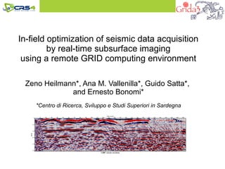
  • 1. In-field optimization of seismic data acquisition by real-time subsurface imaging using a remote GRID computing environment Zeno Heilmann*, Ana M. Vallenilla*, Guido Satta*, and Ernesto Bonomi* *Centro di Ricerca, Sviluppo e Studi Superiori in Sardegna
  • 2. Overview The Grida3 project The basic concept of EIAGRID The EIAGRID portal Data Examples Conclusions
  • 3. Grida3, Shared Resources Manager for Environmental Data Analysis and Applications The Grida3 portal aims at supporting problem solving and APPLICATIONS decision making by integrating  resources for  communication GIS Tools  computation Site  data storage Meteorology Remediation  software for  simulation  inversion Geophysical  visualization Hydrology  and human know how Imaging into a grid computing platform for Environmental Sciences Secure access Infrastructure User Interfaces TECHNOLOGIES
  • 4. Grida3, Shared Resources Manager for Environmental Data Analysis and Applications The Grida3 portal aims at supporting problem solving and APPLICATIONS decision making by integrating  resources for  communication GIS Tools  computation Site  data storage Meteorology Remediation  software for  simulation  inversion Geophysical  visualization Hydrology  and human know how EIAGRID Imaging into a grid computing platform Service for Environmental Sciences Secure access Infrastructure User Interfaces TECHNOLOGIES
  • 5. The EIAGRID Portal Main Objectives Creating a grid computing environment for in-field QC and Optimization of SR/GPR data acquisition by:
  • 6. The EIAGRID Portal Main Objectives Creating a grid computing environment for in-field QC and Optimization of SR/GPR data acquisition by: 1. Providing a web-browser-based user interface easily accessible from the field 2. On-the-fly processing of the seismic field data using a remote GRID environment 3. Fast optimization of data analysis and imaging parameters by parallel processing of alternative workflows
  • 7. The EIAGRID Portal Main Objectives Creating a data grid environment to facilitate analysis & decision making in integrated multi-disciplinary studies by: 1. Providing a flexible and customizable data grid management architecture using iRODS 2. Georeferencing the data using Geo Information System (GIS) technologies 3. Interconnecting the different types of data by mesh-generators and data crossing techniques
  • 8. The EIAGRID Portal Main Objectives Creating a data grid environment to facilitate analysis & decision making in integrated multi-disciplinary studies by: 1. Providing a flexible and customizable data grid management architecture using iRODS 2. Georeferencing the data using Geo Information System (GIS) technologies 3. Interconnecting the different types of data by mesh-generators and data crossing techniques
  • 10. Seismic reflection data processing Input Seismic Records
  • 11. Seismic reflection data processing Input System Seismic Records Processing Phases
  • 12. Seismic reflection data processing Input System Seismic Records Processing Phases
  • 13. Seismic reflection data processing Input System Seismic Records Processing Phases
  • 14. Seismic reflection data processing Input System Seismic Records Processing Phases
  • 15. Seismic reflection data processing Input System Output Seismic Records Processing Phases Subsurface Image
  • 16. Seismic reflection data processing Input System Output Seismic Records Processing Phases Subsurface Image
  • 17. Main Problem of SR/GPR acquisition: Real-time processing is difficult and cost intensive  Acquisition parameters such as recording time, sampling interval, source strength and receiver spacing cannot be optimized in the field Solution: Wireless data transmission + remote GRID computing facilities
  • 18. Remote Grid Computing Preprocessing and Visualization using SU:  Basic preprocessing steps can be applied without installing the complex SU processing package. Imaging and RSC using CRS technology:  Data-driven CRS imaging technology---state-of-the-art in oil exploration---enables highly automated data processing.  GRID deployment using high performance computing facilities provides the necessary computing power. Parallel processing of different workflows:  Cumbersome sequential optimization of processing workflow and processing parameters speeds up drastically.
  • 21. Data-set uploading and format conversion Near Surface & Environment & Geotechnical Geophysics: SO-14
  • 22. Data-set uploading and format conversion Near Surface & Environment & Geotechnical Geophysics: SO-14
  • 23. Data-set uploading and format conversion Near Surface & Environment & Geotechnical Geophysics: SO-14
  • 24. Data-set uploading and format conversion Near Surface & Environment & Geotechnical Geophysics: SO-14
  • 25. Data-set uploading and format conversion Near Surface & Environment & Geotechnical Geophysics: SO-14
  • 26. Creating a project using the uploaded data Near Surface & Environment & Geotechnical Geophysics: SO-14
  • 27. Creating a project using the uploaded data Near Surface & Environment & Geotechnical Geophysics: SO-14
  • 28. Preprocessing the uploaded data Near Surface & Environment & Geotechnical Geophysics: SO-14
  • 29. Preprocessing the uploaded data Near Surface & Environment & Geotechnical Geophysics: SO-14
  • 30. Preprocessing the uploaded data Near Surface & Environment & Geotechnical Geophysics: SO-14
  • 31. Displaying the jobs Near Surface & Environment & Geotechnical Geophysics: SO-14
  • 32. Data visualization tools Near Surface & Environment & Geotechnical Geophysics: SO-14
  • 33. CRS data processing Near Surface & Environment & Geotechnical Geophysics: SO-14
  • 34. CRS data processing Near Surface & Environment & Geotechnical Geophysics: SO-14
  • 35. CRS data processing Near Surface & Environment & Geotechnical Geophysics: SO-14
  • 36. CRS data processing Near Surface & Environment & Geotechnical Geophysics: SO-14
  • 37. CRS data processing Near Surface & Environment & Geotechnical Geophysics: SO-14
  • 38. CRS data processing Near Surface & Environment & Geotechnical Geophysics: SO-14
  • 39. CRS data processing Near Surface & Environment & Geotechnical Geophysics: SO-14
  • 41. iRods Implementation for data-grid management Available actions from local spooler. The user can save, download, and eliminate files from iRods space Near Surface & Environment & Geotechnical Geophysics: SO-14
  • 42. iRods Implementation for data-grid management Data and collections management protocol implemented in the remote spooler Near Surface & Environment & Geotechnical Geophysics: SO-14
  • 43. Time domain imaging Results SR data Near Surface & Environment & Geotechnical Geophysics: SO-14
  • 44. Time domain imaging Published in: Deidda, G. P., Ranieri, G, Uras, G., Cosentino, P., Martorana, R., 2006: Geophysical investigations in the Flumendosa River Delta, Sardinia (Italy) --- Seismic reflection imaging: Geophysics, 71, B121–B128. Results SR data Near Surface & Environment & Geotechnical Geophysics: SO-14
  • 45. Time domain imaging Results GPR data Near Surface & Environment & Geotechnical Geophysics: SO-14
  • 46. Time domain imaging Published in: Perroud, H., and Tygel, M., 2005, Velocity estimation by the common-reflection-surface (CRS) method: Using ground- penetrating radar: Geophysics, 70, 1343–1352. Results GPR data Near Surface & Environment & Geotechnical Geophysics: SO-14
  • 47. New field study using SH-waves (DIT) Advantage of shear wave data: Neither ground roll nor direct waves are generated Near Surface & Environment & Geotechnical Geophysics: SO-14
  • 48. Time domain imaging Obtained using the EIAGRID portal Results shear wave data Near Surface & Environment & Geotechnical Geophysics: SO-14
  • 49. Time domain imaging Obtained using Seismic Processing Workshop © (Parallel Geoscience Corporation) Results shear wave data Near Surface & Environment & Geotechnical Geophysics: SO-14
  • 50. Conclusions EIAGRID  ...minimizes the software and hardware requirements needed to perform a successful SR/GPR data acquisition.  ...reduces the complexity of data QC and choice of acquisition parameter for less experienced users.  …provides fast and accurate results by using modern imaging technology and high performance computing.  … facilitates the creation of an integrated geophysical database for environmental studies. Enables a wider use of SR/GPR surveys in environmental and earth sciences through Grid technologies
  • 51. Thank you for your attention…