
Recommandé
Recommandé
Contenu connexe
Tendances
Tendances (20)
En vedette
En vedette (20)
Similaire à Clad agm intro_dave_gilvear
Similaire à Clad agm intro_dave_gilvear (20)
Plus de CarbonLandscapes
Clad agm intro_dave_gilvear
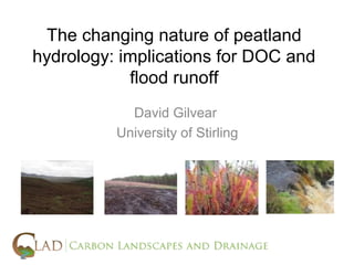
- 1. The changing nature of peatland hydrology: implications for DOC and flood runoff David Gilvear University of Stirling
- 2. Presentation prompted by: (i) Recent comment to me by an employee of RSPB with extensive field experience that “the peat bog up there acts as a sponge (ii) Frustration in 2009 while undertaking a project on natural flood management. Difference of opinions between policy makers and scientists could not be reconciled (iii) Not having the “bottle” to resist Susan Waldron’s suggestion I give a paper after having opened my big trap
- 3. Aims: (i) to explore level of agreement between the views of the scientific community and the traditional and “stakeholders” perception of peatlands and hydrology. (ii) to review chronology of peatland hydrological research in the UK and how our understanding has developed and the significance for flood generation and DOC export. (iii) raise awareness of how changing precipitation patterns may be critical in terms of peatland hydrology and runoff in the future (as well as land use)
- 4. The “stakeholder view” • Rain falling in the hills, or melting in the spring, should under natural conditions, filter slowly through bog, heath ……. (SNH, “Ill Fares the Land”) • Rainfall which used to be absorbed by peat bogs, rushes through these moorland drains into streams and lowland rivers .….. Restoration of these peat bogs will not only benefit precious wildlife habitat, but also reduce run-off (Natural England) • ““the peat bog up there acts as a sponge” (RSPB pers comm) • What are the hydrological processes that results in peat bogs attenuating flood hydrographs ? “they just do” (Scottish Government pers comm) • “Lewis peatlands would have been devastated by the construction of 181 giant turbines and 88 miles of roads … disrupted the hydrology of the peat bog, releasing thousands of tons of CO2 into the atmosphere”. (Struan Stevenson, MEP, 2008)
- 5. The “scientists view - runoff ” • “The idea that peatlands soak up water is a myth in many areas because the water table in an intact wetland will be close to the surface and with additional inputs of water, surface runoff may be readily generated” (Black and Gilvear, 2009). • A study by Jo Holden and Tim Burt on the Moor House catchment in the Pennines suggests that 80% of runoff is via overland flow. • Hydrological regime of Trout Beck, a rare example of a peatland catchment with flow gauging data ,has been shown to be flashy
- 6. Holden 2005 The “scientists view” • The idea that peatlands soak up water is probably a myth in many areas because the water table in an intact wetland will be close to the surface and with additional inputs of water, surface runoff may be readily generated. A study by Jo Holden and Tim Burt on the Moor House catchment in the Pennines suggests that 80% of runoff is via overland flow. • Hydrological regime of Trout Beck, a rare example of a peatland catchment with flow gauging data ,has been shown to be flashy 5)
- 7. View across Loch Fyne; October 2010 within 30 minutes of start of rainfall event
- 8. The “scientists view – runoff and drainage” • Peat soils of Plynlimon were deemed WRAP 5 - “very low infiltration capacity with a flashy flood response” (Farquharson (1978). I of H (1991) classified the soils as HOST 14 (water table depth > 2 m). Chappel and Trenan (1992) used this to infer that mapping peatland hydrology was “over generalised and inconsistent”. • Institute of Hydrology (1972) “in the short-term drained peat may be a better sponge than an intact mire” • Coalburn catchment research showed that flood peaks were increased by 30% as a result of drainage ditching (Robinson, 1986). • Robinson (1985,98) showed drainage of peat increased runoff response under wet conditions due to reduction in transit times but larger antecedent soil moisture was then apparent • Gripping – There is ongoing scientific debate as to whether reduced travel time or increased storage effect dominates (e.g. Robinson et al., 1991; Gunn and Walker, 2000). Lane (2003) concluded that the effect on flood runoff depends upon local topography and nature of the network. Thus the effect of blocking will be catchment specific.
- 9. Presentation aims: (i) to explore level of discrepancy between scientific community and the traditional and “stakeholder” perception of peatland runoff. (ii) to review how are knowledge of peatland hydrological processes has changed and significance for flooding and DOC export. (iii) consider the significance of changing precipitation patterns on peatland runoff
- 10. Hydrological theory • The physical understanding of the rates with which water moves through the environment has long-distant origins. In 1856, Henri Darcy put forward his theory to predict the rate at which water moves below the ground surface through natural materials – the so-called Darcy’s Law. This states that the rate of flow is accelerated by the pressure gradient, but regulated by the hydraulic conductivity of the materials through which it is flowing. • Above the ground surface, the so-called Manning equation was first proposed in 1867 and later developed by the Irish engineer Robert Manning. A key component is Mannings ‘n’ an estimate of surface roughness • Peat is 90-98% water by mass and water table for majority of time is within 30 cm of surface
- 11. Massive progress in hillslope hydrology and runoff (1970s>)
- 13. Key variables influencing runoff identified • Surface roughness (controls rate of overland and channelised flow) • Slope and topography (hollows/concave slopes) • Infiltration capacity (not really important under natural conditions) • Hydraulic conductivity (micropores and macropores) • Antecedent soil moisture (drives Saturated overland flow) • Precipitation intensity ( affects rate of runoff) • Drainage density (related to flood peaks) • Drainage pattern (flood peak conveyance)
- 14. Drainage density Wishart and Warburton (2001) by comparing 1951 and 1983 aerial photographs of the Cheviot Hills identified that footpath erosion has created preferential flow paths that in effect increase the natural drainage density.
- 15. Despite widespread (8%) distribution of peatlands hillslope UK hydrology generally avoided peatlands. Hydrological models developed solely on raised bogs. Had to look to Russia and Scandenavia for knowledge Knowledge in UK by-product of upland forestry and water yield studies by Institute of Hydrology
- 16. Chronology of research on UK peat hydrology 70s/80s – Acrotelm/catotelm model; Soil hydrology classification; water table drawdown around drainage ditches. Drainage and flooding including some peatlands. 1990s – Raised bog hydrology; affects of drainage on nutrients initiated; Studies of hydraulic conductivity in peat 2000s – Explosion in interest but geographically focussed; DOC loss and runoff studies on intact, drained and burned catchments; Use of new techniques – GPR; LiDAR, hyper- spectral remote sensing; High temporal resolution monitoring of DOC
- 17. Early peatland hydrology centred around water table elevations and impacts of diching on vegetation – precursor to field of hydro-ecology Based on 2 layer acrotelm-catotelm model Burke(1975) 1.83 metres 15-20cm lowering (4 metre spacing) - Peat Knight et al. (3 metre spacing 10 cm lowering) Blanket Bog, Scotland Rayment and Cooper (1968); 11 metres sedge peat
- 18. Recent Advances • Much of the time peatland water table at surface at base of slopes and in hollows within intact peatlands (dynamic contributing areas and saturated overland; non-linear response thus likely) • Macropores now shown to be highly prevalent in peatlands. (Observed in all 160 peatlands examined by Joe Holden (2004); Andy Baird (1997) estimated 30% of runoff). Use of GPR. • Small-scale processes now seen important in terms of water movement and at hillslope-scale variety of flow pathways and residence times. Multiple flow pathways (upward and downward; macro-pore flow; re-emerging sub-surface water) and complex 3D hydrology
- 21. Significance of advances in peatland hydrology to DOC • Peat pipes which when full with water will convey flow at high velocities and when not full possibility of oxidation Thus may be an important source of DOC and POC • Presence of rapid runoff pathways may exert an important control on DOC and POC export • Drained peat results has lower water tables and hence space over which aerobic processes can operate. On re- wetting macropores may still exists that can act as a source and mode of water and nutrient export. However contrasting result as to effect of drainage on DOC
- 22. Significance of advances in peatland hydrology to flooding • Saturated overland flow and peat pipes are hydrological processes that create the flashy regimes observed • Flood runoff may be generated from specific zones within peatlands (sensitivity to drainage) • A non-linear response between rainfall and flood runoff is to be expected according to antecedent conditions • Drained peat may create additional rapid flow pathways that are irreversible; two competing impacts on flood generation – storage capacity increased but accelerated flow pathways • Pipeflow can bypass blocking of grips
- 23. More general significance of advances in peatland hydrology • Spatial and temporal complexity is an inherent trait of peatland hydrology. Need to capture this at landscape scale. • Peatlands should not be considered as solution to flooding problem but sound land management is an issue. • Location of peatlands and human modifications in the catchment context and upscaling is important and a complex. Contributes to source of debate about gripping and drainage • Small scale hydrological processes drive carbon sequestration and release from peatlands and thus sound knowledge is critical
- 24. Further hydrological research needs • DOC and POC sampling still does not fully account for flashy nature of peatland catchments • There is needs to improve our ability to predict the distribution of water table depths, runoff pathways; scope via LiDAR (coverage limited in Scotland), thermal remote sensing and modelling. Hydromorphic mapping as well as vegetation mapping can assist mapping “runoff vulnerable zones”. • Further hillslope hydrological studies coupled to modelling would improve situation further. Need to integrate with hydrochemistry and ecology
- 25. Presentation aims: (i) to explore level of discrepancy between scientific community and the traditional and “stakeholder” perception of peatland runoff. (ii) to review how are knowledge of peatland hydrological processes has changed and significance for flooding and DOC export. (iii) consider the significance of changing precipitation patterns on peatland runoff
- 26. Hydroclimatic variability changing •Wetter winters forecast – Increased likelihood of saturation •Summer droughts periods predicted - drop in summer water tables likely and possibility of associated vegetation community change •Autumnal runoff roughly the same •Likely to exacerbate flood and DOC potential?
- 27. Total precipitation Days of heavy rain (>10mm) Total precipitation
- 30. Concluding remarks - 3Cs •COMMUNICATION: The scientific community working on peatland hydrology needs to be better at communicating our science and reasons for uncertainty •COMPLEXITY: The advances made in understanding of peatland hydrology at the local scale need to be up-scaled and integrated in to other area of carbon landscape science. However it is apparent that peatland hydrology is a complex multi-scalar 3D problem and peatland hydrology is still in it infancy. •CHANGE Need to try and determine future changes in peatland hydrology given hydrological change scenarios and evaluate significance for flooding and DOC export
- 32. • Effect of flood magnitude – many NFM measures may be most effective in small floods, and become less effective, and less noticeable in terms of flood attenuation, in larger floods, e.g. due to the water-slowing effects becoming ‘drowned out’ by rising water levels. • • Effects of local climate and preceding weather conditions – the general wetness of an area, as illustrated by its mean annual rainfall, and the specific pattern of rainfall/snowmelt in the days or weeks leading up to a flood event, will affect soil wetness conditions and so affect the scope for water to be stored below the ground surface and lead to delayed runoff. The direction a storm tracks across the catchment can also massively affect the flood hydrograph shape. • • Physical characteristics of the upstream catchment – soils types and depths, vegetation cover, the permeability of the underlying bedrock and the steepness of catchment slopes will all control the rates at which water in a catchment will travel downstream. Principally, the distinction is made between ‘quick flow’ travelling either over the ground surface or at shallow depths below the surface, and ‘slow flow’ which involves travel by deeper or poorly-defined pathways. The same characteristics also control the amount of water which can be stored below the ground surface, which in turn controls the timing and intensity of quick flow, and so also flooding. • • Type, size, shape and location of NFM features – these also control the flood-attenuating effectiveness of NFM features. Location is particularly important: in some cases, it might be that because of runoff from a larger adjacent catchment area, the interests of flood management may best be served by not attenuating runoff, e.g. because of an existing pond, loch or wetland in the adjacent catchment (note that in planning NFM implementation, it will be vital to define which downstream location is the target of protection). The type of measure(s) deployed is also very important: there are many types of catchment intervention from which to choose.
- 33. Implications in terms of peatland hydrology Complex hydrology Instantaneous overland flow Throughflow via micro and macro pores Upward and downward water movement Re-emerging subsurface water
- 34. • DRAINAGE DITCH (GRIP) BLOCKING • • Process impact - There is still inadequate scientific understanding of peat hydrology to fully understand the effect of drainage ditches on flood generation and hence the flood response to blocking in all situations. • • Gripping – There is ongoing scientific debate as to whether reduced travel time or increased storage effect dominates (Hudson et al., 1997; Robinson et al., 1991; Gunn and Walker, 2000). Lane (2003) using a SCIMAP toll and LiDAR derived topographic data concludes that the effect on flood runoff depends upon local topography and nature of the network. Thus the effect of blocking with be catchment specific – in the specific study drainage was shown to reduce time to peaks. • • Weight of evidence – (COMPLEX) still continued scientific debate but possibly in more cases than not reduced travel times dominates (e.g. Gunn and Walker, 2000) and thus a flashier response is produced. Therefore drainage blocking may be an appropriate technique. Holden (pers comm.) however emphasises that drainage ditch blocking should be targeted according to topography and ditch location. He also states that in England too much money has been spent on blocking grips spent without assessment of priority zones for blocking. Also shown that intensive continuous maintenance is needed. • • On-going – work at Wharfedale by Holden (2007) on effect of grip blocking on flood peaks at the catchment scale. Work by Labadz on the River Ashop in the Derbyshore High Peak.
- 35. Courtesy of James Curran, SEPA
- 36. Strategic Research domain Strategic planning needs User needs Pre-operational needs Policy Operational domain needs Tactical Short-term Time horizon Next 10 years
- 37. The “politics of science, policy and action” • Scientific uncertainty is perceived as unhelpful to policy makers and land managers • Science can “get in the way” of decision-making where multiple drivers. Decision makers often need considerable ammunition to get action. • Statistical testing is recognised as providing rigour in the analysis of observations, and provides results with a quantified level of confidence. It is recognised practice in many areas of science that statistical testing of quantitative data will be undertaken at a ‘5% significance level’. Does not equate with knowledge exchange requirement
- 38. • DRAINAGE DITCH (GRIP) BLOCKING • • Process impact - There is still inadequate scientific understanding of peat hydrology to fully understand the effect of drainage ditches on flood generation and hence the flood response to blocking in all situations. • • Gripping – There is ongoing scientific debate as to whether reduced travel time or increased storage effect dominates (Hudson et al., 1997; Robinson et al., 1991; Gunn and Walker, 2000). Lane (2003) using a SCIMAP toll and LiDAR derived topographic data concludes that the effect on flood runoff depends upon local topography and nature of the network. Thus the effect of blocking with be catchment specific – in the specific study drainage was shown to reduce time to peaks. • • Weight of evidence – (COMPLEX) still continued scientific debate but possibly in more cases than not reduced travel times dominates (e.g. Gunn and Walker, 2000) and thus a flashier response is produced. Therefore drainage blocking may be an appropriate technique. Holden (pers comm.) however emphasises that drainage ditch blocking should be targeted according to topography and ditch location. He also states that in England too much money has been spent on blocking grips spent without assessment of priority zones for blocking. Also shown that intensive continuous maintenance is needed. • • On-going – work at Wharfedale by Holden (2007) on effect of grip blocking on flood peaks at the catchment scale. Work by Labadz on the River Ashop in the Derbyshore High Peak.
- 39. • Should not expect simple relationships between land management activities and flood generation • This complexity does not lend itself to practicality of peatland management
- 40. Small-scale processes important in terms of water movement and at hillslope-scale variety of flow pathways and residence times
- 41. • • CONTROL OF HEATHER BURNS • • Process impact - There is a poor scientific understanding of how heather burning might affect flood generation but high intensity fires may reduce infiltration by capping the soil. More known on sediment loss impacts • • Hydrological response – No known information to date. • • Weight of evidence – (NONE) No weight of evidence • • On-going – PhD studentship advertised for autumn 2009 at the University of Leeds. Some work being undertaken by Labadz at Nottingham Trent University on the Derbyshire High Peak. • • Policy relevance – the activity is covered by primary legislation and the Muirburn Code (Scottish Government, 2008), which provides requirements to be met under the Single Farm Payment regime. The Code does address fire intensity indirectly, through requiring avoidance of unduly dry or windy conditions. • • Research Priority – HIGH due to considerable uncertainty over whether control of heather burns has any significant impact and it being a widespread activity. In part this priority area is starting to be addressed by studies but these alone will not give high levels of confidence. Need for more field monitoring at the sub-catchment level.
Notes de l'éditeur
- Goof morning I think you all appreciate that hydrology is the over-riding detreminand on the behaviour of peatlans principally through the creation of oxix and anoxic environments and thus biogeochemistry Peatlands pretty unique hydrologically in that it is a medium that substantially changes its hydraulic properties with changes on soil moisture underpins issues offlooding and aqueos carbon losses(concentrate on) and other nutrients, gaseaos Carbon losses, low flows biodiversity
- Given CLAD is a knowledge exchange network important to look at science v popular views. Appears to be myths present and controversy is abundant Important to improve understanding of peat and demystify why the myths and the controversy– unique in that it is a medium that substantially changes its properties with changes on soil moisture and being organic water plays important part in its biogeochemistry Important obviously that we think to the future given in period of environmental change – we are all here really for managing in to the future
- Knowledge, perceptions and myths prevail in land management and stakeholder community
- Opposite and fairly definitive statement
- Hint of uncertainty Source of controversy and thus myths still prevail Perhaps appreciate Scientific uncertainty is perceived as unhelpful to policy makers and land managers Science can “get in the way” of decision-making where multiple drivers. Decision makers often need considerable ammunition to get action. Statistical testing is recognised as providing rigour in the analysis of observations, and provides results with a quantified level of confidence. It is recognised practice in many areas of science that statistical testing of quantitative data will be undertaken at a ‘5% significance level’. Does not equate with knowledge exchange requirement
- Should in theory be easy to apply to peat but Darcy law complicated by hydraulic conductivity not being constant in time And quantification of flow velocities over peat surface,and in peat channels and pipes is problematic because of roughness
- Indeed theory with catchment experiments led to good understanding of hydrology of non-peat catchments being dveloped during 60,70 and 80. In temperate envit roll of saturated overland flow being the main mecahnism for flood runoff generation was recognised along with the dynamic contributing area concept with them building up in hollows and concave slopes. However at this time peat still seen as a sponge despite realisation that water table was at or close to the surface. Perhaps focus on hydrology of domed raised bogs helped this compared to more topographically complex peat bogs with abrupt change sin slope and hollows etc Understanding of temperate hillslope hydrology basically understood since early 1970’s (East Twin catchment; Parallel work in USA – Hubbard Brook, Coweeta). Indeed as late as 2004 Jor holden stated that is was unaware of a study of carbon release from drianed moorland peat.
- Neverthess At this time our understanding of the factors affecting runoff froms urfaces was increased and can now see importanc efor peatlands which at the time perhaps was not apparent high driange density indicative of high runoff But not demonstarted on peat catchment with empirical data But can start to hypothesisis Hot and cool burning, bare earth – overland flow seen on both but rate of travel See blanket bogs as dome of peat but very much follow underlying topography but in smoothed form Role of bruning on crusting
- Hypothesise more flashy regime due to more rapid runoff pathways but at catchment scale hydorlogy complex due to timing of flows from individual sub catchments.
- Show book In UK early work by CLymo had identified oxic catotlem with faster aerobic deompositin 50x Symposoiim on Hydrology of wetlands in remperate and cld regions (1988) Anoic catotelm slower anareobic decomposition
- However within UK very few studies of peatland hydrology undertaken and were relaint on Canadian, russian and scandanivian studies In UK early work by CLymo had identified oxic catotlem with faster aerobic deompositin 50x Anoic catotelm slower anareobic decomposition Clymo 84 and ingram 94 kevin gilamn Hydrology and Wetland conservation Indeed as late as 2004 Jor holden stated that is was unaware of a study of carbon release from drianed moorland peat. Focussed on few sites and not acros significant areas with are peatland coverage Acrotel and catotelm suggested water table kind of rose and feel uniformly and not account for differences on hydraulic condicutity and topography
- Key of course of drainage is that lets oxygen in and get decomposotion and mineralisation of nutreoitns Measured water table draw down but key is smc in acrotelm Drainage
- Thanks mainly to jo holden, and co-workers working in leeds and durham universties mad e recent advances.
- Need to look at micro and catchment
- However within UK very few studies of peatland hydrology undertaken and were relaint on Canadian, russian and scandanivian studies Laine and Minkinen (1996) said Csiunk to source but in 1998 found opposite Pippa chapman obserbved lower concnetartions of DOC and DON in streams drianing peaty podzols. Edards et al drained more DOC DOC release very seasonal relating to temperature and bigeochemical processes but hydrological signatures and still not really captruing what happened during flood peaks even with daily sampling. Rising stage samplers. POC
- DOC release very seasonal relating to temperature and bigeochemical processes but hydrological signatures and still not really captruing what happened during flood peaks even with daily sampling. Rising stage samplers. POC
- Theoretically at most basic wetter and warmer should lead to peat accumulation while cooler and rier lead to lowest peat accumulation when productivity is more temp sensitive then decomposotion rates
- Theoret
- Heinemey et al (in press) MIllenia peat cohort model published in cliamte research “predicting soil carbon budgets and fluxes under changing climates in peatlands”.
- Functioning chnange, still not fully known how affecting services. Downstream flooding Diagram acrotelm catotelm. Different pathways Natyural envt some how idea provide all services Raod building hydraulic gradient CLAD publication, SAGES, Application of Heinemeye et al MODEL climate research for predicting loss with cliamte change on peatlands UNCERTIANTY, COMPLEXITY 3D SCALE CHANGE COMMUNICATION
- Nicholas ketterdige showed complex structres . Holen piupe erosion and carbon flux Roulet McGIll 1996 hydrology control accumulation anmd ecomposotion Baird and aldron 2003 horizontal gw flow reduced by bacterigenic gas production Land drinage lead to POC loss on blanket bogs (holden 2006
- Need to improve better models for linking science , knowledge exchange and policy and planning over a number fo scales
- The Role of Pipes in Carbon Export from Peatlands Approach This work will examine the role that water movement through peatlands plays in the (i) retention and (ii) release of particulate, dissolved and gaseous forms of carbon. We know relatively little about what controls the transport of DOC and particulate organic carbon (POC) within peatlands and the hydrological processes leading to their delivery to rivers. Furthermore, we aim to investigate the role of pipe hydrological conditions in controlling carbon losses. The rate of pipe erosion will also be studied through direct measurements of POC loss from pipes in the study catchment Using a new direct method for trapping CO2 using molecular sieves we plan to use a dual isotope approach to both source and age CO2 within the pipe network. This will aid in the understanding of carbon production processes in peatland pipe systems and help to identify/quantify the various water sources from within the peats themselves. This project will measure the fluxes of carbon from pipe networks to determine whether they are important sources of carbon to the stream network. Measurements will allow the dissolved, gaseous and particulate fluxes to be determined. The combination of hydrological measurements with carbon measurements will allow us to investigate the processes that control the production of the different forms of organic carbon released by pipe systems and aid in identification of connections between the various carbon pools. The presence of pipes in deep peat catchments may result in peat oxidation or humifcation around pipe walls. We hope to determine the volume of peat soil surrounding a peat pipe that provides water and carbon to the pipe (the water and carbon catchment of the pipe), and see if there is a measurable volume of peat surrounding a pipe or pipe network that may have different chemical and physical properties due to oxidation or other piping processes. This is important because environmental degradation of peats is associated with an increase in the number and volume of peat pipes (Holden, 2005a, 2006). If we can understand what controls fluxes of water and carbon from pipes and how pipes affect the physical and chemical properties of peat then we will be one step closer to understanding the potential impacts of environmental change on peatland processes, streamwater quality and carbon production. Conflicting isotopic and solute data from upland soils (not deep peats) suggest that pipes transport both old and young water. This project will determine sources for pipe water and carbon for the first time in a peat dominated catchment. Laboratory work, modelling and field measurement have suggested that pipes are hydrologically important in many environments. Recent work in the UK by the principal investigator has shown the high frequency of piping in deep peat and highlighted its potential importance for water flow. Ground-penetrating radar (GPR) has been used by the group to detect peatland pipes (a technique developed for surveying peatland pipes by Holden et al., 2002) and found piping in all 160 study catchments surveyed, it was also demonstrated that environmental disturbance such as that caused by artificial drainage of peats resulted in significant expansions of the pipe network (Holden 2005c, Holden, 2006). Seepage into pipes from deep peat layers may occur, and water from the surface can enter pipe networks and then pass through the pipe walls into the peat mass. The project will utilise GPR and tracers to map pipes remotely and also to help determine their hydrological connectivity within a peatland system. This will also aid understanding of pipe carbon production processes. Many northern ombrotrophic peats appear to be dominated by surface and near-surface runoff. These catchments have a flashy regime, with short lag times, high flow peaks and large catchment efficiencies. This has been reported to be because runoff response is either dominated by saturation-excess overland flow or rapid throughflow in the upper root mass and upper peat layers. In traditional models of peat hydrology, flowpaths are closely coupled between saturation-excess overland flow and near-surface throughflow. The lower peat layers have been viewed as 'inert' with a very low hydraulic conductivity (K) and permanent saturation. Much research has, therefore, focussed on overland and near-surface matrix flow rather than subsurface bypassing flow. There have been recent advances in the study of subsurface water flow in peatlands such as the North American and UK work on K determination and the effect of biogenic gas bubbles (Beckwith & Baird, 2001; Baird & Waldron, 2003; Beckwith et al., 2003), which illustrates that peats are not saturated below the water table. However, little is known about the role of pipeflow in peatland hydrology. Pipes could (i) decouple overland flow from subsurface matrix flow by allowing water to bypass large parts of the peat mass and/or (ii) couple deep and shallow sources of matrix flow with overland flow. In many environments pipes are typically found at the interface between two very different soil types. In peats, however, pipe networks undulate throughout the peat profile. Piping may alter the proportion of water which flows as overland flow and as matrix throughflow in peatlands, thus affecting water residence time, evaporation and the value of the runoff coefficient. While some pipes emit directly into streams, others discharge over peat soils as overland flow, or feed near-surface flow, resulting in local areas of hillslope saturation around the pipe outlet. This project will examine how pipes interact with other peatland hydrological processes through their role as drainage channels (escape routes) and as sources of water for different parts of the peatland. Such assessments will aid coupled process understanding of the role of pipes in carbon cycling. Since much of our understanding about water movement in peats tends to exclude the role of pipes, it is important to investigate the role that they play in delivering water and carbon to streams. Peat pipes could provide an important route to connect the large reservoir of carbon stored in peats to peatland pools and streams, and may act as pathways along which carbon can leak away. We aim to investigate how pipes control the loss of water and carbon from peatlands. Most of the research work, which will take three years to complete and involves collaboration between scientists in Leeds, London and Edinburgh, will be carried out at Moor House in the north Pennines, UK in a catchment that has been designated a carbon study catchment by the Centre for Ecology and Hydrology. Our work will involve measuring the concentrations and fluxes of carbon and water flowing in and from pipes and streams. We will use techniques that allow us to determine the age of the carbon being released and therefore where in the peat the carbon is coming from. The overall aim of our work is to help scientists to understand more about the natural processes which affect this important global store of carbon.