SlideShare une entreprise Scribd logo
1  sur  10
Télécharger pour lire hors ligne
Policy brief                 no.4 | March 2013	


FILLING THE GAP BETWEEN DATA & POLICY


                                        IN THE BLACK SEA CATCHMENT


 Earth Observation in the Black Sea
 catchment
 The enviroGRIDS project aims to gather,
 store,    distribute,   analyze,
 visualize           and
 disseminate crucial
 information on the
 environment of the
 Black Sea catchment
 in order to increase the
 capacity of decision-makers and
 other interested stakeholders to use it
 for development of most relevant
 management options. It is building a state
 of the art Grid-enabled Spatial Data
 Infrastructure (G-SDI) as a component of the Global
 Earth Observation System of Systems (GEOSS)                 An
 targeting the needs of the Commission on the                online
 Protection of the Black Sea Against Pollution (BSC)
 and the International Commission for the Protection of      Questionnaire                                 was
 the Danube River (ICPDR).                                   developed      in                 order to get
                                                             information from the project partners on
                                                             available datasets and observation systems at
 What are the data and observation gaps ?                    different scales: local, national, regional and
 A gap analysis was performed to identify the list of        global. In total, information about 162 datasets
 existing datasets and observation systems within the        and 30 observations systems covering the
 Black Sea catchment and to assess their level of            Black Sea catchment was received. This
 compatibility with the international standards of           information was supplemented with an
 interoperability (deliverable D2.6). The gap analysis       extensive Internet search. All collected
 allows identifying areas where further efforts are          information was analyzed in order to produce
 needed to reinforce existing observation systems in         cross-tables showing the availability of identified
 this region. The gap analysis was undertaken by the         datasets and observation systems for the end-
 BSC and ICPDR with contributions from all project           user and project needs.
 partners. Generalized data and observation systems          The analysis of the identified datasets and
 requirements were formulated on the basis of end-           observation systems against the project
 user needs (primarily BSC, ICPDR) as well as the            requirements revealed spatial and temporal
 project requirements.                                       gaps in data coverage, gaps in observation


                                                                                                             1
systems,     problems     with      data   accessibility,
compatibility and interoperability.

enviroGRIDS data requirements
The general aim of the project is to build capacities in
the Black Sea region modern Earth Observation
systems and environmental data processing and
sharing. The main outputs of the project is the Black
Sea catchment Observation System targeting both
decision-makers and citizens.
Another aim of enviroGRIDS is to develop integrated
scenarios of climatic, demographic and land cover
changes using the Metronamica model (RIKS 2005).
Several datasets were gathered at the best possible
spatial and temporal resolutions to meet the objectives     EnviroGRIDS is also exploring through several
of this part of the project.                                case studies the potential impacts of
                                                            environmental changes on so-called GEO
                                                            (GEO 2005) Societal Benefit Areas (SBAs):
                                                            ecosystems, biodiversity, agriculture, health,
                                                            energy and disasters early warning. These case
                                                            studies increased significantly the number and
                                                            type of datasets needed by the project.

                                                            The enviroGRIDS project end-users are
                                                            International    organizations    dealing  with
                                                            environmental issues in the region; National
                                                            authorities   responsible     for   themes    of
                                                            enviroGRIDS; Local authorities and Scientists.
                                                            From the first category of international
                                                            organizations listed above, the Black Sea
Then, enviroGRIDS needed data to use the Soil &
                                                            Commission (BSC) and the International
Water Assessment Tool (SWAT, Arnold et al. 1998),
                                                            Commission for the Protection of the Danube
which is a river basin scale model developed to
                                                            River (ICPDR) are considered as the main end-
quantify the impact of land management practices in
                                                            users of the project.
large, complex watersheds. It performs simulations
that integrate various processes such as hydrology,
climate, chemical transport, soil erosion, pesticide        BSC data requirements
dynamics, and agricultural management. The model            The mission of the BSC is the implementation
can use a daily to sub-hourly time step, and can            of the Convention on the Protection of the Black
perform continuous simulation for a 1- to 100-year          Sea Against Pollution (Bucharest Convention,
period.                                                     1992), its Protocols and Strategic Action Plan
                                                            (SAP) for the rehabilitation and protection of the
                                                            Black Sea. The primary geographical scope of
                                                            the Bucharest Convention is the Black Sea
                                                            itself. However, its SAP covers pollution
                                                            sources from coastal area and encourages
                                                            Black Sea coastal states to implement
                                                            depollution at the Black Sea catchment level.
                                                            The new Protocol on the Protection of the
                                                            Marine Environment of the Black Sea from
                                                            Land-Based Sources and Activities also applies
                                                            to pollution emissions originating from land-
                                                            based point and diffuse sources, which reach


                                                                                                           2
the marine environment through rivers or other            transboundary water management in the
watercourses; inputs of polluting substances              Danube River Basin.
transported through the atmosphere; and activities        The ICPDR is a transnational body, which has
that may directly or indirectly affect the marine         been established to implement the Danube
environment or coastal areas. Considering the above,      River Protection Convention. The ICPDR is
the whole Black Sea catchment is an area of interest      formally comprised by the Delegations of all
to the BSC with respect to implementation of its          Contracting Parties to the Danube River
mission.                                                  Protection Convention, but has also established
The activities of BSC are concerning the following        a framework for other organizations to join.
transboundary problems:                                   In 2000, the ICPDR has also been nominated
 • Eutrophication/Nutrient Enrichment;                    for the implementation of the transboundary
 • Chemical Pollution, including Oil;                     aspects of the EU Water Framework Directive
 • Changes          in   Marine    Living   Resources,    (WFD). The work for the successful
      Overfishing;                                        implementation of the EU WFD is therefore high
 • Biodiversity Changes/Habitats Loss, including          on the political agenda of the countries of the
      Alien Species Introduction;                         Danube river basin district.
 • Climate Change.                                        Today national delegates, representatives from
In order to carry out the activities on a regular basis   highest ministerial levels, technical experts, and
BSC has established following Advisory Groups (AG):       members of the civil society and of the scientific
 • AG on pollution monitoring and assessment              community cooperate in the ICPDR to ensure
      (PMA);                                              the sustainable and equitable use of waters in
 • AG on control of pollution from land based             the Danube River Basin.
      sources (LBS);                                      Since its creation in 1998, the ICPDR has
                                                          effectively promoted policy agreements and the
 • AG on development of common methodologies
                                                          setting of joint priorities and strategies for
      for integrated coastal zone management (ICZM);
                                                          improving the state of the Danube and its
 • AG on environmental safety aspects of shipping
                                                          tributaries. This includes improving the tools
      (ESAS);
                                                          used to manage environmental issues in the
 • AG on conservation of biological diversity (CBD);      Danube basin, such as:
 • AG on environmental aspects of the management           • the Accident Emergency Warning System,
      of fisheries and other marine living resources
                                                           • the Trans-National Monitoring Network for
      (FOMLR); and
                                                                water quality, and
 • AG on information and data exchange (IDE).
                                                           • the information system for the Danube
AGs of BSC have Focal Points in each Black Sea
                                                                (Danubis),
country, which are responsible for collection of data
                                                           • DanubeGIS.
and information in area of their responsibility and
                                                          The main goals of the ICPDR are summarized
reporting them on an annual basis to the Commission
                                                          below:
via its Permanent Secretariat (BSC PS). The reported
data and information, which are obtained in the            • Safeguarding          the   Danube’s     Water
framework of the Black Sea Integrated Monitoring and            resources for future generation,
Assessment Programme (BSIMAP), are used for                • Naturally balanced waters free from excess
periodical assessment of the State of Environment               nutrients,
(SoE) of the Black Sea (annually and every 5 years for     • No more risk from toxic chemicals,
changes and trends); Transboundary Diagnostic              • Healthy and sustainable river systems,
Analysis (every 5 years) and assessment of SAP             • Damage-free floods.
implementation (every 5 years).                           The different bodies of the ICPDR are:
                                                           • The Ordinary Meeting Group: taking the
                                                                political decisions,
ICPDR data requirements
                                                           • The Standing Working Group: providing
The ICPDR works to ensure the sustainable and
                                                                political guidance,
equitable use of watershed freshwater resources in
the Danube River Basin. The work of the ICPDR is           • The Technical Expert Groups: preparing
based on the Danube River Protection Convention,                the technical background documents.
the major legal instrument for cooperation and


                                                                                                         3
Technical Expert Groups are the backbone of the                          Finally, the Danube-Black Sea Joint Technical
operation and the success of the ICPDR. They are                         Working Group co-ordinates the work of the
formed by national experts from the Contracting                          ICPDR and the International Commission for
Parties and representatives of the observer                              the Protection of the Black Sea, particularly
organizations. Seven Expert Groups deal with a                           aiming to reduce nutrient inputs into the Black
variety of issues - from policy measures to reduce                       Sea.
water pollution to the implementation of the EU Water
Framework Directive.                                                     Generalized data requirements
All technical work within the ICPDR is carried out by                    The amount of different data types required by
the Expert Groups. These Expert Groups are essential                     the project and project end-users is very large.
to the operation of the ICPDR, and rely upon the                         Moreover, requirements to spatial and temporal
inputs and contributions of national experts from the                    resolution of each kind of data are also very
Contracting Parties and from the Observers. The                          diverse, so a gap analysis with respect to each
ICPDR Expert Groups are focusing on:                                     data type would be time consuming and
 • River Basin Management                                                impracticable.
 • Pressures and Measures                                                Hereby we undertook an attempt to generalize
 • Monitoring and Assessment                                             the data requirements that are most important
 • Flood Protection                                                      for the project and its end-users. The
 • Public Participation                                                  generalized data requirements are presented in
 • Strategy                                                              the table below.

                                      Generalized enviroGRIDS data requirements

 Data theme / category                          Spatial Resolution                                      Temporal resolution
 GIS satisfying project requirements and user
 needs, i.e. including detailed watersheds,     At least 1:200000                                       Most recent
 protected areas, land use etc.
 DEM                                            30m                                                     Most recent
 Land cover /use                                1km, 300m, 100m                                         since 1990
 Soil                                           1km
 Population                                     Administrative data downscaled at 1km                   since 1990
 Meteorology (in situ)                          All existing stations in Black Sea catchment            Daily
 Meteorology (remote sensing)                   0.25°                                                   Daily
 Hydrology                                      All existing stations in Black Sea catchment            Daily
                                                Stations in coastal waters of Black Sea countries and
 Oceanography (in situ)                                                                                 Quarterly
                                                in open sea
 Oceanography (remote sensing)                  Whole Black Sea                                         Daily
                                                All industrial and municipal sources in Black Sea
 Pollutants discharges                                                                                  Monthly
                                                catchment
 Pollutants emissions                           Per enterprises or administrative units                 monthly
                                                                                                        According to monitoring
 Pollutants in water, sediments and biota       Black Sea
                                                                                                        program

 River water quality                            All existing stations in Black Sea catchment            monthly
                                                Stations in coastal waters of Black Sea countries and
 Sea water quality                                                                                      quarterly
                                                open sea
 Climatic data (climatic stations)              All existing stations in Black Sea catchment            Daily
                                                                                                        monthly,            daily
 Climatic data (remote sensing)                 Best available (1x1km)
                                                                                                        (depending on data)
 River biology                                  Best available                                          quarterly
 Marine biology                                 Best available                                          quarterly
 Biodiversity                                   Best available                                          quarterly
 Invasive species                               Point observation                                       date
 Agriculture                                    Administrative units                                    yearly
 Disasters                                      Best available                                          permanent monitoring


                                                                                                                               4
Results from the gap analysis                          however for the rest of the Black Sea catchment
                                                       the problem persists.
The datasets reported by project partners cover the    With respect to the river basins of the Black Sea
nine GEO Societal Benefits Areas. Most identified      Catchment:
datasets are related to the Water, Ecosystems, and      • The Danube river basin has the best data
Climate SBAs, while the least covered SBAs are              coverage. Data are available on all scales:
Energy, Weather and Health.                                 global, European, regional and national;
The methods for accessing data are various: direct      • The large river basins of Ukraine (Dnepr,
Internet links, ftp, e-mail, CD. The datasets of            Dniester, Bug) seem to have rather
country scale are usually not accessible online and         acceptable data coverage, however due to the
have to be requested via e-mail from data holders.          lack of access to data it is difficult to assess
The variety of formats for data storage, as well as         their completeness;
absence of online access to the data hamper the         • For the large river basins of Russia (Don,
data exchange and appear to be a significant gap            Kuban) and Turkey (Kizilirmak, Yesilirmak)
for the datasets at country scale.                          project partners did not report any dataset.
In the Questionnaire project partners reported              This is identified as a significant gap in data,
national datasets only for four countries around the        particularly taking into account that these river
Black Sea. A large spatial gap in national data             basins are important for the project end-users
coverage remains. This gap is partly covered by             and decision-makers: they cover large
available regional and European scale datasets              territories populated by millions of people and
containing data from Danube basin countries,                have important socio-economic value for
                                                            these countries.


 River basins in the Black Sea catchment with least data availability for the project (brown shading).


                                                                                                          5
The analysis of available data confirmed the           regional datasets more easily available. The BS-
assumption that for most required data exist at        OS is based on a modern Spatial Data
least at one of the spatial scales. The analysis       Infrastructure (SDI), which is interoperable with
also confirmed that the accessibility of data is one   the international GEO (GEO 2005) and the
of the main problems. The data of global and           European INSPIRE (EU 2007) standards and
European scale are mostly free, while access to        framework. The situation at the global, European
the data on regional and national level is usually     and regional scale is quite satisfactory. This
limited or restricted. For such data categories as     follows from the fact that there are already many
climatic, hydro-meteorological, agricultural, and      datasets at these scales registered in the GEOSS
pollutants discharges data of required spatial and     portal, but this is not the case for data at the
temporal resolution are not accessible, which is       country scale.
considered as a significant gap, because these         SDI can clearly improve the situation of data and
data are crucial for running and calibrating models    metadata exchange among partners and beyond.
such as SWAT.                                          The project decided therefore to concentrate its
                                                       capacity building efforts through courses
The     enviroGRIDS            Spatial       Data      dedicated to high-level decision makers capable
Infrastructure (SDI)                                   of changing national data policies in one hand,
The Black Sea catchment Observation System             and to technicians capable of setting new local
(BS-OS) built by enviroGRIDS aims at filling some      SDI needed to register existing data and metadata
of the identified data gaps by making national and     services into GEOSS and INSPIRE.


                         Reinforcing regional data sharing through web services


                                                                                                     6
All stakeholders in the Black Sea region are now
strongly encouraged to make available their
metadata and data available through the BS-OS
using the following web services:
 • CSW allows to share metadata
 • Web Mapping Services (WMS) transform
     spatial data into dynamic maps created on
     request as images that are published on the
     Internet without making the raw data
     available
 • Web Feature Service (WFS) allow to share
     vector data itself with all its geometric
     features and related attributes
 • Web Coverage Services (WCS) allows a
     client to access raster datasets.

The Black Sea catchment Observation                gSWAT allows users to calibrate the SWAT
System components                                  hydrological model on the GRID.

          portal.envirogrids.net

The Geoportal allows users to search, discover,
and access data sets in the Black Sea catchment.


                                                   eGLE implements both a user interface, and the
                                                   tools for the development, the execution and the
                                                   management of teaching materials.


GreenLand generates and executes on the
GRID workflows for instance to process satellite
images.


                                                                                                7
such as GEOSS and INSPIRE, as well as
                                                       metadata catalogues from selected projects.

                                                       Unlike in the Danube countries, the gaps in data
                                                       availability for large areas of the Black Sea
                                                       catchment within Russia, Georgia and Turkey
                                                       cannot be covered with datasets available in the
                                                       European union.

                                                       In order to further improve Earth Observation in
                                                       the Black Sea region, the following actions are
                                                       recommended:
                                                        • Improve the compatibility of existing datasets
                                                            and observation systems with INSPIRE and
                                                            GEO standards of interoperability,
                                                        • Identify and federate national observation
                                                            systems, services, and responsible agencies
Bashyt is a Collaborative Working Environment               in all countries of the Black Sea catchment in
(CWE) on the web that builds on complex                     order to elaborate recommendation on filling
"physically based" hydrological, land cover and             data gaps at country level,
ocean models to support decision makers through         • Encourage countries (e.g. Georgia, Bulgaria)
a user-friendly Web interface.                              that are not yet members of GEO to join this
                                                            organization,
                                                        • Enhance networks of data acquisition in each
                                                            region/country,
                                                        • Publish the information on available datasets
                                                            at the enviroGRIDS portal as the entry-point
                                                            to discover data and metadata within the
                                                            Black Sea catchment.

                                                       Conclusions
                                                       The large amount of datasets relevant to the
                                                       project and end-users data need has been
                                                       identified at different scales from national to
                                                       regional, European and global. At the same time,
                                                       it was found that access to data in many cases is
                                                       limited or restricted, particularly at national level,
                                                       so the data accessibility appears to be the main
Some enviroGRIDS recommendations                       problem preventing effective data usage.
The issue of data accessibility is of primary          With respect to the data and observation systems
importance. Even the access to project partner’s       needs of the main end-users, the gap analysis
data can be limited or restricted. In general, it is   concluded that:
recommended to elaborate appropriate data              BSC:
policies favoring free data access and exchange         • There are significant gaps in availability of
for non-commercial purposes.                                 marine environment data from water column,
The metadata catalogs and portals are key                    sediments and biota resulted from gaps in
gateways to discover data. The enviroGRIDS                   corresponding observation / monitoring
geoportal allows discovering datasets relevant to            systems. It is unlikely that these gaps can be
the project and end-users data needs. It is                  covered within the enviroGRIDS, since the
harvesting the content of other metadata catalogs            project is focused mainly on the catchment


                                                                                                          8
area rather than on the Black Sea water          The project tried to show the best practices on
    body.                                            SDI development, on data and metadata portals,
 • There are gaps in data on pollution loads to      and on useful applications for citizens and
    the Black Sea from land based sources,           decision makers. The beauty, interest and unique
    including rivers,                                identity of the Black Sea region well disserve a
 • Observation system to monitor pollutants          state-of-the-art system to preserve its value and
    deposition from atmosphere is missing.           assess its vulnerability to global changes. Let’s
ICPDR:                                               hope that the effort of the enviroGRIDS project will
 • Most of required data are available at the        contribute to convince more data owners that
    regional (Danube) or European scales,            sharing their data is good for the future
 • There are gaps on availability of data on         development of the Black Sea region, and
    pollutants deposition from atmosphere.           therefore for themselves as well. By sharing its
SWAT:                                                data, regional and national institutions become
 • Some of required data (DEM, land cover,           more visible thanks to the efforts of the Global
    soil, population) are available at regional to   Earth Observation System of Systems.
    global scales, however,
 • Data from weather and river stations are          Relevant enviroGRIDS deliverables
    rather scarce;
                                                     D2.6 Gap analysis
 • Access to the data on pollution discharges        D2.10 Spatial Data Infrastructure: GEOSS, INSPIRE
    and water quality, particularly in non-EU           and UNSDI
    counties, is limited or restricted;              D3.5 Proposed demographic scenario analysis and
 • The spatial resolution of crop yield data from       overview of driving forces and justification, model
    open sources of global scale may be not             input parameters and allocation rules.
    satisfactory, while access to more detailed      D3.6 Proposed climatic scenario analysis and overview
    national agriculture data is limited or             of the more relevant driving and its justification,
                                                        model input parameters and allocation rules.
    restricted.
                                                     D3.7 Proposed land cover scenario analysis and
                                                        overview of the more relevant driving and its
The analysis of available datasets revealed the         justification, model input parameters and allocation
problem of data compatibility at different scales.      rules.
For example, global and European datasets for        D3.8 Outputs from Spatially explicit combined
land cover are not compatible in terms of land          scenarios.
cover categories. Similar problem exist between      D4.11 Calibrated water quantity and quality model for
datasets of country scale and other scales.             BSC, with impacts of scenarios
Resolving this problem may require significant       D6.4 First implementation of the BSC-OS portal
                                                     D6.8 National GEO committees
efforts, particularly when it is necessary to
                                                     D7.12 Policy makers involvement report
combine data from different scales.
Combining data from different scales is directly     Selected references
linked to the issue of correspondence of datasets    Arnold, J.G. et al. 1998. Large area hydrologic
and observation systems to INSPIRE and GEO              modeling and assessment, Part 1: Model
interoperability standards. The fact, that most of      Development. JAWRA Journal of the American
reported national datasets are not accessible           Water Resources Association 34: 73-89.
through the Internet and do not have relevant        EU 2007. Directive 2007/2/EC of the European
metadata available, points to the absence of such       Parliament and the Council of 14 March 2007
correspondence.                                         establishing an Infrastructure for Spatial Information
In conclusion, the aim of the enviroGRIDS project       in the European Community (INSPIRE). Brussels:
                                                        14.
to build capacity on Earth Observation Systems
                                                     GEO 2005. Global Earth Observation System of
through improved data collection, management,           Systems 10-Year Implementation Plan Reference
storage, analyses and dissemination is more than        Document: 209.
ever a necessity in the Black Sea catchment.         Giuliani, G. et al. 2011. Grid-enabled Spatial Data
                                                        Infrastructure    for    environmental       sciences:


                                                                                                          9
Challenges and opportunities. In: Future Generation
   Computer Systems.
Giuliani, G. et al. 2011. Sharing Environmental Data
   through GEOSS. In: International Journal of Applied
   Geospatial Research.
Gorgan, D. 2012. Software Platform Interoperability
   Throughout EnviroGRIDS Portal. In: IEEE Journal of
   Selected Topics in Applied Earth Observations and
   Remote Sensing.
RIKS 2005. The Metronamica modelling framework:
   model      descriptions.   Model     documentation.
   Maastricht: Research Institute for Knowledge
   Systems.
Rouholahnejad, E. et al. 2012. A parallelization
   framework for calibration of hydrological models. In:
   Environmental Modelling & Software. 2012.

Selected websites

enviroGRIDS project: www.envirogrids.net
GEO/GEOSS: www.earthobservations.org
INSPIRE: inspire.jrc.ec.europa.eu
BSC PS: www.blacksea-commission.org
ICPDR: www.icpdr.org
METRONAMICA:www.metronamica.nl
SWAT: swatmodel.tamu.edu

Search enviroGRIDS data portal
http://www.envirogrids.cz

View enviroGRIDS on Youtube
http://www.youtube.com/user/envirogrids

Join enviroGRIDS on LinkedIn
http://www.linkedin.com/groups?gid=3374617
                                                           www.envirogrids.net
Follow enviroGRIDS on Twitter
http://twitter.com/#!/envirogrids

enviroGRIDS consortium

UNIGE/UNEP, Switzerland; AZBOS, Ukraine; ARXIT,
Switzerland; BSC PS, Turkey; BSREC, Bulgaria;
CCSS, Czech Republic; CERN, Switzerland (Int.);
CEU/ACWC, Hungary; CRS4, Italy; DDNI, Romania;
DHMO, Ukraine; EAWAG, Switzerland; Geographic,
Georgia; ICPDR, International Organization; IGAR,
Romania; IHE, The Netherlands (UN); INHGA,
Romania; ITU, Turkey; IBSS, Ukraine; MEF, Turkey;
NIMH, Bulgaria; ONU, Ukraine; ANTEA, Belgium;
SPSU, Russian Federation; TNU, Ukraine; UAB, Spain;
UMA, Spain; UTC, Romania; USRIEP, Ukraine;
VITUKI, Hungary.


                                                                                 10

Contenu connexe

Tendances

2012 status report on the application of integrated approaches to water resou...
2012 status report on the application of integrated approaches to water resou...2012 status report on the application of integrated approaches to water resou...
2012 status report on the application of integrated approaches to water resou...Christina Parmionova
 
Jekyll Island Conservation Plan Draft 1A
Jekyll Island Conservation Plan Draft 1A Jekyll Island Conservation Plan Draft 1A
Jekyll Island Conservation Plan Draft 1A Jekyll Island
 
US EPA and Beazer Final Koppers Feasibility Study Rev. 1 5/12/2010
US EPA and Beazer Final Koppers Feasibility Study Rev. 1 5/12/2010US EPA and Beazer Final Koppers Feasibility Study Rev. 1 5/12/2010
US EPA and Beazer Final Koppers Feasibility Study Rev. 1 5/12/2010Protect Gainesville's Citizens
 
"IMPACT OF COAL BED METHANE MINING IN KORBA AND RAIGARH DISTRICT OF CHHATTISG...
"IMPACT OF COAL BED METHANE MINING IN KORBA AND RAIGARH DISTRICT OF CHHATTISG..."IMPACT OF COAL BED METHANE MINING IN KORBA AND RAIGARH DISTRICT OF CHHATTISG...
"IMPACT OF COAL BED METHANE MINING IN KORBA AND RAIGARH DISTRICT OF CHHATTISG...Neeraj Parashar
 
Final Paper - The Clean Water Act
Final Paper - The Clean Water ActFinal Paper - The Clean Water Act
Final Paper - The Clean Water Acttrisol1
 
NZCA submission on Next steps for fresh water April 2016
NZCA submission on Next steps for fresh water April 2016NZCA submission on Next steps for fresh water April 2016
NZCA submission on Next steps for fresh water April 2016Mark Christensen
 
EIA report on jaitapur nuclear power plant
EIA report on jaitapur nuclear power plantEIA report on jaitapur nuclear power plant
EIA report on jaitapur nuclear power plantsumankumar507
 
CL:AIRE Site Bulletin SB2
CL:AIRE Site Bulletin SB2CL:AIRE Site Bulletin SB2
CL:AIRE Site Bulletin SB2chrisberryman
 
Mine Waste A Social Deviance
Mine Waste A Social DevianceMine Waste A Social Deviance
Mine Waste A Social Devianceijtsrd
 
Organizacije za zaštitu okoliša pozivaju Europsku banku za obnovu i razvoj (E...
Organizacije za zaštitu okoliša pozivaju Europsku banku za obnovu i razvoj (E...Organizacije za zaštitu okoliša pozivaju Europsku banku za obnovu i razvoj (E...
Organizacije za zaštitu okoliša pozivaju Europsku banku za obnovu i razvoj (E...Baobab Udruga
 
Day 1 4. andreas scheidleder european commission
Day 1   4. andreas scheidleder european commissionDay 1   4. andreas scheidleder european commission
Day 1 4. andreas scheidleder european commissiongroundwatercop
 
Brockholes slidesfinal
Brockholes slidesfinalBrockholes slidesfinal
Brockholes slidesfinalobjass
 

Tendances (20)

2012 status report on the application of integrated approaches to water resou...
2012 status report on the application of integrated approaches to water resou...2012 status report on the application of integrated approaches to water resou...
2012 status report on the application of integrated approaches to water resou...
 
Jekyll Island Conservation Plan Draft 1A
Jekyll Island Conservation Plan Draft 1A Jekyll Island Conservation Plan Draft 1A
Jekyll Island Conservation Plan Draft 1A
 
US EPA and Beazer Final Koppers Feasibility Study Rev. 1 5/12/2010
US EPA and Beazer Final Koppers Feasibility Study Rev. 1 5/12/2010US EPA and Beazer Final Koppers Feasibility Study Rev. 1 5/12/2010
US EPA and Beazer Final Koppers Feasibility Study Rev. 1 5/12/2010
 
Aczmp athens, greece
Aczmp   athens, greeceAczmp   athens, greece
Aczmp athens, greece
 
storage tanks
storage tanksstorage tanks
storage tanks
 
TAGD's TWCA Presentation
TAGD's TWCA PresentationTAGD's TWCA Presentation
TAGD's TWCA Presentation
 
"IMPACT OF COAL BED METHANE MINING IN KORBA AND RAIGARH DISTRICT OF CHHATTISG...
"IMPACT OF COAL BED METHANE MINING IN KORBA AND RAIGARH DISTRICT OF CHHATTISG..."IMPACT OF COAL BED METHANE MINING IN KORBA AND RAIGARH DISTRICT OF CHHATTISG...
"IMPACT OF COAL BED METHANE MINING IN KORBA AND RAIGARH DISTRICT OF CHHATTISG...
 
Final Paper - The Clean Water Act
Final Paper - The Clean Water ActFinal Paper - The Clean Water Act
Final Paper - The Clean Water Act
 
NZCA submission on Next steps for fresh water April 2016
NZCA submission on Next steps for fresh water April 2016NZCA submission on Next steps for fresh water April 2016
NZCA submission on Next steps for fresh water April 2016
 
EMA. (2011)..
EMA. (2011)..EMA. (2011)..
EMA. (2011)..
 
EIA report on jaitapur nuclear power plant
EIA report on jaitapur nuclear power plantEIA report on jaitapur nuclear power plant
EIA report on jaitapur nuclear power plant
 
The Clean Water Act
The Clean Water ActThe Clean Water Act
The Clean Water Act
 
Nam Ngiep Hydropower Dam -- Climate Risk Assessment
Nam Ngiep Hydropower Dam -- Climate Risk Assessment Nam Ngiep Hydropower Dam -- Climate Risk Assessment
Nam Ngiep Hydropower Dam -- Climate Risk Assessment
 
CL:AIRE Site Bulletin SB2
CL:AIRE Site Bulletin SB2CL:AIRE Site Bulletin SB2
CL:AIRE Site Bulletin SB2
 
WST-WSTWS-EM11803
WST-WSTWS-EM11803WST-WSTWS-EM11803
WST-WSTWS-EM11803
 
Mine Waste A Social Deviance
Mine Waste A Social DevianceMine Waste A Social Deviance
Mine Waste A Social Deviance
 
Organizacije za zaštitu okoliša pozivaju Europsku banku za obnovu i razvoj (E...
Organizacije za zaštitu okoliša pozivaju Europsku banku za obnovu i razvoj (E...Organizacije za zaštitu okoliša pozivaju Europsku banku za obnovu i razvoj (E...
Organizacije za zaštitu okoliša pozivaju Europsku banku za obnovu i razvoj (E...
 
Hungary Tisza Cooperation
Hungary Tisza CooperationHungary Tisza Cooperation
Hungary Tisza Cooperation
 
Day 1 4. andreas scheidleder european commission
Day 1   4. andreas scheidleder european commissionDay 1   4. andreas scheidleder european commission
Day 1 4. andreas scheidleder european commission
 
Brockholes slidesfinal
Brockholes slidesfinalBrockholes slidesfinal
Brockholes slidesfinal
 

Similaire à Policy brief 4 march 2013 ok

C4.01: Overview of the Coastal Zone Community of Practice & Services for the ...
C4.01: Overview of the Coastal Zone Community of Practice & Services for the ...C4.01: Overview of the Coastal Zone Community of Practice & Services for the ...
C4.01: Overview of the Coastal Zone Community of Practice & Services for the ...Blue Planet Symposium
 
C4.02: Development of an Integrated Global Water Quality Monitoring and Forec...
C4.02: Development of an Integrated Global Water Quality Monitoring and Forec...C4.02: Development of an Integrated Global Water Quality Monitoring and Forec...
C4.02: Development of an Integrated Global Water Quality Monitoring and Forec...Blue Planet Symposium
 
Joint Monitoring and Assessment in transboundary basins: obligations and expe...
Joint Monitoring and Assessment in transboundary basins: obligations and expe...Joint Monitoring and Assessment in transboundary basins: obligations and expe...
Joint Monitoring and Assessment in transboundary basins: obligations and expe...Iwl Pcu
 
stampriet first meeting report
stampriet first meeting reportstampriet first meeting report
stampriet first meeting reportgroundwatercop
 
International Cooperation in Water Management and Pollution Control in the Da...
International Cooperation in Water Management and Pollution Control in the Da...International Cooperation in Water Management and Pollution Control in the Da...
International Cooperation in Water Management and Pollution Control in the Da...Iwl Pcu
 
Stampriet first meeting report
Stampriet first meeting reportStampriet first meeting report
Stampriet first meeting reportgroundwatercop
 
DSD-INT 2023 RESTCOAST ecotope quantification using D-Eco Impact - Caillibotte
DSD-INT 2023 RESTCOAST ecotope quantification using D-Eco Impact - CaillibotteDSD-INT 2023 RESTCOAST ecotope quantification using D-Eco Impact - Caillibotte
DSD-INT 2023 RESTCOAST ecotope quantification using D-Eco Impact - CaillibotteDeltares
 
Coastal Urban DEM project - Mapping the vulnerability of Australia's Coast
Coastal Urban DEM project - Mapping the vulnerability of Australia's CoastCoastal Urban DEM project - Mapping the vulnerability of Australia's Coast
Coastal Urban DEM project - Mapping the vulnerability of Australia's CoastFungis Queensland
 
10.2478_pjg-2020-0006.pdf
10.2478_pjg-2020-0006.pdf10.2478_pjg-2020-0006.pdf
10.2478_pjg-2020-0006.pdfssuserf52e17
 
env_mgmt_framework_march_2016.pdf
env_mgmt_framework_march_2016.pdfenv_mgmt_framework_march_2016.pdf
env_mgmt_framework_march_2016.pdfKentThomas17
 
Water safety plans & catchment management
Water safety plans & catchment managementWater safety plans & catchment management
Water safety plans & catchment managementIwl Pcu
 

Similaire à Policy brief 4 march 2013 ok (20)

C4.01: Overview of the Coastal Zone Community of Practice & Services for the ...
C4.01: Overview of the Coastal Zone Community of Practice & Services for the ...C4.01: Overview of the Coastal Zone Community of Practice & Services for the ...
C4.01: Overview of the Coastal Zone Community of Practice & Services for the ...
 
Sediment network
Sediment networkSediment network
Sediment network
 
C4.02: Development of an Integrated Global Water Quality Monitoring and Forec...
C4.02: Development of an Integrated Global Water Quality Monitoring and Forec...C4.02: Development of an Integrated Global Water Quality Monitoring and Forec...
C4.02: Development of an Integrated Global Water Quality Monitoring and Forec...
 
2. c2 c
2. c2 c2. c2 c
2. c2 c
 
Joint Monitoring and Assessment in transboundary basins: obligations and expe...
Joint Monitoring and Assessment in transboundary basins: obligations and expe...Joint Monitoring and Assessment in transboundary basins: obligations and expe...
Joint Monitoring and Assessment in transboundary basins: obligations and expe...
 
Joint Monitoring and Assessment in transboundary basins: obligations and expe...
Joint Monitoring and Assessment in transboundary basins: obligations and expe...Joint Monitoring and Assessment in transboundary basins: obligations and expe...
Joint Monitoring and Assessment in transboundary basins: obligations and expe...
 
stampriet first meeting report
stampriet first meeting reportstampriet first meeting report
stampriet first meeting report
 
International Cooperation in Water Management and Pollution Control in the Da...
International Cooperation in Water Management and Pollution Control in the Da...International Cooperation in Water Management and Pollution Control in the Da...
International Cooperation in Water Management and Pollution Control in the Da...
 
Stampriet first meeting report
Stampriet first meeting reportStampriet first meeting report
Stampriet first meeting report
 
DSD-INT 2023 RESTCOAST ecotope quantification using D-Eco Impact - Caillibotte
DSD-INT 2023 RESTCOAST ecotope quantification using D-Eco Impact - CaillibotteDSD-INT 2023 RESTCOAST ecotope quantification using D-Eco Impact - Caillibotte
DSD-INT 2023 RESTCOAST ecotope quantification using D-Eco Impact - Caillibotte
 
1 ijhcum 7-1-2022
1  ijhcum 7-1-20221  ijhcum 7-1-2022
1 ijhcum 7-1-2022
 
1 ijhcum 7-1-2022
1  ijhcum 7-1-20221  ijhcum 7-1-2022
1 ijhcum 7-1-2022
 
Assessing Groundwater Quality: A Global Perspective Importance, methods and p...
Assessing Groundwater Quality: A Global Perspective Importance, methods and p...Assessing Groundwater Quality: A Global Perspective Importance, methods and p...
Assessing Groundwater Quality: A Global Perspective Importance, methods and p...
 
Coastal Urban DEM project - Mapping the vulnerability of Australia's Coast
Coastal Urban DEM project - Mapping the vulnerability of Australia's CoastCoastal Urban DEM project - Mapping the vulnerability of Australia's Coast
Coastal Urban DEM project - Mapping the vulnerability of Australia's Coast
 
D3602026041
D3602026041D3602026041
D3602026041
 
10.2478_pjg-2020-0006.pdf
10.2478_pjg-2020-0006.pdf10.2478_pjg-2020-0006.pdf
10.2478_pjg-2020-0006.pdf
 
Stormwater Magazine
Stormwater MagazineStormwater Magazine
Stormwater Magazine
 
env_mgmt_framework_march_2016.pdf
env_mgmt_framework_march_2016.pdfenv_mgmt_framework_march_2016.pdf
env_mgmt_framework_march_2016.pdf
 
Presentazione Pierluigi Cau, 24-05-2012
Presentazione Pierluigi Cau, 24-05-2012Presentazione Pierluigi Cau, 24-05-2012
Presentazione Pierluigi Cau, 24-05-2012
 
Water safety plans & catchment management
Water safety plans & catchment managementWater safety plans & catchment management
Water safety plans & catchment management
 

Plus de WirelessInfo

Presentation INSPIRE HAck
Presentation INSPIRE HAckPresentation INSPIRE HAck
Presentation INSPIRE HAckWirelessInfo
 
Using geo dcat ap specification for sharing metadata in geoss and inspire
Using geo dcat ap specification for sharing metadata in geoss and inspireUsing geo dcat ap specification for sharing metadata in geoss and inspire
Using geo dcat ap specification for sharing metadata in geoss and inspireWirelessInfo
 
Find your farm producer1
Find your farm producer1Find your farm producer1
Find your farm producer1WirelessInfo
 
Introduction to the 2nd inspire hack 2017
Introduction to the 2nd inspire hack 2017Introduction to the 2nd inspire hack 2017
Introduction to the 2nd inspire hack 2017WirelessInfo
 
Data bio d1.1-agriculture-pilot-definition_v1.0_2017-06-30_lespro
Data bio d1.1-agriculture-pilot-definition_v1.0_2017-06-30_lesproData bio d1.1-agriculture-pilot-definition_v1.0_2017-06-30_lespro
Data bio d1.1-agriculture-pilot-definition_v1.0_2017-06-30_lesproWirelessInfo
 
Data bio d6.2-data-management-plan_v1.0_2017-06-30_crea
Data bio d6.2-data-management-plan_v1.0_2017-06-30_creaData bio d6.2-data-management-plan_v1.0_2017-06-30_crea
Data bio d6.2-data-management-plan_v1.0_2017-06-30_creaWirelessInfo
 
Open data and rural communities v5
Open data and rural communities v5Open data and rural communities v5
Open data and rural communities v5WirelessInfo
 
Indikátory pro územní plánování nejen v turistice na bázi otevřených dat final
Indikátory pro územní plánování nejen v turistice na bázi otevřených dat finalIndikátory pro územní plánování nejen v turistice na bázi otevřených dat final
Indikátory pro územní plánování nejen v turistice na bázi otevřených dat finalWirelessInfo
 
Iot and big data technologies for bio industry data bio
Iot and big data technologies for bio industry   data bioIot and big data technologies for bio industry   data bio
Iot and big data technologies for bio industry data bioWirelessInfo
 
H2020 big data and fiware an d iot
H2020 big data and fiware an d iotH2020 big data and fiware an d iot
H2020 big data and fiware an d iotWirelessInfo
 
Data bio big data worksop Brussels
Data bio big data worksop BrusselsData bio big data worksop Brussels
Data bio big data worksop BrusselsWirelessInfo
 
Concept of collaborative and open innovation approaches for development of ag...
Concept of collaborative and open innovation approaches for development of ag...Concept of collaborative and open innovation approaches for development of ag...
Concept of collaborative and open innovation approaches for development of ag...WirelessInfo
 
Foodie data models for crops from seed to store
Foodie   data models for crops from seed to storeFoodie   data models for crops from seed to store
Foodie data models for crops from seed to storeWirelessInfo
 
Pa17 asia australasia_partner_prospectus_28_nov2016
Pa17 asia australasia_partner_prospectus_28_nov2016Pa17 asia australasia_partner_prospectus_28_nov2016
Pa17 asia australasia_partner_prospectus_28_nov2016WirelessInfo
 
Pa17 abstract extension_flyer
Pa17 abstract extension_flyerPa17 abstract extension_flyer
Pa17 abstract extension_flyerWirelessInfo
 
Otn barcelona presentation
Otn  barcelona presentationOtn  barcelona presentation
Otn barcelona presentationWirelessInfo
 
Vgi and inspire introduction
Vgi and inspire   introductionVgi and inspire   introduction
Vgi and inspire introductionWirelessInfo
 
Sens log – way to standardize vgi data collection
Sens log – way to standardize vgi data collectionSens log – way to standardize vgi data collection
Sens log – way to standardize vgi data collectionWirelessInfo
 

Plus de WirelessInfo (20)

Presentation INSPIRE HAck
Presentation INSPIRE HAckPresentation INSPIRE HAck
Presentation INSPIRE HAck
 
Using geo dcat ap specification for sharing metadata in geoss and inspire
Using geo dcat ap specification for sharing metadata in geoss and inspireUsing geo dcat ap specification for sharing metadata in geoss and inspire
Using geo dcat ap specification for sharing metadata in geoss and inspire
 
Find your farm producer1
Find your farm producer1Find your farm producer1
Find your farm producer1
 
Introduction to the 2nd inspire hack 2017
Introduction to the 2nd inspire hack 2017Introduction to the 2nd inspire hack 2017
Introduction to the 2nd inspire hack 2017
 
Data bio d1.1-agriculture-pilot-definition_v1.0_2017-06-30_lespro
Data bio d1.1-agriculture-pilot-definition_v1.0_2017-06-30_lesproData bio d1.1-agriculture-pilot-definition_v1.0_2017-06-30_lespro
Data bio d1.1-agriculture-pilot-definition_v1.0_2017-06-30_lespro
 
Data bio d6.2-data-management-plan_v1.0_2017-06-30_crea
Data bio d6.2-data-management-plan_v1.0_2017-06-30_creaData bio d6.2-data-management-plan_v1.0_2017-06-30_crea
Data bio d6.2-data-management-plan_v1.0_2017-06-30_crea
 
Open data and rural communities v5
Open data and rural communities v5Open data and rural communities v5
Open data and rural communities v5
 
Indikátory pro územní plánování nejen v turistice na bázi otevřených dat final
Indikátory pro územní plánování nejen v turistice na bázi otevřených dat finalIndikátory pro územní plánování nejen v turistice na bázi otevřených dat final
Indikátory pro územní plánování nejen v turistice na bázi otevřených dat final
 
Iot and big data technologies for bio industry data bio
Iot and big data technologies for bio industry   data bioIot and big data technologies for bio industry   data bio
Iot and big data technologies for bio industry data bio
 
H2020 big data and fiware an d iot
H2020 big data and fiware an d iotH2020 big data and fiware an d iot
H2020 big data and fiware an d iot
 
Data bio big data worksop Brussels
Data bio big data worksop BrusselsData bio big data worksop Brussels
Data bio big data worksop Brussels
 
Concept of collaborative and open innovation approaches for development of ag...
Concept of collaborative and open innovation approaches for development of ag...Concept of collaborative and open innovation approaches for development of ag...
Concept of collaborative and open innovation approaches for development of ag...
 
Foodie data models for crops from seed to store
Foodie   data models for crops from seed to storeFoodie   data models for crops from seed to store
Foodie data models for crops from seed to store
 
Pa17 asia australasia_partner_prospectus_28_nov2016
Pa17 asia australasia_partner_prospectus_28_nov2016Pa17 asia australasia_partner_prospectus_28_nov2016
Pa17 asia australasia_partner_prospectus_28_nov2016
 
Pa17 abstract extension_flyer
Pa17 abstract extension_flyerPa17 abstract extension_flyer
Pa17 abstract extension_flyer
 
Foodie data model
Foodie data modelFoodie data model
Foodie data model
 
Fatima p oster
Fatima p osterFatima p oster
Fatima p oster
 
Otn barcelona presentation
Otn  barcelona presentationOtn  barcelona presentation
Otn barcelona presentation
 
Vgi and inspire introduction
Vgi and inspire   introductionVgi and inspire   introduction
Vgi and inspire introduction
 
Sens log – way to standardize vgi data collection
Sens log – way to standardize vgi data collectionSens log – way to standardize vgi data collection
Sens log – way to standardize vgi data collection
 

Policy brief 4 march 2013 ok

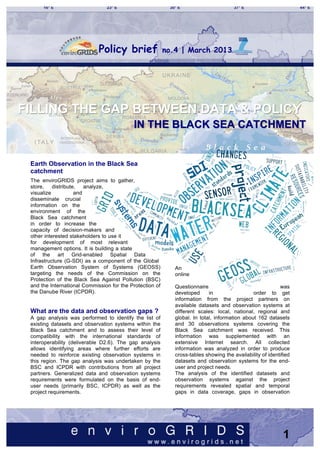
  • 1. Policy brief no.4 | March 2013     FILLING THE GAP BETWEEN DATA & POLICY     IN THE BLACK SEA CATCHMENT     Earth Observation in the Black Sea catchment The enviroGRIDS project aims to gather, store, distribute, analyze, visualize and disseminate crucial information on the environment of the Black Sea catchment in order to increase the capacity of decision-makers and other interested stakeholders to use it for development of most relevant management options. It is building a state of the art Grid-enabled Spatial Data Infrastructure (G-SDI) as a component of the Global Earth Observation System of Systems (GEOSS) An targeting the needs of the Commission on the online Protection of the Black Sea Against Pollution (BSC) and the International Commission for the Protection of Questionnaire was the Danube River (ICPDR). developed in order to get information from the project partners on available datasets and observation systems at What are the data and observation gaps ? different scales: local, national, regional and A gap analysis was performed to identify the list of global. In total, information about 162 datasets existing datasets and observation systems within the and 30 observations systems covering the Black Sea catchment and to assess their level of Black Sea catchment was received. This compatibility with the international standards of information was supplemented with an interoperability (deliverable D2.6). The gap analysis extensive Internet search. All collected allows identifying areas where further efforts are information was analyzed in order to produce needed to reinforce existing observation systems in cross-tables showing the availability of identified this region. The gap analysis was undertaken by the datasets and observation systems for the end- BSC and ICPDR with contributions from all project user and project needs. partners. Generalized data and observation systems The analysis of the identified datasets and requirements were formulated on the basis of end- observation systems against the project user needs (primarily BSC, ICPDR) as well as the requirements revealed spatial and temporal project requirements. gaps in data coverage, gaps in observation 1
  • 2. systems, problems with data accessibility, compatibility and interoperability. enviroGRIDS data requirements The general aim of the project is to build capacities in the Black Sea region modern Earth Observation systems and environmental data processing and sharing. The main outputs of the project is the Black Sea catchment Observation System targeting both decision-makers and citizens. Another aim of enviroGRIDS is to develop integrated scenarios of climatic, demographic and land cover changes using the Metronamica model (RIKS 2005). Several datasets were gathered at the best possible spatial and temporal resolutions to meet the objectives EnviroGRIDS is also exploring through several of this part of the project. case studies the potential impacts of environmental changes on so-called GEO (GEO 2005) Societal Benefit Areas (SBAs): ecosystems, biodiversity, agriculture, health, energy and disasters early warning. These case studies increased significantly the number and type of datasets needed by the project. The enviroGRIDS project end-users are International organizations dealing with environmental issues in the region; National authorities responsible for themes of enviroGRIDS; Local authorities and Scientists. From the first category of international organizations listed above, the Black Sea Then, enviroGRIDS needed data to use the Soil & Commission (BSC) and the International Water Assessment Tool (SWAT, Arnold et al. 1998), Commission for the Protection of the Danube which is a river basin scale model developed to River (ICPDR) are considered as the main end- quantify the impact of land management practices in users of the project. large, complex watersheds. It performs simulations that integrate various processes such as hydrology, climate, chemical transport, soil erosion, pesticide BSC data requirements dynamics, and agricultural management. The model The mission of the BSC is the implementation can use a daily to sub-hourly time step, and can of the Convention on the Protection of the Black perform continuous simulation for a 1- to 100-year Sea Against Pollution (Bucharest Convention, period. 1992), its Protocols and Strategic Action Plan (SAP) for the rehabilitation and protection of the Black Sea. The primary geographical scope of the Bucharest Convention is the Black Sea itself. However, its SAP covers pollution sources from coastal area and encourages Black Sea coastal states to implement depollution at the Black Sea catchment level. The new Protocol on the Protection of the Marine Environment of the Black Sea from Land-Based Sources and Activities also applies to pollution emissions originating from land- based point and diffuse sources, which reach 2
  • 3. the marine environment through rivers or other transboundary water management in the watercourses; inputs of polluting substances Danube River Basin. transported through the atmosphere; and activities The ICPDR is a transnational body, which has that may directly or indirectly affect the marine been established to implement the Danube environment or coastal areas. Considering the above, River Protection Convention. The ICPDR is the whole Black Sea catchment is an area of interest formally comprised by the Delegations of all to the BSC with respect to implementation of its Contracting Parties to the Danube River mission. Protection Convention, but has also established The activities of BSC are concerning the following a framework for other organizations to join. transboundary problems: In 2000, the ICPDR has also been nominated • Eutrophication/Nutrient Enrichment; for the implementation of the transboundary • Chemical Pollution, including Oil; aspects of the EU Water Framework Directive • Changes in Marine Living Resources, (WFD). The work for the successful Overfishing; implementation of the EU WFD is therefore high • Biodiversity Changes/Habitats Loss, including on the political agenda of the countries of the Alien Species Introduction; Danube river basin district. • Climate Change. Today national delegates, representatives from In order to carry out the activities on a regular basis highest ministerial levels, technical experts, and BSC has established following Advisory Groups (AG): members of the civil society and of the scientific • AG on pollution monitoring and assessment community cooperate in the ICPDR to ensure (PMA); the sustainable and equitable use of waters in • AG on control of pollution from land based the Danube River Basin. sources (LBS); Since its creation in 1998, the ICPDR has effectively promoted policy agreements and the • AG on development of common methodologies setting of joint priorities and strategies for for integrated coastal zone management (ICZM); improving the state of the Danube and its • AG on environmental safety aspects of shipping tributaries. This includes improving the tools (ESAS); used to manage environmental issues in the • AG on conservation of biological diversity (CBD); Danube basin, such as: • AG on environmental aspects of the management • the Accident Emergency Warning System, of fisheries and other marine living resources • the Trans-National Monitoring Network for (FOMLR); and water quality, and • AG on information and data exchange (IDE). • the information system for the Danube AGs of BSC have Focal Points in each Black Sea (Danubis), country, which are responsible for collection of data • DanubeGIS. and information in area of their responsibility and The main goals of the ICPDR are summarized reporting them on an annual basis to the Commission below: via its Permanent Secretariat (BSC PS). The reported data and information, which are obtained in the • Safeguarding the Danube’s Water framework of the Black Sea Integrated Monitoring and resources for future generation, Assessment Programme (BSIMAP), are used for • Naturally balanced waters free from excess periodical assessment of the State of Environment nutrients, (SoE) of the Black Sea (annually and every 5 years for • No more risk from toxic chemicals, changes and trends); Transboundary Diagnostic • Healthy and sustainable river systems, Analysis (every 5 years) and assessment of SAP • Damage-free floods. implementation (every 5 years). The different bodies of the ICPDR are: • The Ordinary Meeting Group: taking the political decisions, ICPDR data requirements • The Standing Working Group: providing The ICPDR works to ensure the sustainable and political guidance, equitable use of watershed freshwater resources in the Danube River Basin. The work of the ICPDR is • The Technical Expert Groups: preparing based on the Danube River Protection Convention, the technical background documents. the major legal instrument for cooperation and 3
  • 4. Technical Expert Groups are the backbone of the Finally, the Danube-Black Sea Joint Technical operation and the success of the ICPDR. They are Working Group co-ordinates the work of the formed by national experts from the Contracting ICPDR and the International Commission for Parties and representatives of the observer the Protection of the Black Sea, particularly organizations. Seven Expert Groups deal with a aiming to reduce nutrient inputs into the Black variety of issues - from policy measures to reduce Sea. water pollution to the implementation of the EU Water Framework Directive. Generalized data requirements All technical work within the ICPDR is carried out by The amount of different data types required by the Expert Groups. These Expert Groups are essential the project and project end-users is very large. to the operation of the ICPDR, and rely upon the Moreover, requirements to spatial and temporal inputs and contributions of national experts from the resolution of each kind of data are also very Contracting Parties and from the Observers. The diverse, so a gap analysis with respect to each ICPDR Expert Groups are focusing on: data type would be time consuming and • River Basin Management impracticable. • Pressures and Measures Hereby we undertook an attempt to generalize • Monitoring and Assessment the data requirements that are most important • Flood Protection for the project and its end-users. The • Public Participation generalized data requirements are presented in • Strategy the table below. Generalized enviroGRIDS data requirements Data theme / category Spatial Resolution Temporal resolution GIS satisfying project requirements and user needs, i.e. including detailed watersheds, At least 1:200000 Most recent protected areas, land use etc. DEM 30m Most recent Land cover /use 1km, 300m, 100m since 1990 Soil 1km Population Administrative data downscaled at 1km since 1990 Meteorology (in situ) All existing stations in Black Sea catchment Daily Meteorology (remote sensing) 0.25° Daily Hydrology All existing stations in Black Sea catchment Daily Stations in coastal waters of Black Sea countries and Oceanography (in situ) Quarterly in open sea Oceanography (remote sensing) Whole Black Sea Daily All industrial and municipal sources in Black Sea Pollutants discharges Monthly catchment Pollutants emissions Per enterprises or administrative units monthly According to monitoring Pollutants in water, sediments and biota Black Sea program River water quality All existing stations in Black Sea catchment monthly Stations in coastal waters of Black Sea countries and Sea water quality quarterly open sea Climatic data (climatic stations) All existing stations in Black Sea catchment Daily monthly, daily Climatic data (remote sensing) Best available (1x1km) (depending on data) River biology Best available quarterly Marine biology Best available quarterly Biodiversity Best available quarterly Invasive species Point observation date Agriculture Administrative units yearly Disasters Best available permanent monitoring 4
  • 5. Results from the gap analysis however for the rest of the Black Sea catchment the problem persists. The datasets reported by project partners cover the With respect to the river basins of the Black Sea nine GEO Societal Benefits Areas. Most identified Catchment: datasets are related to the Water, Ecosystems, and • The Danube river basin has the best data Climate SBAs, while the least covered SBAs are coverage. Data are available on all scales: Energy, Weather and Health. global, European, regional and national; The methods for accessing data are various: direct • The large river basins of Ukraine (Dnepr, Internet links, ftp, e-mail, CD. The datasets of Dniester, Bug) seem to have rather country scale are usually not accessible online and acceptable data coverage, however due to the have to be requested via e-mail from data holders. lack of access to data it is difficult to assess The variety of formats for data storage, as well as their completeness; absence of online access to the data hamper the • For the large river basins of Russia (Don, data exchange and appear to be a significant gap Kuban) and Turkey (Kizilirmak, Yesilirmak) for the datasets at country scale. project partners did not report any dataset. In the Questionnaire project partners reported This is identified as a significant gap in data, national datasets only for four countries around the particularly taking into account that these river Black Sea. A large spatial gap in national data basins are important for the project end-users coverage remains. This gap is partly covered by and decision-makers: they cover large available regional and European scale datasets territories populated by millions of people and containing data from Danube basin countries, have important socio-economic value for these countries. River basins in the Black Sea catchment with least data availability for the project (brown shading). 5
  • 6. The analysis of available data confirmed the regional datasets more easily available. The BS- assumption that for most required data exist at OS is based on a modern Spatial Data least at one of the spatial scales. The analysis Infrastructure (SDI), which is interoperable with also confirmed that the accessibility of data is one the international GEO (GEO 2005) and the of the main problems. The data of global and European INSPIRE (EU 2007) standards and European scale are mostly free, while access to framework. The situation at the global, European the data on regional and national level is usually and regional scale is quite satisfactory. This limited or restricted. For such data categories as follows from the fact that there are already many climatic, hydro-meteorological, agricultural, and datasets at these scales registered in the GEOSS pollutants discharges data of required spatial and portal, but this is not the case for data at the temporal resolution are not accessible, which is country scale. considered as a significant gap, because these SDI can clearly improve the situation of data and data are crucial for running and calibrating models metadata exchange among partners and beyond. such as SWAT. The project decided therefore to concentrate its capacity building efforts through courses The enviroGRIDS Spatial Data dedicated to high-level decision makers capable Infrastructure (SDI) of changing national data policies in one hand, The Black Sea catchment Observation System and to technicians capable of setting new local (BS-OS) built by enviroGRIDS aims at filling some SDI needed to register existing data and metadata of the identified data gaps by making national and services into GEOSS and INSPIRE. Reinforcing regional data sharing through web services 6
  • 7. All stakeholders in the Black Sea region are now strongly encouraged to make available their metadata and data available through the BS-OS using the following web services: • CSW allows to share metadata • Web Mapping Services (WMS) transform spatial data into dynamic maps created on request as images that are published on the Internet without making the raw data available • Web Feature Service (WFS) allow to share vector data itself with all its geometric features and related attributes • Web Coverage Services (WCS) allows a client to access raster datasets. The Black Sea catchment Observation gSWAT allows users to calibrate the SWAT System components hydrological model on the GRID. portal.envirogrids.net The Geoportal allows users to search, discover, and access data sets in the Black Sea catchment. eGLE implements both a user interface, and the tools for the development, the execution and the management of teaching materials. GreenLand generates and executes on the GRID workflows for instance to process satellite images. 7
  • 8. such as GEOSS and INSPIRE, as well as metadata catalogues from selected projects. Unlike in the Danube countries, the gaps in data availability for large areas of the Black Sea catchment within Russia, Georgia and Turkey cannot be covered with datasets available in the European union. In order to further improve Earth Observation in the Black Sea region, the following actions are recommended: • Improve the compatibility of existing datasets and observation systems with INSPIRE and GEO standards of interoperability, • Identify and federate national observation systems, services, and responsible agencies Bashyt is a Collaborative Working Environment in all countries of the Black Sea catchment in (CWE) on the web that builds on complex order to elaborate recommendation on filling "physically based" hydrological, land cover and data gaps at country level, ocean models to support decision makers through • Encourage countries (e.g. Georgia, Bulgaria) a user-friendly Web interface. that are not yet members of GEO to join this organization, • Enhance networks of data acquisition in each region/country, • Publish the information on available datasets at the enviroGRIDS portal as the entry-point to discover data and metadata within the Black Sea catchment. Conclusions The large amount of datasets relevant to the project and end-users data need has been identified at different scales from national to regional, European and global. At the same time, it was found that access to data in many cases is limited or restricted, particularly at national level, so the data accessibility appears to be the main Some enviroGRIDS recommendations problem preventing effective data usage. The issue of data accessibility is of primary With respect to the data and observation systems importance. Even the access to project partner’s needs of the main end-users, the gap analysis data can be limited or restricted. In general, it is concluded that: recommended to elaborate appropriate data BSC: policies favoring free data access and exchange • There are significant gaps in availability of for non-commercial purposes. marine environment data from water column, The metadata catalogs and portals are key sediments and biota resulted from gaps in gateways to discover data. The enviroGRIDS corresponding observation / monitoring geoportal allows discovering datasets relevant to systems. It is unlikely that these gaps can be the project and end-users data needs. It is covered within the enviroGRIDS, since the harvesting the content of other metadata catalogs project is focused mainly on the catchment 8
  • 9. area rather than on the Black Sea water The project tried to show the best practices on body. SDI development, on data and metadata portals, • There are gaps in data on pollution loads to and on useful applications for citizens and the Black Sea from land based sources, decision makers. The beauty, interest and unique including rivers, identity of the Black Sea region well disserve a • Observation system to monitor pollutants state-of-the-art system to preserve its value and deposition from atmosphere is missing. assess its vulnerability to global changes. Let’s ICPDR: hope that the effort of the enviroGRIDS project will • Most of required data are available at the contribute to convince more data owners that regional (Danube) or European scales, sharing their data is good for the future • There are gaps on availability of data on development of the Black Sea region, and pollutants deposition from atmosphere. therefore for themselves as well. By sharing its SWAT: data, regional and national institutions become • Some of required data (DEM, land cover, more visible thanks to the efforts of the Global soil, population) are available at regional to Earth Observation System of Systems. global scales, however, • Data from weather and river stations are Relevant enviroGRIDS deliverables rather scarce; D2.6 Gap analysis • Access to the data on pollution discharges D2.10 Spatial Data Infrastructure: GEOSS, INSPIRE and water quality, particularly in non-EU and UNSDI counties, is limited or restricted; D3.5 Proposed demographic scenario analysis and • The spatial resolution of crop yield data from overview of driving forces and justification, model open sources of global scale may be not input parameters and allocation rules. satisfactory, while access to more detailed D3.6 Proposed climatic scenario analysis and overview national agriculture data is limited or of the more relevant driving and its justification, model input parameters and allocation rules. restricted. D3.7 Proposed land cover scenario analysis and overview of the more relevant driving and its The analysis of available datasets revealed the justification, model input parameters and allocation problem of data compatibility at different scales. rules. For example, global and European datasets for D3.8 Outputs from Spatially explicit combined land cover are not compatible in terms of land scenarios. cover categories. Similar problem exist between D4.11 Calibrated water quantity and quality model for datasets of country scale and other scales. BSC, with impacts of scenarios Resolving this problem may require significant D6.4 First implementation of the BSC-OS portal D6.8 National GEO committees efforts, particularly when it is necessary to D7.12 Policy makers involvement report combine data from different scales. Combining data from different scales is directly Selected references linked to the issue of correspondence of datasets Arnold, J.G. et al. 1998. Large area hydrologic and observation systems to INSPIRE and GEO modeling and assessment, Part 1: Model interoperability standards. The fact, that most of Development. JAWRA Journal of the American reported national datasets are not accessible Water Resources Association 34: 73-89. through the Internet and do not have relevant EU 2007. Directive 2007/2/EC of the European metadata available, points to the absence of such Parliament and the Council of 14 March 2007 correspondence. establishing an Infrastructure for Spatial Information In conclusion, the aim of the enviroGRIDS project in the European Community (INSPIRE). Brussels: 14. to build capacity on Earth Observation Systems GEO 2005. Global Earth Observation System of through improved data collection, management, Systems 10-Year Implementation Plan Reference storage, analyses and dissemination is more than Document: 209. ever a necessity in the Black Sea catchment. Giuliani, G. et al. 2011. Grid-enabled Spatial Data Infrastructure for environmental sciences: 9
  • 10. Challenges and opportunities. In: Future Generation Computer Systems. Giuliani, G. et al. 2011. Sharing Environmental Data through GEOSS. In: International Journal of Applied Geospatial Research. Gorgan, D. 2012. Software Platform Interoperability Throughout EnviroGRIDS Portal. In: IEEE Journal of Selected Topics in Applied Earth Observations and Remote Sensing. RIKS 2005. The Metronamica modelling framework: model descriptions. Model documentation. Maastricht: Research Institute for Knowledge Systems. Rouholahnejad, E. et al. 2012. A parallelization framework for calibration of hydrological models. In: Environmental Modelling & Software. 2012. Selected websites enviroGRIDS project: www.envirogrids.net GEO/GEOSS: www.earthobservations.org INSPIRE: inspire.jrc.ec.europa.eu BSC PS: www.blacksea-commission.org ICPDR: www.icpdr.org METRONAMICA:www.metronamica.nl SWAT: swatmodel.tamu.edu Search enviroGRIDS data portal http://www.envirogrids.cz View enviroGRIDS on Youtube http://www.youtube.com/user/envirogrids Join enviroGRIDS on LinkedIn http://www.linkedin.com/groups?gid=3374617 www.envirogrids.net Follow enviroGRIDS on Twitter http://twitter.com/#!/envirogrids enviroGRIDS consortium UNIGE/UNEP, Switzerland; AZBOS, Ukraine; ARXIT, Switzerland; BSC PS, Turkey; BSREC, Bulgaria; CCSS, Czech Republic; CERN, Switzerland (Int.); CEU/ACWC, Hungary; CRS4, Italy; DDNI, Romania; DHMO, Ukraine; EAWAG, Switzerland; Geographic, Georgia; ICPDR, International Organization; IGAR, Romania; IHE, The Netherlands (UN); INHGA, Romania; ITU, Turkey; IBSS, Ukraine; MEF, Turkey; NIMH, Bulgaria; ONU, Ukraine; ANTEA, Belgium; SPSU, Russian Federation; TNU, Ukraine; UAB, Spain; UMA, Spain; UTC, Romania; USRIEP, Ukraine; VITUKI, Hungary. 10