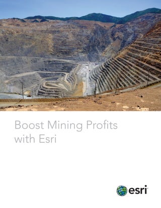
Boost Mining Profits with Esri
•
0 j'aime•634 vues

boost mining profits with Esri's GIS technologies

Recommandé
Recommandé
Contenu connexe
Tendances
Tendances (20)
En vedette
En vedette (9)
Similaire à Boost Mining Profits with Esri
Similaire à Boost Mining Profits with Esri (20)
Plus de Esri
Plus de Esri (20)
Dernier
Dernier (20)
Boost Mining Profits with Esri
- 1. Boost Mining Profits with Esri
- 2. Seize the Power of the Platform When you deploy ArcGIS® software from Esri, you harness the power of location. Now you can wield that power to manage, plan, analyze, map, monitor, and communicate from one complete technology platform: ArcGIS.
- 3. Increase ROI To make real money in the business of mining, you need a platform that ties all phases together. The ArcGIS platform combines real-time operational data with state-of-the- art science and proven evaluation procedures, enabling better decision making through the entire mine life cycle. ArcGIS software shows data within a geographic context so you can quickly identify leads, opportunities, and new prospects. It allows you to analyze huge stores of data quickly and revise investment scenarios based on accurate analytics. Monitor Assets Your assets don’t remain static. They move, undergo maintenance and construction, and get replaced. ArcGIS allows you to manage assets more efficiently by displaying all information about your equipment and facilities on a map. Managers can use interactive dashboards to better keep track of work orders, schedules, and field operations. Field staff can use mobile devices to update data and feed it back into maps that the whole enterprise can access. Visualize exploration prospects. Gain real-time views of assets and operations.
- 4. Visualize Risk Ensuring safety and proper regulatory compliance in mining is a paramount concern. ArcGIS maps and reports quickly demonstrate how your company is complying with health, safety, and environmental requirements. Maps convey emergency response strategies and drill information better than any other medium. Engage Stakeholders You need to be transparent with the public and stakeholders. Map viewers enable understanding of mine business details. They give a quick and convenient view of everything from licensing information to remediation plans that stakeholders can see on any device. Esri web maps also provide the public with authoritative information about local activities. Make better sense of mine data in a geographic context. Keep track of licensing information and maintain transparency.
- 5. Learn more at esri.com/mining. Esri Understands Mining Information Management You have a very broad range of information management challenges. That’s why we developed ArcGIS technology—to help you manage data throughout your organization, including prospects, assets, infrastructure, projects, customers, and risk. A proven platform, ArcGIS has significantly helped mining businesses do the following: • Collaborate among departments via a spatial platform • Analyze data for planning, maintenance, operations, and compliance • Share select data with staff and stakeholders • Increase operational efficiency and improve decision making
- 6. Printed in USA Contact Esri 380 New York Street Redlands, California 92373-8100 usa 1 800 447 9778 t 909 793 2853 f 909 793 5953 info@esri.com esri.com Offices worldwide esri.com/locations Esri inspires and enables people to positively impact their future through a deeper, geographic understanding of the changing world around them. Governments, industry leaders, academics, and nongovernmental organizations trust us to connect them with the analytic knowledge they need to make the critical decisions that shape the planet. For more than 40 years, Esri has cultivated collaborative relationships with partners who share our commitment to solving earth’s most pressing challenges with geographic expertise and rational resolve. Today, we believe that geography is at the heart of a more resilient and sustainable future. Creating responsible products and solutions drives our passion for improving quality of life everywhere. Copyright © 2014 Esri. All rights reserved. Esri, the Esri globe logo, ArcGIS, @esri.com, and esri.com are trademarks, service marks, or registered marks of Esri in the United States, the European Community, or certain other jurisdictions. Other companies and products or services mentioned herein may be trademarks, service marks, or registered marks of their respective mark owners. 140750 CRWN2M5/14tk