SlideShare a Scribd company logo
1 of 4
Download to read offline
Creating Custom Web Mapping Applications
without Programming
By Derek Law, Esri Product Management


                                                                          	 These three configurable web client viewer options—ArcGIS.
                                                                          com Map Viewer, ArcGIS Viewer for Flex, and ArcGIS Viewer for
                                                                          Silverlight—are ArcGIS Online application templates. Each option
                                                                          was built on one of the three web mapping APIs for JavaScript, Flex,
                                                                          and Silverlight technologies. All enable you to easily configure and
                                                                          deploy a custom web mapping application. Each follows a similar
                                                                          design pattern: specify the web application’s data content, then its
                                                                          functionality, and finally its appearance.

                                                                          ArcGIS Online Application Templates
                                                                          This is the simplest and easiest configurable client viewer option. All
                                                                          you need is an Internet connection so you can use the map viewer
                                                                          at ArcGIS Online (arcgis.com), the online component of the ArcGIS
                                                                          system. No additional hardware, such as servers or other resources,
                                                                          is required.
 A web map created in the ArcGIS.com Map Viewer                          	 With the map viewer, you can easily create your own interactive
                                                                          map. To create a custom web map, just select a basemap; combine
                                                                          additional data content, such as web services, shapefiles, Microsoft
Web GIS is becoming an essential component of many GIS applica-           Excel spreadsheets, CSV files, or KML data; and specify data layer
tion solutions. From federal government agencies and corporate            display properties such as pop-up dialogs. Essentially, you create a
enterprise solutions to state/municipal governments and private           mashup of data from your own data sources and online data sources.
organizations, a website presence with mapping capabilities is now        Once complete, save it as an ArcGIS Online web map.
very common.                                                              	 Your web map can be consumed by many different clients. It
	 ArcGIS for Server lets you share and publish your GIS resources         can be shared with the public or with members of one or more
on the web as web services. To work with these services, you can
develop web client applications using the web mapping APIs for
                                                                           ArcGIS.com web map sharing options
JavaScript, Flex, and Silverlight. This is a great technology workflow,
but for organizations with limited developer resources, enabling GIS
on the web can be challenging.
	 Esri has been making it much easier for ArcGIS users to create and
deploy custom web mapping applications without programming. The
objective has been to empower traditional desktop GIS analysts to
easily create and deploy GIS application solutions on the web.
	 Three easy-to-use solutions for creating custom web mapping ap-
plications are available. All are designed to work with services from
ArcGIS for Server and ArcGIS Online as well as ArcGIS Online web
maps. They provide a means to easily configure and deploy custom
web mapping applications without having to write a single line of
code. They are ideal for nondevelopers and novice web mapping ap-
plication creators. They can also be leveraged by developers working
with web mapping APIs who can use these viewers as a starting
point for building custom client applications.


42   au  Summer 2012  esri.com
Developer’s Corner


                                                                                                  (RIA) that requires the Adobe Flash Player
                                                                                                  plug-in on your web browser. With it, you can
                                                                                                  easily customize and deploy a robust and
                                                                                                  interactive web mapping client hosted on
                                                                                                  your web server (e.g., Internet Information
                                                                                                  Server, or IIS). This configurable web client
                                                                                                  viewer option is more comprehensive than
                                                                                                  the ArcGIS Online application templates.
                                                                                                  	      You start with the ArcGIS Viewer for
                                                                                                  Flex application builder, an Adobe Air ap-
                                                                                                  plication that installs on your local machine
                                                                                                  and executes as a desktop application. The
                                                                                                  application builder provides a wizard-like
                                                                                                  interface for configuring the viewer’s proper-
                                                                                                  ties. When the application builder is run for
                                                                                                  the first time, it will prompt you for a default
                                                                                                  location to deploy the new web applications
 Gear icons indicate that these ArcGIS.com application templates are configurable.
                                                                                                  it creates. Typically, this would be in the web
                                                                                                  server resources directory. To begin, simply
                                                                                                  click the Create a New Application button
arcgis.com user groups. You can also share it via e-mail, Facebook, or and provide a name for the application.
Twitter or embed it in a website as an interactive map.                  	 The application builder user interface consists of five control tabs
	 You have another sharing option. You can create a new web map- that follow the general design pattern for configuring web applica-
ping application for the web map by using one of the web applica- tions. By navigating to each tab, you configure different aspects of
tion templates available on ArcGIS Online for a variety of use cases. the viewer. On the Maps tab, you specify the data content. This can
Approximately half these templates have some configuration options be an ArcGIS Online web map or your own basemap and operational
(indicated with a gray gear icon), and all were built using the ArcGIS layers. On the Widgets tab, specific GIS functionality, such as draw-
API for JavaScript.                                                      ing, editing, charting, geocoding, search, legend, geoprocessing,
	 The web application template can be published to ArcGIS Online or printing, is defined. ArcGIS Viewer for Flex includes more than
so the web application will be hosted on ArcGIS.com. Once published 20 core widgets that provide the common GIS functionalities needed
and shared, the newly created and deployed web application for your in web mapping applications. On the Layout tab, you select which
web map can be configured. Simply navigate to the web application’s user interface controls (overview map, navigation tools, show coor-
item page on ArcGIS Online and click the Configure App button on dinates) to include in the application. On the Design tab, you set the
the web application template’s configuration options.                    application’s look and feel by adding a title, logo, or theme colors.
	 Options for the Basic Viewer application template include turning
on/off many of the viewer’s capabilities such as the legend, print tool,  The basic ArcGIS Viewer for Flex application template
and bookmarks. Some functionality, such as the Edit tool, will only configuration options
be available if the web map contains editable data. The configuration
options available will vary depending on the application template
selected.
	 Alternatively, you can download the web application to your own
machine as a ZIP file so you can host the web application on your
own web server machine. Hosting the web application on premises
lets you further customize it via JavaScript API development.
	 To learn more about ArcGIS Online application templates, navi-
gate to help.arcgis.com/en/arcgisonline/help/ and choose Popular
Topics > Videos > Working with Web Maps.

ArcGIS Viewer for Flex
Originally released as the Sample Flex Viewer, this application
became an official product in summer 2010. Built on the ArcGIS API
for Flex, it is a ready-to-deploy, configurable, rich Internet application


                                                                                                                  esri.com  Summer 2012  au    43
builder. The new web application can be accessed and used immedi-
                                                                        ately in a web browser.
                                                                        	 The ArcGIS Viewer for Flex application builder can also be used to
                                                                        manage the web mapping applications it has deployed. Web applica-
                                                                        tions built on the ArcGIS Viewer for Flex can be further customized
                                                                        by directly configuring their XML configuration files. By making
                                                                        simple text edits to these XML files, you can apply more precise
                                                                        customization to your deployed web applications. Comprehensive
                                                                        documentation and samples for editing the viewer’s XML configura-
                                                                        tion files are available online at the ArcGIS Viewer for Flex resource
                                                                        center. Learn more about the ArcGIS Viewer for Flex at links.esri.
 Use the ArcGIS Viewer for Flex application builder to choose          com/flexviewer.
basemaps and operational layers for an application
                                                                        ArcGIS Viewer for Silverlight
                                                                        Released in the first quarter of 2012, the ArcGIS Viewer for Silverlight
The configuration workflow for a new application is nonlinear and       is another ready-to-deploy RIA option for Windows operating
dynamic, which is one of the application builder’s strengths. For ex-   systems. It is built on the ArcGIS API for Silverlight and requires
ample, you can select the data content, define the functionality and    the Microsoft Silverlight browser plug-in. The ArcGIS Viewer for
appearance, and then go back and change the data content—there is       Silverlight provides an intuitive browser-based application builder
no preset configuration workflow. You preview the final application     with an interactive “what you see is what you get” (WYSIWYG) user
with the Preview tab.                                                   experience. This option makes the process of creating new web map-
	 When you are finished, click Done to complete and deploy the new      ping applications that are hosted on your own web servers very easy
web application. The files that comprise the new web application are    and, again, is more comprehensive than the ArcGIS Online applica-
stored at the location specified when you first ran the application     tion templates.


                                        ArcGIS Online                     ArcGIS Viewer for Flex ArcGIS Viewer for
                                        application templates                                    Silverlight
 Technology based on                    JavaScript                        Flex                               Silverlight

 Web browser plug-in required           No                                Adobe Flash Player                 Microsoft Silverlight

 Installation location                  Can be hosted on                  On premises on your own            On premises on your own
                                        ArcGIS.com or on premises         web server                         web server
                                        on your own web server

 Supports ArcGIS.com login              Yes                               No                                 Yes
 authentication

 Works with ArcGIS Online web           Yes                               Yes                                Yes
 maps

 Works with ArcGIS for Server   Yes                                       Yes                                Yes
 and ArcGIS Online web services

 Application builder GUI user           No                                Yes                                Yes
 experience

 Configuration options                  Varies between different          Many configuration options         Many configuration options
                                        templates

 Extensible framework for               Yes, with JavaScript API, if      Yes, with Flex API (viewer         Yes, with Silverlight API
 developers                             the template is download-         source code available)             (extensibility kit available)
                                        ed to a local machine

 Table 1: Comparison of configurable web client viewer options


44   au  Summer 2012  esri.com
Developer’s Corner


                                                                          Three ArcGIS Viewer for
                                                                          Flex Download Options
                                                                           You can get the ArcGIS Viewer for Flex as a compiled web
                                                                           client application that can be used immediately, or as an
                                                                           application builder used to create new web applications,
                                                                           or as uncompiled source code from GitHub that can be
                                                                           extended by Flex API developers.


 The ArcGIS Viewer for Silverlight application builder steps the
user through creation of a web application.


	 The ArcGIS Viewer for Silverlight setup installs the application application by clicking the Deploy button, which creates the sup-
in your machine’s web server resources directory (e.g., IIS). Its ap- porting files for the new web application in the web server resources
plication builder runs in a web browser. When you start it the first directory.
time, the application builder will display some introductory text. 	 The ArcGIS Viewer for Silverlight application builder can also be
Just click the Create New Application button to start creating a used to manage the web mapping applications it has deployed. With
web application.                                                      the extensibility kit, Silverlight API developers can create add-ins to
	 Deciding on data content for the new web application is the first extend viewer capabilities. To learn more about the ArcGIS Viewer
step. You can create a new map with data you specify or use a web for Silverlight, see links.esri.com/silverlightviewer.
map from ArcGIS Online including your own ArcGIS.com items and
content in groups that you belong to on ArcGIS.com.                   Conclusion
	 After choosing the data content option, the application builder’s Esri offers three configurable web client viewer options that benefit
main user interface appears, which includes three control tabs, nondevelopers, novice website creators, and developers. The ArcGIS
Map, Tools, and Layout, located at the top above the main preview Online application templates are the easiest. The viewers for Flex and
window. In the lower right-hand corner is an interactive Getting Silverlight offer more configuration options and include application
Started panel. This panel guides beginning users. Clicking an option builders. All are client applications to ArcGIS for Server and ArcGIS
in the Getting Started panel activates the corresponding application Online web services and work with web maps from ArcGIS Online.
builder functionality on the control tabs.
	 On the Map tab, you can specify data  A deployed ArcGIS Viewer for Silverlight application
content such as basemaps, operational
layers, and GeoRSS feeds. You can also set
the data layer symbolization properties and
configure how attribute tables and pop-up
dialogs appear. On the Tools tab, you define
functionality, such as editing, geoprocess-
ing, layer filters, printing, and selection
tools, that will be available in the new web
application. On the Layout tab, you can
configure the application’s look and feel by
applying a custom logo, custom title, and
colors and select from the prebuilt layout
templates furnished. Any property changes
will immediately be displayed in the main
preview window.
	 The ArcGIS Viewer for Silverlight work-
flow is also nonlinear, so you can configure
web application properties in any order.
Finish creating the new web mapping


                                                                                                              esri.com  Summer 2012  au   45

More Related Content

More from Esri

Aena Aeropuerto Adolfo Suárez-Barajas crea potentes aplicaciones para sus cli...
Aena Aeropuerto Adolfo Suárez-Barajas crea potentes aplicaciones para sus cli...Aena Aeropuerto Adolfo Suárez-Barajas crea potentes aplicaciones para sus cli...
Aena Aeropuerto Adolfo Suárez-Barajas crea potentes aplicaciones para sus cli...Esri
 
Plataforma Smart City de Móstoles
Plataforma Smart City de MóstolesPlataforma Smart City de Móstoles
Plataforma Smart City de MóstolesEsri
 
ArcGIS Online para Organizaciones
ArcGIS Online para OrganizacionesArcGIS Online para Organizaciones
ArcGIS Online para OrganizacionesEsri
 
Molina de Segura se convierte en una smart city
Molina de Segura se convierte en una smart cityMolina de Segura se convierte en una smart city
Molina de Segura se convierte en una smart cityEsri
 
Portal for ArcGIS
Portal for ArcGISPortal for ArcGIS
Portal for ArcGISEsri
 
GIS-Based Web Services Provide Rapid Analysis and Dissemination of Maritime Data
GIS-Based Web Services Provide Rapid Analysis and Dissemination of Maritime DataGIS-Based Web Services Provide Rapid Analysis and Dissemination of Maritime Data
GIS-Based Web Services Provide Rapid Analysis and Dissemination of Maritime DataEsri
 
An Effective Tool for Drinking Water Protection
An Effective Tool for Drinking Water ProtectionAn Effective Tool for Drinking Water Protection
An Effective Tool for Drinking Water ProtectionEsri
 
GeoCollector for ArcPad
GeoCollector for ArcPadGeoCollector for ArcPad
GeoCollector for ArcPadEsri
 
GeoCollector for ArcGIS for Windows Mobile
GeoCollector for ArcGIS for Windows MobileGeoCollector for ArcGIS for Windows Mobile
GeoCollector for ArcGIS for Windows MobileEsri
 
Data Appliance for ArcGIS
Data Appliance for ArcGISData Appliance for ArcGIS
Data Appliance for ArcGISEsri
 
Esri and BlackBridge
Esri and BlackBridgeEsri and BlackBridge
Esri and BlackBridgeEsri
 
GeoPlanner for ArcGIS
GeoPlanner for ArcGISGeoPlanner for ArcGIS
GeoPlanner for ArcGISEsri
 
Esri and AccuWeather
Esri and AccuWeatherEsri and AccuWeather
Esri and AccuWeatherEsri
 
Esri and Airbus Defense & Space
Esri and Airbus Defense & SpaceEsri and Airbus Defense & Space
Esri and Airbus Defense & SpaceEsri
 
Esri US Data Fact Sheet
Esri US Data Fact SheetEsri US Data Fact Sheet
Esri US Data Fact SheetEsri
 
ArcGIS for Server on Microsoft Azure Jumpstart
ArcGIS for Server on Microsoft Azure JumpstartArcGIS for Server on Microsoft Azure Jumpstart
ArcGIS for Server on Microsoft Azure JumpstartEsri
 
ArcGIS for the Military--Maritime Operations
ArcGIS for the Military--Maritime OperationsArcGIS for the Military--Maritime Operations
ArcGIS for the Military--Maritime OperationsEsri
 
Esri Geoportal Server
Esri Geoportal ServerEsri Geoportal Server
Esri Geoportal ServerEsri
 
ArcGIS GeoEvent Extension for Server
ArcGIS GeoEvent Extension for ServerArcGIS GeoEvent Extension for Server
ArcGIS GeoEvent Extension for ServerEsri
 
The NATO Core Geographic Services System
The NATO Core Geographic Services SystemThe NATO Core Geographic Services System
The NATO Core Geographic Services SystemEsri
 

More from Esri (20)

Aena Aeropuerto Adolfo Suárez-Barajas crea potentes aplicaciones para sus cli...
Aena Aeropuerto Adolfo Suárez-Barajas crea potentes aplicaciones para sus cli...Aena Aeropuerto Adolfo Suárez-Barajas crea potentes aplicaciones para sus cli...
Aena Aeropuerto Adolfo Suárez-Barajas crea potentes aplicaciones para sus cli...
 
Plataforma Smart City de Móstoles
Plataforma Smart City de MóstolesPlataforma Smart City de Móstoles
Plataforma Smart City de Móstoles
 
ArcGIS Online para Organizaciones
ArcGIS Online para OrganizacionesArcGIS Online para Organizaciones
ArcGIS Online para Organizaciones
 
Molina de Segura se convierte en una smart city
Molina de Segura se convierte en una smart cityMolina de Segura se convierte en una smart city
Molina de Segura se convierte en una smart city
 
Portal for ArcGIS
Portal for ArcGISPortal for ArcGIS
Portal for ArcGIS
 
GIS-Based Web Services Provide Rapid Analysis and Dissemination of Maritime Data
GIS-Based Web Services Provide Rapid Analysis and Dissemination of Maritime DataGIS-Based Web Services Provide Rapid Analysis and Dissemination of Maritime Data
GIS-Based Web Services Provide Rapid Analysis and Dissemination of Maritime Data
 
An Effective Tool for Drinking Water Protection
An Effective Tool for Drinking Water ProtectionAn Effective Tool for Drinking Water Protection
An Effective Tool for Drinking Water Protection
 
GeoCollector for ArcPad
GeoCollector for ArcPadGeoCollector for ArcPad
GeoCollector for ArcPad
 
GeoCollector for ArcGIS for Windows Mobile
GeoCollector for ArcGIS for Windows MobileGeoCollector for ArcGIS for Windows Mobile
GeoCollector for ArcGIS for Windows Mobile
 
Data Appliance for ArcGIS
Data Appliance for ArcGISData Appliance for ArcGIS
Data Appliance for ArcGIS
 
Esri and BlackBridge
Esri and BlackBridgeEsri and BlackBridge
Esri and BlackBridge
 
GeoPlanner for ArcGIS
GeoPlanner for ArcGISGeoPlanner for ArcGIS
GeoPlanner for ArcGIS
 
Esri and AccuWeather
Esri and AccuWeatherEsri and AccuWeather
Esri and AccuWeather
 
Esri and Airbus Defense & Space
Esri and Airbus Defense & SpaceEsri and Airbus Defense & Space
Esri and Airbus Defense & Space
 
Esri US Data Fact Sheet
Esri US Data Fact SheetEsri US Data Fact Sheet
Esri US Data Fact Sheet
 
ArcGIS for Server on Microsoft Azure Jumpstart
ArcGIS for Server on Microsoft Azure JumpstartArcGIS for Server on Microsoft Azure Jumpstart
ArcGIS for Server on Microsoft Azure Jumpstart
 
ArcGIS for the Military--Maritime Operations
ArcGIS for the Military--Maritime OperationsArcGIS for the Military--Maritime Operations
ArcGIS for the Military--Maritime Operations
 
Esri Geoportal Server
Esri Geoportal ServerEsri Geoportal Server
Esri Geoportal Server
 
ArcGIS GeoEvent Extension for Server
ArcGIS GeoEvent Extension for ServerArcGIS GeoEvent Extension for Server
ArcGIS GeoEvent Extension for Server
 
The NATO Core Geographic Services System
The NATO Core Geographic Services SystemThe NATO Core Geographic Services System
The NATO Core Geographic Services System
 

Recently uploaded

The 7 Things I Know About Cyber Security After 25 Years | April 2024
The 7 Things I Know About Cyber Security After 25 Years | April 2024The 7 Things I Know About Cyber Security After 25 Years | April 2024
The 7 Things I Know About Cyber Security After 25 Years | April 2024Rafal Los
 
04-2024-HHUG-Sales-and-Marketing-Alignment.pptx
04-2024-HHUG-Sales-and-Marketing-Alignment.pptx04-2024-HHUG-Sales-and-Marketing-Alignment.pptx
04-2024-HHUG-Sales-and-Marketing-Alignment.pptxHampshireHUG
 
Finology Group – Insurtech Innovation Award 2024
Finology Group – Insurtech Innovation Award 2024Finology Group – Insurtech Innovation Award 2024
Finology Group – Insurtech Innovation Award 2024The Digital Insurer
 
From Event to Action: Accelerate Your Decision Making with Real-Time Automation
From Event to Action: Accelerate Your Decision Making with Real-Time AutomationFrom Event to Action: Accelerate Your Decision Making with Real-Time Automation
From Event to Action: Accelerate Your Decision Making with Real-Time AutomationSafe Software
 
FULL ENJOY 🔝 8264348440 🔝 Call Girls in Diplomatic Enclave | Delhi
FULL ENJOY 🔝 8264348440 🔝 Call Girls in Diplomatic Enclave | DelhiFULL ENJOY 🔝 8264348440 🔝 Call Girls in Diplomatic Enclave | Delhi
FULL ENJOY 🔝 8264348440 🔝 Call Girls in Diplomatic Enclave | Delhisoniya singh
 
CNv6 Instructor Chapter 6 Quality of Service
CNv6 Instructor Chapter 6 Quality of ServiceCNv6 Instructor Chapter 6 Quality of Service
CNv6 Instructor Chapter 6 Quality of Servicegiselly40
 
Scaling API-first – The story of a global engineering organization
Scaling API-first – The story of a global engineering organizationScaling API-first – The story of a global engineering organization
Scaling API-first – The story of a global engineering organizationRadu Cotescu
 
Strategies for Unlocking Knowledge Management in Microsoft 365 in the Copilot...
Strategies for Unlocking Knowledge Management in Microsoft 365 in the Copilot...Strategies for Unlocking Knowledge Management in Microsoft 365 in the Copilot...
Strategies for Unlocking Knowledge Management in Microsoft 365 in the Copilot...Drew Madelung
 
Google AI Hackathon: LLM based Evaluator for RAG
Google AI Hackathon: LLM based Evaluator for RAGGoogle AI Hackathon: LLM based Evaluator for RAG
Google AI Hackathon: LLM based Evaluator for RAGSujit Pal
 
Presentation on how to chat with PDF using ChatGPT code interpreter
Presentation on how to chat with PDF using ChatGPT code interpreterPresentation on how to chat with PDF using ChatGPT code interpreter
Presentation on how to chat with PDF using ChatGPT code interpreternaman860154
 
Raspberry Pi 5: Challenges and Solutions in Bringing up an OpenGL/Vulkan Driv...
Raspberry Pi 5: Challenges and Solutions in Bringing up an OpenGL/Vulkan Driv...Raspberry Pi 5: Challenges and Solutions in Bringing up an OpenGL/Vulkan Driv...
Raspberry Pi 5: Challenges and Solutions in Bringing up an OpenGL/Vulkan Driv...Igalia
 
GenCyber Cyber Security Day Presentation
GenCyber Cyber Security Day PresentationGenCyber Cyber Security Day Presentation
GenCyber Cyber Security Day PresentationMichael W. Hawkins
 
Handwritten Text Recognition for manuscripts and early printed texts
Handwritten Text Recognition for manuscripts and early printed textsHandwritten Text Recognition for manuscripts and early printed texts
Handwritten Text Recognition for manuscripts and early printed textsMaria Levchenko
 
🐬 The future of MySQL is Postgres 🐘
🐬  The future of MySQL is Postgres   🐘🐬  The future of MySQL is Postgres   🐘
🐬 The future of MySQL is Postgres 🐘RTylerCroy
 
08448380779 Call Girls In Diplomatic Enclave Women Seeking Men
08448380779 Call Girls In Diplomatic Enclave Women Seeking Men08448380779 Call Girls In Diplomatic Enclave Women Seeking Men
08448380779 Call Girls In Diplomatic Enclave Women Seeking MenDelhi Call girls
 
WhatsApp 9892124323 ✓Call Girls In Kalyan ( Mumbai ) secure service
WhatsApp 9892124323 ✓Call Girls In Kalyan ( Mumbai ) secure serviceWhatsApp 9892124323 ✓Call Girls In Kalyan ( Mumbai ) secure service
WhatsApp 9892124323 ✓Call Girls In Kalyan ( Mumbai ) secure servicePooja Nehwal
 
Neo4j - How KGs are shaping the future of Generative AI at AWS Summit London ...
Neo4j - How KGs are shaping the future of Generative AI at AWS Summit London ...Neo4j - How KGs are shaping the future of Generative AI at AWS Summit London ...
Neo4j - How KGs are shaping the future of Generative AI at AWS Summit London ...Neo4j
 
Automating Business Process via MuleSoft Composer | Bangalore MuleSoft Meetup...
Automating Business Process via MuleSoft Composer | Bangalore MuleSoft Meetup...Automating Business Process via MuleSoft Composer | Bangalore MuleSoft Meetup...
Automating Business Process via MuleSoft Composer | Bangalore MuleSoft Meetup...shyamraj55
 
SQL Database Design For Developers at php[tek] 2024
SQL Database Design For Developers at php[tek] 2024SQL Database Design For Developers at php[tek] 2024
SQL Database Design For Developers at php[tek] 2024Scott Keck-Warren
 
08448380779 Call Girls In Civil Lines Women Seeking Men
08448380779 Call Girls In Civil Lines Women Seeking Men08448380779 Call Girls In Civil Lines Women Seeking Men
08448380779 Call Girls In Civil Lines Women Seeking MenDelhi Call girls
 

Recently uploaded (20)

The 7 Things I Know About Cyber Security After 25 Years | April 2024
The 7 Things I Know About Cyber Security After 25 Years | April 2024The 7 Things I Know About Cyber Security After 25 Years | April 2024
The 7 Things I Know About Cyber Security After 25 Years | April 2024
 
04-2024-HHUG-Sales-and-Marketing-Alignment.pptx
04-2024-HHUG-Sales-and-Marketing-Alignment.pptx04-2024-HHUG-Sales-and-Marketing-Alignment.pptx
04-2024-HHUG-Sales-and-Marketing-Alignment.pptx
 
Finology Group – Insurtech Innovation Award 2024
Finology Group – Insurtech Innovation Award 2024Finology Group – Insurtech Innovation Award 2024
Finology Group – Insurtech Innovation Award 2024
 
From Event to Action: Accelerate Your Decision Making with Real-Time Automation
From Event to Action: Accelerate Your Decision Making with Real-Time AutomationFrom Event to Action: Accelerate Your Decision Making with Real-Time Automation
From Event to Action: Accelerate Your Decision Making with Real-Time Automation
 
FULL ENJOY 🔝 8264348440 🔝 Call Girls in Diplomatic Enclave | Delhi
FULL ENJOY 🔝 8264348440 🔝 Call Girls in Diplomatic Enclave | DelhiFULL ENJOY 🔝 8264348440 🔝 Call Girls in Diplomatic Enclave | Delhi
FULL ENJOY 🔝 8264348440 🔝 Call Girls in Diplomatic Enclave | Delhi
 
CNv6 Instructor Chapter 6 Quality of Service
CNv6 Instructor Chapter 6 Quality of ServiceCNv6 Instructor Chapter 6 Quality of Service
CNv6 Instructor Chapter 6 Quality of Service
 
Scaling API-first – The story of a global engineering organization
Scaling API-first – The story of a global engineering organizationScaling API-first – The story of a global engineering organization
Scaling API-first – The story of a global engineering organization
 
Strategies for Unlocking Knowledge Management in Microsoft 365 in the Copilot...
Strategies for Unlocking Knowledge Management in Microsoft 365 in the Copilot...Strategies for Unlocking Knowledge Management in Microsoft 365 in the Copilot...
Strategies for Unlocking Knowledge Management in Microsoft 365 in the Copilot...
 
Google AI Hackathon: LLM based Evaluator for RAG
Google AI Hackathon: LLM based Evaluator for RAGGoogle AI Hackathon: LLM based Evaluator for RAG
Google AI Hackathon: LLM based Evaluator for RAG
 
Presentation on how to chat with PDF using ChatGPT code interpreter
Presentation on how to chat with PDF using ChatGPT code interpreterPresentation on how to chat with PDF using ChatGPT code interpreter
Presentation on how to chat with PDF using ChatGPT code interpreter
 
Raspberry Pi 5: Challenges and Solutions in Bringing up an OpenGL/Vulkan Driv...
Raspberry Pi 5: Challenges and Solutions in Bringing up an OpenGL/Vulkan Driv...Raspberry Pi 5: Challenges and Solutions in Bringing up an OpenGL/Vulkan Driv...
Raspberry Pi 5: Challenges and Solutions in Bringing up an OpenGL/Vulkan Driv...
 
GenCyber Cyber Security Day Presentation
GenCyber Cyber Security Day PresentationGenCyber Cyber Security Day Presentation
GenCyber Cyber Security Day Presentation
 
Handwritten Text Recognition for manuscripts and early printed texts
Handwritten Text Recognition for manuscripts and early printed textsHandwritten Text Recognition for manuscripts and early printed texts
Handwritten Text Recognition for manuscripts and early printed texts
 
🐬 The future of MySQL is Postgres 🐘
🐬  The future of MySQL is Postgres   🐘🐬  The future of MySQL is Postgres   🐘
🐬 The future of MySQL is Postgres 🐘
 
08448380779 Call Girls In Diplomatic Enclave Women Seeking Men
08448380779 Call Girls In Diplomatic Enclave Women Seeking Men08448380779 Call Girls In Diplomatic Enclave Women Seeking Men
08448380779 Call Girls In Diplomatic Enclave Women Seeking Men
 
WhatsApp 9892124323 ✓Call Girls In Kalyan ( Mumbai ) secure service
WhatsApp 9892124323 ✓Call Girls In Kalyan ( Mumbai ) secure serviceWhatsApp 9892124323 ✓Call Girls In Kalyan ( Mumbai ) secure service
WhatsApp 9892124323 ✓Call Girls In Kalyan ( Mumbai ) secure service
 
Neo4j - How KGs are shaping the future of Generative AI at AWS Summit London ...
Neo4j - How KGs are shaping the future of Generative AI at AWS Summit London ...Neo4j - How KGs are shaping the future of Generative AI at AWS Summit London ...
Neo4j - How KGs are shaping the future of Generative AI at AWS Summit London ...
 
Automating Business Process via MuleSoft Composer | Bangalore MuleSoft Meetup...
Automating Business Process via MuleSoft Composer | Bangalore MuleSoft Meetup...Automating Business Process via MuleSoft Composer | Bangalore MuleSoft Meetup...
Automating Business Process via MuleSoft Composer | Bangalore MuleSoft Meetup...
 
SQL Database Design For Developers at php[tek] 2024
SQL Database Design For Developers at php[tek] 2024SQL Database Design For Developers at php[tek] 2024
SQL Database Design For Developers at php[tek] 2024
 
08448380779 Call Girls In Civil Lines Women Seeking Men
08448380779 Call Girls In Civil Lines Women Seeking Men08448380779 Call Girls In Civil Lines Women Seeking Men
08448380779 Call Girls In Civil Lines Women Seeking Men
 

Creating Custom Web Mapping Applications without Programming

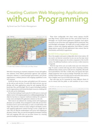
  • 1. Creating Custom Web Mapping Applications without Programming By Derek Law, Esri Product Management These three configurable web client viewer options—ArcGIS. com Map Viewer, ArcGIS Viewer for Flex, and ArcGIS Viewer for Silverlight—are ArcGIS Online application templates. Each option was built on one of the three web mapping APIs for JavaScript, Flex, and Silverlight technologies. All enable you to easily configure and deploy a custom web mapping application. Each follows a similar design pattern: specify the web application’s data content, then its functionality, and finally its appearance. ArcGIS Online Application Templates This is the simplest and easiest configurable client viewer option. All you need is an Internet connection so you can use the map viewer at ArcGIS Online (arcgis.com), the online component of the ArcGIS system. No additional hardware, such as servers or other resources, is required.  A web map created in the ArcGIS.com Map Viewer With the map viewer, you can easily create your own interactive map. To create a custom web map, just select a basemap; combine additional data content, such as web services, shapefiles, Microsoft Web GIS is becoming an essential component of many GIS applica- Excel spreadsheets, CSV files, or KML data; and specify data layer tion solutions. From federal government agencies and corporate display properties such as pop-up dialogs. Essentially, you create a enterprise solutions to state/municipal governments and private mashup of data from your own data sources and online data sources. organizations, a website presence with mapping capabilities is now Once complete, save it as an ArcGIS Online web map. very common. Your web map can be consumed by many different clients. It ArcGIS for Server lets you share and publish your GIS resources can be shared with the public or with members of one or more on the web as web services. To work with these services, you can develop web client applications using the web mapping APIs for  ArcGIS.com web map sharing options JavaScript, Flex, and Silverlight. This is a great technology workflow, but for organizations with limited developer resources, enabling GIS on the web can be challenging. Esri has been making it much easier for ArcGIS users to create and deploy custom web mapping applications without programming. The objective has been to empower traditional desktop GIS analysts to easily create and deploy GIS application solutions on the web. Three easy-to-use solutions for creating custom web mapping ap- plications are available. All are designed to work with services from ArcGIS for Server and ArcGIS Online as well as ArcGIS Online web maps. They provide a means to easily configure and deploy custom web mapping applications without having to write a single line of code. They are ideal for nondevelopers and novice web mapping ap- plication creators. They can also be leveraged by developers working with web mapping APIs who can use these viewers as a starting point for building custom client applications. 42 au  Summer 2012  esri.com
  • 2. Developer’s Corner (RIA) that requires the Adobe Flash Player plug-in on your web browser. With it, you can easily customize and deploy a robust and interactive web mapping client hosted on your web server (e.g., Internet Information Server, or IIS). This configurable web client viewer option is more comprehensive than the ArcGIS Online application templates. You start with the ArcGIS Viewer for Flex application builder, an Adobe Air ap- plication that installs on your local machine and executes as a desktop application. The application builder provides a wizard-like interface for configuring the viewer’s proper- ties. When the application builder is run for the first time, it will prompt you for a default location to deploy the new web applications  Gear icons indicate that these ArcGIS.com application templates are configurable. it creates. Typically, this would be in the web server resources directory. To begin, simply click the Create a New Application button arcgis.com user groups. You can also share it via e-mail, Facebook, or and provide a name for the application. Twitter or embed it in a website as an interactive map. The application builder user interface consists of five control tabs You have another sharing option. You can create a new web map- that follow the general design pattern for configuring web applica- ping application for the web map by using one of the web applica- tions. By navigating to each tab, you configure different aspects of tion templates available on ArcGIS Online for a variety of use cases. the viewer. On the Maps tab, you specify the data content. This can Approximately half these templates have some configuration options be an ArcGIS Online web map or your own basemap and operational (indicated with a gray gear icon), and all were built using the ArcGIS layers. On the Widgets tab, specific GIS functionality, such as draw- API for JavaScript. ing, editing, charting, geocoding, search, legend, geoprocessing, The web application template can be published to ArcGIS Online or printing, is defined. ArcGIS Viewer for Flex includes more than so the web application will be hosted on ArcGIS.com. Once published 20 core widgets that provide the common GIS functionalities needed and shared, the newly created and deployed web application for your in web mapping applications. On the Layout tab, you select which web map can be configured. Simply navigate to the web application’s user interface controls (overview map, navigation tools, show coor- item page on ArcGIS Online and click the Configure App button on dinates) to include in the application. On the Design tab, you set the the web application template’s configuration options. application’s look and feel by adding a title, logo, or theme colors. Options for the Basic Viewer application template include turning on/off many of the viewer’s capabilities such as the legend, print tool,  The basic ArcGIS Viewer for Flex application template and bookmarks. Some functionality, such as the Edit tool, will only configuration options be available if the web map contains editable data. The configuration options available will vary depending on the application template selected. Alternatively, you can download the web application to your own machine as a ZIP file so you can host the web application on your own web server machine. Hosting the web application on premises lets you further customize it via JavaScript API development. To learn more about ArcGIS Online application templates, navi- gate to help.arcgis.com/en/arcgisonline/help/ and choose Popular Topics > Videos > Working with Web Maps. ArcGIS Viewer for Flex Originally released as the Sample Flex Viewer, this application became an official product in summer 2010. Built on the ArcGIS API for Flex, it is a ready-to-deploy, configurable, rich Internet application esri.com  Summer 2012  au 43
  • 3. builder. The new web application can be accessed and used immedi- ately in a web browser. The ArcGIS Viewer for Flex application builder can also be used to manage the web mapping applications it has deployed. Web applica- tions built on the ArcGIS Viewer for Flex can be further customized by directly configuring their XML configuration files. By making simple text edits to these XML files, you can apply more precise customization to your deployed web applications. Comprehensive documentation and samples for editing the viewer’s XML configura- tion files are available online at the ArcGIS Viewer for Flex resource center. Learn more about the ArcGIS Viewer for Flex at links.esri.  Use the ArcGIS Viewer for Flex application builder to choose com/flexviewer. basemaps and operational layers for an application ArcGIS Viewer for Silverlight Released in the first quarter of 2012, the ArcGIS Viewer for Silverlight The configuration workflow for a new application is nonlinear and is another ready-to-deploy RIA option for Windows operating dynamic, which is one of the application builder’s strengths. For ex- systems. It is built on the ArcGIS API for Silverlight and requires ample, you can select the data content, define the functionality and the Microsoft Silverlight browser plug-in. The ArcGIS Viewer for appearance, and then go back and change the data content—there is Silverlight provides an intuitive browser-based application builder no preset configuration workflow. You preview the final application with an interactive “what you see is what you get” (WYSIWYG) user with the Preview tab. experience. This option makes the process of creating new web map- When you are finished, click Done to complete and deploy the new ping applications that are hosted on your own web servers very easy web application. The files that comprise the new web application are and, again, is more comprehensive than the ArcGIS Online applica- stored at the location specified when you first ran the application tion templates. ArcGIS Online ArcGIS Viewer for Flex ArcGIS Viewer for application templates Silverlight Technology based on JavaScript Flex Silverlight Web browser plug-in required No Adobe Flash Player Microsoft Silverlight Installation location Can be hosted on On premises on your own On premises on your own ArcGIS.com or on premises web server web server on your own web server Supports ArcGIS.com login Yes No Yes authentication Works with ArcGIS Online web Yes Yes Yes maps Works with ArcGIS for Server Yes Yes Yes and ArcGIS Online web services Application builder GUI user No Yes Yes experience Configuration options Varies between different Many configuration options Many configuration options templates Extensible framework for Yes, with JavaScript API, if Yes, with Flex API (viewer Yes, with Silverlight API developers the template is download- source code available) (extensibility kit available) ed to a local machine  Table 1: Comparison of configurable web client viewer options 44 au  Summer 2012  esri.com
  • 4. Developer’s Corner Three ArcGIS Viewer for Flex Download Options You can get the ArcGIS Viewer for Flex as a compiled web client application that can be used immediately, or as an application builder used to create new web applications, or as uncompiled source code from GitHub that can be extended by Flex API developers.  The ArcGIS Viewer for Silverlight application builder steps the user through creation of a web application. The ArcGIS Viewer for Silverlight setup installs the application application by clicking the Deploy button, which creates the sup- in your machine’s web server resources directory (e.g., IIS). Its ap- porting files for the new web application in the web server resources plication builder runs in a web browser. When you start it the first directory. time, the application builder will display some introductory text. The ArcGIS Viewer for Silverlight application builder can also be Just click the Create New Application button to start creating a used to manage the web mapping applications it has deployed. With web application. the extensibility kit, Silverlight API developers can create add-ins to Deciding on data content for the new web application is the first extend viewer capabilities. To learn more about the ArcGIS Viewer step. You can create a new map with data you specify or use a web for Silverlight, see links.esri.com/silverlightviewer. map from ArcGIS Online including your own ArcGIS.com items and content in groups that you belong to on ArcGIS.com. Conclusion After choosing the data content option, the application builder’s Esri offers three configurable web client viewer options that benefit main user interface appears, which includes three control tabs, nondevelopers, novice website creators, and developers. The ArcGIS Map, Tools, and Layout, located at the top above the main preview Online application templates are the easiest. The viewers for Flex and window. In the lower right-hand corner is an interactive Getting Silverlight offer more configuration options and include application Started panel. This panel guides beginning users. Clicking an option builders. All are client applications to ArcGIS for Server and ArcGIS in the Getting Started panel activates the corresponding application Online web services and work with web maps from ArcGIS Online. builder functionality on the control tabs. On the Map tab, you can specify data  A deployed ArcGIS Viewer for Silverlight application content such as basemaps, operational layers, and GeoRSS feeds. You can also set the data layer symbolization properties and configure how attribute tables and pop-up dialogs appear. On the Tools tab, you define functionality, such as editing, geoprocess- ing, layer filters, printing, and selection tools, that will be available in the new web application. On the Layout tab, you can configure the application’s look and feel by applying a custom logo, custom title, and colors and select from the prebuilt layout templates furnished. Any property changes will immediately be displayed in the main preview window. The ArcGIS Viewer for Silverlight work- flow is also nonlinear, so you can configure web application properties in any order. Finish creating the new web mapping esri.com  Summer 2012  au 45