GIS-Based Web Services Provide Rapid Analysis and Dissemination of Maritime Data
•
0 j'aime•1,429 vues

GIS-based web services for maritime data

Recommandé
Recommandé
Contenu connexe
Tendances
Tendances (14)
En vedette
En vedette (14)
Similaire à GIS-Based Web Services Provide Rapid Analysis and Dissemination of Maritime Data
Similaire à GIS-Based Web Services Provide Rapid Analysis and Dissemination of Maritime Data (20)
Plus de Esri
Plus de Esri (20)
Dernier
Dernier (20)
GIS-Based Web Services Provide Rapid Analysis and Dissemination of Maritime Data
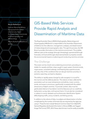
- 1. GIS-Based Web Services Provide Rapid Analysis and Dissemination of Maritime Data Contact Information Martin Rutherford Director Maritime Military Geospatial Information and Services, Royal Australian Navy, Directorate of Oceanography and Meteorology Martin.Rutherford@defence. gov.au The Royal Australian Navy´s (RAN’s) Hydrography, Meteorology and Oceanography (HM) Branch is responsible to the Australian Department of Defence for the collection, management, analyses, and dissemination of meteorological and oceanographic data. Through this process, the HM Branch provides information on the maritime environment. This enables defense users at the strategic (through climatology), operational (through forecasts), and tactical (through observations) levels to properly consider the environmental impacts on planning and conducting maritime activities. The Challenge The ocean can be a harsh and unrelenting environment, providing no shelter for vessels and their crews caught in open waters. Extreme winds, rogue waves, untracked icebergs, and freezing ship superstructures are only a few of the conditions that can disrupt maritime activities. In extreme cases they can lead to disasters. The ability to rapidly assess change for safe navigation is crucial for the mariner and the defense planner. The volume of data collected for parameters such as ocean temperature and salinity, ocean currents, winds, and waves is enormous, significantly increased with the added dimensions of depth and time. To provide context, data must be geolocated relative to foundation maritime features such as coastlines, bathymetric survey data, and nautical charts. It must also be considered in relation to vector datasets such as Automatic Identification System (AIS) shipping traffic, piracy incidents, and fishing activity. In addition to the volume of data, its analysis and dissemination is further complicated by the number of formats that are required by the agencies using it. These formats include Network Common Data Form (NetCDF), General Regularly-distributed Information in Binary (GRIB), and Tagged Image File Format (TIFF). All of these data formats must be easily accessible.
- 2. The Solution Using a combination of custom scripts and ArcGIS® for Server, the HM Branch is able to satisfy a variety of requirements to quickly serve meteorological and oceanographic (METOC), bathymetric, and geospatial foundation data. • Foundation data is served as Open Geospatial Consortium, Inc. (OGC), web services. • Nautical charts and bathymetric data are served as OGC Web Map Service (WMS) with a REST endpoint and also as native GeoTIFF. • The netCDF weather data is published as WMS and Web Coverage Service (WCS) and served as netCDF. • The use of WMS and WCS also allows the use of OGC web processing services (WPS). These make the data readily available for use in ArcGIS for Desktop and a variety of systems that use OGC Web Services. The Result The ability to load data, quickly develop products, and serve the resulting information in a variety of formats and web services are a significant advantage when analyzing rapidly changing environmental conditions. This process enables commanders and analysts to gain superior knowledge of its battlespace and environment, leading to the best course of action at both operational and tactical levels. For more information, e-mail defenseinfo@esri.com. esri.com/defense Copyright © 2014 Esri. All rights reserved. Esri, the Esri globe logo, ArcGIS, @esri.com, and esri.com are trademarks, service marks, or registered marks of Esri in the United States, the European Community, or certain other jurisdictions. Other companies and products or services mentioned herein may be trademarks, service marks, or registered marks of their respective mark owners. G63406 ESRI5M6/14tk Nautical chart data, such as the approach to Darwin, can be viewed in ArcGIS. (Maps © Commonwealth of Australia 2014) Group for High-Resolution Sea Surface Temperature (GHRSST) data can be served as a time-aware service. The time slider can be used to view the data over a period of time.