13. Stratigraphy and sedimentology tell us about past tsunami. Here we are studying the
2004 tsunami sands on Nias island, Sumatra
14. We can see four separate waves of the tsunami and an older tsunami sand layer as
well
15. Along the coast of Aceh, Sumatra, is a cave that contains a remarkable record of
tsunami over >10,000 years
16.
17. We collect the layers to determine their age and to
determine whether they are from a tsunami
18. >10,000- Years BP
year record 2004
of sand 2,900-3,200
deposition 4,800-5,300
in a coastal 3,210-3,900
cave about 4,900-5,300
60 south of
Banda 9,500-10,300
Aceh.
Sands are
interbedded Tsunami
with bat sand beds
guano.
Dates
(before AD
1950) are
from
19. Recall that the islands get dragged down between
earthquakes
26. We now have
48 GPS
The Sumatran
stations
GPS Array
throughout
Sumatra.
We callstations
48 this
installed
network the
Sumatran 2002
between
and 2011
GPS Array, or
SuGAr
27. Here is an example of what it showed, during a M 7.8
Progression of the 25 Oct 2010 Tsunami earthquake, from the SuGAr
earthquake in October 2010
An arrow this
long means 10
centimeters of
horizontal motion
Time since the beginning of the
28. Model for
fault slip
based on GPS
and tsunami
field survey
data
The piece of megathrust
that ruptured was ~30-km
wide, 100-km long and
very close to the trench
with max slip of ~10
meters
Based upon 24-hour solutions scaled by the 1-Hz data Hill and others, in press
29. This is our interpretation of the deformed layers above the
megathrust, from data collected by the oil industry.
30. We also measure
uplift and subsidence
using corals
Sea-level before 26 Dec 2004
uplift
Sea-level after 26 Dec 2004
31. From GPS and coral measurements we could tell from Rich Briggs, after
what part of
the megathrust ruptured to produce the great earthquake et al 2006
Briggs
and
tsunami of 2005
32. Southern extent of
the Dec 2004 rupture
In the months
following December
2004, we warned that
these regions were
now at increased risk
from great
earthquakes and
tsunami
33. This section
did, indeed, fail just
a few months later
All that was now left
was this one
section, which we
refer to as the
Mentawai patch
34. A portion of this locked
patch (in red) broke in
a rapid series of 3
large earthquakes on
Sept 12-13, 2007
Another little patch (in
yellow) broke in
October 2010 and
produced a deadly
tsunami
35. How were we able to
make these forecasts?
When will the rest of
the Mentawai patch
fail?
36. We use ancient corals and the SuGAr to make
forecasts
This coral died due to uplift during a big earthquake in
37. Here’s another one that records the great earthquakes of
1797 and 1833.
We know the ages of the corals from radiometric dating, using
the decay of Uranium to Thorium
44. Other than just curiosity,is a
Padang there
are good reasons to studycity
sprawling
geohazards such as about
of
earthquakes. 800,000 people.
Most of the
Here is Padang, a town is less
city of
than 10 meters
nearly a million people, sea level
above on the
west coast of Sumatra.
We are making forecasts,
based on physics
(hydrodynamics) and
engineering of the effects of
the coming tsunami on the city
So here is a summary of the past decade of big megathrust ruptures offshore Sumatra, as well as a summary of how our understanding has progressed, thanks to GPS geodesy and coral measurements.
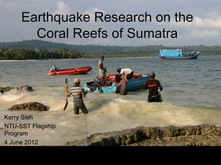
Do sample the fossil corals, we cut big slabs out of them with a chain saw that is equipped to cut under water. Good exercise for an earthquake scientist!
A map-view history of what we call “super-cycles” of rupture on this section of the Sumatran megathrust