
Recommandé
Contenu connexe
Tendances
Tendances (20)
En vedette
En vedette (13)
Similaire à Session 4: Establishment of Community-Based Flood Early Warning System (CBFEWS)
Similaire à Session 4: Establishment of Community-Based Flood Early Warning System (CBFEWS) (20)
Plus de IFRCCOMMS
Plus de IFRCCOMMS (20)
Dernier
Dernier (20)
Session 4: Establishment of Community-Based Flood Early Warning System (CBFEWS)
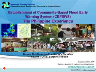
- 1. Department of Science and Technology Philippine Atmospheric, Geophysical and Astronomical Services Administration Disaster Risk Reduction Practitioner’s Workshop 14 November 2013 * Bangkok, Thailand Rosalie C. PAGULAYAN Weather Specialist II, Hydrometeorology Division oyiep@pagasa.dost.gov.ph
- 2. Geographical landscape of the Philippines and the different weather systems that govern its climatic condition Existing flood early warning system Community-based flood early warning system
- 3. The climate of the Philippines is influenced by the complex interactions of various factors such as: Windward side Philippine Geography and Topography Ocean currents Semi-permanent cyclones and anti-cyclones Principal Air Streams Linear systems Tropical Cyclones Associated hazard: flashflood
- 4. Name of River Basin Drainage Area (square kilometer) River Length (km) 1. Cagayan 27,280 505 2. Mindanao 23,169 373 3. Agusan 10,621 350 4. Pampanga 9,759 260 5. Agno 5,952 206 6. Abra 5,125 181 7. Pasig-Marikina-Laguna Bay 4,678 78 8. Bicol 3,771 136 9. Abulog 3,372 175 10. Tagum-Libuganon 3,064 89 11. Ilog-Hilabangan 1,945 178 12. Panay 1,843 152 13. Tagoloan 1,704 106 14. Agus 1,645 36 15. Davao 1,623 150 16. Cagayan De Oro 1,521 90 17. Jalaur 1,503 123 18. Buayan-Malungon 1,434 64
- 5. Telemetered River Basins: • Pampanga • Agno • Bicol • Cagayan Telemetered Reservoirs: • Angat • Pantabangan • Magat • Binga/Ambuklao • San Roque 2012 – Caliraya Dam FFWSDO started its operation
- 6. Rainfall station Flood Forecasting and WarningMain Operation Center Telemetry Equipment Communication tower Water level gauge River Center & its Operation Room Rain gauge & solar panel Fixed and mobile warning facilities
- 7. A “Non-Structural” flood disaster mitigation/management program that is based on the operative capability of the community operating it.
- 8. Conceptualized in 1999. The initiative of the Province of Bulacan to address the need for an early warning system in their flood prone areas was the pilot CBFEWS in the country, which was set-up in 2003, followed by the City of Dumangas, Iloilo in 2005. Both LGUs utilized their own funds for this endeavor. 2006 launching of the READY Project (Hazard Mapping and Assessment for Effective Community-Based Disaster Risk Management). It was aimed at addressing the problem of Disaster Risk Management (DRM) at the local level. Three (3) main components: 1. Multi-hazard identification and disaster risk assessment - Multihazard mapping (1:10,000 scale for landslide and floods; 1:50,000 scale for earthquake/volcano-related hazards and storm surge)
- 9. 2. Community-Based Disaster Preparedness 2.1. Development of Information Education and Campaign (IEC) strategies and materials for specific target groups 2.2 Installation of Community-Based Early Warning System (CBEWS) for hydrometeorological and geologic hazards 3. Mainstreaming of Disaster Risk Reduction into the local Disaster Preparedness Plan PAGASA provides the technical assistance. PAGASA develops the standard methodology on how the CBFEWS shall be established in two (2) phases: implementation phase and operational phase LGUs to ensure the sustainability of the CBFEWS thru Municipal Resolution, Ordinance, etc.
- 10. It empowers local government units (LGU’s) and the communities to protect themselves against floods. The community and LGUs are in the best position to undertake preparedness measures against floods, since the CBFEWS will make the most out of the indigenous/home-grown practices of the community in mitigating the impacts of flooding in their area. It is economical and easy to maintain. It is one way of addressing the need for an EWS in a small communities that are not covered by the conventional (telemetered) flood forecasting and warning system.
- 11. 1. River basin approach 2. Community participation or involvement – Local government units (LGUs)/Communities do the observation and are trained to analyze the data; issuance of advisory 3. Mainstreaming of CBFEWS in the Disaster Contingency Plan of the community – to ensure the sustainability of the system.
- 12. 1. Consultation with the LGUs/Community and other stakeholders – roles and responsibilities LGUs and stakeholders are explained; proposed network design is presented, counterpart activities, MOA, etc. 2. Ocular survey of proposed sites – for site verification, check available means of communication, conduct survey of flooding scenarios, check availability of warning system (if there are any), indigenous practices that could be integrated in the CBFEWS.
- 13. 3. Installation of monitoring equipment, flood signages, hydrographic survey and
- 14. 4. Training of observers 5. Conduct of Special IEC and Pilot testing/Dry-run
- 15. 6. Turn over of CBFEWS to the Local Government Units
- 16. 1. Observation and recording of rainfall and water level data at specified time interval described in the DATA OBSERVATION PROTOCOL (cited in the CBFEWS Operation Manual). Output: Hourly, daily, monthly data summaries, daily hydrological advisories 2. Analysis of observed data &/or preparation & issuance of flood advisories/warnings during inclement weather conditions described in the WARNING PROTOCOL (Manual) Output: Flood advisories/flood warning; actions to be undertaken, disaster & rescue activities undertaken during inclement weather conditions 3. Physical check, maintenance & repair, if necessary, of installed instruments & communication system by observers and LGUs; Output: Working/operational instrument and communication system 4. Post flood survey and evaluation/documentation of flood warning activities that would serve as reference to improve the subsequent operation of CBFEWS Output: Flood warning activity reports – actions taken and recommendations; record of flood marks, correlation between rainfall & water level
- 17. Rainfall Values Meaning Flood Warning Rainfall observation of 15 mm – 20 mm for the past hour Awareness READY Rainfall observation is 60 mm – 80 mm for the past 3 hours Preparedness GET SET Continuous rainfall for the last three hours and 3-hourly observation is more than 80 mm Response GO * Values are arbitrary and will be modified when sufficient data becomes available.
- 18. Rainfall Values Meaning Flood Warning Rainfall observation of 006 – 008* for the past hour Awareness READY Rainfall observation is 008 to 024 for the past 3 hrs Preparedness GET SET Continuous rainfall for the last three Response hours and 3-hourly observation is 024- 032 or more GO Values are arbitrary and will be modified when sufficient data becomes available. * Values of RR for the digital raingauge is in inches (in)
- 19. 3 2 GO 1 Actual Water Level (m) Meaning Flood Warning Level 1 1.1 m Awareness READY Level 2 1.5 m Preparedness GET SET Level 3 2.0 m Response GO * Values are arbitrary and will be modified when sufficient data becomes available.
- 20. 15-20mm 006 to Digital Rain Gauge LEVEL 1 008 Standard Manual Rain Gauge Staff or Water Level Gauge * Rainfall & water level criteria are preliminary estimates and still requires validation during actual events to refine the rainfall criteria.
- 21. 60-80 mm in 3-hours 008 to Digital Rain Gauge 024 Standard Manual Rain Gauge Staff or Water Level Gauge * Rainfall & water level criteria are preliminary estimates and still requires validation during actual events to refine the rainfall criteria.
- 22. More than 80 mm in 3 hours 024 to Digital Rain Gauge 032 or LEVEL 3 River conditions show signs of mud-like color; with debris Standard Manual Staff or Water Level Rain Gauge Gauge * Rainfall & water level criteria are preliminary estimates and still requires validation during actual events to refine the rainfall criteria.
- 25. Warning Phase 1 - READY 2 - Get SET 3 - GO Flood Advisory Communication of Warning 1 - MDCC 2 – BDCC 3 – Local Volunteers Data / Flood Advisory / Warning Weather Update / Info D a O ta/R RR Observers bs er ain va fa tio ll W n Up ea da the Disaster te/ r In fo Operation Center er th nfo (DOC) ea I W ate/ d ll Municipal Hall Up fa n n ai io /R vat Water Level ta r Da bse Observers O Bandillo Megaphone w/siren Church Bells Target Community Batingaw Sitio/Purok Leaders Evacuation Center ◄◄ ◄◄ ◄◄ ◄◄ Flood info 1 – Color 2 – Speed of Flow 3- Sound 4 – Presence of Debris RDCC PDCC Weather Update / Info PAGASA- Field Station Legend: ◄ Information starts here in case of large-scale ◄◄ ◄◄ ◄◄ River Observation ◄ system (Ex. typhoon and monsoon). Information starts here in case of local/ small-scale system (Ex. Thunderstorm and ITCZ).
- 26. 1. Agreement among the stakeholders Prior to installation, a Memorandum of Agreement (MOA), which stipulates the roles and responsibilities of the LGUs and community, including their full support in all the activities that will be undertaken and the involved institutions, is prepared, agreed upon and signed. 2. Enhancement of a Local Ordinance for Operation and Maintenance The MOA is binding only within the tenure of the Local Chief Executive, which is 3 years. To ensure the sustainability of CBFEWS, particularly the allocation of a reasonable amount for the O&M, a local Ordinance has to be enacted by the City or Municipal Council. ORDINANCE NO 2005-01 entitled, “AN ORDINANCE PROVIDING AN ANNUAL APPROPRIATION FOR THE MAINTENANCE AND OTHER OPERATIONAL EXPENSES OF THE COMMUNITY-BASED FLOOD AND DROUGHT FORECASTING AND WARNING SYSTEM IN DUMANGAS, ILOILO”.
- 27. The improvement in warning systems and better preparedness has resulted in the reduction of casualties due to flooding. - The passage of Typhoon Fengshen (locally known as Frank) in June 2008 saw the death of hundreds of people and damage to infrastructure and agriculture in the island of Panay. In the municipality of Dumangas, Iloilo (a CBFEWS site), there was no reported casualty and was even able to send emergency team to assist their neighboring towns in the rescue operation. - In August 2009, the province of Zambales was devastated by flooding due to passage of a Typhoon Kiko but no casualties were recorded. This was mainly attributed to the community based flood early warning system (CBFEWS) in place. - On 16 Dec 2011, Surigao del Sur recorded 2 casualties compared to Cagayan de Oro and Iligan City (more than 1,000) due to the passage of TS Washi. In 2005, CBFEWS was established under the UNDP Ready project. People in the area still remember the lessons during the flood drills conducted. LGUs immediately convened the local DRRMC in anticipation of storm Washi. Cagayan de Oro Surigao de Sur
- 28. During the Revisit of Ready Team on 6016 May 2008: Success stories were noted in the municipalities of Hinatuan, Barobo &Tagbina in SDS, in Libjo for Dinagat Island & in Mainit & Surigao City. Observed data were used to forewarn the threatened communities, i.e. before the landslide that occurred in Surigao City in Feb 2008 and in Hinatuan river basin.
- 29. 1. Operation and Maintenance - responsibility of the concerned LGUs. CBFEWS should be included in the planning process of the LGUs. 2. Institutional stability of CBFEWS - DOC should be an integral part of the institutional set-up of the LGUs. - Some DRRMCs are organized but not functional. - The tenure of the LCEs (3 years) is often the major constraint in the sustanability of the CBFEWS. 3. Differences in political affiliation, priorities and agenda - can often negate the benefits of undertaking a communitybased system - river basins encompasses so many barangay, municipalities. Importance of data/information sharing is encourage.
- 30. 4. Sustainability - The passage of an Ordinance is the most effective mechanism that will ensure the sustaiinability of CBFEWS as this will go beyond the tenure of the local officials. 5. Acceptability of CBFEWS - often those who have experienced a major disaster are more appreciative of CBFEWS. The increasing trend in hydrometeorological hazards, such as flood, contributed to the shift on disaster preparedness and prevention/mitigation, instead of the usual disaster response, recovery and rehabilitation.
- 31. 6. Institutionalization of Partnership among Stakeholders - CBFEWS often involves several stakeholders such as technical agencies from the national agencies, LGUs, private sector, academe, NGO and even the media. It is important that the various stakeholders convene on a regular basis to discuss the issues and concerns of the CBFEWS, including the limitations and possible improvements of the system. 7. Role of Volunteers and Schools - The basic activities of CBFEWS is observation of RR and WL by the observers designated by the LGUs. School children are also tapped as volunteer observers who are often supervised by their teachers. These kind of observations boost the observation network.
- 32. 1. Hazard maps – how can this be appreciated by people who are color blind? Or the warning siren by people with hearing impairment? 2. Laymanizing technical terms – translating scientific knowledge/information into something that the community could understand and would comple them to take appropriate actions. 3. Fast turn-over of leadership at the community level
- 33. Thank you for your kind attention http://kidlat.pagasa.dost.gov.ph/annualreport/annualreport2010.pdf