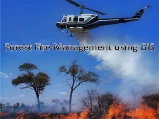
Forest fire management using gis
•Télécharger en tant que PPTX, PDF•
8 j'aime•5,351 vues

Forest fire management using gis

Recommandé
Contenu connexe
Tendances
Tendances (20)
Similaire à Forest fire management using gis
Similaire à Forest fire management using gis (20)
Dernier
Dernier (20)
Forest fire management using gis
- 2. Wild fire - destroys human wealth Avoid Wild fire Using forest fire simulation Factors o Wind velocity o Direction
- 3. Application o Hazard map production o Forest fire simulation & Resource management Information layers such as Digital Elevation Model (DEM) Index of flammability
- 4. Natural fire Prescribed burning the one which starts by human
- 5. GIS in fire risk/probability assessment GIS in prescribed burn planning GIS in preventing fire and its spread GIS in fire simulation GIS in post fire assessment and monitoring GIS in disaster management
- 6. Simulation of a phenomenon is the operation that consists of studying its behaviour in situations generated by virtual data in order to better understand the behaviour of the phenomenon in the real world. Parameters of forest fire simulation Wind Vegetation coverage Topography Fire starting point Temperature
- 7. Combined effect of wind and topography: wind increases the flame of a burning cell and decreases resistance to fire. If the aspect of a cell is against the wind, the effect of wind is increased and if it is toward the wind, the effect of wind is decreased and even sometimes it can be neglected. Effect of the wind can be evaluated by determining the angle between normal vector (perpendicular to the surface) of a cell and vector of wind direction.
- 8. Combined effect of wind, topography and temperature: Another effect of wind is to accelerate cooling. In the case of adjacent cells to the burning ones, wind increases the loss of received energy. If the aspect of a cell is against the wind direction, the cooling effect of the wind will increase and reduction of temperature makes this effect more severe.
- 9. Concentric model R=x a Vf T Concentric model, two circles show fire spread prediction after 1 and 2 hours. where, T is the time in hour, Vf is wind velocity in kilometer per hour, a is a unit less coefficient, x is a coefficient which falls between 0 and 1 and is related to index of flammability and finally R is the radius of circles in kilometer.
- 10. Concentric model ADVANTAGES: •It is the simplest model for forest fire simulation. DISADVANTAGES: •This model not onlt has some technical problem s but also experiment have show that fire spread is never circular •So it is nit always reliable.
- 11. Pseudo-conical Model pseudo-conical model, two conics show fire spread prediction after 1 and 2 hours In pseudo-conical model fire is assumed to spread in a flat conic shape which its vertex is located at the starting point of fire and its extension is along the direction of wind.
- 12. Pseudo-conical Model ADVANTAGES: •More accurate than concentric model. DISADVANTAGES: •This model has no perticular information layer. •This model is not base on GIS.
- 13. Polygonal model If q is the angle measured anticlockwise from x axes of a Cartesian coordinate system then the coordinates of each vertex can be calculated by: Where Yd, Xd are the coordinates of fire starting point, Vf is wind velocity in kilometer per hour, T is the time in hour, Dv is wind direction, Ic is the flammability index, Mt is a parameter for DEM, q is sampling angle, ai is a set of three coefficients that sum of them is equal to 1 and shows the relative effect of slope, flammability and wind, and finally X and Y are the coordinates of sampling vertex.
- 14. Fire spread after 1 and 2 hours predicted by polygonal model , when wind velocity is severe. Fire spread after 1 and 2 hours predicted by polygonal model , when wind velocity is not severe.
- 15. Polygonal model ADVANTAGES: •This is most accurate model. •It takes more information like starting point, wind velocity, direction of wind, flammability. DISADVANTAGES: •The value of sampling angle is not obvious effect of DEM and flammability index is average or determination of correct value for is very difficult if not impossible and even if not determine it will not be correct after any changes in environment situation.
- 16. Network model •This model uses a grid-based DEM and considers burning area as cells in a raster network. • Each burning cell has a burning period and in this period emits heat to its adjacent cells (four cells which have common edge with it). • Also each cell has a flammability degree and if a cell receives more energy than its degree of flammability, it will begin to burn. •So the process of burning continues until no cell is left for burning. •The importance of this model is that it considers individual cells and follows the process of burning.
- 17. Network model ADVANTAGES: •It consider individual cell and follows the process of burning. DISADVANTAGES: •It takes just few parameters which are not enough such as topography,velocity,direction of wind are negleted.
- 18. Implemented model (Normal model) fire life in a cell is assumed to follow a normal PDF curve. During fire life, a burning cell emits heat to its neighbouring cells. If the received heat by a cell is more than its degree of flammability, it begins to burn and this process goes go. Input Data Main information layers in this model are: DEM and index of flammability. DEM is used in grid form. Index of flammability or combustibility is a map. Wind velocity and direction are two other main parameters in this model.
- 19. Algorithm 1. Capturing and setting parameters 2. Loading DEM and index of flammability 3. Calculating normal vector for the whole cells 4. Acquisition of fire starting point 5. Performing main fire loop up to the end of burning 6. Illustration of the fire spread prediction 7. Providing statistical information about fire
- 20. Algorithm The main part of this algorithm is fire loop which work as following: This loop becomes active when the fire starts and becomes inactive when the fire stops. The input for this loop is the fire starting point and as a function of time calculates the amount of heat for the burning cell according to the normal cure. Meanwhile, the heat of the burning cell is emitted to the adjacent cells and if the received heat is more than the degree of flammability, adjacent cells start to burn too. Cells adjacent to one or more burning cells receive heat continuously but do not absorb all of the received heat. Some of the received heat is continuously lost. Temperature of a burning cell, value of heat transfer to the adjacent cells and value of heat loss are all depended on some factors which are set by parameters. Fire loop continues till no burning cell exists. After the loop is over, the cells are mainly divided into two categories: burnt and not burnt.
- 21. Increasing Situational Awareness and Providing Firefighter Safety Response • Where is the fire located? • What is the best way to access the fire? • What is the terrain and fuel type? • Where are the evacuation routes? • What are the hazards to responding units? • What are the values at risk? • Whose jurisdiction is the incident within?
- 22. Recovery Rapid and accurate damage assessment Using GIS integration platforms for the collection, analysis, and display of various types of postincident data Can collect accurate damage information from the field.
- 23. The GIS map provides an overall view of damage and recovery needs with location-specific photos and reports including • Severity of damage to buildings • Status of infrastructure and utilities • Condition of landscapes • Impact on natural resources
- 24. Simulation of a forest fire is a real challenge. For example velocity and direction of the wind can vary continuously but real time determination of these variations is almost impossible. On the other hand, the combined effect of wind and topography can not be easily determined. More assessment on the relative effect of the fire parameters is one of the requirements of this model in the future. In case a real forest fire record exists, setting coefficients with artificial neural networks seems to be appropriate. Also because of the similar effect of fire in all directions, one can use a network with hexagonal cells instead of square ones.
Notes de l'éditeur
- Forest Fire is a natural phenomenon. It is part of the nitrogen cycle and it helps forests to grow healthy. However, "wildfire" is a huge and out of control fire which destroys human wealth and therefore, it is kind of disaster. The very first strategy to defend the forests against wildfire is to avoid it. So fire risk maps are produced and even prescribed burning is done. Nevertheless, wildfire happens and the only choice in this case is to control it. Knowing the fire behavior, one can use forest fire simulation to predict and control the wildfire. There are many factors which play a role in a forest fire. The most important ones are wind velocity and direction, index of forest flammability, slope and aspect of the terrain. Slope is an efficient factor to determine the fire spread direction. Velocity of the wind plays a more serious role in fire spread, if its direction matches with the aspect. A grid-based Digital Terrain Model (DTM) is used to extract slope and aspect of the terrain. Also raster maps showing the index of flammability, velocity and direction of the wind are used. All of these information are put in a Geospatial Information System (GIS) to simulate and visualize the wildfire spread. It is shown that GIS is a very efficient tool to predict and control the wildfire.
- Nowadays application of Geospatial Information Systems (GIS) in disaster management has extended considerably and in some cases it is even unavoidable. Forest fire happens from time to time and this has given human a chance to observe and develop different models for forest fire behavior. GIS as a powerful tool for management of spatial information, has also proved its potential in forest fire management. There are different applications of GIS in forest fire management out of which the most important ones are hazard map production, forest fire simulation and resource management. Simulation by itself has a main role in the management of forest fire. GIS uses various information layers such as Digital Elevation Model (DEM) and index of flammability along with different models for the pur[ose of forest fire management. Models can be simple or complex. Simple models have few parameters and can be implemented even without GIS, however, because of their simplicity their results are not so reliable. On the other hand, very complex models which use detailed physical characteristics of fire are not reliable either as there is not either enough or up to date information on their parameters. So finding an optimum model that takes advantage of sufficient number of parameters while has an acceptable level of simplicity is very important.
- Nowadays application of Geospatial Information Systems (GIS) in disaster management has extended considerably and in some cases it is even unavoidable. Forest fire happens from time to time and this has given human a chance to observe and develop different models for forest fire behavior. GIS as a powerful tool for management of spatial information, has also proved its potential in forest fire management. There are different applications of GIS in forest fire management out of which the most important ones are hazard map production, forest fire simulation and resource management. Simulation by itself has a main role in the management of forest fire. GIS uses various information layers such as Digital Elevation Model (DEM) and index of flammability along with different models for the pur[ose of forest fire management. Models can be simple or complex. Simple models have few parameters and can be implemented even without GIS, however, because of their simplicity their results are not so reliable. On the other hand, very complex models which use detailed physical characteristics of fire are not reliable either as there is not either enough or up to date information on their parameters. So finding an optimum model that takes advantage of sufficient number of parameters while has an acceptable level of simplicity is very important.
- There are many different parameters which can be used in forest fire simulation and obviously different models take different set of parameters into consideration. Using too many parameters in a model doesn’t necessarily increase the precision of model and even sometimes makes the model very unreliable. In other word, a reliable model uses the most important and effective parameters. The most important parameters for forest fire simulation are: Wind which both its velocity and direction are important. Velocity of wind affects velocity of fire spread and direction of wind affects direction of fire spread. Information about wind can be extract from meteorological data. Vegetation coverage which determines index of flammability. The best tool to analyze vegetation coverage is remote sensing and Canada has used this tool for this purpose ninety's [8]. Of course direct sampling is necessary to better determine vegetation coverage. Topography which determines slope and aspect of the terrain. Digital Elevation Model is the best source for topographic data. Fire starting point which is the initial point in fire modeling. Regional temperature: This factor and moisture are from the most important factors which determine forest fire risk. At the time of forest fire, loss of heat in cells that receive the heat, is strongly depended on regional temperature. Therefore, in cold weather the domain of forest fires are more limited and speed of fire spread is much lower.
- There are many different parameters which can be used in forest fire simulation and obviously different models take different set of parameters into consideration. Using too many parameters in a model doesn’t necessarily increase the precision of model and even sometimes makes the model very unreliable. In other word, a reliable model uses the most important and effective parameters. The most important parameters for forest fire simulation are: Wind which both its velocity and direction are important. Velocity of wind affects velocity of fire spread and direction of wind affects direction of fire spread. Information about wind can be extract from meteorological data. Vegetation coverage which determines index of flammability. The best tool to analyze vegetation coverage is remote sensing and Canada has used this tool for this purpose ninety's [8]. Of course direct sampling is necessary to better determine vegetation coverage. Topography which determines slope and aspect of the terrain. Digital Elevation Model is the best source for topographic data. Fire starting point which is the initial point in fire modeling. Regional temperature: This factor and moisture are from the most important factors which determine forest fire risk. At the time of forest fire, loss of heat in cells that receive the heat, is strongly depended on regional temperature. Therefore, in cold weather the domain of forest fires are more limited and speed of fire spread is much lower.
- There are many different parameters which can be used in forest fire simulation and obviously different models take different set of parameters into consideration. Using too many parameters in a model doesn’t necessarily increase the precision of model and even sometimes makes the model very unreliable. In other word, a reliable model uses the most important and effective parameters. The most important parameters for forest fire simulation are: Wind which both its velocity and direction are important. Velocity of wind affects velocity of fire spread and direction of wind affects direction of fire spread. Information about wind can be extract from meteorological data. Vegetation coverage which determines index of flammability. The best tool to analyze vegetation coverage is remote sensing and Canada has used this tool for this purpose ninety's [8]. Of course direct sampling is necessary to better determine vegetation coverage. Topography which determines slope and aspect of the terrain. Digital Elevation Model is the best source for topographic data. Fire starting point which is the initial point in fire modeling. Regional temperature: This factor and moisture are from the most important factors which determine forest fire risk. At the time of forest fire, loss of heat in cells that receive the heat, is strongly depended on regional temperature. Therefore, in cold weather the domain of forest fires are more limited and speed of fire spread is much lower.