PA Shale-Gas Monitoring Report Summary

This document provides a summary of the Pennsylvania Bureau of Forestry's shale gas monitoring report from April 2014. The report details the bureau's shale gas monitoring program and findings on various values including infrastructure, flora, forest health, invasive species, water, soil, and air. Some key findings are that approximately 1,486 acres of state forest have been converted for gas infrastructure, water quality monitoring has not found any significant impacts from development so far, and placement of infrastructure has largely avoided wet soils and areas with high runoff potential. The report is intended to objectively communicate the bureau's monitoring efforts and findings to inform management decisions around balancing gas development with other forest uses and values.

Recommandé
Recommandé
Contenu connexe
Similaire à PA Shale-Gas Monitoring Report Summary
Similaire à PA Shale-Gas Monitoring Report Summary (20)
Plus de Marcellus Drilling News
Plus de Marcellus Drilling News (20)
Dernier
Dernier (11)
PA Shale-Gas Monitoring Report Summary
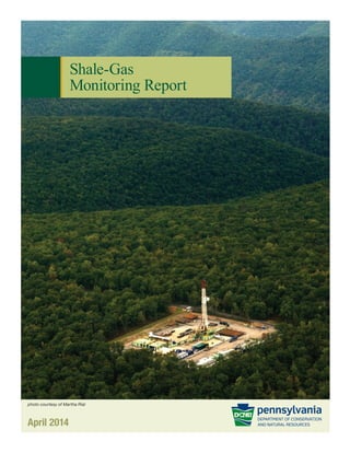
- 1. Shale-Gas Monitoring Report April 2014 photo courtesy of Martha Rial
- 2. 2 Shale-Gas Monitoring Report As scientists, we define “monitoring” as repeated measurements over time to determine trends or patterns. As managers and stewards of our forests on behalf of all Pennsylvanians, those trends and patterns inform our decisions as we balance the many uses and values of the state forest system. This Shale-Gas Monitoring Report represents a first iteration of our measurements and is intended to represent a snapshot in time. Future reports are anticipated as more data are collected and analyzed and more trends are observed. Monitoring is a long-term effort and one that the department is committed to continue. Most people want to be assured that shale-gas activity on state forest land is being “monitored” properly. They may have different perspectives on how monitoring is defined, but they want to know that staff members are on the ground observing and managing the activity that is occurring. I hope that the breadth and depth of this report allays those concerns and demonstrates that shale-gas production on the state forests is being carefully managed. Monitoring helps us learn whether our management decisions are successful. We already have and continue to make adjustments based on our observations, and our management guidelines will continually be updated as more information is brought forth to inform our decision-making. It is important to note that a broad set of values is being monitored. This is critical as limiting data collection to one or a few values may lead to misplaced conclusions. Only by viewing this activity in the broadest sense can one get a more complete picture of the various tradeoffs involved. Monitoring does not necessarily give you answers – it gives you data to inform or to be used for decision-making. This report is not intended to impose a certain viewpoint on the reader. The intent of the report is to present information in as objective a manner as possible. Depending on one’s viewpoint, or perspective, the reader can place his or her values on the information presented in the report. For example, the addition of new roads on the state forest can be viewed as increasing access for forest visitors or viewed as diminishment of wild character, depending on one’s perspective. Preface
- 3. 1Shale-Gas Monitoring Report Oftentimes, trends, or effects, are not evident for years or decades. Despite that, there are some findings that can be gleaned from this initial report. First and foremost is that shale-gas production on state forest lands is neither benign nor catastrophic. There are clearly impacts and tradeoffs associated with this activity. The question is what tradeoffs are acceptable. The Bureau of Forestry considers these tradeoffs and attempts to balance the various uses and values of the forest. Some examples: • Water is the resource that most people cite when expressing their concerns about shale-gas production. This report describes our monitoring efforts, as well as other agencies’ efforts, in some detail. Although incidents have occurred, the monitoring data show that water quality has not been affected due to this activity. • Forest conversion and fragmentation also are often cited as concerns. The data do demonstrate that forests are being converted and fragmented, but less than originally expected. This is probably a result of the management decision to place this activity within or adjacent to existing infrastructure or existing disturbances, where it is more noticeable to the public but requires less forest disturbance. • Invasive species are a concern as areas of disturbance tend to create conditions conducive to invasion by pests or unwanted species. The report clearly shows that invasive species need to be carefully managed and controlled. • Recreational experiences and expectations vary by user. Some recreationists prefer solitude and a more wilderness-type experience, whereas others, such as motorized vehicle enthusiasts, are happy with a less primitive and more developed experience. The monitoring data show a trend from the more remote experience to a semi-primitive experience. This warrants close scrutiny in the future to ensure that a wide variety of recreational experiences are available on the state forests. These observations are but a few that could be extracted from the report. Future iterations of the monitoring report will reveal more emerging and interesting trends. As well pads are reclaimed; impoundments are drained and converted back to forest; new well pads and pipelines are added; and new best management practices are implemented, there will be new findings and observations. Shale-gas production on the state forest likely will continue to grow as the areas currently leased begin or continue to be developed. It is the management philosophy of the bureau to avoid this activity altogether in the most sensitive areas of the state forest. Where the activity is permitted to occur, we will strive to minimize the surface impact to the greatest reasonable extent and to mitigate for the impact whenever possible. And of course, we will continue to monitor this activity, use our observations to adjust management decisions, and report our findings periodically. This monitoring report is the result of the hard work and effort of many dedicated staff members in the Department of Conservation and Natural Resources and specifically the Bureau of Forestry. I trust that you will find their work and this report informative. We welcome your observations on this report and on our efforts to manage the state forests in a sustainable manner while balancing the many uses and values of these forests. Daniel A. Devlin Deputy Secretary for Parks and Forestry (Former Director, Bureau of Forestry) Department of Conservation and Natural Resources
- 4. 2 Shale-Gas Monitoring Report Executive Summary........................................ 3 Part 1: Introduction........................................12 A Steward of the Commonwealth’s Forest System Natural Gas Development and State Forest Lands Shale-Gas Monitoring Program Part 2: Monitoring Values............................. 34 Part 3: Partner Monitoring......................... 220 SRBC Remote Water Quality Monitoring Network Forest Certification Part 4: Research Partnerships ................. 244 Part 5: References...................................... 256 Part 6: Index of Figures & Tables.............. 260 Infrastructure.................34 Flora (Plants)..................70 Forest Health.................88 Invasive Species............94 Water.............................102 Soil.................................126 Air..................................134 Incidents.......................140 Fauna (Wildlife)....................144 Recreation............................152 Community Engagement... 174 Timber...................................180 Energy...................................188 Revenue................................198 The Forest Landscape........204 Table of Contents
- 5. 3Shale-Gas Monitoring Report 3 Introduction The Department of Conservation and Natural Resources (DCNR) Bureau of Forestry is broadly responsible for conserving the forests of the commonwealth. One of the bureau’s most significant roles is to act, in the public trust, as steward of the commonwealth’s 2.2-million-acre state forest system. Natural gas development is one of the management activities that historically has occurred on state forest land. The activity contributes significantly to Pennsylvania’s economy and provides a source of domestic energy. Natural gas development, however, especially at the scale seen in the modern shale-gas era, affects a variety of forest resources and values, such as recreational opportunities, the forest’s wild character, scenic beauty, and plant and wildlife habitat. Overall, approximately 1.5 million acres of state forest are underlain by Marcellus shale. Of that acreage, 44 percent (673,000 acres) is available for gas development either through bureau-issued leases (386,000 acres) or severed lands development (287,000). Modern shale-gas leases restrict surface disturbance in sensitive areas and limit overall surface disturbance to approximately 2 percent of the acreage within the lease tract. Executive Summary photocourtesyofMarthaRial
- 6. 4 Shale-Gas Monitoring Report Given the host of potential impacts of shale-gas development to the state forest system and its associated uses and values, the bureau has established a Shale-Gas Monitoring Program to track, detect, and report on the impacts of the activity. The program aims to provide objective and credible information to the public and inform and improve shale-gas management efforts. The bureau’s Shale-Gas Monitoring Program was initiated in late 2010, when the bureau was authorized to hire a dedicated monitoring team of 15 staff members. The program began full implementation in 2011, when the bureau completed staff hiring, met with advisory committees, and began developing monitoring protocols and building a variety of internal monitoring tools. The bureau takes a three-tiered approach to its monitoring, recognizing that an effective, long-term monitoring program must be multifaceted. These tiers include: 1) an integrated and dedicated Shale-Gas Monitoring Team; 2) related forest resource monitoring and on-the-ground management activities; and 3) research and external partner collaboration. These tiers form the foundation for the bureau’s shale-gas monitoring effort. An essential function of the Shale-Gas Monitoring Program is to regularly compile and analyze its data and findings. This first report is also an opportunity to communicate basic information about the bureau’s monitoring program and its plans for future monitoring efforts. Monitoring Values To help guide its monitoring program, the bureau devised a suite of “monitoring values.” These values, developed with input from its advisory committees, help focus monitoring efforts on values that relate to the sustainability of the state forest system, the impacts of natural gas drilling on state forest to stakeholders and communities, and the bureau’s mission. The values follow with key points and findings: Infrastructure Natural gas exploration and development can cause short-term or long-term conversion of existing natural habitats to gas infrastructure. The footprint of shale- gas infrastructure is a necessary part of shale-gas development; however, the bureau attempts to manage this infrastructure to reduce surface disturbance and minimize impacts to other state forest uses and values. Key points and findings include: • Approximately 1,486 acres of forest have been converted to facilitate gas development in the core gas districts (state forests subject to shale gas development), including roads, infrastructure and well pads and pipelines. During the same time period (2008 to 2012), the bureau acquired 33,500 acres to add to state forest system, including 8,900 acres in core gas forest districts. • One hundred and sixty-one total miles of road have been improved or constructed for shale-gas development in the core gas districts. Of these, 131 miles of state forest roads that existed prior to the shale-gas development have been improved or upgraded for gas development activities, and 30 miles of new roads have been constructed for gas development activities. • One hundred and ninety-one infrastructure pads have been constructed to facilitate shale-gas development in the core gas forest districts. • One hundred and four miles of pipeline corridor have been constructed or widened in the core gas forest districts.
- 7. 5Shale-Gas Monitoring Report Flora (Plants) The bureau oversees the protection of Pennsylvania state-listed native wild plants on state forest lands by reviewing proposed shale-gas development projects and advising bureau managers on the best means to avoid impacts to rare plant species and communities. There are four main components of the plant monitoring program, including: evaluating vegetation communities immediately adjacent to shale-gas development; monitoring tracts subject to shale-gas development for non-native, invasive plant species; assessing rare plant populations and important wetland habitats; and conducting vegetation inventories in areas of potential future shale-gas extraction. Key points and findings include: • A majority of forest conversion for the construction of gas infrastructure on state forest lands occurs in the dry oak-heath community type. • In undisturbed forest habitat surrounding pads, New York fern (Thelypteris noveboracensis) and hay- scented fern (Dennstaedtia punctilobula) had the highest average percent cover in the understory, with 31.2 percent and 31.0 percent cover, respectively. • The most prevalent species in areas around the edges of pads re-vegetated with erosion and sedimentation control seed mixes were Festuca species, with 19.2 percent average percent cover, Orchardgrass (Dactylis glomerata, 16.0 percent), and red clover (Trifolium pratense, 14.2 percent). Forest Health The bureau promotes programs to improve and maintain the long-term health and biodiversity of forest ecosystems. The bureau evaluates biotic and abiotic factors affecting the health of trees and woodlands, utilizes integrated pest management techniques to mitigate the effects of destructive agents, and promotes forest health to the public. Key points and findings include: • The bureau participates with the USDA Forest Service in the Forest Health Monitoring Program, a national program designed to determine the status, changes, and trends in indicators of forest condition on an annual basis. • The principal damage-causing agents from 2008 to 2012 in the core gas forest districts were gypsy moth, forest tent caterpillar, and frost. • Impacts to the forest surrounding disturbance can only be discovered through long-term forest health monitoring. Invasive Species The development of shale-gas resources on state forest lands has the potential to increase the spread of nonnative invasive species. The bureau works cooperatively with the Pennsylvania Invasive Species Council, the Pennsylvania Department of Agriculture, the U.S. Department of Agriculture, and other state agencies and organizations to coordinate efforts regarding invasive species. Key points and findings include: • Eleven non-native invasive plant species were present at 14 of 18 representative pads across core gas forest districts. The invasive plant with the largest mean population size was Japanese stilt-grass (Microstegium vimineum). • Increased susceptibility to pest attack, especially by nonnative invasive species, may occur wherever there is forest disturbance, especially for trees along newly created edges. However, impacts in the surrounding forests can be discovered only through long-term forest health monitoring. Water Numerous methods are employed by the bureau to sample and analyze water resources within the core gas forest districts, with an emphasis on water quality of surface waters. The present focus is surface water
- 8. 6 Shale-Gas Monitoring Report quality because this forest system value is of critical concern to stakeholders, could be impacted by shale-gas development, and can be readily and cost- effectively assessed. Key points and findings include: • The majority of streams in the core gas forest districts (71 percent) are first-order, headwater streams. • The majority of streams in the shale-gas region (87 percent) are classified as high quality or exceptional value by the DEP, and many streams are identified as having naturally reproducing trout populations by the Fish and Boat Commission. • A widespread sampling of field chemistry, including over 300 locations, showed that pH results were primarily in the circum-neutral range, with 72 percent of results between 6.5 and 7.5 and a median pH of 7.01. • A widespread sampling of field chemistry showed that 91 percent of specific conductance results were below 100 microsiemens(μS)/cm, with a median of 41.3 μS/cm. • Initial water monitoring results have not identified any significant impacts due to shale-gas development. This is based on one round of field chemistry sampling throughout the shale-gas region and over a year of operation for 10 continuous monitoring devices in key watersheds. At this early stage, the data collected are primarily for establishing baseline conditions. • Future monitoring efforts include longitudinal surveys of field chemistry, surface water grab sampling, installation of continuous monitoring devices, and an assessment of pipeline-stream crossings. Soil Shale-gas development often involves earth disturbance activities that require careful planning and oversight to minimize negative effects on soil quality. Soil resource management and monitoring is achieved in collaboration with DEP. Regulation of earth disturbing activities falls within DEP’s jurisdiction. The bureau helps to monitor for problems relating to erosion and sediment control and reports issues to DEP. Key points and findings include: • To the extent possible, placement of shale-gas infrastructure has avoided wet soils and soils with high runoff potential. • Of all pads, impoundments, and compressors constructed, over 85 percent were on well-drained to excessively well-drained soils, and over 80 percent were on soils with medium to very low surface runoff index. • Of all pipelines constructed, over 70 percent occurred within well-drained to excessively well-drained soils and within soils with medium to very low surface runoff index. • Of all roads newly constructed or improved due to shale-gas development, over 80 percent occurred within well-drained to excessively well-drained soils and within soils with medium to very low surface runoff index. • Future research and monitoring will focus on the effects of well pad construction on soil physical and chemical properties, as well as the effects of best management practices on hydrology and sediment loads. Air Shale-gas development involves many stages that provide different avenues for the release of air pollutants. Although shale-gas development may emit various pollutants, the natural gas produced through shale-gas development also has the potential to create an overall positive effect on air quality. The bureau is not conducting air quality monitoring. The bureau relies on DEP to assess potential effects of air emissions from the shale-gas industry and to require applicable air permits of shale-gas operations. Key points and findings include: • Since shale-gas development began in Pennsylvania in 2008, there has been a marked decrease in several major air pollutants, such as sulfur, nitrogen oxides, and carbon dioxide. This is due, in part, to the
- 9. 7Shale-Gas Monitoring Report increased use of natural gas for power generation, the shutdown of several major facilities, and the installation of air pollution control equipment. • Short-term air sampling at several locations around the state has detected natural gas constituents and associated compounds in the vicinity of shale-gas operations. These compounds were not detected at concentrations that would likely cause health-related impacts, although some were detected at levels which would produce an odor. • A one-year study is under way in southwest Pennsylvania to study the potential long-term and cumulative effect of air emissions from compressor stations and a major processing facility. A study is also under way to examine the concentrations of ground- level ozone in the vicinity of shale-gas operations. • A short-term air quality study in Ramsey Village, in Lycoming County along the Pine Creek Rail Trail, did not detect air pollutants above rural background conditions. Incidents Incidents occurring on state forest lands related to shale gas development are recorded by both DEP and the bureau. DEP tracks incidents that are investigated involving violations of state environmental laws and regulations. Additionally, the bureau’s Incident Reporting System records more general incidents in a variety of categories that occur on state forest land. Key points and findings include: • From 2008 through 2012, DEP investigated 324 incidents on state forest land, resulting in 308 notices of violations (NOVs). • From July 1, 2009, through 2012, 264 incidents in 50 different categories were reported through the bureau Incident Reporting System across all state forest districts directly related to gas development activity. Fauna (Wildlife) State forest lands are an important source of food, cover, water, and space for wildlife, which are critical components of ecosystems. The bureau manages forested habitat, ensuring that natural biological communities can thrive. The bureau will base wildlife monitoring efforts on habitat and certain indicator species. The bureau will focus on habitats adjacent to gas development, along with restored gas infrastructure areas. Monitoring efforts will focus on well pads, roadsides, pipeline rights of way, wetlands adjacent to development, forest interior areas near gas infrastructure, and reclaimed or reforested areas. Key points and findings include: • Wildlife habitat will change due to shale-gas infrastructure, resulting in more edge and early successional habitat. • The bureau is monitoring the positive and negative impacts of shale-gas development on wildlife communities to better understand their long-range implications and steps that can be instituted to avoid and mitigate negative impacts. • The bureau is in the early stages of developing its wildlife monitoring protocols. The bureau will focus on monitoring changes in habitat conditions in relation to shale-gas development.
- 10. 8 Shale-Gas Monitoring Report • Through its monitoring program, the bureau is funding multiple research projects to advance the understanding of the impacts of shale-gas development to wildlife species, such as interior forest birds and timber rattlesnakes. Recreation Gas development includes extensive infrastructure that requires careful siting to minimize impacts to recreational features. New infrastructure can affect wild character and viewsheds. Noise-generating activities may affect visitor experience. Roads, well pads, pipelines and other shale-gas infrastructure also can affect snowmobile and hiking trails. At the same time, opportunities to enhance recreational trails and experiences can be realized through new shale-gas infrastructure. Key points and findings include: • No national hiking trails in Pennsylvania have been impacted by shale-gas development. Three designated state forest hiking trails have been impacted. • Statewide, since 2006, there has been a 5 percent increase (145 miles) in total snowmobile trail miles across the state forest system. This is the result of a 203-mile decrease in joint-use trails and a 348-mile increase in designated snowmobile trails. • Snowmobile trail systems have been impacted in each of the core gas forest districts. New snowmobile trails have been created to replace impacted snowmobile trails. • The need for road access for shale-gas development has resulted in heavier traffic on state forest roads. Upgraded roads may be safer and easier to drive but may have lost some of their “wild character” value. • The impact of shale-gas development on recreational experience and wild character as measured by the Recreation Opportunity Spectrum is a 9,341-acre increase in semi-developed and developed acreage; a 913-acre decrease in semi-primitive acreage; an 8,409- acre decrease in semi-primitive non-motorized acreage; and a 19-acre decrease in primitive acreage. • Initial measurements at six out of the seven operating compressor stations measured on state forest lands were louder than the 55db(A) suggested by the updated Guidelines for Administering Oil and Gas Activity on State Forest Lands. • Forty-six out of 116 comment card respondents in core gas forest districts indicated that Marcellus activity had changed their visitation experience. Forty-one out of 116 respondents indicated that Marcellus activity had changed their recreational use of the state forest. Community Engagement Natural gas development on state forest lands has potential economic and social effects on local communities. The bureau interacts with local communities through the implementation of its public participation policy, which includes public education and participation as an integral part of the management of state forest lands. The components included in the community engagement section of this report are advisory committees, gas tours on state forest land, and focus groups. Key points and findings include: • Natural gas development on state forest lands has potential economic and social effects on local communities. • The bureau uses advisory committees to promote stakeholder feedback and produce recommendations.
- 11. 9Shale-Gas Monitoring Report • Outreach offers valuable opportunities to demonstrate how natural gas activity is conducted and managed on public lands and has become a source of understanding public perceptions. • Focus groups have been designed to identify and understand the social effects on communities resulting from natural gas development on state forest lands. One pilot focus group targeting community leaders in Pine Creek Valley was conducted in November of 2013. Two additional groups targeting government leaders in Tioga and Clinton counties were conducted in 2014. Timber One of the purposes for the creation of a state forest system was to provide a continuous supply of timber, lumber, wood and other forest products. According to the bureau’s strategic plan, state forest lands should provide a sustained yield of high-quality timber consistent with the principles of ecosystem management. In relationship to shale-gas management, the bureau will monitor the impacts to silvicultural practices, timber sales, distribution and placement, logging access, and revenues. Key points and findings include: • Initial analysis shows that some timber management activities in core gas forest districts may be shifting away from areas leased for shale-gas development. Some of this change, however, may be due to gypsy moth salvage harvesting. • The effect of shale-gas development on timber harvest placement and harvest allocation goals is inconsistent across core gas forest districts. More information and data are needed to discern reliable trends. • Shale-gas development is indirectly decreasing timber harvest revenue due to Route 44 bonding costs resulting from heavy hauling associated with shale-gas development. Energy The modern energy mix within the United States today consists chiefly of five energy sources: oil or petroleum, natural gas, coal, various renewable energy sources, and nuclear energy. The second-largest portion of U.S. energy usage is derived from natural gas or methane at approximately 25 percent of all consumption. Natural gas is a fuel of choice for heating and industrial processes and electrical production where available in large quantities at a competitive price. Natural gas can be expected to gain market share over time and may gain the majority of new national energy consumption that arises from normal annual energy need increases. Key points and findings include: • Approximately 15 percent of all shale gas produced in Pennsylvania comes from state forest lands. This gas is sold and distributed across the eastern and midwestern United States to service energy markets on a daily basis. • Natural gas in the United States is an open-market traded commodity that has seen the price per product unit fall from a high of approximately $10 per Mcf (1,000 cubic feet) in 2010 to the current (end of 2013) $4.75 per Mcf as a direct result of Pennsylvania shale gas coming onto the market grid and forcing gas prices to moderate with respect to the gas supply. • On state forest land, the number of wells per pad ranges from one to ten, with approximately four to eight wells being the average. A typical well drains approximately 100 acres, but that figure can be less or greater depending on a number of factors. • The bureau anticipates that approximately 3,000 gas wells may be drilled on state forest lands to fully develop the current leased acreage on commonwealth gas leases, on which approximately 568 had been drilled by the end of 2013. A portion of these new wells will be drilled on existing well pads. • State forest lease tracts targeting shale gas are estimated to be approximately one-fifth developed. This, however, is only a projection, as future energy development patterns are difficult to accurately predict and depend on market conditions and the performance of individual tracts.
- 12. 10 Shale-Gas Monitoring Report Revenue Since the first leases in 1947, the development of natural gas resources on state forest land has generated a steady and increasing revenue source for the commonwealth in the form of rents and royalties. The data presented have been tracked and tabulated by the bureau since 1947. Key findings and points include: • The pre-shale-gas period of oil and gas activity provided a total income to the commonwealth of approximately $153,659,522. The shale-gas period (through 2012, for the purposes of this report) has provided $582,250,644 in revenue. The combined total of all revenue from the oil and gas lease program from 1947 to the end of 2012 has been approximately $735,910,166. • The influx of shale-gas production revenue began in 2009 when most of the wells that had been first proposed in 2007, 2008, and early 2009 were drilled and connected to the pipeline system and gas was delivered to the market. • Royalty income is just beginning to come to DCNR from the hundreds of new shale-gas wells on state forest land. • Steady revenue growth from gas extraction is expected to continue for the next decade as the full development of the leases comes to a conclusion. Forest Landscapes Approaches to forest management must take into account not only the direct impacts of various activities, but also the cumulative, landscape-level impacts of these activities over time. Landscapes are contextual in nature, and thus there is no firm definition of what constitutes a “landscape” in a forested setting. This chapter, however, attempts to address certain forest values and impacts of shale-gas activities across the greater forested land base. This initial report focuses on the landscape-level impacts of shale-gas development to forest conversion, the value of “wild character,” forest fragmentation, and restoration. Key points and findings include: • Approximately 1,486 acres of the 2.2-million-acre state forest system have been converted to facilitate shale- gas development. During the same time period (2008 to 2012), the bureau acquired 33,500 acres to add to state forest system, including 8,900 acres in the core gas forest districts. • One assessment of the current impact of gas infrastructure on wild character, using the Recreation Opportunity Spectrum as a measurement tool, is a 9,340-acre increase in semi-developed and developed acreage. Correspondingly, there was a 912-acre decrease in semi-primitive area, an 8,409-acre decrease in semi-primitive non-motorized area, and a 19-acre decrease in primitive area. • In core gas forest districts, the bureau’s forest fragmentation analysis showed the largest increases in edge forest in Tiadaghton State Forest (1,813 acres) and Tioga State Forest (1,257 acres). Overall, core gas forest districts added 4,355 acres of edge forest. • In the core gas forest districts, there was a loss of 9,242 acres of core forest greater than 200 hectares. Core forests are large parcels of interior forest not affected by roads, pipelines, well pads, and other infrastructure. • Elk, Moshannon, and Tiadaghton state forests have had a combined total of 10 well pads that have been partially reclaimed by reducing the pad size and replanting the adjacent areas with vegetation. No gas infrastructure sites have received full ecological restoration. Partner Monitoring Susquehanna River Basin Commission (Remote Water Quality Monitoring Network) The Susquehanna River Basin Commission (SRBC) is a federal, interstate commission that guides the conservation, development, and administration of water resources of the Susquehanna River basin.
- 13. 11Shale-Gas Monitoring Report In response to increased levels of shale-gas development in the Susquehanna River basin, SRBC established its Remote Water Quality Monitoring Network (RWQMN) for real-time, continuous monitoring of field chemistry parameters. The RWQMN is intended to help SRBC and its stakeholders develop a baseline characterization of water quality in the shale-gas region and monitor for potential changes in water quality due to shale-gas development. In November 2009, SRBC announced it was seeking partners with whom it could expand its RWQMN to rivers and streams remotely located in the northern tier of Pennsylvania. In 2010, the bureau provided $280,000 from the Oil and Gas Lease Fund to SRBC to purchase monitoring equipment and for subsequent operation and maintenance costs. This funding source allowed for the establishment of 10 monitoring stations. The bureau selected sites on state forest that were expected to experience shale-gas development and aid in the collection of baseline water quality data. It also selected areas where private shale gas development borders state forest and which DEP designated high quality or exceptional value streams. Forest Certification Pennsylvania state forests are certified (FSC® C017154) under Forest Stewardship Council™ standards. Timber harvested from Pennsylvania’s state forests are FSC certified to ensure that the chain of custody from the forestland to the mill can be continued and that products are coming from forests managed in an environmentally responsible manner. Third-party audits are conducted annually to ensure that state forests are managed in compliance with FSC® standards. Every five years, a comprehensive re- certification audit is conducted, followed by four annual surveillance audits. Results of these audits are included in reports to reflect the focus of the audit and to outline any areas for needed improvement. In 2010, an audit with an intensified focus on shale-gas activities was conducted. In 2013, the bureau underwent a comprehensive five-year re-certification and was issued a new certificate with no major corrective action requests issued. Since 2008, there have been four corrective action requests and six observations made related to the recent shale-gas activity and management. A summary of those findings by the auditors is listed in the report. Research Partnerships The bureau regularly seeks partnerships and cooperates with projects that advance the goals of its shale-gas monitoring program. These research projects are part of the bureau’s overall monitoring approach, and help address specific questions and issues with a greater degree of scientific vigor and certainty. Research partnerships also help the bureau address management issues and questions with additional expertise and resources. The projects listed in this section will be completed in 2014 and 2015, and represent the bureau’s initial round of research projects related to shale-gas development on state forest lands. The following are research projects currently funded by the bureau’s Shale-Gas Monitoring Program: • Evaluating Storm Water and Erosion and Sedimentation Control Measures Associated with Shale-Gas Infrastructure in Forested Landscapes • Quantifying Soil and Landform Change Across Shale-Gas Infrastructure in Northern Pennsylvania • Quantifying the Cumulative Effects of Multiple Disturbance Regimes on Forested Ecosystems in Northern Pennsylvania • Effects of Natural Gas Pipelines and Infrastructure on Forest Wildlife • Assessing Potential Impacts of Marcellus and Utica Shale Energy Development on the Timber Rattlesnake (Crotalus horridus) in North Central Pennsylvania
- 14. 12 Shale-Gas Monitoring Report – Part 1: Introduction The Department of Conservation and Natural Resources (DCNR) Bureau of Forestry is broadly responsible for conserving the forests of the commonwealth. Specifically, its mission is to “ensure the long-term health, viability, and productivity of the commonwealth’s forests and to conserve native, wild plants.” While this forest conservation responsibility extends across all ownerships in Pennsylvania, one of the bureau’s most significant roles is to act, in the public trust, as steward of the commonwealth’s 2.2-million-acre state forest system (Figure 1.1). The state forest system is truly a priceless asset for the citizens of Pennsylvania, stretching across 48 of the commonwealth’s 67 counties and comprising 13 percent of Pennsylvania’s forested land base. State forests were originally created “to provide a continuous supply of timber, lumber, wood and other forest products, to protect the watersheds, conserve the waters and regulate the flow of rivers and streams of this Commonwealth and to furnish opportunities for healthful recreation to the public” (Conservation and Natural Resources Act, 1995). The Bureau of Forestry manages state forests – the largest block of public land in the commonwealth – for many uses and values. The overarching goal of state forest management is to “manage state forests sustainably under sound ecosystem management, to retain their wild character and maintain biological diversity while providing pure water, emphasizing opportunities for dispersed recreation, habitats for forest plants and animals, sustained yields of quality timber, and environmentally sound utilization of mineral resources” (Penn’s Woods 1995). Part 1: Introduction ›› A Steward of the State Forest System Figure 1.1
- 15. 13Shale-Gas Monitoring Report – Part 1: Introduction Natural gas development is one of the management activities that have historically occurred on state forest land. The activity contributes significantly to Pennsylvania’s economy and provides a source of domestic energy. State forests, in providing multiple uses and values to society, are considered “working forests.” The economic use and sound utilization of mineral resources is part of the bureau’s mission in managing these lands. Natural gas development, however, especially at the scale seen in the modern shale-gas era, can have impacts on a variety of forest resources and values, such as recreational opportunities, the forest’s wild character, scenic beauty, and plant and wildlife habitat. As part of its overarching goal of ensuring the sustainability of the commonwealth’s forests, the bureau, in 2010 and 2011, put into place a Shale-gas Monitoring Program to monitor, evaluate, and report on the impacts of shale-gas development to the state forest system and its stakeholders. Additionally, in 2011, the Governor’s Marcellus Shale Advisory Commission recommended that “DCNR should monitor and document effects, both positive and negative, of natural gas development on plants and forests, wildlife, habitat, water, soil, and recreational resources.” This document represents the bureau’s effort to report on the initial findings of this monitoring program and to communicate to stakeholders information about the activity on state forest lands. The Bureau’s Challenge: Balancing Uses and Values Given the broad set of uses and values for which the state forest is managed and the diverse expectations of its stakeholders, the bureau aims to balance these uses and values across the state forest system. Managing for multiple resources as well as human needs and values in a single landbase is a considerable challenge. Different forest uses and values can sometimes conflict. Furthermore, all citizens of Pennsylvania share ownership of the state forest system, and as a result, there are many contrasting views and perspectives regarding management strategies and permitted activities. The resource management conflicts and trade-offs involved in natural gas development are reflected in the variety of views expressed by bureau stakeholders, which often depend on the perspectives, experiences, and values of the individual or group. State forest users who enjoy back-country recreational experiences or have a cabin near heavy gas activity may look upon shale-gas development unfavorably. Other users who utilize natural gas for home heating or who experience improved road access because of the development may have more positive views of the activity. Some stakeholders may approve of the activity but only at a limited scale, while others may believe any natural gas development is incompatible with state forest management. The bureau must consider the many viewpoints about the activity and its impacts as the bureau manages the state forest system for the citizens of the commonwealth.
- 16. 14 Shale-Gas Monitoring Report – Part 1: Introduction An Ecosystem Approach In managing for the varied uses and values of the state forest system, the bureau takes an “ecosystem management approach.” A key principle of this approach is to keep the complex interdependencies among organisms, communities, and natural processes within an ecosystem functioning over long periods of time. Forest ecosystem management is the implementation of practices that promote the long-term health of the forested systems. Another aim of this approach is the maintenance of ecosystem integrity to accommodate short-term stresses and adapt to long-term changes. The application of ecosystem management should guarantee that resource management activities are compatible with the long-term ecological health of the state forest system. Forest Resource Monitoring Forest resource monitoring plays an essential role in ecosystem management by aiding in measuring ecological health, as well as other social and economic considerations. Systematically monitoring key indicators and the results and impacts of management activities creates an important feedback loop for forest managers. Monitoring allows managers to objectively analyze both short-term and long-term changes in the forest and the impacts of management decisions. Forest managers can then learn from this information and adapt management practices accordingly. The bureau monitors a variety of activities and resources on state forest land. Monitoring shale-gas development is especially important because the activity has the potential to impact other important forest uses and values. The systematic monitoring of shale-gas activity helps forest managers better understand the impacts and inform management decisions and practices. These impacts can be positive, negative, or neutral, depending on the forest resource value being considered and the perspective of the individual stakeholder or state forest user. The objective reporting of shale-gas monitoring information promotes transparency while providing stakeholders with credible, objective information about the activity on state forest lands. II. Natural Gas Development and State Forest Lands Pennsylvania allows land to be subdivided not only by surface acreage but also by subsurface minerals (coal, limestone, sandstone, etc.) and various fluids (oil and gas). This ability to “sever” certain subsurface rights in part or whole has been a key feature in Pennsylvania land ownership patterns since minerals extraction first began in Pennsylvania in the late 1700s. In the case of state forest lands in Pennsylvania, approximately 312,000 acres have some severed gas and oil subsurface rights attached to the title, which is approximately 14 percent of the system (Figure 1.2). On these “severed lands,” The bureau respects the ownership of the subsurface rights and, consistent with state law, allows “reasonable” surface access for mineral extraction. The commonwealth owns the majority of state forest land, approximately 1.8 million acres (86 percent), in “fee simple,” meaning the bureau owns and controls all the surface and subsurface rights (Table 1.1). Across the 2.2-million-acre state forest system, approximately 388,000 acres have been leased by the commonwealth (Figure 1.2).
- 17. 15Shale-Gas Monitoring Report – Part 1: Introduction Figure 1.2 Table 1.1 Statewide state forest acreage by gas ownership type (All state forest districts). Note: Data is based on GIS analysis. In some severed rights acres the Commonwealth has partial ownership. State Forest DCNR Issued Lease Acres Severed Gas Rights Acres Remaining Acreage Owned Fee Simple Total State Forest Acreage Michaux 0 8,296 77,206 85,502 Buchanan 2,007 8,119 59,551 69,677 Tuscarora 0 5,037 90,988 96,025 Forbes 17,350 4,149 37,021 58,519 Rothrock 0 1,204 94,771 95,975 Gallitzin 2,597 3,013 18,760 24,370 Bald Eagle 0 1,601 191,789 193,390 Clear Creek 463 12,833 2,670 15,966 Moshannon 45,016 40,157 104,858 190,032 Sproul 140,414 32,996 132,030 305,439 Lackawanna 0 0 29,603 29,603 Tiadaghton 50,076 1,566 94,948 146,590 Elk 7,493 44,427 148,032 199,952 Cornplanter 0 1,362 129 1,491 Susquehannock 61,456 86,372 112,286 260,113 Tioga 40,704 17,710 103,477 161,890 William Penn 0 734 73 807 Weiser 0 310 27,749 28,059 Delaware 0 512 82,591 83,103 Loyalsock 20,646 41,798 52,106 114,550 Total 388,222 312,197 1,460,636 2,161,054
- 18. 16 Shale-Gas Monitoring Report – Part 1: Introduction Figure 1.3 Pre-Shale-Gas Development Oil and gas development has been part of state forest management since 1947. During this time, DCNR (or its predecessor agencies) has conducted 74 oil and gas lease sales, resulting in more than 2,000 wells drilled on state forest lands. For purposes of this report, state forest gas development is divided into two time periods – the historical period from 1947 to 2008, and the shale-gas time period from 2008 to present day. In the pre-Marcellus period, approximately 1,400 historic natural gas wells were drilled on state forest lands for the Oriskany sandstone and the Upper Devonian gas sandstone targets (Figure 1.4). The Oriskany sandstone is a conventional gas target present in the geologic section below the Marcellus and considered to be a “deep” target in Pennsylvania. The Upper Devonian sandstones are a “shallow” gas target and are considered to be unconventional targets as their reservoir properties tend toward low permeability and porosity. Of the approximate 1,400 gas wells drilled on state forest lands from 1947 to 2008, approximately 750 remain in service as producing gas wells or as gas storage wells. The gas storage wells are entirely developed within the Oriskany sandstone horizon and for the most part utilize the original existing wells for production access to the reservoirs. The 74 lease sales mentioned above resulted in hundreds of thousands of acres of state forest lands being under lease at various times. The least amount of acreage under lease in any one year was fewer than 50,000 acres in the startup years of 1947 to 1951, and the greatest amount of acres under lease peaked in 1984 at near 1 million acres. The largest single lease sale offering of 450,000 acres occurred in 1982. Prior to Marcellus Shale development, a lease sale of 217,000 acres was offered targeting the Trenton-Black River formation, which occurred in 2002. A large decrease in the acreage under lease occurred between 1984 and 1997 (Figure 1.5). This was due to the fact that natural gas operators had been unsuccessful in discovering commercially feasible quantities of gas during this time period. In order to avoid paying annual lease agreement rental fees, the operators relinquished undeveloped leased acreage back to the commonwealth.
- 19. 17Shale-Gas Monitoring Report – Part 1: Introduction Figure 1.4 The bureau’s leases currently do not limit the depths or geologic formations which may be drilled for oil or natural gas. Consequently, many historically leased acres now include a combination of both older deep and shallow natural gas wells, as well as more recent shale-gas wells. Natural Gas Storage on State Forest Lands: The bureau issued its first natural gas storage agreement in 1956. Since then, the number of acres under lease for this purpose has remained under 100,000 acres. Most of the acreage under lease by the bureau for gas storage is represented by the Wharton, Leidy, and Greenlick storage fields located in northern Clinton and southeastern Potter counties. The Oriskany sandstone was originally drilled for natural gas production in this area in the early 1950s, and the sandstone formation was converted over to natural gas storage within a short period of time. Marcellus and Other Shale-Gas Geology and Development The geologic diagram shown in Figure 1.6 represents a simplified “layer cake” depiction of the rock formations, which historically have been and currently are being targeted for natural gas development in Pennsylvania. On the top right of the diagram are the shallow sandstones that were the mainstay of Pennsylvania’s gas drilling for many decades – these include the Venango, Bradford, and Elk groups of rocks. Closer to the bottom of the diagram is the much deeper Oriskany sandstone, which was targeted for drilling in about the 1950s. In between these two depths of rock targets are other black shales, including the Marcellus.
- 20. 18 Shale-Gas Monitoring Report – Part 1: Introduction Figure 1.5 Marcellus Shale: The Marcellus Shale is an organic-rich rock unit of Middle Devonian Age (approximately 375 million years in age), which is found throughout most of Pennsylvania (except for the southeastern portion of the state). At some locations, it is present at the ground surface and can be seen in road cuts, etc. However, in most locations within the state, it is located only below the ground surface. Where the Marcellus is located at certain depths and certain thicknesses, it does lend itself to natural gas drilling and production. These areas are generally located north and west of the Allegheny Front, which is a physical geographic line of demarcation between the uplifted plateau section of the state (the northern, northwestern, and southwestern areas) and the ridge and valley areas of the state. In general, Marcellus Shale is thickest (>250 feet) in northeastern Pennsylvania and thinnest (<50 feet) in western and northwestern Pennsylvania. Figure 1.7 is a contour map of Marcellus Shale thickness in Pennsylvania. The limit-of-study area edge is approximately coincident with the Allegheny Front. Marcellus Shale is composed of very fine grain silica particles resembling sand, some clay content, and up to 10 percent organic material called kerogen. It is the kerogen material that has been acted upon by heat and pressure over millions of years to produce oil, condensate, natural gas liquids, and natural gas. Prior to the success of Range Resources’ Marcellus well development in the early 2000s in southwestern Pennsylvania, natural gas drillers often observed “hits” of gas coming from the Marcellus and other black shales while drilling through them to reach deeper rock targets. The flow of gas from these shales was not sustained for any length of time and thus not considered economically feasible to develop. However, using a combination of lateral drilling (technology which has existed in at least basic form since the early 1870s) and hydraulic fracturing
- 21. 19Shale-Gas Monitoring Report – Part 1: Introduction (used in Pennsylvania since at least the 1950s), shale-gas wells did become economically viable. By 2007, it was becoming apparent that the Marcellus was becoming a legitimate new gas “play” (an area of gas development) in the state. Other black shales: Two other black shales lying above the Marcellus are also being targeted for drilling. These are the Burket and Geneseo black shales. As Marcellus wells are being drilled, the natural gas operators are drilling through these shallower black shales. If these shales have potential, they too are being developed for gas production. The Utica Shale is located several thousand feet deeper than the Marcellus and is not shown on Figure 1.7. Currently, there are no wells on state forest lands producing gas from the Utica Shale. The overwhelming majority of shale-gas production on state forest lands is coming from the Marcellus Shale, and for purposes of this report, discussion will focus on Marcellus Shale wells. Marcellus Shale production areas in PA: So far, the natural gas industry has focused on two main areas in Pennsylvania where they have had the most success in establishing commercial production – in northeastern/ north-central and southwestern Pennsylvania. In southwestern PA (where there are fewer acres of state forest lands), the Marcellus is considered a “wet gas” because it produces natural gas liquids in addition to natural gas. These liquids add to the value of the gas produced from the wells. Figure 1.8 shows these two areas of the greatest current Marcellus production and highlights the economic fairway for the Marcellus in Pennsylvania. Since the first wells were drilled into the Marcellus in Pennsylvania in the mid-2000s, nearly 8,000 such wells have been drilled across the state. Very few Marcellus wells have been plugged and abandoned, indicating that the rock unit has commercial potential across vast areas. The map in Figure 1.9 shows the locations of Marcellus wells permitted and completed through the end of 2012. Marcellus Shale and State Forest Land Because the Marcellus Shale play underlies such a large area in northern and western Pennsylvania, it is coincident with large areas of state forest lands. Figure 1.10 indicates the position of state forest lands in relation to the Marcellus play fairway and the lease/subsurface ownership status of the acreage on state forest lands. Overall, approximately 1.5 million acres of state forest are underlain by Marcellus Shale. Of that acreage, 44 percent (673,000 acres) is currently subjected to gas development either through bureau-issued leases (386,000 acres) or severed lands development (287,000). See Figure 1.11, Figure 1.12, and Table 1.2. Figure 1.6 Stratigraphic column of shale targets in central Pennsylvania. Carter, Harper, Schmidt, and Kostelnik, AAPG Journal, January 2014
- 22. 20 Shale-Gas Monitoring Report – Part 1: Introduction Figure 1.7 Possible limits of the Marcellus Shale present in Pennsylvania. Harper, Topographic and Geologic Survey of PA, 2012 Figure 1.8 Location of current concentrations of driiling activity for the Marcellus in the Appalachian Basin. Harper, Topographic and Geologic Survey of PA, 2012
- 23. 21Shale-Gas Monitoring Report – Part 1: Introduction Figure 1.9 Extent of the Marcellus In PA and locations of well permits issued by the state for the Marcellus from 2008 to the end of 2012. Harper, Topographic and Geologic Survey of PA, 2012 Pennsylvania State Forest Land and The Marcellus Shale DCNR Oil & Gas Lease Agreements Privately Owned Oil & Gas Rights State Forest Land Marcellus Shale Fairway1:1,900,000 · Date: 02/27/2014 Figure 1.10
- 24. 22 Shale-Gas Monitoring Report – Part 1: Introduction Table 1.2 State forest acreage in Marcellus fairway subject to natural gas exploration and development. State Forest District Acreage in Marcellus Shale Fairway Lease Tract Acres Severed Rights Acres Total Acreage Subject to Gas Development Forbes 58,519 17,350 4,149 21,499 Gallitzin 24,370 2,597 3,013 5,610 Clear Creek 15,966 463 12,833 13,296 Moshannon 190,032 45,016 40,157 85,173 Sproul 305,348 139,829 32,996 172,825 Lackawanna 18,159 0 0 0 Tiadaghton 105,572 50,076 1,290 51,367 Elk 199,952 7,493 44,427 51,920 Cornplanter 1,491 0 1,362 1,362 Susquehannock 260,113 61,456 86,372 147,828 Tioga 161,890 40,704 17,710 58,414 Delaware 83,103 0 512 512 Loyalsock 114,033 20,646 41,798 62,444 Total 1,538,548 385,630 286,620 672,250 Figure 1.11 DCNR Shale-Gas Leases In 2008, DCNR held its first competitive gas lease sale targeting the Marcellus Shale in its north-central Pennsylvania holdings. The summary of the results of the 2008 leasing event and the subsequent events in 2010 is detailed in Table 1.3. The shale-gas leases the bureau issued in 2008 and 2010 provide enhanced surface protections, such as: increased setbacks from critical recreation infrastructure, streams, state parks, and designated wild and natural areas; surface disturbance limit of approximately 2 percent of total tract acreage; increased bonding for well plugging; requirement for pollution liability and deep drilling insurance; and prohibited entry in areas of special concern without written approval. An executive order, issued in 2010, prohibits additional leasing of state forest and parks for oil and natural gas development. As a result of the 2008 and 2010 lease sales and the large acreage inventory of the existing historical leases, the period from 2008 until 2013 saw approximately 568 new wells drilled on state forest lands. Table 1.4 details a
- 25. 23Shale-Gas Monitoring Report – Part 1: Introduction Figure 1.12 Table 1.3 State forest shale-gas leases 2008-2010. Lease Event # of Tracts # of Acres High Bid Total September 2008 18 74,023 $168,408,695 January 2010 6 31,947 $128,397,888 May 2010 11 32,896 $120,162,000 Total 35 138,866 $416,968,583 Year Wells Approved on State Forest Leases Wells Approved on Severed Lands (Private Subsurface Rights) Total Wells Approved 2008 10 11 21 2009 136 43 179 2010 244 59 303 2011 264 51 315 2012 64 12 76 2013 59 20 79 Totals 777 196 973 Table 1.4 Shale-gas well locations approved by BOF (end of 2013). Total Number of Shale-Gas Wells Drilled on SF Lands: 568 (Wells spud by the DEP definition) Total Number of Shale-Gas Wells Reporting Royalty Production in December 2013: 394 listing of well activity on state forest lands from 2008 to the end of 2013. Leased Tract Summary This document http://www.dcnr.state. pa.us/cs/groups/public/documents/ document/dcnr_20028689.pdf represents an index to existing commonwealth oil and gas leases on Pennsylvania state forest lands. The document details the current lessee(s) of record for each lease contract in existence, the corresponding effective lease date, contract number, contract acreage, and defined royalty rate due the commonwealth for oil or gas production from the leased tract. Additional information regarding state forest district, county, and township pertinent to each lease can also be found on this index. Year Well Pads Approved on State Forest Leases Well Pads Approved on Severed Rights Lands Total Well Pads 2008 to 2013 199 27 226 Table 1.5 Number of approved well pads on state forest, Dec. 2013.
- 26. 24 Shale-Gas Monitoring Report – Part 1: Introduction The index also contains information related to environmental provisions included in the 2008 and 2010 leases pertaining to allowable disturbance thresholds permitted per lease and current status of each tract in relation to those defined lease thresholds. Shale-Gas Management on State Forest Lands The Bureau of Forestry’s mission statement recognizes natural gas as a component of state forest management. When considering shale-gas resources, the bureau approaches its management in the context of ensuring the long-term sustainability of the state forest system. Decisions are guided by many sources of information, including laws and regulations, public input, the State Forest Resource Management Plan, gas leases and contracts, and guidelines and procedures. Examples of legislation or regulations that influence decisions include: • Act 18 (Conservation and Natural Resources Act): This act created the Department of Conservation and Natural Resources and states, “The department is hereby empowered to make and execute contracts or leases in the name of the commonwealth for the mining or removal of any valuable minerals that may be found in state forests.” • State Forest Rules and Regulations: Lawful rules and regulations provided under Act 18 for “land which is owned or leased by the commonwealth and which is administered by the Bureau of Forestry.” • Act 13 (Oil and Gas Act): Since DCNR shale-gas lease agreements occurred in 2008 and 2010, there have been substantial changes to state oil and gas law. Some of these changes include: increased notification; increased setback distances from rivers, streams, wetlands, wells, and public water supplies; increased well bonding; increased penalties; enhanced ability for the state to suspend, revoke, or deny a permit; mandatory disclosure of hydraulic fracturing chemicals; mandatory on-site inspection of erosion and sedimentation controls; mandatory notification to DEP prior to commencing critical stages of development, such as hydraulic fracturing and cementing; updating well construction and casing standards; consideration of public resources; new air quality standards; and the adoption of permit updates. These enhanced environmental standards, many signed into law by Gov. Corbett under Act 13, strengthened the protections in place for all shale-gas development, included that conducted on state forest lands. • Applicable Department of Environmental Protection regulations, including but not limited to: Chapter 78 (Oil and Gas Wells), Chapter 102 (Erosion and Sedimentation Control), and Chapter 105 (Dam Safety and Waterway Management). According to the bureau’s State Forest Resource Management Plan, “…The extraction of mineral resources on state forest lands will be managed and utilized by exploration and development using wise and sound conservation practices for the long-term good of the citizens of the commonwealth.” When administering the activity, whether through the lease or other agreement with a private owner, several key principles guide management decisions: • The bureau is responsible for managing and protecting natural resource values and uses on state forest lands where multiple activities occurring in close proximity may present conflicts. The bureau strives to balance those potential conflicts to ensure the long-term viability of those resources for the commonwealth. • The safety of workers and the general public will be foremost when making management decisions. • The lease is a binding contract, and the bureau is obligated to ensure that all lessees are following the lease provisions. Bureau staff should have a detailed understanding of the applicable leases in order to successfully manage oil and gas activities on state forest lands in accordance with the bureau’s mission. Historic leases are referred to as “legacy leases.” • Bureau staff and operators should work cooperatively to establish constructive relationships to enable consistent, reasonable, and environmentally sound development of oil and gas resources.
- 27. 25Shale-Gas Monitoring Report – Part 1: Introduction • Planning is an important component of state forest management. The bureau and operators should work together to review and discuss work plans relating to oil and gas development, production, and transmission prior to the initiation of the activity (for leased and private ownership). Planning is a mutually beneficial tool that promotes efficiency and cost effectiveness, while minimizing adverse impacts to state forest resources, uses, and values. • Bureau staff will use adaptive resource management to monitor oil and gas activities on state forest lands. This approach includes the documentation of impacts – both beneficial and adverse. The knowledge and experience gained from these efforts will promote continued understanding to and improvement to the guidelines, best management practices, and the bureau’s ability to manage oil and gas activity. • Whenever feasible, the placement of roads, pipelines, impoundments, compressor stations, well pads, and associated oil and gas infrastructure should utilize existing disturbances, such as road networks, right- of-way corridors, or abandoned mine lands in order to minimize forest conversion and impacts to state forest lands. The Oil and Gas Lease The oil and gas lease the bureau uses to manage oil and gas exploration and development on state forest lands is a product of multiple generations of experience since the first leases were issued in 1947. The lease agreement used for shale-gas operations on state forest lands is one of the most robust and comprehensive oil and gas agreements in the country. The lease itself is multifaceted and designed to protect the environment, recreation opportunities, and rare plant and wildlife habitat while considering other forest management values and activities, such as timber harvesting. At the same time, the lease allows for an economic return to the commonwealth through rental and royalty payments as the gas resource is extracted. The modern shale-gas lease agreement is designed to minimize the surface impacts of exploration and development, especially during development, when large amounts of surface infrastructure are needed to support operations. One method the bureau uses is to limit the number of well pads that any given lease tract may contain, thus limiting overall surface development impacts.
- 28. 26 Shale-Gas Monitoring Report – Part 1: Introduction Figure 1.13 Sample lease tract map with ecological, recreational, timber management, and scenic areas of special consideration. Technology advancements in shale-gas development are conducive to this goal as operators continue to improve how much shale gas they can drain from a single well and well pad. Expected future technological improvements are all considered to be positive in respect to reducing the amount of surface disturbance. Another way the bureau limits impacts to state forest resources is through extensive pre-lease and development planning. Before tracts are offered for lease, the bureau identifies areas off limits to surface development, such as designated Wild and Natural Areas as well as sensitive areas that require special consideration when planning development activities. Figure 1.13 shows an example of a map provided to potential lessees. Surface Use Agreements On lands where the oil and gas rights have been previously severed from the surface, the deed reservation clause is used as the primary guidance for management of the lands by the bureau. In most cases, the reservations are such that the commonwealth has little to no ability to directly control gas management activities due to the rights of the subsurface owner, reserved in the deed. In these cases, the bureau strives to enter into a voluntary surface use agreement (SUA) with the severed-rights owner or lessee, which has advantages to both parties. With an agreement in place, both parties know with certainty that operations can be scheduled and carried out with a minimal difficulty as both parties are required to agree on operations prior to their commencement. This near elimination of uncertainty is beneficial to the operator, and the ability to manage surface impacts has much value to the bureau. The SUA typically includes environmental guidance, best management practices, and surface impact mitigation provisions.
- 29. 27Shale-Gas Monitoring Report – Part 1: Introduction Guidelines for Administering Oil and Gas Activity on State Forest Lands Another critical document that guides gas activity on state forest lands is Guidelines for Administering Oil & Gas Activity on State Forest Lands. The administration of oil and gas development is complicated by a myriad of existing ownership rights, the quantity and various vintages of existing lease agreements, the number of private operators involved, and rapid advancements in oil and gas technologies. The objective of the guidelines document is to establish and communicate a set of “guidelines” and best management practices (BMPs) that provide consistent, reasonable, and appropriate direction for managing oil and gas activity on state forest lands in accordance with the bureau’s mission. Specifically, these guidelines provide information for: • Bureau staff: to manage oil and gas activities consistently across state forest districts • Operators: to clearly communicate the Bureau of Forestry’s mission, expectations, and protocols for managing natural gas development activities in an environmentally sound manner • Public: to provide transparency in the management of their state forest lands Guidelines for Administering Oil & Gas Activity on State Forest Lands can be found at http://www.dcnr.state.pa.us/ cs/groups/public/documents/document/dcnr_20028601.pdf. Staffing With the advent of shale-gas development on state forest lands, the bureau adjusted its internal structure to more effectively administer leases and address the myriad management issues associated with the activity. The bureau formed a Gas Leadership Team in its central office headquarters to coordinate the activity, provide guidance to field staff, and address issues related to shale-gas development. The bureau also formed a Gas Management Team (GMT), which includes field and central office staff engaged in shale-gas management. The GMT is a multidisciplinary team that implements management of all aspects of the gas leasing and development program. The team consists of approximately 65 professionals who meet regularly to discuss the larger issues within the gas and land management program. The bureau’s Minerals Division administers subsurface management programs, including oil and gas management. The division has 10 staff members, including geologists, an accountant, administrative personnel, and one water monitoring specialist. The division administers subsurface minerals leases, manages gas development on state forest lands, serves as geologic consultants for other commonwealth agencies, and coordinates and/or conducts geologic research on state forest lands. Other central office program staff involved with shale-gas management include right-of- way specialists, wildlife biologists, botanists, recreation specialists, communications specialists, silviculture specialists, and program managers and directors. Field staff in the bureau’s state forest districts are responsible for on-the-ground implementation of shale- gas development programs and directly coordinate with natural gas operators during all phases of development. Personnel involved include dedicated gas foresters and district managers to oversee the program. The bureau tracks staff time dedicated to different programs. In 2012, approximately 56,500 hours were dedicated to gas-related activities. III. Monitoring Efforts/Results Shale-gas development raises concerns about a wide range of environmental and social values of the state forest system, including water quality and quantity, plant and animal habitats, core forest areas, recreation and aesthetics, forest soils, and air quality. Shale-gas development requires the clearing of forests to construct well pads, roads, pipelines, and other
- 30. 28 Shale-Gas Monitoring Report – Part 1: Introduction infrastructure. This conversion directly affects forestland by increasing habitat fragmentation and reducing the overall amount of forest cover. Construction activities could impact plants and animals and their habitat, such as wetlands, forest-interior bird species, and species of concern, including timber rattlesnakes, bats, Allegheny woodrats, and an array of native plant species. In addition to environmental concerns, shale-gas development could alter the character of north-central Pennsylvania, an area known as the “Pennsylvania Wilds,” that abounds with scenic beauty and outdoor recreational opportunities. Understanding impacts to state forest visitors is critical to sustaining tourism and the ability to provide healthful outdoor recreation opportunities to Pennsylvanians. Monitoring also helps the Bureau of Forestry understand the positive effects of shale-gas development on state forest lands. Road improvements and construction associated with the development has promoted increased access to state forest land for recreation activities and administrative purposes. The increase in forest edge around well pads and pipeline corridors may provide additional habitat for edge-frequenting wildlife species. Seeded pipeline corridors have the potential to increase sightings of popular wildlife species such as turkeys and white-tailed deer. Restoring cleared and disturbed forestlands may also bring additional opportunities to enhance habitat diversity in large blocks of mature forest. Shale-gas development on state forest lands has also played a significant role by increasing domestic energy supplies and revitalizing the economies of many local communities. Revenue generated from state forest leasing has provided a significant funding source for DCNR and other conservation efforts and state forest and park improvements. Additionally, each well on state forest land is assessed an “impact fee,” which is allocated by state law and helps fund, among other initiatives, Growing Greener and the environmental and conservation programs funded under the Marcellus Legacy Fund. The Bureau’s Shale-Gas Monitoring Program Given the host of potential impacts of shale-gas development to the state forest system and its associated uses and values, the bureau has established a Shale-Gas Monitoring Program to track, detect, and report on the impacts of the activity. The program aims to provide objective and credible information to the public and inform and improve shale-gas management efforts. The bureau’s Shale-Gas Monitoring Program was initiated in late 2010, when the Bureau of Forestry was authorized to hire a dedicated monitoring team of 15 staff members. The program began full implementation in 2011, when the bureau completed staff hiring, met with advisory committees, and began developing monitoring protocols and building a variety of internal monitoring tools, such as tracking and mapping databases. At this time, the bureau also initiated a variety of shale-gas-specific research projects to better understand the specific potential impacts to state forest land. Data collection and field implementation began in earnest in 2012, with a fully staffed program and established protocols and procedures. In early 2013, the bureau began compiling its monitoring data and initiated the writing of this report. Monitoring Defined Monitoring is defined as “…the collection and analysis of repeated observations or measurements to evaluate changes in condition and progress toward meeting a management objective” (Elzinga et al. 1998). A well- designed monitoring program can demonstrate that current management objectives and strategies are working and provide supporting evidence for their continuation. A monitoring program can also identify when current management objectives and strategies are not working by detecting changes. These changes, either desirable or undesirable, are critical for providing the evidence supporting updates, changes, or continuation of on-the-ground management practices. It is important to note that monitoring data are sometimes of limited value in conclusively identifying
- 31. 29Shale-Gas Monitoring Report – Part 1: Introduction the exact cause of detected changes. Identifying the exact cause of change falls into the realm of “research,” where great effort is made in isolating and testing the responses from potential change agents in a controlled environment through a rigorous experimental design. However, monitoring data and information plays an important role in identifying trends, guiding research, and evaluating management guidelines and practices. (The Bureau of Forestry does fund research projects as part of its overall monitoring program. See Part 4 for additional information.) Depending on the monitoring value and indicator, the amount of time and data necessary to register change or trends varies significantly. Measuring acres of cleared forest, fragmentation, visitor attitudes, and certain water quality parameters can be accomplished in a short time frame. However, other data related to changes in plant communities, wildlife habitat, aquatic communities, tree mortality, soil impacts, and forest health – to name a few – may take longer for change to be noted or for any clear trends to emerge, which is why monitoring must be approached from a long-term perspective. The Bureau’s Monitoring Approach To help guide its monitoring program, the bureau devised a suite of “monitoring values.” These values, developed with input from its advisory committees, help focus monitoring efforts on values that relate to the sustainability of the state forest system, the impacts of natural gas drilling on state forest to stakeholders and communities, and the Bureau of Forestry’s mission. The bureau organizes and reports on its monitoring efforts by these values, which include: • Water • Wildlife • Plants • Invasive species • Incidents • Air • Land-use (forest landscapes) • Soils • Revenue • Energy • Recreation • Local communities (community engagement) • Forest health • Timber products • Infrastructure These monitoring values may change over time as more is learned about the activity and its impacts on state forest lands. To systematically monitor these values, the bureau takes a three-tiered approach, recognizing that an effective, long-term monitoring program must be multifaceted. These tiers include: 1) an integrated and dedicated Shale-Gas Monitoring Team; 2) related forest resource monitoring and on-the-ground management activities; and 3) research and external partner collaboration. These tiers form the foundation for the bureau’s shale-gas monitoring effort. An Integrated and Dedicated Monitoring Team The core of the bureau’s monitoring effort includes a dedicated and integrated Shale-Gas Monitoring Team. This team consists of 15 staff positions embedded in various program areas of the the bureau. Staff are located in the bureau’s headquarters in Harrisburg, Penn Nursery in Spring Mills, and the Tiadaghton Forest Resource Management Center in Waterville. The dedicated monitoring team positions and their program areas are outlined below. • Forest assistant manager – Resource Inventory and Monitoring Section • Forester (three positions) – Resource Inventory and Monitoring Section • Forest technician (three positions) – Resource Inventory and Monitoring Section • Biometrician – Resource Inventory and Monitoring Section • Plant specialist – Resource Inventory and Monitoring Section
- 32. 30 Shale-Gas Monitoring Report – Part 1: Introduction Figure 1.14 Dedicated and integrated Shale-Gas Monitoring Team. • Plant specialist – Ecological Services Section • Wildlife specialist – Ecological Services Section • Water specialist – Minerals Division • Infrastructure specialist – Recreation Section • Social specialist – Resource Planning Section • GIS specialist – Geospatial Applications Section Supervision and coordination of the dedicated monitoring team falls under the responsibility of the forest program manager for the Forest Resource Inventory and Monitoring Section. The organizational structure is shown in Figure 1.14. The Shale-Gas Monitoring Team has compiled and/or developed numerous monitoring protocols to address specific monitoring values. These protocols are in various stages (proposed, pilot, implementation, and discontinued) and subject to continuous review and refinement. In total, there exist three protocols for soils, five for water, six for local communities, five for infrastructure, one for invasive species, seven for plants, and one for animals. A summary of these protocols is found in Table 1.6. Related Forest Resource Monitoring and On-the-Ground Management Activities Monitoring data used in this report is not limited to targeted protocols developed specifically for shale-gas monitoring. The bureau and its partners regularly collect data and information on forest resources – such as forest health data and forest community inventories – that are valuable in discerning trends and analyzing potential impacts. Where appropriate, these data sources are used to support monitoring the values outlined in this report. When it comes to on-the-ground management activities, the bureau incorporates regular monitoring as part of its oil and gas management program administration. These mechanisms include planning, on-the-ground management, and tracking and reporting of activities and accomplishments.
- 33. 31Shale-Gas Monitoring Report – Part 1: Introduction Table 1.6 Shale-gas monitoring protocols. Details regarding each protocol can be found in the respective sections of this report and the Bureau of Forestry’s website. Monitoring Value Protocol Name Status Water Widespread Field Water Chemistry Sampling (hand-held meters) Pebble Counts Pipeline ROW Stream Crossing Water Quality Monitoring Stations (sondes & grab samples) Water Quality Monitoring Stations (HOBOs & grab samples) Implemented Implemented Pilot Implemented Implemented Soils Well Pad Soils Wetland Buffer Soils Roadside Soils Proposed Proposed Proposed Local Communities Focus Groups Gas Tour Surveys DCNR Comment Cards Noise Viewshed Analysis ROS Analysis Pilot Implemented Implemented Implemented Implemented Implemented Infrastructure Road Assessment Chemical Dust Control Bridges Trails Post Construction Stormwater Management Implemented Implemented Implemented Implemented Implemented Invasive Species Early Detection – Rapid Response (EDRR) Implemented Plants Well Pad Vegetation Roadside Vegetation Species of Special Concern Wetland Buffer Vegetation Seismic Reclamation Vegetation & Overstory Inventory Implemented Implemented Pilot Pilot Proposed Proposed Implemented Animals Drift Fence Arrays Discontinued DCNR has dedicated nine forester positions to administering shale-gas programs in the core-gas state forest districts (Figure 1.15). Core-gas state forest districts are state forest districts that fall in the shale-gas fairway and are involved with the majority of the leasing and development for shale-gas that is occurring on state forest land. These districts currently include the Moshannon, Sproul, Tiadaghton, Elk, Susquehannock, Tioga, and Loyalsock state forests. These “gas foresters” are responsible for: • Maintaining district mineral records and reviewing mineral exploration permits
- 34. 32 Shale-Gas Monitoring Report – Part 1: Introduction • Monitoring compliance with various specific terms of the lease • Reviewing lease development plans and providing recommendations • Administering and monitoring infrastructure construction • Administering right-of-way agreements and monitoring the implementation of and compliance with specific terms of the agreement • Administering road use agreements and monitoring the implementation of and compliance with specific terms of the agreement • Monitoring and mitigating impacts to other forest uses by negotiating restricted gas traffic during peak recreational use periods, e.g. hunting seasons, joint-use snowmobile trails, etc. The major components of the bureau’s approach to on-the-ground management include: Proactive planning to avoid sensitive resource areas. This planning occurs at various points in time and ranges from the State Forest Environmental Reviews (SFER) that occur prior to lease sales to the review and approval process for locating specific infrastructure. Proposed locations for well pads, rights-of-way, access roads, compressor stations, and water impoundments are thoroughly reviewed by district personnel in the field as well as by central office program area specialists prior to approval and construction. In certain situations, additional field surveys are conducted by bureau experts or environmental consultants. Overall, this effort represents a significant and critical process as potential negative impacts are avoided or minimized as a result. Significant measures are taken to protect, minimize, avoid, or mitigate impacts to water quality, wetlands, vernal ponds, spring seeps, sensitive habitats, federally or state-listed plant and wildlife species, trails, recreation features, and other special resources. Appropriate monitoring of the resources follows to ensure long-term protection. Field management and inspections. Once approval is granted and construction begins, on-the-ground management and inspections are critical for protecting special natural resources and state forest uses and values. Weekly inspections occur for most construction activities. Field inspections include items for safety and recreation, permitting, and environmental resources. Figure 1.15 Core gas state forest districts.
- 35. 33Shale-Gas Monitoring Report – Part 1: Introduction Incidents. The bureau tracks environmental and public incidents that occur on its lands, including areas with shale-gas development. When appropriate, bureau staff report incidents to DEP. Waivers. Operators may submit waiver requests for certain conditions specified in the lease, including buffers, non-development areas, viewshed areas, spacing, offsets, and drilling requirements. Any deviation from conditions specified in any of the leases or agreements requires a waiver. Proper justification and review ensures that potential impacts to environmental and social values (non-development areas, aesthetics, wetland buffers, etc.) are avoided or minimized. Requests must be justified and submitted in writing to the state forester for review and approval. The bureau’s intent is to review the waiver requests on a case-by-case basis and to consider granting waivers where the waiver provides greater protection for environmental or social values and is in the best interest of the commonwealth. The waiver process aids in the further refinement of future lease terms and management practices. Research and External Partner Collaboration When appropriate and as resources become available, the bureau seeks to fund and cooperate with research entities in a coordinated fashion to address specific bureau needs related to shale-gas development. The intent is to leverage opportunities and resources for work that the bureau would not be able to accomplish otherwise, or work that is best suited for a research effort. In addition to working directly with researchers on state forest land, the bureau stays abreast of projects occurring on other ownerships in the shale-gas region. The bureau is currently working with several partners or pursuing projects relating to water quality, habitat fragmentation, rattlesnake impacts, and visitor use and recreation impacts. See the chapter specifically devoted to this topic for more information. Core Monitoring Areas While the shale-gas region in Pennsylvania covers almost two-thirds of the state and many state forest districts, the bureau currently focuses its monitoring efforts in what it refers to as “core gas districts.” While conventional gas activity has occurred outside these defined districts, and shale-gas activity may occur outside the region in the future, this region – consisting of Susquehannock, Elk, Moshannon, Sproul, Tioga, Tiadaghton, and Loyalsock state forest districts – currently is home to the most concentrated shale-gas activity. Monitoring efforts, data collection, and reporting are all focused on this seven- district region. The composition of this core area may change over time if there are changes in the patterns of gas exploration and development. Shale-Gas Monitoring Reports An essential function of the Shale-Gas Monitoring Program is to regularly compile and analyze its data and findings. As mentioned previously, this reporting serves two functions: It assists the bureau in evaluating impacts and adjusting, if necessary, its management planning and practices. And it communicates to the public the impact of the activity on commonwealth-owned state forest lands. This first report is also an opportunity to communicate basic information about the bureau’s monitoring program and its plans for future monitoring efforts. Periodically, the bureau will issue additional reports as more data and information are collected. The data included in this report are derived from a variety of sources. Most of the data and information presented go through Dec. 31, 2012. When possible, the most up-to-date information was incorporated into each section’s monitoring analysis.
- 36. 34 Shale-Gas Monitoring Report – Part 2: Monitoring Values, Infrastructure II. Introduction State forest lands located within the shale-gas region are experiencing significant activity associated with the development of the shale-gas resource. Natural gas exploration and development can cause short-term or long-term conversion of existing natural habitats to gas infrastructure. The footprint of shale-gas infrastructure is a necessary part of shale-gas development; however, the bureau attempts to manage this infrastructure to reduce surface disturbance and minimize impacts to other state forest uses and values. In addition, the existing transportation infrastructure on state forest lands, such as roads and bridges, is experiencing a considerable increase in use due to shale-gas development. The bureau strives to design and maintain its infrastructure to efficiently serve its intended purpose and ensure the safety of its staff and state forest users, while providing opportunities for quality outdoor experiences. Part 2: Monitoring Values ››Infrastructure I. Key Points: • Approximately 1,486 acres of forest have been converted to facilitate gas development in the core gas districts, including roads, infrastructure, well pads, and pipelines. • 161 total miles of road have been improved or constructed for shale-gas development in the core gas districts. Of these, 131 miles of state forest roads that existed prior to the shale-gas development have been improved or upgraded for gas development activities, and 30 miles of new roads have been constructed for gas development activities. This road work involved the conversion of approximately 242 acres of forest. • 191 infrastructure pads have been constructed to facilitate shale-gas development in the core gas districts. This involved the conversion of approximately 786 acres of forest. • 104 miles of pipeline corridor have been constructed or widened in the core gas districts. This involved the conversion of approximately 459 acres of forest. • Six new bridges and six large culvert stream crossings have been either replaced or installed by gas companies in the core gas districts. • 83 percent of all dust control activities on state forest lands related to shale-gas development have used non-potable water rather than chemical dust suppressants. • Extensive amounts of heavy truck traffic have been reduced on state forest roads through the use of water transport systems. • Waivers are typically granted to reduce overall impact to the forest. The most common lease-term waivers are related to buffers on wetlands and roads.
- 37. 35Shale-Gas Monitoring Report – Part 2: Monitoring Values, Infrastructure This chapter focuses on the infrastructure required for shale-gas development as well as the effect of shale-gas development on existing state forest roads. State forest infrastructure that is generally associated with recreation, such as hiking and ATV trails, is covered in greater detail in the Recreation section of this report. Roads The right of ingress and egress to private subsurface estates is provided for by law. This may include the right to construct new roads as necessary. Similarly, lessees are permitted to construct new roads to develop their leased lands. The bureau works with private subsurface owners and lessees to use existing roads whenever feasible, reducing the need for additional clearing and new road construction. The use of state forest roads by private subsurface operators is mandated by a road use agreement. A road use agreement is required for lessees using state forest roads outside of their lease boundaries. Road use agreements set limitations on road use and establish conditions for road improvements and maintenance. Some state forest districts have also successfully used road use agreements to coordinate the construction of recreational infrastructure, such as alternative snowmobile trails, where the operators have affected traditional recreational use of state forest roads and trails. Most state forest roads are improved dirt roads surfaced with shale, gravel, or limestone and designed to accommodate travel by licensed motor vehicles at maximum speeds of 25 miles per hour. Historically, the majority of traffic on state forest roads has been attributed to the following: • Recreational users of state forests in passenger vehicles • Bureau personnel in light duty and occasional heavy duty vehicles for administration of state forest lands • Bureau maintenance staff and equipment to maintain and rehabilitate roads • Commercial timber operators utilizing tri-axle log trucks or tractor-trailers to haul timber purchased from the bureau to lumber mills (averaging two to four trips per day) These types of traffic are considered the traditional uses of state forest roads, and the roads were constructed and are maintained to accommodate such uses.
- 38. 36 Shale-Gas Monitoring Report – Part 2: Monitoring Values, Infrastructure On average over the past few years, the bureau has annually administered the construction of approximately 12 miles of new road and 100 miles of road improvements as part of its statewide timber management program. These timber haul roads are built to the specifications in the Silviculture Manual. This new construction is typically considered temporary in that the majority of these roads are retired at the conclusion of the timber sale operation. Roads that are improved as part of a timber sale include both public use roads and previously retired haul roads that are reopened. Improvements to these types of roads as part of a timber sale are implemented to bring the road condition up to the minimum standard necessary to accommodate the sale. The minimum road standards required to facilitate shale- gas development on state forest land exceed the minimum requirements necessary to accommodate the traditional uses of state forest roads. Shale-gas development requires extensive truck traffic (hundreds of trips per day during periods of peak activity) by vehicles larger than those typically using state forest roads. As a result, existing roads that are utilized by the shale-gas industry must be upgraded to meet different standards. Commonly, the road’s base material must be increased to accommodate frequent trips of heavier equipment, and road widths must be increased to accommodate wider trucks and two- lane travel. Similar road characteristics are necessary when new roads are constructed for this activity. Although temporary in nature, the volume and frequency of shale-gas truck traffic is in stark contrast to the public’s expectations and typical experiences on state forest lands. Heavy truck traffic increases social and environmental concerns related to noise, dust, access limitations, public safety, and user experience, as well as operational concerns associated with road conditions, maintenance, and rehabilitation. One primary attribute of the state forest roads being affected by shale-gas development is the “wild character” of the road. State forest roads, in general, have a traditionally rustic and aesthetically pleasing value and wild character. Scenic or pleasure driving is the largest motorized recreational use of state forest lands. Even when other recreational activities are the primary reason for forest visits, most of the visiting public appreciates and values what they see on their way to their ultimate destination. It is important that the wild character of state forest roads be preserved to the greatest extent possible during and following use by gas companies. The bureau has adapted to this non-traditional forest road use by shale-gas operators by developing updated standards applying to road construction and road improvements for shale-gas development. Implementation of these new standards is required before use of state forest roads commences. This ensures that any road suitability issues are addressed prior to handling the increased truck traffic. In addition, heavy-hauling restriction guidance has been given to gas operators to avoid conflict with traditional forest users. On days with heavy-hauling restrictions, operators are asked not to operate heavy-hauling trucks (e.g., water trucks, drill rigs) on state forest roads. The heavy-hauling restriction dates are adapted from year to year, but the general timeframes are found in Figure 2.1.
- 39. 37Shale-Gas Monitoring Report – Part 2: Monitoring Values, Infrastructure There are distinct benefits associated with the use of state forest infrastructure by shale-gas operators for their development operations. With regard to cost, it is of benefit to the bureau that the roads needed for gas operations are improved or constructed at the cost of the gas companies. Forest managers ensure that that these roads meet or will meet the standards needed by the bureau and forest users while also being suitable for the gas industry. In most cases, roads used by gas companies will not need large scale maintenance investments by the bureau for many years. This allows the bureau’s limited road maintenance budget to be utilized on other roads. Not only are roads improved, but also bridges and large culverts. These stream crossing improvements have also been completed by gas companies at no cost to the bureau. In some cases, crossings have been installed in areas where it may have been cost prohibitive for the bureau to otherwise provide access for traditional forest activities such as timber management and recreation. In such cases, construction by the gas companies has opened new areas for access by other forest users. Another distinct benefit of working with the gas companies on infrastructure construction has been an increased knowledge of new technologies for infrastructure construction and maintenance. This new knowledge has and will continue to benefit the bureau through cost savings and durability improvements related to construction and maintenance techniques. Well Pads A well pad is the area where shale-gas well drilling and hydraulic fracturing occurs. A typical shale-gas well pad is approximately 3.5 to 7 acres. On state forest land, the number of wells per pad ranges from one to 10, with approximately four to eight wells being the average. A typical well drains approximately 100 acres, but that Hunting and Fishing Seasons • Opening weekend of trout season • Opening weekend of youth spring gobbler season • Opening weekend of regular spring gobbler season • Regular bear season • Portion of regular firearms deer season, including opening day Holidays • Memorial Day weekend • Fourth of July holiday and weekend (if applicable) • Labor Day weekend Heavy hauling and seismic activity may be restricted during the following dates at the discretion of the district forester: • Seismic activity may be restricted during the morning hours of spring turkey season. • Special activities or events on state forest or adjacent state park lands as identified by district. Restricted roads and hours of operation will be determined by the district. Operators should be advised that the list of restricted dates has been minimized to the greatest extent possible and that potential visitor use conflict may be encountered beyond the specified dates. The bureau will permit minor truck traffic between the hours of 10 p.m. and 4 a.m. for daily or essential needs only (e.g., cutting removal, drinking water delivery, sanitation, cement). • Opening day of deer archery season • Opening day of youth/special use hunting • Opening day of early muzzleloader season State Forest Heavy Hauling Restrictions Figure 2.1