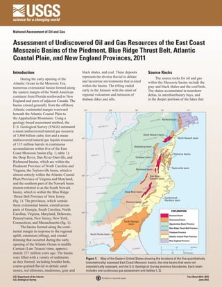
USGS Assessment of East Coast Natural Gas Basins including the South Newark Basin
•
1 j'aime•2,552 vues

The overview of a study by the U.S. Geological Survey of smaller rock formations along the East Coast of the United States, focusing on five basins, including the South Newark Basin. The study gives estimates for the amount of natural gas and natural gas liquids each formation is likely to contain. The South Newark Basin is currently in the news because it was exempted from drilling in Pennsylvania until 2018 under the state budge passed June 30, 2012.
![Table 1. East Coast Mesozoic basin assessment results.
[MMBO, million barrels of oil; BCFG, billion cubic feet of gas; MMBNGL, million barrels of natural gas liquids; TPS, total petroleum system; AU, assessment unit. Results shown are fully
risked estimates. For gas accumulations, all liquids are included as NGL (natural gas liquids). F95 represents a 95-percent chance of at least the amount tabulated; other fractiles are defined
similarly. Fractiles are additive under the assumption of perfect positive correlation. Gray shading indicates not applicable]
Total undiscovered resources
Total Petroleum System (TPS) Field
Oil (MMBO) Gas (BCFG) NGL (MMBNGL)
and Assessment Unit (AU) type
F95 F50 F5 Mean F95 F50 F5 Mean F95 F50 F5 Mean
Taylorsville Basin Composite TPS
Taylorsville Basin Continuous Gas 516 985 1,880 1,064 16 34 71 37
Gas AU
Richmond Basin Composite TPS
Richmond Basin Continuous Gas 99 194 382 211 4 10 20 11
Gas AU
Newark Basin Composite TPS
South Newark Basin Continuous Gas 363 785 1,698 876 1 4 10 4
Gas AU
Deep River Basin Composite TPS
Deep River Basin Continuous Gas 779 1,527 2,990 1,660 35 75 158 83
Gas AU
Dan River-Danville Basin Composite TPS
Dan River-Danville Basin Gas 17 42 106 49 0 0 1 0
Continuous Gas AU
Total continuous resources 1,774 3,533 7,056 3,860 56 123 260 135
occupied the basins. The majority of the geologic framework, the USGS defined Table 2. East Coast Mesozoic basins with
coal accumulated in marshes and swamps a composite TPS and an assessment unit probable total petroleum systems that were not
that developed around the basin margins (AU) for continuous accumulations in quantitatively assessed, showing type of total
early in the depositional history of the each of the 14 major East Coast Mesozoic petroleum system and assessment unit.
basins. In addition, smaller amounts rift basins. The basins are present Type of total Type of
of coal accumulated locally within the both onshore and offshore (in State- Basin petroleum assessment
overlying deltaic deposits. Black shale administered waters) of the Eastern United system unit
beds may range in thickness from a few States (fig. 1). The USGS quantitatively Hartford Composite Continuous gas
feet to several hundred feet. Kerogen in assessed the technically recoverable, North Newark Composite Continuous gas
these beds generally consists of material undiscovered resources within five of the (northern half of
total petroleum systems and associated Newark basin)
derived from vascular plants and algae,
assessment units that demonstrated the Gettysburg Composite Continuous gas
which are the types of kerogen that are
most potential for generating and accumu- Culpeper Composite Continuous gas
prone to yield both gas and oil. With Delmarva (basins) Composite Continuous gas
respect to the generation of liquid hydro- lating hydrocarbons (fig. 1; tables 1, 2).
Several assessment units appear to contain Cumberland- Composite Continuous gas
carbons, the thermal maturation values of Marlboro
the source rocks range widely from basin continuous accumulations of gas, within
Florence Composite Continuous gas
to basin, from within the zone of dry gas both the shale and coal source rocks
South Georgia Composite Continuous gas
and within the adjacent coarser grained,
to immature. The potential reservoirs in North Florida Composite Continuous gas
siliciclastic strata. Small amounts of oil
these basins are continuous accumulations
and petroliferous hydrocarbons, such as
that encompass a variety of lithologies
asphalt, have been detected in some of the
ranging from boulder conglomerates and
wells drilled in these basins. East Coast Mesozoic Basin
very coarse sandstones to mudstone, shale,
For the total of the continuous
and coal. The shale beds that are interbed- Assessment Team
resources, the USGS estimated a mean
ded with coarser grained strata may act of 3,860 billion cubic feet of gas and a Robert C. Milici (rmilici@usgs.gov),
effectively as seals. mean of 135 million barrels of natural James L. Coleman, Elisabeth L. Rowan,
gas liquids (table 1). The available data Troy A. Cook, Ronald R. Charpentier,
Resource Summary indicate that, of the five basins that were Mark A. Kirschbaum, Timothy R. Klett,
The assessment of the East Coast quantitatively assessed, the Deep River, Richard M. Pollastro, and Christopher J.
Mesozoic basins is based on the geologic Taylorsville, and South Newark basins Schenk.
and geochemical characteristics of the appear to possess the potential to produce
individual total petroleum systems (TPS) the most hydrocarbons (table 1). Acknowledgments
that were recognized within the basins. The East Coast Mesozoic Basin
For the petroleum source rock, the For Further Information Assessment Team acknowledges the
characteristics include the source rock More information about the East Directors and staff of the State geological
richness, thermal maturation, timing of Coast Mesozoic basins and the assessment surveys of North Carolina, Virginia,
petroleum generation, and migration; for methodology, as well as other oil and gas Pennsylvania, and New Jersey for provid-
the reservoir rocks and seals, they include assessments, total petroleum systems, and ing geological information and assisting
their stratigraphic position and content assessment units may be found at this USGS with the basin-analysis workshops, which
and petrophysical properties. Using this Web site: http://energy.usgs.gov. were held in preparation for the assessment.](data:image/gif;base64,R0lGODlhAQABAIAAAAAAAP///yH5BAEAAAAALAAAAAABAAEAAAIBRAA7)
Recommandé
Recommandé
Contenu connexe
Plus de Marcellus Drilling News
Plus de Marcellus Drilling News (20)
Dernier
Dernier (20)
USGS Assessment of East Coast Natural Gas Basins including the South Newark Basin
- 1. National Assessment of Oil and Gas Assessment of Undiscovered Oil and Gas Resources of the East Coast Mesozoic Basins of the Piedmont, Blue Ridge Thrust Belt, Atlantic Coastal Plain, and New England Provinces, 2011 Introduction black shales, and coal. These deposits Source Rocks represent the diverse fluvial to deltaic The source rocks for oil and gas During the early opening of the and lacustrine environments that existed within the Mesozoic basins include the Atlantic Ocean in the Mesozoic Era, within the basins. The rifting ended gray and black shales and the coal beds. numerous extensional basins formed along early in the Jurassic with the onset of The shales accumulated in nearshore the eastern margin of the North American continent from Florida northward to New regional volcanism and intrusion of deltas, in interdistributary bays, and England and parts of adjacent Canada. The diabase dikes and sills. in the deeper portions of the lakes that basins extend generally from the offshore Atlantic continental margin westward 87° 83° 79° 75° 71° beneath the Atlantic Coastal Plain to VT. . MASS the Appalachian Mountains. Using a Y ORK Hartford basin NEW geology-based assessment method, the CONN . R.I. U.S. Geological Survey (USGS) estimated MICHIGA N a mean undiscovered natural gas resource DA AT ES NA ST of 3,860 billion cubic feet and a mean CA TED I South Newark basin 42° UN ANIA North Newark basin undiscovered natural gas liquids resource PENN SYLV of 135 million barrels in continuous NEW JERSE Y Gettysburg basin accumulations within five of the East Coast Mesozoic basins (fig. 1; table 1): OHIO Delmarva basins INDIANA the Deep River, Dan River-Danville, and Culpeper basin Richmond basins, which are within the WEST IA VIRGIN Piedmont Province of North Carolina and VIRGIN IA Taylorsville basin Virginia; the Taylorsville basin, which is Richmond basin almost entirely within the Atlantic Coastal 38° Dan River– Plain Province of Virginia and Maryland; KENTUCKY Danville basin and the southern part of the Newark basin OLINA (herein referred to as the South Newark NORT H CAR basin), which is within the Blue Ridge TENNESSEE Deep River basin Thrust Belt Province of New Jersey Cumberland– (fig. 1). The provinces, which contain Florence basin Marlboro basin these extensional basins, extend across SOUTH CA ROLINA parts of Georgia, South Carolina, North EXPLANATION Carolina, Virginia, Maryland, Delaware, 34° Assessed basin GEORGIA Pennsylvania, New Jersey, New York, Unassessed basin South Georgia Connecticut, and Massachusetts (fig. 1). ALABAMA basin Appalachian Basin Province The basins formed along the conti- Blue Ridge Thrust Belt Province nental margin in response to the regional Piedmont Province North Florida basin uplift, extension (rifting), and crustal Atlantic Coastal Plain Province thinning that occurred during the early New England Province opening of the Atlantic Ocean in middle Carnian (Late Triassic) time, approxi- 30° FLORIDA 0 120 240 Miles mately 227 million years ago. The basins 0 140 280 Kilometers were filled with a variety of sediments Figure 1. Map of the Eastern United States showing the locations of the five quantitatively as they formed, including boulder beds, (volumetrically) assessed East Coast Mesozoic basins, the nine basins that were not coarse-grained fluvial to deltaic sand- volumetrically assessed, and the U.S. Geological Survey province boundaries. Each basin stones, red siltstones, mudstones, gray and includes one continuous gas assessment unit (tables 1, 2). U.S. Department of the Interior Fact Sheet 2012–3075 Printed on recycled paper U.S. Geological Survey June 2012
- 2. Table 1. East Coast Mesozoic basin assessment results. [MMBO, million barrels of oil; BCFG, billion cubic feet of gas; MMBNGL, million barrels of natural gas liquids; TPS, total petroleum system; AU, assessment unit. Results shown are fully risked estimates. For gas accumulations, all liquids are included as NGL (natural gas liquids). F95 represents a 95-percent chance of at least the amount tabulated; other fractiles are defined similarly. Fractiles are additive under the assumption of perfect positive correlation. Gray shading indicates not applicable] Total undiscovered resources Total Petroleum System (TPS) Field Oil (MMBO) Gas (BCFG) NGL (MMBNGL) and Assessment Unit (AU) type F95 F50 F5 Mean F95 F50 F5 Mean F95 F50 F5 Mean Taylorsville Basin Composite TPS Taylorsville Basin Continuous Gas 516 985 1,880 1,064 16 34 71 37 Gas AU Richmond Basin Composite TPS Richmond Basin Continuous Gas 99 194 382 211 4 10 20 11 Gas AU Newark Basin Composite TPS South Newark Basin Continuous Gas 363 785 1,698 876 1 4 10 4 Gas AU Deep River Basin Composite TPS Deep River Basin Continuous Gas 779 1,527 2,990 1,660 35 75 158 83 Gas AU Dan River-Danville Basin Composite TPS Dan River-Danville Basin Gas 17 42 106 49 0 0 1 0 Continuous Gas AU Total continuous resources 1,774 3,533 7,056 3,860 56 123 260 135 occupied the basins. The majority of the geologic framework, the USGS defined Table 2. East Coast Mesozoic basins with coal accumulated in marshes and swamps a composite TPS and an assessment unit probable total petroleum systems that were not that developed around the basin margins (AU) for continuous accumulations in quantitatively assessed, showing type of total early in the depositional history of the each of the 14 major East Coast Mesozoic petroleum system and assessment unit. basins. In addition, smaller amounts rift basins. The basins are present Type of total Type of of coal accumulated locally within the both onshore and offshore (in State- Basin petroleum assessment overlying deltaic deposits. Black shale administered waters) of the Eastern United system unit beds may range in thickness from a few States (fig. 1). The USGS quantitatively Hartford Composite Continuous gas feet to several hundred feet. Kerogen in assessed the technically recoverable, North Newark Composite Continuous gas these beds generally consists of material undiscovered resources within five of the (northern half of total petroleum systems and associated Newark basin) derived from vascular plants and algae, assessment units that demonstrated the Gettysburg Composite Continuous gas which are the types of kerogen that are most potential for generating and accumu- Culpeper Composite Continuous gas prone to yield both gas and oil. With Delmarva (basins) Composite Continuous gas respect to the generation of liquid hydro- lating hydrocarbons (fig. 1; tables 1, 2). Several assessment units appear to contain Cumberland- Composite Continuous gas carbons, the thermal maturation values of Marlboro the source rocks range widely from basin continuous accumulations of gas, within Florence Composite Continuous gas to basin, from within the zone of dry gas both the shale and coal source rocks South Georgia Composite Continuous gas and within the adjacent coarser grained, to immature. The potential reservoirs in North Florida Composite Continuous gas siliciclastic strata. Small amounts of oil these basins are continuous accumulations and petroliferous hydrocarbons, such as that encompass a variety of lithologies asphalt, have been detected in some of the ranging from boulder conglomerates and wells drilled in these basins. East Coast Mesozoic Basin very coarse sandstones to mudstone, shale, For the total of the continuous and coal. The shale beds that are interbed- Assessment Team resources, the USGS estimated a mean ded with coarser grained strata may act of 3,860 billion cubic feet of gas and a Robert C. Milici (rmilici@usgs.gov), effectively as seals. mean of 135 million barrels of natural James L. Coleman, Elisabeth L. Rowan, gas liquids (table 1). The available data Troy A. Cook, Ronald R. Charpentier, Resource Summary indicate that, of the five basins that were Mark A. Kirschbaum, Timothy R. Klett, The assessment of the East Coast quantitatively assessed, the Deep River, Richard M. Pollastro, and Christopher J. Mesozoic basins is based on the geologic Taylorsville, and South Newark basins Schenk. and geochemical characteristics of the appear to possess the potential to produce individual total petroleum systems (TPS) the most hydrocarbons (table 1). Acknowledgments that were recognized within the basins. The East Coast Mesozoic Basin For the petroleum source rock, the For Further Information Assessment Team acknowledges the characteristics include the source rock More information about the East Directors and staff of the State geological richness, thermal maturation, timing of Coast Mesozoic basins and the assessment surveys of North Carolina, Virginia, petroleum generation, and migration; for methodology, as well as other oil and gas Pennsylvania, and New Jersey for provid- the reservoir rocks and seals, they include assessments, total petroleum systems, and ing geological information and assisting their stratigraphic position and content assessment units may be found at this USGS with the basin-analysis workshops, which and petrophysical properties. Using this Web site: http://energy.usgs.gov. were held in preparation for the assessment.