Transforming Tysons: Comprehensive Plan Guides Development
•Télécharger en tant que PPT, PDF•
1 j'aime•563 vues

The document summarizes the comprehensive plan to transform Tysons Corner, Virginia from a traffic-clogged commercial area into a more livable urban center. It outlines the vision for Tysons, including 100,000 residents, 200,000 jobs, a grid of complete streets, transit-oriented development, and parks and open spaces. It also discusses plans for affordable housing, including requiring 20% of new units be affordable, and contributions from commercial developers to support affordable housing. Finally, it shows several rezoning proposals submitted that are being evaluated for conformance with the comprehensive plan.

Recommandé
Recommandé
Contenu connexe
Similaire à Transforming Tysons: Comprehensive Plan Guides Development
Similaire à Transforming Tysons: Comprehensive Plan Guides Development (20)
Plus de National Housing Conference & the Center for Housing Policy
Plus de National Housing Conference & the Center for Housing Policy (20)
Dernier
Dernier (20)
Transforming Tysons: Comprehensive Plan Guides Development
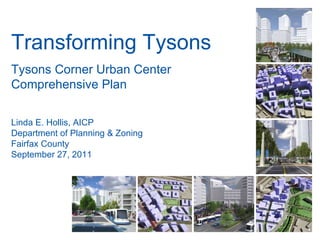
- 1. Transforming Tysons Tysons Corner Urban Center Comprehensive Plan Linda E. Hollis, AICP Department of Planning & Zoning Fairfax County September 27, 2011
- 2. Image source: VDOT Tysons Today
- 3. “ That it is also a strip-malled, traffic-clogged mess does not take away from the fact that it is one of the great economic success stories of our time.” – Time Quote source: http://www.time.com/time/magazine/article/0,9171,1587284,00.html Tysons Today
- 13. Rezoning Cases Submitted 1/4 mile Metro rings
- 14. Spring Hill Station (Georgelas) Spring Hill Rd Tyco Rd Rt. 7 Image source: Bing Maps
- 15. Spring Hill Station (Georgelas) Spring Hill Rd Tyco Rd Rt. 7
- 16. Spring Hill Rd. Rt. 7 Dominion Square (CARS) Image source: Bing Maps
- 17. Dominion Square (CARS) Metro Station
- 18. Rt. 7 Rt. 123 Pinnacle Dr. Tysons Central (NV Comm.) Image source: Bing Maps
- 19. Tysons Central (NV Comm.) Metro Station
- 20. Rt. 123 Jones Branch Dr. Tysons Blvd. Westpark Dr. WestPark (Cityline) Image source: Bing Maps
- 22. Rt. 123 Scotts Crossing Rd. Capital Beltway Capital One Image source: Bing Maps
- 23. Capital One Metro Station Existing Cap One Buildings
- 24. Rt. 123 Anderson Rd. Colshire Dr. Old Meadow Rd. Scotts Run Station (Cityline) Image source: Bing Maps
- 25. Scotts Run Station (Cityline) Metro Station
- 26. Anderson Rd. Colshire Dr. The Commons (LCOR) Image source: Bing Maps
- 28. For more information, please go to www.fairfaxcounty.gov/tysons
Notes de l'éditeur
- Segue from Metro construction to Comprehensive Plan that is focused on taking full advantage of the investment in rail
- Won’t go into all of the negative aspects of Tysons because they are readily apparent to anyone who comes here, but it is an incredibly successful place from an economic development perspective. - 12 th largest business district in the country, largest outside of a traditional downtown Corporate headquarters of five fortune 500 companies Significant portion of county and state tax revenue comes from Tysons
- Current Jobs/Housing Ratio is 13:1 Regional Goal is 1.6 Jobs per household Goal for Tysons is 8 jobs per household by 2030 and 4 jobs per household by 2050
- - Comp Plan is a guide for future land use, transportation, and environmental decisions Tysons Plan is part of the Countywide Comp Plan, which is amended over time Tysons Plan last updated in 1994 Robust citizen participation, over 50 public outreach sessions and hundreds of task force and planning commission meetings
- Land Use Pattern - Most redevelopment should be mixed use Higher proportion of office uses closest to Metro More residential character as distance from Metro increases
- Plan also sets a non-residential contribution amount ($3 per sf) to be used to provide affordable housing opportunities in Tysons
- 9 projects currently under review, mostly within ¼ mile of Metro stations
- Located on west side of Route 7 also near the Tysons West station is the proposed Dominion Square development. The Dominion Square development, which consists of two concurrent zoning applications, includes a total of 19.58 acres, which are currently developed with three vehicle dealerships.
- Dominion Square proposes a total of 4,365,000 square feet of mixed-use development and a 5.10 FAR. The mix of uses is 49% office, 46% residential, 5% hotel and 1% retail.
- Also adjacent to the Tysons Central 7 Station is the NV Commercial application. NV Commercial and Clyde’s restaurant have consolidated 4.78 acres between the SAIC property and the Route 7/123 interchange.
- This rezoning application proposes to remove all of the existing structures and replace it with 1,307,660 SF of mixed use development for total FAR of 6.28. The proposed mix of uses consists of 38% office, 47% residential, 12% hotel and 2% retail and service uses.
- No rezoning applications have been submitted in the vicinity of the Tysons Central 123 Station. Moving to the Tysons East station, Capital One has submitted a rezoning application for its existing campus located at Route 123 and Scott’s Crossing Road. The property consists of 26.21 acres and is currently developed with Capital One’s headquarters building.
- Under Capital One’s proposal, the existing building would be remained while the rest of the site would be developed with 4,937,720 square feet of gross floor area. This equates to an overall FAR of 3.88. The mix of uses would consist of 55% office, 25% residential, 7% hotel and 13% retail and civic uses.
- Cityline has submitted three rezoning application for its properties within the existing West*Gate office park. Total of ? Acres of property to the north and south of 123.
- Under these proposals, a total of ? Square feet of gross floor area is proposed or a ? FAR. The land use mix would be ?
- Finally, to the east and south of the West*Gate office park is the Commons of McLean. LCOR has submitted an application to rezone the ? Acres of the Commons which are to the north of the existing Safeway grocery store.
- Under LCOR’s proposal, all of the existing structures would be removed and redeveloped with high-rise multifamily development. A total of ? Of units is proposed.