SlideShare une entreprise Scribd logo
1  sur  12
Télécharger pour lire hors ligne
Welcome to Zion National Park. Zion is a spectacular network of
colorful canyons, forested mesas, and striking deserts. All of the land
within the park boundary is preserved by the National Park Service
for the benefit of the public. In addition, a remarkable 84 percent of this
extraordinary landscape is preserved as wilderness. This designation
ensures that over 124,000 acres of the park will continue to be a place where nature
and its “community of life are untrammeled by man, a place where man himself is a
visitor who does not remain.” 2014 marks the 50th anniversary of the Wilderness Act.
National Park Service
U.S. Department of the Interior
Zion National Park
Wilderness Guide
The official wilderness guide
of Zion National Park
2014-2015
Plan Your Trip
NPS/RENDALL SEELY
LEAVE NO TRACE
While traveling through
the wilderness, please
show respect for your
national park, fellow
visitors, and future generations.
Stay on the trail. If you must leave the
trail, travel in canyon bottoms, in river
or stream courses, or on slickrock
whenever possible. Avoid stepping on
vegetation or biological soil crusts.
Do not build or destroy rock cairns.
They are used to mark the trail or route.
If placed incorrectly, they can mislead
visitors, causing unnecessary damage
to the resource and potential injuries.
Also, do not build structures including
benches, tables and shelters. Leave the
area in a natural state for others to enjoy.
Camping is limited to designated sites
in much of the Zion Wilderness. In areas
where at-large camping is permitted,
camp at least 200 feet from water and
out of view of trails and streams. Camp
one-quarter mile from springs. Campfires
are not allowed in the wilderness. Please
use a gas stove.
Carry all of your trash out of the park,
including toilet paper. Use a human waste
disposal bag, or trash bag, to transport
your solid waste. If you do not have a
disposal bag, waste can be buried in a
small hole 4 to 8 inches deep and at
least 200 feet from water and campsites.
PREPARE AND PLAN AHEAD
More than 40,000 people
receive permits to visit
the Zion Wilderness
each year. Traveling into
the wilderness, even on short trips,
can be challenging and risky and requires
careful planning before you begin.
Summer weather is hot and dry and
winters can be cold and icy. Narrow
canyons are subject to flash flooding
and dangerous cliffs are common. Often
there are no trail indicators or directional
signs and routes can be difficult to find
and follow. Each year, people are injured
or die while exploring the park. Your
safety depends on your own good
judgment, adequate preparation, and
constant observation. Speak with park
rangers at park visitor centers for current
conditions, weather forecasts, and flash
flood potential ratings.
Human waste bags must be used in
The Narrows.
It is illegal to remove anything from
the park. Leave the flowers, rocks, and
everything else for others to enjoy. Do
not write or carve on natural surfaces.
Feeding wildlife is illegal and unhealthy.
Animals can become aggressive when fed.
Store food and trash responsibly.
Allow others to enjoy the peace and
solitude of the park. Keep your group
quiet and limit the size of your group.
October 12 to March 7
March 8 to April 19
April 20 to May 23
May 24 to September 1
September 2 to October 11
Kolob Canyons Visitor Center
435 586-9548
8:00 am to 4:30 pm
8:00 am to 5:00 pm
8:00 am to 5:00 pm
8:00 am to 6:00 pm
8:00 am to 5:00 pm
Zion Canyon Visitor Center
435 772-0170
8:00 am to 4:30 pm
8:00 am to 5:00 pm
	
7:00 am to 6:00 pm
7:00 am to 7:30 pm
7:00 am to 6:00 pm
Wilderness Permit Hours
Permits are required for overnight trips in the wilderness, including climbing bivouacs, through-
hikes of The Narrows and its tributaries, and canyons requiring the use of descending gear or
ropes, including The Subway. Permits may be obtained on the day before or day of your trip.
Permits are required
for all overnight trips,
including climbing
bivouacs, all through-
hikes of The Narrows
and its tributaries, all canyons requiring
the use of descending gear or ropes,
and all trips into Left Fork (The Subway).
All permits (including those with
reservations and those awarded though
the lottery) must be obtained in person
on the day before or day of the trip at
the Zion Canyon or Kolob Canyons
Visitor Centers. Use the park’s online
reservation system to help you plan
ahead and save time at www.nps.gov/
zion/planyourvisit/wilderness.htm.
GET A PERMIT
There are several ways to obtain a permit
for your trip into the Zion Wilderness.
Over half of all available permits are
secured using the advance reservation
system. The remaining permits are
obtained through the Last Minute
Drawing (canyoneering day trips) or
as Walk-in Permits (backpacking trips).
CALENDAR RESERVATIONS
All visitors can reserve a wide variety of
canyoneering, camping, and climbing
2 Wilderness Guide
Zion National Park
Acting Superintendent
Jim Milestone
Mailing Address
Zion National Park
Springdale, UT 84767
Park Information
435 772-3256
Wilderness Information
435 772-0170
Website
www.nps.gov/zion
E-mail
zion_park_information@nps.gov
Lost and Found
Report at any visitor center
Emergencies
911 or 435 772-3322
National Park Service
U.S. Department of the Interior
Reservation Dates
For a	 Calendar reservations
trip in	 are available on
March	 January 5
April	 February 5
May	 March 5
June	 April 5
July	 May 5	
August	 June 5
September	 July 5
October	 August 5
November	 September 5
December	 October 5
January	 November 5
February 	 December 5
For Left Fork (The Subway) or Mystery
Canyon, please read the Advance Lottery
Reservations section on this page.
Reservations & Permits
trips using the online reservation system.
Please note that calendar reservations are
not permits. Visitors with calendar
reservations must pick up their permits
at either the Zion Canyon or Kolob
Canyons Visitor Center before beginning
their trip.
MAKING A CALENDAR RESERVATION
Reservations are available online during
a three month time frame. On the fifth
day of every month at 10:00 am MT,
reservations for the next month become
available. If they are still available,
reservations can be made until 5:00 pm
MT on the day before your trip.
There is a $5.00 non-refundable fee for
an online calendar reservation, and there
is an additional charge for a permit that is
determined by the size of your group.
Many of the permits for Left Fork
(The Subway) and Mystery Canyon are
secured through the Advance Lottery
prior to calendar reservations becoming
available.
ADVANCE LOTTERY RESERVATIONS
The Advance Lottery is for trips through
Left Fork (The Subway) and Mystery
Canyon. Due to the popularity of these
areas, the park created an online lottery
for reservations. The Advance Lottery
does not run from November through
March due to a low demand for permits.
Advance Lottery applications are
completed online. Entries must be
submitted three months prior to your
planned trip. Entries are limited to one
request per individual per canyon per
month. Entrants can request three
prioritized dates. The non-refundable
lottery application fee is $5.00.
Applicants will be sent a notification
email on the fifth day of the following
month with information about the status
of their request. If a reservation is
awarded, the permit must be obtained
before the trip at a park visitor center.
Occasionally, a few spaces remain after
the Advance Lottery has been held.
These spaces can be reserved through
the Calendar Reservations system.
LAST MINUTE DRAWING RESERVATIONS
All visitors can apply for the Last Minute
Drawing for canyoneering day trips.
The Last Minute Drawing eliminates the
need to wait in long lines for last minute
permits. When a slot canyon day trip
is fully booked online through the
Calendar Reservations system or the
Advance Lottery, the Last Minute
Drawing becomes an option. Individuals
can submit an application for the Last
Minute Drawing to obtain any remaining
reservations for permits. The Last Minute
Drawing is limited to one request per
individual per canyon.
Last Minute Drawing applications
are completed online. Entries can be
submitted as early as one week prior
to a trip date until two days before at
noon MT. The drawing is held at
1:00 pm MT, two days before a trip date.
Any spaces not taken through the
drawing will be available as Walk-in
Permits the day before a trip date.
Applicants will be sent a notification
email with information about the status
of their request. If a reservation is
awarded, the permit must be obtained
before the trip at a park visitor center.
WALK-IN PERMITS
About one-third of wilderness campsites
are not available through the reservation
system. They are made available as
Walk-in Permits and can be obtained
the day before your trip starts. Any slot
canyon or climbing permits not taken
through the reservation system are
available as Walk-in Permits. Wilderness
campsites, climbing areas, and slot
canyons that are not listed in the
reservation system, are only available as
Walk-in Permits. Plan ahead and obtain a
reservation to avoid any disappointment.
ZION EXPRESS MEMBERSHIP
Zion Express Membership allows
members, who obtain a reservation in
their account, to convert it to a permit
online, three days before their trip. The
entire permit process can be completed
online. Zion Express Membership is
recommended for frequent visitors.
The benefits of membership include:
• No cost to enroll.
• No waiting in line to pick up permit.
• No need to coordinate with Wilderness
Desk hours of operation.
• Greater flexibility in planning (allows
for early starts and late finishes)
• Reservation fees are applied to the cost
of the permit.
• Membership is valid for three years.
To become a Zion Express Member,
visit the Zion Canyon Wilderness Desk
to complete a short orientation and sign
a program agreement form.
Permit Fees
Fees help cover the costs of issuing
permits, wilderness patrols, resource
monitoring, and trail repairs. Fees are
non-refundable and based on group size.
• $10.00 for 1 to 2 people
• $15.00 for 3 to 7 people
• $20.00 for 8 to 12 people
GROUP SIZE LIMITS
Large groups result in larger impacts. All
groups traveling into the Zion Wilderness
must follow the group size limit for that
area. These limits apply to all trips into
the park’s wilderness including trips that
do not require a permit. Wilderness trails
have a group size limit of 12, but many
canyoneering areas are limited to 6.
Group size limits are strictly enforced.
Permits will be denied and violators will
be cited if limits are exceeded.
Groups are limited to a maximum of
6 or 12 people that share the same
affiliation (e.g., school, club, scout troop,
family, and friends). Groups that exceed
these limits may not split up and visit the
same drainage, route, or wilderness trail
on the same day, but may split up and visit
different areas.
Group size limits do not apply to most
trails in Zion Canyon, including the
Emerald Pools Trails, Angels Landing,
Riverside Walk, Watchman Trail, and
The Narrows below the junction with
Orderville Canyon.
SPRING
As the park warms, more
areas of the wilderness
become accessible. One
of the first areas without
snow is the Southwest Desert of the
park. La Verkin Creek is often snow
free by mid-March, and the East and
West Rims are usually snow free by early
April. In an average year, high water
due to snowmelt makes The Narrows
impassable until late May.
SUMMER
Zion National Park is hot through the
summer months with temperatures
regularly exceeding 100°F. Even higher
Wilderness Guide 3
Weather
elevation areas such as the Kolob
Canyons and West Rim can see high
temperatures in excess of 90°F. Visitors
must pay constant attention to the
possibility of thunderstorms and
lightning. The park typically experiences
a monsoon season from mid-July through
mid-September with an increased risk
of severe thunderstorms and dramatic
flash flooding.
FALL
The brilliant autumn colors and cooler
temperatures can make the fall an ideal
time for backpacking trips in the park.
Canyoneering trips through The
Narrows and other slot canyons are
best if completed prior to mid-October
when cooler temperatures may require
wetsuits and other specialized gear.
WINTER
Much of Zion National Park is snow-
covered through the winter months.
All trails, even at lower elevations, can
be ice-covered and traction devices
are highly recommended. In winter,
sections of the Kolob Terrace Road are
not plowed. Snow causes closures of
the Kolob Terrace Road near the Hop
Valley Trailhead throughout the winter,
as well as periodic closures of the
Kolob Canyons Road. Recreational
use is limited to skis and snowshoes.
Flash floods can be extremely violent. The
strength of the water can tumble logs and
large boulders. A hiker caught in a flash
flood like this would not survive.
Flash Floods
All narrow canyons are
potentially hazardous.
Flash floods, often caused
by storms miles away, are
a real danger and can be
life threatening. By entering a narrow
canyon you are assuming a risk.
During a flash flood, the water level rises
quickly, within minutes or even seconds.
A flash flood can rush down a canyon in
a wall of water 12 feet high or more.
BE PREPARED
Before starting your trip, pay close
attention to the weather forecast and
the Flash Flood Potential Rating for the
park. If bad weather threatens, do not
enter a narrow canyon. Whether hiking,
climbing, or canyoneering, your safety
depends on your own good judgment,
adequate preparation, and constant
attention to your surroundings. Your
safety is your responsibility.
FLASH FLOOD POTENTIAL RATINGS
In the summer, the National Weather
Service issues a daily Flash Flood
Potential Rating for multiple areas in
Utah. Zion has worked in partnership
with the National Weather Service to
create specific Flash Flood Potential
Ratings for Zion National Park’s unique
environment and terrain. These flash
flood ratings predict the severity of the
flooding that is expected to occur within
the park.
• Dry: Flash flooding is not expected.
• Low: Flash flooding is possible.
Some slot canyons may experience
flash flooding.
• Moderate: Flash flooding is probable.
Some slot canyons are expected to
experience flash flooding.
• High: Flash flooding is expected.
Many slot canyons are expected to
experience flash flooding.
Watch for these indications of a possible
flash flood:
•	Any deterioration in weather conditions
•	Build up of clouds or sounds of thunder
•	Sudden changes in water clarity from
clear to muddy
•	Floating debris
•	Rising water levels or stronger currents
•	Increasing roar of water upcanyon
If you observe any of these signs, seek
higher ground immediately—even
climbing a few feet may save your life.
Remain on high ground until conditions
improve. Water levels usually drop
within 24 hours. Flash floods can occur
in the park during periods of low flash
flood potential. A moderate or higher
flash flood potential is a serious cause
for concern. Slot canyons will be closed
if a Flash Flood Warning is issued. The
canyons will reopen two hours after the
Flash Flood Warning has expired.
NPS
	 Jan	 Feb	 Mar	 Apr	 May	 Jun	 Jul	 Aug	 Sep	 Oct	 Nov	 Dec
Temperature (°F)
Average high	 52	 57	 63	 73	 83	 93	 100	 97	 91	 78	 63	 53
Average low	 29	 31	 36	 43	 52	 60	 68	 66	 60	 49	 37	 30
Record high	 71	 78	 86	 94	 102	 114	 115	 111	 110	 97	 83	 71
Record low	 –2	 4	 12	 23	 22	 40	 51	 50	 33	 23	 13	 6
Days above 90°F	 0	 0	 0	 1	 8	 21	 30	 28	 18	 3	 0	 0
Days below 32°F	 19	 14	 10	 3	 0	 0	 0	 0	 0	 1	 9	 18
Precipitation (inches)
Average	 1.6	 1.6	 1.7	 1.3	 0.7	 0.6	 0.8	 1.6	 0.8	 1.0	 1.2	 1.5
Record high	 7.5	 6.7	 7.1	 4.4	 3.0	 4.0	 3.6	 4.8	 6.7	 3.3	 3.2	 4.3
Record snowfall	 26	 18	 14	 3	 1	 0	 0	 0	 1	 1	 5	 21
Thunderstorms	 0	 0	 0	 1	 4	 5	 14	 15	 5	 2	 0	 0
Climate
Temperatures at higher elevations, including the Kolob Canyons area of the park, may be 5 to 10 degrees cooler than Zion Canyon.
Wildlife
You will encounter
wildlife while in the
wilderness. Be aware
that wild animals can be
unpredictable. Do not
approach or attempt to move sick or
injured wildlife. Please report any
encounters with aggressive, sick, or
injured animals to a park ranger.
RESPECT WILDLIFE
Please keep all animals wild and healthy
by viewing them from a safe distance.
Do not feed or touch wildlife. Store food
and trash responsibly.
MOUNTAIN LIONS
Mountain lions are wild animals and can
be dangerous. They have been seen in
the park. An attack is unlikely, and the
park has never had a reported attack on
people or pets. However, mountain lions
have attacked in other wilderness areas.
• Watch children closely, and never let
them run ahead or lag behind.
• Solo hiking is not encouraged.
• Never approach a mountain lion. Most
will avoid a confrontation. Always give
them a route to escape.
• Do not run. Try to look large and put
your arms up.
• If a mountain lion approaches, wave
your arms, shout, and throw rocks or
sticks at it.
• If attacked, fight back.
disorientation, behavior changes, and
seizures. If you believe that a member of
your party is suffering from heat stroke,
it is imperative to cool them using any
available means and obtain immediate
medical assistance.
HYPOTHERMIA
Hypothermia occurs
when the body is cooled
to dangerous levels. It is
the number one killer of
outdoor recreationists, even in summer,
and it usually happens without the
victim’s awareness. It is a hazard in
narrow canyons because immersion in
water is the quickest route to body heat
loss. To prevent hypothermia, avoid
cotton clothing (it provides no insulation
when wet) and eat high-energy food
before you are chilled. The signs of
hypothermia include:
• Uncontrollable shivering
• Stumbling and poor coordination
• Fatigue and weakness
• Confusion or slurred speech
If you recognize any of these signs, stop
hiking and immediately replace wet
clothing with dry clothing. Warm the
victim with your own body and a warm
drink, and shelter the individual from
breezes. A pre-warmed sleeping bag will
also help prevent further heat loss.
PETS
Pets are not allowed on
wilderness trails or on the
shuttle buses. Even well-
behaved pets may disrupt
wildlife and other visitors. Do not leave
pets in vehicles. Boarding kennels are
available in Rockville, Kanab, Hurricane,
St. George, and Cedar City.
FIREARMS
Firearms are permitted
in Zion National Park.
As of February 22, 2010,
a new federal law allows
people who can legally possess firearms
under federal, Utah, and local laws, to
possess firearms in the park. It is the
visitor’s responsibility to understand
and comply with all applicable Utah,
local, and federal firearms laws. Federal
law prohibits firearms in certain facilities
in Zion National Park, which are posted
with signs. The discharge of firearms and
hunting within the park are prohibited.
Utah state law prohibits the open carry
of loaded firearms on park shuttle buses.
4 Wilderness Guide
STEEP CLIFFS
Falls from cliffs on trails
have resulted in deaths.
Loose sand or pebbles on
stone are very slippery. Be
careful of edges when using cameras or
binoculars. Never throw or roll rocks, as
there may be hikers below you. Trails can
be snow and ice covered in winter.
• Stay on the trail.
• Stay back from cliff edges.
• Observe posted warnings.
• Please watch children.
WATER
The desert is an extreme
environment. Carry
enough water, one gallon
per person per day, and
drink it. Water is available at visitor
centers, campgrounds, and the Zion
Lodge. Water flow at natural springs
can vary, check for information at visitor
centers. Do not drink untreated water.
Water collected in the wilderness is not
safe to drink without treatment. There
are two safe methods to treat water.
BOIL WATER
Bring water to a rolling boil for one
minute. Add one minute for each 1,000
feet above sea level.
FILTER AND DISINFECT WATER
Filter through an “absolute” 1 micron
filter, or one labeled as meeting ANSI/
NSF International Standard #53. Then
add eight drops of liquid chlorine bleach,
or four drops of iodine, per gallon of
water and let stand for 30 minutes.
HEAT EXHAUSTION
Heat exhaustion occurs
when the body loses more
fluid than is taken in. Signs
of heat exhaustion include
nausea, vomiting, fatigue, headaches, pale
appearance, stomach cramps, and cool
clammy skin. If a member of your party
begins to experience any of these symp-
toms, stop your hike immediately. Find a
cool, shady area and rest with your feet
up to distribute fluids throughout your
body. It is important to drink fluids, but it
is also important to eat. Drinking lots of
fluids and not eating, while suffering from
heat exhaustion, can lead to a potentially
dangerous condition of low blood salt.
If heat exhaustion symptoms persist for
more than two hours, seek medical help.
Heat stroke is an advanced stage of heat
exhaustion. It is the body’s inability to
cool itself. Symptoms include confusion,
SafetyEmergencies
For 24-hour emergency response, call 911 or 435-772-3322. The Zion
Canyon Medical Clinic is located in Springdale near the south entrance
to the park. For hours, please call 435-772-3226. Other medical clinics
are located in Hurricane. The nearest hospitals are in St. George, Cedar
City, and Kanab.
Transportation
ZION CANYON SHUTTLE
Travel in Zion Canyon
from April 1 to October 26
and on weekends in
November is by shuttle
bus only. The buses are accessible and
have room for backpacks, climbing gear,
and bicycles. The buses are free and you
may get on and off as often as you like.
Pets are not allowed.
Plan your trip to include the shuttle. For
instance, if your hike ends at a trailhead
in Zion Canyon, time your trip so you
will not miss the last shuttle of the day.
AUTOMOBILES
Private vehicles are not
permitted on the Zion
Canyon Scenic Drive from
April 1 to October 26 and
on weekends in November. The Zion-Mt.
Carmel Highway and other roads in the
park are open to private vehicles all year.
PRIVATE TAXIS
You may choose to
complete your hike at a
different location from
your starting point. Other
shuttle and taxi services are available.
Please inquire at the Wilderness Desk.
BICYCLES
Bicycles are not permitted
in the wilderness. Bicycles
may travel on roadways
and on the Pa’rus Trail.
Shuttles will not pass moving bicycles.
Pull over to allow a bus to pass. Do not
pass a moving shuttle. Shuttles have racks
for bicycles. Bicycles are not permitted
in the Zion-Mt. Carmel Tunnel.
OTHER VEHICLES
ATVs and OHVs are not
permitted in the park.
Access to private property
by snowmobile is allowed.
Zion Canyon Shuttle
First Bus
from Zion Canyon Visitor Center
Last Bus to Springdale Shuttle
from Temple of Sinawava
from Zion Lodge
Last Bus
from Zion Canyon Visitor Center
from Temple of Sinawava
Springdale Shuttle
First Bus
from Majestic View Lodge
from Zion Canyon Theatre
Last Bus to Zion Canyon Shuttle
from Majestic View Lodge
Last Bus
from Zion Canyon Theatre
from Majestic View Lodge
Shuttle Schedule
The average wait for a shuttle bus is fifteen minutes or less. The wait is longer in the morning
and evening, but shorter during peak hours. Shuttles will also operate on weekends in
November, with additional service on Thanksgiving Day and Friday. The Shuttle Schedule
is subject to change. Please check your Map and Guide for current information.
Late Fall
9/28 to 10/26
7:00 am
6:15 pm
6:30 pm
6:45 pm
7:30 pm
8:10 am
8:30 am
6:15 pm
7:00 pm
7:15 pm
Early Fall
9/07 to 9/27
7:00 am
7:15 pm
7:30 pm
7:45 pm
8:30 pm
8:10 am
8:30 am
7:25 pm
8:00 pm
8:15 pm
Spring
4/01 to 5/17
7:00 am
7:15 pm
7:30 pm
7:45 pm
8:30 pm
8:10 am
8:30 am
7:25 pm
8:00 pm
8:15 pm
Summer
5/18 to 9/06
6:00 am
8:15 pm
8:30 pm
8:30 pm
9:15 pm
7:10 am
7:30 am
8:05 pm
9:00 pm
9:15 pm
ALWAYS HAVE A PLAN B
There is no substitute for
planning ahead, taking the
proper equipment, having
the right skills, and using
sound judgment. Be prepared to take care
of yourself and your group by resolving
any difficulties that may arise. Rescue is
not a certainty. If rescue is possible, it will
take hours or days to remove an injured
hiker from the wilderness.
THE SUBWAY
On September 18, 2010, a 20-year-old
woman was descending The Subway
route. When she arrived at the top of
a small waterfall, she and other group
members jumped instead of using a
rope. When she landed, she suffered an
angulated, unstable ankle fracture. The
injury occurred at 3:00 pm. She was
successfully evacuated from the canyon
around noon the following day. Her
injury required surgery and a long,
difficult recovery.
Lower leg fractures are the most common
injuries suffered in the wilderness. The
most common cause of lower leg injuries
is jumping. Do not jump. Bring a rope
and use it.
Wilderness Guide 5
FAT MAN’S MISERY
On June 10, 2010, a father and his two
children attempted a one-day trip
through the Fat Man’s Misery route.
The group relied heavily on a GPS unit
to locate the route and entered the
wrong canyon. They continued through
the canyon, even though the features
did not match their route description.
Eventually, they emerged at the top of
a 400-foot cliff without enough rope to
descend or the ability to travel back up
the canyon. The group was reported
missing on the afternoon of June 11
and was not found until the afternoon
of June 12.
Even heavily traveled canyons in the park
are routes, not maintained trails. Do you
have a map and a route description? Are
you confident in your ability to use them?
When you enter a canyon and pull your
rope after your first rappel, you are
committed. You must complete the
canyon whether or not it is the canyon
that you intended to enter.
SPRY CANYON
On July 24, 2010, the National Weather
Service forecast indicated a 30 percent
chance of rain and a moderate flash flood
potential. There were no clouds in the
morning sky. Three men began a descent
of Spry Canyon. As the day progressed,
the clouds increased, and hard rain
began around 4:00 pm. The men found
themselves clinging to a small shelf in a
narrow canyon with rapidly rising water
levels. All three eventually had to let go.
One man was washed over a 40-foot cliff.
The other two men were washed over the
40-foot drop, plus an additional 60-foot
cliff. Remarkably, all three men survived.
Flash floods occur even during periods
of low flash flood potential. When the
National Weather Service states that
there is a 30 percent chance of rain, they
are not stating that there is a 30 percent
chance that it will rain. They are stating
that 30 percent of the forecast area will
be affected by measurable precipitation.
PINE CREEK CANYON
On April 30, 2010, a group of eight
entered Pine Creek Canyon. The second
person to attempt the last rappel flipped
upside down 10 feet below the anchor.
He was free hanging 80 feet above the
ground. After 45 minutes, he had almost
entirely slipped out of his harness and felt
he could no longer hold on to the rope to
prevent his fall. Another group arrived in
time to provide assistance.
Can you assist another group member?
Are you capable of stopping yourself
mid-rappel to correct a problem? If not,
consider taking a canyoneering course
before heading out on your own.
Canyoneering Safety
Fractured pelvis caused by a rappelling accident.
Lower leg injury
caused by a
rappelling accident.
Spinal fracture and bruised lung caused by a rappelling accident.
Lower leg injury caused by a jumping accident.
Fractured pelvis caused by a rappelling accident.
Broken ankle
caused by
a fall.
NPS
15
Exit
40
Kolob
Canyons
Road
KolobTerraceRoad
North
F
ork
Road
LavaPoint Rd
Beyond this point, road
not plowed in winter.
Unpaved roads are
impassable when wet.
Unpaved roads are
impassable when wet.
Closed in winter.
Trailhead and trail
are on private property.
Please close gates.
Vehicles longer than
19 feet/5.8 meters are
not allowed on Lava
Point Road. Unpaved
roads are impassable
when wet.
Private
property
of Zion
Ponderosa
Ranch
Left Fork
Trailhead
permit parking only
Right Fork
Trailhead
Grapevine
Trailhead
Hop Valley
Trailhead
Wildcat
Canyon
Trailhead
Lee Pass
Trailhead
West Rim Trailhead
Chamberlain’s Ranch
Trailhead
LaVerkinCreekTrail
Hop
Valley
Trail
Taylor Creek Trail
W
i
ldcat
CanyonTrail
NorthgatePeaks
Trail
Connector Trail
WestRim
Trail
West R
im
Trail
East Mesa Trail
East
Rim
Trail
Kolob
Arch
Angels
Landing
Deertrap
Mountain
Cable
Mountain
LEE
VALLEY
CAVE
VA
L
LEY
ECHO
C
ANYON
HOP
VALLEY
CANYON
K O L O B
C A N Y O N S
HORSE
PASTURE
PLATEAU
ORDERVILLE CANYON
THENARROWS
W E S T
R I M
E A S T
North Fork Virgin River
C
reek
Left
Fork
Right
Fork
La Verkin
Creek
La Verkin
Creek
TimberCreek
Willis
Creek
North Fork
South Fork
Taylor Creek
Camp
Creek
Middle Fork
Kolob
Creek
Creek
Deep
Chasm
Lake
Kolob
Reservoir
Beatty
Spring
Sawmill
Springs
Big Spring
West Rim
(Cabin)
Spring
Spring
Potato Hollow
Spring
Spring
Kolob
Canyons
Viewpoint
Lava
Point
Lava Point
Overlook
Temple of
Sinawava
The Grotto
Zion Lodge
Kolob Canyons
Visitor Center
6.4 mi
0.3 mi
1.8 mi
6.5 mi
4.1 mi
1.1 mi1.0 mi
4.8 mi
5.9 mi
4.4 mi
0.1 mi
3.0 mi
1.5 mi
0.4 mi 2.5 mi
1.1 mi
5.9 mi
0.3 mi
1.8 mi
3.2 mi
0.3 mi
0.6 mi
2.1 mi
3.0 mi
0.8 mi
1
2
3
7-10
6
4 5
13
12
11
A horse camp
B
8 7
11
12
10 9
3
4-6
2
1
7
8
6
5
9
3
4
2
1
To Cedar City,
Cedar Breaks NM,
and Salt Lake City
To La Verkin,
Springdale and
Zion Canyon
Visitor Center
2.4 mi
Lava Point
No reservations, no fee, primitive
campground with six sites with
pit toilets and no water. Closed
in winter.
Kolob Canyons
Site Number	 Max Group Size
1		 4
2 online	 4
3		 6
4 online	 7
5 online	 4
6		 4
7		 2
8 online	 12
9		 12
10		 2
11 online	 4
12		 8
13		 4
A online	 12 horse camp
B		 7
The Narrows
Site Number	 Max Group Size
1 online	 4
2		 4
3 online	 6
4		 2
5 online	 6
6		 12
7 online	 6
8		 6
9 online	 6
10		 6
11		 4
12 online	 12
West Rim
Site Number	 Max Group Size
1		 12
2 online	 2
3		 4
4 online	 12
5		 4
6 online	 6
7		 4
8 online	 6
9		 6
Zion National Park
Wildcat Canyon
At-large camping is limited
to 30 people per night. 18
reservations are available online.
The maximum group size is 12.
9
9
9
Grafton
(ghost town) Rockville
Springdale
Virgin
Zion-Mount Carmel Highway
Tunnel
Kolo
b
Terrace
Road
S
m
ithsonian Butte Scenic Backw
a
y
Grafton Road
Bridge
Road
Tunnel
Unpaved roads are
impassable when wet.
May be closed in winter.
Vehicles pulling trailers
not recommended.
Narrow winding road
with steep grades. The
upper section is not
plowed in winter.
From April 1 through October 26,
the Zion Canyon Scenic Drive is
open to shuttle buses only.
Private vehicles are not permitted
beyond Canyon Junction.
turn on Anasazi Way
Chinle
Trailhead
Area closed
to all access.
Chinle Tra
il
ZIO
N
PA R U N U W E A P
C A N Y O N
R I MS O U T H W E S T
D E S E R T
East Fork Virgin River
NorthFo
rk
Virgin
River
Virgin
River
North
Coalpits
Scoggins
Wash
Wash
W
as
h
Hube
r
Spring
12
Coalpits Wash
South
Watchman
East Entrance
South Entrance
Zion Canyon Visitor Center
Zion Human History Museum
Backcountry
campsite
Hiking trail
Unpaved road
(impassable when wet)
Trail mileagePaved road open to
private vehicles
Zion Canyon shuttle
route
Springdale shuttle
route
Shuttle Information Visitor Information
From April 1 through
October 26, the Zion Canyon
Scenic Drive is open to
shuttle buses only. Private
vehicles are not permitted
beyond Canyon Junction.
Campground
No camping except
in designated sites
Hiking and
stock trail
This map is for planning purposes only.
Do not use this map for wilderness travel.
Topographic maps are available for sale.
Primitive
campground
2.5 mi
3.2 mi2.1 mi
1.7 mi
3.5 mi
1.9 mi
1.4 mi
1.5 mi
1
2
3
4
5
6
Hiking route
At-large camping
No designated sites
To La Verkin and
Kolob Canyons
To Mt. Carmel
Junction and
Bryce Canyon NP
0 1 2 3 4
0
5 Miles
5 Kilometers1 2 3 4
North
Wilderness Guide 6-7
Southwest Desert
Site Number	 Max Group Size
1		 6
2 online	 6
3		 6
4		 6
5 online	 6
6 online	 12
Wilderness Use Limits
Area			 Total Use Limit	 Advance Reservations 	 Last Minute Drawing		 Group Size Limit
Behunin Canyon*	 12 people per day	 6 people per day	 6 people per day	 6
Echo Canyon*		 12 people per day	 6 people per day	 6 people per day	 6
Keyhole Canyon	 80 people per day	 60 people per day	 20 people per day	 12
Left Fork (The Subway)	 80 people per day	 60 people per day	 20 people per day	 12
Mystery Canyon	 12 people per day	 6 people per day	 6 people per day	 6
Orderville Canyon*	 50 people per day	 30 people per day	 20 people per day	 12
Pine Creek Canyon*	 50 people per day	 30 people per day	 20 people per day	 12
Spry Canyon		 20 people per day	 14 people per day	 6 people per day	 6
The Narrows		 40 people per day	 24 people per day	 16 people per day	 12
*Total use limits are reduced from March through August for wildlife protection.
Zion National Park’s wilderness is managed using standards that were developed to measure the health of natural resources and to determine the number of encounters people considered desirable and acceptable while experiencing wilderness.
These two standards were combined with existing management zones to create overall use limits and group size limits. The use limits are evaluated each year, and may change as conditions warrant.
Wilderness
On March 30, 2009, President Barack Obama signed the Omnibus Public
Land Management Act of 2009 into law designating 124,406 acres of
wilderness in Zion National Park. Ninety percent of the acreage of Zion
National Park is managed under the 1964 Wilderness Act. According to
the act “a wilderness, in contrast with those areas where man and his own
works dominate the landscape, is hereby recognized as an area where the
earth and its community of life are untrammeled by man, where man
himself is a visitor who does not remain.”
East Rim
At-large camping is limited
to 50 people per night. 20
reservations are available online.
The maximum group size is 12.
8 Wilderness Guide
Stock Use
Horses traditionally
have been used to explore
Zion National Park.
Allowed stock animals
include horses, mules,
and burros. Llamas, dogs, goats, camels,
and others are not allowed.
Permits are not required for day trips.
However, stock are prohibited during
spring thaws, unusually wet periods,
or times when their use would cause
trail damage. Maximum group size is
six animals.
TRAILS
Where trails are present, stock animals
must remain on trails. Free trailing or
loose herding is not allowed. Maintain
a slow walk when passing hikers. When
Backpacking
Zion National Park has
a number of trails in a
variety of landscapes
for backpackers to
explore. Backpackers
in the Zion Wilderness can camp in
designated campsites or in at-large
areas on Zion’s high plateaus, in the
low desert shrublands, or next to a
river in a narrow canyon.
When planning your trip, consider your
interests, time, and ability. There is no
perfect trail. Use the Wilderness Guide,
other guidebooks, and topographic maps
to plan the best trip for you during your
visit. Please refer to the map for campsite
locations.
WEST RIM TRAIL
Late spring and fall are ideal times for
hiking the West Rim. Temperatures are
usually ten to fifteen degrees cooler than
Zion Canyon. The trail is typically snow
covered from December through April.
The West Rim Trail traces a series of
canyon rims with panoramic views.
A difficult but rewarding one-night
backpacking trip can be accomplished
by hiking from The Grotto to one of the
campsites near Cabin Spring. The trip
is five miles one way, with 2,500 feet
of elevation gain. A more moderate
one-night trip descends from Lava
Point to campsites near Potato Hollow.
Water may be available at Cabin, Potato
Hollow, and Sawmill Springs. Check at
visitor centers for availability.
EAST RIM TRAIL
This trail begins at the east entrance
of the park and climbs 1,000 feet onto
the plateau with views into Jolley Gulch
and several small canyons. There are
sweeping views of the surrounding
terrain before entering a high desert
ponderosa forest. As you near the
east rim of Zion Canyon, the trail
begins a 2,300-foot descent through
Echo Canyon, ultimately ending at
the Weeping Rock Trailhead.
Water may be available at Stave Spring.
Check at visitor centers for availability.
SOUTHWEST DESERT
The Chinle Trail crosses the open desert
as it winds toward the base of Mount
Kinesava. The trail offers spectacular
views of the West Temple and Mount
Kinesava. The Chinle Trail can be very
hot in the summer, but mild in the spring
and fall. Coalpits Wash has no developed
trail, but there is a well-worn path to the
junction with Scoggins Wash.
Water may be available at Coalpits Spring.
Check at visitor centers for availability.
LA VERKIN CREEK TRAIL
Spring and fall are ideal seasons for
hiking in La Verkin Creek. Temperatures
are typically 5 to 10 degrees cooler
than Zion Canyon. Trails in the Kolob
Canyons area of the park are frequently
snow covered in winter.
The La Verkin Creek Trail begins at the
Lee Pass Trailhead and descends past
the finger canyons of the nearby cliffs to
Timber Creek. The trail follows the creek
downstream until it reaches La Verkin
Creek, where the trail starts to gain
elevation. As the canyon narrows,
you receive stunning views of the
surrounding cliffs. The trail from Lee
Pass to Kolob Arch is seven miles.
Water may be available at Beatty Spring.
Check at visitor centers for availability.
OTHER TRAILS AND ROUTES
The map shows the locations where
camping is limited to designated
campsites, including The Narrows,
West Rim, La Verkin Creek, and the
Southwest Desert. In other areas,
at-large camping is permitted. Online
reservations are available for at-large
camping on the East Rim and in
Wildcat Canyon.
Water and maintained trails are not
always available in the at-large camping
areas. Permits are required and visitors
must camp one mile from roads, out
of sight of trails, and one-quarter mile
from any springs.
EXTENDED TRIPS
Trips up to 50 miles in length can
be made in Zion National Park’s
wilderness by combining the La Verkin
Creek, Hop Valley, Wildcat Canyon,
West Rim, and East Rim Trails. These
routes cross several roads, so many
variations to your trip are possible.
A vehicle shuttle may be necessary.
Backpackers that intend to camp in
multiple locations need to make a
separate reservation for each location.
FIRES
Campfires are not allowed
in the wilderness. Please
use a gas stove.
NPS/CAITLIN CECI
West Rim Trail
standing, stock must be kept at least
100 feet from drainages.
Check the map on pages 6 and 7 for
trails open to stock use. Off-trail use is
permitted only in Lower Coalpits Wash
from the trailhead to the junction with
Scoggins Wash, in Scoggins Wash, and
in Huber Wash.
OVERNIGHT TRIPS
The only overnight stock camp is Hop
Valley Site A and your stay is limited to
one night. A permit is required. Stock
must be hobbled or tethered to reduce
damage to vegetation.
To reduce the spread of noxious and
exotic weeds, stock must be fed certified
weed-free hay two days prior to the trip.
Wilderness Guide 9
Canyoneering
Canyoneering combines
route finding, rappelling,
problem solving, hiking,
and swimming. Zion
National Park is one of
the premier places in the country to
participate in this exciting activity. With
dozens of different canyons to explore,
some barely wide enough for a human
to squeeze through, the park offers
opportunities that range from trips
for beginners to experiences requiring
advanced technical skills.
A short trip into the lower end of The
Narrows from the Temple of Sinawava is
a great introduction to the slot canyons
of the park. For those with expertise and
experience, The Subway and Orderville
Canyon offer opportunities for route
finding, swimming, and short rappels.
MINIMUM IMPACT CANYONEERING
Travel on durable surfaces, like slickrock,
river bottoms, or drainages. Avoid steep,
sandy, or erodible slopes.
Carry solid waste disposal bags and pack
out everything, including toilet paper.
Don’t bury it, burn it, or leave it.
Prevent bottlenecks. If a faster group
catches up to you, allow them to pass.
Avoid bolting. Bolts should only be
placed as a last result. Only use a bolt
if there are no other safe options for
creating an anchor. If bolts are used, they
should be placed so that they will last for
many years and will avoid scarring on the
rock caused by rope pulls.
There are several items that you should
bring on every canyoneering trip in Zion
National Park.
BACKUP EQUIPMENT
The ability to stop, move up, or down 	
while hanging mid-rope is a lifesaving 	
skill that must be learned before you 	
need it. Can you create extra friction? 	
Do you have ascenders? Can you
belay the less experienced members
of your group?
WEATHER & FLASH FLOOD POTENTIAL
Carefully evaluate the forecast and 	
flash flood potential before entering
a narrow canyon. Remember that a
30 percent chance of rain means that
30 percent of the forecasted area will
receive measurable precipitation.
Continuously evaluate weather
conditions. If bad weather threatens,
avoid traveling in a slot canyon. If you
are in a slot canyon, find higher ground
and wait for conditions to improve.
MAP AND ROUTE DESCRIPTION
You must have and use them. Carefully
assess your location before beginning
your first rappel.
ANCHOR EQUIPMENT
Can you replace webbing if it is worn?
Can you create a new anchor if needed?
EXTRA CLOTHING
Could you spend an unexpected night in
the canyon?
EXTRA FOOD
Food keeps your energy up and helps you
stay warm if you remain out overnight.
WATER
Drink a minimum of one gallon per
person per day.
FLASHLIGHT / HEADLAMP
Every week, canyoneers spend
unintended nights camped in the
wilderness of the park. A headlamp could
make the difference between spending
the night in the canyon and making it out.
HELMET
Rock falls can cause severe injuries.
FIRST AID KIT
Even a minor injury can cause major
problems in the wilderness.
Remember, even the most reliable cell
phones and GPS units rarely work in the
narrow canyons of Zion National Park.
NPS
River Trips
All watercraft use in
the park requires a
wilderness permit.
Permits are issued when
the river is flowing in
excess of 150 cubic feet per second.
Watercraft must be specifically designed
for whitewater use. Operators must be
equipped with approved personal
flotation devices. Kayak trips through
The Narrows should only be attempted
by expert paddlers who are prepared to
survive without assistance for multiple
days. Permits for kayaking through The
Narrows will not be issued on the day
of the trip and must be obtained the
day before. An early start to this trip is
needed. Inner tubes are not permitted
at any time on any watercourse within
the park.
Climbing
Zion National Park’s
2,000-foot sandstone
cliffs are world renowned
for their big wall climbs.
Due to their difficulty,
most routes in the park are not
recommended for inexperienced
climbers. There are few top roping
areas and no sport climbs. Permits are
not required for day climbs, but they
are required for all overnight bivouacs.
It is illegal to camp at the base of the
wall or in your vehicle. Detailed route
descriptions are available at wilderness
desks.
ROUTE CLOSURES
Some rock formations and routes are
closed to climbing from March through
August each year to protect nesting
peregrine falcons. Some areas that are
routinely closed include the Great
White Throne, Cable Mountain, Court
of the Patriarchs, and Angels Landing.
Check at the visitor center or visit
www.nps.gov/zion for current closure
information.
MINIMUM IMPACT CLIMBING
Many of the park’s routes are now going
clean. Avoid using pitons and hammers
where they are not needed. Excess
bolting is discouraged and the use of
power drills to place bolts is prohibited.
When approaching a climb, please use
established trails. Never climb directly
above trails where hikers may be hit by
dislodged rocks. Tube or bag human
waste and carry it out. Do not drop
your waste.
Keyhole
Canyon
The Virgin River has
carved a spectacular gorge
in the upper reaches of
Zion Canyon: 16 miles
long, up to 2,000-feet
deep, and at times only 20 to 30-feet
wide. The Narrows, with its soaring walls,
sandstone grottos, natural springs, and
hanging gardens can be an unforgettable
wilderness experience.
The Narrow is not a hike to be
underestimated. Hiking The Narrows
means hiking in the Virgin River. At least
60 percent of the hike is spent wading,
walking, and sometimes swimming in
the river. There is no maintained trail
because the route is the river. The current
is swift, the water is cold, and the rocks
underfoot are slippery. Flash flooding
and hypothermia are constant dangers.
Good planning, proper equipment, and
sound judgment are essential for a safe
and successful trip. Your safety is your
responsibility.
GROUP SIZE LIMIT
Large groups produce increased impacts
on the wilderness. Group size is limited
to a maximum of 12 people sharing the
same affiliation (e.g., school, club, scout
troop, family, and friends) in the same
10 Wilderness Guide
The Narrows
drainage, route, or wilderness trail on
the same day. Group size limits are strictly
enforced. Permits will be denied and
violators cited, if limits are exceeded.
WHEN TO HIKE THE NARROWS
Entering The Narrows is safest when the
forecast has little chance of rain and the
river is low, clear, and relatively warm.
Conditions change from day to day and
are impossible to predict. Check at the
Zion Canyon Visitor Center for the latest
weather forecast and possible advisories.
Permits are not issued when the flow is
120 cubic feet per second (cfs) or greater.
Flash floods can occur any time, but are
more common in mid-summer and early
fall. From November through May, trips
through The Narrows require wetsuits,
or even drysuits, and special cold weather
preparation. Spring snowmelt frequently
causes the river to run at dangerously
high levels from March to early June.
DAY HIKE FROM THE BOTTOM AND BACK
To experience The Narrows, start at the
Temple of Sinawava and hike one mile to
the end of the Riverside Walk and wade
into the river. In less than a mile, you will
be hiking in one of the narrowest sections
of the canyon. There is not a formal
destination, and you will return the same
way you came. Some hikers try to reach
Orderville Canyon, a tributary roughly
two hours upstream from the end of
the trail. Travel upstream into Orderville
Canyon or beyond Big Spring is
prohibited. No permit is required for this
day hike. Groups size limits apply beyond
the junction with Orderville Canyon.
DAY HIKE FROM TOP TO BOTTOM
Walking the entire length of The
Narrows can be a grueling experience.
Under favorable conditions, the 16-mile
route takes an average of 12 hours. Even
for well-conditioned hikers, this makes
for a long and strenuous day.
The trailhead at Chamberlain’s Ranch
is a 1.5-hour drive from the Temple of
Sinawava. Two vehicles or a shuttle is
necessary. A wilderness permit is
required. Group size limits apply.
OVERNIGHT HIKE FROM TOP TO BOTTOM
To enjoy The Narrows at a more leisurely
pace, some visitors choose to spend a
night in the gorge. There are twelve
numbered sites. Only one-night stays are
allowed, and overnight trips must start
from Chamberlain’s Ranch. Reservations
are recommended for weekend trips.
Campsite capacity is limited and only two
sites can accommodate groups of more
than six people.
TRANSPORTATION
If you are planning to hike The Narrows
from top to bottom, there are a couple of
transportation options:
• If you have two vehicles, you can shuttle
yourself by parking one vehicle at
Chamberlain’s Ranch and the other
at the Zion Canyon Visitor Center.
• You may make arrangements with a
local shuttle service.
At the end of your hike at the Temple
of Sinawava, you must catch the Zion
Canyon Shuttle to the visitor center.
Plan your hike so you do not miss the
last shuttle of the night.
DIRECTIONS TO CHAMBERLAIN’S RANCH
Chamberlain’s Ranch is a 1.5-hour drive
from Zion Canyon, along paved and
dirt roads. The dirt roads are passable
for normal cars only when dry. When
wet, they may be impassable even for
four-wheel drive vehicles. Snow closes
the road in winter. From the park’s East
Entrance, drive 2.5 miles east on Route 9.
Turn left on a paved road and continue
18 miles to a bridge that crosses the
North Fork of the Virgin River. Turn left
beyond the bridge and drive one-quarter
mile to the gate of Chamberlain’s Ranch.
Please close the gate behind you. Drive
one-half mile farther and park just before
the road crosses the river. To begin your
hike, cross the river and follow the road
for approximately 3 miles. Enter the river
at the end of the road past the old cabin.
Chamberlain’s Ranch is a private ranch
outside Zion National Park. Please
respect private property.
FOOTWEAR
Hiking The Narrows is like walking
on slippery bowling balls. It requires
balancing on algae-coated rocks in the
middle of a swiftly flowing river. Sturdy
footwear is essential. Hiking boots with
good ankle support are best. Sandals
and bare feet are not appropriate.
Inappropriate footwear often results
in twisted ankles and crushed toes.
CLOTHING
Even in mid-summer The Narrows can
be cool. The water is cold, breezes blow
steadily, and very little sunlight penetrates
to the canyon floor. Although you’ll
probably hike in shorts, take extra warm
clothing. Clothing made of wool or
synthetic fibers has the best insulation.
DRINKING WATER
Untreated water from the river and its
springs is not safe to drink. It has passed
over rangeland and may be contaminated
with illness-causing bacteria. Treat the
water you collect by filter, tablets, or by
boiling. Hikers are encouraged to carry
in all of their water. Drink one gallon of
water per person per day.
FALLS
Even the most experienced hikers fall in
The Narrows. Pack a walking stick for
additional stability. It is also a good idea
to waterproof your belongings. Many
hikers line their packs with plastic bags.
Smaller resealable bags provide extra
protection for cameras and other items.
WATER DEPTH
The water level varies in The Narrows.
Under ideal conditions, when flow is
less than 70 cubic feet per second, most
crossings are around knee-deep. Higher
flows mean higher water, a stronger
current, and may require wading in
waist-deep water. Be prepared to swim.
Even when the river is low, chest-deep
holes are common. When possible, help
the park protect fragile vegetation in The
Narrows and hike in or near the river.
NPS/MARC NEIDIG
With the increase in
recreational use along
Zion National Park’s
waterways, the National
Park Service introduced
a human waste disposal program for
overnight users in The Narrows. An
environmentally friendly human waste
disposal bag, complete with use and
disposal instructions, is provided to
all party members with an overnight
wilderness permit for The Narrows.
It is a lightweight and sanitary way to
pack out human waste.
The bag-within-a-bag design and
interlocking closure securely contains
waste and odor, while the blend of
polymers breaks down the waste and
transforms it into a deodorized gel. The
contents of the disposal bag are safe for
landfills and may be deposited in the
trash. Use of this waste disposal system
is required in The Narrows, and strongly
encouraged for all hikers in all park slot
canyons, to help protect the Virgin River
and the drinking water for Springdale,
Rockville, Virgin, La Verkin, Hurricane,
St. George, and other communities
downstream.
Wilderness Guide 11
Left Fork (The Subway)
Protect the Virgin RiverThe Narrows Timetable
Chamberlain’s Ranch 0:00 / 0.0 mi
Old Cabin	 1:00 / 2.3 mi
First Narrows	 3:30 / 6.1 mi
Waterfall	 4:15 / 8.3 mi
Deep Creek	 5:00 / 8.9 mi
Kolob Creek	 5:45 / 9.8 mi
Goose Creek	 6:35 / 10.9 mi
Big Spring	 7:20 / 11.5 mi
Orderville Canyon 10:00 / 13.5 mi
Riverside Walk	 11:50 / 15.1 mi
Temple of Sinawava 12:20 / 16.2 mi
Track your progress by recognizing side
canyons like Deep Creek, Kolob Creek,
and Big Spring. Watch closely for the
mouth of Goose Creek.
There are two ways to
hike Left Fork (The
Subway). Both trips
involve extensive route
finding. Visitors are
encouraged to travel with an experienced
hiker of Left Fork (The Subway) or
obtain a detailed route description.
Permits are required regardless of the
direction of travel. Left Fork (The
Subway) is a day-use area only.
FROM THE BOTTOM AND BACK
This strenuous 9-mile round-trip hike
requires route finding, stream crossing,
and scrambling over boulders. This hike
begins and ends at the Left Fork
Trailhead on the Kolob Terrace Road.
FROM THE TOP TO THE BOTTOM
This strenuous 9.5-mile hike requires
rappelling skills, 60 feet of rope, and
extensive route finding experience.
The route also requires swimming
through several deep pools of very cold
debris-filled water. The trail begins at the
Wildcat Canyon Trailhead and ends at
the Left Fork Trailhead. Both trailheads
are located on the Kolob Terrace Road
north of Virgin, Utah.
NPS/CAITLIN CECI
NPS/MARC NEIDIGNPS
12 Wilderness Guide
Maps & Guides
ZION NATURAL HISTORY ASSOCIATION
The Zion Natural History Association sells maps and guides, as well as
other books, at park visitor centers. ZNHA is a non-profit membership
organization which supports the scientific, educational, historical, and
interpretive activities of the park. Members receive a 20% discount.
MAPS
Trails Illustrated Map of Zion National Park
Scale approximately 1:37,700, 30 x 25”
Wilderness and hiking information, waterproof, tear-resistant, folded.
St. George and Springdale, UtahTrail Map
Scale 1:25,000, 27 x 39”
Hiking information, waterproof, tear resistant, folded.
USGSTopographic Maps
Scale 1:24,000, 7.5 minute quads. Paper, rolled.
Kanarraville, Kolob Arch, Kolob Reservoir, Cogswell Point, Smith Mesa, Guardian
Angels, Temple of Sinawava, Clear Creek, Springdale East and West, and The Barracks.
HOW-TO BOOKS
Desert HikingTips by Bruce Grubbs
Covers desert tips from drinking water to flash floods.
Leave NoTrace by Will Harmon
The official pocket-size Leave No Trace manual of the American Hiking Society.
Reading Weather by Jim Woodmency
Weather basics to help you avoid bad weather on your outdoor adventures.
Route Finding by Gregory Crouch
Pocket-sized guide to map and compass navigation.
Backpacker Magazine’sTrailside First Aid by Molly Absolon
Information about recognition, treatment, and prevention of injuries.
AREA GUIDES
Hiking Zion and Bryce Canyon National Parks by Eric Molvar and Tamara Martin
An illustrated guide to the breathtaking slickrock canyons and towering cliffs of
southwestern Utah.
Hiking the Southwest’s Geology, Four Corners Region by Ralph Lee Hopkins
Information on 50 hikes includes the landscape and geologic features along each trail.
Favorite Hikes In & Around Zion National Park by Tanya Milligan and Bo Beck
Information about hikes within a 100-mile radius of Zion National Park.
Zion: Canyoneering by Tom Jones
Descriptions of trail hikes, off-trail hikes, and technical canyoneering routes.
Desert Rock by Eric Bjornstad
Rock climbing routes in National Parks of the Colorado Plateau.
Rock Climbing Utah: A Falcon Guide by Stewart M. Green
A guide for planning climbing trips in Utah.
Zion Climbing: Free and Clean by Bryan Bird
A climber’s guide to Zion National Park.
To find out more about the programs
and publications available through the
Zion Natural History Association, please
visit our website at www.zionpark.org
or call 800 635-3959.
The printing of this newspaper was made
possible by the Zion Natural History Association.
Printed with
SOY INK
Printed on recycled paper. Please recycle again.

Contenu connexe

Similaire à NostalgicOutdoors™- Zion National Park Guide - WILDERNESS GUIDE

NostalgicOutdoors™- Grand Canyon National Park- North Rim Guide & Maps
NostalgicOutdoors™- Grand Canyon National Park- North Rim Guide & MapsNostalgicOutdoors™- Grand Canyon National Park- North Rim Guide & Maps
NostalgicOutdoors™- Grand Canyon National Park- North Rim Guide & MapsNostalgicOutdoors™
 
NostalgicOutdoors™- Grand Teton National Park Guide- Backcountry Camping
NostalgicOutdoors™- Grand Teton National Park Guide- Backcountry CampingNostalgicOutdoors™- Grand Teton National Park Guide- Backcountry Camping
NostalgicOutdoors™- Grand Teton National Park Guide- Backcountry CampingNostalgicOutdoors™
 
NostalgicOutdoors™- Everglades National Park- Trip Planner
NostalgicOutdoors™- Everglades National Park- Trip PlannerNostalgicOutdoors™- Everglades National Park- Trip Planner
NostalgicOutdoors™- Everglades National Park- Trip PlannerNostalgicOutdoors™
 
ZionSummerMG2015
ZionSummerMG2015ZionSummerMG2015
ZionSummerMG2015Sarah Stio
 
NostalgicOutdoorsTM- Cuyahoga Valley NP- Ohio & Erie Canal Towpath Trail
NostalgicOutdoorsTM- Cuyahoga Valley NP- Ohio & Erie Canal Towpath TrailNostalgicOutdoorsTM- Cuyahoga Valley NP- Ohio & Erie Canal Towpath Trail
NostalgicOutdoorsTM- Cuyahoga Valley NP- Ohio & Erie Canal Towpath TrailNostalgicOutdoors™
 
NostalgicOutdoors™- Voyageurs National Park- Guide & Map Part 2
NostalgicOutdoors™- Voyageurs National Park- Guide & Map Part 2NostalgicOutdoors™- Voyageurs National Park- Guide & Map Part 2
NostalgicOutdoors™- Voyageurs National Park- Guide & Map Part 2NostalgicOutdoors™
 
NostalgicOutdoors™- Rocky Mountain National Park- Wild basin-summer-2014 Hiki...
NostalgicOutdoors™- Rocky Mountain National Park- Wild basin-summer-2014 Hiki...NostalgicOutdoors™- Rocky Mountain National Park- Wild basin-summer-2014 Hiki...
NostalgicOutdoors™- Rocky Mountain National Park- Wild basin-summer-2014 Hiki...NostalgicOutdoors™
 
NostalgicOutdoors™- Rocky Mountain National Park- Bear lake-hiking-summer-2014
NostalgicOutdoors™- Rocky Mountain National Park- Bear lake-hiking-summer-2014NostalgicOutdoors™- Rocky Mountain National Park- Bear lake-hiking-summer-2014
NostalgicOutdoors™- Rocky Mountain National Park- Bear lake-hiking-summer-2014NostalgicOutdoors™
 
Año Nuevo State Park Guided Walks
Año Nuevo State Park Guided WalksAño Nuevo State Park Guided Walks
Año Nuevo State Park Guided Walks6D45520z848622K444
 
fieldtripplanningguideFINAL
fieldtripplanningguideFINALfieldtripplanningguideFINAL
fieldtripplanningguideFINALErin Plachy
 
NostalgicOutdoors™- Grand Canyon National Park- South Rim Guide & Maps
NostalgicOutdoors™- Grand Canyon National Park- South Rim Guide & MapsNostalgicOutdoors™- Grand Canyon National Park- South Rim Guide & Maps
NostalgicOutdoors™- Grand Canyon National Park- South Rim Guide & MapsNostalgicOutdoors™
 
Safety brief and notes for 2021 Florida JROTC Orienteering Championships
Safety brief and notes for 2021 Florida JROTC Orienteering ChampionshipsSafety brief and notes for 2021 Florida JROTC Orienteering Championships
Safety brief and notes for 2021 Florida JROTC Orienteering ChampionshipsGord Hunter
 
WS Nature Activities
WS Nature Activities WS Nature Activities
WS Nature Activities aguselipe
 
NostalgicOutdoors™- Acadia National Park- Visitor Guide Summary
NostalgicOutdoors™- Acadia National Park- Visitor Guide SummaryNostalgicOutdoors™- Acadia National Park- Visitor Guide Summary
NostalgicOutdoors™- Acadia National Park- Visitor Guide SummaryNostalgicOutdoors™
 
2018 Teens Adventure Brochure
2018 Teens Adventure Brochure2018 Teens Adventure Brochure
2018 Teens Adventure BrochureGeorge McDonnell
 
Discovering South Africa's Hidden Gems: A Travel Guide
Discovering South Africa's Hidden Gems: A Travel GuideDiscovering South Africa's Hidden Gems: A Travel Guide
Discovering South Africa's Hidden Gems: A Travel GuideSouth Africa Travel
 
NostalgicOutdoors™- Rocky Mountain National Park CAMPING
NostalgicOutdoors™- Rocky Mountain National Park CAMPINGNostalgicOutdoors™- Rocky Mountain National Park CAMPING
NostalgicOutdoors™- Rocky Mountain National Park CAMPINGNostalgicOutdoors™
 
Dead horse bay teacher packet 2007
Dead horse bay teacher packet 2007Dead horse bay teacher packet 2007
Dead horse bay teacher packet 2007EducationJamaicaBay
 
Dead horse bay teacher packet 2007
Dead horse bay teacher packet 2007Dead horse bay teacher packet 2007
Dead horse bay teacher packet 2007EducationJamaicaBay
 

Similaire à NostalgicOutdoors™- Zion National Park Guide - WILDERNESS GUIDE (20)

NostalgicOutdoors™- Grand Canyon National Park- North Rim Guide & Maps
NostalgicOutdoors™- Grand Canyon National Park- North Rim Guide & MapsNostalgicOutdoors™- Grand Canyon National Park- North Rim Guide & Maps
NostalgicOutdoors™- Grand Canyon National Park- North Rim Guide & Maps
 
NostalgicOutdoors™- Grand Teton National Park Guide- Backcountry Camping
NostalgicOutdoors™- Grand Teton National Park Guide- Backcountry CampingNostalgicOutdoors™- Grand Teton National Park Guide- Backcountry Camping
NostalgicOutdoors™- Grand Teton National Park Guide- Backcountry Camping
 
NostalgicOutdoors™- Everglades National Park- Trip Planner
NostalgicOutdoors™- Everglades National Park- Trip PlannerNostalgicOutdoors™- Everglades National Park- Trip Planner
NostalgicOutdoors™- Everglades National Park- Trip Planner
 
ZionSummerMG2015
ZionSummerMG2015ZionSummerMG2015
ZionSummerMG2015
 
NostalgicOutdoorsTM- Cuyahoga Valley NP- Ohio & Erie Canal Towpath Trail
NostalgicOutdoorsTM- Cuyahoga Valley NP- Ohio & Erie Canal Towpath TrailNostalgicOutdoorsTM- Cuyahoga Valley NP- Ohio & Erie Canal Towpath Trail
NostalgicOutdoorsTM- Cuyahoga Valley NP- Ohio & Erie Canal Towpath Trail
 
NostalgicOutdoors™- Voyageurs National Park- Guide & Map Part 2
NostalgicOutdoors™- Voyageurs National Park- Guide & Map Part 2NostalgicOutdoors™- Voyageurs National Park- Guide & Map Part 2
NostalgicOutdoors™- Voyageurs National Park- Guide & Map Part 2
 
NostalgicOutdoors™- Rocky Mountain National Park- Wild basin-summer-2014 Hiki...
NostalgicOutdoors™- Rocky Mountain National Park- Wild basin-summer-2014 Hiki...NostalgicOutdoors™- Rocky Mountain National Park- Wild basin-summer-2014 Hiki...
NostalgicOutdoors™- Rocky Mountain National Park- Wild basin-summer-2014 Hiki...
 
NostalgicOutdoors™- Rocky Mountain National Park- Bear lake-hiking-summer-2014
NostalgicOutdoors™- Rocky Mountain National Park- Bear lake-hiking-summer-2014NostalgicOutdoors™- Rocky Mountain National Park- Bear lake-hiking-summer-2014
NostalgicOutdoors™- Rocky Mountain National Park- Bear lake-hiking-summer-2014
 
Año Nuevo State Park Guided Walks
Año Nuevo State Park Guided WalksAño Nuevo State Park Guided Walks
Año Nuevo State Park Guided Walks
 
fieldtripplanningguideFINAL
fieldtripplanningguideFINALfieldtripplanningguideFINAL
fieldtripplanningguideFINAL
 
NostalgicOutdoors™- Grand Canyon National Park- South Rim Guide & Maps
NostalgicOutdoors™- Grand Canyon National Park- South Rim Guide & MapsNostalgicOutdoors™- Grand Canyon National Park- South Rim Guide & Maps
NostalgicOutdoors™- Grand Canyon National Park- South Rim Guide & Maps
 
CA_PVWM2016-DIGITAL
CA_PVWM2016-DIGITALCA_PVWM2016-DIGITAL
CA_PVWM2016-DIGITAL
 
Safety brief and notes for 2021 Florida JROTC Orienteering Championships
Safety brief and notes for 2021 Florida JROTC Orienteering ChampionshipsSafety brief and notes for 2021 Florida JROTC Orienteering Championships
Safety brief and notes for 2021 Florida JROTC Orienteering Championships
 
WS Nature Activities
WS Nature Activities WS Nature Activities
WS Nature Activities
 
NostalgicOutdoors™- Acadia National Park- Visitor Guide Summary
NostalgicOutdoors™- Acadia National Park- Visitor Guide SummaryNostalgicOutdoors™- Acadia National Park- Visitor Guide Summary
NostalgicOutdoors™- Acadia National Park- Visitor Guide Summary
 
2018 Teens Adventure Brochure
2018 Teens Adventure Brochure2018 Teens Adventure Brochure
2018 Teens Adventure Brochure
 
Discovering South Africa's Hidden Gems: A Travel Guide
Discovering South Africa's Hidden Gems: A Travel GuideDiscovering South Africa's Hidden Gems: A Travel Guide
Discovering South Africa's Hidden Gems: A Travel Guide
 
NostalgicOutdoors™- Rocky Mountain National Park CAMPING
NostalgicOutdoors™- Rocky Mountain National Park CAMPINGNostalgicOutdoors™- Rocky Mountain National Park CAMPING
NostalgicOutdoors™- Rocky Mountain National Park CAMPING
 
Dead horse bay teacher packet 2007
Dead horse bay teacher packet 2007Dead horse bay teacher packet 2007
Dead horse bay teacher packet 2007
 
Dead horse bay teacher packet 2007
Dead horse bay teacher packet 2007Dead horse bay teacher packet 2007
Dead horse bay teacher packet 2007
 

Plus de NostalgicOutdoors™

NostalgicOutdoors™- Natchez Trace Parkway - Emerald Mound
NostalgicOutdoors™- Natchez Trace Parkway - Emerald MoundNostalgicOutdoors™- Natchez Trace Parkway - Emerald Mound
NostalgicOutdoors™- Natchez Trace Parkway - Emerald MoundNostalgicOutdoors™
 
NostalgicOutdoors™- Everglades National Park- Wilderness Trip Planner
NostalgicOutdoors™- Everglades National Park- Wilderness Trip PlannerNostalgicOutdoors™- Everglades National Park- Wilderness Trip Planner
NostalgicOutdoors™- Everglades National Park- Wilderness Trip PlannerNostalgicOutdoors™
 
NostalgicOutdoors™- Isle Royal National Park- Trail Mileage between Campgrounds
NostalgicOutdoors™- Isle Royal National Park- Trail Mileage between CampgroundsNostalgicOutdoors™- Isle Royal National Park- Trail Mileage between Campgrounds
NostalgicOutdoors™- Isle Royal National Park- Trail Mileage between CampgroundsNostalgicOutdoors™
 
NostalgicOutdoors™- Isle Royal National Park- Boating Guide
NostalgicOutdoors™- Isle Royal National Park- Boating GuideNostalgicOutdoors™- Isle Royal National Park- Boating Guide
NostalgicOutdoors™- Isle Royal National Park- Boating GuideNostalgicOutdoors™
 
NostalgicOutdoors™- Isle Royal National Park- Visitor Guide
NostalgicOutdoors™- Isle Royal National Park- Visitor GuideNostalgicOutdoors™- Isle Royal National Park- Visitor Guide
NostalgicOutdoors™- Isle Royal National Park- Visitor GuideNostalgicOutdoors™
 
NostalgicOutdoors™- Buffalo National River- Lower district-hiking-trails
NostalgicOutdoors™- Buffalo National River- Lower district-hiking-trailsNostalgicOutdoors™- Buffalo National River- Lower district-hiking-trails
NostalgicOutdoors™- Buffalo National River- Lower district-hiking-trailsNostalgicOutdoors™
 
NostalgicOutdoors™- Buffalo National River- Middle district-hiking-trails
NostalgicOutdoors™- Buffalo National River- Middle district-hiking-trailsNostalgicOutdoors™- Buffalo National River- Middle district-hiking-trails
NostalgicOutdoors™- Buffalo National River- Middle district-hiking-trailsNostalgicOutdoors™
 
NostalgicOutdoors™- Buffalo National River- Upper District Hiking Trails
NostalgicOutdoors™- Buffalo National River- Upper District Hiking TrailsNostalgicOutdoors™- Buffalo National River- Upper District Hiking Trails
NostalgicOutdoors™- Buffalo National River- Upper District Hiking TrailsNostalgicOutdoors™
 
NostalgicOutdoors™- Congaree River Map
NostalgicOutdoors™- Congaree River MapNostalgicOutdoors™- Congaree River Map
NostalgicOutdoors™- Congaree River MapNostalgicOutdoors™
 
NostalgicOutdoors™- Congaree National Park- Camping Rules
NostalgicOutdoors™- Congaree National Park- Camping RulesNostalgicOutdoors™- Congaree National Park- Camping Rules
NostalgicOutdoors™- Congaree National Park- Camping RulesNostalgicOutdoors™
 
NostalgicOutdoors™- Crater Lake- Visitor Guide
NostalgicOutdoors™- Crater Lake- Visitor GuideNostalgicOutdoors™- Crater Lake- Visitor Guide
NostalgicOutdoors™- Crater Lake- Visitor GuideNostalgicOutdoors™
 
NostalgicOutdoors™- Badlands National Park Visitors Guide
NostalgicOutdoors™- Badlands National Park Visitors GuideNostalgicOutdoors™- Badlands National Park Visitors Guide
NostalgicOutdoors™- Badlands National Park Visitors GuideNostalgicOutdoors™
 
NostalgicOutdoors™- Blue Ridge Parkway- Rocky Knob
NostalgicOutdoors™- Blue Ridge Parkway- Rocky KnobNostalgicOutdoors™- Blue Ridge Parkway- Rocky Knob
NostalgicOutdoors™- Blue Ridge Parkway- Rocky KnobNostalgicOutdoors™
 
NostalgicOutdoors™- Blue Ridge Parkway- Price Park
NostalgicOutdoors™- Blue Ridge Parkway- Price ParkNostalgicOutdoors™- Blue Ridge Parkway- Price Park
NostalgicOutdoors™- Blue Ridge Parkway- Price ParkNostalgicOutdoors™
 
NostalgicOutdoors™- Blue Ridge Parkway Attractions/Mileposts
NostalgicOutdoors™- Blue Ridge Parkway Attractions/MilepostsNostalgicOutdoors™- Blue Ridge Parkway Attractions/Mileposts
NostalgicOutdoors™- Blue Ridge Parkway Attractions/MilepostsNostalgicOutdoors™
 
NostalgicOutdoors™-Self guiding trails, CAPE COD NATIONAL SEASHORE
NostalgicOutdoors™-Self guiding trails, CAPE COD  NATIONAL SEASHORENostalgicOutdoors™-Self guiding trails, CAPE COD  NATIONAL SEASHORE
NostalgicOutdoors™-Self guiding trails, CAPE COD NATIONAL SEASHORENostalgicOutdoors™
 
NostalgicOutdoors™- Scenic drives & overlooks , CAPE COD NATIONAL SEASHORE
NostalgicOutdoors™- Scenic drives & overlooks , CAPE COD NATIONAL SEASHORENostalgicOutdoors™- Scenic drives & overlooks , CAPE COD NATIONAL SEASHORE
NostalgicOutdoors™- Scenic drives & overlooks , CAPE COD NATIONAL SEASHORENostalgicOutdoors™
 
NostalgicOutdoors™- Grand Teton National Park Guide- Fishing
NostalgicOutdoors™- Grand Teton National Park Guide- FishingNostalgicOutdoors™- Grand Teton National Park Guide- Fishing
NostalgicOutdoors™- Grand Teton National Park Guide- FishingNostalgicOutdoors™
 
NostalgicOutdoors™- Grand Teton National Park- Bicycling
NostalgicOutdoors™- Grand Teton National Park- BicyclingNostalgicOutdoors™- Grand Teton National Park- Bicycling
NostalgicOutdoors™- Grand Teton National Park- BicyclingNostalgicOutdoors™
 
NostalgicOutdoors™- Grand Teton National Park- PARK MAP
NostalgicOutdoors™- Grand Teton National Park- PARK MAPNostalgicOutdoors™- Grand Teton National Park- PARK MAP
NostalgicOutdoors™- Grand Teton National Park- PARK MAPNostalgicOutdoors™
 

Plus de NostalgicOutdoors™ (20)

NostalgicOutdoors™- Natchez Trace Parkway - Emerald Mound
NostalgicOutdoors™- Natchez Trace Parkway - Emerald MoundNostalgicOutdoors™- Natchez Trace Parkway - Emerald Mound
NostalgicOutdoors™- Natchez Trace Parkway - Emerald Mound
 
NostalgicOutdoors™- Everglades National Park- Wilderness Trip Planner
NostalgicOutdoors™- Everglades National Park- Wilderness Trip PlannerNostalgicOutdoors™- Everglades National Park- Wilderness Trip Planner
NostalgicOutdoors™- Everglades National Park- Wilderness Trip Planner
 
NostalgicOutdoors™- Isle Royal National Park- Trail Mileage between Campgrounds
NostalgicOutdoors™- Isle Royal National Park- Trail Mileage between CampgroundsNostalgicOutdoors™- Isle Royal National Park- Trail Mileage between Campgrounds
NostalgicOutdoors™- Isle Royal National Park- Trail Mileage between Campgrounds
 
NostalgicOutdoors™- Isle Royal National Park- Boating Guide
NostalgicOutdoors™- Isle Royal National Park- Boating GuideNostalgicOutdoors™- Isle Royal National Park- Boating Guide
NostalgicOutdoors™- Isle Royal National Park- Boating Guide
 
NostalgicOutdoors™- Isle Royal National Park- Visitor Guide
NostalgicOutdoors™- Isle Royal National Park- Visitor GuideNostalgicOutdoors™- Isle Royal National Park- Visitor Guide
NostalgicOutdoors™- Isle Royal National Park- Visitor Guide
 
NostalgicOutdoors™- Buffalo National River- Lower district-hiking-trails
NostalgicOutdoors™- Buffalo National River- Lower district-hiking-trailsNostalgicOutdoors™- Buffalo National River- Lower district-hiking-trails
NostalgicOutdoors™- Buffalo National River- Lower district-hiking-trails
 
NostalgicOutdoors™- Buffalo National River- Middle district-hiking-trails
NostalgicOutdoors™- Buffalo National River- Middle district-hiking-trailsNostalgicOutdoors™- Buffalo National River- Middle district-hiking-trails
NostalgicOutdoors™- Buffalo National River- Middle district-hiking-trails
 
NostalgicOutdoors™- Buffalo National River- Upper District Hiking Trails
NostalgicOutdoors™- Buffalo National River- Upper District Hiking TrailsNostalgicOutdoors™- Buffalo National River- Upper District Hiking Trails
NostalgicOutdoors™- Buffalo National River- Upper District Hiking Trails
 
NostalgicOutdoors™- Congaree River Map
NostalgicOutdoors™- Congaree River MapNostalgicOutdoors™- Congaree River Map
NostalgicOutdoors™- Congaree River Map
 
NostalgicOutdoors™- Congaree National Park- Camping Rules
NostalgicOutdoors™- Congaree National Park- Camping RulesNostalgicOutdoors™- Congaree National Park- Camping Rules
NostalgicOutdoors™- Congaree National Park- Camping Rules
 
NostalgicOutdoors™- Crater Lake- Visitor Guide
NostalgicOutdoors™- Crater Lake- Visitor GuideNostalgicOutdoors™- Crater Lake- Visitor Guide
NostalgicOutdoors™- Crater Lake- Visitor Guide
 
NostalgicOutdoors™- Badlands National Park Visitors Guide
NostalgicOutdoors™- Badlands National Park Visitors GuideNostalgicOutdoors™- Badlands National Park Visitors Guide
NostalgicOutdoors™- Badlands National Park Visitors Guide
 
NostalgicOutdoors™- Blue Ridge Parkway- Rocky Knob
NostalgicOutdoors™- Blue Ridge Parkway- Rocky KnobNostalgicOutdoors™- Blue Ridge Parkway- Rocky Knob
NostalgicOutdoors™- Blue Ridge Parkway- Rocky Knob
 
NostalgicOutdoors™- Blue Ridge Parkway- Price Park
NostalgicOutdoors™- Blue Ridge Parkway- Price ParkNostalgicOutdoors™- Blue Ridge Parkway- Price Park
NostalgicOutdoors™- Blue Ridge Parkway- Price Park
 
NostalgicOutdoors™- Blue Ridge Parkway Attractions/Mileposts
NostalgicOutdoors™- Blue Ridge Parkway Attractions/MilepostsNostalgicOutdoors™- Blue Ridge Parkway Attractions/Mileposts
NostalgicOutdoors™- Blue Ridge Parkway Attractions/Mileposts
 
NostalgicOutdoors™-Self guiding trails, CAPE COD NATIONAL SEASHORE
NostalgicOutdoors™-Self guiding trails, CAPE COD  NATIONAL SEASHORENostalgicOutdoors™-Self guiding trails, CAPE COD  NATIONAL SEASHORE
NostalgicOutdoors™-Self guiding trails, CAPE COD NATIONAL SEASHORE
 
NostalgicOutdoors™- Scenic drives & overlooks , CAPE COD NATIONAL SEASHORE
NostalgicOutdoors™- Scenic drives & overlooks , CAPE COD NATIONAL SEASHORENostalgicOutdoors™- Scenic drives & overlooks , CAPE COD NATIONAL SEASHORE
NostalgicOutdoors™- Scenic drives & overlooks , CAPE COD NATIONAL SEASHORE
 
NostalgicOutdoors™- Grand Teton National Park Guide- Fishing
NostalgicOutdoors™- Grand Teton National Park Guide- FishingNostalgicOutdoors™- Grand Teton National Park Guide- Fishing
NostalgicOutdoors™- Grand Teton National Park Guide- Fishing
 
NostalgicOutdoors™- Grand Teton National Park- Bicycling
NostalgicOutdoors™- Grand Teton National Park- BicyclingNostalgicOutdoors™- Grand Teton National Park- Bicycling
NostalgicOutdoors™- Grand Teton National Park- Bicycling
 
NostalgicOutdoors™- Grand Teton National Park- PARK MAP
NostalgicOutdoors™- Grand Teton National Park- PARK MAPNostalgicOutdoors™- Grand Teton National Park- PARK MAP
NostalgicOutdoors™- Grand Teton National Park- PARK MAP
 

Dernier

5S - House keeping (Seiri, Seiton, Seiso, Seiketsu, Shitsuke)
5S - House keeping (Seiri, Seiton, Seiso, Seiketsu, Shitsuke)5S - House keeping (Seiri, Seiton, Seiso, Seiketsu, Shitsuke)
5S - House keeping (Seiri, Seiton, Seiso, Seiketsu, Shitsuke)Mazie Garcia
 
Paragliding Billing Bir at Himachal Pardesh
Paragliding Billing Bir at Himachal PardeshParagliding Billing Bir at Himachal Pardesh
Paragliding Billing Bir at Himachal PardeshParagliding Billing Bir
 
It’s Time Get Refresh Travel Around The World
It’s Time Get Refresh Travel Around The WorldIt’s Time Get Refresh Travel Around The World
It’s Time Get Refresh Travel Around The WorldParagliding Billing Bir
 
Revolutionalizing Travel: A VacAI Update
Revolutionalizing Travel: A VacAI UpdateRevolutionalizing Travel: A VacAI Update
Revolutionalizing Travel: A VacAI Updatejoymorrison10
 
a presentation for foreigners about how to travel in Germany.
a presentation for foreigners about how to travel in Germany.a presentation for foreigners about how to travel in Germany.
a presentation for foreigners about how to travel in Germany.moritzmieg
 
Lucknow to Sitapur Cab | Lucknow to Sitapur Taxi
Lucknow to Sitapur Cab | Lucknow to Sitapur TaxiLucknow to Sitapur Cab | Lucknow to Sitapur Taxi
Lucknow to Sitapur Cab | Lucknow to Sitapur TaxiCab Bazar
 
Sicily Holidays Guide Book: Unveiling the Treasures of Italy's Jewel
Sicily Holidays Guide Book: Unveiling the Treasures of Italy's JewelSicily Holidays Guide Book: Unveiling the Treasures of Italy's Jewel
Sicily Holidays Guide Book: Unveiling the Treasures of Italy's JewelTime for Sicily
 
Solbello Sun Shade Umbrella for Beach 2024
Solbello Sun Shade Umbrella for Beach 2024Solbello Sun Shade Umbrella for Beach 2024
Solbello Sun Shade Umbrella for Beach 2024Solbello
 
Authentic Travel Experience 2024 Greg DeShields.pptx
Authentic Travel Experience 2024 Greg DeShields.pptxAuthentic Travel Experience 2024 Greg DeShields.pptx
Authentic Travel Experience 2024 Greg DeShields.pptxGregory DeShields
 
How Safe Is It To Witness Whales In Maui’s Waters
How Safe Is It To Witness Whales In Maui’s WatersHow Safe Is It To Witness Whales In Maui’s Waters
How Safe Is It To Witness Whales In Maui’s WatersMakena Coast Charters
 
69 Girls ✠ 9599264170 ✠ Call Girls In East Of Kailash (VIP)
69 Girls ✠ 9599264170 ✠ Call Girls In East Of Kailash (VIP)69 Girls ✠ 9599264170 ✠ Call Girls In East Of Kailash (VIP)
69 Girls ✠ 9599264170 ✠ Call Girls In East Of Kailash (VIP)Escort Service
 
Disney Dreams in Europe: A Guide to Disneyland Paris
Disney Dreams in Europe: A Guide to Disneyland ParisDisney Dreams in Europe: A Guide to Disneyland Paris
Disney Dreams in Europe: A Guide to Disneyland ParisisangoTravel
 
Inspirational Quotes About Italy and Food
Inspirational Quotes About Italy and FoodInspirational Quotes About Italy and Food
Inspirational Quotes About Italy and FoodKasia Chojecki
 
Phil....National-Capital-Region-NCR.pptx
Phil....National-Capital-Region-NCR.pptxPhil....National-Capital-Region-NCR.pptx
Phil....National-Capital-Region-NCR.pptxDitasDelaCruz
 

Dernier (16)

5S - House keeping (Seiri, Seiton, Seiso, Seiketsu, Shitsuke)
5S - House keeping (Seiri, Seiton, Seiso, Seiketsu, Shitsuke)5S - House keeping (Seiri, Seiton, Seiso, Seiketsu, Shitsuke)
5S - House keeping (Seiri, Seiton, Seiso, Seiketsu, Shitsuke)
 
Paragliding Billing Bir at Himachal Pardesh
Paragliding Billing Bir at Himachal PardeshParagliding Billing Bir at Himachal Pardesh
Paragliding Billing Bir at Himachal Pardesh
 
It’s Time Get Refresh Travel Around The World
It’s Time Get Refresh Travel Around The WorldIt’s Time Get Refresh Travel Around The World
It’s Time Get Refresh Travel Around The World
 
Revolutionalizing Travel: A VacAI Update
Revolutionalizing Travel: A VacAI UpdateRevolutionalizing Travel: A VacAI Update
Revolutionalizing Travel: A VacAI Update
 
a presentation for foreigners about how to travel in Germany.
a presentation for foreigners about how to travel in Germany.a presentation for foreigners about how to travel in Germany.
a presentation for foreigners about how to travel in Germany.
 
Lucknow to Sitapur Cab | Lucknow to Sitapur Taxi
Lucknow to Sitapur Cab | Lucknow to Sitapur TaxiLucknow to Sitapur Cab | Lucknow to Sitapur Taxi
Lucknow to Sitapur Cab | Lucknow to Sitapur Taxi
 
Sicily Holidays Guide Book: Unveiling the Treasures of Italy's Jewel
Sicily Holidays Guide Book: Unveiling the Treasures of Italy's JewelSicily Holidays Guide Book: Unveiling the Treasures of Italy's Jewel
Sicily Holidays Guide Book: Unveiling the Treasures of Italy's Jewel
 
Solbello Sun Shade Umbrella for Beach 2024
Solbello Sun Shade Umbrella for Beach 2024Solbello Sun Shade Umbrella for Beach 2024
Solbello Sun Shade Umbrella for Beach 2024
 
Authentic Travel Experience 2024 Greg DeShields.pptx
Authentic Travel Experience 2024 Greg DeShields.pptxAuthentic Travel Experience 2024 Greg DeShields.pptx
Authentic Travel Experience 2024 Greg DeShields.pptx
 
How Safe Is It To Witness Whales In Maui’s Waters
How Safe Is It To Witness Whales In Maui’s WatersHow Safe Is It To Witness Whales In Maui’s Waters
How Safe Is It To Witness Whales In Maui’s Waters
 
69 Girls ✠ 9599264170 ✠ Call Girls In East Of Kailash (VIP)
69 Girls ✠ 9599264170 ✠ Call Girls In East Of Kailash (VIP)69 Girls ✠ 9599264170 ✠ Call Girls In East Of Kailash (VIP)
69 Girls ✠ 9599264170 ✠ Call Girls In East Of Kailash (VIP)
 
Disney Dreams in Europe: A Guide to Disneyland Paris
Disney Dreams in Europe: A Guide to Disneyland ParisDisney Dreams in Europe: A Guide to Disneyland Paris
Disney Dreams in Europe: A Guide to Disneyland Paris
 
Enjoy ➥8448380779▻ Call Girls In Sector 62 Noida Escorts Delhi NCR
Enjoy ➥8448380779▻ Call Girls In Sector 62 Noida Escorts Delhi NCREnjoy ➥8448380779▻ Call Girls In Sector 62 Noida Escorts Delhi NCR
Enjoy ➥8448380779▻ Call Girls In Sector 62 Noida Escorts Delhi NCR
 
Enjoy ➥8448380779▻ Call Girls In Sector 74 Noida Escorts Delhi NCR
Enjoy ➥8448380779▻ Call Girls In Sector 74 Noida Escorts Delhi NCREnjoy ➥8448380779▻ Call Girls In Sector 74 Noida Escorts Delhi NCR
Enjoy ➥8448380779▻ Call Girls In Sector 74 Noida Escorts Delhi NCR
 
Inspirational Quotes About Italy and Food
Inspirational Quotes About Italy and FoodInspirational Quotes About Italy and Food
Inspirational Quotes About Italy and Food
 
Phil....National-Capital-Region-NCR.pptx
Phil....National-Capital-Region-NCR.pptxPhil....National-Capital-Region-NCR.pptx
Phil....National-Capital-Region-NCR.pptx
 

NostalgicOutdoors™- Zion National Park Guide - WILDERNESS GUIDE

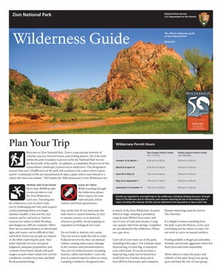
  • 1. Welcome to Zion National Park. Zion is a spectacular network of colorful canyons, forested mesas, and striking deserts. All of the land within the park boundary is preserved by the National Park Service for the benefit of the public. In addition, a remarkable 84 percent of this extraordinary landscape is preserved as wilderness. This designation ensures that over 124,000 acres of the park will continue to be a place where nature and its “community of life are untrammeled by man, a place where man himself is a visitor who does not remain.” 2014 marks the 50th anniversary of the Wilderness Act. National Park Service U.S. Department of the Interior Zion National Park Wilderness Guide The official wilderness guide of Zion National Park 2014-2015 Plan Your Trip NPS/RENDALL SEELY LEAVE NO TRACE While traveling through the wilderness, please show respect for your national park, fellow visitors, and future generations. Stay on the trail. If you must leave the trail, travel in canyon bottoms, in river or stream courses, or on slickrock whenever possible. Avoid stepping on vegetation or biological soil crusts. Do not build or destroy rock cairns. They are used to mark the trail or route. If placed incorrectly, they can mislead visitors, causing unnecessary damage to the resource and potential injuries. Also, do not build structures including benches, tables and shelters. Leave the area in a natural state for others to enjoy. Camping is limited to designated sites in much of the Zion Wilderness. In areas where at-large camping is permitted, camp at least 200 feet from water and out of view of trails and streams. Camp one-quarter mile from springs. Campfires are not allowed in the wilderness. Please use a gas stove. Carry all of your trash out of the park, including toilet paper. Use a human waste disposal bag, or trash bag, to transport your solid waste. If you do not have a disposal bag, waste can be buried in a small hole 4 to 8 inches deep and at least 200 feet from water and campsites. PREPARE AND PLAN AHEAD More than 40,000 people receive permits to visit the Zion Wilderness each year. Traveling into the wilderness, even on short trips, can be challenging and risky and requires careful planning before you begin. Summer weather is hot and dry and winters can be cold and icy. Narrow canyons are subject to flash flooding and dangerous cliffs are common. Often there are no trail indicators or directional signs and routes can be difficult to find and follow. Each year, people are injured or die while exploring the park. Your safety depends on your own good judgment, adequate preparation, and constant observation. Speak with park rangers at park visitor centers for current conditions, weather forecasts, and flash flood potential ratings. Human waste bags must be used in The Narrows. It is illegal to remove anything from the park. Leave the flowers, rocks, and everything else for others to enjoy. Do not write or carve on natural surfaces. Feeding wildlife is illegal and unhealthy. Animals can become aggressive when fed. Store food and trash responsibly. Allow others to enjoy the peace and solitude of the park. Keep your group quiet and limit the size of your group. October 12 to March 7 March 8 to April 19 April 20 to May 23 May 24 to September 1 September 2 to October 11 Kolob Canyons Visitor Center 435 586-9548 8:00 am to 4:30 pm 8:00 am to 5:00 pm 8:00 am to 5:00 pm 8:00 am to 6:00 pm 8:00 am to 5:00 pm Zion Canyon Visitor Center 435 772-0170 8:00 am to 4:30 pm 8:00 am to 5:00 pm 7:00 am to 6:00 pm 7:00 am to 7:30 pm 7:00 am to 6:00 pm Wilderness Permit Hours Permits are required for overnight trips in the wilderness, including climbing bivouacs, through- hikes of The Narrows and its tributaries, and canyons requiring the use of descending gear or ropes, including The Subway. Permits may be obtained on the day before or day of your trip.
  • 2. Permits are required for all overnight trips, including climbing bivouacs, all through- hikes of The Narrows and its tributaries, all canyons requiring the use of descending gear or ropes, and all trips into Left Fork (The Subway). All permits (including those with reservations and those awarded though the lottery) must be obtained in person on the day before or day of the trip at the Zion Canyon or Kolob Canyons Visitor Centers. Use the park’s online reservation system to help you plan ahead and save time at www.nps.gov/ zion/planyourvisit/wilderness.htm. GET A PERMIT There are several ways to obtain a permit for your trip into the Zion Wilderness. Over half of all available permits are secured using the advance reservation system. The remaining permits are obtained through the Last Minute Drawing (canyoneering day trips) or as Walk-in Permits (backpacking trips). CALENDAR RESERVATIONS All visitors can reserve a wide variety of canyoneering, camping, and climbing 2 Wilderness Guide Zion National Park Acting Superintendent Jim Milestone Mailing Address Zion National Park Springdale, UT 84767 Park Information 435 772-3256 Wilderness Information 435 772-0170 Website www.nps.gov/zion E-mail zion_park_information@nps.gov Lost and Found Report at any visitor center Emergencies 911 or 435 772-3322 National Park Service U.S. Department of the Interior Reservation Dates For a Calendar reservations trip in are available on March January 5 April February 5 May March 5 June April 5 July May 5 August June 5 September July 5 October August 5 November September 5 December October 5 January November 5 February December 5 For Left Fork (The Subway) or Mystery Canyon, please read the Advance Lottery Reservations section on this page. Reservations & Permits trips using the online reservation system. Please note that calendar reservations are not permits. Visitors with calendar reservations must pick up their permits at either the Zion Canyon or Kolob Canyons Visitor Center before beginning their trip. MAKING A CALENDAR RESERVATION Reservations are available online during a three month time frame. On the fifth day of every month at 10:00 am MT, reservations for the next month become available. If they are still available, reservations can be made until 5:00 pm MT on the day before your trip. There is a $5.00 non-refundable fee for an online calendar reservation, and there is an additional charge for a permit that is determined by the size of your group. Many of the permits for Left Fork (The Subway) and Mystery Canyon are secured through the Advance Lottery prior to calendar reservations becoming available. ADVANCE LOTTERY RESERVATIONS The Advance Lottery is for trips through Left Fork (The Subway) and Mystery Canyon. Due to the popularity of these areas, the park created an online lottery for reservations. The Advance Lottery does not run from November through March due to a low demand for permits. Advance Lottery applications are completed online. Entries must be submitted three months prior to your planned trip. Entries are limited to one request per individual per canyon per month. Entrants can request three prioritized dates. The non-refundable lottery application fee is $5.00. Applicants will be sent a notification email on the fifth day of the following month with information about the status of their request. If a reservation is awarded, the permit must be obtained before the trip at a park visitor center. Occasionally, a few spaces remain after the Advance Lottery has been held. These spaces can be reserved through the Calendar Reservations system. LAST MINUTE DRAWING RESERVATIONS All visitors can apply for the Last Minute Drawing for canyoneering day trips. The Last Minute Drawing eliminates the need to wait in long lines for last minute permits. When a slot canyon day trip is fully booked online through the Calendar Reservations system or the Advance Lottery, the Last Minute Drawing becomes an option. Individuals can submit an application for the Last Minute Drawing to obtain any remaining reservations for permits. The Last Minute Drawing is limited to one request per individual per canyon. Last Minute Drawing applications are completed online. Entries can be submitted as early as one week prior to a trip date until two days before at noon MT. The drawing is held at 1:00 pm MT, two days before a trip date. Any spaces not taken through the drawing will be available as Walk-in Permits the day before a trip date. Applicants will be sent a notification email with information about the status of their request. If a reservation is awarded, the permit must be obtained before the trip at a park visitor center. WALK-IN PERMITS About one-third of wilderness campsites are not available through the reservation system. They are made available as Walk-in Permits and can be obtained the day before your trip starts. Any slot canyon or climbing permits not taken through the reservation system are available as Walk-in Permits. Wilderness campsites, climbing areas, and slot canyons that are not listed in the reservation system, are only available as Walk-in Permits. Plan ahead and obtain a reservation to avoid any disappointment. ZION EXPRESS MEMBERSHIP Zion Express Membership allows members, who obtain a reservation in their account, to convert it to a permit online, three days before their trip. The entire permit process can be completed online. Zion Express Membership is recommended for frequent visitors. The benefits of membership include: • No cost to enroll. • No waiting in line to pick up permit. • No need to coordinate with Wilderness Desk hours of operation. • Greater flexibility in planning (allows for early starts and late finishes) • Reservation fees are applied to the cost of the permit. • Membership is valid for three years. To become a Zion Express Member, visit the Zion Canyon Wilderness Desk to complete a short orientation and sign a program agreement form. Permit Fees Fees help cover the costs of issuing permits, wilderness patrols, resource monitoring, and trail repairs. Fees are non-refundable and based on group size. • $10.00 for 1 to 2 people • $15.00 for 3 to 7 people • $20.00 for 8 to 12 people GROUP SIZE LIMITS Large groups result in larger impacts. All groups traveling into the Zion Wilderness must follow the group size limit for that area. These limits apply to all trips into the park’s wilderness including trips that do not require a permit. Wilderness trails have a group size limit of 12, but many canyoneering areas are limited to 6. Group size limits are strictly enforced. Permits will be denied and violators will be cited if limits are exceeded. Groups are limited to a maximum of 6 or 12 people that share the same affiliation (e.g., school, club, scout troop, family, and friends). Groups that exceed these limits may not split up and visit the same drainage, route, or wilderness trail on the same day, but may split up and visit different areas. Group size limits do not apply to most trails in Zion Canyon, including the Emerald Pools Trails, Angels Landing, Riverside Walk, Watchman Trail, and The Narrows below the junction with Orderville Canyon.
  • 3. SPRING As the park warms, more areas of the wilderness become accessible. One of the first areas without snow is the Southwest Desert of the park. La Verkin Creek is often snow free by mid-March, and the East and West Rims are usually snow free by early April. In an average year, high water due to snowmelt makes The Narrows impassable until late May. SUMMER Zion National Park is hot through the summer months with temperatures regularly exceeding 100°F. Even higher Wilderness Guide 3 Weather elevation areas such as the Kolob Canyons and West Rim can see high temperatures in excess of 90°F. Visitors must pay constant attention to the possibility of thunderstorms and lightning. The park typically experiences a monsoon season from mid-July through mid-September with an increased risk of severe thunderstorms and dramatic flash flooding. FALL The brilliant autumn colors and cooler temperatures can make the fall an ideal time for backpacking trips in the park. Canyoneering trips through The Narrows and other slot canyons are best if completed prior to mid-October when cooler temperatures may require wetsuits and other specialized gear. WINTER Much of Zion National Park is snow- covered through the winter months. All trails, even at lower elevations, can be ice-covered and traction devices are highly recommended. In winter, sections of the Kolob Terrace Road are not plowed. Snow causes closures of the Kolob Terrace Road near the Hop Valley Trailhead throughout the winter, as well as periodic closures of the Kolob Canyons Road. Recreational use is limited to skis and snowshoes. Flash floods can be extremely violent. The strength of the water can tumble logs and large boulders. A hiker caught in a flash flood like this would not survive. Flash Floods All narrow canyons are potentially hazardous. Flash floods, often caused by storms miles away, are a real danger and can be life threatening. By entering a narrow canyon you are assuming a risk. During a flash flood, the water level rises quickly, within minutes or even seconds. A flash flood can rush down a canyon in a wall of water 12 feet high or more. BE PREPARED Before starting your trip, pay close attention to the weather forecast and the Flash Flood Potential Rating for the park. If bad weather threatens, do not enter a narrow canyon. Whether hiking, climbing, or canyoneering, your safety depends on your own good judgment, adequate preparation, and constant attention to your surroundings. Your safety is your responsibility. FLASH FLOOD POTENTIAL RATINGS In the summer, the National Weather Service issues a daily Flash Flood Potential Rating for multiple areas in Utah. Zion has worked in partnership with the National Weather Service to create specific Flash Flood Potential Ratings for Zion National Park’s unique environment and terrain. These flash flood ratings predict the severity of the flooding that is expected to occur within the park. • Dry: Flash flooding is not expected. • Low: Flash flooding is possible. Some slot canyons may experience flash flooding. • Moderate: Flash flooding is probable. Some slot canyons are expected to experience flash flooding. • High: Flash flooding is expected. Many slot canyons are expected to experience flash flooding. Watch for these indications of a possible flash flood: • Any deterioration in weather conditions • Build up of clouds or sounds of thunder • Sudden changes in water clarity from clear to muddy • Floating debris • Rising water levels or stronger currents • Increasing roar of water upcanyon If you observe any of these signs, seek higher ground immediately—even climbing a few feet may save your life. Remain on high ground until conditions improve. Water levels usually drop within 24 hours. Flash floods can occur in the park during periods of low flash flood potential. A moderate or higher flash flood potential is a serious cause for concern. Slot canyons will be closed if a Flash Flood Warning is issued. The canyons will reopen two hours after the Flash Flood Warning has expired. NPS Jan Feb Mar Apr May Jun Jul Aug Sep Oct Nov Dec Temperature (°F) Average high 52 57 63 73 83 93 100 97 91 78 63 53 Average low 29 31 36 43 52 60 68 66 60 49 37 30 Record high 71 78 86 94 102 114 115 111 110 97 83 71 Record low –2 4 12 23 22 40 51 50 33 23 13 6 Days above 90°F 0 0 0 1 8 21 30 28 18 3 0 0 Days below 32°F 19 14 10 3 0 0 0 0 0 1 9 18 Precipitation (inches) Average 1.6 1.6 1.7 1.3 0.7 0.6 0.8 1.6 0.8 1.0 1.2 1.5 Record high 7.5 6.7 7.1 4.4 3.0 4.0 3.6 4.8 6.7 3.3 3.2 4.3 Record snowfall 26 18 14 3 1 0 0 0 1 1 5 21 Thunderstorms 0 0 0 1 4 5 14 15 5 2 0 0 Climate Temperatures at higher elevations, including the Kolob Canyons area of the park, may be 5 to 10 degrees cooler than Zion Canyon. Wildlife You will encounter wildlife while in the wilderness. Be aware that wild animals can be unpredictable. Do not approach or attempt to move sick or injured wildlife. Please report any encounters with aggressive, sick, or injured animals to a park ranger. RESPECT WILDLIFE Please keep all animals wild and healthy by viewing them from a safe distance. Do not feed or touch wildlife. Store food and trash responsibly. MOUNTAIN LIONS Mountain lions are wild animals and can be dangerous. They have been seen in the park. An attack is unlikely, and the park has never had a reported attack on people or pets. However, mountain lions have attacked in other wilderness areas. • Watch children closely, and never let them run ahead or lag behind. • Solo hiking is not encouraged. • Never approach a mountain lion. Most will avoid a confrontation. Always give them a route to escape. • Do not run. Try to look large and put your arms up. • If a mountain lion approaches, wave your arms, shout, and throw rocks or sticks at it. • If attacked, fight back.
  • 4. disorientation, behavior changes, and seizures. If you believe that a member of your party is suffering from heat stroke, it is imperative to cool them using any available means and obtain immediate medical assistance. HYPOTHERMIA Hypothermia occurs when the body is cooled to dangerous levels. It is the number one killer of outdoor recreationists, even in summer, and it usually happens without the victim’s awareness. It is a hazard in narrow canyons because immersion in water is the quickest route to body heat loss. To prevent hypothermia, avoid cotton clothing (it provides no insulation when wet) and eat high-energy food before you are chilled. The signs of hypothermia include: • Uncontrollable shivering • Stumbling and poor coordination • Fatigue and weakness • Confusion or slurred speech If you recognize any of these signs, stop hiking and immediately replace wet clothing with dry clothing. Warm the victim with your own body and a warm drink, and shelter the individual from breezes. A pre-warmed sleeping bag will also help prevent further heat loss. PETS Pets are not allowed on wilderness trails or on the shuttle buses. Even well- behaved pets may disrupt wildlife and other visitors. Do not leave pets in vehicles. Boarding kennels are available in Rockville, Kanab, Hurricane, St. George, and Cedar City. FIREARMS Firearms are permitted in Zion National Park. As of February 22, 2010, a new federal law allows people who can legally possess firearms under federal, Utah, and local laws, to possess firearms in the park. It is the visitor’s responsibility to understand and comply with all applicable Utah, local, and federal firearms laws. Federal law prohibits firearms in certain facilities in Zion National Park, which are posted with signs. The discharge of firearms and hunting within the park are prohibited. Utah state law prohibits the open carry of loaded firearms on park shuttle buses. 4 Wilderness Guide STEEP CLIFFS Falls from cliffs on trails have resulted in deaths. Loose sand or pebbles on stone are very slippery. Be careful of edges when using cameras or binoculars. Never throw or roll rocks, as there may be hikers below you. Trails can be snow and ice covered in winter. • Stay on the trail. • Stay back from cliff edges. • Observe posted warnings. • Please watch children. WATER The desert is an extreme environment. Carry enough water, one gallon per person per day, and drink it. Water is available at visitor centers, campgrounds, and the Zion Lodge. Water flow at natural springs can vary, check for information at visitor centers. Do not drink untreated water. Water collected in the wilderness is not safe to drink without treatment. There are two safe methods to treat water. BOIL WATER Bring water to a rolling boil for one minute. Add one minute for each 1,000 feet above sea level. FILTER AND DISINFECT WATER Filter through an “absolute” 1 micron filter, or one labeled as meeting ANSI/ NSF International Standard #53. Then add eight drops of liquid chlorine bleach, or four drops of iodine, per gallon of water and let stand for 30 minutes. HEAT EXHAUSTION Heat exhaustion occurs when the body loses more fluid than is taken in. Signs of heat exhaustion include nausea, vomiting, fatigue, headaches, pale appearance, stomach cramps, and cool clammy skin. If a member of your party begins to experience any of these symp- toms, stop your hike immediately. Find a cool, shady area and rest with your feet up to distribute fluids throughout your body. It is important to drink fluids, but it is also important to eat. Drinking lots of fluids and not eating, while suffering from heat exhaustion, can lead to a potentially dangerous condition of low blood salt. If heat exhaustion symptoms persist for more than two hours, seek medical help. Heat stroke is an advanced stage of heat exhaustion. It is the body’s inability to cool itself. Symptoms include confusion, SafetyEmergencies For 24-hour emergency response, call 911 or 435-772-3322. The Zion Canyon Medical Clinic is located in Springdale near the south entrance to the park. For hours, please call 435-772-3226. Other medical clinics are located in Hurricane. The nearest hospitals are in St. George, Cedar City, and Kanab. Transportation ZION CANYON SHUTTLE Travel in Zion Canyon from April 1 to October 26 and on weekends in November is by shuttle bus only. The buses are accessible and have room for backpacks, climbing gear, and bicycles. The buses are free and you may get on and off as often as you like. Pets are not allowed. Plan your trip to include the shuttle. For instance, if your hike ends at a trailhead in Zion Canyon, time your trip so you will not miss the last shuttle of the day. AUTOMOBILES Private vehicles are not permitted on the Zion Canyon Scenic Drive from April 1 to October 26 and on weekends in November. The Zion-Mt. Carmel Highway and other roads in the park are open to private vehicles all year. PRIVATE TAXIS You may choose to complete your hike at a different location from your starting point. Other shuttle and taxi services are available. Please inquire at the Wilderness Desk. BICYCLES Bicycles are not permitted in the wilderness. Bicycles may travel on roadways and on the Pa’rus Trail. Shuttles will not pass moving bicycles. Pull over to allow a bus to pass. Do not pass a moving shuttle. Shuttles have racks for bicycles. Bicycles are not permitted in the Zion-Mt. Carmel Tunnel. OTHER VEHICLES ATVs and OHVs are not permitted in the park. Access to private property by snowmobile is allowed. Zion Canyon Shuttle First Bus from Zion Canyon Visitor Center Last Bus to Springdale Shuttle from Temple of Sinawava from Zion Lodge Last Bus from Zion Canyon Visitor Center from Temple of Sinawava Springdale Shuttle First Bus from Majestic View Lodge from Zion Canyon Theatre Last Bus to Zion Canyon Shuttle from Majestic View Lodge Last Bus from Zion Canyon Theatre from Majestic View Lodge Shuttle Schedule The average wait for a shuttle bus is fifteen minutes or less. The wait is longer in the morning and evening, but shorter during peak hours. Shuttles will also operate on weekends in November, with additional service on Thanksgiving Day and Friday. The Shuttle Schedule is subject to change. Please check your Map and Guide for current information. Late Fall 9/28 to 10/26 7:00 am 6:15 pm 6:30 pm 6:45 pm 7:30 pm 8:10 am 8:30 am 6:15 pm 7:00 pm 7:15 pm Early Fall 9/07 to 9/27 7:00 am 7:15 pm 7:30 pm 7:45 pm 8:30 pm 8:10 am 8:30 am 7:25 pm 8:00 pm 8:15 pm Spring 4/01 to 5/17 7:00 am 7:15 pm 7:30 pm 7:45 pm 8:30 pm 8:10 am 8:30 am 7:25 pm 8:00 pm 8:15 pm Summer 5/18 to 9/06 6:00 am 8:15 pm 8:30 pm 8:30 pm 9:15 pm 7:10 am 7:30 am 8:05 pm 9:00 pm 9:15 pm
  • 5. ALWAYS HAVE A PLAN B There is no substitute for planning ahead, taking the proper equipment, having the right skills, and using sound judgment. Be prepared to take care of yourself and your group by resolving any difficulties that may arise. Rescue is not a certainty. If rescue is possible, it will take hours or days to remove an injured hiker from the wilderness. THE SUBWAY On September 18, 2010, a 20-year-old woman was descending The Subway route. When she arrived at the top of a small waterfall, she and other group members jumped instead of using a rope. When she landed, she suffered an angulated, unstable ankle fracture. The injury occurred at 3:00 pm. She was successfully evacuated from the canyon around noon the following day. Her injury required surgery and a long, difficult recovery. Lower leg fractures are the most common injuries suffered in the wilderness. The most common cause of lower leg injuries is jumping. Do not jump. Bring a rope and use it. Wilderness Guide 5 FAT MAN’S MISERY On June 10, 2010, a father and his two children attempted a one-day trip through the Fat Man’s Misery route. The group relied heavily on a GPS unit to locate the route and entered the wrong canyon. They continued through the canyon, even though the features did not match their route description. Eventually, they emerged at the top of a 400-foot cliff without enough rope to descend or the ability to travel back up the canyon. The group was reported missing on the afternoon of June 11 and was not found until the afternoon of June 12. Even heavily traveled canyons in the park are routes, not maintained trails. Do you have a map and a route description? Are you confident in your ability to use them? When you enter a canyon and pull your rope after your first rappel, you are committed. You must complete the canyon whether or not it is the canyon that you intended to enter. SPRY CANYON On July 24, 2010, the National Weather Service forecast indicated a 30 percent chance of rain and a moderate flash flood potential. There were no clouds in the morning sky. Three men began a descent of Spry Canyon. As the day progressed, the clouds increased, and hard rain began around 4:00 pm. The men found themselves clinging to a small shelf in a narrow canyon with rapidly rising water levels. All three eventually had to let go. One man was washed over a 40-foot cliff. The other two men were washed over the 40-foot drop, plus an additional 60-foot cliff. Remarkably, all three men survived. Flash floods occur even during periods of low flash flood potential. When the National Weather Service states that there is a 30 percent chance of rain, they are not stating that there is a 30 percent chance that it will rain. They are stating that 30 percent of the forecast area will be affected by measurable precipitation. PINE CREEK CANYON On April 30, 2010, a group of eight entered Pine Creek Canyon. The second person to attempt the last rappel flipped upside down 10 feet below the anchor. He was free hanging 80 feet above the ground. After 45 minutes, he had almost entirely slipped out of his harness and felt he could no longer hold on to the rope to prevent his fall. Another group arrived in time to provide assistance. Can you assist another group member? Are you capable of stopping yourself mid-rappel to correct a problem? If not, consider taking a canyoneering course before heading out on your own. Canyoneering Safety Fractured pelvis caused by a rappelling accident. Lower leg injury caused by a rappelling accident. Spinal fracture and bruised lung caused by a rappelling accident. Lower leg injury caused by a jumping accident. Fractured pelvis caused by a rappelling accident. Broken ankle caused by a fall. NPS
  • 6. 15 Exit 40 Kolob Canyons Road KolobTerraceRoad North F ork Road LavaPoint Rd Beyond this point, road not plowed in winter. Unpaved roads are impassable when wet. Unpaved roads are impassable when wet. Closed in winter. Trailhead and trail are on private property. Please close gates. Vehicles longer than 19 feet/5.8 meters are not allowed on Lava Point Road. Unpaved roads are impassable when wet. Private property of Zion Ponderosa Ranch Left Fork Trailhead permit parking only Right Fork Trailhead Grapevine Trailhead Hop Valley Trailhead Wildcat Canyon Trailhead Lee Pass Trailhead West Rim Trailhead Chamberlain’s Ranch Trailhead LaVerkinCreekTrail Hop Valley Trail Taylor Creek Trail W i ldcat CanyonTrail NorthgatePeaks Trail Connector Trail WestRim Trail West R im Trail East Mesa Trail East Rim Trail Kolob Arch Angels Landing Deertrap Mountain Cable Mountain LEE VALLEY CAVE VA L LEY ECHO C ANYON HOP VALLEY CANYON K O L O B C A N Y O N S HORSE PASTURE PLATEAU ORDERVILLE CANYON THENARROWS W E S T R I M E A S T North Fork Virgin River C reek Left Fork Right Fork La Verkin Creek La Verkin Creek TimberCreek Willis Creek North Fork South Fork Taylor Creek Camp Creek Middle Fork Kolob Creek Creek Deep Chasm Lake Kolob Reservoir Beatty Spring Sawmill Springs Big Spring West Rim (Cabin) Spring Spring Potato Hollow Spring Spring Kolob Canyons Viewpoint Lava Point Lava Point Overlook Temple of Sinawava The Grotto Zion Lodge Kolob Canyons Visitor Center 6.4 mi 0.3 mi 1.8 mi 6.5 mi 4.1 mi 1.1 mi1.0 mi 4.8 mi 5.9 mi 4.4 mi 0.1 mi 3.0 mi 1.5 mi 0.4 mi 2.5 mi 1.1 mi 5.9 mi 0.3 mi 1.8 mi 3.2 mi 0.3 mi 0.6 mi 2.1 mi 3.0 mi 0.8 mi 1 2 3 7-10 6 4 5 13 12 11 A horse camp B 8 7 11 12 10 9 3 4-6 2 1 7 8 6 5 9 3 4 2 1 To Cedar City, Cedar Breaks NM, and Salt Lake City To La Verkin, Springdale and Zion Canyon Visitor Center 2.4 mi Lava Point No reservations, no fee, primitive campground with six sites with pit toilets and no water. Closed in winter. Kolob Canyons Site Number Max Group Size 1 4 2 online 4 3 6 4 online 7 5 online 4 6 4 7 2 8 online 12 9 12 10 2 11 online 4 12 8 13 4 A online 12 horse camp B 7 The Narrows Site Number Max Group Size 1 online 4 2 4 3 online 6 4 2 5 online 6 6 12 7 online 6 8 6 9 online 6 10 6 11 4 12 online 12 West Rim Site Number Max Group Size 1 12 2 online 2 3 4 4 online 12 5 4 6 online 6 7 4 8 online 6 9 6 Zion National Park Wildcat Canyon At-large camping is limited to 30 people per night. 18 reservations are available online. The maximum group size is 12.
  • 7. 9 9 9 Grafton (ghost town) Rockville Springdale Virgin Zion-Mount Carmel Highway Tunnel Kolo b Terrace Road S m ithsonian Butte Scenic Backw a y Grafton Road Bridge Road Tunnel Unpaved roads are impassable when wet. May be closed in winter. Vehicles pulling trailers not recommended. Narrow winding road with steep grades. The upper section is not plowed in winter. From April 1 through October 26, the Zion Canyon Scenic Drive is open to shuttle buses only. Private vehicles are not permitted beyond Canyon Junction. turn on Anasazi Way Chinle Trailhead Area closed to all access. Chinle Tra il ZIO N PA R U N U W E A P C A N Y O N R I MS O U T H W E S T D E S E R T East Fork Virgin River NorthFo rk Virgin River Virgin River North Coalpits Scoggins Wash Wash W as h Hube r Spring 12 Coalpits Wash South Watchman East Entrance South Entrance Zion Canyon Visitor Center Zion Human History Museum Backcountry campsite Hiking trail Unpaved road (impassable when wet) Trail mileagePaved road open to private vehicles Zion Canyon shuttle route Springdale shuttle route Shuttle Information Visitor Information From April 1 through October 26, the Zion Canyon Scenic Drive is open to shuttle buses only. Private vehicles are not permitted beyond Canyon Junction. Campground No camping except in designated sites Hiking and stock trail This map is for planning purposes only. Do not use this map for wilderness travel. Topographic maps are available for sale. Primitive campground 2.5 mi 3.2 mi2.1 mi 1.7 mi 3.5 mi 1.9 mi 1.4 mi 1.5 mi 1 2 3 4 5 6 Hiking route At-large camping No designated sites To La Verkin and Kolob Canyons To Mt. Carmel Junction and Bryce Canyon NP 0 1 2 3 4 0 5 Miles 5 Kilometers1 2 3 4 North Wilderness Guide 6-7 Southwest Desert Site Number Max Group Size 1 6 2 online 6 3 6 4 6 5 online 6 6 online 12 Wilderness Use Limits Area Total Use Limit Advance Reservations Last Minute Drawing Group Size Limit Behunin Canyon* 12 people per day 6 people per day 6 people per day 6 Echo Canyon* 12 people per day 6 people per day 6 people per day 6 Keyhole Canyon 80 people per day 60 people per day 20 people per day 12 Left Fork (The Subway) 80 people per day 60 people per day 20 people per day 12 Mystery Canyon 12 people per day 6 people per day 6 people per day 6 Orderville Canyon* 50 people per day 30 people per day 20 people per day 12 Pine Creek Canyon* 50 people per day 30 people per day 20 people per day 12 Spry Canyon 20 people per day 14 people per day 6 people per day 6 The Narrows 40 people per day 24 people per day 16 people per day 12 *Total use limits are reduced from March through August for wildlife protection. Zion National Park’s wilderness is managed using standards that were developed to measure the health of natural resources and to determine the number of encounters people considered desirable and acceptable while experiencing wilderness. These two standards were combined with existing management zones to create overall use limits and group size limits. The use limits are evaluated each year, and may change as conditions warrant. Wilderness On March 30, 2009, President Barack Obama signed the Omnibus Public Land Management Act of 2009 into law designating 124,406 acres of wilderness in Zion National Park. Ninety percent of the acreage of Zion National Park is managed under the 1964 Wilderness Act. According to the act “a wilderness, in contrast with those areas where man and his own works dominate the landscape, is hereby recognized as an area where the earth and its community of life are untrammeled by man, where man himself is a visitor who does not remain.” East Rim At-large camping is limited to 50 people per night. 20 reservations are available online. The maximum group size is 12.
  • 8. 8 Wilderness Guide Stock Use Horses traditionally have been used to explore Zion National Park. Allowed stock animals include horses, mules, and burros. Llamas, dogs, goats, camels, and others are not allowed. Permits are not required for day trips. However, stock are prohibited during spring thaws, unusually wet periods, or times when their use would cause trail damage. Maximum group size is six animals. TRAILS Where trails are present, stock animals must remain on trails. Free trailing or loose herding is not allowed. Maintain a slow walk when passing hikers. When Backpacking Zion National Park has a number of trails in a variety of landscapes for backpackers to explore. Backpackers in the Zion Wilderness can camp in designated campsites or in at-large areas on Zion’s high plateaus, in the low desert shrublands, or next to a river in a narrow canyon. When planning your trip, consider your interests, time, and ability. There is no perfect trail. Use the Wilderness Guide, other guidebooks, and topographic maps to plan the best trip for you during your visit. Please refer to the map for campsite locations. WEST RIM TRAIL Late spring and fall are ideal times for hiking the West Rim. Temperatures are usually ten to fifteen degrees cooler than Zion Canyon. The trail is typically snow covered from December through April. The West Rim Trail traces a series of canyon rims with panoramic views. A difficult but rewarding one-night backpacking trip can be accomplished by hiking from The Grotto to one of the campsites near Cabin Spring. The trip is five miles one way, with 2,500 feet of elevation gain. A more moderate one-night trip descends from Lava Point to campsites near Potato Hollow. Water may be available at Cabin, Potato Hollow, and Sawmill Springs. Check at visitor centers for availability. EAST RIM TRAIL This trail begins at the east entrance of the park and climbs 1,000 feet onto the plateau with views into Jolley Gulch and several small canyons. There are sweeping views of the surrounding terrain before entering a high desert ponderosa forest. As you near the east rim of Zion Canyon, the trail begins a 2,300-foot descent through Echo Canyon, ultimately ending at the Weeping Rock Trailhead. Water may be available at Stave Spring. Check at visitor centers for availability. SOUTHWEST DESERT The Chinle Trail crosses the open desert as it winds toward the base of Mount Kinesava. The trail offers spectacular views of the West Temple and Mount Kinesava. The Chinle Trail can be very hot in the summer, but mild in the spring and fall. Coalpits Wash has no developed trail, but there is a well-worn path to the junction with Scoggins Wash. Water may be available at Coalpits Spring. Check at visitor centers for availability. LA VERKIN CREEK TRAIL Spring and fall are ideal seasons for hiking in La Verkin Creek. Temperatures are typically 5 to 10 degrees cooler than Zion Canyon. Trails in the Kolob Canyons area of the park are frequently snow covered in winter. The La Verkin Creek Trail begins at the Lee Pass Trailhead and descends past the finger canyons of the nearby cliffs to Timber Creek. The trail follows the creek downstream until it reaches La Verkin Creek, where the trail starts to gain elevation. As the canyon narrows, you receive stunning views of the surrounding cliffs. The trail from Lee Pass to Kolob Arch is seven miles. Water may be available at Beatty Spring. Check at visitor centers for availability. OTHER TRAILS AND ROUTES The map shows the locations where camping is limited to designated campsites, including The Narrows, West Rim, La Verkin Creek, and the Southwest Desert. In other areas, at-large camping is permitted. Online reservations are available for at-large camping on the East Rim and in Wildcat Canyon. Water and maintained trails are not always available in the at-large camping areas. Permits are required and visitors must camp one mile from roads, out of sight of trails, and one-quarter mile from any springs. EXTENDED TRIPS Trips up to 50 miles in length can be made in Zion National Park’s wilderness by combining the La Verkin Creek, Hop Valley, Wildcat Canyon, West Rim, and East Rim Trails. These routes cross several roads, so many variations to your trip are possible. A vehicle shuttle may be necessary. Backpackers that intend to camp in multiple locations need to make a separate reservation for each location. FIRES Campfires are not allowed in the wilderness. Please use a gas stove. NPS/CAITLIN CECI West Rim Trail standing, stock must be kept at least 100 feet from drainages. Check the map on pages 6 and 7 for trails open to stock use. Off-trail use is permitted only in Lower Coalpits Wash from the trailhead to the junction with Scoggins Wash, in Scoggins Wash, and in Huber Wash. OVERNIGHT TRIPS The only overnight stock camp is Hop Valley Site A and your stay is limited to one night. A permit is required. Stock must be hobbled or tethered to reduce damage to vegetation. To reduce the spread of noxious and exotic weeds, stock must be fed certified weed-free hay two days prior to the trip.
  • 9. Wilderness Guide 9 Canyoneering Canyoneering combines route finding, rappelling, problem solving, hiking, and swimming. Zion National Park is one of the premier places in the country to participate in this exciting activity. With dozens of different canyons to explore, some barely wide enough for a human to squeeze through, the park offers opportunities that range from trips for beginners to experiences requiring advanced technical skills. A short trip into the lower end of The Narrows from the Temple of Sinawava is a great introduction to the slot canyons of the park. For those with expertise and experience, The Subway and Orderville Canyon offer opportunities for route finding, swimming, and short rappels. MINIMUM IMPACT CANYONEERING Travel on durable surfaces, like slickrock, river bottoms, or drainages. Avoid steep, sandy, or erodible slopes. Carry solid waste disposal bags and pack out everything, including toilet paper. Don’t bury it, burn it, or leave it. Prevent bottlenecks. If a faster group catches up to you, allow them to pass. Avoid bolting. Bolts should only be placed as a last result. Only use a bolt if there are no other safe options for creating an anchor. If bolts are used, they should be placed so that they will last for many years and will avoid scarring on the rock caused by rope pulls. There are several items that you should bring on every canyoneering trip in Zion National Park. BACKUP EQUIPMENT The ability to stop, move up, or down while hanging mid-rope is a lifesaving skill that must be learned before you need it. Can you create extra friction? Do you have ascenders? Can you belay the less experienced members of your group? WEATHER & FLASH FLOOD POTENTIAL Carefully evaluate the forecast and flash flood potential before entering a narrow canyon. Remember that a 30 percent chance of rain means that 30 percent of the forecasted area will receive measurable precipitation. Continuously evaluate weather conditions. If bad weather threatens, avoid traveling in a slot canyon. If you are in a slot canyon, find higher ground and wait for conditions to improve. MAP AND ROUTE DESCRIPTION You must have and use them. Carefully assess your location before beginning your first rappel. ANCHOR EQUIPMENT Can you replace webbing if it is worn? Can you create a new anchor if needed? EXTRA CLOTHING Could you spend an unexpected night in the canyon? EXTRA FOOD Food keeps your energy up and helps you stay warm if you remain out overnight. WATER Drink a minimum of one gallon per person per day. FLASHLIGHT / HEADLAMP Every week, canyoneers spend unintended nights camped in the wilderness of the park. A headlamp could make the difference between spending the night in the canyon and making it out. HELMET Rock falls can cause severe injuries. FIRST AID KIT Even a minor injury can cause major problems in the wilderness. Remember, even the most reliable cell phones and GPS units rarely work in the narrow canyons of Zion National Park. NPS River Trips All watercraft use in the park requires a wilderness permit. Permits are issued when the river is flowing in excess of 150 cubic feet per second. Watercraft must be specifically designed for whitewater use. Operators must be equipped with approved personal flotation devices. Kayak trips through The Narrows should only be attempted by expert paddlers who are prepared to survive without assistance for multiple days. Permits for kayaking through The Narrows will not be issued on the day of the trip and must be obtained the day before. An early start to this trip is needed. Inner tubes are not permitted at any time on any watercourse within the park. Climbing Zion National Park’s 2,000-foot sandstone cliffs are world renowned for their big wall climbs. Due to their difficulty, most routes in the park are not recommended for inexperienced climbers. There are few top roping areas and no sport climbs. Permits are not required for day climbs, but they are required for all overnight bivouacs. It is illegal to camp at the base of the wall or in your vehicle. Detailed route descriptions are available at wilderness desks. ROUTE CLOSURES Some rock formations and routes are closed to climbing from March through August each year to protect nesting peregrine falcons. Some areas that are routinely closed include the Great White Throne, Cable Mountain, Court of the Patriarchs, and Angels Landing. Check at the visitor center or visit www.nps.gov/zion for current closure information. MINIMUM IMPACT CLIMBING Many of the park’s routes are now going clean. Avoid using pitons and hammers where they are not needed. Excess bolting is discouraged and the use of power drills to place bolts is prohibited. When approaching a climb, please use established trails. Never climb directly above trails where hikers may be hit by dislodged rocks. Tube or bag human waste and carry it out. Do not drop your waste. Keyhole Canyon
  • 10. The Virgin River has carved a spectacular gorge in the upper reaches of Zion Canyon: 16 miles long, up to 2,000-feet deep, and at times only 20 to 30-feet wide. The Narrows, with its soaring walls, sandstone grottos, natural springs, and hanging gardens can be an unforgettable wilderness experience. The Narrow is not a hike to be underestimated. Hiking The Narrows means hiking in the Virgin River. At least 60 percent of the hike is spent wading, walking, and sometimes swimming in the river. There is no maintained trail because the route is the river. The current is swift, the water is cold, and the rocks underfoot are slippery. Flash flooding and hypothermia are constant dangers. Good planning, proper equipment, and sound judgment are essential for a safe and successful trip. Your safety is your responsibility. GROUP SIZE LIMIT Large groups produce increased impacts on the wilderness. Group size is limited to a maximum of 12 people sharing the same affiliation (e.g., school, club, scout troop, family, and friends) in the same 10 Wilderness Guide The Narrows drainage, route, or wilderness trail on the same day. Group size limits are strictly enforced. Permits will be denied and violators cited, if limits are exceeded. WHEN TO HIKE THE NARROWS Entering The Narrows is safest when the forecast has little chance of rain and the river is low, clear, and relatively warm. Conditions change from day to day and are impossible to predict. Check at the Zion Canyon Visitor Center for the latest weather forecast and possible advisories. Permits are not issued when the flow is 120 cubic feet per second (cfs) or greater. Flash floods can occur any time, but are more common in mid-summer and early fall. From November through May, trips through The Narrows require wetsuits, or even drysuits, and special cold weather preparation. Spring snowmelt frequently causes the river to run at dangerously high levels from March to early June. DAY HIKE FROM THE BOTTOM AND BACK To experience The Narrows, start at the Temple of Sinawava and hike one mile to the end of the Riverside Walk and wade into the river. In less than a mile, you will be hiking in one of the narrowest sections of the canyon. There is not a formal destination, and you will return the same way you came. Some hikers try to reach Orderville Canyon, a tributary roughly two hours upstream from the end of the trail. Travel upstream into Orderville Canyon or beyond Big Spring is prohibited. No permit is required for this day hike. Groups size limits apply beyond the junction with Orderville Canyon. DAY HIKE FROM TOP TO BOTTOM Walking the entire length of The Narrows can be a grueling experience. Under favorable conditions, the 16-mile route takes an average of 12 hours. Even for well-conditioned hikers, this makes for a long and strenuous day. The trailhead at Chamberlain’s Ranch is a 1.5-hour drive from the Temple of Sinawava. Two vehicles or a shuttle is necessary. A wilderness permit is required. Group size limits apply. OVERNIGHT HIKE FROM TOP TO BOTTOM To enjoy The Narrows at a more leisurely pace, some visitors choose to spend a night in the gorge. There are twelve numbered sites. Only one-night stays are allowed, and overnight trips must start from Chamberlain’s Ranch. Reservations are recommended for weekend trips. Campsite capacity is limited and only two sites can accommodate groups of more than six people. TRANSPORTATION If you are planning to hike The Narrows from top to bottom, there are a couple of transportation options: • If you have two vehicles, you can shuttle yourself by parking one vehicle at Chamberlain’s Ranch and the other at the Zion Canyon Visitor Center. • You may make arrangements with a local shuttle service. At the end of your hike at the Temple of Sinawava, you must catch the Zion Canyon Shuttle to the visitor center. Plan your hike so you do not miss the last shuttle of the night. DIRECTIONS TO CHAMBERLAIN’S RANCH Chamberlain’s Ranch is a 1.5-hour drive from Zion Canyon, along paved and dirt roads. The dirt roads are passable for normal cars only when dry. When wet, they may be impassable even for four-wheel drive vehicles. Snow closes the road in winter. From the park’s East Entrance, drive 2.5 miles east on Route 9. Turn left on a paved road and continue 18 miles to a bridge that crosses the North Fork of the Virgin River. Turn left beyond the bridge and drive one-quarter mile to the gate of Chamberlain’s Ranch. Please close the gate behind you. Drive one-half mile farther and park just before the road crosses the river. To begin your hike, cross the river and follow the road for approximately 3 miles. Enter the river at the end of the road past the old cabin. Chamberlain’s Ranch is a private ranch outside Zion National Park. Please respect private property. FOOTWEAR Hiking The Narrows is like walking on slippery bowling balls. It requires balancing on algae-coated rocks in the middle of a swiftly flowing river. Sturdy footwear is essential. Hiking boots with good ankle support are best. Sandals and bare feet are not appropriate. Inappropriate footwear often results in twisted ankles and crushed toes. CLOTHING Even in mid-summer The Narrows can be cool. The water is cold, breezes blow steadily, and very little sunlight penetrates to the canyon floor. Although you’ll probably hike in shorts, take extra warm clothing. Clothing made of wool or synthetic fibers has the best insulation. DRINKING WATER Untreated water from the river and its springs is not safe to drink. It has passed over rangeland and may be contaminated with illness-causing bacteria. Treat the water you collect by filter, tablets, or by boiling. Hikers are encouraged to carry in all of their water. Drink one gallon of water per person per day. FALLS Even the most experienced hikers fall in The Narrows. Pack a walking stick for additional stability. It is also a good idea to waterproof your belongings. Many hikers line their packs with plastic bags. Smaller resealable bags provide extra protection for cameras and other items. WATER DEPTH The water level varies in The Narrows. Under ideal conditions, when flow is less than 70 cubic feet per second, most crossings are around knee-deep. Higher flows mean higher water, a stronger current, and may require wading in waist-deep water. Be prepared to swim. Even when the river is low, chest-deep holes are common. When possible, help the park protect fragile vegetation in The Narrows and hike in or near the river. NPS/MARC NEIDIG
  • 11. With the increase in recreational use along Zion National Park’s waterways, the National Park Service introduced a human waste disposal program for overnight users in The Narrows. An environmentally friendly human waste disposal bag, complete with use and disposal instructions, is provided to all party members with an overnight wilderness permit for The Narrows. It is a lightweight and sanitary way to pack out human waste. The bag-within-a-bag design and interlocking closure securely contains waste and odor, while the blend of polymers breaks down the waste and transforms it into a deodorized gel. The contents of the disposal bag are safe for landfills and may be deposited in the trash. Use of this waste disposal system is required in The Narrows, and strongly encouraged for all hikers in all park slot canyons, to help protect the Virgin River and the drinking water for Springdale, Rockville, Virgin, La Verkin, Hurricane, St. George, and other communities downstream. Wilderness Guide 11 Left Fork (The Subway) Protect the Virgin RiverThe Narrows Timetable Chamberlain’s Ranch 0:00 / 0.0 mi Old Cabin 1:00 / 2.3 mi First Narrows 3:30 / 6.1 mi Waterfall 4:15 / 8.3 mi Deep Creek 5:00 / 8.9 mi Kolob Creek 5:45 / 9.8 mi Goose Creek 6:35 / 10.9 mi Big Spring 7:20 / 11.5 mi Orderville Canyon 10:00 / 13.5 mi Riverside Walk 11:50 / 15.1 mi Temple of Sinawava 12:20 / 16.2 mi Track your progress by recognizing side canyons like Deep Creek, Kolob Creek, and Big Spring. Watch closely for the mouth of Goose Creek. There are two ways to hike Left Fork (The Subway). Both trips involve extensive route finding. Visitors are encouraged to travel with an experienced hiker of Left Fork (The Subway) or obtain a detailed route description. Permits are required regardless of the direction of travel. Left Fork (The Subway) is a day-use area only. FROM THE BOTTOM AND BACK This strenuous 9-mile round-trip hike requires route finding, stream crossing, and scrambling over boulders. This hike begins and ends at the Left Fork Trailhead on the Kolob Terrace Road. FROM THE TOP TO THE BOTTOM This strenuous 9.5-mile hike requires rappelling skills, 60 feet of rope, and extensive route finding experience. The route also requires swimming through several deep pools of very cold debris-filled water. The trail begins at the Wildcat Canyon Trailhead and ends at the Left Fork Trailhead. Both trailheads are located on the Kolob Terrace Road north of Virgin, Utah. NPS/CAITLIN CECI NPS/MARC NEIDIGNPS
  • 12. 12 Wilderness Guide Maps & Guides ZION NATURAL HISTORY ASSOCIATION The Zion Natural History Association sells maps and guides, as well as other books, at park visitor centers. ZNHA is a non-profit membership organization which supports the scientific, educational, historical, and interpretive activities of the park. Members receive a 20% discount. MAPS Trails Illustrated Map of Zion National Park Scale approximately 1:37,700, 30 x 25” Wilderness and hiking information, waterproof, tear-resistant, folded. St. George and Springdale, UtahTrail Map Scale 1:25,000, 27 x 39” Hiking information, waterproof, tear resistant, folded. USGSTopographic Maps Scale 1:24,000, 7.5 minute quads. Paper, rolled. Kanarraville, Kolob Arch, Kolob Reservoir, Cogswell Point, Smith Mesa, Guardian Angels, Temple of Sinawava, Clear Creek, Springdale East and West, and The Barracks. HOW-TO BOOKS Desert HikingTips by Bruce Grubbs Covers desert tips from drinking water to flash floods. Leave NoTrace by Will Harmon The official pocket-size Leave No Trace manual of the American Hiking Society. Reading Weather by Jim Woodmency Weather basics to help you avoid bad weather on your outdoor adventures. Route Finding by Gregory Crouch Pocket-sized guide to map and compass navigation. Backpacker Magazine’sTrailside First Aid by Molly Absolon Information about recognition, treatment, and prevention of injuries. AREA GUIDES Hiking Zion and Bryce Canyon National Parks by Eric Molvar and Tamara Martin An illustrated guide to the breathtaking slickrock canyons and towering cliffs of southwestern Utah. Hiking the Southwest’s Geology, Four Corners Region by Ralph Lee Hopkins Information on 50 hikes includes the landscape and geologic features along each trail. Favorite Hikes In & Around Zion National Park by Tanya Milligan and Bo Beck Information about hikes within a 100-mile radius of Zion National Park. Zion: Canyoneering by Tom Jones Descriptions of trail hikes, off-trail hikes, and technical canyoneering routes. Desert Rock by Eric Bjornstad Rock climbing routes in National Parks of the Colorado Plateau. Rock Climbing Utah: A Falcon Guide by Stewart M. Green A guide for planning climbing trips in Utah. Zion Climbing: Free and Clean by Bryan Bird A climber’s guide to Zion National Park. To find out more about the programs and publications available through the Zion Natural History Association, please visit our website at www.zionpark.org or call 800 635-3959. The printing of this newspaper was made possible by the Zion Natural History Association. Printed with SOY INK Printed on recycled paper. Please recycle again.