SlideShare une entreprise Scribd logo
1  sur  29
An Embedded Linux Based Navigation
System for an Autonomous Underwater
Vehicle
Presented By:
Priyanka Katkar
Under the Guidance of
Mr. B.G. Patil
1
Outline
 Introduction
 Interfacing With SBC
 System Architecture
 Hardware Development
 Software Development
 Conclusion and Future Work
2
Introduction
• AUVs are unmanned and untethered submarine vehicles, used to
gather ocean data.
• Find applications in the area of mines clearing operation, feature
tracking, cable or pipeline tracking and deep ocean exploration.
• HUGlN 3000 was the world's first AUV used in commercial survey
operations.
3
Use of the AUV
• Search and Recovery of Government
Property.
• Prediction of Waves and Currents.
• Readings for depth, salinity, pressure
and temperature.
• Pictures of visual light,
bioluminescence.
• Discovery of never seen before
species and footage.
4
UUV Research
5
6
Nomenclature
• Unmanned Underwater Vehicle (UUV): Self propelled
unmanned submersible
• Remotely Operated Vehicle (ROV): controlled and
powered from the surface by an operator/pilot via an
umbilical or using remote control
• Autonomous Undersea Vehicle (AUV): Un-tethered
UUV operating with no or very limited operator control.
• Two paddle wheel thrusters are installed on AUV, one for
horizontal motion and other for vertical motion
7
Navigation Techniques
• AUV: The benefits of offered by autonomous data gathering
• Examples include the Theseus AUV, developed by Interna-
tional Submarine Engineering, the DARPA UUVs, developed
by Draper Laboratories, the LDUUV and 21UUV developed
by the Naval Undersea Warfare Centre in Newport.
• The three primary methods for navigation of AUVs are:
1. Inertial navigation systems
2. Acoustic navigation
3. Geophysical navigation techniques.
8
System Architecture
9
INS KF
DGPS +USBL UTP
Pressure
Sensor
Compass
DVL
Bottom-Track
Velocity
Altitude
Depth
Smoothing
Position
Error
estimates
Inertial Measurement Unit
10
Outline of Conventional Aided INS
11
The Complete System Setup
12
Interfacing With SBC
• Single Board Computers (SBC) like Kontron E2Brain
EB8540, Gumstix, Inhand Fingertip- Elf, AMD GX SOM-144
and TS-7200
• TS-7200 SBC selected due to its features, good support by the
manufacturer and a huge user community. TS-7200 is based on
200MHz Strong ARM processor.
13
TS-7200 Hardware
14
The CirrusLogic EP9302 and TS-7200
• The EP9302 features an advanced ARM920T processor design
with a memory management unit (MMU) .
• Supports Linux & many other operating systems.
• Contains 16Kbyte instruction cache and 16Kbyte data cache.
• supports both the 32-bit ARM and
16-bit Thumb instruction set.
• The core can operate in big
and little endian mode
15
(Cont...)
• The TS-7200 is a compact full-featured (SBC) based upon the Cirrus
EP9302 ARM9 CPU
• The TS-7200 SBC runs on a 200MHz EP9302 ARM9 processor with
power as low as 0.5Watts.
• includes a compact flash interface which allows booting from large
flash drives to the different Linux distros.
• fast boot from the on-board Strata Flash memory using a compact TS-
Linux distribution.
16
Interfacing of INS with SBC
Block Diagram of Integrated Sensor Pack
17
Tracking Algorithm
Calculation of object
centroid in the image
Separation of moving
objects from the
stationary objects
Identification of moving
objects based on change
in centroid values
Comparison of centroid
values in all subsequent
frames
Calculation of trajectory
for all moving objects
Calculation of speed and
direction of moving
objects
Block diagram of the complete model
18
Kalman filter
• The Kalman Filter is an estimator for the linear-quadratic
problem, estimating the instantaneous ‘state’ of a linear
dynamic system perturbed by white noise.
• The Kalman filter is a set of mathematical equations that
provides an efficient computational (recursive) means to
estimate the state of a process, in a way that minimizes the
mean of the squared error.
• Various Kalman filter configurations applied to a low-cost
inertial navigation system (INS) for AUV.
19
Kalman Filtering Algorithm
 Time Update ( Predict ) equations:
• Step 1: Project the state ahead:
𝑋 𝑘
−
= A 𝑋 𝑘−1 + 𝑊𝑘
• Step 2: Project the error covariance ahead:
𝑃𝑘= A 𝑃𝑘−1 𝐴 𝑇+ Q
 Measurement Update ( Correct ) equations:
• Step 3: Compute the Kalman gain:
𝐾𝑘 = 𝑃𝑘 𝐻 𝑇(H 𝑃𝑘 𝐻 𝑇 + R)
−1
• Step 4: Update estimation with measurements:
𝑋 𝑘= 𝑋 𝑘
−
+ 𝐾𝑘 (𝑍 𝑘 - H 𝑋 𝑘
−
)
• Step 5: Update the error covariance:
𝑃𝑘 = (I - 𝐾𝑘 H) 𝑃𝑘
−
• Step 6: Go to Step 1. 20
GPS Receiver
• To provide the absolute positioning of any object, GPS uses a
constellation of 24 satellites.
• Four satellites are visible at all times from any point on the earth’s
surface.
• GPS receiver supports NMEA 0183 data protocol.
21
Software Development
• TS-Linux embedded distribution is installed on the on-board Flash
memory of the TS-7200.
• TS-Linux is a compact distribution, which is based on Busy Box
• The GPS receiver is interfaced to the TS-7200 through the serial port
• Linux distinguishes devices into three fundamental device types: a
char module, a block module, or a network module.
• Developing a serial class is classified.
22
Results
Output from the ADC and the GPS Receiver.
23
Future Scope
• The exact position of the vehicle can be determined by
processing the logged sensor data using the Kalman filter.
• Current version does not have a driver for the digital I/O port.
• This can be implemented to increase the no of sensors that
can be interfaced with SBC.
24
Applications
• Pipeline inspection and intervention.
• Under ice surveys (transponders may be deployed from
an ice breaker or along the ice ridge).
• Mines clearing operation, feature tracking, cable or pipeline
tracking and deep ocean exploration.
• Autonomous surveys where surfacing or support from a
surface ship are infeasible due to e.g. heave traffic.
25
Pros And Cons
 Pros
• Smaller, Lighter and less expensive equipment became
available, the access to operational vehicles which made more
affordable AUVs.
• TS7200 has on board Apaches web server therefore data logged
from SBC can be displayed on a web page.
 Cons
• Limited number of DIO ports available on SBC board.
• loss of controllability at low speeds, 26
Conclusion
• The SBC with Linux setup and the development tools form the
embedded Linux development system.
• Provides lower development cost with interfaces such as Ethernet and
USB and have made AUVs more affordable.
• As a data logger/analyzer of various sensor measurements for Marine
research.
27
References
• Grenon, G., Edgar, P., Smith, S., and Healey, A., “Enhancement of the inertial
navigation System for the Morpheus Autonomous underwater Vehicles”,
IEEE Journal of Oceanic Engineering, Vol. 26, No. 4, October, 2012.
• Yun, X.; McGhee, R.; Whalen, R.; Roberts, R; Healey, A, and Zyda, M.,
“Testing and Evaluation of an Integrated GPS/INS System for Small AUV
Navigation” IEEE Journal of Oceanic Engineering, Vol. 24, Issue 3, pp.396–
404, 19-20 July, 2007.
• B. Jalving, K. Vestgkd, N. Sterkersen, “Detailed seabed surveys with AUVs” in
TechnologV and Apphcurions of Autonomous Underwater Vehicles. Edited
by Gwyn Grifiths. Tavlor & Francis. London and New York. 2008. pp. 179-201
28
Thank You
29

Contenu connexe

Tendances

Autonomous Underwater Vehicle (AUV)
Autonomous Underwater Vehicle (AUV)Autonomous Underwater Vehicle (AUV)
Autonomous Underwater Vehicle (AUV)Ahmed ElSheikh
 
Global Positioning System
Global Positioning SystemGlobal Positioning System
Global Positioning SystemGaurav Raj
 
Introduction to radar
Introduction to radarIntroduction to radar
Introduction to radarUlsah T N
 
Presentation on Drones and Open Street Maps
Presentation on Drones and Open Street MapsPresentation on Drones and Open Street Maps
Presentation on Drones and Open Street MapsNepal Flying Labs
 
Introduction of gps global navigation satellite systems
Introduction of gps   global navigation satellite systems Introduction of gps   global navigation satellite systems
Introduction of gps global navigation satellite systems DocumentStory
 
Drone-Unmanned Aerial Vehicle
Drone-Unmanned Aerial VehicleDrone-Unmanned Aerial Vehicle
Drone-Unmanned Aerial Vehicleshivu1234
 
Jack Rowley on USV Technologies
Jack Rowley on USV TechnologiesJack Rowley on USV Technologies
Jack Rowley on USV TechnologiesICSA, LLC
 
NAVIC (Navigation with Indian Constellation)
NAVIC (Navigation with Indian Constellation)NAVIC (Navigation with Indian Constellation)
NAVIC (Navigation with Indian Constellation)Mohan Kanni
 
UAV Presentation
UAV PresentationUAV Presentation
UAV PresentationRuyyan
 
Drone.Mechanism
Drone.MechanismDrone.Mechanism
Drone.MechanismStudent
 
Gliders the autonomous under water vehicles
Gliders the autonomous under water vehiclesGliders the autonomous under water vehicles
Gliders the autonomous under water vehiclesNasihaHussain
 
UAV(unmanned aerial vehicle) and its application
UAV(unmanned aerial vehicle) and its application UAV(unmanned aerial vehicle) and its application
UAV(unmanned aerial vehicle) and its application Joy Karmakar
 
GAGAN (GPS Aided Geo Augmented Navigation)
GAGAN (GPS Aided Geo Augmented Navigation)GAGAN (GPS Aided Geo Augmented Navigation)
GAGAN (GPS Aided Geo Augmented Navigation)Prakhar Aditya
 
SAR Data Applications for Disasters
SAR Data Applications for DisastersSAR Data Applications for Disasters
SAR Data Applications for DisastersNopphawanTamkuan
 
Uav presentation
Uav presentationUav presentation
Uav presentationMeshut
 

Tendances (20)

Autonomous Underwater Vehicle (AUV)
Autonomous Underwater Vehicle (AUV)Autonomous Underwater Vehicle (AUV)
Autonomous Underwater Vehicle (AUV)
 
Gps
GpsGps
Gps
 
Global Positioning System
Global Positioning SystemGlobal Positioning System
Global Positioning System
 
Introduction to GNSS (1)
Introduction to GNSS (1)Introduction to GNSS (1)
Introduction to GNSS (1)
 
Introduction to radar
Introduction to radarIntroduction to radar
Introduction to radar
 
Presentation on Drones and Open Street Maps
Presentation on Drones and Open Street MapsPresentation on Drones and Open Street Maps
Presentation on Drones and Open Street Maps
 
Introduction of gps global navigation satellite systems
Introduction of gps   global navigation satellite systems Introduction of gps   global navigation satellite systems
Introduction of gps global navigation satellite systems
 
Drone-Unmanned Aerial Vehicle
Drone-Unmanned Aerial VehicleDrone-Unmanned Aerial Vehicle
Drone-Unmanned Aerial Vehicle
 
Jack Rowley on USV Technologies
Jack Rowley on USV TechnologiesJack Rowley on USV Technologies
Jack Rowley on USV Technologies
 
NAVIC (Navigation with Indian Constellation)
NAVIC (Navigation with Indian Constellation)NAVIC (Navigation with Indian Constellation)
NAVIC (Navigation with Indian Constellation)
 
IRNSS
IRNSSIRNSS
IRNSS
 
UAV Presentation
UAV PresentationUAV Presentation
UAV Presentation
 
Drone.Mechanism
Drone.MechanismDrone.Mechanism
Drone.Mechanism
 
Gliders the autonomous under water vehicles
Gliders the autonomous under water vehiclesGliders the autonomous under water vehicles
Gliders the autonomous under water vehicles
 
UAV(unmanned aerial vehicle) and its application
UAV(unmanned aerial vehicle) and its application UAV(unmanned aerial vehicle) and its application
UAV(unmanned aerial vehicle) and its application
 
Radar
RadarRadar
Radar
 
GAGAN (GPS Aided Geo Augmented Navigation)
GAGAN (GPS Aided Geo Augmented Navigation)GAGAN (GPS Aided Geo Augmented Navigation)
GAGAN (GPS Aided Geo Augmented Navigation)
 
SAR Data Applications for Disasters
SAR Data Applications for DisastersSAR Data Applications for Disasters
SAR Data Applications for Disasters
 
Introduction to global position system
Introduction to global position systemIntroduction to global position system
Introduction to global position system
 
Uav presentation
Uav presentationUav presentation
Uav presentation
 

Similaire à AUV based on EL - Copy

Design & Implementation of a Cube Satellite
Design & Implementation of a Cube SatelliteDesign & Implementation of a Cube Satellite
Design & Implementation of a Cube SatelliteMd. Saifur Rahman
 
CDH on Board Cubesat.pptx
CDH on Board Cubesat.pptxCDH on Board Cubesat.pptx
CDH on Board Cubesat.pptxssuser035685
 
Senior Design Presentation 2014
Senior Design Presentation 2014Senior Design Presentation 2014
Senior Design Presentation 2014Paulo Borges
 
NatSat INSPIRE Presenation
NatSat INSPIRE Presenation NatSat INSPIRE Presenation
NatSat INSPIRE Presenation Linda Schmidt
 
Nick - Benefits of Using Combined Bathymetry and Side Scan Sonar in Shallow W...
Nick - Benefits of Using Combined Bathymetry and Side Scan Sonar in Shallow W...Nick - Benefits of Using Combined Bathymetry and Side Scan Sonar in Shallow W...
Nick - Benefits of Using Combined Bathymetry and Side Scan Sonar in Shallow W...Codevintec Italiana srl
 
Underwater Sensor wireless Network
Underwater Sensor wireless NetworkUnderwater Sensor wireless Network
Underwater Sensor wireless NetworkSunilPoddar7
 
Underwater sensor network
Underwater sensor networkUnderwater sensor network
Underwater sensor networkfrestoadi
 
Global positioning system by abhiram
Global positioning system by abhiramGlobal positioning system by abhiram
Global positioning system by abhiramAbhiram Reddy Kamsani
 
IT-ISS 7710 Controller - Intellisystem - Integrated Satellite Solutions
IT-ISS 7710 Controller - Intellisystem - Integrated Satellite SolutionsIT-ISS 7710 Controller - Intellisystem - Integrated Satellite Solutions
IT-ISS 7710 Controller - Intellisystem - Integrated Satellite SolutionsCristian Randieri PhD
 
ET-NavSwarm 2016 URC Poster
ET-NavSwarm 2016 URC PosterET-NavSwarm 2016 URC Poster
ET-NavSwarm 2016 URC PosterJoshua Proulx
 
Aerospace defensetechs
Aerospace  defensetechsAerospace  defensetechs
Aerospace defensetechsalancabe
 
ACOUSTIC SYSTEM FOR HIGH-ACCURACY POSITIONING SOLUTIONS
ACOUSTIC SYSTEM FOR HIGH-ACCURACY POSITIONING SOLUTIONSACOUSTIC SYSTEM FOR HIGH-ACCURACY POSITIONING SOLUTIONS
ACOUSTIC SYSTEM FOR HIGH-ACCURACY POSITIONING SOLUTIONSiQHub
 
Nautilus Expedition Programme
Nautilus Expedition ProgrammeNautilus Expedition Programme
Nautilus Expedition ProgrammeFHRahman1
 
television broadcasting
television broadcastingtelevision broadcasting
television broadcastingKausik das
 
Acoustic doppler current profiler
Acoustic doppler current profilerAcoustic doppler current profiler
Acoustic doppler current profilerhydrologyproject0
 
Black Sky: Advancing the Geospatial Revolution with Cloud-First Approach
Black Sky: Advancing the Geospatial Revolution with Cloud-First ApproachBlack Sky: Advancing the Geospatial Revolution with Cloud-First Approach
Black Sky: Advancing the Geospatial Revolution with Cloud-First ApproachAmazon Web Services
 

Similaire à AUV based on EL - Copy (20)

Design & Implementation of a Cube Satellite
Design & Implementation of a Cube SatelliteDesign & Implementation of a Cube Satellite
Design & Implementation of a Cube Satellite
 
DGdovis
DGdovisDGdovis
DGdovis
 
Security and functional safety
Security and functional safetySecurity and functional safety
Security and functional safety
 
Parameters for drive test
Parameters for drive testParameters for drive test
Parameters for drive test
 
CDH on Board Cubesat.pptx
CDH on Board Cubesat.pptxCDH on Board Cubesat.pptx
CDH on Board Cubesat.pptx
 
Senior Design Presentation 2014
Senior Design Presentation 2014Senior Design Presentation 2014
Senior Design Presentation 2014
 
NatSat INSPIRE Presenation
NatSat INSPIRE Presenation NatSat INSPIRE Presenation
NatSat INSPIRE Presenation
 
Nick - Benefits of Using Combined Bathymetry and Side Scan Sonar in Shallow W...
Nick - Benefits of Using Combined Bathymetry and Side Scan Sonar in Shallow W...Nick - Benefits of Using Combined Bathymetry and Side Scan Sonar in Shallow W...
Nick - Benefits of Using Combined Bathymetry and Side Scan Sonar in Shallow W...
 
Underwater Sensor wireless Network
Underwater Sensor wireless NetworkUnderwater Sensor wireless Network
Underwater Sensor wireless Network
 
Bathymetry ME Thesis
Bathymetry ME ThesisBathymetry ME Thesis
Bathymetry ME Thesis
 
Underwater sensor network
Underwater sensor networkUnderwater sensor network
Underwater sensor network
 
Global positioning system by abhiram
Global positioning system by abhiramGlobal positioning system by abhiram
Global positioning system by abhiram
 
IT-ISS 7710 Controller - Intellisystem - Integrated Satellite Solutions
IT-ISS 7710 Controller - Intellisystem - Integrated Satellite SolutionsIT-ISS 7710 Controller - Intellisystem - Integrated Satellite Solutions
IT-ISS 7710 Controller - Intellisystem - Integrated Satellite Solutions
 
ET-NavSwarm 2016 URC Poster
ET-NavSwarm 2016 URC PosterET-NavSwarm 2016 URC Poster
ET-NavSwarm 2016 URC Poster
 
Aerospace defensetechs
Aerospace  defensetechsAerospace  defensetechs
Aerospace defensetechs
 
ACOUSTIC SYSTEM FOR HIGH-ACCURACY POSITIONING SOLUTIONS
ACOUSTIC SYSTEM FOR HIGH-ACCURACY POSITIONING SOLUTIONSACOUSTIC SYSTEM FOR HIGH-ACCURACY POSITIONING SOLUTIONS
ACOUSTIC SYSTEM FOR HIGH-ACCURACY POSITIONING SOLUTIONS
 
Nautilus Expedition Programme
Nautilus Expedition ProgrammeNautilus Expedition Programme
Nautilus Expedition Programme
 
television broadcasting
television broadcastingtelevision broadcasting
television broadcasting
 
Acoustic doppler current profiler
Acoustic doppler current profilerAcoustic doppler current profiler
Acoustic doppler current profiler
 
Black Sky: Advancing the Geospatial Revolution with Cloud-First Approach
Black Sky: Advancing the Geospatial Revolution with Cloud-First ApproachBlack Sky: Advancing the Geospatial Revolution with Cloud-First Approach
Black Sky: Advancing the Geospatial Revolution with Cloud-First Approach
 

AUV based on EL - Copy

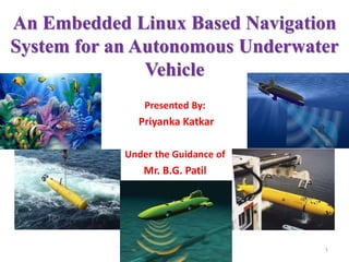
  • 1. An Embedded Linux Based Navigation System for an Autonomous Underwater Vehicle Presented By: Priyanka Katkar Under the Guidance of Mr. B.G. Patil 1
  • 2. Outline  Introduction  Interfacing With SBC  System Architecture  Hardware Development  Software Development  Conclusion and Future Work 2
  • 3. Introduction • AUVs are unmanned and untethered submarine vehicles, used to gather ocean data. • Find applications in the area of mines clearing operation, feature tracking, cable or pipeline tracking and deep ocean exploration. • HUGlN 3000 was the world's first AUV used in commercial survey operations. 3
  • 4. Use of the AUV • Search and Recovery of Government Property. • Prediction of Waves and Currents. • Readings for depth, salinity, pressure and temperature. • Pictures of visual light, bioluminescence. • Discovery of never seen before species and footage. 4
  • 6. 6
  • 7. Nomenclature • Unmanned Underwater Vehicle (UUV): Self propelled unmanned submersible • Remotely Operated Vehicle (ROV): controlled and powered from the surface by an operator/pilot via an umbilical or using remote control • Autonomous Undersea Vehicle (AUV): Un-tethered UUV operating with no or very limited operator control. • Two paddle wheel thrusters are installed on AUV, one for horizontal motion and other for vertical motion 7
  • 8. Navigation Techniques • AUV: The benefits of offered by autonomous data gathering • Examples include the Theseus AUV, developed by Interna- tional Submarine Engineering, the DARPA UUVs, developed by Draper Laboratories, the LDUUV and 21UUV developed by the Naval Undersea Warfare Centre in Newport. • The three primary methods for navigation of AUVs are: 1. Inertial navigation systems 2. Acoustic navigation 3. Geophysical navigation techniques. 8
  • 10. INS KF DGPS +USBL UTP Pressure Sensor Compass DVL Bottom-Track Velocity Altitude Depth Smoothing Position Error estimates Inertial Measurement Unit 10
  • 11. Outline of Conventional Aided INS 11
  • 13. Interfacing With SBC • Single Board Computers (SBC) like Kontron E2Brain EB8540, Gumstix, Inhand Fingertip- Elf, AMD GX SOM-144 and TS-7200 • TS-7200 SBC selected due to its features, good support by the manufacturer and a huge user community. TS-7200 is based on 200MHz Strong ARM processor. 13
  • 15. The CirrusLogic EP9302 and TS-7200 • The EP9302 features an advanced ARM920T processor design with a memory management unit (MMU) . • Supports Linux & many other operating systems. • Contains 16Kbyte instruction cache and 16Kbyte data cache. • supports both the 32-bit ARM and 16-bit Thumb instruction set. • The core can operate in big and little endian mode 15
  • 16. (Cont...) • The TS-7200 is a compact full-featured (SBC) based upon the Cirrus EP9302 ARM9 CPU • The TS-7200 SBC runs on a 200MHz EP9302 ARM9 processor with power as low as 0.5Watts. • includes a compact flash interface which allows booting from large flash drives to the different Linux distros. • fast boot from the on-board Strata Flash memory using a compact TS- Linux distribution. 16
  • 17. Interfacing of INS with SBC Block Diagram of Integrated Sensor Pack 17
  • 18. Tracking Algorithm Calculation of object centroid in the image Separation of moving objects from the stationary objects Identification of moving objects based on change in centroid values Comparison of centroid values in all subsequent frames Calculation of trajectory for all moving objects Calculation of speed and direction of moving objects Block diagram of the complete model 18
  • 19. Kalman filter • The Kalman Filter is an estimator for the linear-quadratic problem, estimating the instantaneous ‘state’ of a linear dynamic system perturbed by white noise. • The Kalman filter is a set of mathematical equations that provides an efficient computational (recursive) means to estimate the state of a process, in a way that minimizes the mean of the squared error. • Various Kalman filter configurations applied to a low-cost inertial navigation system (INS) for AUV. 19
  • 20. Kalman Filtering Algorithm  Time Update ( Predict ) equations: • Step 1: Project the state ahead: 𝑋 𝑘 − = A 𝑋 𝑘−1 + 𝑊𝑘 • Step 2: Project the error covariance ahead: 𝑃𝑘= A 𝑃𝑘−1 𝐴 𝑇+ Q  Measurement Update ( Correct ) equations: • Step 3: Compute the Kalman gain: 𝐾𝑘 = 𝑃𝑘 𝐻 𝑇(H 𝑃𝑘 𝐻 𝑇 + R) −1 • Step 4: Update estimation with measurements: 𝑋 𝑘= 𝑋 𝑘 − + 𝐾𝑘 (𝑍 𝑘 - H 𝑋 𝑘 − ) • Step 5: Update the error covariance: 𝑃𝑘 = (I - 𝐾𝑘 H) 𝑃𝑘 − • Step 6: Go to Step 1. 20
  • 21. GPS Receiver • To provide the absolute positioning of any object, GPS uses a constellation of 24 satellites. • Four satellites are visible at all times from any point on the earth’s surface. • GPS receiver supports NMEA 0183 data protocol. 21
  • 22. Software Development • TS-Linux embedded distribution is installed on the on-board Flash memory of the TS-7200. • TS-Linux is a compact distribution, which is based on Busy Box • The GPS receiver is interfaced to the TS-7200 through the serial port • Linux distinguishes devices into three fundamental device types: a char module, a block module, or a network module. • Developing a serial class is classified. 22
  • 23. Results Output from the ADC and the GPS Receiver. 23
  • 24. Future Scope • The exact position of the vehicle can be determined by processing the logged sensor data using the Kalman filter. • Current version does not have a driver for the digital I/O port. • This can be implemented to increase the no of sensors that can be interfaced with SBC. 24
  • 25. Applications • Pipeline inspection and intervention. • Under ice surveys (transponders may be deployed from an ice breaker or along the ice ridge). • Mines clearing operation, feature tracking, cable or pipeline tracking and deep ocean exploration. • Autonomous surveys where surfacing or support from a surface ship are infeasible due to e.g. heave traffic. 25
  • 26. Pros And Cons  Pros • Smaller, Lighter and less expensive equipment became available, the access to operational vehicles which made more affordable AUVs. • TS7200 has on board Apaches web server therefore data logged from SBC can be displayed on a web page.  Cons • Limited number of DIO ports available on SBC board. • loss of controllability at low speeds, 26
  • 27. Conclusion • The SBC with Linux setup and the development tools form the embedded Linux development system. • Provides lower development cost with interfaces such as Ethernet and USB and have made AUVs more affordable. • As a data logger/analyzer of various sensor measurements for Marine research. 27
  • 28. References • Grenon, G., Edgar, P., Smith, S., and Healey, A., “Enhancement of the inertial navigation System for the Morpheus Autonomous underwater Vehicles”, IEEE Journal of Oceanic Engineering, Vol. 26, No. 4, October, 2012. • Yun, X.; McGhee, R.; Whalen, R.; Roberts, R; Healey, A, and Zyda, M., “Testing and Evaluation of an Integrated GPS/INS System for Small AUV Navigation” IEEE Journal of Oceanic Engineering, Vol. 24, Issue 3, pp.396– 404, 19-20 July, 2007. • B. Jalving, K. Vestgkd, N. Sterkersen, “Detailed seabed surveys with AUVs” in TechnologV and Apphcurions of Autonomous Underwater Vehicles. Edited by Gwyn Grifiths. Tavlor & Francis. London and New York. 2008. pp. 179-201 28

Notes de l'éditeur

  1. First “AUV” may have packed a bigger punch than our modern day vehicles Robert Whitehead created the first AUV while in search for the torpedo in 1866 In the late 50’s the first true AUV was created Stan Murphy, Bob Francois and Terry Ewart developed SPURV (self propelled underwater research vehicle) Throughout the 60’s and 70’s the AUV’s advanced greatly through technology There is a shift towards understanding the predictability of ocean activity
  2. Autonomous Underwater Vehicles (AUV), also known as unmanned underwater vehicles, can be used to perform underwater survey missions such as detecting and mapping submerged wrecks, rocks, and obstructions that pose a hazard to navigation for commercial and recreational vessels. Autonomous Underwater Vehicles (AUV), also known as unmanned underwater vehicles, can be used to perform underwater survey missions such as detecting and mapping submerged wrecks, rocks, and obstructions that pose a hazard to navigation for commercial and recreational vessels.
  3. Remote Environmental Monitoring UnitS, or REMUS vehicles, are low-cost autonomous underwater vehicles (AUVs) designed by the Oceanographic Systems Lab to operate with a simple laptop computer. Designed for coastal monitoring as well as survey operations at various depths in the ocean. SeaBED Can fly slowly or hover over the seafloor to depths of 6,000 feet, making it particularly suited to collect highly detailed seafloor sonar and optical images.
  4. Boeing Undersea Vehicle History
  5. climate change assessment, marine habitat monitoring, and shallow water mine countermeasures.
  6. UTP underwater transponder positioning. DVL doppler velocity log LBL - Long Base Line The calculation of position is based on range measurements only. The ROV, a subsea module and the vessel are positioned relative to a calibrated array of transponders. SBL - Short Base Line The calculation of position is based on range, and vertical and horizontal angle measurements from a minimum of three hull mounted transducers. The baselines are between transducers on the vessel. A transponder is positioned relative to the vessel. Accuracy is < 0.5% of slant range. The system provides three-dimensional transponder positions relative to the vessel.  
  7. ˇzk is the measured or calculated value zk is the actual true value, zk is corresponding error An INS calculates position, velocity and attitude using high frequency data from an IMU which typically consists of three accelerometers measuring specific force and three gyros measuring angular rate, all relative to the inertial space. Due to inherent errors in the gyros and accelerometers, the solution of the navigation equations embedded in the INS will have an unbounded drift unless counteracted.
  8. Ts7200 have source current 4ma and sink current 8ma. 200 MHz ARM9 CPU with MMU 32MB RAM 8MB on-board Flash (Boots to Linux) True IDE Compact Flash socket (for additional Flash memory) 10/100 Megabit Ethernet port 2 USB compliant Full Speed host (OHCI) ports -- (12 Mb/s max) 2 COM ports (up to 230 Kbaud) Watchdog Timer PC/104 expansion bus SPI bus interface 20 Digital I/O lines Alphanumeric LCD and matrix keypad interface Single +5VDC supply @ 400 mA – (under 2 watts) Small size -- 3.8 x 4.5 inches (9.7 x 11.5 cm) These optional features are also available: 8-channel 12-bit analog-to-digital converter Battery-backed Real-Time Clock (TS-5620) RS-485 support on COM2 with automatic TX enable Temperature sensor Additional COM ports TS-7200 power supply: The TS-7200 requires regulated 5VDC at 400 mA (typical maximum). It is possible to lower this power significantly by lowering the CPU clock rate or by powering-down the Ethernet PHY chip. A quick release screw-down terminal block for the 5V power and power GND connections is provided for easy connection to an external power supply. Note: Supply voltages over 6 VDC may damage the TS-7200. Be sure to use a regulated 5 VDC power supply, preferably with current limiting to 1 to 3 Amps. A current limited supply is very forgiving of common errors during development. A PC power supply that may be capable of supplying 20 Amps or more is not recommended -- it is possible to do irreversible damage to the TS-7200 if the polarity on the power leads is reversed. When power is first supplied to the TS-7200, the board mounted LEDs are immediately turned on under hardware control. Once the processor begins execution, the LEDs are turned off. The RED led is briefly turned on while the processor looks for the TS-BOOTROM stored in the first sector of Flash. If the processor does not find the TS-BOOTROM, it will turn off the red LED and continuously blink the green LED. If the LEDs do not turn on at all, the most likely problem is the power supply. Check that the +5V and GND connections are not reversed. A diode protects the board against damage in such a situation. Once t
  9. ISP Integrated sensor pack
  10. The extended Kalman filter (EKF) allows a non-linear The time update equations are responsible for projecting forward (in time) the current state 𝑋 𝑘 − is the position (x, y) of the object at the instant k The measurement update equations are responsible for the feedback. 𝑋 𝑘−1 is the old position. A is referred to as the state transition matrix 𝑍 𝑘 is the Actual/true value.
  11. Developing a serial class is classified as: opening serial port, configuring serial port, checking for input data, reading from port, writing to port, and closing the port. Customizing the os is done by reengineering processs called as callgraph.
  12. The data received from the ADC and the GPS module is continuously displayed on the telnet screen. This data is simultaneously logged in the CompactFlash, which is mounted on the board, to analyze the data received.