GEO North America's Regions
•Télécharger en tant que PPTX, PDF•
7 j'aime•4,117 vues

North America is the third largest continent located between the Atlantic and Pacific Oceans. It has diverse geographic features ranging from the Rocky Mountains in the west to the Great Plains in the central region. The climate varies from region to region with more constant temperatures in southern areas and four distinct seasons in the north. North America has a population of over 500 million people concentrated in eastern areas with the United States and Canada being the most economically developed countries.

Recommandé
Contenu connexe
Tendances
Tendances (20)
En vedette
En vedette (20)
Similaire à GEO North America's Regions
Similaire à GEO North America's Regions (20)
Plus de Aruna Poddar
Plus de Aruna Poddar (12)
Dernier
Dernier (20)
GEO North America's Regions
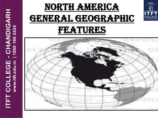
- 2. Location North America is the World's third-largest continent - 24,474,000 km². It is bordered by the Atlantic Ocean to the east, the Arctic Ocean to the north and the Pacific Ocean to the west. The eastern side of the continent is generally lower than the west which contains the Rocky mountains. The five Great Lakes lie on the United States Canadian border. The highest mountain is Mt McKinley in Alaska (6,194 m) and the longest river is the Mississippi (3,765 km).
- 3. REGIONS AND SEASONS North America has 23 Countries, the largest of which are the United States, Canada and Mexico. Central America is part of North America. If we include Central America and the Caribbean, there will be 26 countries overall Mexico, Central America and southern United States have more constant temperatures throughout the year but have a wet season - May to October and a dry season - November to April.
- 4. DEMOGRAPHY North America is the fourth most populated continent and covers about 5.5% of the World's population. Eastern United States, Mexico, Central America and the Caribbean are the most densely populated areas. Canada, Alaska and Greenland are the least populated areas. The United States and Canada are the most economically developed countries. The countries of central America and the Caribbean are less economically developed and poorer.
- 5. PHYSIOGRAPHIC DIVISIONS North America is divided into 5 parts:- 1) Western Region 2) Great Plains 3) Canadian Shield 4) Eastern Region 5) Caribbean Region
- 6. WESTERN REGION It comprises of young mountains. the most familiar of these mountains is Rockies, the largest mountain chain in N.America. It also include Brooks range, Mt.Mackanzee range, Alaska Range and Sierra Nevada. Rocky Mt. are the part of part of a system of parallel mountain ranges called as CODILLERALS. A Cordillera is a long series of mountain range. Although cordillera exist all over the world but in USA it means a massive
- 7. The cordillera extend from Canada to all the way to panama. The Sierra Madre Mountains system is a part of Cordillera. It stretch from SW USA to Mexico City. Sonoran is the largest Desert of USA. In addition to mountains western regions of N America also has the rich deposits of oil and natural gas.
- 8. GREAT PLAINS the great plains lie in the middle of the continent. They are deep rich soil blankets in the large areas of plains in Canada and N.America. Grains are grown in this region so it is also called as THE BREAD BASKET OF N.AMERICA. Much of the fertile soil is formed from material deposited during the glacial period. This ice age reached its peak around 18000 yrs ago. As glaciers retreated, streams of melted ice form dropped sediments on land building layers of productive soil. Grassland of prairie region make up largest biome in America.
- 9. CANADIAN SHIELD The Canadian Shield is raised but relatively flat plateau. It extend over eastern, central and north –western Canada. the Canadian Shield is Characterized by a rocky landscape poked by an astonishing no of lakes.
- 10. EASTERN REGION APPLACHIAN + COASTAL PLAINS. The Atlantic Coastal Plains extends from rivers, marsh, and wetland regions. Wetland are the areas of land whose soil is saturated with permanent or seasonal moisture. The Eastern region have been mined for rich deposits of coal and other minerals for hundred of year.
- 11. CARIBBEAN REGION The Caribbean Region includes more than 7,000 islands The region’s islands and smaller islets are varied in their topography; some have relatively flat and sandy terrain while others are rugged, mountainous, and volcanic. The coral reefs and cays of the Caribbean Sea are among the most spectacular biomes in North America. Coral reefs are made of millions of tiny animals—corals—that form a hard shell around their bodies. This hard surface provides a rich community for algae and plants such as sea grass.
- 12. GREAT LAKES OF NORTH AMERICA The Great Lakes are a chain of freshwater lakes located in eastern North America. They are the largest group of freshwater lakes on Earth. Lake Superior, Lake Michigan, Lake Huron, Lake Erie, and Lake Ontario, form the Great Lakes and make up the largest group of freshwater lakes in the world.
- 13. The Great Lakes contain almost 95 percent of the surface water in the United States and 20 percent of the earth’s surface fresh water. The Great Lakes Basin is home to more than one-tenth the population of the United States and over one-quarter the population of Canada, for a total combined population of over thirty million people. The lakes not only provide water for consumption but also serve for transportation, recreation, power generation, and many other uses. Lakes Superior, Michigan, Huron, Erie and Ontario, along with the connecting rivers and channels, compose the Great Lakes Basin system, which is located along the eastern international boundary between Canada and the United States. The international boundary between Canada and the United States runs right down the middle of the Great Lakes, with the exception of Lake Michigan, which lies entirely within the US.
- 14. FLORA The plant life of North America is characterized according to climatic region. The coniferous forest region contains trees such as pine, fir and spruce. The deciduous forest region has a wealth of plant life and includes tall and short trees, shrubs and small plants Due to the cold during the winter months, only short grasses and shrubs can survive in the tundra and alpine/mountain regions. The grassland region is characterized by large open areas of tall or short grass.(e.g. prarie) The rainforest areas are jungles of dense, wet forests. The desert regions are home to those plants that can survive the arid conditions and include varieties of cactii.
- 15. FAUNA North America is home to a range of wild animals including the bobcat, sea otter, raccoon and the mountain lion. Polar bears and wolves live in the arctic regions of Canada and Greenland. Bobcat-America female Cat
- 16. SOUTH AMERICA
- 17. INTRODUCTION INTRODUCTION The physical environments of South America range from the Atacama Desert of Chile where years pass without measurable precipitation, to the dense Amazonian rain forest and from snow capped volcanoes of the Andes Mountain Range to hot vast subtropical grasslands.
- 18. •4th largest continent, includes (12) independent countries. • The continent contains the world's highest waterfall Angel Falls in Venezuela; the largest river (by volume)- the Amazon River; the longest mountain range-the Andes, and the driest place on earth, the Atacama Desert in Chile. • It includes the largest rainforest, the Amazon Rainforest. GENERAL GEOGRAPHY
- 19. PHYSIOGRAPHIC DIVISIONS South America is physiographically divided into various divisions:- Mountains and Highlands River Basins Coastal Plains
- 20. MOUNTAINS AND HIGHLANDS ANDES MOUNTAIN The most prominent physical feature in South America is probably the Andes Mountains. The Andes occupy the western part of the South American continent and run generally from north to south. hundreds of peaks over 15,000 feet many volcanic peaks In North America there are also prominent mountains--the Rockies-- in the western portion of the continent. When compared with the Rockies, though, the Andes for the most part are significantly higher in elevation. The Andes also tend to be narrower from west to east than the Rockies in North America.
- 21. HIGHLANDS South America the eastern highlands are divided into two main pieces. To the north are the Guiana Highlands, and to the south are the Brazilian Highlands. Brazilian Highlands elevations: 1,500-6,000 ft. Guiana Highlands Venezuela, Guyana, Surinam e separated from Andes by Orinoco River separated from Brazilian Highlands by Amazon River
- 22. RIVERS 1.Orinoco River 2. Amazon River S. America's most extensive lowland area world's largest river 1/5 of world's fresh water basin of 2 million square miles rainy season flooding of forest 3. Paraguay/Parana River empties into Rio de la Plata Iguazu Falls, Parana River- world's largest Pampas of Argentina and Uruguay either side of Rio de la Plata was mainly grazing land now much is cropland
- 23. COASTAL PLAINS west of the Andes dry because of the cold ocean current narrow escarpment on the east corresponds to the escarpment on the west coast of Africa [created when South America broke away from Africa]
- 24. REGIONS & SEASONS South America is not divided into regions. South America is located in the southern hemisphere. Those countries to the south of the continent have four distinct seasons. Spring - September, October, November Summer - December, January, February Autumn - March, April, May Winter - June, July, August The countries in the north of the continent have more constant high temperatures and high rainfall throughout the year.
- 25. CLIMATE The climate of South America can be broadly divided into seven different climate types: Desert - Warm to high temperatures with very little rainfall. Grassland - Hot summers and cold winters with above average rainfall. Deciduous- Four distinct seasons with warm summers and cold, wet winters. The trees shed their leaves in autumn. Rainforest - High temperatures and high rainfall throughout the year. Savanna - This region has very high temperatures all year and rain during the summer season only. Mediterranean - Warm to high temperatures with rainfall in the autumn and winter months. Alpine/mountain - Cold, windy and snowy.
- 26. South America is the fifth most populated continent . The north-west coastal region and the eastern coast of Brazil are the most densely populated areas while the Amazon rainforest area is the least populated. The countries with the highest populations (to the nearest million) are: Brazil – 188 million Colombia – 43 million Argentina - 40 million Peru - 28 million Venezuela - 26 million Brazil is the most economically developed country but the economies of Argentina, Venezuela, Peru and Uruguay are growing the most quickly. Throughout South America there is a wide gap between the rich and poor. DEMOGRAPHY
- 27. NATURAL VEGETATION MAP The rainforest areas are jungles of dense, wet forests. The desert regions are home to those plants that can survive the arid conditions and include varieties of cacti. The deciduous forest region has a wealth of plant life and includes tall and short trees, shrubs, small plants and mosses. Due to the cold during the winter months, only short grasses and shrubs can survive in the alpine/mountain region. The grassland and savanna regions are characterized by large open areas of tall or short grass. Plants found in the Mediterranean region have adapted to the differences in rainfall and temperature between winter and summer and include, palm trees,