Soumettre la recherche
Mettre en ligne
History Of North American Datums
•
Télécharger en tant que PPT, PDF
•
3 j'aime
•
2,717 vues
R
RHC2008
Suivre
North American Datums
Lire moins
Lire la suite
Signaler
Partager
Signaler
Partager
1 sur 41
Télécharger maintenant
Recommandé
Coordinate system Geographical coordinate system
Naresh Kumar
Ppt on remote sensing system
Alisha Korpal
Lecture 04 astronomical observations
Awais Ahmad
Landform characterization through satellite image
Swarnima singh
Map projection
Map projection
lila_mahato1971
Introduction to GNSS (1)
NopphawanTamkuan
Curve setting ppt
Curve setting ppt
Naufil Sayyad
Field Astronomy
Field Astronomy
Mujeeb Muji
Projections and coordinate system
Mohsin Siddique
Traverse Survey Part 1/2
Muhammad Zubair
Remote Sensing fundamentals
Mohammed_82
7_UELSurveyingMeasurement.pdf
YusufAhmed331510
Types of maps
Types of maps
ChachkaMii
1 2 aerial photography
mayasubodh22
Map projections
Map projections
Shayan Ahmad Yar
Introduction to gps and gnss
Vivek Srivastava
Aerial photography- Concept and Terminologies
UTTIYACHATTOPADHYAY2
Module 4 Introduction to Surveying and Levelling.pptx
SilasChaudhari
Basics of Remote Sensing
Akash Tikhe
Presentation1.1
Presentation1.1
Zahid22
Geo referencing
Geo referencing
Jaweria Shamshad
Field astronomy - Advanced surveying
Vijay Parmar
Control surveying
Control surveying
Prakash Kumar Sekar
Astronomical surveying
Rathnavel Ponnuswami
Dgps
Dgps
baljinder5590
Map Skills Revision
Map Skills Revision
whiskeyhj
Metar decode guide
Metar decode guide
Flyman6
International spheroid[1]
Waleed Liaqat
History Of North American Vertical Datums
RHC2008
2012 PLSC Track, Datums and tools to connect geospatial data accurately, Pame...
GIS in the Rockies
Contenu connexe
Tendances
Projections and coordinate system
Mohsin Siddique
Traverse Survey Part 1/2
Muhammad Zubair
Remote Sensing fundamentals
Mohammed_82
7_UELSurveyingMeasurement.pdf
YusufAhmed331510
Types of maps
Types of maps
ChachkaMii
1 2 aerial photography
mayasubodh22
Map projections
Map projections
Shayan Ahmad Yar
Introduction to gps and gnss
Vivek Srivastava
Aerial photography- Concept and Terminologies
UTTIYACHATTOPADHYAY2
Module 4 Introduction to Surveying and Levelling.pptx
SilasChaudhari
Basics of Remote Sensing
Akash Tikhe
Presentation1.1
Presentation1.1
Zahid22
Geo referencing
Geo referencing
Jaweria Shamshad
Field astronomy - Advanced surveying
Vijay Parmar
Control surveying
Control surveying
Prakash Kumar Sekar
Astronomical surveying
Rathnavel Ponnuswami
Dgps
Dgps
baljinder5590
Map Skills Revision
Map Skills Revision
whiskeyhj
Metar decode guide
Metar decode guide
Flyman6
International spheroid[1]
Waleed Liaqat
Tendances
(20)
Projections and coordinate system
Traverse Survey Part 1/2
Remote Sensing fundamentals
7_UELSurveyingMeasurement.pdf
Types of maps
Types of maps
1 2 aerial photography
Map projections
Map projections
Introduction to gps and gnss
Aerial photography- Concept and Terminologies
Module 4 Introduction to Surveying and Levelling.pptx
Basics of Remote Sensing
Presentation1.1
Presentation1.1
Geo referencing
Geo referencing
Field astronomy - Advanced surveying
Control surveying
Control surveying
Astronomical surveying
Dgps
Dgps
Map Skills Revision
Map Skills Revision
Metar decode guide
Metar decode guide
International spheroid[1]
En vedette
History Of North American Vertical Datums
RHC2008
2012 PLSC Track, Datums and tools to connect geospatial data accurately, Pame...
GIS in the Rockies
Unit4 in Central Government
Unit4
G4
G4
katsen
Service Environment
Service Environment
lianti
GeekMeet Intro - Filip C.T.E.
GeekMeet
Part 2: Lifestyle and health monitoring for the future
NAPWA
iPhone and Appstore
iPhone and Appstore
Home
Line Upgrade Deferral Scenarios for Distributed Renewable Energy Resources
Iain Sanders
Hermeneus Euskaraz - Jakintza Librea
Xabi del Rey
Cyclops Intro 2011
Cyclops Intro 2011
garykellmann
Estampilla nueva
Estampilla nueva
silvia shapiro
AtticTV Pte. Ltd. Strategy Slide
Johnson Goh
Resources
Resources
jactlc
The Beatles Parte II
silvia shapiro
HR head dilemma ideate assignment
Kameswaran Subbaraman
Howgirlsunderstand
Howgirlsunderstand
R. RAVINDRA KUMAR CHIEF MENTOR
Balaur.ro - Cristian George Strat
GeekMeet
Measuring Human Experiences
UserZoom
Outsourcing to India Publication IJAS 2010
Debopriyo Roy
En vedette
(20)
History Of North American Vertical Datums
2012 PLSC Track, Datums and tools to connect geospatial data accurately, Pame...
Unit4 in Central Government
G4
G4
Service Environment
Service Environment
GeekMeet Intro - Filip C.T.E.
Part 2: Lifestyle and health monitoring for the future
iPhone and Appstore
iPhone and Appstore
Line Upgrade Deferral Scenarios for Distributed Renewable Energy Resources
Hermeneus Euskaraz - Jakintza Librea
Cyclops Intro 2011
Cyclops Intro 2011
Estampilla nueva
Estampilla nueva
AtticTV Pte. Ltd. Strategy Slide
Resources
Resources
The Beatles Parte II
HR head dilemma ideate assignment
Howgirlsunderstand
Howgirlsunderstand
Balaur.ro - Cristian George Strat
Measuring Human Experiences
Outsourcing to India Publication IJAS 2010
Similaire à History Of North American Datums
maps
maps
samkush
IGARSS_Brown_Aquarius_2011.pptx
grssieee
Types of north surveing
Diana Dian
Lab five us geological survey topographic maps & us public
Lisa Schmidt
NAD83_paper
NAD83_paper
Dane Ericksen
Lecture 2.pptx.pdf
Lecture 2.pptx.pdf
ssuser7386811
WE2.L09 - DESDYNI LIDAR FOR SOLID EARTH APPLICATIONS
grssieee
Neuralog Well Geodetics
Dean Mikkelsen
Nadcon
Nadcon
Mounir Slimani
datum
datum
Riya Gupta
Map Reading
Map Reading
Sam Olayvar
Measuring Ice Mass Loss from Melting Ice Sheets
Christopher Harig
2017 Glossary Of Cartographic Terms
Atiqa khan
Map reading
Map reading
PranjalSharma104
Modern Survey Techniques
Kalyan Kumar Patra
From the Arctic to the Tropics: The U.S. UNCLOS Bathymetric Mapping Program
Larry Mayer
Delineation and Comparison of Urban Heat Islands in Tamilnadu
Vignesh Sekar
Final_Project_Poster2PDF_Final
Rachel Kinney
Which type of projection is adopted by the state of California- How ma.docx
SUKHI5
Datum
Datum
tushar mehra
Similaire à History Of North American Datums
(20)
maps
maps
IGARSS_Brown_Aquarius_2011.pptx
Types of north surveing
Lab five us geological survey topographic maps & us public
NAD83_paper
NAD83_paper
Lecture 2.pptx.pdf
Lecture 2.pptx.pdf
WE2.L09 - DESDYNI LIDAR FOR SOLID EARTH APPLICATIONS
Neuralog Well Geodetics
Nadcon
Nadcon
datum
datum
Map Reading
Map Reading
Measuring Ice Mass Loss from Melting Ice Sheets
2017 Glossary Of Cartographic Terms
Map reading
Map reading
Modern Survey Techniques
From the Arctic to the Tropics: The U.S. UNCLOS Bathymetric Mapping Program
Delineation and Comparison of Urban Heat Islands in Tamilnadu
Final_Project_Poster2PDF_Final
Which type of projection is adopted by the state of California- How ma.docx
Datum
Datum
History Of North American Datums
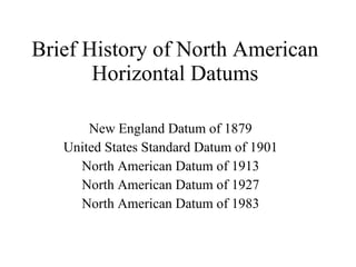
1.
Brief History of
North American Horizontal Datums New England Datum of 1879 United States Standard Datum of 1901 North American Datum of 1913 North American Datum of 1927 North American Datum of 1983
2.
3.
Fire Island Triangulation
Network – Long Island, New York – Point Judith, Rhode Island. 1851
4.
U.S. Coast Survey
- Chart of Boston Harbor – 1857 – Based on early New England Datum.
5.
6.
7.
Transcontinental Arc of
Triangulation - 1899
8.
9.
10.
Ellipsoid – Geoid
surfaces in comparison with local topography
11.
12.
13.
Relative Datums
14.
15.
16.
Geodetic Latitude &
Longitude
17.
18.
19.
20.
21.
Preparing a station
for observations – North Dakota - 1913
22.
Triangulation setup –
Kaibab Plateau, Arizona - 1914
23.
Triangulation crew, Idaho-Montana
- 1922
24.
Backsighting with a
Heliotrope – Snake River, Idaho - 1922
25.
Measuring a baseline
with an Invar tape, Southeastern Oregon - 1916
26.
Measuring a baseline
with a microwave distance meter – Cook Inlet, Alaska - 1970
27.
NAD-27 Triangulation Network
in The U.S. as of 1931
28.
29.
30.
31.
WGS-84 ellipsoidal parameters
32.
NAD-27 relative to
NAD-83
33.
There are differences
in the two datums ranging from ~100m in the western U.S., to ~1m – 3m in the central and eastern U.S. as show below.
34.
35.
36.
Datum Transformation Algorithm
37.
38.
39.
40.
41.
NGS - Data
Sheets KG0640 *********************************************************************** KG0640 FBN - This is a Federal Base Network Control Station. KG0640 DESIGNATION - MEADES RANCH RESET KG0640 PID - KG0640 KG0640 STATE/COUNTY- KS/OSBORNE KG0640 USGS QUAD - MEADES RANCH (1978) KG0640 KG0640 *CURRENT SURVEY CONTROL KG0640 ___________________________________________________________________ KG0640* NAD 83(1997)- 39 13 26.71169(N) 098 32 31.74579(W) ADJUSTED KG0640* NAVD 88 - 600.3 (meters) 1969. (feet) GPS OBS KG0640 ___________________________________________________________________ KG0640 X - -734,972.577 (meters) COMP KG0640 Y - -4,893,188.523 (meters) COMP KG0640 Z - 4,011,982.818 (meters) COMP KG0640 LAPLACE CORR- -2.96 (seconds) DEFLEC99 KG0640 ELLIP HEIGHT- 573.99 (meters) (08/12/03) GPS OBS KG0640 GEOID HEIGHT- -26.35 (meters) GEOID03 KG0640 KG0640 HORZ ORDER - B KG0640 ELLP ORDER - FOURTH CLASS I
Télécharger maintenant