SlideShare une entreprise Scribd logo
1  sur  13
Télécharger pour lire hors ligne
2013
Tenure Management Software
A Cost Effective Solution to Populate Your Land
Tenure and Cadastre System

A lack of effective land tenure security represents a
serious problem in many emerging economies. No
country can sustain stability within its boundaries, or
economic development within the wider world, unless it
has an effective land tenure security process that
promotes confidence in its people, its commercial
enterprises and its government. Current solutions are
both complex and expensive and require costly
training, maintenance and support which is difficult to
maintain once donor funding runs out. There is a
desperate need for systems that are intuitive, less
costly, can be rapidly deployed and are easy to
maintain.
This white paper proposes such a system.

Vesselka Consulting Ltd
IkubINFO Software Solutions Ltd
Sharp Consulting
1 Executive Summary
This paper examines the importance of secure land tenure as a driver for economic growth and the
problems with current registration software solutions. In doing so, it looks at the reasons why success
has been difficult to achieve and proposes a solution for success in the future.
The benefits of an effective land registration system are that it will;











Guarantee ownership and/or security of tenure.
Be the basis for land and property taxation.
Be a driver for economic growth.
Provide security for credit.
Guarantee the result of judicial procedures relating to land rights.
Reduce land disputes.
Develop and monitor land and mortgage markets.
Protect State lands.
Facilitate land reform.
Promote improvement of land and buildings.

There is widespread recognition that land lies at heart of strong economies, good governance and
effective public administration. Nations that prosper promote widespread, secure land tenure as a
foundation of social and economic policy. For nations to unlock that wealth requires effective systems
of land registration.
Security of tenure is therefore a primary goal of governments, the private sector and donors; but the
methods used to achieve that goal have become progressively more complex and costly. Furthermore,
despite the “off-the-shelf” designation of some, they are not because of their complexity, promise more
than they can deliver and require significant modifications to suit the environment.
Conversely, some recent products have swung in the opposite direction, providing methods that do not
include sufficient capabilities. Results to date have been inconclusive at best in almost all jurisdictions
that do not have the resources or capacity to build and maintain a land administration system that
secures title to land. This failure has, in some jurisdictions, led to the private sector implementing
private registries to serve their clients more efficiently whilst adding real value to the process.
To overcome the stalled status of registration projects, it has become necessary to create a new software
solution that is both regional in nature, requiring only minor adjustment for each jurisdiction, and
which only contains the necessary components to secure tenure and which can also be used by the
private sector as needed.

Page

1

A simplified but robust mapping function that does not involve considerable expense to populate with
data as well as maintain, is essential. Rural and semi-urban areas do not require the exact surveys that
have been promoted by the industry. The majority of people in the rural areas of Africa, India and the
Middle East, having occupied their land for generations, know where their property boundaries are
located. Local representatives can be trained to use the mapping software to create parcel maps,
indicate easements, etc. thereby reducing costs.
A simplified solution such as that outlined in this paper can overcome these pressing social and
economic issues.
2 Background and Problem
‘Modern market economies generate growth because widespread formal property rights, registered in a system
governed by legal rules, afford indisputable proof of ownership and protection from uncertainty and fraud so
permitting massive low cost exchange, fostering specialization and greater productivity. It is law that defines the
relationship of rights to people. Civilised living in market economies is not simply due to greater prosperity but to the
order that formalized property rights bring.’ (Hernando de Soto 1993)
Hernando de Soto has correctly identified insecure land tenure as a major impediment to economic growth
and an increase in the informal economy in many countries. The informal economy is inefficient and
subjects those operating within it to unacceptable economic risks. One aspect of the informal economy that
can be tackled and move participants toward the formal economy where they may take advantage of its
benefits such as protection of legal rights, is an efficient land tenure system.
For more than twenty years international donors have funded land reform in emerging economies focusing
on registration of land rights as a key factor leading to economic growth. Of course, as one would expect,
within a 20+ year time frame, success has been achieved in many nations but by any measure, that time
frame has been excessive, producing an impressive array of scholarly papers and plans, yet many emerging
economies still do not have adequate systems for protecting land tenure. Why?
Somewhere early on, securing people’s rights became hostage to two factors. One unanticipated factor was
the dedication of emerging economies in collecting data for its own sake and which had nothing to do with
protecting rights.
The second factor, not unrelated to the first, was the desire for extreme surveying accuracy in parcel
boundary identification. This introduced a burden of unacceptable and unsustainable costs and time
delays which caused the process to become paralysed by its own ineffectiveness thus adversely impacting
the objective of rapid and widespread title registration.
The tenure security solutions applied during many land registration projects could not be implemented
successfully because they lost sight of the goal and did not adequately recognize local customs and
knowledge. In the search for rapid introduction of tenure security for the majority of people, those
involved took their eye off the target and instead opted for inappropriate technology solutions.

Page

2

For almost twenty years international donors have funded land reform in emerging
economies…as one would expect, within a 20+ year time frame, success has been
achieved in many nations…yet many emerging economies still do not have adequate
systems for protecting land tenure.
Two problem factors in the attempt to rapidly register secure land rights have become strikingly obvious.
The first is an overwhelming emphasis on parcel mapping in semi-urban settlement areas to an
unnecessary high degree of accuracy at considerable expense both in time and money. The second
problem is the development and deployment of inappropriate software to identify and protect legal rights
that is complex, expensive, involves costly hardware and is extremely difficult to maintain locally.
The complexity of the systems has been further increased by including, many times at the request of the
beneficiary, multiple components - valuation and tax modules for example - that only serves to increase the
time and expense of building and rolling out a tenure security system while delaying the primary need of
rapid and secure registration of rights in land.
Let’s take the Kingdom of Lesotho as an example of system development over-reach.
One of the poorest countries in Africa (pop. 2.194 million; 56.6% at and below poverty level; over 70% rural
farmers; life expectancy 49 years: source World Bank) land is not
owned, but is leased from the State, just as it is in Tanzania and other
countries. The registry system in Lesotho is paper based, controlled
by an inefficient land administration bureaucracy and is poorly
administered.
In an attempt to streamline the system, securing leasehold rights
quickly and promoting a land market, the selected solution initially
involved a software system costing over $2 million to develop, install
and provide basic training in its use. After two years of attempting
to implement the system, which required modification of existing
laws, regulations and land administration governance, the system
was abandoned.
The selected system was complex and needed to work with a
mapping component that required exact surveys, which represented significant further expense. It would
have taken years to populate the data base.
Was the solution selected reasonable? Well perhaps, until one understands that the number of transactions
in the Kingdom is approximately 750 – per year. Even if the number of transactions were to triple, an
unlikely scenario because of poverty levels and rural farm nature of the population, a much less complex
and less costly solution was needed. The current belief is that perhaps a purely open-source, less costly
solution will work but this risks failure from lack of training and maintenance. This program began in 2008
and the expense is readily apparent and was avoidable.

The private sector dealing with land related issues is frustratingly dependent on
government run registries which fail to deliver…the efficient system of information to
make decisions and serve customers.

Page

3

In Ghana, millions of dollars have been expended since the 1990s to develop and implement a title
registration system. Although Ghana is moving forward to register communal lands, the entire effort has
encountered significant delays as well, with multiple solutions investigated. But, vast rural populated
areas have not been reached. This should not have been the case and need not continue.
In Tanzania, numerous studies have identified an inefficient land administration system needing
organizational streamlining and computerization. In 2009 funding was provided to re-engineer the
governance structure, develop a software design plan for the registry and recommend necessary legal
changes. Again, although more than 50% of communal rural land has been registered, implementation has
encountered delays and another plan is being designed by an international consulting firm to provide a
solution. A more locally developed approach may have produced a more rapid result, increased capacity
and achieved results more efficiently and at less cost.
Finally, the private sector dealing with land related issues is frustratingly dependent on government run
registries which fail to deliver timely or at times deliver inaccurate information. Banks, developers and
private land management firms need an efficient system of information to make decisions and serve clients.
There is room for public-private partnerships in this situation.
For example, in the Gulf region, private developers have sought out and have begun to develop private
registration systems to serve clients and provide a value added service, simultaneously working with
government institutions.
Other private sector initiatives include extractive resource companies which need reliable information
regarding their sites and the land users in the surrounding area which official sources often lack. These are
needs that must be met.
It is time to offer governments, the private sector and donors an alternative. The result of the ineffective
implementation of tenure security systems is a loss of faith by the governments involved in the efforts,
continued exposure to land grabs especially affecting the poor and vulnerable, distrust of vendors by
donors and the governments’ involved and eventual fatigue in funding any further ventures. Most
important, of course, is the continued lack of tenure security by the people on the land.

3 Solutions
Basic Goals
There is a need to re-address how tenure security systems are structured and scale-up efforts in order to
streamline procedures, protect tenure rights, particularly for the poor, and store sufficient information,
both in the legal and mapping components, to provide a robust but less costly solution.
An efficient approach is to develop a software solution that achieves three basic goals:





Accurate information regarding the holder of the rights to the land so that the person(s) are
identified by name, address, passport, national ID number or other officially recognized
identification;
The type of land interest involved and its priority (classification); and,
A link to map data identifying the extent of the registered rights.

There is a need to re-address how tenure security systems are structured and scale-up efforts
in order to streamline procedures, protect tenure rights, particularly for the poor, and store
sufficient information, both in the legal and mapping components, to provide a robust but
less costly solution.

Page

4

Where an existing parcel identification system exists, such as in Tanzania, which identifies parcels by lot
and block numbers, there is no need to alter how each parcel is identified as fields in the software can be
built to accommodate existing identification systems.
As might be expected, the costly element is the mapping component. Existing maps may need to be
digitized and new parcels surveyed. However, there are ways to reduce these mapping component costs.
Re-surveying parcels with high degrees of accuracy should be avoided; what is on the ground should be
accepted if it is agreed by the adjoining landowners/right holders. A system of regularization or general
boundaries should be acceptable. It is, of course, accepted that the terms of existing jurisdictional
legislation must be adhered to.
To overcome the present resistance to accepting anything less than a full, multi-level software system it will
be necessary to show that security of tenure through a registry that identifies parcels, owners and other
right holders against that parcel (e.g. easements and mortgages), and the ability to easily expand the
registry system, will provide immediate benefits to both the land administration authorities and the users.
Our Solution
We propose a Tenure Management System (TMS) which is built around core regional factors that will only
require minor modifications for specific legal environments. For example, East Africa – particularly
Uganda, Tanzania and Kenya – follow a legal system based on English law. The tenure systems and their
laws regarding land administration and rights are very similar. There is no reason why a regional “East
Africa TMS” cannot be produced requiring only slight modifications to accommodate local legal conditions.
This situation is also true of India where the legal system is also based on English law and a similar
regional approach could be adopted for most Arab countries, particularly those located in the Gulf.
The TMS should be an integrated system consisting of a core legal and spatial registry – with a spatial
component that is simple and very importantly, easily built upon in the field.
The TMS must provide administrators with the capability to process new applications for registration of
rights in land; display current document details and maintain a spatial data link. The screen shots in
Figures 1 and 2 show input of first registration data; subsequent registrations (eg. Mortgages) and
subdivisions are handled with similar ease.

Page

5

Figure 1: Applicant Input Information Screen First Registration
From an information perspective, the system must provide an inquiry service, facilitating the provision of
information in respect of applications for registration and details of rights evidenced by registered
documents.
Figure 2: Automatic Applicant Data - First Registration

Finally, a document imaging component should be included to reduce the dependence on physical files
whilst acting as a back-up system to safeguard against hardware failure.
The basic objectives of the system will be to expedite the processing of new registration applications and
transactions without complex data gathering. It should also provide for transparency in land
administration activities, ensure the security of land related data and prevent corrupt practices. It should
rapidly acquire tenure information with the goal of registering land holder parcels quickly.
The system must be based on the workflow engine to force activities to be carried out in a predetermined
sequence. Any overwriting of the system to allow certain activities to be performed out of sequence should
only be granted following authorization by relevant users.
1. Functional Requirements
The system must:

Page

6





be able to allow the user to capture basic applicant and application details including transaction
type once legally mandated documents have been submitted and are complete;
disallow processing of a new application for registration if the transaction violates current laws;
automatically generate a unique application number to each application;









be able to allow a user to link the application to an already generated parcel number shown on a
submitted land survey plan;
allow for multiple people to be associated with one lease application and lease record (e.g. wife and
a husband or directors of a company);
allow all authorised users to have access to application files opened and stored in the system;
permit recording of representatives for applicants (e.g. guardians, agents, etc.) of ownership and
other interests;
allow creation of ‘editing request’, whereby lower level users seek approval to modify data;
maintain an audit trail of all modification to the TMS database;
provide the ability to search application details by application number or applicant name/s or by
their attributes, such as parcel number; and,
provide the ability to track status of the application

2. Validation
The system must:







allow for scanning and indexing application forms and supporting documents of incoming
applications and link the images to the appropriate application number;
allow the user to open existing applications and update status if the documents are valid;
allow users to add comments on transaction steps, checks and approvals;
notify other users by system generated notifications once the application status has changed after
validation of documents;
allow updating of images through rescanning and re-indexing of the application documents; and,
allow the user to archive old copies of documents updated through rescanning

3. Approvals
If the documents are not valid the user must be able to record details of rejection and a rejection note must
be generated, stored in the system and linked to the application number.
The system must notify a customer service representative (or intake clerk) of pending rejection notes and
allow for printing of such notes for the customer.

Page

7

Figure 3.1: Automatic Applicant List and Status
Mapping – Parcel Creation
Identification and mapping of land parcels can involve considerable expense. This can be avoided using
general boundary surveys, or in the case of semi-urbanized areas, simple regularisation. It is well known
that most people living in close proximity to one another for any reasonable period of time know where
their boundaries are located. These should not be disturbed through artificially created requirements
which tend to create disputes where none had existed before. It is of course accepted that the terms of
existing jurisdictional legislation must be adhered to; however, efforts should be made to modify
legislation that raises unnecessary barriers to registration of rights.
There are many mapping solutions on the market. They are robust, complex and expensive. For emerging
economies we recommend a different approach using a custom Web-GIS application.
Register Web-GIS Application
The existing mapping solutions in the marketplace can be divided into desktop and Web GIS solutions. In
developing our solution, we believe that a Web GIS solution is the most appropriate.
A Web GIS application must be accessible from any current web browser which results in key benefits
such as avoiding stand-alone software and reducing the need for hardware upgrades. Information should
be able to be shared and be open source. The application will satisfy all OGC (Open Geospatial Consortium)
standards, ensuring in this way sharing of information. All software required to build the Web-GIS
application will use Free and Open Source platforms, thereby avoiding the additional cost currently arising
from the purchase of licenses for commercial software.
The data required for the Web-GIS application are stored and managed in a Relational Database
Management System (RDBMS). This adds support for storing and managing geographic (with geometry)
objects together with attribute tables, in this way allowing it to be used as a spatial database for geographic
information systems, much like ESRI’s SDE® or Oracle’s Spatial® extension.

Page

8

Figure 3: Approved Applicant Details with Parcel
A free GIS Server is used to publish the spatial information in the web through Web Map Service (WMS),
Web Feature Service (WFS) and Web Coverage Service (WCS) standards. The Web-GIS application displays
the map data in the web browser through a user-friendly interface. Additional Free and Open Source
JavaScript Libraries are used for user interface development of the Web-GIS application.
The application has two main components: the server and the web-client(s). The server side will store
processed and analyzed data in a spatially enabled database. The client is used to view and visually
manage the data, as well as enter new data.
The Web GIS application can display Google Satellite Images (in background) to enable the users digitizing
the ownership. The application can also display other raster data sources, such as orthophotos, topographic
maps, Bing Satellite, etc., depending on their availability in different countries. The user can choose which
of the available sources is going to be used as the background.
Figure 4: View of Web GIS application showing multiple layers

The Web GIS application will display all available information organized in layers. The user will have the
capability to switch these layers on or off and create the required map view themselves. The list of layers
can include cadastral parcels, roads, rivers, etc., depending on their availability in different countries.

Page

9

Re-surveying parcels with high degrees of accuracy must be avoided; what is on the
ground should be accepted if it is agreed by adjoining land owners/title holders.

The user will be able to navigate the map with all required tools (zoom in/out, pan, etc. etc.). The
application will provide tools for coordinates, distance, area measurements, dynamic scale and coordinates
display, as well as information retrieval for any of the drawn layers, etc.
Figure 5: Parcel Identification, Source - Google Map

Figure 5.1: Parcel Identification, Get-Info - Source - Google Map

Page

10

A principal functionality of the Web GIS application will be the possibility to add/edit cadastral parcels
and any other available layer as required. This will be provided through an easy and user friendly interface.
The application will provide tools to ensure the geometrical correctness of the drawn objects. The add/edit
functionalities will be provided to registered users, who will have the possibility to add/edit only in
respect of their own work.
Figure 6: Urban Area Parcel View

The Web GIS application will also provide attribute and spatial queries capabilities. The user will be able to
search and query using parcel number, owner name, etc. as well as using relationships between
geometrical objects, such as finding all parcels that are within a specific distance of the specified object.
Figure 7: Search Functionality

Page

11

The system can contain other spatial capabilities such as infrastructure and land use designations
depending on user requirements.
4 Conclusion
Secure land tenure is at the heart of strong economies, good governance and effective public administration.
Nations that prosper promote widespread, secure land tenure as a foundation of social and economic
policy.
Current software solutions to protect tenure rights are too expensive and complex to build and maintain
for emerging economies. The results are stalled land reform programs often resulting in violence. Judi
Wakhungu, Elvin Nyukuri and Chris Huggins from the African Centre for Technology Studies pointed out
in their 2008 study, 'Land Tenure and Violent Conflict in Kenya', that issues of ownership, access and use
all feature in land tenure conflicts in Kenya causing not only violence but also poverty and economic
instability.

…issues of ownership, access and use all feature in land tenure conflicts in Kenya
causing not only violence but also poverty and economic instability.
The fundamental goal of securing land rights while simultaneously protecting “secondary rights” holders,
such as tenants or those with rights to natural resources is delayed or abandoned. There is an urgent need
to streamline, simplify and reduce costs of implementation and maintenance so that rights are quickly
secured. Scaling up current efforts is critical to achieving economic growth and social stability.

Page

12

Contact us: info@vesselkaconsult.com and place TMS in the subject line.

Contenu connexe

En vedette

Research problem
Research problemResearch problem
Research problem
Nits Kedia
 
Conditional Statements
Conditional StatementsConditional Statements
Conditional Statements
micdsram
 
Land administration for_sustainable_development-2012_ebook
Land administration for_sustainable_development-2012_ebookLand administration for_sustainable_development-2012_ebook
Land administration for_sustainable_development-2012_ebook
Jerzyius Kankius
 

En vedette (17)

Research methods revision 2015
Research methods revision 2015Research methods revision 2015
Research methods revision 2015
 
How to write a problem statement
How to write a problem statementHow to write a problem statement
How to write a problem statement
 
Visual Note Taking is for Everyone
Visual Note Taking is for EveryoneVisual Note Taking is for Everyone
Visual Note Taking is for Everyone
 
Research problem
Research problemResearch problem
Research problem
 
Conditional Statements
Conditional StatementsConditional Statements
Conditional Statements
 
What Are Problem Statements
What Are Problem StatementsWhat Are Problem Statements
What Are Problem Statements
 
CONDITIONAL STATEMENT IN C LANGUAGE
CONDITIONAL STATEMENT IN C LANGUAGECONDITIONAL STATEMENT IN C LANGUAGE
CONDITIONAL STATEMENT IN C LANGUAGE
 
Writing Objectives & Problem Statements
Writing Objectives & Problem StatementsWriting Objectives & Problem Statements
Writing Objectives & Problem Statements
 
Research Methods
Research MethodsResearch Methods
Research Methods
 
Learning Skills 3 Note Making And Note Taking Skills Slides
Learning Skills   3   Note Making And Note Taking Skills   SlidesLearning Skills   3   Note Making And Note Taking Skills   Slides
Learning Skills 3 Note Making And Note Taking Skills Slides
 
Basic principles of research
Basic principles of researchBasic principles of research
Basic principles of research
 
Research Variables types and identification
Research Variables types and identificationResearch Variables types and identification
Research Variables types and identification
 
Placement management system
Placement management systemPlacement management system
Placement management system
 
Research methods in psychology
Research methods in psychologyResearch methods in psychology
Research methods in psychology
 
Build Measure Learn is Broken
Build Measure Learn is Broken Build Measure Learn is Broken
Build Measure Learn is Broken
 
Experimental
ExperimentalExperimental
Experimental
 
Land administration for_sustainable_development-2012_ebook
Land administration for_sustainable_development-2012_ebookLand administration for_sustainable_development-2012_ebook
Land administration for_sustainable_development-2012_ebook
 

Dernier

Artificial Intelligence: Facts and Myths
Artificial Intelligence: Facts and MythsArtificial Intelligence: Facts and Myths
Artificial Intelligence: Facts and Myths
Joaquim Jorge
 

Dernier (20)

The Role of Taxonomy and Ontology in Semantic Layers - Heather Hedden.pdf
The Role of Taxonomy and Ontology in Semantic Layers - Heather Hedden.pdfThe Role of Taxonomy and Ontology in Semantic Layers - Heather Hedden.pdf
The Role of Taxonomy and Ontology in Semantic Layers - Heather Hedden.pdf
 
Powerful Google developer tools for immediate impact! (2023-24 C)
Powerful Google developer tools for immediate impact! (2023-24 C)Powerful Google developer tools for immediate impact! (2023-24 C)
Powerful Google developer tools for immediate impact! (2023-24 C)
 
[2024]Digital Global Overview Report 2024 Meltwater.pdf
[2024]Digital Global Overview Report 2024 Meltwater.pdf[2024]Digital Global Overview Report 2024 Meltwater.pdf
[2024]Digital Global Overview Report 2024 Meltwater.pdf
 
How to Troubleshoot Apps for the Modern Connected Worker
How to Troubleshoot Apps for the Modern Connected WorkerHow to Troubleshoot Apps for the Modern Connected Worker
How to Troubleshoot Apps for the Modern Connected Worker
 
Artificial Intelligence: Facts and Myths
Artificial Intelligence: Facts and MythsArtificial Intelligence: Facts and Myths
Artificial Intelligence: Facts and Myths
 
08448380779 Call Girls In Greater Kailash - I Women Seeking Men
08448380779 Call Girls In Greater Kailash - I Women Seeking Men08448380779 Call Girls In Greater Kailash - I Women Seeking Men
08448380779 Call Girls In Greater Kailash - I Women Seeking Men
 
Understanding Discord NSFW Servers A Guide for Responsible Users.pdf
Understanding Discord NSFW Servers A Guide for Responsible Users.pdfUnderstanding Discord NSFW Servers A Guide for Responsible Users.pdf
Understanding Discord NSFW Servers A Guide for Responsible Users.pdf
 
GenAI Risks & Security Meetup 01052024.pdf
GenAI Risks & Security Meetup 01052024.pdfGenAI Risks & Security Meetup 01052024.pdf
GenAI Risks & Security Meetup 01052024.pdf
 
Scaling API-first – The story of a global engineering organization
Scaling API-first – The story of a global engineering organizationScaling API-first – The story of a global engineering organization
Scaling API-first – The story of a global engineering organization
 
Finology Group – Insurtech Innovation Award 2024
Finology Group – Insurtech Innovation Award 2024Finology Group – Insurtech Innovation Award 2024
Finology Group – Insurtech Innovation Award 2024
 
How to Troubleshoot Apps for the Modern Connected Worker
How to Troubleshoot Apps for the Modern Connected WorkerHow to Troubleshoot Apps for the Modern Connected Worker
How to Troubleshoot Apps for the Modern Connected Worker
 
Bajaj Allianz Life Insurance Company - Insurer Innovation Award 2024
Bajaj Allianz Life Insurance Company - Insurer Innovation Award 2024Bajaj Allianz Life Insurance Company - Insurer Innovation Award 2024
Bajaj Allianz Life Insurance Company - Insurer Innovation Award 2024
 
🐬 The future of MySQL is Postgres 🐘
🐬  The future of MySQL is Postgres   🐘🐬  The future of MySQL is Postgres   🐘
🐬 The future of MySQL is Postgres 🐘
 
08448380779 Call Girls In Civil Lines Women Seeking Men
08448380779 Call Girls In Civil Lines Women Seeking Men08448380779 Call Girls In Civil Lines Women Seeking Men
08448380779 Call Girls In Civil Lines Women Seeking Men
 
Axa Assurance Maroc - Insurer Innovation Award 2024
Axa Assurance Maroc - Insurer Innovation Award 2024Axa Assurance Maroc - Insurer Innovation Award 2024
Axa Assurance Maroc - Insurer Innovation Award 2024
 
How to convert PDF to text with Nanonets
How to convert PDF to text with NanonetsHow to convert PDF to text with Nanonets
How to convert PDF to text with Nanonets
 
Tech Trends Report 2024 Future Today Institute.pdf
Tech Trends Report 2024 Future Today Institute.pdfTech Trends Report 2024 Future Today Institute.pdf
Tech Trends Report 2024 Future Today Institute.pdf
 
ProductAnonymous-April2024-WinProductDiscovery-MelissaKlemke
ProductAnonymous-April2024-WinProductDiscovery-MelissaKlemkeProductAnonymous-April2024-WinProductDiscovery-MelissaKlemke
ProductAnonymous-April2024-WinProductDiscovery-MelissaKlemke
 
04-2024-HHUG-Sales-and-Marketing-Alignment.pptx
04-2024-HHUG-Sales-and-Marketing-Alignment.pptx04-2024-HHUG-Sales-and-Marketing-Alignment.pptx
04-2024-HHUG-Sales-and-Marketing-Alignment.pptx
 
Driving Behavioral Change for Information Management through Data-Driven Gree...
Driving Behavioral Change for Information Management through Data-Driven Gree...Driving Behavioral Change for Information Management through Data-Driven Gree...
Driving Behavioral Change for Information Management through Data-Driven Gree...
 

Cost Effective Land Administration

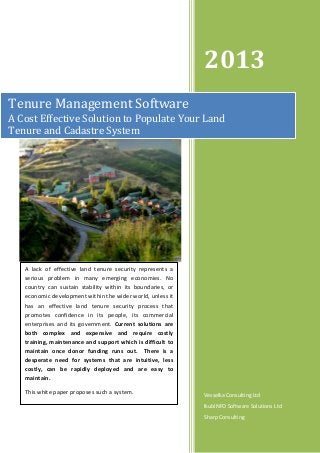
  • 1. 2013 Tenure Management Software A Cost Effective Solution to Populate Your Land Tenure and Cadastre System A lack of effective land tenure security represents a serious problem in many emerging economies. No country can sustain stability within its boundaries, or economic development within the wider world, unless it has an effective land tenure security process that promotes confidence in its people, its commercial enterprises and its government. Current solutions are both complex and expensive and require costly training, maintenance and support which is difficult to maintain once donor funding runs out. There is a desperate need for systems that are intuitive, less costly, can be rapidly deployed and are easy to maintain. This white paper proposes such a system. Vesselka Consulting Ltd IkubINFO Software Solutions Ltd Sharp Consulting
  • 2. 1 Executive Summary This paper examines the importance of secure land tenure as a driver for economic growth and the problems with current registration software solutions. In doing so, it looks at the reasons why success has been difficult to achieve and proposes a solution for success in the future. The benefits of an effective land registration system are that it will;           Guarantee ownership and/or security of tenure. Be the basis for land and property taxation. Be a driver for economic growth. Provide security for credit. Guarantee the result of judicial procedures relating to land rights. Reduce land disputes. Develop and monitor land and mortgage markets. Protect State lands. Facilitate land reform. Promote improvement of land and buildings. There is widespread recognition that land lies at heart of strong economies, good governance and effective public administration. Nations that prosper promote widespread, secure land tenure as a foundation of social and economic policy. For nations to unlock that wealth requires effective systems of land registration. Security of tenure is therefore a primary goal of governments, the private sector and donors; but the methods used to achieve that goal have become progressively more complex and costly. Furthermore, despite the “off-the-shelf” designation of some, they are not because of their complexity, promise more than they can deliver and require significant modifications to suit the environment. Conversely, some recent products have swung in the opposite direction, providing methods that do not include sufficient capabilities. Results to date have been inconclusive at best in almost all jurisdictions that do not have the resources or capacity to build and maintain a land administration system that secures title to land. This failure has, in some jurisdictions, led to the private sector implementing private registries to serve their clients more efficiently whilst adding real value to the process. To overcome the stalled status of registration projects, it has become necessary to create a new software solution that is both regional in nature, requiring only minor adjustment for each jurisdiction, and which only contains the necessary components to secure tenure and which can also be used by the private sector as needed. Page 1 A simplified but robust mapping function that does not involve considerable expense to populate with data as well as maintain, is essential. Rural and semi-urban areas do not require the exact surveys that have been promoted by the industry. The majority of people in the rural areas of Africa, India and the Middle East, having occupied their land for generations, know where their property boundaries are located. Local representatives can be trained to use the mapping software to create parcel maps, indicate easements, etc. thereby reducing costs. A simplified solution such as that outlined in this paper can overcome these pressing social and economic issues.
  • 3. 2 Background and Problem ‘Modern market economies generate growth because widespread formal property rights, registered in a system governed by legal rules, afford indisputable proof of ownership and protection from uncertainty and fraud so permitting massive low cost exchange, fostering specialization and greater productivity. It is law that defines the relationship of rights to people. Civilised living in market economies is not simply due to greater prosperity but to the order that formalized property rights bring.’ (Hernando de Soto 1993) Hernando de Soto has correctly identified insecure land tenure as a major impediment to economic growth and an increase in the informal economy in many countries. The informal economy is inefficient and subjects those operating within it to unacceptable economic risks. One aspect of the informal economy that can be tackled and move participants toward the formal economy where they may take advantage of its benefits such as protection of legal rights, is an efficient land tenure system. For more than twenty years international donors have funded land reform in emerging economies focusing on registration of land rights as a key factor leading to economic growth. Of course, as one would expect, within a 20+ year time frame, success has been achieved in many nations but by any measure, that time frame has been excessive, producing an impressive array of scholarly papers and plans, yet many emerging economies still do not have adequate systems for protecting land tenure. Why? Somewhere early on, securing people’s rights became hostage to two factors. One unanticipated factor was the dedication of emerging economies in collecting data for its own sake and which had nothing to do with protecting rights. The second factor, not unrelated to the first, was the desire for extreme surveying accuracy in parcel boundary identification. This introduced a burden of unacceptable and unsustainable costs and time delays which caused the process to become paralysed by its own ineffectiveness thus adversely impacting the objective of rapid and widespread title registration. The tenure security solutions applied during many land registration projects could not be implemented successfully because they lost sight of the goal and did not adequately recognize local customs and knowledge. In the search for rapid introduction of tenure security for the majority of people, those involved took their eye off the target and instead opted for inappropriate technology solutions. Page 2 For almost twenty years international donors have funded land reform in emerging economies…as one would expect, within a 20+ year time frame, success has been achieved in many nations…yet many emerging economies still do not have adequate systems for protecting land tenure. Two problem factors in the attempt to rapidly register secure land rights have become strikingly obvious. The first is an overwhelming emphasis on parcel mapping in semi-urban settlement areas to an unnecessary high degree of accuracy at considerable expense both in time and money. The second problem is the development and deployment of inappropriate software to identify and protect legal rights that is complex, expensive, involves costly hardware and is extremely difficult to maintain locally.
  • 4. The complexity of the systems has been further increased by including, many times at the request of the beneficiary, multiple components - valuation and tax modules for example - that only serves to increase the time and expense of building and rolling out a tenure security system while delaying the primary need of rapid and secure registration of rights in land. Let’s take the Kingdom of Lesotho as an example of system development over-reach. One of the poorest countries in Africa (pop. 2.194 million; 56.6% at and below poverty level; over 70% rural farmers; life expectancy 49 years: source World Bank) land is not owned, but is leased from the State, just as it is in Tanzania and other countries. The registry system in Lesotho is paper based, controlled by an inefficient land administration bureaucracy and is poorly administered. In an attempt to streamline the system, securing leasehold rights quickly and promoting a land market, the selected solution initially involved a software system costing over $2 million to develop, install and provide basic training in its use. After two years of attempting to implement the system, which required modification of existing laws, regulations and land administration governance, the system was abandoned. The selected system was complex and needed to work with a mapping component that required exact surveys, which represented significant further expense. It would have taken years to populate the data base. Was the solution selected reasonable? Well perhaps, until one understands that the number of transactions in the Kingdom is approximately 750 – per year. Even if the number of transactions were to triple, an unlikely scenario because of poverty levels and rural farm nature of the population, a much less complex and less costly solution was needed. The current belief is that perhaps a purely open-source, less costly solution will work but this risks failure from lack of training and maintenance. This program began in 2008 and the expense is readily apparent and was avoidable. The private sector dealing with land related issues is frustratingly dependent on government run registries which fail to deliver…the efficient system of information to make decisions and serve customers. Page 3 In Ghana, millions of dollars have been expended since the 1990s to develop and implement a title registration system. Although Ghana is moving forward to register communal lands, the entire effort has encountered significant delays as well, with multiple solutions investigated. But, vast rural populated areas have not been reached. This should not have been the case and need not continue. In Tanzania, numerous studies have identified an inefficient land administration system needing organizational streamlining and computerization. In 2009 funding was provided to re-engineer the governance structure, develop a software design plan for the registry and recommend necessary legal changes. Again, although more than 50% of communal rural land has been registered, implementation has
  • 5. encountered delays and another plan is being designed by an international consulting firm to provide a solution. A more locally developed approach may have produced a more rapid result, increased capacity and achieved results more efficiently and at less cost. Finally, the private sector dealing with land related issues is frustratingly dependent on government run registries which fail to deliver timely or at times deliver inaccurate information. Banks, developers and private land management firms need an efficient system of information to make decisions and serve clients. There is room for public-private partnerships in this situation. For example, in the Gulf region, private developers have sought out and have begun to develop private registration systems to serve clients and provide a value added service, simultaneously working with government institutions. Other private sector initiatives include extractive resource companies which need reliable information regarding their sites and the land users in the surrounding area which official sources often lack. These are needs that must be met. It is time to offer governments, the private sector and donors an alternative. The result of the ineffective implementation of tenure security systems is a loss of faith by the governments involved in the efforts, continued exposure to land grabs especially affecting the poor and vulnerable, distrust of vendors by donors and the governments’ involved and eventual fatigue in funding any further ventures. Most important, of course, is the continued lack of tenure security by the people on the land. 3 Solutions Basic Goals There is a need to re-address how tenure security systems are structured and scale-up efforts in order to streamline procedures, protect tenure rights, particularly for the poor, and store sufficient information, both in the legal and mapping components, to provide a robust but less costly solution. An efficient approach is to develop a software solution that achieves three basic goals:    Accurate information regarding the holder of the rights to the land so that the person(s) are identified by name, address, passport, national ID number or other officially recognized identification; The type of land interest involved and its priority (classification); and, A link to map data identifying the extent of the registered rights. There is a need to re-address how tenure security systems are structured and scale-up efforts in order to streamline procedures, protect tenure rights, particularly for the poor, and store sufficient information, both in the legal and mapping components, to provide a robust but less costly solution. Page 4 Where an existing parcel identification system exists, such as in Tanzania, which identifies parcels by lot and block numbers, there is no need to alter how each parcel is identified as fields in the software can be built to accommodate existing identification systems. As might be expected, the costly element is the mapping component. Existing maps may need to be digitized and new parcels surveyed. However, there are ways to reduce these mapping component costs.
  • 6. Re-surveying parcels with high degrees of accuracy should be avoided; what is on the ground should be accepted if it is agreed by the adjoining landowners/right holders. A system of regularization or general boundaries should be acceptable. It is, of course, accepted that the terms of existing jurisdictional legislation must be adhered to. To overcome the present resistance to accepting anything less than a full, multi-level software system it will be necessary to show that security of tenure through a registry that identifies parcels, owners and other right holders against that parcel (e.g. easements and mortgages), and the ability to easily expand the registry system, will provide immediate benefits to both the land administration authorities and the users. Our Solution We propose a Tenure Management System (TMS) which is built around core regional factors that will only require minor modifications for specific legal environments. For example, East Africa – particularly Uganda, Tanzania and Kenya – follow a legal system based on English law. The tenure systems and their laws regarding land administration and rights are very similar. There is no reason why a regional “East Africa TMS” cannot be produced requiring only slight modifications to accommodate local legal conditions. This situation is also true of India where the legal system is also based on English law and a similar regional approach could be adopted for most Arab countries, particularly those located in the Gulf. The TMS should be an integrated system consisting of a core legal and spatial registry – with a spatial component that is simple and very importantly, easily built upon in the field. The TMS must provide administrators with the capability to process new applications for registration of rights in land; display current document details and maintain a spatial data link. The screen shots in Figures 1 and 2 show input of first registration data; subsequent registrations (eg. Mortgages) and subdivisions are handled with similar ease. Page 5 Figure 1: Applicant Input Information Screen First Registration
  • 7. From an information perspective, the system must provide an inquiry service, facilitating the provision of information in respect of applications for registration and details of rights evidenced by registered documents. Figure 2: Automatic Applicant Data - First Registration Finally, a document imaging component should be included to reduce the dependence on physical files whilst acting as a back-up system to safeguard against hardware failure. The basic objectives of the system will be to expedite the processing of new registration applications and transactions without complex data gathering. It should also provide for transparency in land administration activities, ensure the security of land related data and prevent corrupt practices. It should rapidly acquire tenure information with the goal of registering land holder parcels quickly. The system must be based on the workflow engine to force activities to be carried out in a predetermined sequence. Any overwriting of the system to allow certain activities to be performed out of sequence should only be granted following authorization by relevant users. 1. Functional Requirements The system must: Page 6    be able to allow the user to capture basic applicant and application details including transaction type once legally mandated documents have been submitted and are complete; disallow processing of a new application for registration if the transaction violates current laws; automatically generate a unique application number to each application;
  • 8.         be able to allow a user to link the application to an already generated parcel number shown on a submitted land survey plan; allow for multiple people to be associated with one lease application and lease record (e.g. wife and a husband or directors of a company); allow all authorised users to have access to application files opened and stored in the system; permit recording of representatives for applicants (e.g. guardians, agents, etc.) of ownership and other interests; allow creation of ‘editing request’, whereby lower level users seek approval to modify data; maintain an audit trail of all modification to the TMS database; provide the ability to search application details by application number or applicant name/s or by their attributes, such as parcel number; and, provide the ability to track status of the application 2. Validation The system must:       allow for scanning and indexing application forms and supporting documents of incoming applications and link the images to the appropriate application number; allow the user to open existing applications and update status if the documents are valid; allow users to add comments on transaction steps, checks and approvals; notify other users by system generated notifications once the application status has changed after validation of documents; allow updating of images through rescanning and re-indexing of the application documents; and, allow the user to archive old copies of documents updated through rescanning 3. Approvals If the documents are not valid the user must be able to record details of rejection and a rejection note must be generated, stored in the system and linked to the application number. The system must notify a customer service representative (or intake clerk) of pending rejection notes and allow for printing of such notes for the customer. Page 7 Figure 3.1: Automatic Applicant List and Status
  • 9. Mapping – Parcel Creation Identification and mapping of land parcels can involve considerable expense. This can be avoided using general boundary surveys, or in the case of semi-urbanized areas, simple regularisation. It is well known that most people living in close proximity to one another for any reasonable period of time know where their boundaries are located. These should not be disturbed through artificially created requirements which tend to create disputes where none had existed before. It is of course accepted that the terms of existing jurisdictional legislation must be adhered to; however, efforts should be made to modify legislation that raises unnecessary barriers to registration of rights. There are many mapping solutions on the market. They are robust, complex and expensive. For emerging economies we recommend a different approach using a custom Web-GIS application. Register Web-GIS Application The existing mapping solutions in the marketplace can be divided into desktop and Web GIS solutions. In developing our solution, we believe that a Web GIS solution is the most appropriate. A Web GIS application must be accessible from any current web browser which results in key benefits such as avoiding stand-alone software and reducing the need for hardware upgrades. Information should be able to be shared and be open source. The application will satisfy all OGC (Open Geospatial Consortium) standards, ensuring in this way sharing of information. All software required to build the Web-GIS application will use Free and Open Source platforms, thereby avoiding the additional cost currently arising from the purchase of licenses for commercial software. The data required for the Web-GIS application are stored and managed in a Relational Database Management System (RDBMS). This adds support for storing and managing geographic (with geometry) objects together with attribute tables, in this way allowing it to be used as a spatial database for geographic information systems, much like ESRI’s SDE® or Oracle’s Spatial® extension. Page 8 Figure 3: Approved Applicant Details with Parcel
  • 10. A free GIS Server is used to publish the spatial information in the web through Web Map Service (WMS), Web Feature Service (WFS) and Web Coverage Service (WCS) standards. The Web-GIS application displays the map data in the web browser through a user-friendly interface. Additional Free and Open Source JavaScript Libraries are used for user interface development of the Web-GIS application. The application has two main components: the server and the web-client(s). The server side will store processed and analyzed data in a spatially enabled database. The client is used to view and visually manage the data, as well as enter new data. The Web GIS application can display Google Satellite Images (in background) to enable the users digitizing the ownership. The application can also display other raster data sources, such as orthophotos, topographic maps, Bing Satellite, etc., depending on their availability in different countries. The user can choose which of the available sources is going to be used as the background. Figure 4: View of Web GIS application showing multiple layers The Web GIS application will display all available information organized in layers. The user will have the capability to switch these layers on or off and create the required map view themselves. The list of layers can include cadastral parcels, roads, rivers, etc., depending on their availability in different countries. Page 9 Re-surveying parcels with high degrees of accuracy must be avoided; what is on the ground should be accepted if it is agreed by adjoining land owners/title holders. The user will be able to navigate the map with all required tools (zoom in/out, pan, etc. etc.). The application will provide tools for coordinates, distance, area measurements, dynamic scale and coordinates display, as well as information retrieval for any of the drawn layers, etc.
  • 11. Figure 5: Parcel Identification, Source - Google Map Figure 5.1: Parcel Identification, Get-Info - Source - Google Map Page 10 A principal functionality of the Web GIS application will be the possibility to add/edit cadastral parcels and any other available layer as required. This will be provided through an easy and user friendly interface. The application will provide tools to ensure the geometrical correctness of the drawn objects. The add/edit functionalities will be provided to registered users, who will have the possibility to add/edit only in respect of their own work.
  • 12. Figure 6: Urban Area Parcel View The Web GIS application will also provide attribute and spatial queries capabilities. The user will be able to search and query using parcel number, owner name, etc. as well as using relationships between geometrical objects, such as finding all parcels that are within a specific distance of the specified object. Figure 7: Search Functionality Page 11 The system can contain other spatial capabilities such as infrastructure and land use designations depending on user requirements.
  • 13. 4 Conclusion Secure land tenure is at the heart of strong economies, good governance and effective public administration. Nations that prosper promote widespread, secure land tenure as a foundation of social and economic policy. Current software solutions to protect tenure rights are too expensive and complex to build and maintain for emerging economies. The results are stalled land reform programs often resulting in violence. Judi Wakhungu, Elvin Nyukuri and Chris Huggins from the African Centre for Technology Studies pointed out in their 2008 study, 'Land Tenure and Violent Conflict in Kenya', that issues of ownership, access and use all feature in land tenure conflicts in Kenya causing not only violence but also poverty and economic instability. …issues of ownership, access and use all feature in land tenure conflicts in Kenya causing not only violence but also poverty and economic instability. The fundamental goal of securing land rights while simultaneously protecting “secondary rights” holders, such as tenants or those with rights to natural resources is delayed or abandoned. There is an urgent need to streamline, simplify and reduce costs of implementation and maintenance so that rights are quickly secured. Scaling up current efforts is critical to achieving economic growth and social stability. Page 12 Contact us: info@vesselkaconsult.com and place TMS in the subject line.