Building Climate Resilience: Translating Climate Data into Risk Assessments

Climate change affects us all. It is an urgent issue that requires practical solutions to mitigate its impacts. Data is at the center of understanding this challenge. In this informative webinar, we will explore how data can be leveraged to translate climate change projections into tangible hazard and risk assessments at the local level. The webinar will cover a range of topics: including flood, fire, heat, drought, population health, and critical infrastructure, among others. We will also highlight our partner and customer experiences in this field and present key results from our participation in recent OGC pilots on Climate Resilience and Disaster Response. We will also be joined by special guests sharing their experience in the AgriTech sector, where gathering metrics and data from sensors is helping to reduce the demand from farming on precious resources like water for irrigation. Through live demos, attendees will gain practical knowledge in accessing climate services from USGS & Environment Canada and how to convert climate model NetCDF outputs into more GIS-friendly formats like geodatabase & GeoJSON. Finally, we will address the significant gaps and challenges that remain in assessing climate-related hazards and risks, and explore how FME can play a critical role in addressing these gaps. Join us for this important discussion on how you can use FME to build resilience and mitigate the impacts of climate change.

Recommended
Recommended
More Related Content
Similar to Building Climate Resilience: Translating Climate Data into Risk Assessments
Similar to Building Climate Resilience: Translating Climate Data into Risk Assessments (20)
More from Safe Software
More from Safe Software (20)
Recently uploaded
Recently uploaded (20)
Building Climate Resilience: Translating Climate Data into Risk Assessments
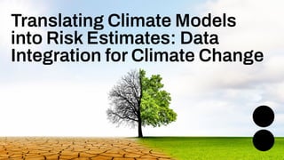
- 1. Translating Climate Models into Risk Estimates: Data Integration for Climate Change
- 2. Dean Hintz Strategic Solutions Manager Don Murray Co-Founder Oliver Morris Data Integration specialist, Tensing UK Panagis Tzivras GIS Software Engineer, Agri-EPI Centre
- 3. Agenda 1 Introduction 2 Understanding Climate Change Data 3 Who is this important to 4 Story 1: Agri-EPI Centre - Precision Farming 5 Story 2: Climate Projections to Risk Estimates - OGC 6 Key Results: Climate Resilience Pilot - Data pipeline 7 Gaps & Challenges in Assessing Hazards 8 Conclusion and Q&A Agenda
- 4. Welcome to Livestorm. A few ways to engage with us during the webinar: Audio issues? Click this for 4 simple troubleshooting steps.
- 5. How to download slides 1. Hover over the slide deck in the webinar room 2. Click this button
- 6. Chat Storm: What is your biggest data challenge related to climate change impacts?
- 8. Data is key to understanding our Changing Climate In particular the Data Cube and its importance will be made clear during this webinar.
- 9. Unrivalled Data Support , ,...
- 10. 29+ 27K+ 128 190 20K+ years of solving data challenges FME Community members countries with FME customers organizations worldwide global partners with FME services 29+ 29K+ 128 140+ 25K+ years of solving data challenges FME Community members countries with FME customers organizations worldwide global partners with FME services 200K+ users worldwide
- 11. FME Form (was FME Desktop) FME Flow (was FME Server) FME Flow Hosted (was FME Cloud) FME Enterprise Integration Platform
- 12. Largest Ecosystem (Only with Geospatial) Unrivalled Productivity (No-Code Environment) Deploy Anywhere (performance, security) We Care You Get It All (Every component, every capability) (Restaurant Model)
- 13. Flash Demo
- 14. Source: Open OGC API Features connection to: https://disasterpilot-dean.fmecloud.com/fmedatastre aming/OGCAPI/collections.fmw/collections Parameters: Collection: Precipitation-by-Mon-points StartYear: 2030 EndYear: 2031 bbox: -98.0,49.0,-96.0,50.0 Limit: 20000 Flash Demo: Climate Feature Service - OGC API
- 15. Flash Demo: Climate Feature Service - OGC API
- 16. Challenges around Climate Data ● Understanding climate model terminology ● Finding and knowing how to use the data to support different use cases ● Techniques to simplify & make the data easy to use.
- 18. Poll: What is your experience with climate model services & data?
- 19. Disaster and Climate Data Sources to Impact Risk How can data for climate impact and disaster indicators be provided to a wider audience? ● Past & present data: Situational awareness - base map, hazards, imagery, sensors. ● Future data: Change awareness - risk scenarios due to climate change - climate variables: e.g. precipitation, temperature. ● Challenge: Climate services not well known or utilized within the communities likely to be affected by impacts. Environment Canada NetCDF GCM time series downscaled to Vancouver area, 1950-2042 https://climate-change.canada.ca/climate-data/#/ downscaled-data
- 20. Climate Model Results: Time Series Data Cube Predictive weather selection for impact analysis: ● Emissions scenario: RCP 2.6, 4.5, … ● Model type: Regional (RCM), Global (GCM) ● Extent: Spatial and temporal ● Resolution: spatial, temporal ● Climate variable: temperature, precipitation, soil moisture ● Statistics: mean, min, max ● Target data structure: geometry, values Goal: Extract climate variables to assess population and critical infrastructure impacts Data cube - example data structure Data cube - example data formats
- 21. Climate Data Services Sources: ● Environment Canada Climate Scenarios portal ● Climate Data Canada ● Copernicus Climate Data Store ● USGS THREDDS Data Service ● NOAA and others
- 22. Climate Data Services Sources: ● Environment Canada Climate Scenarios portal ● Climate Data Canada ● Copernicus Climate Data Store ● USGS THREDDS Data Service ● NOAA and others USGS THREDDS Data Service
- 23. Manitoba Heat & Drought: From Climate Model https://en.wikipedia.org/wiki/Representative_Concentration_Pathway Key Climate Model Terms: needed to get the same results ● RCP - Representative Concentration Pathway - emissions scenario (2.6, 4.5, 6.0, 8.5) ● CMIP - Coupled Model Intercomparison Project - model generation (CMIP5) ● BCSD - Bias corrected statistically downscaled RCP4.5: ‘Business as usual’ "the most probable baseline scenario (no climate policies) taking into account the exhaustible character of non-renewable fuels."
- 24. Manitoba Heat & Drought: Climate Model Data Cube NetCDF in FME
- 25. Heat Impact Component: Manitoba ● Max temperature ● Heat wave: consecutive days above threshold temp ● Integrate land use & building effects (OSM, CityGML) ● Integrate population & medical infrastructure ● Multi-scenario evaluation ● Proxy indicators as needed (% change) https://www.cbc.ca/news/canada/edmonton/alberta-saskatchewan-britis h-columbia-facing-heat-wave-climate-change-1.6551675
- 26. Drought Impact Component: Manitoba ● Aggregate precipitation by catch basin over time ● Hydrology, geology, soils, vegetation land use, surface types & withdrawals ● Gauges, IoT ● Identify key drought indicators from stakeholder feedback ● Trends vs historical Manitoba Drought Monitor - Drought Indicator Map - Groundwater Canadian Drought Monitor https://agriculture.canada.ca/en/agricultural-p roduction/weather/canadian-drought-monitor
- 27. 3 Who is this important to?
- 28. Who is this important to? ● Planners, managers: Local & Regional Gov’t ● Engineers: Utilities, transportation, facilities ● Government: Environment, public safety, health, energy, agriculture, etc ● Insurance: Interested in quantifying future risks ● Citizens: We are all impacted by climate change.
- 29. 4 Story 1: Panagis Tzivras - AEC Oliver Morris - Tensing
- 30. ● Introductions ● Who we are and what we support ● How is agriculture affected by Climate Change ● How can Agri-tech help mitigate the Climate Change effects Agri-EPI Centre
- 31. Agri-EPI Centre Our purpose Our vision Our mission
- 33. ● Changing Precipitation and Temperature ● Extreme Weather ● Pest and Disease ● Socio Economic Impact Agriculture and Climate Change
- 34. ● Efficient Resource Management ● Digital Tools & Data Analytics ● Soil Monitoring ● Precision Farming ● Harvest Management How can Agri-tech help mitigate the Climate Change effects?
- 35. ● Climate impacts herd health and crop growth ● FME is used to integrate data from a range of platforms including: ○ Beef Monitor, Fullwood, UNIFORM Agri “Fitbit” for Cows! Sensors and systems to make Agriculture ‘smarter’
- 36. ● Network of high precision soil sensors ● 70 IoT sensors across 20 farms, gathering data since January 2021 ● Datasets include soil moisture, salinity, and temperature ● Allows real-time monitoring of water use for precision irrigation ● IrriMAX Live exposes the sensor data via an API A focus on IrriMAX
- 37. ● Helping Agri-EPI centralise datasets from a range of platforms including farm computer systems, webpages and third-party APIs ● Created a repository of data in a PostgreSQL database ● All powered by FME: a number of FME data integration workflows, built with FME Form, automated using scheduled triggers in FME Flow Tensing
- 38. Demo
- 40. ● Smart Sensors in Agri-Tech: The future of agri-tech ● FME Integration: Integrates IoT datasets to drive real-time insights ● Data Centralisation: Access latest data ● Wide Accessibility: Data is made available to wide audience Mitigating Climate Risk in Agriculture
- 41. 5 Story 2: Climate Projections to Risk Assessments
- 42. OGC Climate Resilience Pilot 2023 Pilot Goals: ● Build climate resilience ● Expand audience for climate services ● Demonstrate the value of OGC standards and SDI’s (FAIR) ● Show how OGC can support international climate change goals ● Build a community of stakeholders better understand the range of possible impacts - allows us to better prepare and compensate for them https://www.ogc.org/initiatives/crp/
- 43. Climate Model Results: Time Series Data Cube Model results selection for predictive weather for use in impact analysis: ● Emissions scenario: RCP 4.5 ● Model type: Regional (RCM) ● Extent: Spatial and temporal: MB, LA ● Resolution: spatial, temporal: 10km, month ● Climate variable: temperature, precipitation ● Statistics: mean, min, max ● Target data structure: geometry, values Goal: Extract climate variables to assess population and critical infrastructure impacts Time series data cube - example structure
- 44. Data Cube to GIS: NetCDF to GeoPackage How to extract and transform climate results (NetCDF data cubes) in order to load a database for use in impact analysis? 1. Split data cube into individual grids 2. Set grid timestep parameters 3. Compute timestep stats by band 4. Compute time range stats by cell 5. Classify by cell value range 6. Convert grids to vector areas by class 7. Aggregation by month, year Goal: Assess impact: population and critical infrastructure Input NetCDF from ECCC climate model
- 45. Data Cube to GIS: NetCDF to GeoPackage 1. Split data cube 2. Set timestep parameters 3. Compute timestep stats by band 4. Compute time range stats by cell 5. Classify by cell value range 6. Convert grids to vector contour areas by class Split: RasterBandSeparator Stats: RasterStatisticsCalculator Classify: RasterCellValueReplacer Convert: RasterCellCoercer
- 46. Data Cube to ARD: Key Raster Filters Classification: Temp Min / Max Range Band Statistic s Cell Statistics Aggregated By Time Range (month, year)
- 47. Geopackage Time Series: MaxYearly Temp
- 48. Query: Monthly Max Temp Contours
- 49. Query: Average Daily Max Temp > 25C Time: July 2039
- 50. Query: Average Daily Max Temp > 25C Highlighted area on previous slide close to location where the town of Lytton, BC burned to the ground during the Western Canadian heat dome of summer 2021. https://www.bbc.com/news/world-us-cana da-57678054 https://www.cbc.ca/news/canada/british-c olumbia/bc-wildfires-lytton-july-1-2021-1.6 087311 Source BBC Source CBC Source google maps
- 51. Precipitation Stats by Month: Area Time Series Manitoba precipitation areas / contours
- 52. Time Series: NetCDF to Geopackage Points Convert data cube to grids, then extract monthly and yearly points for both temperature and precipitation (based on end user feedback)
- 53. Data Cube to GIS: NetCDF to GeoPackage
- 54. FME Cloud: OGC API Service Test https://disasterpilot-dean.fmecloud.com/fmedatastreaming/OGCAPI/collections.fmw/collections
- 55. OGC API Querier: Geopackage to GeoJSON
- 56. Temperature Stats byYear – Point Time Series
- 57. Temperature Stats byYear – Area Time Series Query: Temp Class = 25: (Max period temp > 20) Band max > 23 Band min > 18.5
- 58. Temperature Stats byYear – Point Time Series
- 59. Indicator Queries to Support Heat waves: ● Max period temp > TH (e.g. 26C) ● Min period temp > TM (e.g. 20C) ● Difference from historical (max, min, mean) Drought: ● Total precipitation (total, max, min, mean) ● Soil moisture period stats (max, min, mean) ● Difference from historical (max, min, mean) Fire & Health ● Temperature, Soil Moisture, Precipitation, but likely with different business rules ● Wind speed, direction, vegetation, fuel
- 60. OGC API Feature Layers & Parameters Allows user to explore climate scenario values by type, value range, time & extent Heat waves: ● Temperature Stats per month ● Temperature delta from historical per month Drought: ● Precipitation, soil moisture per month ● Precipitation delta from historical Parameters: ● Bbox, StartTime, EndTime, ClimateVarMax, ClimateVarMin
- 61. OGC API Querier: Geopackage to GeoJSON Variable range, temporal, spatial extents and feature limit passed to database reader
- 62. Precipitation Stats by Month – Point Time Series
- 63. FME Climate Service Component Integration with Pixalytics Drought Indicator Pilot Component ● FME Analysis Ready Data (ARD) Component extracts NetCDF to Precipitation totals by month time series GeoJSON ● Pixalytics Drought Decision Ready Indicator (DRI) component integrates future projections with historical and present data Samantha Lavender, pixalytics.com
- 64. Los Angeles Drought Scenario: Landscape Visualization Goal: Use climate projections to visualize the impact of climate change on the Los Angeles landscape over time. Process: Apply input climate variables to vegetation model to determine which species survive per time step. Result: Sequence of landscape visualizations over time showing the effects of climate change. Getty images Dean Hintz
- 65. LA Drought: NetCDF Source from RCM https://en.wikipedia.org/wiki/Representative_Concentration_Pathway Regional Climate Model (RCM) • Future total monthly precipitation and mean temp from RCP45 CMIP5 • for 2020-2100 • Statistically downscaled climate scenarios (BCSD) • from USGS THREDDS RCP4.5: ‘Business as usual’ "the most probable baseline scenario (no climate policies) taking into account the exhaustible character of non-renewable fuels."
- 66. LA: Precipitation Delta 1. Calculate historical mean precipitation per month across 30 years of time series using grid algebra (by cell, 1950 -1980) 2. Read future precipitation time series per month 3. PrecipDelta_ts = PrecipFuture_ts – PrecipHistoricalMean_ts 4. PrecipIndex = PrecipDelta / PrecipHistoricalMean 5. Raster to vector convert delta grid to points 6. Apply PrecipDelta properties to points, and write to Geopackage, GeoJSON 7. Provided as input to vegetation model within visualization component RasterMosaicker: grid calculations - historical average monthly precipitation
- 67. LA Precipitation: Historical Mean Calculate historical mean precipitation per month per cell across 30 years of time series (1950 -1980) Jan 1950 Jan 1951 Jan 1952 Jan 1953 Jan 1954 … Jan 1980 Feb 1950 Feb 1951 Feb 1952 Feb 1953 Feb 1954 … Feb 1980 https://www.linkedin.com/pulse/explore-spatial-data-space-time-pattern-mining-emrah-dirmit/
- 68. LA Precipitation: Future Delta PrecipDelta = PrecipFuture – PrecipHistoricalMean _ =
- 69. LA: Precipitation Delta: FME Workflow 1. Read and split data cubes 2. Set time step properties and dates 3. Compute historical average per month 4. Compute delta by subtracting historical average from future time steps values 5. Merge in record level metadata 6. Write to geopackage
- 72. LA: Precipitation Delta > Visualization 1. Compute Precipitation Delta (Future – Historical) 2. Export to format suitable for Laubwerk’s visualization platform: GeoJSON 3. Vegetation is modelled based on combination of growth model and environmental conditions over time 4. First visualization based on current climate 5. Second visualization incorporates climate variables from FME Visualizations provided courtesy of Timm Dapper, Laubwerk
- 73. LA Visualization: Landscape Impact
- 74. LA Visualization: Landscape Impact
- 75. 2020
- 76. 2040a
- 77. 2060a
- 78. 2040b
- 79. 2060b
- 80. Climate / Disaster Pilot Progress ● Stakeholder feedback on desired outputs: e.g., point vs. classified contours ● Climate variable time series via OGC Features API - client and test service ● Layers from climate model outputs: Manitoba Temp, Precip (Monthly and Yearly) ● Additional query parameters: Extents, date, min/max climate variable value, limit ● Rate limiting with default max features cap ● LA: Computed historical mean precipitation, estimated future delta per timestep.
- 81. To Do ● Gather feedback from stakeholders & users ● Generate metadata, register service with catalog ● Publish US NW data ● Add context layers, new climate variables for MB ● Experiment with other statistical approaches ● Provide additional data format options, cloud native (ZARR) ● Test direct connection to climate services using URL, APIs + cloud native (USGS, NOAA) ● Investigate pan sharpening techniques to improve resolution of climate-related impacts.
- 82. Lessons Learned ● Improve access to climate model results for geospatial industry and climate resilience ● Retain climate variable information sufficient to support decision making ● Point data instead of classified contours for data cube translation ● Point data with statistics enables advanced query capabilities ● Empower domain expert users, collaborate on indicator business rules for services ● The goal is not to make climate predictions. Rather this process serves as a pipeline to help users consume projection scenarios from climate services and distill potential risks from them.
- 83. Outstanding Questions: Data Cube / Time Series ● What climate variables would be most useful for you to track related to your local context? ● What impacts are you most concerned about? ● What are best methods for summarizing time series data to support impact analysis? ● How can we effectively aggregate data from single to multi-timesteps? Should we use maximum, mean, clustering, or other techniques? ● Which data structures (raster, vector, geometry) are most useful for output or analytics? ● What questions can be answered using existing analysis ready data such as temperature, precipitation, or soil moisture time series? ● Which indicators are best served by comparing between historical and future periods? These questions may seed QnA discussion, or contact us any time to follow-up.
- 84. Disaster Pilot 2021: Red River Flood Routing Recipe
- 85. Flood Routing Recipe: Flood Contours Published to Pilot GeoNode/GeoServer DP21 Pilot GeoNode ● Layer search ● Metadata ● Styling ● Interactive web map interface ● Time Series ● Data download ● OGC web services: WMS / WFS
- 86. 20 22 FME User Conference Routing Client for Exploring Decision Ready Indicators Optimal route Select flood levels for Road restrictions New optimal route
- 87. Assiniboine River Flood Risk: Winnipeg, MB
- 88. Assiniboine River Flood Risk: Winnipeg, MB
- 90. CUSTOMER STORY “We love FME. We’ve been using it for about 20 years.” - Piet Nooij, Fortis BC PROJECT Assess the current wildfire threat to assets. SOLUTION Integrate active wildfire data from provincial government with their GIS. RESULTS ● Workflow automatically runs at same interval as source dataset updates. ● Notifications & reports are immediately sent to Operations Managers who can coordinate with Emergency Services. FORTIS BC >
- 91. 6 Conclusion
- 92. Summary ● Combine past, current and future environment data: to better assess climate change risks ● Stakeholder feedback: relevant data, services, indicators for climate impact management ● Optimal detail through data simplification: Goldilocks principle ● Geometry trade-offs: vector vs raster, client vs data flexibility ● Agile rapid prototyping of data transform models with FME ● Prioritize open standards, OGC APIs, cloud-native: for availability, scalability & collaboration ● By publishing and evaluating a range of climate impact scenarios we can explore mitigation options to help better prepare for improved resilience
- 93. 7 Next Steps
- 94. We’d love to help you get started. Get in touch with us at info@safe.com Experience the FME Accelerator Contact Us Unlock the power of your data in only 90 minutes Register for free at fme.safe.com/accelerator
- 95. 8 Resources
- 96. Get our Ebook Spatial Data for the Enterprise fme.ly/gzc Guided learning experiences at your fingertips community.safe.com /s/academy FME Academy
- 97. Check out how-to’s & demos in the knowledge base community.safe.com /s/knowledge-base Knowledge Base Webinars Upcoming & on-demand webinars safe.com/webinars
- 98. ● OGC Disaster Pilot - Safe Contribution ● Flood and Landslide Impact Components for the OGC 2021 Disaster Pilot using FME ● Using Data Integration to Deliver Intelligence to Anyone, Anywhere (Disaster Focus) Implementation Examples: ● Weather Network: Real time lightning ● Wildfire Threat Assessment ● Manitoba Hydro: Fire Proximity Awareness Climate Data Services: ● Climate Change Canada - Data Extraction Tool ● USGS THREDDS Data Service Climate Change Resources
- 99. Our largest FME user conference yet. Sept 5-7 | 100+ sessions co-hosted by Safe Software & con terra
- 100. ClaimYour Community Badge ● Get community badges for watching webinars! ● fme.ly/WebinarBadge ● Today’s code: WMGBP Join the Community today!
- 101. 9 Q&A
- 102. ThankYou dean.hintz@safe.com omorris@tensing.com panagis.tzivras@agri-epicentre.com Fill out our webinar survey
- 103. Bridge the gap between climate models and GIS Using extraction, transforms and automations with FME!