Larry James
•
1 like•707 views

This document summarizes Larry James' research on recognizing an 18th century historic landscape within Pensacola, Florida. It discusses British and Spanish colonial forts from 1763-1821, the American Civil War period, and antebellum urban development. Archaeological surveys have found remnants of Fort George, Queen's Redoubt, Fort San Miguel, and Fort San Bernardo. A residential survey in a historic neighborhood found high levels of cultural awareness, recognition of altered landscapes, and presences of military artifacts, showing remnants of the area's military and colonial past. The research aims to increase community awareness of the local cultural identity and heritage through history and archaeology.

More Related Content
More from Savannah Under Fire project/ Coastal Heritage Society
More from Savannah Under Fire project/ Coastal Heritage Society (7)
Larry James
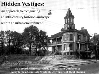
- 1. Hidden Vestiges: An approach to recognizing an 18th-century historic landscape within an urban environment Society of Historical Archaeology, 2010 Conference Larry James, Graduate Student, University of West Florida
- 2. 1763 Treaty of Paris British Pensacola Image courtesy of: The UWF Archaeology institute Map taken from unknown internet site
- 3. Above image courtesy of : UWF John C Pace Library, Special Drawn By H. Charles McBarron for the U.S. Army Center for Military History Collections
- 4. Landscape of Conflict American Revolutionary War 1779-1781 Fort George 1779-1781 Queen’s Redoubt 1779-1781 Prince of Wales War of 1812 / Seminole Wars 1781-1821? Fort San Miguel 1781-1821? Fort San Bernardo 1781-1821? Fort Sombrero American Civil War 1863-1864 Fort McClellan Images courtesy of: Pensacola Historical Society and The UWF Archaeology institute
- 6. Herron Residence, Early 1900s
- 8. 8ES46: Fort George Palafox Street N La Rua Street 1974 Map of the North Hill Preservation District, Pensacola Fl
- 9. Image taken from: Pensacola News Journal May 3, 1981 8ES46: Fort George 1. Dry Moat / Palisade Wall 2. Powder Magazine Warehouse 3. Ind. Brick Structure with vaulted ceiling / compartments 18th and 19th century military and civilian artifacts Artifact Images courtesy of: The Florida Public Archaeology Network
- 10. The Historical Record 1785 Fachin de Paramis Map “Plano del Castillo de San Miguel de la Avenzada en Panzacalo” 1780 Henry Heldring Map Images courtesy of: “Plan of Fort George” Pensacola Historical Society and The UWF Archaeology institute
- 11. 8ES1367: Fort San Bernardo Barcelona Street Brainerd Street N 1974 Map of the North Hill Preservation District, Pensacola Fl
- 12. Architectural Maps Advanced Redoubt 1779-1781 “Queen’s Redoubt” Spanish Fort 1781-1818? “Fort San Bernardo”
- 14. LOOKING EAST < BRAINERD STREET > < BARCELONA STREET >
- 16. Residential Survey of North Hill Preliminary Results ♦ ♦ A record of cultural ♦♦ ♦ N awareness: ♦♦♦ ♦ ♦ 92 out of 125 ♦ A record of altered landscapes: ♦ ♦ 47 out of 125 ♦ ♦♦ ♦ ♦ ♦ A record of the ♦ presence artifacts: ♦ ♦♦ 36 out of 125 ♦ Recorded Site ♦ ♦ Military-Related Artifact Numbers represent positive results-to-# of homes surveyed where primary resident was interviewed
- 17. Conclusions 1. Neighborhood Growth: affects historic districts zoning and preservation laws 2. Community Awareness: educates schools, social and political groups 3. Cultural Identity: Local and National heritage tourism
- 18. Special Thanks to: The University of West Florida Archaeology Institute faculty, staff and volunteers Pensacola Historical Society staff and volunteers North Hill Preservation Association And to: Shawna Fulton for showing us her unusual artifact from her garden! Historic Maps and Images courtesy of: Pensacola Historical Society University of West Florida Archaeology Institute John C. Pace Library Special Collections Google Earth Florida Public Archaeology Network