SlideShare une entreprise Scribd logo
1  sur  169
Télécharger pour lire hors ligne
LONG ISLAND SOUTH SHORE
ESTUARY RESERVE

Comprehensive Management Plan

George E. Pataki, Governor
Randy A. Daniels, Secretary of State
Vers F cov CMP

1

8/30/01, 11:45 AM
Acknowledgements
This comprehensive management plan for the South Shore Estuary Reserve was prepared by the South Shore Estuary Reserve
Council with assistance from the New York State Department of State, as provided in Article 46 of the Laws of 1993.

George E. Pataki, Governor
Randy A. Daniels, New York State Secretary of State

South Shore Estuary Reserve Council Members/Designees
Randy A. Daniels, Council Chair/George R. Stafford
Robert J. Gaffney, Suffolk County Executive/George Proios
Thomas S. Gulotta, Nassau County Executive/Dan C. Fucci
Edwin L. Eaton, City Manager, City of Long Beach/Joe Fabrizio
Richard V. Guardino, Supervisor, Town of Hempstead/
Ronald Masters/Mike Foley
John Venditto, Supervisor, Town of Oyster Bay/
James M. Byrne, P.E./Nancy Kearney
Richard H. Schaffer, Jr., Supervisor, Town of Babylon/
Richard Groh
Peter McGowan, Supervisor, Town of Islip/Alan Svoboda`
John Jay LaValle, Supervisor, Town of Brookhaven/
Jeffrey Kassner
Vincent Cannuscio, Supervisor, Town of Southampton/
Marty Shea
William Glacken, Mayor, Village of Freeport
Jeff Fullmer, Chair, Citizens Advisory Committee
Cornelia Schlenk, Chair, Technical Advisory Committee
Robert Grover, Great South Bay Audubon Society
Jill Ozarski, Long Island Chapter of the Nature Conservancy
Marvin Geller, Dean, Marine Sciences Research Center, SUNY
Stony Brook/William M. Wise
Patrick H. Augustine, New York Sportsshing Federation
Mitch Pally, Long Island Association/Marion Cohn
Robert Wieboldt, Long Island Builders Institute, Inc.
Christopher Squeri, New York Marine Trades Association
Carole Neidich-Ryder, North Shore Audubon Society
Gregory LoVece, Brookhaven Bayman’s Association

New York State Department of State
Division of Coastal Resources
George R. Stafford, Director
Rodney McNeil, Project Manager
Dennis Mildner (Water Resources)
Jeffrey Zappieri (Living Resources)
Nancy Rucks (Land Use/Embayment Use/Underwater Lands)
Peter Lauridsen (Geographic Information System)
Other Contributing Staff: Fred Anders; D. Peter Berical;
Paul R. Churchhill; Fitzroy Collins; Susan DiDonato; John Herring;
Jeffrey Herter; Charles McCaffrey; Nikifor Nikiforov; Laurissa Parent;
Kenneth Smith; Lee York; and Thomas Zyskowski
Other Contributors
Patrick Dooley (Technical Advisory Committee support)
Veronica Kemler (Citizens Advisory Committee support)
SUNY Albany: Floyd Henderson and Matthew Kohberger (Geographic
Information System and Remote Sensing)
Previous Council Members/Designees: Ken Cynar (Nassau County);
Felix J. Grucci (former Supervisor of the Town of Brookhaven);
Anthony Limoli (Town of Islip); Nick Manzari (Captree Boatman’s
Association); George Nussbaum (former Mayor of the Village of
Massapequa Park); Bruce Nyman (former City Manager, City of Long
Beach); and Adeline Quinn (City of Long Beach)
Former Department of State Staff: Robert Crafa; Diane Hamilton-Bell;
Susan Dzurica; Thomas Hart; and Joseph Sicluna
The South Shore Estuary Reserve Council acknowledges the
dedication of former Secretary of State Alexander “Sandy” Treadwell
over the last ve years to bring the Plan to fruition.

Council Advisors
Erin M. Crotty, Commissioner, NYS Department of
Environmental Conservation/Gordon Colvin/Karen Chytalo
Bernadette Castro, Commissioner, NYS Ofce of Parks,
Recreation and Historic Preservation/Gary Lawton

Preparation of this plan was nancially aided by: the New York State Environmental
Protection Fund; New York State legislative member initiatives; and a grant from the U.S.
Department of Commerce, National Oceanic and Atmospheric Administration, Ofce of
Ocean and Coastal Resource Management, under the Coastal Zone Management Act of
1972, as amended.

Vers F cov CMP

2

8/30/01, 11:45 AM
Resolution
South Shore Estuary Reserve Council Adoption of the
Long Island South Shore Estuary Reserve
Comprehensive Management Plan
WHEREAS, Article forty-six of the Executive Law declares it to be in the public interest to protect and
manage the South Shore Estuary system as a single integrated estuary and in furtherance of that goal
created the South Shore Estuary Reserve Council and directed it to prepare a comprehensive management plan and make recommendations to preserve, protect and enhance the natural, recreational, economic and educational resources of the Reserve; and
WHEREAS, the South Shore Estuary Reserve Council (“Council”) has undertaken those tasks, in
accordance with such law; and
WHEREAS, the Council identied the extent of the South Shore Estuary Reserve as Long Island’s south
shore bays and the adjacent upland areas draining into them, as described in the Long Island South
Shore Estuary Reserve Comprehensive Management Plan; and
WHEREAS, the Council, in conjunction with its Citizens Advisory Committee and its Technical Advisory Committee reviewed data and prepared technical reports pertaining to the Reserve; and
WHEREAS, the Council prepared a draft South Shore Estuary Reserve Comprehensive Management
Plan in accordance with Article forty-six of the Executive Law; and
WHEREAS, the Council submitted the draft Comprehensive Management Plan to public scrutiny and
comment at public hearings held on the 28th day of February and the 1st day of March, 2001 and
accepted written comments until the 28th day of March, 2001; and
WHEREAS, the Council has duly considered the oral and written comments submitted and has incorporated the comments and its responses thereto in the Comprehensive Management Plan; and
WHEREAS, the Council has determined, after due deliberation, that the Comprehensive Management
Plan meets the statutory criteria as well as the spirit of Article forty-six of the Executive Law;
NOW, THEREFORE, the South Shore Estuary Reserve Council does hereby ADOPT, the Comprehensive Management Plan for the Long Island South Shore Estuary Reserve, and DIRECT that it be
submitted herewith to each town and village within the reserve, the county executives of the counties of
Nassau and Suffolk, and to the Governor and the Legislature of the State of New York.

DATED: April 12, 2001

f resolution

1

8/30/01, 11:50 AM
Randy A. Daniels, New York State Secretary of State,
Chair, South Shore Estuary Reserve Council

Jeff Fullmer, Chair, Citizens Advisory Committee

Cornelia Schlenk, Chair, Technical Advisory Committee
Robert J. Gaffney, Suffolk County Executive

Robert Grover, Great South Bay Audubon Society
Thomas S. Gulotta, Nassau County Executive

Jill Ozarski, The Nature Conservancy, Long Island Chapter
Edwin L. Eaton, City Manager, City of Long Beach

Richard V. Guardino, Supervisor, Town of Hempstead

Dr. Marvin Geller, Dean, SUNY, Stony Brook,
Marine Sciences Research Center

John Venditto, Supervisor, Town of Oyster Bay

Patrick H. Augustine, New York Sportshing Federation

Richard H. Schaffer, Jr., Supervisor, Town of Babylon

Christopher Squeri, New York Maritime Trades Association

Peter McGowan, Supervisor, Town of Islip

Mitch Pally, Long Island Association

John Jay LaValle, Supervisor, Town of Brookhaven

Robert Wieboldt, Long Island Builders Institute, Inc.

Vincent Cannuscio, Supervisor, Town of Southampton

Carole Neidich-Ryder, North Shore Audubon Society

William Glacken, Mayor, Village of Freeport
Conference of Mayors

Gregory LoVece, Brookhaven Bayman’s Association

f resolution

2

8/30/01, 11:50 AM
EXECUTIVE SUMMARY
Long Island South Shore Estuary Reserve
Comprehensive Management Plan
Under the leadership of Governor George E.
Pataki, over 70 state-assisted projects have
been completed or are underway to improve
the health of the South Shore estuary. Nearly
$10 million in Clean Water/Clean Air Bond
Act grants and more than $6 million in
Environmental Protection Fund grants have
been awarded to Reserve communities to
acquire open space, restore habitats and manage
stormwater runoff. The South Shore Estuary
Reserve Comprehensive Management Plan
proposes steps to be taken over the next 5 years
to continue these improvements.

Preface
At the urging of Long Islanders concerned with
the future health of the South Shore estuary, the
New York State Legislature passed the Long
Island South Shore Estuary Reserve Act. The
Act created the South Shore Estuary Reserve
(Reserve) - Long Island’s South Shore bays and
the adjacent upland areas draining to them - and
called for the Reserve’s protection and prudent
management. The Act also created the South
Shore Estuary Reserve Council (Council), a
group of representatives from South Shore
towns and villages, Nassau and Suffolk counties
and the City of Long Beach, and recreation,
business, academic, environmental and citizens
interests. The Act charged the Council with
preparation of a comprehensive management
plan for the Reserve.

Access the document on the Web at http://www.estuary.cog.ny.us

Vers F2 ex summ

1

Development of this comprehensive
management plan has followed a process in
which many individuals have had opportunities
to participate. In 1994, the Council held a
series of scoping meetings during which public
views and concerns about the estuary and its
management were received. Monthly meetings,
open to the public, have allowed interested
parties to learn about and participate in Council
activities and those of its Technical Advisory
Committee, Citizens Advisory Committee, and
topic-based subcommittees and workgroups.
To assist the Council, the New York State
Department of State’s Division of Coastal
Resources, working through partnerships with
local governments and federal agencies,
gathered and analyzed information on land and
embayment uses, the estuarine economy, water
quality, living resources, and other aspects of
the Reserve. Much of this information was
analyzed by the Department of State through
geographic information system technology, and
the analyses have served as a basis for the
implementation actions offered in the plan.
Important data were also supplied by the six
towns and two counties in the Reserve as
part of assessments of their nonpoint source
management practices conducted in conjunction
with the Department. All of this information is
presented in the series of technical reports and
working papers referenced in Appendix A to
the plan.

Executive Summary

8/30/01, 11:42 AM

Page i
Implementation actions identied in Chapter
7 address major issues in the Reserve as they
relate to water quality and living resources,
public access and open space, the Reserve’s
maritime heritage, its economy, and education
and outreach. Although much has been
accomplished since 1995 by the State and its
local government partners through the many
Clean Water Clean Air Bond Act and
Environmental Protection Fund projects, and by
the Council’s Technical and Citizens Advisory
committees, much remains to be done to assure
the long-term health of the Reserve.
[Note to reader: An electronic version of the
South Shore Estuary Reservecomprehensive
management plan, with links to the technical
report series and associated data sets and maps,
can be accessed at: www.estuary.cog.ny.us.]

Chapter 1: The Region
Estuaries are coastal areas where fresh water
mixes with salt water. Long Island’s South
Shore estuary was formed during the last 5,000
years by the interaction of rising seas with
the glacially deposited material that makes
up Long Island. The interaction shaped the
barrier islands to enclose 173 square miles

Executive Summary

Vers F2 ex summ

of bays characterized by tidal marshes, mud
and sand ats, beds of underwater vegetation
and extensive shallows ranging from 1 to 7
meters deep. The shallows support microscopic
plants and animals which, in turn, support the
nsh, shellsh, waterfowl and other wildlife
that typify the South Shore estuary. This barrier/
bays system continues to respond to wave
action, the tides, coastal storms and a rising sea
level. It is also affected by human actions.
The South Shore Estuary Reserve is home
to about 1.5 million people. The anchor of
the region’s tourism, seafood and recreation
industries, the Reserve stretches from the
western boundary of the Town of Hempstead to
the middle of the Town of Southampton. South
to north, the Reserve extends from the mean
high tide line on the ocean side of the barrier
islands to the inland limits of the mainland
watersheds that drain into Hempstead Bay,
South Oyster Bay, Great South Bay, Moriches
Bay and Shinnecock Bay.
For purposes of planning and description, the
South Shore Estuary Reserve is conveniently
viewed as three subregions: the western bays,
Great South Bay and the eastern bays.
The western bays subregion extends from the
western boundary of the Town of Hempstead to

Access the document on the Web at http://www.estuary.cog.ny.us

Page ii

2-3

8/30/01, 11:42 AM
the Nassau-Suffolk County line, and includes
Hempstead Bay and South Oyster Bay and
all the lands that drain into them. These
embayments are an extensive area of shallow
water and salt marsh islands connected by
channels and tidal creeks. Its watershed is the
most densely populated in the Reserve, with
stormwater runoff from its developed landscape
the most signicant source of pollution reaching
the subregion’s tributaries and bays. Coliform
bacteria, responsible for the closure of 14,155
acres of shellsh beds in the western bays
and the periodic bathing closures of Zachs
Bay and Biltmore Beach, is the principal
pollutant carried by the runoff, but human
waste discharges from vessels, excrement from
waterfowl, and discharges from municipal
wastewater treatment plant outfalls in the
western bays are also contributing sources. This
portion of the Reserve also contains the greatest
concentration of salt marsh islands, most of
which have been ditched through mosquito
control programs.
Great South Bay is the largest shallow estuarine
bay in New York State, with extensive back
barrier and tidal creek salt marshes, eelgrass
beds, and intertidal ats. Most marshes in the
subregion are ditched, with many mainland
marshes impaired by ll and bulkheads or
restrictions to tidal ow. The watershed of Great
South Bay can be described as “developing,” in
contrast to the more fully “developed” western
bays region, and development is generally less
intense and open areas more extensive. Like the
western bays subregion, Great South Bay has
extensive impervious surfaces in its watershed.
For this reason, nonpoint source pollution from
stormwater runoff is the primary issue.
Nutrients, sediment and coliform bacteria are the
principal pollutants carried by stormwater runoff
into the subregion’s tributaries and ultimately
Great South Bay. Vessel waste discharges and
waterfowl are also contributors to the bacterial
load. Elevated levels of coliform are responsible
for the closure of 10,711 acres of shellsh
beds in Great South Bay and the periodic

Access the document on the Web at http://www.estuary.cog.ny.us

Vers F2 ex summ

2-3

closure of three of its bathing beaches. Nutrients
and sediments in stormwater runoff threaten
shing, sh propagation and sh survival in
the subregion’s tributaries and coves.
Hydromodications - alterations of water level
and stream ow - and lowering of groundwater
levels also have signicant effects on shery
resources in tributaries.
The shallow eastern bays - Moriches and
Shinnecock - are distinguished by the presence
of inlets, strong tidal exchanges between the
ocean and the bays, and minor inows of lower
salinity water from the Peconics through the
Shinnecock Canal. Salt marshes and dredged
material islands of the eastern bays support
signicant nesting colonies of terns, gulls, and
wading birds. Shallow water areas are highly
productive, especially the salt marshes and
intertidal ats that fringe the barrier islands
and the estuarine habitats around the tributary
mouths.
Although the watershed of Moriches and
Shinnecock bays is the least developed in
the Reserve, elevated levels of fecal coliform
bacteria from polluted stormwater runoff have
closed 6,075 acres of shellsh beds in the
bays. Sediment and excessive nutrients in
stormwater runoff have affected sh survival
in tributaries, and organic nutrients play a role
in the brown tide outbreaks in the subregion.
Agriculture occurs in this subregion to some
degree, with potential impacts on water quality
from sediments, fertilizers and pesticides.

Chapter 2: Improve and
Maintain Water Quality
Water quality in the South Shore Estuary
Reserve is important to everyone on Long
Island. Poor water quality diminishes
recreational and economic opportunities.
Nonpoint source pollution is the primary water
quality concern in the South Shore Estuary
Reserve. Polluted stormwater runoff alone is the

Executive Summary

8/30/01, 11:42 AM

Page iii
principal source of nonpoint pollution in 48 of
the 51 waterbody segments in the Reserve with
use impairments. Elevated levels of coliform
bacteria in stormwater runoff, an indicator of the
potential presence of pathogens, are responsible
for the closures of shellsh beds and bathing
beaches. Sediment and excessive nutrients in
stormwater runoff have pronounced negative
effects on the Reserve’s living resources.
Point sources of pollution - municipal
wastewater treatment plants, inactive hazardous
waste sites and active and inactive solid waste
disposal facilities - are not as widespread
and are comparatively less signicant sources
of pollution than nonpoint sources, but still
cause water quality degradation in their
immediate areas. Point sources are regulated
and monitored through the State Pollution
Discharge Elimination System (SPDES) permit
program.
Improving water quality in the Reserve is
dependent on federal, State and local
governments, and private sector partners,
implementing a strategy that: 1) identies
opportunities and develops schedules to protect
lands that provide signicant pollutant
abatement functions; 2) designs and undertakes
projects that retrot existing storm sewer and
other conveyance systems to remove pollutants
from storm water; 3) adopts nonpoint source
pollution best management practices; and 4)
increases education and outreach to modify
resident and user behavior.
This chapter identies recommendations to
reduce and control nonpoint source pollution;
enhance point source controls; implement the
Environmental Protection Agency’s Storm
Water Phase II Final Rule; and address scientic
information needs.

Chapter 3: Protect and Restore
Living Resources of the Reserve
The South Shore estuary is a rich and complex
ecosystem. Its beaches, shallow bays, tidal
marshes, tributaries and upland areas make the
Reserve one of the most ecologically productive
regions in the United States. In addition to
providing the basic necessities for estuarine
life, the estuary, its shoreline and upland areas
provide open space, contribute to the scenic
beauty of the region and support its tourism,
recreation and seafood industries.
Human population growth and burgeoning
development in the Reserve, especially since
World War II, had and continues to have a
dramatic effect on the estuary. Most habitat
loss in the Reserve has been the result of the
lling of low-lying lands in the western portion
of the Reserve for residential and commercial
uses. Other development activities, including
construction of canals, roads and bridges, have
also destroyed or degraded habitats. According
to the NYS Department of Environmental
Conservation 1996 Priority Waterbody List,
stormwater polluted by elevated levels of fecal
coliform bacteria, excessive nutrients and
sediment has affected the viability of sh
populations in the Reserve’s tributaries and has
closed almost 31,000 acres of hard clam beds
in its bays.
Regulations have slowed the loss of tidal and
freshwater wetlands in the Reserve, but the
remaining wetlands present both challenges and
opportunities for management and restoration.
The Reserve’s open bays have also undergone
notable changes, inuenced chiey by inlet
dynamics, while its upland forests seem to be
experiencing a loss comparable to that of the
region’s tidal wetlands.
Recommendations are offered to incorporate
an ecosystem perspective into the management
of the Reserve’s living estuarine resources;
to increase wetland community values; to

Executive Summary

Vers F2 ex summ

Access the document on the Web at http://www.estuary.cog.ny.us

Page iv

4-5

8/30/01, 11:42 AM
recognize, restore and protect tributary-based
resource values; to protect and improve habitat
conditions for estuarine bird species; to improve
the productivity of important living resources;
and to address scientic information needs.

Chapter 4: Expand Public Use
and Enjoyment of the Estuary
The public’s ability to use and enjoy the natural
resources of the South Shore estuary depends
upon access to its tributaries, bays and shoreline.
The supply of formal, dedicated shoreline public
access sites and recreational facilities is nite,
and opportunities to increase the supply will
become fewer as private shoreline development
continues. The more intensive and widespread
such development becomes, the more valuable
is the remaining open space. While generally
important for retaining variety and visual
interest in the pattern of development, open
space is critical to the health of the estuary and
its coastal habitats and the coastal character
of Long Island’s South Shore. All levels of
government must work together in cooperation
with private development interests to preserve
open space in the Reserve, buffer sensitive
habitats, improve water quality and retain the
visual landscape of the estuary.
Commercial shing, island bay houses,
recreational boating, yacht clubs, boat repair
shops, ferries and shoreline parks are all part
of the region’s maritime heritage and dene its
present-day culture. These traditional estuaryrelated uses are gradually being displaced by
more economically competitive non-traditional
uses. Concerted public and private efforts will
be needed to perpetuate the region’s historical
legacy.
Recommendations are offered to improve
shoreline public access and estuary-related
recreation; to retain open space within the
Reserve; and to protect, maintain and enhance
the Reserve’s maritime heritage.

Access the document on the Web at http://www.estuary.cog.ny.us

Vers F2 ex summ

4-5

Chapter 5: Sustain and Expand
Estuary-related Economy
The relatively calm, protected waters and
abundant natural resources of the South Shore
estuary provide the basis for the water-related
economic activities that have evolved from the
harvesting of oysters, hard clams and salt hay,
and boat building, to recreational boating, sport
shing, waterborne transportation and tourism.
Changes in the nature of these water-dependent
businesses reect the inuence of a growing
population and market demand, transportation
improvements and increased recreational
demands. Today, the estuary is home to the
largest concentrations of commercial and
recreational vessels, marinas and other waterdependent businesses in the State. The estuary
supports, in whole or in part, about 3,000 waterdependent and water-enhanced businesses that
employ nearly 30,000 people.
The amount of estuary shoreline suitable for
establishing new water-dependent uses or
expanding existing ones is limited, while, at
the same time, some existing water-dependent
businesses are gradually being displaced by
more economically-competitive non waterdependent uses. This is of particular concern in
maritime centers where water-dependent uses
are concentrated and embody much of the
estuary-related cultural heritage that supports
local tourism. Recommendations are offered
to support water-dependent businesses and to
enhance maritime centers.

Chapter 6: Increase Education,
Outreach and Stewardship
Academic institutions can be highly effective
conduits of information on the South Shore
estuary. Of the 124 public school districts
on Long Island responsible for primary and
secondary level education, nearly half (60) are
located in whole or part within the Reserve

Executive Summary

8/30/01, 11:42 AM

Page v
and serve a major portion of the approximately
423,000 school age children on Long Island.
Teachers have many sources of information
at their disposal, and a number of nature
centers and museums in the Reserve offer
eld programs for school groups. Yet
elementary, middle and high school teachers
face various constraints in trying to raise student
consciousness about the environment outside
their classrooms.
People in the Reserve learn about their
environment from a variety of sources:
newspapers, magazines, television and radio,
as well as from numerous public and private
organizations, many of which are represented
on the South Shore Estuary Reserve Council.
Many organizations on Long Island are moving
beyond education and outreach activities and
are striving to motivate individuals to become
active stewards of their environment. At the
community level, local governments and
neighborhood, civic and environmental groups
are bringing citizens together in collective
efforts to improve the environment.

the Reserve. The actions target effort where
the greatest potential exists for halting further
degradation of the Reserve’s natural resources
and realizing improvements to them, and where
multiple goals and objectives of the Council
can be achieved.
The actions focus attention where problems
have been clearly identied and where the
existence of motivated partners assures a higher
likelihood of success. They are organized and
presented according to outcomes they will
fulll.
In order to make signicant progress toward
achieving these outcomes, funding will be
necessary from a variety of governmental and
non-governmental sources to meet the estimated
$97.8 million ve year cost of implementing
the actions called for in Chapter 7.
Outcome 1:
Reduced nonpoint source pollution.
1-1 Construction of stormwater abatement projects
in signicant nonpoint source contributing areas

This chapter identies recommendations to
strengthen the mechanisms for raising
awareness and understanding of the South Shore
estuary; to nurture awareness and understanding
on the part of young people through formal
education activities that focus on the South
Shore estuary; to increase public awareness
and understanding through outreach activities
geared to general and specic audiences; and
to encourage people of all ages to become
stewards of the estuary.

associated with closed shellsh beds, impaired living

Chapter 7: Implementation

1-5 Completion of assessments of municipal nonpoint

Building on what has already been
accomplished since 1995 by the State, local
governments and the Reserve’s Council, the
implementation actions presented in this chapter
provide the necessary road map to fullling
the recommendations offered in the preceding
chapters and assuring the long-term health of

1-6 Development of watershed action plans.

Executive Summary

Vers F2 ex summ

resources, and bathing beaches that experience
periodic closures due to water quality concerns.
1-2 Amendment of county and local government codes
and regulations to include best management practices.
1-3 Implementation of on-site wastewater treatment
(septic) system maintenance and upgrades.
1-4 Implementation of Agricultural Environmental
Management.

pollution management practices.

1-7 Preparation for compliance with the
Environmental Protection Agency’s Stormwater
Phase II Final Rule.
1-8 Exploring the feasibility of stormwater
management districts.

Access the document on the Web at http://www.estuary.cog.ny.us

Page vi

6-7

8/30/01, 11:42 AM
Outcome 2:
Reduced point source pollution.

4-9 Management of upland ponds.

2-1 Assessment of inactive hazardous waste sites.

4-10 Augmentation of streamow.

2-2 Assessment of abandoned and closed landlls.

Outcome 5:
Open space preserved to sustain
community character and protect water
quality and habitat.

2-3 Exploring regulation of private petroleum tanks
less than 1,100 gallons.
2-4 Evaluation of need for wastewater treatment plant
upgrades and outfall relocations.
2-5 Expansion of Village of Patchogue Sewer District.

Outcome 3:
Increased harvest levels of hard clams
and other estuarine shellsh species.
3-1 Population assessment and seeding of hard clams
and other shellsh species.
3-2 Feasibility of Islip hatchery expansion.
3-3 Increasing grow-out of shellsh.
3-4 Enhancement of hard clam habitat through shell

5-1 Development of a Reserve open space acquisition
and protection action strategy.
5-2 Analysis of small parcel open space opportunities.
5-3 Use of a land trust to assist local acquisition
efforts.
5-4 Implementation of local open space plans.
5-5 Acquisition of open space.

Outcome 6:
Improved knowledge for ecosystem
management.

augmentation.

6-1 Monitoring water quality.

3-5 Evaluation of potential spawner sanctuaries.

6-2 Land use build-out analysis.

3-6 Creation of a Reserve shellsh management

6-3 Determination of additional point and nonpoint

forum.

source pollution controls.

Outcome 4:
Coastal habitats protected and restored
to support shellsh, nsh and coastal
bird populations.
4-1 Restoration of tidal wetlands.
4-2 Coordination of wetland restoration efforts.
4-3 Restoration of anadromous sh.
4-4 Habitat restoration in tributaries.
4-5 Evaluation and restoration of eelgrass beds.

6-4 Determination of sediment composition in Reserve
tributaries and bays.
6-5 Monitoring landll performance and compliance.
6-6 Analysis of existing information on leaks and
spills.
6-7 Development of a Reserve-wide hydrologic model.
6-8 Monitoring the ecosystem.
6-9 Study of hard clam biology.
6-10 Assessment of additional tidal wetland sites for

4-6 Vegetation management for coastal birds.

restoration.

4-7 Recognition of shorebird reserves.

6-11 Completion of baseline inventory of eelgrass

4-8 Increased protection of marine turtle populations.

Access the document on the Web at http://www.estuary.cog.ny.us

Vers F2 ex summ

6-7

distribution.

Executive Summary

8/30/01, 11:42 AM

Page vii
6-12 Undertaking research on ooding and erosion.
6-13 Expansion of brown tide research.
6-14 Analyzing duck sludge deposits as potential
pollutant sources.

Outcome 10:
Heightened public awareness of
the estuary.
10-1 Supporting a Reserve web site.
10-2 Updating education resource directory.

Outcome 7:
Increased public use of the estuary and
expanded tourism.
7-1 Expanding public access and recreation facilities
at existing sites.
7-2 Creating new public access and recreation
opportunities.
7-3 Expansion of existing interpretive centers and

10-3 Creation of an access guide.
10-4 Production of South Shore video.
10-5 Working with outreach partners.
10-6 Identication of professional development
opportunities for teachers.
10-7 Supporting the existing network of entities that
conduct education programs on board watercraft.

development of new ones.

10-8 Identication of potential mentors.

7-4 Establishing a South Shore Estuary Reserve

10-9 Establishment of a clearinghouse for student

Coastal Heritage Trail.

Outcome 8:
Water-dependent businesses sustained.

research.
10-10 Establishing an awards program.
10-11 Designation of bird conservation areas.

8-1 Provision of adequate infrastructure to support

10-12 Undertaking a native landscaping pilot

existing and new water-dependent uses.

program.

8-2 Development of a dredging and dredged materials

10-13 Creation of a homeowner certication program.

management plan.

8-4 Planning for local waterfront development.

Outcome 11:
Actions advanced through Council
partnerships and ofce.

8-5 Improving local waterfront regulation.

11-1 Promotion and oversight of plan implementation.

8-6 Facilitating public/private partnerships to support

11-2 Establishment and operation of Reserve ofce.

8-3 Dredging for safe navigation.

water-dependent business.
8-7 Preparation of Local Harbor Management Plans.

Outcome 9:
Maritime centers thrive.
9-1 Preparation of maritime center action plans.
9-2 Implementation of maritime center action plans.
9-3 Promotion of maritime centers.

Executive Summary

Vers F2 ex summ

Page viii

8

Access the document on the Web at http://www.estuary.cog.ny.us

8/30/01, 11:42 AM
Table of Contents
Page

Executive Summary

i-viii

Preface

ix

Chapter 1

The Region

1-8

Chapter 2

Improve and Maintain Water Quality

Chapter 3

Protect and Restore Living Resources of the Reserve

25-38

Chapter 4

Expand Public Use and Enjoyment of the Estuary

39-48

Chapter 5

Sustain and Expand the Estuary-related Economy

49-56

Chapter 6

Increase Education, Outreach and Stewardship

57-70

Chapter 7

Implementation

9-24

71-108

• Integrative Analysis and Implementation Map Series
Appendix A
Appendix B

State-assisted Projects to Benet the Estuary

Appendix C

F TOC

Abstracts of Technical Reports

Response to Public Comments

1

109
A1-A12
B1-B6
C1-C20

8/30/01, 11:51 AM
F TOC

2

8/30/01, 11:51 AM
Preface
The New York State Legislature passed the Long Island South Shore Estuary Reserve
Act in 1993 at the urging of Long Islanders concerned about the future health of the
South Shore estuary. The Act declared the estuary to be a resource of unparalleled
biological, economic and social value, created the South Shore Estuary Reserve
(Reserve) and called for its protection and prudent management.
The Act also created the South Shore Estuary Reserve Council (Council), designated
the New York Secretary of State as its Chair, and provided for membership representing
six South Shore towns, thirty-one villages, Nassau and Suffolk counties, the City
of Long Beach, and recreation, business, academic, environmental and citizen
interests. The Act also charged the Council with the preparation of a comprehensive
management plan for the Reserve.
Development of the plan has followed a process in which many individuals have had
opportunities to participate. In 1994, the Council held a series of scoping meetings
during which public views and concerns about the estuary and its management
were received. Monthly meetings, open to the public, have allowed interested
parties to learn about and participate in Council activities and those of its Technical
Advisory Committee, Citizens Advisory Committee, and topic-based subcommittees
and workgroups.
To assist the Council, the Department of State Division of Coastal Resources gathered
information primarily through partnerships with local governments and federal
agencies. The information addressed land and embayment uses, the estuarine economy,
water quality, living resources, and other aspects of the Reserve. Much of this
information was analyzed by the Department of State through geographic information
system technology, and this analysis served as a basis for the implementation actions
offered in the plan. All of this information is presented in the series of technical
reports and working papers referenced in Appedix A to the plan.
The Council is pursuing multiple purposes in issuing this plan:

•
•
•
•

to recommend management actions for protecting and improving the health of the
South Shore estuary, and to expand such efforts;
to sustain cooperation and commitment among all public and private interests with
a stake in the estuary;
to build public awareness and understanding about the estuary and the issues that
affect its health and vitality, and to involve the public in its management; and
to identify future research in areas where further scientic information is needed
to improve management actions.

[Note to reader: An electronic version of the South Shore Estuary Reserve
comprehensive management plan, with links to the technical report series and
associated data sets and maps, can be accessed at: www.estuary.cog.ny.us.]

Preface

Access the document on the Web at http://www.estuary.cog.ny.us

Vers F preface

9

8/30/01, 11:48 AM

Page ix
Access the document on the Web at http://www.estuary.cog.ny.us

Vers F preface

10

8/30/01, 11:48 AM
CHAPTER 1

The Region

Vers f intr-1

1

8/30/01, 11:10 AM
CHAPTER 1

The Region
This chapter provides a brief overview of the
South Shore Estuary Reserve, characterizes the
ve estuarine bays and the lands that drain
to them, and introduces the many resource
management concerns that relate to the different
parts of the Reserve.
Estuaries are transition zones between the
world’s freshwater and marine ecosystems
where fresh water mixes with salt water. Long
Island’s South Shore estuary is a dynamic
ecosystem, formed during the past 5,000 years
by the interaction of a rising sea level with the
glacially-deposited material that makes up Long
Island. The entire natural system, including
the barrier islands and the 173 square miles
of shallow bays behind them, is still changing
and evolving in response to wave action, tides,
coastal storms, and the continuing rise of
sea level. In this estuarine environment, tidal
marshes, mud and sand ats, underwater plant
beds and broad shallows support microscopic
plants and animals which, in turn, support the
nsh, shellsh, waterfowl and other wildlife
that typify the South Shore estuary.

Chapter 1

Vers f intr-1

Overview of the South Shore
Estuary Reserve
The South Shore Estuary Reserve is home
to about 1.5 million people. The anchor of
the region’s tourism, seafood and recreation
industries, the Reserve stretches from the
western boundary of the Town of Hempstead to
the middle of the Town of Southampton. South
to north, the Reserve extends from the mean
high tide line on the ocean side of the barrier
islands to the inland limits of the mainland
watersheds that drain into Hempstead Bay,
South Oyster Bay, Great South Bay, Moriches
Bay and Shinnecock Bay.
Human population growth and burgeoning
development in the Reserve, especially since
World War II, had and continues to have a
dramatic effect on the estuary. Most habitat

The South Shore Estuary
Reserve is the anchor of the
region’s tourism, seafood and
recreation industries, and is
home to about 1.5 million
people.

Access the document on the Web at http://www.estuary.cog.ny.us

Page 2

2-3

8/30/01, 11:10 AM
loss in the Reserve has been the result of the
lling of low-lying lands in the western portion
of the Reserve for residential and commercial
uses. Other development activities, including
construction of canals, roads and bridges, have
also destroyed or degraded habitats. According
to the NYS Department of Environmental
Conservation’s 1996 Priority Waterbody List,
stormwater polluted by elevated levels of fecal
coliform bacteria, excessive nutrients and sediment
has effected the viability of sh populations in the
Reserve’s tributaries and has closed over 34,000
acres of hard clam beds in its bays.
For purposes of planning and description, the
South Shore Estuary Reserve is conveniently
viewed as three subregions: the western bays,
Great South Bay and the eastern bays.

Western Bays
The western bays subregion extends from the
western boundary of the Town of Hempstead
to the Nassau-Suffolk County line, and includes
Hempstead Bay and South Oyster Bay and all the
lands that drain into them. These embayments
are an extensive area of shallow water and salt
marsh islands connected by channels and tidal

Freeport shoreline in the Western Bays

creeks. This portion of the Reserve contains the
greatest concentration of salt marsh islands, most
of which have been ditched through mosquito
control programs. These islands are frequently
subject to erosion due to the relatively high
tidal range and proximity to heavy commercial
and recreational boat trafc. Dredged material
islands, over both wetland and shallow water
habitats, are also prominent in the subregion.
Almost all of the mainland shoreline in this
subregion is bulkheaded, with the most intense
development along the shoreline in the western
part of the subregion. Much of the original
development occurred in the 1950s and 60s as
thousands of acres of tidal wetlands were lled
to create new home sites. Virtually all mainland
tidal wetlands were eliminated in this manner.
The western bays also support a variety of benthic
macroalgae (seaweeds) and submerged aquatic
vegetation (seagrasses), the most important of
which is eelgrass. As a result of disease and water
quality problems, signicant losses of submerged
aquatic vegetation beds have also occurred in
parts of these bays.
Habitat loss and water quality problems have
also had a negative impact on most of the estuarine species in the western bays. Recreational
nsh species have declined,
as have shellsh populations,
which are also impaired by low
rates of recruitment. The subregion’s signicant concentrations
of shorebirds, wintering waterfowl and colonial nesting water
birds also have been reduced.
Most waterbird colonies in the
Reserve occur on the islands of
the western bays from Hempstead east to Captree. South
Oyster Bay and Hempstead Bay
are also an important part of the
Atlantic Flyway for migrating
and wintering waterfowl, particularly brant, with an average of nearly 25,000 water-

Chapter 1

Access the document on the Web at http://www.estuary.cog.ny.us

Vers f intr-1

2-3

8/30/01, 11:10 AM

Page 3
fowl counted on mid-winter aerial surveys. The
importance of the western bays for migrating,
wintering and resident coastal birds also needs
to be recognized.
The watershed of the western bays is the most
densely populated in the Reserve. It exhibits
the highest proportion of watershed rendered
impervious by roads, parking lots and roofs.
Land use south of Sunrise Highway and Merrick
Road is highly urbanized and predominantly
residential. Intersections along major highways
are developed with high density residential,
industrial, and/or transportation and utility uses.
Land use close to the bays includes parks,
nature preserves and protected areas for local
and regional recreational purposes. However,
residential development along canals, tributaries
and the shoreline is increasing the pressure on
these natural areas.
Stormwater runoff from this developed
landscape is the most signicant source of
pollution reaching the subregion’s tributaries
and bays. Elevated levels of coliform bacteria,
responsible for the closure of 15,575 acres
of shellsh beds in the western bays and
the periodic bathing closures of Zachs Bay
and Biltmore Beach, is the principal pollutant
carried by the runoff, but human waste
discharges from vessels, excrement from
waterfowl, and discharges from municipal
wastewater treatment plant outfalls in the
western bays are also contributing sources.
Nutrients from these same point and nonpoint
sources promote the subregion’s extensive mats
of seaweeds that are in part responsible for
the loss of valuable seagrass beds, while
nutrients and sediments in stormwater runoff
are held responsible for threatening sh survival
and propagation in several of the subregion’s
tributary streams. Petroleum products are also
documented pollutants. Thus water quality in
the western bays is affected by both nonpoint
and point sources of pollution.

Chapter 1

Vers f intr-1

For this subregion, comprehensive efforts are
needed to achieve signicant improvements
in water quality and living resources. Such
efforts must include: the restoration of ditched
and lled salt marshes; vegetation management
in shorebird and waterbird nesting areas;
restoration of eelgrass beds; protection and
restoration of inland ponds; augmentation of
water level and ow in streams; improved
boating management; seed clam planting; and
educational outreach. Also needed are
implementation of management practices as
source controls to prevent nonpoint source
pollutants from reaching stormwater runoff or
from owing directly into tributaries and bays,
and management of polluted stormwater runoff
before it reaches those tributaries and bays.
Management of polluted stormwater runoff in
areas where the most signicant reductions can
be gained will correct this major source of
nonpoint pollution. One aspect of this effort
will be local implementation of stormwater
remediation projects with State technical and
nancial assistance. Such projects will be
implemented at roadway crossings of tributaries,
at street ends draining to waterbodies, and
in parking lots throughout contributing areas.
Improvements to municipal stormwater
drainage systems that reduce the volume and
ow of stormwater runoff to the western bays
will be an important element of stormwater
management.

Great South Bay
Great South Bay is the largest shallow estuarine
bay in New York State, with extensive back
barrier and tidal creek salt marshes, eelgrass
beds, and intertidal ats. Most marshes in the
subregion are ditched, with many mainland
marshes impaired by ll and bulkheads or
restrictions to tidal ow. As the only South
Shore bay with major riverine input, Great South
Bay’s living resources have been signicantly
affected by diminished tributary water quality.

Access the document on the Web at http://www.estuary.cog.ny.us

Page 4

4-5

8/30/01, 11:10 AM
The loss of tidal marshes and other coastal
habitats has reduced estuarine productivity and
eliminated critical feeding and nursery habitat
for nsh, shellsh, shorebirds and colonial
waterbirds. Additionally, in the past 25 years,
the hard clam harvest in Great South Bay has
fallen by more than 93% to record lows.
The watershed of Great South Bay can be
described as “developing,” in contrast to the
more fully “developed” western bays region,
and development is generally less intense and
open areas more extensive. The primary land
use pattern is medium density development with
pockets of more intense residential use on ngers
of land separated by canals and waterways.
Along the shoreline are substantial areas of green
space dedicated as parklands and preserves. The
intensity of development lessens from west to
east within the subregion. Its population has
grown over the last decade and is projected to
continue to do so over the next twenty years, but
at a gradually decreasing rate.
Like the western bays subregion, Great South
Bay has extensive impervious surfaces in its
watershed. For this reason, polluted stormwater
runoff is the primary issue. Nutrients, sediment
and coliform bacteria are the principal pollutants
carried by stormwater runoff into the
subregion’s tributaries and ultimately Great

South Bay. Vessel waste discharges and
waterfowl are also contributors to the bacterial
load. Elevated levels of coliform are responsible
for the year-round closure of 12,886 acres
of shellsh beds in Great South Bay and
the periodic closure of three of its bathing
beaches. Nutrients and sediments in stormwater
runoff threaten shing, sh propagation and sh
survival in the subregion’s tributaries and coves.
Hydromodications - alterations of water level
and stream ow - and lowering of groundwater
levels also have signicant effects on shery
resources in tributaries.
For this subregion, efforts to improve water
quality are proposed to focus on the management
of nonpoint source pollution, especially polluted
stormwater runoff. These efforts would include
implementation of the management practices
recommended in Chapter 2 to prevent nonpoint
source pollutants from reaching stormwater runoff
or from owing directly to tributaries and the bay.
Management of polluted stormwater runoff in
areas where the most signicant reductions can be
gained would begin to correct this major source
of nonpoint pollution. One aspect of this effort
would be local implementation of stormwater
remediation projects with State technical and
nancial assistance. Such projects would be
implemented at roadway crossings of tributaries,
at street ends draining to waterbodies, and in
parking lots throughout contributing areas. Parcel acquisition
for stormwater management projects, construction of stormwater
wetlands, and continued improvements to municipal stormwater
drainage systems that reduce the
volume and ow of stormwater
runoff to Great South Bay will also
be important elements of stormwater management.

Great South Bay at the Robert Moses Causeway

Chapter 1

Access the document on the Web at http://www.estuary.cog.ny.us

Vers f intr-1

4-5

8/30/01, 11:10 AM

Page 5
Projects to restore the living resources of
Great South Bay are proposed to focus on:
the restoration of ditched, lled back barrier
and cove salt marshes, and riverine wetlands;
vegetation management in shorebird and
colonial waterbird nesting areas; protection
of submerged aquatic vegetation beds;
augmentation of water level and ow in streams;
improved boating and boat maintenance
practices; and evaluation of shell augmentation
of bay bottoms and seed clam planting.

Eastern Bays
The shallow eastern bays - Moriches and
Shinnecock - are distinguished by the presence
of inlets, strong tidal exchanges between the
ocean and the bays, and minor inows of lower
salinity water from the Great Peconic Bay
through the Shinnecock Canal. Salt marshes
and dredged material islands of the eastern
bays support signicant nesting colonies of
terns, gulls, and wading birds. Shallow water
areas are highly productive, especially the salt
marshes and intertidal ats that fringe the barrier
islands and the estuarine habitats around the
tributary mouths. The deeper water habitats
are composed of sandy shoals and submerged
aquatic vegetation beds.
The major land use in the subregion is medium to low density
residential, with the greatest concentration of residences along the
shoreline and waterways. The area
is interspersed with parks, agricultural lands, conservation areas
and small clusters of service-oriented commercial establishments,
all contributing the rural aspect of
the subregion. Population projections indicate that this area will
have the largest sustained rate of
growth of all the Reserve within

the next decade, although the total population
and population density are expected to remain
the lowest within the Reserve.
Although the watersheds of Moriches and
Shinnecock bays are the least developed in
the Reserve, elevated levels of fecal coliform
bacteria from stormwater runoff, waterfowl
and vessel discharges of human waste have
closed 6,170 acres of shellsh beds in the bays.
Nutrients and sediment in stormwater runoff
have affected sh survival in tributaries, and
nutrients are suspected of playing a role in the
brown tide outbreaks in the subregion.
Agriculture occurs in this subregion to some
degree, with potential impacts on water quality
from sediments, fertilizers and pesticides. The
Agricultural Environmental Management
initiative, headed by the Department of
Agriculture and Markets, is aimed at minimizing
potential pollution from agricultural operations
of all types and would help control nonpoint
pollution from this source.
The Town of Southampton is exemplary in its
efforts to protect and restore the water and
living resources of this subregion, but additional
work remains. This includes: the restoration of
back barrier and mainland fringe salt marshes,
especially those formerly connected wetlands

Shinnecock Bay at the Ponquogue Bridge

Chapter 1

Vers f intr-1

Access the document on the Web at http://www.estuary.cog.ny.us

Page 6

6-7

8/30/01, 11:10 AM
where tidal exchange has been halted, and
submerged aquatic vegetation beds; the
restoration of dredge material islands used for
shorebird and colonial waterbird nesting; and
the preservation of upland and riparian corridors
as protective buffers.
The proposed implementation of management
practices will reduce nonpoint source pollution.
Management of polluted stormwater runoff in
areas where the most signicant reductions
can be gained is also an important part of
achieving high water quality, and would include
local implementation of stormwater remediation
projects. Such projects would be constructed
at roadway crossing of tributaries, at street
ends draining to waterbodies, and in parking
lots throughout contributing areas. Parcel
acquisition for stormwater management
projects, construction of stormwater wetlands,
and continued improvements to municipal
stormwater drainage systems that reduce the
volume and ow of stormwater runoff to the
eastern bays will also be important elements of
stormwater management.

Chapter 1

Access the document on the Web at http://www.estuary.cog.ny.us

Vers f intr-1

6-7

8/30/01, 11:10 AM

Page 7
Access the document on the Web at http://www.estuary.cog.ny.us

Vers f intr-1

8

8/30/01, 11:10 AM
CHAPTER 2

Improve and Maintain
Water Quality

Vers f Chap2

9

8/30/01, 11:11 AM
CHAPTER 2
Improve and Maintain Water Quality
Overview of the Issues
Nonpoint source pollution presently degrades
the quality of ground and surface waters in the
South Shore Estuary Reserve. Nonpoint source
pollution generally results from stormwater
runoff, precipitation, atmospheric deposition,
drainage, seepage and modications to
waterways. In the Reserve it poses potential
hazards to human health, causes the periodic
closure of bathing beaches, and has forced the
closure of approximately 34,643 acres of hard
clam beds in the Reserve, about one-third of its
total area [Technical report: Nonpoint Sources
of Pollution (1998)].
The dominant effect of nonpoint source
pollution on water quality in the Reserve is
well documented. The NYS Department of
Environmental Conservation has identied
polluted stormwater runoff from urban areas -from new and existing development and from
roads, highways, and bridges -- as the primary
pollutant responsible in nearly all of the ftyone South Shore Estuary Reserve waterbody
segments listed with impaired uses in its 1996
Priority Waterbody List (see map at end of this
chapter). Furthermore, when the Department
updated its 1991 Priority Waterbody List in
1996, only one waterbody segment in the
Reserve had improved in water quality while
two were added to the list and seven others
had their use impairments worsen [Technical
reports: Nonpoint Sources of Pollution (1998);
Status and Trends (1999)].

Chapter 2

Vers f Chap2

Nonpoint source pollution
poses potential hazards to
human health, causes the
periodic closures of bathing
beaches, and has forced the
closure of approximately
34,643 acres of hard clam
beds in the Reserve.
At least ve reports, the rst dating from 1978
-- the 208 Areawide Waste Treatment Study,
Long Island Segment of the Nationwide Urban
Runoff Program, Nonpoint Source Handbook,
Nonpoint Water Quality Strategy for Nassau
County, and Suffolk County Water Quality
Strategy - - concluded that nonpoint source
pollution was a priority concern and that, in
particular, polluted stormwater runoff was the
primary source. Each of these reports sets forth
recommendations to control nonpoint source
pollution. These recommendations, however,
were never fully implemented.
Point sources of pollution - typically discrete
and discernible pipe outfalls - also exist within
the Reserve, and are regulated and monitored
through the State Pollution Discharge
Elimination System (SPDES) permit program.
Point sources of pollution, while not as
widespread and comparatively less signicant
than nonpoint sources, can still cause water
quality degradation in their immediate areas.

Access the document on the Web at http://www.estuary.cog.ny.us

Page 10

10-11

8/30/01, 11:11 AM
Such point sources include ve wastewater
treatment plants (Bay Park, Long Beach, West
Long Beach, Lawrence, Jones Beach) that
discharge treated efuent into the western bays;
the Ocean Beach plant, discharging into Great
South Bay; and the Village of Patchogue plant
that discharges into the Patchogue River. Point
sources also include other discharges regulated by
SPDES and inactive hazardo us and inactive and
active solid waste disposal sites [Technical report:
SSER State Pollution Discharge Elimination
System (SPDES) Permit Sites (1999)].

bacteria are responsible for the closure of
shellsh beds and bathing beaches due to
potential threats to human health [Technical
report: Nonpoint Sources of Pollution (1998)].
Nutrients in amounts greater than natural
background levels cause eutrophication, the
enrichment of surface waters. In some areas

In keeping with Article 46 of Executive Law,
the Council established as one of its goals
the need to “achieve and maintain the water
quality necessary to preserve and rehabilitate
resources of the estuary.” Attaining this
ambitious water quality goal depends upon the
cooperative efforts of many players -- federal,
State, and local governments, non-governmental
organizations, resource users and residents. This
chapter offers a fundamental approach to guide
public and private efforts in the achievement
of this goal. Recommendations in this chapter
provide for the implementation of a strategy
to control nonpoint source pollution and to
further evaluate the effects of point sources.
These recommendations are intended to guide
the actions of governments seeking to improve
water quality in the estuary.

Pollutants and Nonpoint Sources

Storm water outfall

Two of the most signicant pollutants in the
South Shore Estuary Reserve are elevated levels
of
coliform
bacteria
and
excessive
concentrations of certain nutrients. Coliform
bacteria are typically found within the digestive
systems of warm-blooded animals and indicate
the potential presence of fecal wastes in surface
waters. Coliform bacteria from wildlife,
waterfowl and pet wastes and potentially from
failing on-site wastewater treatment systems
enter streams and coastal waters primarily
through stormwater runoff from lawns, roads
and parking lots. Elevated levels of coliform

of the Reserve excessive levels of nitrogen
cause this over enrichment that results in
excessive algal growth (blooms). Algal blooms
create low dissolved oxygen levels (hypoxia)
through their nighttime respiration and gradual
decomposition, threatening the health and
survival of nsh and shellsh in eutrophic
waters. They also shade out and destroy seagrass
beds, estuarine habitats that are nursery areas for
juvenile nsh and shellsh and feeding areas
for waterfowl. Nonpoint sources of nutrients
include fertilizers from lawns and agricultural
lands; wildlife, waterfowl and pet wastes; and

Chapter 2

Access the document on the Web at http://www.estuary.cog.ny.us

Vers f Chap2

10-11

8/30/01, 11:11 AM

Page 11
on-site wastewater treatment systems [Technical
reports: Nonpoint Sources of Pollution (1998);
Summary Report: South Shore Estuary Reserve
Water Quality Workshop (1999)].

Strategy for Reduction and
Control of Nonpoint Source
Pollution

In September 1996, a South Shore Estuary
Reserve workshop addressed water quality
research needs and focused on toxins, nutrients,
coliform bacteria, and sediments as the most
signicant pollutants entering the estuary. It
also examined the potential impacts of
re-suspended sediments, bay shoreline erosion,
and phytoplankton blooms. The workshop
participants reached several important
conclusions: that the total loading of toxins
within the Reserve and the levels of toxic
substances in the waters, sediments and aquatic
biota of the estuary need to be evaluated; that the
potential presence of pathogens in the estuary
clearly represents a risk to public health; and
that the impact of pathogens on the health and
vitality of the Reserve’s plants and animals
remains unclear. [Technical report: Summary
Report: South Shore Estuary Reserve Water
Quality Workshop (1999)].

As nonpoint source pollution originates from
land use and water-based human activities, the
Council’s strategy calls on municipalities within
the Reserve to assume a leadership role in
reducing and controlling nonpoint pollution by
exerting their legal authority to inuence such
activities, and preserving high quality waters
from future pollution. The strategy presents
corrective and preventive actions that local
governments can take, supported by State and
federal programs and grants and augmented by
the efforts of non-governmental organizations, to
reduce and control nonpoint source pollution.

The 1996 workshop also determined that human
development of the margins of the estuary’s
bays and tributaries had increased nutrient
loading and resulted in an increased level
of eutrophication. The seasonal occurrence
of hypoxic conditions associated with excess
nutrients and dissolved oxygen highlights this
concern. Although the shallow waters of the
South Shore bays are well mixed (which
discourages oxygen depletion), low levels of
dissolved oxygen (hypoxia) are typical along
the northern margins of the bays and in the
tributary mouths, with tributaries showing clear
signs of seasonal hypoxia, a serious threat to
aquatic life in these areas.

Chapter 2

Vers f Chap2

The strategy’s corrective and preventive
measures fall into four management approaches:
1) identifying opportunities and developing
schedules to protect lands that provide signicant
pollutant abatement functions; 2) designing and
undertaking projects that retrot existing storm
sewer and other conveyance systems to remove
pollutants carried by stormwater; 3) adopting
nonpoint source pollution best management
practices; and 4) increasing education and
outreach to modify resident and user behavior.
The degree to which each of the four approaches
may be institutionalized in a municipality will
depend upon local circumstances.
Several steps are fundamental to the
implementation of the corrective component of
the strategy. First, the distribution and relative
magnitude of nonpoint source pollution in each
watershed should be identied by municipalities.
Satellite imagery of land cover has been used
with soils, topography and distance to surface
water data to identify nonpoint pollution
potential for the entire Reserve (see map at
end of this chapter). This information will
help focus implementation of site-specic
stormwater remediation projects and water
quality monitoring efforts.

Access the document on the Web at http://www.estuary.cog.ny.us

Page 12

12-13

8/30/01, 11:11 AM
Next, municipalities should characterize their
watersheds. These characterizations should
include a delineation of sub-watersheds or
contributing areas, and the location and
condition of storm sewer outfalls and
stormwater conveyance systems through which
pollutants in stormwater are discharged.
Existing drainage and runoff patterns should be
accounted for in this delineation.
An assessment of the likelihood of correcting
discharge problems through infrastructure
retrot improvements should also be included.
The likelihood of improvement and value of the
receiving water resources are two key factors
to be considered in setting priorities and are
essential to preparing watershed management
plans, a follow-up step that would establish
the basis for the design of cost-effective
corrective projects. Environmental Protection
Fund Local Waterfront Revitalization Program grants are available to assist in this phase of the
process. For example, as part of
its stormwater abatement program, the Town of Southampton has inventoried and mapped
potentially signicant contributing areas, assessed nonpoint
pollution and identied capital
improvement projects to abate
pollution. It has also identied
other areas to be analyzed as
future target areas. Brookhaven
has identied outfalls and conveyance systems that discharge
to tidal tributaries in the town
and developed preliminary recommendations to remove pollutants. Babylon has identied
outfalls, contributing areas and
projects to remove pollutants in
runoff and restore wetlands for

its Ketchams Creek watershed. Nassau County
has mapped stormwater drainage areas and
outfalls, while Hempstead has identied
catchment basins and retention structures for
all of its roads. Inventories in Oyster Bay and
Islip are still underway.
The nal step in the corrective portion of
this strategy is the comprehensive, local
implementation of retrot projects, often with
State technical and nancial assistance.
Environmental Protection Fund and Clean
Water/Clean Air Bond Act grants, and federal
Clean Water Act grants, are available to support
such projects. Additionally, proposed section
6217 funds associated with future renewal
of the Coastal Zone Act Reauthorization
Amendments are another potential source of
nancial assistance for priority nonpoint source
abatement and control projects.

Chapter 2

Access the document on the Web at http://www.estuary.cog.ny.us

Vers f Chap2

12-13

8/30/01, 11:12 AM

Page 13
Some corrective steps of this strategy have
already been implemented. Highlights of such
municipal accomplishments include: completion
of approximately seven hundred stormwater
control projects (Southampton); implementation
of catch and retention basin maintenance
programs (Brookhaven, Islip and Oyster Bay).
Projects for which funds have been awarded
or are currently underway include wetland
restoration (Oyster Bay, Babylon, Brookhaven
and Southampton); hard clam restoration
(Brookhaven); and highway stormwater
discharge remediation (Islip, Southampton and
Nassau and Suffolk counties).

Another element in this strategy, as of January
2001, is the Environmental Protection Agency’s
Final Storm Water Phase II Rule. The rule
represents a signicant expansion of historic
point source management requirements under
National Pollutant Discharge Elimination
System permit coverage to encompass sources
traditionally considered nonpoint. Its intention
is to further reduce adverse impacts to water
quality and aquatic habitats by instituting the
use of controls on the unregulated sources of
stormwater discharges that have the greatest
likelihood of causing continued environmental
degradation.

The strategy’s preventive component is derived
from the assessments of current municipal
nonpoint source pollution control practices. To
varying degrees, towns in the Reserve have in
place practices that can serve as a foundation
for improving water quality. They include: land
and water use regulations; road/highway design
and construction standards; capital improvement
programs;
operation
and
maintenance
procedures; and targeted education and outreach
efforts. But these current practices for managing
nonpoint source pollution have not achieved
adequate success, and strengthening, expanding
and enforcing them is critical to improving and
maintaining water quality in the Reserve.

The rule applies to two classes of stormwater
discharges on a national basis: 1) operators of
small municipal separate storm sewer systems
located in urbanized areas as delineated by
the Bureau of Census or as designated by the
permitting authority; and 2) operators of small
construction activities that disturb equal to or
greater than one and less than ve acres of
land. The implementing program, still being
developed for New York State, is likely to
encourage the use of general permits and
provide exibility for regulated operators to
determine the most appropriate stormwater
controls. While detailed applicability criteria
have not yet been established by the Department
of Environmental Conservation, it is likely that
operators of small municipal separate storm
sewer systems and small construction activities
in all of the Nassau County portion of the
Reserve, and most if not all of the Suffolk
County portion, will be required to apply for
permits.

Assessments of municipal nonpoint source
control practices have been completed for each
of the six Reserve towns and Nassau and Suffolk
counties. These assessments suggest actions,
in light of local circumstances, that individual
towns could implement to improve their efforts at
nonpoint pollution abatement and control. These
suggested actions are based on management
measures and practices documented in the New
York State Coastal Nonpoint Pollution Control
Program, NYS Department of Environmental
Conservation best management practices
catalogues, and NYS Department of
Transportation guidance documents. Villages in
the Reserve, the City of Long Beach, and certain
other state agencies still need to assess their
current nonpoint control practices.

Chapter 2

Vers f Chap2

The rule requires that all municipalities
considered “urbanized areas” under the rule
meet certain permit conditions for managing
stormwater runoff. These conditions include
at least six program elements: public outreach
and education; public participation and
involvement; illicit discharge detection and
elimination; construction site runoff control;
post-construction runoff control; and pollution

Access the document on the Web at http://www.estuary.cog.ny.us

Page 14

14-15

8/30/01, 11:12 AM
prevention. The recommendations and
implementation actions offered in this plan will
help municipalities establish a foundation upon
which to base their efforts at addressing the
required permits and their conditions.

Actions to Enhance Point
Source Controls
Previous actions to control point sources of
pollution within the Reserve have focused
on pollutant loads from private sources and
on upgrades to wastewater treatment plants.
There is also ongoing remediation of inactive
hazardous waste and solid waste disposal sites,
cleanup of spills in waterbodies, identication
of areas of potentially contaminated sediments,
and regulation of discharges through the State
Pollution Discharge Elimination System permit
program. Future efforts should focus on
exploring potential impacts of point sources
relative to one another and to nonpoint sources,
and the remediation, when feasible, of areas
where point sources of pollution have caused
documented impairments to designated uses
and/or living resources [Technical reports: State
Pollution Discharge Elimination System
(SPDES) Permit Sites (1999); Inactive
Hazardous Waste Disposal Sites and Active and
Inactive Solid Waste Disposal Facilities (1999);
Areas of Contaminated Sediments (1998)].

Water Resources Monitoring
Surface water quality data in the South Shore
Estuary Reserve is collected on a regular basis
by the NYS Department of Environmental
Conservation under its Rotating Intensive Basin
Study and shellsh certication program, and
by the U.S. Environmental Protection Agency,
the National Park Service, the Suffolk County
Department of Health Services, the Town of
Hempstead and other municipalities, several
citizen monitoring groups and colleges.
Groundwater resources in the Reserve are

monitored by the U.S. Geological Survey
[Technical report: Coordinated Water Resource
Monitoring Strategy for the South Shore Estuary
Reserve (1999)].
The coordination of these activities is described
in the Coordinated Water Resource Monitoring
Strategy for the South Shore Estuary Reserve
(1999).
This
study
recommends
a
comprehensive and coordinated strategy that
focuses on multiple objectives beyond
corrective efforts for nonpoint source pollution
control. These objectives were drawn from the
Council’s overall goal to protect and restore
the estuary, and include: 1) management of
hard clams; 2) control of coliform bacteria in
stormwater and maintenance of shellsh areas;
3) control of brown tide; and 4) maintenance
and restoration of the natural system. The
strategy evaluated the diverse monitoring
programs already in place and identied gaps
in existing information and approaches. It
is a multi-tiered approach, with a baseline
monitoring program proposed as a rst tier,
and a second tier that calls for hypothesesdriven sampling that would address chemical
loading, water quality, and ecological integrity.
The strategy: proposes that physical, chemical,
biological and human-induced parameters be
tracked; identies general locations and
frequency of sampling, including the rationale
for such sampling; and provides cost estimates.
Human-induced parameters include land use
changes, sewering and on-site wastewater
treatment systems, land application of toxins and
fertilizers, resource harvest, recreational boating
and inlet control. The coordinated monitoring
strategy also recommends that historical water
quality data be analyzed in order to establish
baseline conditions for the Reserve’s tributaries
and bays.

Chapter 2

Access the document on the Web at http://www.estuary.cog.ny.us

Vers f Chap2

14-15

8/30/01, 11:12 AM

Page 15
Recommendations
The
Council
offers
the
following
recommendations to achieve and maintain water
quality in the South Shore Estuary Reserve.
In an effort to reduce and control nonpoint
source pollution, recommendations 1 through
13 call for corrective actions in the form of
remediation projects to manage storm water as
it moves across the landscape and preventive
actions that control the level of pollutants
that enter stormwater runoff and the Reserve’s
bays and tributaries. Many of these preventive
actions involve the implementation of best
management practices by municipalities in the
Reserve. In an effort to address point sources of
pollution, recommendations 14 through 17 call
for enhancements to existing source controls.
Recommendations 18 through 21 relate to
the Environmental Protection Agency’s Storm
Water Phase II Final Rule. Recommendations
22 through 24 identify information gaps that
need to be addressed within the next three
years in order to move toward fulllment of the
Council’s vision for Long Island’s South Shore
Estuary Reserve.

RECOMMENDATIONS TO
REDUCE AND CONTROL
NONPOINT SOURCE
POLLUTION
1. Complete assessments of nonpoint source
pollution management practices and identify
and implement needed preventive measures
based on priorities.
The six towns and two counties in the Reserve
have already co mpleted assessments of their
current nonpoint source pollution control
practices. Villages in the Reserve, the City
of Long Beach, and relevant State agencies
should conduct similar assessments of their
nonpoint control practices and identify gaps in

Chapter 2

Vers f Chap2

those practices. Towns should consider assisting
villages within their borders with the completion
of such assessments.
2. Spatial analysis of land cover, soils,
topography and satellite imagery should
be used by municipalities in the Reserve
to determine the distribution and relative
magnitude of nonpoint source pollution in
their communities.
Comprehensive spatial analysis of land cover,
soils and topography by the NYS Department
of State has resulted in a nonpoint pollution
potential model (see map at end of this chapter).
The model identies the potential distribution
and relative magnitude of nonpoint source
pollution and should be used by municipalities
as they develop watershed plans that address
management of nonpoint source pollution.
3. Complete specic watershed analyses to
determine localized distribution and magnitude of nonpoint pollution, and prepare
watershed plans and retrot improvement
designs for cost-effective nonpoint source
pollution control projects.
A watershed analysis involves identifying and
setting priorities for improvements to storm
sewers and other runoff conveyance systems.
It should also: examine the overall watershed
character, including existing drainage and runoff
patterns; evaluate the benets and feasibility
of correcting runoff problems through road
infrastructure improvements; and identify
opportunities for preservation of high quality
waters from future pollution. This information
could be supported with data from targeted
water quality monitoring programs. Such
watershed analyses have been conducted in
whole or in part by Southampton, Brookhaven,
Babylon, Hempstead and Nassau County, and
are underway in Islip and Oyster Bay. Similar
work needs to be done, where appropriate,
by Suffolk County and by New York State,
particularly the NYS Department of

Access the document on the Web at http://www.estuary.cog.ny.us

Page 16

16-17

8/30/01, 11:12 AM
Transportation, regarding State highways, and
the NYS Ofce of Parks, Recreation and
Historic Preservation, regarding major park
holdings.
Based on the results of watershed analyses,
watershed plans should identify signicant
nonpoint source contributing areas and identify
and set priorities for site-specic projects for
stormwater remediation. Designs for these
projects should be developed according to
the practices from either the Environmental
Protection Agency’s Guidance Specifying
Management Measures for Sources of Nonpoint
Pollution in Coastal Waters or the NYS
Department of Environmental Conservation’s
Management Practices Catalogue for Nonpoint
Source Pollution Prevention and Water Quality
Protection in New York State. The latter is
incorporated by reference into the New York
State Coastal Nonpoint Pollution Control
Program, a compendium of nonpoint pollution
control and abatement practices currently
implemented in New York State.
4. Implement priority stormwater remediation projects in signicant nonpoint source
contributing areas identied in individual
municipal watershed plans.
Stormwater remediation projects can be
implemented through a mix of local resources,
such as general funds, capital improvements
programs, special bond initiatives, or municipal
work crews, and State funding mechanisms
such as the 1996 New York State Clean Water/
Clean Air Bond Act and the Environmental
Protection Fund. In some instances, federal
dollars may be available to fund projects through
the Transportation Enhancement Act (TEA-21),
section 319 of the federal Clean Water Act,
and through the proposed authorization for
the Coastal Nonpoint Source Pollution Control
Program.

5. Municipalities should periodically report
to the Council on progress made and
problems encountered in implementing the
water quality component of this plan in an
effort to enlist its aid in identifying sources of
technical assistance and potential funding.
A system of reporting to the Council by
municipalities should be established to measure
Reserve-wide progress against objectives, and
to enable early detection and resolution of
Reserve-wide problems. The Council could
also serve as a clearinghouse of information
and techniques that would be shared with
individual South Shore Estuary Reserve
municipal stewards.
6. Adopt best management practices to
control drainage, erosion and sedimentation
prior to and during construction.
In an effort to reduce levels of hazardous and
toxic substances associated with construction
activities from contaminating stormwater
runoff, Southampton, Hempstead and Babylon
should incorporate into their site plan review
regulations, and Nassau County into its
subdivision regulations, management practices
that: 1) control erosion and sedimentation before
and during site preparation and construction;
and 2) minimize detrimental effects on the water
quality of waterbodies before and during site
preparation and construction. These practices
are found in NYS Department of Transportation
design specication documents and the NYS
Department of Environmental Conservation’s
Management Practices Catalogue for Nonpoint
Source Pollution Prevention and Water Quality
Protection in New York State; the former
document is also incorporated by reference in
New York State Coastal Nonpoint Pollution
Control Program. Additionally, all towns should
immediately ensure that their land use
regulations address construction activities that
disturb from one to less than ve of acres of land
in advance of the permit conditions that will
be required by the Environmental Protection
Agency’s Final Storm Water Phase II Rule.

Chapter 2

Access the document on the Web at http://www.estuary.cog.ny.us

Vers f Chap2

16-17

8/30/01, 11:12 AM

Page 17
7. Adopt best management roadway operation and maintenance.
To reduce the signicant water quality impacts
of stormwater runoff from existing roads,
highways and bridges, all towns in the Reserve
should formally adopt roadway operation and
maintenance practices from portions of NYS
Department of Transportation procedural
manuals
and
NYS
Department
of
Environmental Conservation’s Management
Practices Catalogue for Nonpoint Source
Pollution Prevention and Water Quality
Protection in New York State.
8. Institute appropriate best management
practices to reduce the contamination of
stormwater runoff by hazardous materials,
fertilizers, herbicides and pesticides,
household hazardous wastes, and wildlife
and pet wastes.
To reduce the impacts caused by stormwater
runoff contaminated by activity-specic
nonpoint sources of pollution, the following
practices should be instituted:
1) To mitigate and prevent spills of petroleum
products and hazardous materials, all towns in
the Reserve should: a) incorporate standards
from the National Fire Protection Association
and Environmental Conservation Law Article
27 for generation, storage, application, handling
and disposal activities before, during and after
site preparation and construction into site plan
review regulations, and local law; b) incorporate
U.S. Occupational Safety and Health
Administration standards and procedures
pertaining to spill cleanups into site plan review
regulations, subdivision requirements and local
law; and c) train an emergency spill response
team in these standards and procedures.
2) To address excessive fertilizer, herbicide
and pesticide use as part of management of
turf grass in public and private areas, all
towns in the Reserve should educate citizens,

Chapter 2

Vers f Chap2

contractors, construction workers, and owners
and managers of private facilities on the
importance of carrying out best management
practices, including soil testing, use of integrated
pest management, organic gardening and lawn
care.
3) To reduce the amount of wildlife and pet
wastes entering waterbodies, Babylon,
Hempstead and Southampton should undertake
multi-component education programs that
discourage the feeding of waterfowl, and
Brookhaven and Southampton should institute
“pooper-scooper” laws.
9. Adopt marina and recreational boating
best management practices, and educate
marina patrons about specic best management practices.
To reduce elevated levels of fecal coliform
bacteria and toxic substances associated with
existing marinas, all towns in the Reserve
should incorporate into local law practices
from the NYS Coastal Nonpoint Pollution
Control Program, the NYS Department of
Environmental Conservation Management
Practices Catalogue for Nonpoint Source
Pollution Prevention and Water Quality
Protection in New York State and the National
Fire Protection Association Fire Protection
Standard for Pleasure and Commercial Motor
Craft. Such efforts should include adoption
of appropriate regulations and practices that
mitigate the impacts of vessel waste discharges.
The imposition of best management practices
on private marinas should be balanced against
the provision of incentive subsidies such as tax
relief and public funding for rehabilitation.
All Reserve towns except Southampton need
to target outreach efforts at marina patrons in
an effort to reduce solid waste reduction and
encourage recycling, while all towns except
Babylon need to target outreach efforts on sh
cleaning practices at sites designated for that
purpose.

Access the document on the Web at http://www.estuary.cog.ny.us

Page 18

18-19

8/30/01, 11:12 AM
10. Adopt best management practices for the
siting and design of new and substantially
redeveloped marinas.
To reduce levels of fecal coliform bacteria and
toxic substances associated with new marinas,
all towns in the Reserve should incorporate
siting and design practices from the NYS
Coastal Nonpoint Pollution Control Program
and the NYS Department of Environmental
Conservation Management Practices Catalogue
for Nonpoint Source Pollution Prevention and
Water Quality Protection in New York State into
site plan review.
These practices should be applied to new and
expanding private marinas and to public marinas
through formally adopted planning approval
procedures. The imposition of these practices
on private marinas undergoing redevelopment
should be balanced against the provision of
incentive subsidies such as tax relief and public
funding for rehabilitation.
11. Adopt best management practices to
restore and create wetlands.
To reduce the water quality impacts of existing
hydromodication activities, all towns in the
Reserve should adopt into local operation and
maintenance procedures those practices from
the NYS Department of Environmental
Conservation Management Practices Catalogue
for Nonpoint Source Pollution Prevention and
Water Quality Protection in New York State
for restoring and creating wetlands. All towns
except Southampton need to adopt those
practices from the catalogue that address
improvements to stream corridors and the
restoration of riparian habitat and vegetation.
12. Adopt best management practices to
protect wetlands and streams.
To prevent the water quality impacts of new
private hydromodication activities, all towns
in the Reserve should incorporate into their
site plan review, and Nassau County into its

subdivision regulations, practices from NYS
Department
of
Transportation
design
specication documents and the NYS
Department of Environmental Conservation
Management Practices Catalogue for Nonpoint
Source Pollution Prevention and Water Quality
Protection in New York State to protect wetlands
and streams, and control erosion and
sedimentation before and during site preparation
and construction. These practices also should
be formally adopted into local operation and
maintenance procedures and applied to
municipal hydromodication activities as well.
All towns also should formally adopt into
local operation and maintenance procedures
those practices from NYS Department of
Transportation procedural manuals and NYS
Department of Conservation’s Management
Practices Catalogue for Nonpoint Source
Pollution Prevention and Water Quality
Protection in New York State that address the
clearing of debris from streams and culverts.
13. Adopt best management practices that
reduce the environmental effects of on-site
wastewater treatment systems (OWTS).
To reduce the water quality impacts of on-site
wastewater treatment systems, Nassau and
Suffolk counties should work with Hempstead,
Babylon, Islip and Brookhaven to develop
and implement on-site system management
strategies that include a regulatory and incentive
program for periodic inspections and pumpouts
of OWTS, require upgrades of OWTS as part
of substantial residential and commercial
redevelopment, and establish a public education
component that informs system owners of
proper use and the maintenance necessary for
proper operation. Southampton should institute
a similar public education program.
The Town of Brookhaven should enforce those
provisions of its town code that address new
and replacement systems in special ood areas
and that establish design criteria for systems in

Chapter 2

Access the document on the Web at http://www.estuary.cog.ny.us

Vers f Chap2

18-19

8/30/01, 11:12 AM

Page 19
coastal high hazard areas. Southampton should
fully implement those provisions of its town
code that require inspections of systems at veyear intervals and remediation as necessary,
amend those provisions to allow inspections
by private individuals certied by the Town,
and establish such a certication program.
Additionally, Southampton should extend its
requirement of OWTS upgrades whenever
wetland permits are issued for expansions and
additions to commercial establishments.
The
Council
offers
the
following
recommendations to address actual and potential
point source pollution. The recommendations
are based on, respectively: a water quality
initiative provided for in the federal Clean
Water Act; comments from Council members;
and completed South Shore Estuary Reserve
technical reports. Implementation of these
actions will take the concerted effort of State,
federal and local governments.

the development of Total Maximum Daily
Loads. In accordance with recently promulgated
federal regulations, the next 303(d) list is
expected to be nalized in April 2002. Later, for
those waterbodies identied on the 303(d) list,
the Department of Environmental Conservation
will develop Total Maximum Daily Loads
(TMDLs) in accordance with the schedule
included in the list. TMDLs will identify
reductions in point and nonpoint sources of
pollutants necessary to meet water quality
standards. Finally, the Department of
Environmental Conservation, the Department of
State, the Council and local governments should
work together to implement any load reduction
actions identied in the TMDL allocations.
15. Re-examine the need, benets and
feasibility of upgrading the municipal
sewage treatment plants discharging into
the estuary or relocating their outfalls to the
Atlantic Ocean.

RECOMMENDATIONS TO
ENHANCE POINT SOURCE
CONTROLS

Five wastewater treatment plants discharge
secondarily treated efuent into the western
bays. TMDL wasteload allocations for the
waterbodies receiving discharges from these
facilities should be used to determine whether
upgrades of the municipal wastewater plants to
tertiary treatment are necessary.

14. Determine point and nonpoint source
controls to reduce loadings of pathogens,
nutrients and toxic substances contributing
to water quality problems in the Reserve’s
tributaries and bays.

16. Ensure Compliance with Existing State
Pollution Discharge Elimination System
(SPDES) permits.

In order to determine point and nonpoint source
controls necessary to address water quality
problems associated with nutrient enrichment,
pathogens or toxic substances, a systematic and
sequential process must be followed. First, water
quality data in the Reserve’s tributaries and bays
must be evaluated. Based on this evaluation,
the NYS Department of Environmental
Conservation will identify any specic
waterbodies that should be included on its
303(d) list of impaired waterbodies that require

Chapter 2

Vers f Chap2

The compliance of point source discharges into
the Reserve with current SPDES limits and
conditions should be investigated. Based on
the results, existing and future infrastructure
or operational needs necessary to ensure
compliance should be identied. The NYS
Department of Environmental Conservation,
the Department of State, the Council and local
governments should then work together to
assure that the needs identied are met.

Access the document on the Web at http://www.estuary.cog.ny.us

Page 20

20-21

8/30/01, 11:12 AM
17. Prevent the future contamination of
sediments through continued implementation
of existing programs that address the
management of hazardous waste, and
remediate identied areas of contaminated
sediments
where
the
sources
of
contamination and impairments to living
resources and/or uses are known and well
documented, mitigation action is feasible,
and funds are available.

anticipated that most of the Suffolk County
portion of the Reserve also will be designated
as “urbanized areas” based on Census data.
The NYS Department of Environmental
Conservation, as the permitting authority,
should ensure that this stormwater management
program applies throughout the entire Reserve
by designating those parts of the Reserve not
considered “urbanized areas” on the basis of
Census gures.

National Fire Protection Association and
Environmental Conservation Law Article 27
standards regulate hazardous waste generation,
storage, application, handling and disposal
activities before, during and after site
preparation and construction. Practices in
previously cited documents are designed to
manage nonpoint source pollution. Areas of
contaminated sediments that potentially impair
waterbodies in the Reserve should be tested to
determine required actions, and, if necessary,
should be remediated on a priority basis when
funding becomes available.

19. All municipalities in the Reserve
designated as “urbanized areas” under the
Environmental Protection Agency’s Storm
Water Phase II Final Rule should
immediately begin to prepare to meet Phase
II permit conditions and secure the necessary
permits by the mandated deadline.

RECOMMENDATIONS TO
IMPLEMENT EPA’S STORM
WATER PHASE II FINAL
RULE
18. The NYS Department of Environmental
Conservation should designate as “urbanized
areas” under the Environmental Protection
Agency’s Storm Water Phase II Final Rule
those portions of the Reserve not so
designated by the Bureau of Census.
The Phase II Final Rule requires nationwide
coverage of all small municipal separate storm
sewer systems that are located within the
boundaries of a Bureau of Census-dened
“urbanized areas” based on the latest decennial
Census. All of Nassau County has been
designated as an “urbanized area.” It is

The National Pollution Discharge Elimination
System permitting authority (the NYS
Department of Environmental Conservation)
will issue general permits for Phase II
designated small municipal separate storm
sewer systems and small construction activity by
December 9, 2002. Designated municipalities
must obtain permit coverage within 90 days
of permit issuance. The permitting authority

Fecal coliform as
indicator organisms
Fecal coliform bacteria are present
in the digestive systems of warmblooded animals. While the bacteria
themselves are not a threat to public
health, their presence in levels in
excess of established water quality
standards is used to indicate the
potential presence of pathogens,
microbes that are actually known
to cause diseases such as dysentery,
gastrointestinal illness and
swimmer’s itch.

Chapter 2

Access the document on the Web at http://www.estuary.cog.ny.us

Vers f Chap2

20-21

8/30/01, 11:12 AM

Page 21
may phase in coverage for municipalities with
populations under 10,000 on a schedule consistent
with a State watershed permitting approach.
Permitted municipalities must fully implement
their stormwater management programs by the
end of the rst permit term, typically a ve
year period. Permit conditions will include at
least six program elements: public outreach and
education; public participation and involvement;
illicit discharge detection and elimination;
construction site runoff control; post-construction
runoff control; and pollution prevention. All
municipalities should immediately start the
process to meet permit requirements. The
implementation actions offered in this plan will
help municipalities establish a foundation upon
which to base their efforts at meeting the required
permit conditions.
20. Information and education programs
need to be developed and conducted for
municipal ofcials on implementation of the
Environmental Protection Agency’s Phase II
Final Rule.
A cooperative information and education
program will facilitate the timely implementation
of the Phase II Final Rule by municipalities in
the Reserve. Such a program should include:
an overview of why the Phase II Storm Water
Program is necessary; who is covered by the
rule and what the rule requires to manage small
municipal separate storm sewer systems and small
construction activity; and the Phase II program
approach, the schedule for implementation, and
the Environmental Protection Agency’s “tool
box” of materials available to ensure that program
implementation is effective and cost-efcient.
21.
Institutional
arrangements
for
implementation of the Phase II Final Rule
need to be established.
Implementation of the Phase II Final Rule will be
the responsibility of counties, towns and villages
in the South Shore Estuary Reserve. In an effort
to address the reality of overlapping municipal
authorities and to make implementation of the

Chapter 2

Vers f Chap2

rule workable, the Departments of State and
Environmental Conservation and municipalities
in the Reserve should work together to identify
optimal ways to develop stormwater
management districts and explore the feasibility
of those options.

RECOMMENDATIONS TO
ADDRESS INFORMATION
NEEDS
22. Implement a coordinated water resources
monitoring strategy that monitors water
quality in the Reserve’s tributaries and bays,
and evaluates the extent to which
management actions are successful in
achieving water quality goals.
The Coordinated Water Resources Monitoring
Strategy for the South Shore Estuary Reserve
proposed a two-tiered program for monitoring
the physical, chemical, biological and humaninduced conditions of the Reserve and its
watershed. Tier 1 monitoring is designed to
establish baseline data on water quality in the
Reserve’s bays and tributaries, identify and
assess trends in water quality, and evaluate the
extent to which desired uses of the Reserve’s
water resources are met. Tier 1 efforts include
monitoring the occurrence of brown tide blooms
in the Reserve’s waters. Tier 2 monitoring
activities are in general short-term investigations,
more intensive in temporal and /or spatial scale,
and designed to test specic hypotheses regarding
water quality or ecological issues in the South
Shore Estuary Reserve.
The monitoring strategy builds on existing
monitoring
programs
and
offers
recommendations for improved coordination
among agencies conducting those programs. It
calls for the hiring of a program manager, the
implementation of a quality assurance/quality
control program, and centralized data analysis
and reporting.

Access the document on the Web at http://www.estuary.cog.ny.us

Page 22

22-23

8/30/01, 11:12 AM
23. Develop a hydrologic model of the
Reserve.
Once strategic information is developed from
the coordinated water quality monitoring
program (Recommendation 22, above), a
hydrodynamic model addressing groundwater
underow, tributary inputs, water circulation,
currents, dispersion and residence times would
add to the capability of rening and enhancing
management strategies. Such a model would
need to identify the potential hydrodynamic and
water quality impacts, ecological consequences
and long-term environmental fate of toxic
substances, coliform bacteria, nutrients, and
other pollutants to the bays to be of value. The
model would be used to test the potential effects
of alternative locations for wastewater outfalls
and predict the water quality consequences of
a storm-related island breach or inlet closure.
Coupled with land use and water quality
monitoring data through a GIS system, the
model would be of use to local governments
for understanding water quality impacts of
alternative land use decisions.
24. Further investigate the hypothesis that
brown tide blooms are related to the ratios
of available dissolved organic and inorganic
nitrogen.
Additional data are needed to further test the
hypothesis that brown tide is related to inputs
and the ratios of available dissolved organic
nitrogen and dissolved inorganic nitrogen from
groundwater, sediment nutrient ux, and other
sources. Such research could also shed light
on other ecological processes such as the
inuence of trace metals and pesticides. This
research effort could also provide valuable
information on conventional water quality and
living resource management issues. Effective
enhancement of hard clams, scallops, oysters,
nsh, crustaceans, and submerged aquatic
vegetation will be difcult until this harmful
algal bloom is better understood.

Chapter 2

Access the document on the Web at http://www.estuary.cog.ny.us

Vers f Chap2

22-23

8/30/01, 11:12 AM

Page 23
Access the document on the Web at http://www.estuary.cog.ny.us

Vers f Chap2

24

8/30/01, 11:12 AM
CHAPTER 3

Protect and Restore Living
Resources of the Reserve

Vers F Chap3

25

8/30/01, 11:18 AM
South Shore Estuary Reserve Council Comprehensive Management Plan (2001)

Contenu connexe

En vedette

How to Use Local Meetups to Build an Audience - with Colin Yearwood
How to Use Local Meetups to Build an Audience - with Colin YearwoodHow to Use Local Meetups to Build an Audience - with Colin Yearwood
How to Use Local Meetups to Build an Audience - with Colin YearwoodLeslie Samuel
 
ABC Vision Diaspora Edition Jan 2013
ABC Vision Diaspora Edition Jan 2013ABC Vision Diaspora Edition Jan 2013
ABC Vision Diaspora Edition Jan 2013ABC Bank Kenya
 
Kings point morning to night, sayville ferries
Kings point morning to night, sayville ferriesKings point morning to night, sayville ferries
Kings point morning to night, sayville ferriesSave The Great South Bay
 
What is content marketing?
What is content marketing? What is content marketing?
What is content marketing? Joseph Hall
 
Chat box from Alison Cameron Edge Talk 7 August 2015
Chat box from Alison Cameron Edge Talk 7 August 2015Chat box from Alison Cameron Edge Talk 7 August 2015
Chat box from Alison Cameron Edge Talk 7 August 2015NHS Improving Quality
 
Hello my name is.. person centred change
Hello my name is.. person centred changeHello my name is.. person centred change
Hello my name is.. person centred changeNHS Improving Quality
 
Introduction of www.e putonghua.com (August)
Introduction of www.e putonghua.com (August)Introduction of www.e putonghua.com (August)
Introduction of www.e putonghua.com (August)Raymond (Hou Pak) IP
 
East Wind Blow Out Of The Great South Bay (courtesy Michael Busch and greatso...
East Wind Blow Out Of The Great South Bay (courtesy Michael Busch and greatso...East Wind Blow Out Of The Great South Bay (courtesy Michael Busch and greatso...
East Wind Blow Out Of The Great South Bay (courtesy Michael Busch and greatso...Save The Great South Bay
 

En vedette (17)

How to Use Local Meetups to Build an Audience - with Colin Yearwood
How to Use Local Meetups to Build an Audience - with Colin YearwoodHow to Use Local Meetups to Build an Audience - with Colin Yearwood
How to Use Local Meetups to Build an Audience - with Colin Yearwood
 
ABC Vision Diaspora Edition Jan 2013
ABC Vision Diaspora Edition Jan 2013ABC Vision Diaspora Edition Jan 2013
ABC Vision Diaspora Edition Jan 2013
 
Dan metcalfe public health england
Dan metcalfe   public health englandDan metcalfe   public health england
Dan metcalfe public health england
 
Kings point morning to night, sayville ferries
Kings point morning to night, sayville ferriesKings point morning to night, sayville ferries
Kings point morning to night, sayville ferries
 
What is content marketing?
What is content marketing? What is content marketing?
What is content marketing?
 
Franchising
FranchisingFranchising
Franchising
 
Bellport mar 23_2013
Bellport mar 23_2013Bellport mar 23_2013
Bellport mar 23_2013
 
Resume format
Resume formatResume format
Resume format
 
Chat box from Alison Cameron Edge Talk 7 August 2015
Chat box from Alison Cameron Edge Talk 7 August 2015Chat box from Alison Cameron Edge Talk 7 August 2015
Chat box from Alison Cameron Edge Talk 7 August 2015
 
Hello my name is.. person centred change
Hello my name is.. person centred changeHello my name is.. person centred change
Hello my name is.. person centred change
 
Introduction of www.e putonghua.com (August)
Introduction of www.e putonghua.com (August)Introduction of www.e putonghua.com (August)
Introduction of www.e putonghua.com (August)
 
Cv template
Cv templateCv template
Cv template
 
Rebel Jam talk 290615 Helen Bevan
Rebel Jam talk 290615 Helen BevanRebel Jam talk 290615 Helen Bevan
Rebel Jam talk 290615 Helen Bevan
 
East Wind Blow Out Of The Great South Bay (courtesy Michael Busch and greatso...
East Wind Blow Out Of The Great South Bay (courtesy Michael Busch and greatso...East Wind Blow Out Of The Great South Bay (courtesy Michael Busch and greatso...
East Wind Blow Out Of The Great South Bay (courtesy Michael Busch and greatso...
 
lesley massey collaborative launch
lesley massey collaborative launchlesley massey collaborative launch
lesley massey collaborative launch
 
The Bay Way Plan 2009
The Bay Way Plan 2009The Bay Way Plan 2009
The Bay Way Plan 2009
 
Plano de marketing_bbom
Plano de marketing_bbomPlano de marketing_bbom
Plano de marketing_bbom
 

Similaire à South Shore Estuary Reserve Council Comprehensive Management Plan (2001)

Herring River Restoration Project
Herring River Restoration ProjectHerring River Restoration Project
Herring River Restoration ProjectMary Lou Roberts
 
Wisconsin’s Great Lakes AOC meeting Nov 3-4 2011 in Green Bay
Wisconsin’s Great Lakes AOC meeting Nov 3-4 2011 in Green BayWisconsin’s Great Lakes AOC meeting Nov 3-4 2011 in Green Bay
Wisconsin’s Great Lakes AOC meeting Nov 3-4 2011 in Green Bayroppedahl
 
SOHC 2014 Program FINAL Lo Res
SOHC 2014 Program FINAL Lo ResSOHC 2014 Program FINAL Lo Res
SOHC 2014 Program FINAL Lo ResElizabeth Riggs
 
Overview of the NAB Subsistence Mapping Project
Overview of the NAB Subsistence Mapping ProjectOverview of the NAB Subsistence Mapping Project
Overview of the NAB Subsistence Mapping ProjectZach Stevenson
 
Best Practices for Riverfront Communities
Best Practices for Riverfront CommunitiesBest Practices for Riverfront Communities
Best Practices for Riverfront Communitiesemfranti
 
Uli city island tap report final
Uli city island tap report finalUli city island tap report final
Uli city island tap report finaltodaysthedayhbg
 
Indiana public trust doctrine
Indiana public trust doctrineIndiana public trust doctrine
Indiana public trust doctrineSilas Sconiers
 
Frank SanPietro Presents the U.S. Department of the Interior
Frank SanPietro Presents the U.S. Department of the InteriorFrank SanPietro Presents the U.S. Department of the Interior
Frank SanPietro Presents the U.S. Department of the InteriorCarl Ceder
 
Long island-tanski
Long island-tanskiLong island-tanski
Long island-tanskiufericor
 
Long Island's Dynamic South Shore
Long Island's Dynamic South ShoreLong Island's Dynamic South Shore
Long Island's Dynamic South ShoreQuogueBeaches
 
Coastal Impact Assistance Program Surge Newsletter (Vol 1 Issue 1 August 2013)
Coastal Impact Assistance Program Surge Newsletter (Vol 1 Issue 1 August 2013)Coastal Impact Assistance Program Surge Newsletter (Vol 1 Issue 1 August 2013)
Coastal Impact Assistance Program Surge Newsletter (Vol 1 Issue 1 August 2013)Zach Stevenson
 
September SMP Update--Summer Progress
September SMP Update--Summer ProgressSeptember SMP Update--Summer Progress
September SMP Update--Summer Progressriseagrant
 
Crisis du Jour: Where is Sea Grant Going Over the Next 20 Years
Crisis du Jour: Where is Sea Grant Going Over the Next 20 YearsCrisis du Jour: Where is Sea Grant Going Over the Next 20 Years
Crisis du Jour: Where is Sea Grant Going Over the Next 20 YearsOregon Sea Grant
 
Integrated coastal zone management
Integrated coastal zone managementIntegrated coastal zone management
Integrated coastal zone managementLoretta Roberson
 
FORU - Friends of the River Uncompahgre Annual Meeting 2008
FORU - Friends of the River Uncompahgre Annual Meeting 2008FORU - Friends of the River Uncompahgre Annual Meeting 2008
FORU - Friends of the River Uncompahgre Annual Meeting 2008Friends of the River Uncompahgre
 
“You Just Can’t Live Without It”
“You Just Can’t  Live Without It”“You Just Can’t  Live Without It”
“You Just Can’t Live Without It”Carmen Ferreiro
 

Similaire à South Shore Estuary Reserve Council Comprehensive Management Plan (2001) (20)

Herring River Restoration Project
Herring River Restoration ProjectHerring River Restoration Project
Herring River Restoration Project
 
Wisconsin’s Great Lakes AOC meeting Nov 3-4 2011 in Green Bay
Wisconsin’s Great Lakes AOC meeting Nov 3-4 2011 in Green BayWisconsin’s Great Lakes AOC meeting Nov 3-4 2011 in Green Bay
Wisconsin’s Great Lakes AOC meeting Nov 3-4 2011 in Green Bay
 
SOHC 2014 Program FINAL Lo Res
SOHC 2014 Program FINAL Lo ResSOHC 2014 Program FINAL Lo Res
SOHC 2014 Program FINAL Lo Res
 
Krueger on wcssp strategy tribal habitat conf 2010
Krueger on wcssp strategy tribal habitat conf 2010Krueger on wcssp strategy tribal habitat conf 2010
Krueger on wcssp strategy tribal habitat conf 2010
 
State of the Estuary Report 2012
State of the Estuary Report 2012State of the Estuary Report 2012
State of the Estuary Report 2012
 
Overview of the NAB Subsistence Mapping Project
Overview of the NAB Subsistence Mapping ProjectOverview of the NAB Subsistence Mapping Project
Overview of the NAB Subsistence Mapping Project
 
Best Practices for Riverfront Communities
Best Practices for Riverfront CommunitiesBest Practices for Riverfront Communities
Best Practices for Riverfront Communities
 
COSWF_50th-Supplement_LR_XX
COSWF_50th-Supplement_LR_XXCOSWF_50th-Supplement_LR_XX
COSWF_50th-Supplement_LR_XX
 
Uli city island tap report final
Uli city island tap report finalUli city island tap report final
Uli city island tap report final
 
Indiana public trust doctrine
Indiana public trust doctrineIndiana public trust doctrine
Indiana public trust doctrine
 
Frank SanPietro Presents the U.S. Department of the Interior
Frank SanPietro Presents the U.S. Department of the InteriorFrank SanPietro Presents the U.S. Department of the Interior
Frank SanPietro Presents the U.S. Department of the Interior
 
Long island-tanski
Long island-tanskiLong island-tanski
Long island-tanski
 
Long Island's Dynamic South Shore
Long Island's Dynamic South ShoreLong Island's Dynamic South Shore
Long Island's Dynamic South Shore
 
Complaint sonar navy
Complaint sonar navyComplaint sonar navy
Complaint sonar navy
 
Coastal Impact Assistance Program Surge Newsletter (Vol 1 Issue 1 August 2013)
Coastal Impact Assistance Program Surge Newsletter (Vol 1 Issue 1 August 2013)Coastal Impact Assistance Program Surge Newsletter (Vol 1 Issue 1 August 2013)
Coastal Impact Assistance Program Surge Newsletter (Vol 1 Issue 1 August 2013)
 
September SMP Update--Summer Progress
September SMP Update--Summer ProgressSeptember SMP Update--Summer Progress
September SMP Update--Summer Progress
 
Crisis du Jour: Where is Sea Grant Going Over the Next 20 Years
Crisis du Jour: Where is Sea Grant Going Over the Next 20 YearsCrisis du Jour: Where is Sea Grant Going Over the Next 20 Years
Crisis du Jour: Where is Sea Grant Going Over the Next 20 Years
 
Integrated coastal zone management
Integrated coastal zone managementIntegrated coastal zone management
Integrated coastal zone management
 
FORU - Friends of the River Uncompahgre Annual Meeting 2008
FORU - Friends of the River Uncompahgre Annual Meeting 2008FORU - Friends of the River Uncompahgre Annual Meeting 2008
FORU - Friends of the River Uncompahgre Annual Meeting 2008
 
“You Just Can’t Live Without It”
“You Just Can’t  Live Without It”“You Just Can’t  Live Without It”
“You Just Can’t Live Without It”
 

Plus de Save The Great South Bay

The great south bay past, present and future
The great south bay past, present and futureThe great south bay past, present and future
The great south bay past, present and futureSave The Great South Bay
 
Water Matters , Episode II 1-29-2016 Prof Sarah Meyland on Managing Long Isl...
Water Matters , Episode II  1-29-2016 Prof Sarah Meyland on Managing Long Isl...Water Matters , Episode II  1-29-2016 Prof Sarah Meyland on Managing Long Isl...
Water Matters , Episode II 1-29-2016 Prof Sarah Meyland on Managing Long Isl...Save The Great South Bay
 
Nitrogen Pollution and The Future of Long Island By Prof. Christopher Gobler
Nitrogen Pollution and The Future of Long Island By Prof. Christopher GoblerNitrogen Pollution and The Future of Long Island By Prof. Christopher Gobler
Nitrogen Pollution and The Future of Long Island By Prof. Christopher GoblerSave The Great South Bay
 
Letter on The Bay Park Sewage Treatment Plant 12-11-13 via The Nature Conserv...
Letter on The Bay Park Sewage Treatment Plant 12-11-13 via The Nature Conserv...Letter on The Bay Park Sewage Treatment Plant 12-11-13 via The Nature Conserv...
Letter on The Bay Park Sewage Treatment Plant 12-11-13 via The Nature Conserv...Save The Great South Bay
 
Susan Brown Great South Bay Series Part II 73 -135
Susan Brown Great South Bay Series Part II 73 -135 Susan Brown Great South Bay Series Part II 73 -135
Susan Brown Great South Bay Series Part II 73 -135 Save The Great South Bay
 
Susan Brown GSB Series Part 1 -- 72 paintings
Susan Brown GSB Series Part 1 --  72 paintingsSusan Brown GSB Series Part 1 --  72 paintings
Susan Brown GSB Series Part 1 -- 72 paintingsSave The Great South Bay
 
Water Worries -- Nitrogen From Septic Tanks, Fertilizer, Poor Sewage Treatmen...
Water Worries -- Nitrogen From Septic Tanks, Fertilizer, Poor Sewage Treatmen...Water Worries -- Nitrogen From Septic Tanks, Fertilizer, Poor Sewage Treatmen...
Water Worries -- Nitrogen From Septic Tanks, Fertilizer, Poor Sewage Treatmen...Save The Great South Bay
 
Long Island's Drinking Water: Threats and Solutions
Long Island's Drinking Water:  Threats and SolutionsLong Island's Drinking Water:  Threats and Solutions
Long Island's Drinking Water: Threats and SolutionsSave The Great South Bay
 
Long Island's Drinking Water -- Threats and Solutions
Long Island's Drinking Water -- Threats and SolutionsLong Island's Drinking Water -- Threats and Solutions
Long Island's Drinking Water -- Threats and SolutionsSave The Great South Bay
 

Plus de Save The Great South Bay (17)

The great south bay past, present and future
The great south bay past, present and futureThe great south bay past, present and future
The great south bay past, present and future
 
Teaching Resources
Teaching ResourcesTeaching Resources
Teaching Resources
 
Earth Day Presentation - 2016
Earth Day Presentation - 2016Earth Day Presentation - 2016
Earth Day Presentation - 2016
 
Water Matters , Episode II 1-29-2016 Prof Sarah Meyland on Managing Long Isl...
Water Matters , Episode II  1-29-2016 Prof Sarah Meyland on Managing Long Isl...Water Matters , Episode II  1-29-2016 Prof Sarah Meyland on Managing Long Isl...
Water Matters , Episode II 1-29-2016 Prof Sarah Meyland on Managing Long Isl...
 
Nitrogen Pollution and The Future of Long Island By Prof. Christopher Gobler
Nitrogen Pollution and The Future of Long Island By Prof. Christopher GoblerNitrogen Pollution and The Future of Long Island By Prof. Christopher Gobler
Nitrogen Pollution and The Future of Long Island By Prof. Christopher Gobler
 
Letter on The Bay Park Sewage Treatment Plant 12-11-13 via The Nature Conserv...
Letter on The Bay Park Sewage Treatment Plant 12-11-13 via The Nature Conserv...Letter on The Bay Park Sewage Treatment Plant 12-11-13 via The Nature Conserv...
Letter on The Bay Park Sewage Treatment Plant 12-11-13 via The Nature Conserv...
 
Vision Report: The Bay Way (2004)
Vision Report:  The Bay Way (2004)Vision Report:  The Bay Way (2004)
Vision Report: The Bay Way (2004)
 
Bellport dec 21_2013_b
Bellport dec 21_2013_bBellport dec 21_2013_b
Bellport dec 21_2013_b
 
Visit to thatch island oyster farm
Visit to thatch island oyster farmVisit to thatch island oyster farm
Visit to thatch island oyster farm
 
Susan Brown Great South Bay Series Part II 73 -135
Susan Brown Great South Bay Series Part II 73 -135 Susan Brown Great South Bay Series Part II 73 -135
Susan Brown Great South Bay Series Part II 73 -135
 
Susan Brown GSB Series Part 1 -- 72 paintings
Susan Brown GSB Series Part 1 --  72 paintingsSusan Brown GSB Series Part 1 --  72 paintings
Susan Brown GSB Series Part 1 -- 72 paintings
 
Water Worries -- Nitrogen From Septic Tanks, Fertilizer, Poor Sewage Treatmen...
Water Worries -- Nitrogen From Septic Tanks, Fertilizer, Poor Sewage Treatmen...Water Worries -- Nitrogen From Septic Tanks, Fertilizer, Poor Sewage Treatmen...
Water Worries -- Nitrogen From Septic Tanks, Fertilizer, Poor Sewage Treatmen...
 
Long Island's Drinking Water: Threats and Solutions
Long Island's Drinking Water:  Threats and SolutionsLong Island's Drinking Water:  Threats and Solutions
Long Island's Drinking Water: Threats and Solutions
 
Long Island's Drinking Water -- Threats and Solutions
Long Island's Drinking Water -- Threats and SolutionsLong Island's Drinking Water -- Threats and Solutions
Long Island's Drinking Water -- Threats and Solutions
 
Stgsb may 2nd deck
Stgsb may 2nd deckStgsb may 2nd deck
Stgsb may 2nd deck
 
Stgsb may 2nd deck
Stgsb may 2nd deckStgsb may 2nd deck
Stgsb may 2nd deck
 
Stgsb may 1st deck
Stgsb may 1st deckStgsb may 1st deck
Stgsb may 1st deck
 

Dernier

ROLES IN A STAGE PRODUCTION in arts.pptx
ROLES IN A STAGE PRODUCTION in arts.pptxROLES IN A STAGE PRODUCTION in arts.pptx
ROLES IN A STAGE PRODUCTION in arts.pptxVanesaIglesias10
 
TEACHER REFLECTION FORM (NEW SET........).docx
TEACHER REFLECTION FORM (NEW SET........).docxTEACHER REFLECTION FORM (NEW SET........).docx
TEACHER REFLECTION FORM (NEW SET........).docxruthvilladarez
 
Expanded definition: technical and operational
Expanded definition: technical and operationalExpanded definition: technical and operational
Expanded definition: technical and operationalssuser3e220a
 
USPS® Forced Meter Migration - How to Know if Your Postage Meter Will Soon be...
USPS® Forced Meter Migration - How to Know if Your Postage Meter Will Soon be...USPS® Forced Meter Migration - How to Know if Your Postage Meter Will Soon be...
USPS® Forced Meter Migration - How to Know if Your Postage Meter Will Soon be...Postal Advocate Inc.
 
ANG SEKTOR NG agrikultura.pptx QUARTER 4
ANG SEKTOR NG agrikultura.pptx QUARTER 4ANG SEKTOR NG agrikultura.pptx QUARTER 4
ANG SEKTOR NG agrikultura.pptx QUARTER 4MiaBumagat1
 
How to Add Barcode on PDF Report in Odoo 17
How to Add Barcode on PDF Report in Odoo 17How to Add Barcode on PDF Report in Odoo 17
How to Add Barcode on PDF Report in Odoo 17Celine George
 
Field Attribute Index Feature in Odoo 17
Field Attribute Index Feature in Odoo 17Field Attribute Index Feature in Odoo 17
Field Attribute Index Feature in Odoo 17Celine George
 
Daily Lesson Plan in Mathematics Quarter 4
Daily Lesson Plan in Mathematics Quarter 4Daily Lesson Plan in Mathematics Quarter 4
Daily Lesson Plan in Mathematics Quarter 4JOYLYNSAMANIEGO
 
THEORIES OF ORGANIZATION-PUBLIC ADMINISTRATION
THEORIES OF ORGANIZATION-PUBLIC ADMINISTRATIONTHEORIES OF ORGANIZATION-PUBLIC ADMINISTRATION
THEORIES OF ORGANIZATION-PUBLIC ADMINISTRATIONHumphrey A Beña
 
4.18.24 Movement Legacies, Reflection, and Review.pptx
4.18.24 Movement Legacies, Reflection, and Review.pptx4.18.24 Movement Legacies, Reflection, and Review.pptx
4.18.24 Movement Legacies, Reflection, and Review.pptxmary850239
 
Active Learning Strategies (in short ALS).pdf
Active Learning Strategies (in short ALS).pdfActive Learning Strategies (in short ALS).pdf
Active Learning Strategies (in short ALS).pdfPatidar M
 
Congestive Cardiac Failure..presentation
Congestive Cardiac Failure..presentationCongestive Cardiac Failure..presentation
Congestive Cardiac Failure..presentationdeepaannamalai16
 
EmpTech Lesson 18 - ICT Project for Website Traffic Statistics and Performanc...
EmpTech Lesson 18 - ICT Project for Website Traffic Statistics and Performanc...EmpTech Lesson 18 - ICT Project for Website Traffic Statistics and Performanc...
EmpTech Lesson 18 - ICT Project for Website Traffic Statistics and Performanc...liera silvan
 
4.16.24 21st Century Movements for Black Lives.pptx
4.16.24 21st Century Movements for Black Lives.pptx4.16.24 21st Century Movements for Black Lives.pptx
4.16.24 21st Century Movements for Black Lives.pptxmary850239
 
ENG 5 Q4 WEEk 1 DAY 1 Restate sentences heard in one’s own words. Use appropr...
ENG 5 Q4 WEEk 1 DAY 1 Restate sentences heard in one’s own words. Use appropr...ENG 5 Q4 WEEk 1 DAY 1 Restate sentences heard in one’s own words. Use appropr...
ENG 5 Q4 WEEk 1 DAY 1 Restate sentences heard in one’s own words. Use appropr...JojoEDelaCruz
 
Keynote by Prof. Wurzer at Nordex about IP-design
Keynote by Prof. Wurzer at Nordex about IP-designKeynote by Prof. Wurzer at Nordex about IP-design
Keynote by Prof. Wurzer at Nordex about IP-designMIPLM
 
Textual Evidence in Reading and Writing of SHS
Textual Evidence in Reading and Writing of SHSTextual Evidence in Reading and Writing of SHS
Textual Evidence in Reading and Writing of SHSMae Pangan
 
Influencing policy (training slides from Fast Track Impact)
Influencing policy (training slides from Fast Track Impact)Influencing policy (training slides from Fast Track Impact)
Influencing policy (training slides from Fast Track Impact)Mark Reed
 

Dernier (20)

ROLES IN A STAGE PRODUCTION in arts.pptx
ROLES IN A STAGE PRODUCTION in arts.pptxROLES IN A STAGE PRODUCTION in arts.pptx
ROLES IN A STAGE PRODUCTION in arts.pptx
 
TEACHER REFLECTION FORM (NEW SET........).docx
TEACHER REFLECTION FORM (NEW SET........).docxTEACHER REFLECTION FORM (NEW SET........).docx
TEACHER REFLECTION FORM (NEW SET........).docx
 
Expanded definition: technical and operational
Expanded definition: technical and operationalExpanded definition: technical and operational
Expanded definition: technical and operational
 
USPS® Forced Meter Migration - How to Know if Your Postage Meter Will Soon be...
USPS® Forced Meter Migration - How to Know if Your Postage Meter Will Soon be...USPS® Forced Meter Migration - How to Know if Your Postage Meter Will Soon be...
USPS® Forced Meter Migration - How to Know if Your Postage Meter Will Soon be...
 
ANG SEKTOR NG agrikultura.pptx QUARTER 4
ANG SEKTOR NG agrikultura.pptx QUARTER 4ANG SEKTOR NG agrikultura.pptx QUARTER 4
ANG SEKTOR NG agrikultura.pptx QUARTER 4
 
How to Add Barcode on PDF Report in Odoo 17
How to Add Barcode on PDF Report in Odoo 17How to Add Barcode on PDF Report in Odoo 17
How to Add Barcode on PDF Report in Odoo 17
 
Field Attribute Index Feature in Odoo 17
Field Attribute Index Feature in Odoo 17Field Attribute Index Feature in Odoo 17
Field Attribute Index Feature in Odoo 17
 
Daily Lesson Plan in Mathematics Quarter 4
Daily Lesson Plan in Mathematics Quarter 4Daily Lesson Plan in Mathematics Quarter 4
Daily Lesson Plan in Mathematics Quarter 4
 
THEORIES OF ORGANIZATION-PUBLIC ADMINISTRATION
THEORIES OF ORGANIZATION-PUBLIC ADMINISTRATIONTHEORIES OF ORGANIZATION-PUBLIC ADMINISTRATION
THEORIES OF ORGANIZATION-PUBLIC ADMINISTRATION
 
LEFT_ON_C'N_ PRELIMS_EL_DORADO_2024.pptx
LEFT_ON_C'N_ PRELIMS_EL_DORADO_2024.pptxLEFT_ON_C'N_ PRELIMS_EL_DORADO_2024.pptx
LEFT_ON_C'N_ PRELIMS_EL_DORADO_2024.pptx
 
4.18.24 Movement Legacies, Reflection, and Review.pptx
4.18.24 Movement Legacies, Reflection, and Review.pptx4.18.24 Movement Legacies, Reflection, and Review.pptx
4.18.24 Movement Legacies, Reflection, and Review.pptx
 
Active Learning Strategies (in short ALS).pdf
Active Learning Strategies (in short ALS).pdfActive Learning Strategies (in short ALS).pdf
Active Learning Strategies (in short ALS).pdf
 
INCLUSIVE EDUCATION PRACTICES FOR TEACHERS AND TRAINERS.pptx
INCLUSIVE EDUCATION PRACTICES FOR TEACHERS AND TRAINERS.pptxINCLUSIVE EDUCATION PRACTICES FOR TEACHERS AND TRAINERS.pptx
INCLUSIVE EDUCATION PRACTICES FOR TEACHERS AND TRAINERS.pptx
 
Congestive Cardiac Failure..presentation
Congestive Cardiac Failure..presentationCongestive Cardiac Failure..presentation
Congestive Cardiac Failure..presentation
 
EmpTech Lesson 18 - ICT Project for Website Traffic Statistics and Performanc...
EmpTech Lesson 18 - ICT Project for Website Traffic Statistics and Performanc...EmpTech Lesson 18 - ICT Project for Website Traffic Statistics and Performanc...
EmpTech Lesson 18 - ICT Project for Website Traffic Statistics and Performanc...
 
4.16.24 21st Century Movements for Black Lives.pptx
4.16.24 21st Century Movements for Black Lives.pptx4.16.24 21st Century Movements for Black Lives.pptx
4.16.24 21st Century Movements for Black Lives.pptx
 
ENG 5 Q4 WEEk 1 DAY 1 Restate sentences heard in one’s own words. Use appropr...
ENG 5 Q4 WEEk 1 DAY 1 Restate sentences heard in one’s own words. Use appropr...ENG 5 Q4 WEEk 1 DAY 1 Restate sentences heard in one’s own words. Use appropr...
ENG 5 Q4 WEEk 1 DAY 1 Restate sentences heard in one’s own words. Use appropr...
 
Keynote by Prof. Wurzer at Nordex about IP-design
Keynote by Prof. Wurzer at Nordex about IP-designKeynote by Prof. Wurzer at Nordex about IP-design
Keynote by Prof. Wurzer at Nordex about IP-design
 
Textual Evidence in Reading and Writing of SHS
Textual Evidence in Reading and Writing of SHSTextual Evidence in Reading and Writing of SHS
Textual Evidence in Reading and Writing of SHS
 
Influencing policy (training slides from Fast Track Impact)
Influencing policy (training slides from Fast Track Impact)Influencing policy (training slides from Fast Track Impact)
Influencing policy (training slides from Fast Track Impact)
 

South Shore Estuary Reserve Council Comprehensive Management Plan (2001)

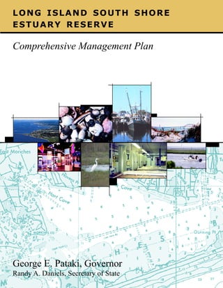
  • 1. LONG ISLAND SOUTH SHORE ESTUARY RESERVE Comprehensive Management Plan George E. Pataki, Governor Randy A. Daniels, Secretary of State Vers F cov CMP 1 8/30/01, 11:45 AM
  • 2. Acknowledgements This comprehensive management plan for the South Shore Estuary Reserve was prepared by the South Shore Estuary Reserve Council with assistance from the New York State Department of State, as provided in Article 46 of the Laws of 1993. George E. Pataki, Governor Randy A. Daniels, New York State Secretary of State South Shore Estuary Reserve Council Members/Designees Randy A. Daniels, Council Chair/George R. Stafford Robert J. Gaffney, Suffolk County Executive/George Proios Thomas S. Gulotta, Nassau County Executive/Dan C. Fucci Edwin L. Eaton, City Manager, City of Long Beach/Joe Fabrizio Richard V. Guardino, Supervisor, Town of Hempstead/ Ronald Masters/Mike Foley John Venditto, Supervisor, Town of Oyster Bay/ James M. Byrne, P.E./Nancy Kearney Richard H. Schaffer, Jr., Supervisor, Town of Babylon/ Richard Groh Peter McGowan, Supervisor, Town of Islip/Alan Svoboda` John Jay LaValle, Supervisor, Town of Brookhaven/ Jeffrey Kassner Vincent Cannuscio, Supervisor, Town of Southampton/ Marty Shea William Glacken, Mayor, Village of Freeport Jeff Fullmer, Chair, Citizens Advisory Committee Cornelia Schlenk, Chair, Technical Advisory Committee Robert Grover, Great South Bay Audubon Society Jill Ozarski, Long Island Chapter of the Nature Conservancy Marvin Geller, Dean, Marine Sciences Research Center, SUNY Stony Brook/William M. Wise Patrick H. Augustine, New York Sportsshing Federation Mitch Pally, Long Island Association/Marion Cohn Robert Wieboldt, Long Island Builders Institute, Inc. Christopher Squeri, New York Marine Trades Association Carole Neidich-Ryder, North Shore Audubon Society Gregory LoVece, Brookhaven Bayman’s Association New York State Department of State Division of Coastal Resources George R. Stafford, Director Rodney McNeil, Project Manager Dennis Mildner (Water Resources) Jeffrey Zappieri (Living Resources) Nancy Rucks (Land Use/Embayment Use/Underwater Lands) Peter Lauridsen (Geographic Information System) Other Contributing Staff: Fred Anders; D. Peter Berical; Paul R. Churchhill; Fitzroy Collins; Susan DiDonato; John Herring; Jeffrey Herter; Charles McCaffrey; Nikifor Nikiforov; Laurissa Parent; Kenneth Smith; Lee York; and Thomas Zyskowski Other Contributors Patrick Dooley (Technical Advisory Committee support) Veronica Kemler (Citizens Advisory Committee support) SUNY Albany: Floyd Henderson and Matthew Kohberger (Geographic Information System and Remote Sensing) Previous Council Members/Designees: Ken Cynar (Nassau County); Felix J. Grucci (former Supervisor of the Town of Brookhaven); Anthony Limoli (Town of Islip); Nick Manzari (Captree Boatman’s Association); George Nussbaum (former Mayor of the Village of Massapequa Park); Bruce Nyman (former City Manager, City of Long Beach); and Adeline Quinn (City of Long Beach) Former Department of State Staff: Robert Crafa; Diane Hamilton-Bell; Susan Dzurica; Thomas Hart; and Joseph Sicluna The South Shore Estuary Reserve Council acknowledges the dedication of former Secretary of State Alexander “Sandy” Treadwell over the last ve years to bring the Plan to fruition. Council Advisors Erin M. Crotty, Commissioner, NYS Department of Environmental Conservation/Gordon Colvin/Karen Chytalo Bernadette Castro, Commissioner, NYS Ofce of Parks, Recreation and Historic Preservation/Gary Lawton Preparation of this plan was nancially aided by: the New York State Environmental Protection Fund; New York State legislative member initiatives; and a grant from the U.S. Department of Commerce, National Oceanic and Atmospheric Administration, Ofce of Ocean and Coastal Resource Management, under the Coastal Zone Management Act of 1972, as amended. Vers F cov CMP 2 8/30/01, 11:45 AM
  • 3.
  • 4.
  • 5. Resolution South Shore Estuary Reserve Council Adoption of the Long Island South Shore Estuary Reserve Comprehensive Management Plan WHEREAS, Article forty-six of the Executive Law declares it to be in the public interest to protect and manage the South Shore Estuary system as a single integrated estuary and in furtherance of that goal created the South Shore Estuary Reserve Council and directed it to prepare a comprehensive management plan and make recommendations to preserve, protect and enhance the natural, recreational, economic and educational resources of the Reserve; and WHEREAS, the South Shore Estuary Reserve Council (“Council”) has undertaken those tasks, in accordance with such law; and WHEREAS, the Council identied the extent of the South Shore Estuary Reserve as Long Island’s south shore bays and the adjacent upland areas draining into them, as described in the Long Island South Shore Estuary Reserve Comprehensive Management Plan; and WHEREAS, the Council, in conjunction with its Citizens Advisory Committee and its Technical Advisory Committee reviewed data and prepared technical reports pertaining to the Reserve; and WHEREAS, the Council prepared a draft South Shore Estuary Reserve Comprehensive Management Plan in accordance with Article forty-six of the Executive Law; and WHEREAS, the Council submitted the draft Comprehensive Management Plan to public scrutiny and comment at public hearings held on the 28th day of February and the 1st day of March, 2001 and accepted written comments until the 28th day of March, 2001; and WHEREAS, the Council has duly considered the oral and written comments submitted and has incorporated the comments and its responses thereto in the Comprehensive Management Plan; and WHEREAS, the Council has determined, after due deliberation, that the Comprehensive Management Plan meets the statutory criteria as well as the spirit of Article forty-six of the Executive Law; NOW, THEREFORE, the South Shore Estuary Reserve Council does hereby ADOPT, the Comprehensive Management Plan for the Long Island South Shore Estuary Reserve, and DIRECT that it be submitted herewith to each town and village within the reserve, the county executives of the counties of Nassau and Suffolk, and to the Governor and the Legislature of the State of New York. DATED: April 12, 2001 f resolution 1 8/30/01, 11:50 AM
  • 6. Randy A. Daniels, New York State Secretary of State, Chair, South Shore Estuary Reserve Council Jeff Fullmer, Chair, Citizens Advisory Committee Cornelia Schlenk, Chair, Technical Advisory Committee Robert J. Gaffney, Suffolk County Executive Robert Grover, Great South Bay Audubon Society Thomas S. Gulotta, Nassau County Executive Jill Ozarski, The Nature Conservancy, Long Island Chapter Edwin L. Eaton, City Manager, City of Long Beach Richard V. Guardino, Supervisor, Town of Hempstead Dr. Marvin Geller, Dean, SUNY, Stony Brook, Marine Sciences Research Center John Venditto, Supervisor, Town of Oyster Bay Patrick H. Augustine, New York Sportshing Federation Richard H. Schaffer, Jr., Supervisor, Town of Babylon Christopher Squeri, New York Maritime Trades Association Peter McGowan, Supervisor, Town of Islip Mitch Pally, Long Island Association John Jay LaValle, Supervisor, Town of Brookhaven Robert Wieboldt, Long Island Builders Institute, Inc. Vincent Cannuscio, Supervisor, Town of Southampton Carole Neidich-Ryder, North Shore Audubon Society William Glacken, Mayor, Village of Freeport Conference of Mayors Gregory LoVece, Brookhaven Bayman’s Association f resolution 2 8/30/01, 11:50 AM
  • 7. EXECUTIVE SUMMARY Long Island South Shore Estuary Reserve Comprehensive Management Plan Under the leadership of Governor George E. Pataki, over 70 state-assisted projects have been completed or are underway to improve the health of the South Shore estuary. Nearly $10 million in Clean Water/Clean Air Bond Act grants and more than $6 million in Environmental Protection Fund grants have been awarded to Reserve communities to acquire open space, restore habitats and manage stormwater runoff. The South Shore Estuary Reserve Comprehensive Management Plan proposes steps to be taken over the next 5 years to continue these improvements. Preface At the urging of Long Islanders concerned with the future health of the South Shore estuary, the New York State Legislature passed the Long Island South Shore Estuary Reserve Act. The Act created the South Shore Estuary Reserve (Reserve) - Long Island’s South Shore bays and the adjacent upland areas draining to them - and called for the Reserve’s protection and prudent management. The Act also created the South Shore Estuary Reserve Council (Council), a group of representatives from South Shore towns and villages, Nassau and Suffolk counties and the City of Long Beach, and recreation, business, academic, environmental and citizens interests. The Act charged the Council with preparation of a comprehensive management plan for the Reserve. Access the document on the Web at http://www.estuary.cog.ny.us Vers F2 ex summ 1 Development of this comprehensive management plan has followed a process in which many individuals have had opportunities to participate. In 1994, the Council held a series of scoping meetings during which public views and concerns about the estuary and its management were received. Monthly meetings, open to the public, have allowed interested parties to learn about and participate in Council activities and those of its Technical Advisory Committee, Citizens Advisory Committee, and topic-based subcommittees and workgroups. To assist the Council, the New York State Department of State’s Division of Coastal Resources, working through partnerships with local governments and federal agencies, gathered and analyzed information on land and embayment uses, the estuarine economy, water quality, living resources, and other aspects of the Reserve. Much of this information was analyzed by the Department of State through geographic information system technology, and the analyses have served as a basis for the implementation actions offered in the plan. Important data were also supplied by the six towns and two counties in the Reserve as part of assessments of their nonpoint source management practices conducted in conjunction with the Department. All of this information is presented in the series of technical reports and working papers referenced in Appendix A to the plan. Executive Summary 8/30/01, 11:42 AM Page i
  • 8. Implementation actions identied in Chapter 7 address major issues in the Reserve as they relate to water quality and living resources, public access and open space, the Reserve’s maritime heritage, its economy, and education and outreach. Although much has been accomplished since 1995 by the State and its local government partners through the many Clean Water Clean Air Bond Act and Environmental Protection Fund projects, and by the Council’s Technical and Citizens Advisory committees, much remains to be done to assure the long-term health of the Reserve. [Note to reader: An electronic version of the South Shore Estuary Reservecomprehensive management plan, with links to the technical report series and associated data sets and maps, can be accessed at: www.estuary.cog.ny.us.] Chapter 1: The Region Estuaries are coastal areas where fresh water mixes with salt water. Long Island’s South Shore estuary was formed during the last 5,000 years by the interaction of rising seas with the glacially deposited material that makes up Long Island. The interaction shaped the barrier islands to enclose 173 square miles Executive Summary Vers F2 ex summ of bays characterized by tidal marshes, mud and sand ats, beds of underwater vegetation and extensive shallows ranging from 1 to 7 meters deep. The shallows support microscopic plants and animals which, in turn, support the nsh, shellsh, waterfowl and other wildlife that typify the South Shore estuary. This barrier/ bays system continues to respond to wave action, the tides, coastal storms and a rising sea level. It is also affected by human actions. The South Shore Estuary Reserve is home to about 1.5 million people. The anchor of the region’s tourism, seafood and recreation industries, the Reserve stretches from the western boundary of the Town of Hempstead to the middle of the Town of Southampton. South to north, the Reserve extends from the mean high tide line on the ocean side of the barrier islands to the inland limits of the mainland watersheds that drain into Hempstead Bay, South Oyster Bay, Great South Bay, Moriches Bay and Shinnecock Bay. For purposes of planning and description, the South Shore Estuary Reserve is conveniently viewed as three subregions: the western bays, Great South Bay and the eastern bays. The western bays subregion extends from the western boundary of the Town of Hempstead to Access the document on the Web at http://www.estuary.cog.ny.us Page ii 2-3 8/30/01, 11:42 AM
  • 9. the Nassau-Suffolk County line, and includes Hempstead Bay and South Oyster Bay and all the lands that drain into them. These embayments are an extensive area of shallow water and salt marsh islands connected by channels and tidal creeks. Its watershed is the most densely populated in the Reserve, with stormwater runoff from its developed landscape the most signicant source of pollution reaching the subregion’s tributaries and bays. Coliform bacteria, responsible for the closure of 14,155 acres of shellsh beds in the western bays and the periodic bathing closures of Zachs Bay and Biltmore Beach, is the principal pollutant carried by the runoff, but human waste discharges from vessels, excrement from waterfowl, and discharges from municipal wastewater treatment plant outfalls in the western bays are also contributing sources. This portion of the Reserve also contains the greatest concentration of salt marsh islands, most of which have been ditched through mosquito control programs. Great South Bay is the largest shallow estuarine bay in New York State, with extensive back barrier and tidal creek salt marshes, eelgrass beds, and intertidal ats. Most marshes in the subregion are ditched, with many mainland marshes impaired by ll and bulkheads or restrictions to tidal ow. The watershed of Great South Bay can be described as “developing,” in contrast to the more fully “developed” western bays region, and development is generally less intense and open areas more extensive. Like the western bays subregion, Great South Bay has extensive impervious surfaces in its watershed. For this reason, nonpoint source pollution from stormwater runoff is the primary issue. Nutrients, sediment and coliform bacteria are the principal pollutants carried by stormwater runoff into the subregion’s tributaries and ultimately Great South Bay. Vessel waste discharges and waterfowl are also contributors to the bacterial load. Elevated levels of coliform are responsible for the closure of 10,711 acres of shellsh beds in Great South Bay and the periodic Access the document on the Web at http://www.estuary.cog.ny.us Vers F2 ex summ 2-3 closure of three of its bathing beaches. Nutrients and sediments in stormwater runoff threaten shing, sh propagation and sh survival in the subregion’s tributaries and coves. Hydromodications - alterations of water level and stream ow - and lowering of groundwater levels also have signicant effects on shery resources in tributaries. The shallow eastern bays - Moriches and Shinnecock - are distinguished by the presence of inlets, strong tidal exchanges between the ocean and the bays, and minor inows of lower salinity water from the Peconics through the Shinnecock Canal. Salt marshes and dredged material islands of the eastern bays support signicant nesting colonies of terns, gulls, and wading birds. Shallow water areas are highly productive, especially the salt marshes and intertidal ats that fringe the barrier islands and the estuarine habitats around the tributary mouths. Although the watershed of Moriches and Shinnecock bays is the least developed in the Reserve, elevated levels of fecal coliform bacteria from polluted stormwater runoff have closed 6,075 acres of shellsh beds in the bays. Sediment and excessive nutrients in stormwater runoff have affected sh survival in tributaries, and organic nutrients play a role in the brown tide outbreaks in the subregion. Agriculture occurs in this subregion to some degree, with potential impacts on water quality from sediments, fertilizers and pesticides. Chapter 2: Improve and Maintain Water Quality Water quality in the South Shore Estuary Reserve is important to everyone on Long Island. Poor water quality diminishes recreational and economic opportunities. Nonpoint source pollution is the primary water quality concern in the South Shore Estuary Reserve. Polluted stormwater runoff alone is the Executive Summary 8/30/01, 11:42 AM Page iii
  • 10. principal source of nonpoint pollution in 48 of the 51 waterbody segments in the Reserve with use impairments. Elevated levels of coliform bacteria in stormwater runoff, an indicator of the potential presence of pathogens, are responsible for the closures of shellsh beds and bathing beaches. Sediment and excessive nutrients in stormwater runoff have pronounced negative effects on the Reserve’s living resources. Point sources of pollution - municipal wastewater treatment plants, inactive hazardous waste sites and active and inactive solid waste disposal facilities - are not as widespread and are comparatively less signicant sources of pollution than nonpoint sources, but still cause water quality degradation in their immediate areas. Point sources are regulated and monitored through the State Pollution Discharge Elimination System (SPDES) permit program. Improving water quality in the Reserve is dependent on federal, State and local governments, and private sector partners, implementing a strategy that: 1) identies opportunities and develops schedules to protect lands that provide signicant pollutant abatement functions; 2) designs and undertakes projects that retrot existing storm sewer and other conveyance systems to remove pollutants from storm water; 3) adopts nonpoint source pollution best management practices; and 4) increases education and outreach to modify resident and user behavior. This chapter identies recommendations to reduce and control nonpoint source pollution; enhance point source controls; implement the Environmental Protection Agency’s Storm Water Phase II Final Rule; and address scientic information needs. Chapter 3: Protect and Restore Living Resources of the Reserve The South Shore estuary is a rich and complex ecosystem. Its beaches, shallow bays, tidal marshes, tributaries and upland areas make the Reserve one of the most ecologically productive regions in the United States. In addition to providing the basic necessities for estuarine life, the estuary, its shoreline and upland areas provide open space, contribute to the scenic beauty of the region and support its tourism, recreation and seafood industries. Human population growth and burgeoning development in the Reserve, especially since World War II, had and continues to have a dramatic effect on the estuary. Most habitat loss in the Reserve has been the result of the lling of low-lying lands in the western portion of the Reserve for residential and commercial uses. Other development activities, including construction of canals, roads and bridges, have also destroyed or degraded habitats. According to the NYS Department of Environmental Conservation 1996 Priority Waterbody List, stormwater polluted by elevated levels of fecal coliform bacteria, excessive nutrients and sediment has affected the viability of sh populations in the Reserve’s tributaries and has closed almost 31,000 acres of hard clam beds in its bays. Regulations have slowed the loss of tidal and freshwater wetlands in the Reserve, but the remaining wetlands present both challenges and opportunities for management and restoration. The Reserve’s open bays have also undergone notable changes, inuenced chiey by inlet dynamics, while its upland forests seem to be experiencing a loss comparable to that of the region’s tidal wetlands. Recommendations are offered to incorporate an ecosystem perspective into the management of the Reserve’s living estuarine resources; to increase wetland community values; to Executive Summary Vers F2 ex summ Access the document on the Web at http://www.estuary.cog.ny.us Page iv 4-5 8/30/01, 11:42 AM
  • 11. recognize, restore and protect tributary-based resource values; to protect and improve habitat conditions for estuarine bird species; to improve the productivity of important living resources; and to address scientic information needs. Chapter 4: Expand Public Use and Enjoyment of the Estuary The public’s ability to use and enjoy the natural resources of the South Shore estuary depends upon access to its tributaries, bays and shoreline. The supply of formal, dedicated shoreline public access sites and recreational facilities is nite, and opportunities to increase the supply will become fewer as private shoreline development continues. The more intensive and widespread such development becomes, the more valuable is the remaining open space. While generally important for retaining variety and visual interest in the pattern of development, open space is critical to the health of the estuary and its coastal habitats and the coastal character of Long Island’s South Shore. All levels of government must work together in cooperation with private development interests to preserve open space in the Reserve, buffer sensitive habitats, improve water quality and retain the visual landscape of the estuary. Commercial shing, island bay houses, recreational boating, yacht clubs, boat repair shops, ferries and shoreline parks are all part of the region’s maritime heritage and dene its present-day culture. These traditional estuaryrelated uses are gradually being displaced by more economically competitive non-traditional uses. Concerted public and private efforts will be needed to perpetuate the region’s historical legacy. Recommendations are offered to improve shoreline public access and estuary-related recreation; to retain open space within the Reserve; and to protect, maintain and enhance the Reserve’s maritime heritage. Access the document on the Web at http://www.estuary.cog.ny.us Vers F2 ex summ 4-5 Chapter 5: Sustain and Expand Estuary-related Economy The relatively calm, protected waters and abundant natural resources of the South Shore estuary provide the basis for the water-related economic activities that have evolved from the harvesting of oysters, hard clams and salt hay, and boat building, to recreational boating, sport shing, waterborne transportation and tourism. Changes in the nature of these water-dependent businesses reect the inuence of a growing population and market demand, transportation improvements and increased recreational demands. Today, the estuary is home to the largest concentrations of commercial and recreational vessels, marinas and other waterdependent businesses in the State. The estuary supports, in whole or in part, about 3,000 waterdependent and water-enhanced businesses that employ nearly 30,000 people. The amount of estuary shoreline suitable for establishing new water-dependent uses or expanding existing ones is limited, while, at the same time, some existing water-dependent businesses are gradually being displaced by more economically-competitive non waterdependent uses. This is of particular concern in maritime centers where water-dependent uses are concentrated and embody much of the estuary-related cultural heritage that supports local tourism. Recommendations are offered to support water-dependent businesses and to enhance maritime centers. Chapter 6: Increase Education, Outreach and Stewardship Academic institutions can be highly effective conduits of information on the South Shore estuary. Of the 124 public school districts on Long Island responsible for primary and secondary level education, nearly half (60) are located in whole or part within the Reserve Executive Summary 8/30/01, 11:42 AM Page v
  • 12. and serve a major portion of the approximately 423,000 school age children on Long Island. Teachers have many sources of information at their disposal, and a number of nature centers and museums in the Reserve offer eld programs for school groups. Yet elementary, middle and high school teachers face various constraints in trying to raise student consciousness about the environment outside their classrooms. People in the Reserve learn about their environment from a variety of sources: newspapers, magazines, television and radio, as well as from numerous public and private organizations, many of which are represented on the South Shore Estuary Reserve Council. Many organizations on Long Island are moving beyond education and outreach activities and are striving to motivate individuals to become active stewards of their environment. At the community level, local governments and neighborhood, civic and environmental groups are bringing citizens together in collective efforts to improve the environment. the Reserve. The actions target effort where the greatest potential exists for halting further degradation of the Reserve’s natural resources and realizing improvements to them, and where multiple goals and objectives of the Council can be achieved. The actions focus attention where problems have been clearly identied and where the existence of motivated partners assures a higher likelihood of success. They are organized and presented according to outcomes they will fulll. In order to make signicant progress toward achieving these outcomes, funding will be necessary from a variety of governmental and non-governmental sources to meet the estimated $97.8 million ve year cost of implementing the actions called for in Chapter 7. Outcome 1: Reduced nonpoint source pollution. 1-1 Construction of stormwater abatement projects in signicant nonpoint source contributing areas This chapter identies recommendations to strengthen the mechanisms for raising awareness and understanding of the South Shore estuary; to nurture awareness and understanding on the part of young people through formal education activities that focus on the South Shore estuary; to increase public awareness and understanding through outreach activities geared to general and specic audiences; and to encourage people of all ages to become stewards of the estuary. associated with closed shellsh beds, impaired living Chapter 7: Implementation 1-5 Completion of assessments of municipal nonpoint Building on what has already been accomplished since 1995 by the State, local governments and the Reserve’s Council, the implementation actions presented in this chapter provide the necessary road map to fullling the recommendations offered in the preceding chapters and assuring the long-term health of 1-6 Development of watershed action plans. Executive Summary Vers F2 ex summ resources, and bathing beaches that experience periodic closures due to water quality concerns. 1-2 Amendment of county and local government codes and regulations to include best management practices. 1-3 Implementation of on-site wastewater treatment (septic) system maintenance and upgrades. 1-4 Implementation of Agricultural Environmental Management. pollution management practices. 1-7 Preparation for compliance with the Environmental Protection Agency’s Stormwater Phase II Final Rule. 1-8 Exploring the feasibility of stormwater management districts. Access the document on the Web at http://www.estuary.cog.ny.us Page vi 6-7 8/30/01, 11:42 AM
  • 13. Outcome 2: Reduced point source pollution. 4-9 Management of upland ponds. 2-1 Assessment of inactive hazardous waste sites. 4-10 Augmentation of streamow. 2-2 Assessment of abandoned and closed landlls. Outcome 5: Open space preserved to sustain community character and protect water quality and habitat. 2-3 Exploring regulation of private petroleum tanks less than 1,100 gallons. 2-4 Evaluation of need for wastewater treatment plant upgrades and outfall relocations. 2-5 Expansion of Village of Patchogue Sewer District. Outcome 3: Increased harvest levels of hard clams and other estuarine shellsh species. 3-1 Population assessment and seeding of hard clams and other shellsh species. 3-2 Feasibility of Islip hatchery expansion. 3-3 Increasing grow-out of shellsh. 3-4 Enhancement of hard clam habitat through shell 5-1 Development of a Reserve open space acquisition and protection action strategy. 5-2 Analysis of small parcel open space opportunities. 5-3 Use of a land trust to assist local acquisition efforts. 5-4 Implementation of local open space plans. 5-5 Acquisition of open space. Outcome 6: Improved knowledge for ecosystem management. augmentation. 6-1 Monitoring water quality. 3-5 Evaluation of potential spawner sanctuaries. 6-2 Land use build-out analysis. 3-6 Creation of a Reserve shellsh management 6-3 Determination of additional point and nonpoint forum. source pollution controls. Outcome 4: Coastal habitats protected and restored to support shellsh, nsh and coastal bird populations. 4-1 Restoration of tidal wetlands. 4-2 Coordination of wetland restoration efforts. 4-3 Restoration of anadromous sh. 4-4 Habitat restoration in tributaries. 4-5 Evaluation and restoration of eelgrass beds. 6-4 Determination of sediment composition in Reserve tributaries and bays. 6-5 Monitoring landll performance and compliance. 6-6 Analysis of existing information on leaks and spills. 6-7 Development of a Reserve-wide hydrologic model. 6-8 Monitoring the ecosystem. 6-9 Study of hard clam biology. 6-10 Assessment of additional tidal wetland sites for 4-6 Vegetation management for coastal birds. restoration. 4-7 Recognition of shorebird reserves. 6-11 Completion of baseline inventory of eelgrass 4-8 Increased protection of marine turtle populations. Access the document on the Web at http://www.estuary.cog.ny.us Vers F2 ex summ 6-7 distribution. Executive Summary 8/30/01, 11:42 AM Page vii
  • 14. 6-12 Undertaking research on ooding and erosion. 6-13 Expansion of brown tide research. 6-14 Analyzing duck sludge deposits as potential pollutant sources. Outcome 10: Heightened public awareness of the estuary. 10-1 Supporting a Reserve web site. 10-2 Updating education resource directory. Outcome 7: Increased public use of the estuary and expanded tourism. 7-1 Expanding public access and recreation facilities at existing sites. 7-2 Creating new public access and recreation opportunities. 7-3 Expansion of existing interpretive centers and 10-3 Creation of an access guide. 10-4 Production of South Shore video. 10-5 Working with outreach partners. 10-6 Identication of professional development opportunities for teachers. 10-7 Supporting the existing network of entities that conduct education programs on board watercraft. development of new ones. 10-8 Identication of potential mentors. 7-4 Establishing a South Shore Estuary Reserve 10-9 Establishment of a clearinghouse for student Coastal Heritage Trail. Outcome 8: Water-dependent businesses sustained. research. 10-10 Establishing an awards program. 10-11 Designation of bird conservation areas. 8-1 Provision of adequate infrastructure to support 10-12 Undertaking a native landscaping pilot existing and new water-dependent uses. program. 8-2 Development of a dredging and dredged materials 10-13 Creation of a homeowner certication program. management plan. 8-4 Planning for local waterfront development. Outcome 11: Actions advanced through Council partnerships and ofce. 8-5 Improving local waterfront regulation. 11-1 Promotion and oversight of plan implementation. 8-6 Facilitating public/private partnerships to support 11-2 Establishment and operation of Reserve ofce. 8-3 Dredging for safe navigation. water-dependent business. 8-7 Preparation of Local Harbor Management Plans. Outcome 9: Maritime centers thrive. 9-1 Preparation of maritime center action plans. 9-2 Implementation of maritime center action plans. 9-3 Promotion of maritime centers. Executive Summary Vers F2 ex summ Page viii 8 Access the document on the Web at http://www.estuary.cog.ny.us 8/30/01, 11:42 AM
  • 15. Table of Contents Page Executive Summary i-viii Preface ix Chapter 1 The Region 1-8 Chapter 2 Improve and Maintain Water Quality Chapter 3 Protect and Restore Living Resources of the Reserve 25-38 Chapter 4 Expand Public Use and Enjoyment of the Estuary 39-48 Chapter 5 Sustain and Expand the Estuary-related Economy 49-56 Chapter 6 Increase Education, Outreach and Stewardship 57-70 Chapter 7 Implementation 9-24 71-108 • Integrative Analysis and Implementation Map Series Appendix A Appendix B State-assisted Projects to Benet the Estuary Appendix C F TOC Abstracts of Technical Reports Response to Public Comments 1 109 A1-A12 B1-B6 C1-C20 8/30/01, 11:51 AM
  • 17. Preface The New York State Legislature passed the Long Island South Shore Estuary Reserve Act in 1993 at the urging of Long Islanders concerned about the future health of the South Shore estuary. The Act declared the estuary to be a resource of unparalleled biological, economic and social value, created the South Shore Estuary Reserve (Reserve) and called for its protection and prudent management. The Act also created the South Shore Estuary Reserve Council (Council), designated the New York Secretary of State as its Chair, and provided for membership representing six South Shore towns, thirty-one villages, Nassau and Suffolk counties, the City of Long Beach, and recreation, business, academic, environmental and citizen interests. The Act also charged the Council with the preparation of a comprehensive management plan for the Reserve. Development of the plan has followed a process in which many individuals have had opportunities to participate. In 1994, the Council held a series of scoping meetings during which public views and concerns about the estuary and its management were received. Monthly meetings, open to the public, have allowed interested parties to learn about and participate in Council activities and those of its Technical Advisory Committee, Citizens Advisory Committee, and topic-based subcommittees and workgroups. To assist the Council, the Department of State Division of Coastal Resources gathered information primarily through partnerships with local governments and federal agencies. The information addressed land and embayment uses, the estuarine economy, water quality, living resources, and other aspects of the Reserve. Much of this information was analyzed by the Department of State through geographic information system technology, and this analysis served as a basis for the implementation actions offered in the plan. All of this information is presented in the series of technical reports and working papers referenced in Appedix A to the plan. The Council is pursuing multiple purposes in issuing this plan: • • • • to recommend management actions for protecting and improving the health of the South Shore estuary, and to expand such efforts; to sustain cooperation and commitment among all public and private interests with a stake in the estuary; to build public awareness and understanding about the estuary and the issues that affect its health and vitality, and to involve the public in its management; and to identify future research in areas where further scientic information is needed to improve management actions. [Note to reader: An electronic version of the South Shore Estuary Reserve comprehensive management plan, with links to the technical report series and associated data sets and maps, can be accessed at: www.estuary.cog.ny.us.] Preface Access the document on the Web at http://www.estuary.cog.ny.us Vers F preface 9 8/30/01, 11:48 AM Page ix
  • 18. Access the document on the Web at http://www.estuary.cog.ny.us Vers F preface 10 8/30/01, 11:48 AM
  • 19. CHAPTER 1 The Region Vers f intr-1 1 8/30/01, 11:10 AM
  • 20. CHAPTER 1 The Region This chapter provides a brief overview of the South Shore Estuary Reserve, characterizes the ve estuarine bays and the lands that drain to them, and introduces the many resource management concerns that relate to the different parts of the Reserve. Estuaries are transition zones between the world’s freshwater and marine ecosystems where fresh water mixes with salt water. Long Island’s South Shore estuary is a dynamic ecosystem, formed during the past 5,000 years by the interaction of a rising sea level with the glacially-deposited material that makes up Long Island. The entire natural system, including the barrier islands and the 173 square miles of shallow bays behind them, is still changing and evolving in response to wave action, tides, coastal storms, and the continuing rise of sea level. In this estuarine environment, tidal marshes, mud and sand ats, underwater plant beds and broad shallows support microscopic plants and animals which, in turn, support the nsh, shellsh, waterfowl and other wildlife that typify the South Shore estuary. Chapter 1 Vers f intr-1 Overview of the South Shore Estuary Reserve The South Shore Estuary Reserve is home to about 1.5 million people. The anchor of the region’s tourism, seafood and recreation industries, the Reserve stretches from the western boundary of the Town of Hempstead to the middle of the Town of Southampton. South to north, the Reserve extends from the mean high tide line on the ocean side of the barrier islands to the inland limits of the mainland watersheds that drain into Hempstead Bay, South Oyster Bay, Great South Bay, Moriches Bay and Shinnecock Bay. Human population growth and burgeoning development in the Reserve, especially since World War II, had and continues to have a dramatic effect on the estuary. Most habitat The South Shore Estuary Reserve is the anchor of the region’s tourism, seafood and recreation industries, and is home to about 1.5 million people. Access the document on the Web at http://www.estuary.cog.ny.us Page 2 2-3 8/30/01, 11:10 AM
  • 21. loss in the Reserve has been the result of the lling of low-lying lands in the western portion of the Reserve for residential and commercial uses. Other development activities, including construction of canals, roads and bridges, have also destroyed or degraded habitats. According to the NYS Department of Environmental Conservation’s 1996 Priority Waterbody List, stormwater polluted by elevated levels of fecal coliform bacteria, excessive nutrients and sediment has effected the viability of sh populations in the Reserve’s tributaries and has closed over 34,000 acres of hard clam beds in its bays. For purposes of planning and description, the South Shore Estuary Reserve is conveniently viewed as three subregions: the western bays, Great South Bay and the eastern bays. Western Bays The western bays subregion extends from the western boundary of the Town of Hempstead to the Nassau-Suffolk County line, and includes Hempstead Bay and South Oyster Bay and all the lands that drain into them. These embayments are an extensive area of shallow water and salt marsh islands connected by channels and tidal Freeport shoreline in the Western Bays creeks. This portion of the Reserve contains the greatest concentration of salt marsh islands, most of which have been ditched through mosquito control programs. These islands are frequently subject to erosion due to the relatively high tidal range and proximity to heavy commercial and recreational boat trafc. Dredged material islands, over both wetland and shallow water habitats, are also prominent in the subregion. Almost all of the mainland shoreline in this subregion is bulkheaded, with the most intense development along the shoreline in the western part of the subregion. Much of the original development occurred in the 1950s and 60s as thousands of acres of tidal wetlands were lled to create new home sites. Virtually all mainland tidal wetlands were eliminated in this manner. The western bays also support a variety of benthic macroalgae (seaweeds) and submerged aquatic vegetation (seagrasses), the most important of which is eelgrass. As a result of disease and water quality problems, signicant losses of submerged aquatic vegetation beds have also occurred in parts of these bays. Habitat loss and water quality problems have also had a negative impact on most of the estuarine species in the western bays. Recreational nsh species have declined, as have shellsh populations, which are also impaired by low rates of recruitment. The subregion’s signicant concentrations of shorebirds, wintering waterfowl and colonial nesting water birds also have been reduced. Most waterbird colonies in the Reserve occur on the islands of the western bays from Hempstead east to Captree. South Oyster Bay and Hempstead Bay are also an important part of the Atlantic Flyway for migrating and wintering waterfowl, particularly brant, with an average of nearly 25,000 water- Chapter 1 Access the document on the Web at http://www.estuary.cog.ny.us Vers f intr-1 2-3 8/30/01, 11:10 AM Page 3
  • 22. fowl counted on mid-winter aerial surveys. The importance of the western bays for migrating, wintering and resident coastal birds also needs to be recognized. The watershed of the western bays is the most densely populated in the Reserve. It exhibits the highest proportion of watershed rendered impervious by roads, parking lots and roofs. Land use south of Sunrise Highway and Merrick Road is highly urbanized and predominantly residential. Intersections along major highways are developed with high density residential, industrial, and/or transportation and utility uses. Land use close to the bays includes parks, nature preserves and protected areas for local and regional recreational purposes. However, residential development along canals, tributaries and the shoreline is increasing the pressure on these natural areas. Stormwater runoff from this developed landscape is the most signicant source of pollution reaching the subregion’s tributaries and bays. Elevated levels of coliform bacteria, responsible for the closure of 15,575 acres of shellsh beds in the western bays and the periodic bathing closures of Zachs Bay and Biltmore Beach, is the principal pollutant carried by the runoff, but human waste discharges from vessels, excrement from waterfowl, and discharges from municipal wastewater treatment plant outfalls in the western bays are also contributing sources. Nutrients from these same point and nonpoint sources promote the subregion’s extensive mats of seaweeds that are in part responsible for the loss of valuable seagrass beds, while nutrients and sediments in stormwater runoff are held responsible for threatening sh survival and propagation in several of the subregion’s tributary streams. Petroleum products are also documented pollutants. Thus water quality in the western bays is affected by both nonpoint and point sources of pollution. Chapter 1 Vers f intr-1 For this subregion, comprehensive efforts are needed to achieve signicant improvements in water quality and living resources. Such efforts must include: the restoration of ditched and lled salt marshes; vegetation management in shorebird and waterbird nesting areas; restoration of eelgrass beds; protection and restoration of inland ponds; augmentation of water level and ow in streams; improved boating management; seed clam planting; and educational outreach. Also needed are implementation of management practices as source controls to prevent nonpoint source pollutants from reaching stormwater runoff or from owing directly into tributaries and bays, and management of polluted stormwater runoff before it reaches those tributaries and bays. Management of polluted stormwater runoff in areas where the most signicant reductions can be gained will correct this major source of nonpoint pollution. One aspect of this effort will be local implementation of stormwater remediation projects with State technical and nancial assistance. Such projects will be implemented at roadway crossings of tributaries, at street ends draining to waterbodies, and in parking lots throughout contributing areas. Improvements to municipal stormwater drainage systems that reduce the volume and ow of stormwater runoff to the western bays will be an important element of stormwater management. Great South Bay Great South Bay is the largest shallow estuarine bay in New York State, with extensive back barrier and tidal creek salt marshes, eelgrass beds, and intertidal ats. Most marshes in the subregion are ditched, with many mainland marshes impaired by ll and bulkheads or restrictions to tidal ow. As the only South Shore bay with major riverine input, Great South Bay’s living resources have been signicantly affected by diminished tributary water quality. Access the document on the Web at http://www.estuary.cog.ny.us Page 4 4-5 8/30/01, 11:10 AM
  • 23. The loss of tidal marshes and other coastal habitats has reduced estuarine productivity and eliminated critical feeding and nursery habitat for nsh, shellsh, shorebirds and colonial waterbirds. Additionally, in the past 25 years, the hard clam harvest in Great South Bay has fallen by more than 93% to record lows. The watershed of Great South Bay can be described as “developing,” in contrast to the more fully “developed” western bays region, and development is generally less intense and open areas more extensive. The primary land use pattern is medium density development with pockets of more intense residential use on ngers of land separated by canals and waterways. Along the shoreline are substantial areas of green space dedicated as parklands and preserves. The intensity of development lessens from west to east within the subregion. Its population has grown over the last decade and is projected to continue to do so over the next twenty years, but at a gradually decreasing rate. Like the western bays subregion, Great South Bay has extensive impervious surfaces in its watershed. For this reason, polluted stormwater runoff is the primary issue. Nutrients, sediment and coliform bacteria are the principal pollutants carried by stormwater runoff into the subregion’s tributaries and ultimately Great South Bay. Vessel waste discharges and waterfowl are also contributors to the bacterial load. Elevated levels of coliform are responsible for the year-round closure of 12,886 acres of shellsh beds in Great South Bay and the periodic closure of three of its bathing beaches. Nutrients and sediments in stormwater runoff threaten shing, sh propagation and sh survival in the subregion’s tributaries and coves. Hydromodications - alterations of water level and stream ow - and lowering of groundwater levels also have signicant effects on shery resources in tributaries. For this subregion, efforts to improve water quality are proposed to focus on the management of nonpoint source pollution, especially polluted stormwater runoff. These efforts would include implementation of the management practices recommended in Chapter 2 to prevent nonpoint source pollutants from reaching stormwater runoff or from owing directly to tributaries and the bay. Management of polluted stormwater runoff in areas where the most signicant reductions can be gained would begin to correct this major source of nonpoint pollution. One aspect of this effort would be local implementation of stormwater remediation projects with State technical and nancial assistance. Such projects would be implemented at roadway crossings of tributaries, at street ends draining to waterbodies, and in parking lots throughout contributing areas. Parcel acquisition for stormwater management projects, construction of stormwater wetlands, and continued improvements to municipal stormwater drainage systems that reduce the volume and ow of stormwater runoff to Great South Bay will also be important elements of stormwater management. Great South Bay at the Robert Moses Causeway Chapter 1 Access the document on the Web at http://www.estuary.cog.ny.us Vers f intr-1 4-5 8/30/01, 11:10 AM Page 5
  • 24. Projects to restore the living resources of Great South Bay are proposed to focus on: the restoration of ditched, lled back barrier and cove salt marshes, and riverine wetlands; vegetation management in shorebird and colonial waterbird nesting areas; protection of submerged aquatic vegetation beds; augmentation of water level and ow in streams; improved boating and boat maintenance practices; and evaluation of shell augmentation of bay bottoms and seed clam planting. Eastern Bays The shallow eastern bays - Moriches and Shinnecock - are distinguished by the presence of inlets, strong tidal exchanges between the ocean and the bays, and minor inows of lower salinity water from the Great Peconic Bay through the Shinnecock Canal. Salt marshes and dredged material islands of the eastern bays support signicant nesting colonies of terns, gulls, and wading birds. Shallow water areas are highly productive, especially the salt marshes and intertidal ats that fringe the barrier islands and the estuarine habitats around the tributary mouths. The deeper water habitats are composed of sandy shoals and submerged aquatic vegetation beds. The major land use in the subregion is medium to low density residential, with the greatest concentration of residences along the shoreline and waterways. The area is interspersed with parks, agricultural lands, conservation areas and small clusters of service-oriented commercial establishments, all contributing the rural aspect of the subregion. Population projections indicate that this area will have the largest sustained rate of growth of all the Reserve within the next decade, although the total population and population density are expected to remain the lowest within the Reserve. Although the watersheds of Moriches and Shinnecock bays are the least developed in the Reserve, elevated levels of fecal coliform bacteria from stormwater runoff, waterfowl and vessel discharges of human waste have closed 6,170 acres of shellsh beds in the bays. Nutrients and sediment in stormwater runoff have affected sh survival in tributaries, and nutrients are suspected of playing a role in the brown tide outbreaks in the subregion. Agriculture occurs in this subregion to some degree, with potential impacts on water quality from sediments, fertilizers and pesticides. The Agricultural Environmental Management initiative, headed by the Department of Agriculture and Markets, is aimed at minimizing potential pollution from agricultural operations of all types and would help control nonpoint pollution from this source. The Town of Southampton is exemplary in its efforts to protect and restore the water and living resources of this subregion, but additional work remains. This includes: the restoration of back barrier and mainland fringe salt marshes, especially those formerly connected wetlands Shinnecock Bay at the Ponquogue Bridge Chapter 1 Vers f intr-1 Access the document on the Web at http://www.estuary.cog.ny.us Page 6 6-7 8/30/01, 11:10 AM
  • 25. where tidal exchange has been halted, and submerged aquatic vegetation beds; the restoration of dredge material islands used for shorebird and colonial waterbird nesting; and the preservation of upland and riparian corridors as protective buffers. The proposed implementation of management practices will reduce nonpoint source pollution. Management of polluted stormwater runoff in areas where the most signicant reductions can be gained is also an important part of achieving high water quality, and would include local implementation of stormwater remediation projects. Such projects would be constructed at roadway crossing of tributaries, at street ends draining to waterbodies, and in parking lots throughout contributing areas. Parcel acquisition for stormwater management projects, construction of stormwater wetlands, and continued improvements to municipal stormwater drainage systems that reduce the volume and ow of stormwater runoff to the eastern bays will also be important elements of stormwater management. Chapter 1 Access the document on the Web at http://www.estuary.cog.ny.us Vers f intr-1 6-7 8/30/01, 11:10 AM Page 7
  • 26. Access the document on the Web at http://www.estuary.cog.ny.us Vers f intr-1 8 8/30/01, 11:10 AM
  • 27. CHAPTER 2 Improve and Maintain Water Quality Vers f Chap2 9 8/30/01, 11:11 AM
  • 28. CHAPTER 2 Improve and Maintain Water Quality Overview of the Issues Nonpoint source pollution presently degrades the quality of ground and surface waters in the South Shore Estuary Reserve. Nonpoint source pollution generally results from stormwater runoff, precipitation, atmospheric deposition, drainage, seepage and modications to waterways. In the Reserve it poses potential hazards to human health, causes the periodic closure of bathing beaches, and has forced the closure of approximately 34,643 acres of hard clam beds in the Reserve, about one-third of its total area [Technical report: Nonpoint Sources of Pollution (1998)]. The dominant effect of nonpoint source pollution on water quality in the Reserve is well documented. The NYS Department of Environmental Conservation has identied polluted stormwater runoff from urban areas -from new and existing development and from roads, highways, and bridges -- as the primary pollutant responsible in nearly all of the ftyone South Shore Estuary Reserve waterbody segments listed with impaired uses in its 1996 Priority Waterbody List (see map at end of this chapter). Furthermore, when the Department updated its 1991 Priority Waterbody List in 1996, only one waterbody segment in the Reserve had improved in water quality while two were added to the list and seven others had their use impairments worsen [Technical reports: Nonpoint Sources of Pollution (1998); Status and Trends (1999)]. Chapter 2 Vers f Chap2 Nonpoint source pollution poses potential hazards to human health, causes the periodic closures of bathing beaches, and has forced the closure of approximately 34,643 acres of hard clam beds in the Reserve. At least ve reports, the rst dating from 1978 -- the 208 Areawide Waste Treatment Study, Long Island Segment of the Nationwide Urban Runoff Program, Nonpoint Source Handbook, Nonpoint Water Quality Strategy for Nassau County, and Suffolk County Water Quality Strategy - - concluded that nonpoint source pollution was a priority concern and that, in particular, polluted stormwater runoff was the primary source. Each of these reports sets forth recommendations to control nonpoint source pollution. These recommendations, however, were never fully implemented. Point sources of pollution - typically discrete and discernible pipe outfalls - also exist within the Reserve, and are regulated and monitored through the State Pollution Discharge Elimination System (SPDES) permit program. Point sources of pollution, while not as widespread and comparatively less signicant than nonpoint sources, can still cause water quality degradation in their immediate areas. Access the document on the Web at http://www.estuary.cog.ny.us Page 10 10-11 8/30/01, 11:11 AM
  • 29. Such point sources include ve wastewater treatment plants (Bay Park, Long Beach, West Long Beach, Lawrence, Jones Beach) that discharge treated efuent into the western bays; the Ocean Beach plant, discharging into Great South Bay; and the Village of Patchogue plant that discharges into the Patchogue River. Point sources also include other discharges regulated by SPDES and inactive hazardo us and inactive and active solid waste disposal sites [Technical report: SSER State Pollution Discharge Elimination System (SPDES) Permit Sites (1999)]. bacteria are responsible for the closure of shellsh beds and bathing beaches due to potential threats to human health [Technical report: Nonpoint Sources of Pollution (1998)]. Nutrients in amounts greater than natural background levels cause eutrophication, the enrichment of surface waters. In some areas In keeping with Article 46 of Executive Law, the Council established as one of its goals the need to “achieve and maintain the water quality necessary to preserve and rehabilitate resources of the estuary.” Attaining this ambitious water quality goal depends upon the cooperative efforts of many players -- federal, State, and local governments, non-governmental organizations, resource users and residents. This chapter offers a fundamental approach to guide public and private efforts in the achievement of this goal. Recommendations in this chapter provide for the implementation of a strategy to control nonpoint source pollution and to further evaluate the effects of point sources. These recommendations are intended to guide the actions of governments seeking to improve water quality in the estuary. Pollutants and Nonpoint Sources Storm water outfall Two of the most signicant pollutants in the South Shore Estuary Reserve are elevated levels of coliform bacteria and excessive concentrations of certain nutrients. Coliform bacteria are typically found within the digestive systems of warm-blooded animals and indicate the potential presence of fecal wastes in surface waters. Coliform bacteria from wildlife, waterfowl and pet wastes and potentially from failing on-site wastewater treatment systems enter streams and coastal waters primarily through stormwater runoff from lawns, roads and parking lots. Elevated levels of coliform of the Reserve excessive levels of nitrogen cause this over enrichment that results in excessive algal growth (blooms). Algal blooms create low dissolved oxygen levels (hypoxia) through their nighttime respiration and gradual decomposition, threatening the health and survival of nsh and shellsh in eutrophic waters. They also shade out and destroy seagrass beds, estuarine habitats that are nursery areas for juvenile nsh and shellsh and feeding areas for waterfowl. Nonpoint sources of nutrients include fertilizers from lawns and agricultural lands; wildlife, waterfowl and pet wastes; and Chapter 2 Access the document on the Web at http://www.estuary.cog.ny.us Vers f Chap2 10-11 8/30/01, 11:11 AM Page 11
  • 30. on-site wastewater treatment systems [Technical reports: Nonpoint Sources of Pollution (1998); Summary Report: South Shore Estuary Reserve Water Quality Workshop (1999)]. Strategy for Reduction and Control of Nonpoint Source Pollution In September 1996, a South Shore Estuary Reserve workshop addressed water quality research needs and focused on toxins, nutrients, coliform bacteria, and sediments as the most signicant pollutants entering the estuary. It also examined the potential impacts of re-suspended sediments, bay shoreline erosion, and phytoplankton blooms. The workshop participants reached several important conclusions: that the total loading of toxins within the Reserve and the levels of toxic substances in the waters, sediments and aquatic biota of the estuary need to be evaluated; that the potential presence of pathogens in the estuary clearly represents a risk to public health; and that the impact of pathogens on the health and vitality of the Reserve’s plants and animals remains unclear. [Technical report: Summary Report: South Shore Estuary Reserve Water Quality Workshop (1999)]. As nonpoint source pollution originates from land use and water-based human activities, the Council’s strategy calls on municipalities within the Reserve to assume a leadership role in reducing and controlling nonpoint pollution by exerting their legal authority to inuence such activities, and preserving high quality waters from future pollution. The strategy presents corrective and preventive actions that local governments can take, supported by State and federal programs and grants and augmented by the efforts of non-governmental organizations, to reduce and control nonpoint source pollution. The 1996 workshop also determined that human development of the margins of the estuary’s bays and tributaries had increased nutrient loading and resulted in an increased level of eutrophication. The seasonal occurrence of hypoxic conditions associated with excess nutrients and dissolved oxygen highlights this concern. Although the shallow waters of the South Shore bays are well mixed (which discourages oxygen depletion), low levels of dissolved oxygen (hypoxia) are typical along the northern margins of the bays and in the tributary mouths, with tributaries showing clear signs of seasonal hypoxia, a serious threat to aquatic life in these areas. Chapter 2 Vers f Chap2 The strategy’s corrective and preventive measures fall into four management approaches: 1) identifying opportunities and developing schedules to protect lands that provide signicant pollutant abatement functions; 2) designing and undertaking projects that retrot existing storm sewer and other conveyance systems to remove pollutants carried by stormwater; 3) adopting nonpoint source pollution best management practices; and 4) increasing education and outreach to modify resident and user behavior. The degree to which each of the four approaches may be institutionalized in a municipality will depend upon local circumstances. Several steps are fundamental to the implementation of the corrective component of the strategy. First, the distribution and relative magnitude of nonpoint source pollution in each watershed should be identied by municipalities. Satellite imagery of land cover has been used with soils, topography and distance to surface water data to identify nonpoint pollution potential for the entire Reserve (see map at end of this chapter). This information will help focus implementation of site-specic stormwater remediation projects and water quality monitoring efforts. Access the document on the Web at http://www.estuary.cog.ny.us Page 12 12-13 8/30/01, 11:11 AM
  • 31. Next, municipalities should characterize their watersheds. These characterizations should include a delineation of sub-watersheds or contributing areas, and the location and condition of storm sewer outfalls and stormwater conveyance systems through which pollutants in stormwater are discharged. Existing drainage and runoff patterns should be accounted for in this delineation. An assessment of the likelihood of correcting discharge problems through infrastructure retrot improvements should also be included. The likelihood of improvement and value of the receiving water resources are two key factors to be considered in setting priorities and are essential to preparing watershed management plans, a follow-up step that would establish the basis for the design of cost-effective corrective projects. Environmental Protection Fund Local Waterfront Revitalization Program grants are available to assist in this phase of the process. For example, as part of its stormwater abatement program, the Town of Southampton has inventoried and mapped potentially signicant contributing areas, assessed nonpoint pollution and identied capital improvement projects to abate pollution. It has also identied other areas to be analyzed as future target areas. Brookhaven has identied outfalls and conveyance systems that discharge to tidal tributaries in the town and developed preliminary recommendations to remove pollutants. Babylon has identied outfalls, contributing areas and projects to remove pollutants in runoff and restore wetlands for its Ketchams Creek watershed. Nassau County has mapped stormwater drainage areas and outfalls, while Hempstead has identied catchment basins and retention structures for all of its roads. Inventories in Oyster Bay and Islip are still underway. The nal step in the corrective portion of this strategy is the comprehensive, local implementation of retrot projects, often with State technical and nancial assistance. Environmental Protection Fund and Clean Water/Clean Air Bond Act grants, and federal Clean Water Act grants, are available to support such projects. Additionally, proposed section 6217 funds associated with future renewal of the Coastal Zone Act Reauthorization Amendments are another potential source of nancial assistance for priority nonpoint source abatement and control projects. Chapter 2 Access the document on the Web at http://www.estuary.cog.ny.us Vers f Chap2 12-13 8/30/01, 11:12 AM Page 13
  • 32. Some corrective steps of this strategy have already been implemented. Highlights of such municipal accomplishments include: completion of approximately seven hundred stormwater control projects (Southampton); implementation of catch and retention basin maintenance programs (Brookhaven, Islip and Oyster Bay). Projects for which funds have been awarded or are currently underway include wetland restoration (Oyster Bay, Babylon, Brookhaven and Southampton); hard clam restoration (Brookhaven); and highway stormwater discharge remediation (Islip, Southampton and Nassau and Suffolk counties). Another element in this strategy, as of January 2001, is the Environmental Protection Agency’s Final Storm Water Phase II Rule. The rule represents a signicant expansion of historic point source management requirements under National Pollutant Discharge Elimination System permit coverage to encompass sources traditionally considered nonpoint. Its intention is to further reduce adverse impacts to water quality and aquatic habitats by instituting the use of controls on the unregulated sources of stormwater discharges that have the greatest likelihood of causing continued environmental degradation. The strategy’s preventive component is derived from the assessments of current municipal nonpoint source pollution control practices. To varying degrees, towns in the Reserve have in place practices that can serve as a foundation for improving water quality. They include: land and water use regulations; road/highway design and construction standards; capital improvement programs; operation and maintenance procedures; and targeted education and outreach efforts. But these current practices for managing nonpoint source pollution have not achieved adequate success, and strengthening, expanding and enforcing them is critical to improving and maintaining water quality in the Reserve. The rule applies to two classes of stormwater discharges on a national basis: 1) operators of small municipal separate storm sewer systems located in urbanized areas as delineated by the Bureau of Census or as designated by the permitting authority; and 2) operators of small construction activities that disturb equal to or greater than one and less than ve acres of land. The implementing program, still being developed for New York State, is likely to encourage the use of general permits and provide exibility for regulated operators to determine the most appropriate stormwater controls. While detailed applicability criteria have not yet been established by the Department of Environmental Conservation, it is likely that operators of small municipal separate storm sewer systems and small construction activities in all of the Nassau County portion of the Reserve, and most if not all of the Suffolk County portion, will be required to apply for permits. Assessments of municipal nonpoint source control practices have been completed for each of the six Reserve towns and Nassau and Suffolk counties. These assessments suggest actions, in light of local circumstances, that individual towns could implement to improve their efforts at nonpoint pollution abatement and control. These suggested actions are based on management measures and practices documented in the New York State Coastal Nonpoint Pollution Control Program, NYS Department of Environmental Conservation best management practices catalogues, and NYS Department of Transportation guidance documents. Villages in the Reserve, the City of Long Beach, and certain other state agencies still need to assess their current nonpoint control practices. Chapter 2 Vers f Chap2 The rule requires that all municipalities considered “urbanized areas” under the rule meet certain permit conditions for managing stormwater runoff. These conditions include at least six program elements: public outreach and education; public participation and involvement; illicit discharge detection and elimination; construction site runoff control; post-construction runoff control; and pollution Access the document on the Web at http://www.estuary.cog.ny.us Page 14 14-15 8/30/01, 11:12 AM
  • 33. prevention. The recommendations and implementation actions offered in this plan will help municipalities establish a foundation upon which to base their efforts at addressing the required permits and their conditions. Actions to Enhance Point Source Controls Previous actions to control point sources of pollution within the Reserve have focused on pollutant loads from private sources and on upgrades to wastewater treatment plants. There is also ongoing remediation of inactive hazardous waste and solid waste disposal sites, cleanup of spills in waterbodies, identication of areas of potentially contaminated sediments, and regulation of discharges through the State Pollution Discharge Elimination System permit program. Future efforts should focus on exploring potential impacts of point sources relative to one another and to nonpoint sources, and the remediation, when feasible, of areas where point sources of pollution have caused documented impairments to designated uses and/or living resources [Technical reports: State Pollution Discharge Elimination System (SPDES) Permit Sites (1999); Inactive Hazardous Waste Disposal Sites and Active and Inactive Solid Waste Disposal Facilities (1999); Areas of Contaminated Sediments (1998)]. Water Resources Monitoring Surface water quality data in the South Shore Estuary Reserve is collected on a regular basis by the NYS Department of Environmental Conservation under its Rotating Intensive Basin Study and shellsh certication program, and by the U.S. Environmental Protection Agency, the National Park Service, the Suffolk County Department of Health Services, the Town of Hempstead and other municipalities, several citizen monitoring groups and colleges. Groundwater resources in the Reserve are monitored by the U.S. Geological Survey [Technical report: Coordinated Water Resource Monitoring Strategy for the South Shore Estuary Reserve (1999)]. The coordination of these activities is described in the Coordinated Water Resource Monitoring Strategy for the South Shore Estuary Reserve (1999). This study recommends a comprehensive and coordinated strategy that focuses on multiple objectives beyond corrective efforts for nonpoint source pollution control. These objectives were drawn from the Council’s overall goal to protect and restore the estuary, and include: 1) management of hard clams; 2) control of coliform bacteria in stormwater and maintenance of shellsh areas; 3) control of brown tide; and 4) maintenance and restoration of the natural system. The strategy evaluated the diverse monitoring programs already in place and identied gaps in existing information and approaches. It is a multi-tiered approach, with a baseline monitoring program proposed as a rst tier, and a second tier that calls for hypothesesdriven sampling that would address chemical loading, water quality, and ecological integrity. The strategy: proposes that physical, chemical, biological and human-induced parameters be tracked; identies general locations and frequency of sampling, including the rationale for such sampling; and provides cost estimates. Human-induced parameters include land use changes, sewering and on-site wastewater treatment systems, land application of toxins and fertilizers, resource harvest, recreational boating and inlet control. The coordinated monitoring strategy also recommends that historical water quality data be analyzed in order to establish baseline conditions for the Reserve’s tributaries and bays. Chapter 2 Access the document on the Web at http://www.estuary.cog.ny.us Vers f Chap2 14-15 8/30/01, 11:12 AM Page 15
  • 34. Recommendations The Council offers the following recommendations to achieve and maintain water quality in the South Shore Estuary Reserve. In an effort to reduce and control nonpoint source pollution, recommendations 1 through 13 call for corrective actions in the form of remediation projects to manage storm water as it moves across the landscape and preventive actions that control the level of pollutants that enter stormwater runoff and the Reserve’s bays and tributaries. Many of these preventive actions involve the implementation of best management practices by municipalities in the Reserve. In an effort to address point sources of pollution, recommendations 14 through 17 call for enhancements to existing source controls. Recommendations 18 through 21 relate to the Environmental Protection Agency’s Storm Water Phase II Final Rule. Recommendations 22 through 24 identify information gaps that need to be addressed within the next three years in order to move toward fulllment of the Council’s vision for Long Island’s South Shore Estuary Reserve. RECOMMENDATIONS TO REDUCE AND CONTROL NONPOINT SOURCE POLLUTION 1. Complete assessments of nonpoint source pollution management practices and identify and implement needed preventive measures based on priorities. The six towns and two counties in the Reserve have already co mpleted assessments of their current nonpoint source pollution control practices. Villages in the Reserve, the City of Long Beach, and relevant State agencies should conduct similar assessments of their nonpoint control practices and identify gaps in Chapter 2 Vers f Chap2 those practices. Towns should consider assisting villages within their borders with the completion of such assessments. 2. Spatial analysis of land cover, soils, topography and satellite imagery should be used by municipalities in the Reserve to determine the distribution and relative magnitude of nonpoint source pollution in their communities. Comprehensive spatial analysis of land cover, soils and topography by the NYS Department of State has resulted in a nonpoint pollution potential model (see map at end of this chapter). The model identies the potential distribution and relative magnitude of nonpoint source pollution and should be used by municipalities as they develop watershed plans that address management of nonpoint source pollution. 3. Complete specic watershed analyses to determine localized distribution and magnitude of nonpoint pollution, and prepare watershed plans and retrot improvement designs for cost-effective nonpoint source pollution control projects. A watershed analysis involves identifying and setting priorities for improvements to storm sewers and other runoff conveyance systems. It should also: examine the overall watershed character, including existing drainage and runoff patterns; evaluate the benets and feasibility of correcting runoff problems through road infrastructure improvements; and identify opportunities for preservation of high quality waters from future pollution. This information could be supported with data from targeted water quality monitoring programs. Such watershed analyses have been conducted in whole or in part by Southampton, Brookhaven, Babylon, Hempstead and Nassau County, and are underway in Islip and Oyster Bay. Similar work needs to be done, where appropriate, by Suffolk County and by New York State, particularly the NYS Department of Access the document on the Web at http://www.estuary.cog.ny.us Page 16 16-17 8/30/01, 11:12 AM
  • 35. Transportation, regarding State highways, and the NYS Ofce of Parks, Recreation and Historic Preservation, regarding major park holdings. Based on the results of watershed analyses, watershed plans should identify signicant nonpoint source contributing areas and identify and set priorities for site-specic projects for stormwater remediation. Designs for these projects should be developed according to the practices from either the Environmental Protection Agency’s Guidance Specifying Management Measures for Sources of Nonpoint Pollution in Coastal Waters or the NYS Department of Environmental Conservation’s Management Practices Catalogue for Nonpoint Source Pollution Prevention and Water Quality Protection in New York State. The latter is incorporated by reference into the New York State Coastal Nonpoint Pollution Control Program, a compendium of nonpoint pollution control and abatement practices currently implemented in New York State. 4. Implement priority stormwater remediation projects in signicant nonpoint source contributing areas identied in individual municipal watershed plans. Stormwater remediation projects can be implemented through a mix of local resources, such as general funds, capital improvements programs, special bond initiatives, or municipal work crews, and State funding mechanisms such as the 1996 New York State Clean Water/ Clean Air Bond Act and the Environmental Protection Fund. In some instances, federal dollars may be available to fund projects through the Transportation Enhancement Act (TEA-21), section 319 of the federal Clean Water Act, and through the proposed authorization for the Coastal Nonpoint Source Pollution Control Program. 5. Municipalities should periodically report to the Council on progress made and problems encountered in implementing the water quality component of this plan in an effort to enlist its aid in identifying sources of technical assistance and potential funding. A system of reporting to the Council by municipalities should be established to measure Reserve-wide progress against objectives, and to enable early detection and resolution of Reserve-wide problems. The Council could also serve as a clearinghouse of information and techniques that would be shared with individual South Shore Estuary Reserve municipal stewards. 6. Adopt best management practices to control drainage, erosion and sedimentation prior to and during construction. In an effort to reduce levels of hazardous and toxic substances associated with construction activities from contaminating stormwater runoff, Southampton, Hempstead and Babylon should incorporate into their site plan review regulations, and Nassau County into its subdivision regulations, management practices that: 1) control erosion and sedimentation before and during site preparation and construction; and 2) minimize detrimental effects on the water quality of waterbodies before and during site preparation and construction. These practices are found in NYS Department of Transportation design specication documents and the NYS Department of Environmental Conservation’s Management Practices Catalogue for Nonpoint Source Pollution Prevention and Water Quality Protection in New York State; the former document is also incorporated by reference in New York State Coastal Nonpoint Pollution Control Program. Additionally, all towns should immediately ensure that their land use regulations address construction activities that disturb from one to less than ve of acres of land in advance of the permit conditions that will be required by the Environmental Protection Agency’s Final Storm Water Phase II Rule. Chapter 2 Access the document on the Web at http://www.estuary.cog.ny.us Vers f Chap2 16-17 8/30/01, 11:12 AM Page 17
  • 36. 7. Adopt best management roadway operation and maintenance. To reduce the signicant water quality impacts of stormwater runoff from existing roads, highways and bridges, all towns in the Reserve should formally adopt roadway operation and maintenance practices from portions of NYS Department of Transportation procedural manuals and NYS Department of Environmental Conservation’s Management Practices Catalogue for Nonpoint Source Pollution Prevention and Water Quality Protection in New York State. 8. Institute appropriate best management practices to reduce the contamination of stormwater runoff by hazardous materials, fertilizers, herbicides and pesticides, household hazardous wastes, and wildlife and pet wastes. To reduce the impacts caused by stormwater runoff contaminated by activity-specic nonpoint sources of pollution, the following practices should be instituted: 1) To mitigate and prevent spills of petroleum products and hazardous materials, all towns in the Reserve should: a) incorporate standards from the National Fire Protection Association and Environmental Conservation Law Article 27 for generation, storage, application, handling and disposal activities before, during and after site preparation and construction into site plan review regulations, and local law; b) incorporate U.S. Occupational Safety and Health Administration standards and procedures pertaining to spill cleanups into site plan review regulations, subdivision requirements and local law; and c) train an emergency spill response team in these standards and procedures. 2) To address excessive fertilizer, herbicide and pesticide use as part of management of turf grass in public and private areas, all towns in the Reserve should educate citizens, Chapter 2 Vers f Chap2 contractors, construction workers, and owners and managers of private facilities on the importance of carrying out best management practices, including soil testing, use of integrated pest management, organic gardening and lawn care. 3) To reduce the amount of wildlife and pet wastes entering waterbodies, Babylon, Hempstead and Southampton should undertake multi-component education programs that discourage the feeding of waterfowl, and Brookhaven and Southampton should institute “pooper-scooper” laws. 9. Adopt marina and recreational boating best management practices, and educate marina patrons about specic best management practices. To reduce elevated levels of fecal coliform bacteria and toxic substances associated with existing marinas, all towns in the Reserve should incorporate into local law practices from the NYS Coastal Nonpoint Pollution Control Program, the NYS Department of Environmental Conservation Management Practices Catalogue for Nonpoint Source Pollution Prevention and Water Quality Protection in New York State and the National Fire Protection Association Fire Protection Standard for Pleasure and Commercial Motor Craft. Such efforts should include adoption of appropriate regulations and practices that mitigate the impacts of vessel waste discharges. The imposition of best management practices on private marinas should be balanced against the provision of incentive subsidies such as tax relief and public funding for rehabilitation. All Reserve towns except Southampton need to target outreach efforts at marina patrons in an effort to reduce solid waste reduction and encourage recycling, while all towns except Babylon need to target outreach efforts on sh cleaning practices at sites designated for that purpose. Access the document on the Web at http://www.estuary.cog.ny.us Page 18 18-19 8/30/01, 11:12 AM
  • 37. 10. Adopt best management practices for the siting and design of new and substantially redeveloped marinas. To reduce levels of fecal coliform bacteria and toxic substances associated with new marinas, all towns in the Reserve should incorporate siting and design practices from the NYS Coastal Nonpoint Pollution Control Program and the NYS Department of Environmental Conservation Management Practices Catalogue for Nonpoint Source Pollution Prevention and Water Quality Protection in New York State into site plan review. These practices should be applied to new and expanding private marinas and to public marinas through formally adopted planning approval procedures. The imposition of these practices on private marinas undergoing redevelopment should be balanced against the provision of incentive subsidies such as tax relief and public funding for rehabilitation. 11. Adopt best management practices to restore and create wetlands. To reduce the water quality impacts of existing hydromodication activities, all towns in the Reserve should adopt into local operation and maintenance procedures those practices from the NYS Department of Environmental Conservation Management Practices Catalogue for Nonpoint Source Pollution Prevention and Water Quality Protection in New York State for restoring and creating wetlands. All towns except Southampton need to adopt those practices from the catalogue that address improvements to stream corridors and the restoration of riparian habitat and vegetation. 12. Adopt best management practices to protect wetlands and streams. To prevent the water quality impacts of new private hydromodication activities, all towns in the Reserve should incorporate into their site plan review, and Nassau County into its subdivision regulations, practices from NYS Department of Transportation design specication documents and the NYS Department of Environmental Conservation Management Practices Catalogue for Nonpoint Source Pollution Prevention and Water Quality Protection in New York State to protect wetlands and streams, and control erosion and sedimentation before and during site preparation and construction. These practices also should be formally adopted into local operation and maintenance procedures and applied to municipal hydromodication activities as well. All towns also should formally adopt into local operation and maintenance procedures those practices from NYS Department of Transportation procedural manuals and NYS Department of Conservation’s Management Practices Catalogue for Nonpoint Source Pollution Prevention and Water Quality Protection in New York State that address the clearing of debris from streams and culverts. 13. Adopt best management practices that reduce the environmental effects of on-site wastewater treatment systems (OWTS). To reduce the water quality impacts of on-site wastewater treatment systems, Nassau and Suffolk counties should work with Hempstead, Babylon, Islip and Brookhaven to develop and implement on-site system management strategies that include a regulatory and incentive program for periodic inspections and pumpouts of OWTS, require upgrades of OWTS as part of substantial residential and commercial redevelopment, and establish a public education component that informs system owners of proper use and the maintenance necessary for proper operation. Southampton should institute a similar public education program. The Town of Brookhaven should enforce those provisions of its town code that address new and replacement systems in special ood areas and that establish design criteria for systems in Chapter 2 Access the document on the Web at http://www.estuary.cog.ny.us Vers f Chap2 18-19 8/30/01, 11:12 AM Page 19
  • 38. coastal high hazard areas. Southampton should fully implement those provisions of its town code that require inspections of systems at veyear intervals and remediation as necessary, amend those provisions to allow inspections by private individuals certied by the Town, and establish such a certication program. Additionally, Southampton should extend its requirement of OWTS upgrades whenever wetland permits are issued for expansions and additions to commercial establishments. The Council offers the following recommendations to address actual and potential point source pollution. The recommendations are based on, respectively: a water quality initiative provided for in the federal Clean Water Act; comments from Council members; and completed South Shore Estuary Reserve technical reports. Implementation of these actions will take the concerted effort of State, federal and local governments. the development of Total Maximum Daily Loads. In accordance with recently promulgated federal regulations, the next 303(d) list is expected to be nalized in April 2002. Later, for those waterbodies identied on the 303(d) list, the Department of Environmental Conservation will develop Total Maximum Daily Loads (TMDLs) in accordance with the schedule included in the list. TMDLs will identify reductions in point and nonpoint sources of pollutants necessary to meet water quality standards. Finally, the Department of Environmental Conservation, the Department of State, the Council and local governments should work together to implement any load reduction actions identied in the TMDL allocations. 15. Re-examine the need, benets and feasibility of upgrading the municipal sewage treatment plants discharging into the estuary or relocating their outfalls to the Atlantic Ocean. RECOMMENDATIONS TO ENHANCE POINT SOURCE CONTROLS Five wastewater treatment plants discharge secondarily treated efuent into the western bays. TMDL wasteload allocations for the waterbodies receiving discharges from these facilities should be used to determine whether upgrades of the municipal wastewater plants to tertiary treatment are necessary. 14. Determine point and nonpoint source controls to reduce loadings of pathogens, nutrients and toxic substances contributing to water quality problems in the Reserve’s tributaries and bays. 16. Ensure Compliance with Existing State Pollution Discharge Elimination System (SPDES) permits. In order to determine point and nonpoint source controls necessary to address water quality problems associated with nutrient enrichment, pathogens or toxic substances, a systematic and sequential process must be followed. First, water quality data in the Reserve’s tributaries and bays must be evaluated. Based on this evaluation, the NYS Department of Environmental Conservation will identify any specic waterbodies that should be included on its 303(d) list of impaired waterbodies that require Chapter 2 Vers f Chap2 The compliance of point source discharges into the Reserve with current SPDES limits and conditions should be investigated. Based on the results, existing and future infrastructure or operational needs necessary to ensure compliance should be identied. The NYS Department of Environmental Conservation, the Department of State, the Council and local governments should then work together to assure that the needs identied are met. Access the document on the Web at http://www.estuary.cog.ny.us Page 20 20-21 8/30/01, 11:12 AM
  • 39. 17. Prevent the future contamination of sediments through continued implementation of existing programs that address the management of hazardous waste, and remediate identied areas of contaminated sediments where the sources of contamination and impairments to living resources and/or uses are known and well documented, mitigation action is feasible, and funds are available. anticipated that most of the Suffolk County portion of the Reserve also will be designated as “urbanized areas” based on Census data. The NYS Department of Environmental Conservation, as the permitting authority, should ensure that this stormwater management program applies throughout the entire Reserve by designating those parts of the Reserve not considered “urbanized areas” on the basis of Census gures. National Fire Protection Association and Environmental Conservation Law Article 27 standards regulate hazardous waste generation, storage, application, handling and disposal activities before, during and after site preparation and construction. Practices in previously cited documents are designed to manage nonpoint source pollution. Areas of contaminated sediments that potentially impair waterbodies in the Reserve should be tested to determine required actions, and, if necessary, should be remediated on a priority basis when funding becomes available. 19. All municipalities in the Reserve designated as “urbanized areas” under the Environmental Protection Agency’s Storm Water Phase II Final Rule should immediately begin to prepare to meet Phase II permit conditions and secure the necessary permits by the mandated deadline. RECOMMENDATIONS TO IMPLEMENT EPA’S STORM WATER PHASE II FINAL RULE 18. The NYS Department of Environmental Conservation should designate as “urbanized areas” under the Environmental Protection Agency’s Storm Water Phase II Final Rule those portions of the Reserve not so designated by the Bureau of Census. The Phase II Final Rule requires nationwide coverage of all small municipal separate storm sewer systems that are located within the boundaries of a Bureau of Census-dened “urbanized areas” based on the latest decennial Census. All of Nassau County has been designated as an “urbanized area.” It is The National Pollution Discharge Elimination System permitting authority (the NYS Department of Environmental Conservation) will issue general permits for Phase II designated small municipal separate storm sewer systems and small construction activity by December 9, 2002. Designated municipalities must obtain permit coverage within 90 days of permit issuance. The permitting authority Fecal coliform as indicator organisms Fecal coliform bacteria are present in the digestive systems of warmblooded animals. While the bacteria themselves are not a threat to public health, their presence in levels in excess of established water quality standards is used to indicate the potential presence of pathogens, microbes that are actually known to cause diseases such as dysentery, gastrointestinal illness and swimmer’s itch. Chapter 2 Access the document on the Web at http://www.estuary.cog.ny.us Vers f Chap2 20-21 8/30/01, 11:12 AM Page 21
  • 40. may phase in coverage for municipalities with populations under 10,000 on a schedule consistent with a State watershed permitting approach. Permitted municipalities must fully implement their stormwater management programs by the end of the rst permit term, typically a ve year period. Permit conditions will include at least six program elements: public outreach and education; public participation and involvement; illicit discharge detection and elimination; construction site runoff control; post-construction runoff control; and pollution prevention. All municipalities should immediately start the process to meet permit requirements. The implementation actions offered in this plan will help municipalities establish a foundation upon which to base their efforts at meeting the required permit conditions. 20. Information and education programs need to be developed and conducted for municipal ofcials on implementation of the Environmental Protection Agency’s Phase II Final Rule. A cooperative information and education program will facilitate the timely implementation of the Phase II Final Rule by municipalities in the Reserve. Such a program should include: an overview of why the Phase II Storm Water Program is necessary; who is covered by the rule and what the rule requires to manage small municipal separate storm sewer systems and small construction activity; and the Phase II program approach, the schedule for implementation, and the Environmental Protection Agency’s “tool box” of materials available to ensure that program implementation is effective and cost-efcient. 21. Institutional arrangements for implementation of the Phase II Final Rule need to be established. Implementation of the Phase II Final Rule will be the responsibility of counties, towns and villages in the South Shore Estuary Reserve. In an effort to address the reality of overlapping municipal authorities and to make implementation of the Chapter 2 Vers f Chap2 rule workable, the Departments of State and Environmental Conservation and municipalities in the Reserve should work together to identify optimal ways to develop stormwater management districts and explore the feasibility of those options. RECOMMENDATIONS TO ADDRESS INFORMATION NEEDS 22. Implement a coordinated water resources monitoring strategy that monitors water quality in the Reserve’s tributaries and bays, and evaluates the extent to which management actions are successful in achieving water quality goals. The Coordinated Water Resources Monitoring Strategy for the South Shore Estuary Reserve proposed a two-tiered program for monitoring the physical, chemical, biological and humaninduced conditions of the Reserve and its watershed. Tier 1 monitoring is designed to establish baseline data on water quality in the Reserve’s bays and tributaries, identify and assess trends in water quality, and evaluate the extent to which desired uses of the Reserve’s water resources are met. Tier 1 efforts include monitoring the occurrence of brown tide blooms in the Reserve’s waters. Tier 2 monitoring activities are in general short-term investigations, more intensive in temporal and /or spatial scale, and designed to test specic hypotheses regarding water quality or ecological issues in the South Shore Estuary Reserve. The monitoring strategy builds on existing monitoring programs and offers recommendations for improved coordination among agencies conducting those programs. It calls for the hiring of a program manager, the implementation of a quality assurance/quality control program, and centralized data analysis and reporting. Access the document on the Web at http://www.estuary.cog.ny.us Page 22 22-23 8/30/01, 11:12 AM
  • 41. 23. Develop a hydrologic model of the Reserve. Once strategic information is developed from the coordinated water quality monitoring program (Recommendation 22, above), a hydrodynamic model addressing groundwater underow, tributary inputs, water circulation, currents, dispersion and residence times would add to the capability of rening and enhancing management strategies. Such a model would need to identify the potential hydrodynamic and water quality impacts, ecological consequences and long-term environmental fate of toxic substances, coliform bacteria, nutrients, and other pollutants to the bays to be of value. The model would be used to test the potential effects of alternative locations for wastewater outfalls and predict the water quality consequences of a storm-related island breach or inlet closure. Coupled with land use and water quality monitoring data through a GIS system, the model would be of use to local governments for understanding water quality impacts of alternative land use decisions. 24. Further investigate the hypothesis that brown tide blooms are related to the ratios of available dissolved organic and inorganic nitrogen. Additional data are needed to further test the hypothesis that brown tide is related to inputs and the ratios of available dissolved organic nitrogen and dissolved inorganic nitrogen from groundwater, sediment nutrient ux, and other sources. Such research could also shed light on other ecological processes such as the inuence of trace metals and pesticides. This research effort could also provide valuable information on conventional water quality and living resource management issues. Effective enhancement of hard clams, scallops, oysters, nsh, crustaceans, and submerged aquatic vegetation will be difcult until this harmful algal bloom is better understood. Chapter 2 Access the document on the Web at http://www.estuary.cog.ny.us Vers f Chap2 22-23 8/30/01, 11:12 AM Page 23
  • 42. Access the document on the Web at http://www.estuary.cog.ny.us Vers f Chap2 24 8/30/01, 11:12 AM
  • 43.
  • 44. CHAPTER 3 Protect and Restore Living Resources of the Reserve Vers F Chap3 25 8/30/01, 11:18 AM