SlideShare une entreprise Scribd logo
1  sur  114
Télécharger pour lire hors ligne
Page | 1
TECHNICAL REPORT
BETA EDITION March 2014
VOORTREKKER ROAD CORRIDOR
REGENERATION FRAMEWORK
Page | 2
Foreword by the Chairman, Dr Musa Shezi of the Greater Tygerberg Partnership
I am pleased to release the “Beta Version” of the Greater Tygerberg Partnership’s Regeneration
Framework for the Voortrekker Road Corridor for comment and input. The Beta Version is an
invitation to join a public conversation with all stakeholders including the various authorities and
those who live, work, learn, play, use public facilities or own businesses on the Corridor.
I am proud that the production of this comprehensive and integrated “Beta” strategy for Cape
Town’s economic engine room has been completed in record time, considering that the Partnership
has only been operational with permanent staff since August 2013. I am especially pleased to report
that this document reflects the outcomes of a process of extensive consultation through the Future
Tyger public engagement programme. The Regeneration Framework embodies the action mandate
that we seek from our partners, members and stakeholders which include local businesses, property
owners and corporates, the University of the Western Cape, the University of Stellenbosch, the Cape
Peninsula University of Technology, the Northlink College, PRASA, Transnet, the City of Cape Town,
the Western Cape Government, National Government Departments and State owned Enterprises
and local communities.
Building partnerships is the core business of the Greater Tygerberg Partnership. Meaningful
partnerships are not possible without focussed programmes, and the most impactful programmes
inevitably require partnerships.
We are particularly keen to hear how your organisation could become a partner in the regeneration
of the Voortrekker Road Corridor. By commenting on the Beta Edition, you will help the Greater
Tygerberg Partnership to facilitate a process of constant improvement for regeneration and
improvement from today towards 2020 and beyond to 2040.
We are especially grateful to Her Worship the Mayor Alderman Patricia de Lille for the funding
provided to the Partnership from the Mayor’s Urban Regeneration Programme, which has made this
work possible. And to Mr Tienie le Roux, Executive Director and chairman of the Business
Development Committee under whose auspices this work has been directed. The baton is handed to
Ms Lindsey Jones our newly appointed COO to translate these bold ideas into a practical programme
of implementation through partnership.
I look forward to working with all our partners, members and stakeholders in delivering on the
inspiring vision outlined in this Regeneration Framework, which indeed will also be a milestone in
implementing the Urban Network Strategy developed by National Treasury, the Integrated
Development Plan and the City Development Strategy of the City of Cape Town and the One Cape
2040 vision for the Western Cape.
Dr Musa Shezi
Chairman of the Board
Greater Tygerberg Partnership
Page | 3
EXECUTIVE SUMMARY
The release of this initial Beta Version1
of the Regeneration Framework by the Greater Tygerberg
Partnership is the fourth step in the Future Tyger public conversation about the Voortrekker Road
Corridor (VRC) and the Bellville Central Area, which is designated as Cape Town’s Second
Metropolitan Node. The Regeneration Framework is a
part of the City of Cape Town’s Mayoral Urban
Regeneration Programme (MURP). The release of the
Beta Version aims to trigger debate and input on an
approach to regeneration, to frame next steps in the
regeneration process and to identify projects and
investigations into a framework for implementation
aligned with the City’s Integrated Development Plan. The
Regeneration Framework is a working document that is constantly revised.
A flexible and responsive approach is essential because urban regeneration is a partnership-driven
process that gives effects to the policies, strategies and investment programmes of the three
spheres of government as well as those of key partners including local higher learning institutions,
transport agencies and the business community. The ultimate goal is to generate a shared
understanding and ongoing programme of action between the partners and the stakeholders who
are involved in regenerating the Voortrekker Road Corridor and the Second Metropolitan Node.
Setting the scene for urban regeneration is the theme of Chapter 2. Regeneration is presented in the
context of the historical evolution of the VRC through seven transitions. It posits four scenarios for
the future of the Corridor based on the insights of a diverse team of academics, specialists,
developers and community leaders. The best case scenario entails a partnership driven approach
with a focus on place making “Tyger Becomes Great”, whereas the worst case “Eish” scenario sees a
level of deterioration comparable with most degraded African inner cities.
Chapter 3 picks up the major findings and outlines the arguments for corridor development through
Transit-Orientated Development or TOD. Perspectives and experiences in South African cities are
considered, with a special focus on Cape Town. Spatial arguments consider the Metro’s growth
options and the potential of TOD as a major driver/enabler for regeneration of the VRC.
1
To borrow the analogy of computer software release life cycle, the Beta Version denotes a product that is
available for the first time outside the organisation who developed it. The Beta Version is used to test and
monitor user acceptance.
Page | 4
The Voortrekker Road Corridor and the Bellville Central Area have considerable investment
potential. A mixed use medium-high intensity scenario for developing the 680 ha of underutilised
public land and TOD development
on the Voortrekker Spine could
conservatively unlock some R 300
bn of investment. Chapter 4
analyses investment growth
scenarios for the Metropolitan
Node as developed by a respected
property analyst. Some 550 000 m2
of additional retail is possible in a
Bellville Decades scenario where
correct preconditions for
regeneration are put in place, the
equivalent of 5 major regional malls
and entailing investment of at least
R 8bn and 250 000 m2 of office
space in 20 years, an additional Century City office park. Another 250 000 people could be located in
high density residential areas on the Spine. These estimates are to be regarded as no more than
indicative prior to detailed work being done on major public land sites and in the four focus areas.
Research must still be done on the large scale industrial development potential of the Bellville – Cape
Town International Airport axis, but it is likely to be of regional significance. Seen in the light of these
perspectives, the growth potential of the VRC such that it can take up a sizeable percentage of Cape
Town’s development potential to 2040.
In Chapter 5, we construct an analytical framework for long term (2040) medium term (2020) and
short term (2014/15) planning. The 2040 vision proposed for the Corridor harmonises with the City
of Cape Town’s 2040 City Development Strategy and the OneCape 2040 vision:
By 2040 a regenerated and inter-connected Voortrekker Road Corridor will link Cape Town’s two
metropolitan nodes with the city at large and it’s regional hinterland to play a dynamic role as an
innovation and development powerhouse in Cape Town’s transition to achieving its 2040 vision of
becoming “one of the world’s greatest cities in which to live and learn, work, invest and discover –
a place of possibility”
A step path from 2014 towards the 2040 Corridor vision is proposed, which builds on the OneCape
2040 step path and the City of Cape Town’s 2040 City Development Strategy. This is discussed in
more detail in Annexure A. The following steps are indicated in the Step Path to 2040:
STEP ONE: Creating the platform (2014-2019): This step sees the Metropolitan Node and
Voortrekker Road Corridor undergoing an urban turnaround through the implementation of catalytic
game changer projects and the creation of an infrastructural and institutional networked platform
that sets in place a cycle of self-sustaining regeneration. The will accelerate a transition from urban
decay, socio economic decline, urban fragmentation and disinvestment to urban regeneration, inter-
connectivity, socio economic up-liftment, re-investment and renewal.
STEP TWO: Implementation at scale (2020-2025): This steps sees he accelerated development of the
Second Metropolitan Node and Voortrekker Road Corridor as a seamlessly managed interconnected
corridor and a fast growing nucleus for innovation, job creation, youth development and high
density urban lifestyles.
Page | 5
STEP THREE: Accelerated improvement (2026-2033)
This steps sees the creation of a distinctive
identity and economic vibrance that renders the Second
Metropolitan Node and the Voortrekker Road Corridor
as leading destinations to live, produce, work, play, visit
and do business in Cape Town.
STEP FOUR: Sustained Performance (2034-2040): This
step sees the phasing out of special measures to
regenerate the Second Metropolitan Node and
Voortrekker Road Corridor due to their seamless
integration within the growth dynamics of the City of
Cape Town and the Western Cape.
The step path is centrally informed by local, provincial
and national short, medium and long term planning.
Chapter 5 extracts 2020 Outcomes as a basis for medium
term planning on the basis of a performance framework
of “Six Regeneration Imperatives” which the Framework
proposes for the assessment of progress and development.
Achieving Step One Creating the platform (2014-2019) will be achieved through progressive
realisation of six regeneration imperatives to achieve the 2020 Outcomes identified. This time
frame is important as it provides the basis for influencing the programmes of action for national and
provincial government 2014 to 2019 and for the City of Cape Town’s IDP from 2015 to 2020. The
following regeneration imperatives and Partnership Programmes are identified:
1. REGENERATION IMPERATIVE: GROWTH & INNOVATION GENERATING
1.1. Learning and Innovation Corridor: Synergising the knowledge and learning capacity of
institutions located in the Corridor for maximum impact in regard to education, skills
development and the application of innovation to business development
1.2. Production Corridor: Integrating the knowledge, air/ road/rail/ sea logistics and
manufacturing capacity of the Corridor to drive “aerotropolis” development, ICT, green
technology, bio technology and niche manufacturing and ensure the retention of existing
manufacturing
1.3. Services Corridor: Developing clusters of office development, business process
outsourcing, business tourism and retail development that couple large scale corporate
businesses and complexes with small and informal business networks
2. REGENERATION IMPERATIVE: PEOPLE SERVING
2.1. Caring Corridor: Providing quality public facilities and over the counter services for the
public at large and livelihood and support opportunities for vulnerable groups
2.2. Youth Corridor: Providing leadership development, career guidance, learning support,
cultural, sport and recreation opportunities that capture the needs and aspirations of
young people for whom the Corridor is the most accessible place to fulfil those needs and
aspirations
3. REGENERATION IMPERATIVE: INTER CONNECTED
3.1. Ease of Movement Corridor: Modernising public transport, developing non-motorised
transport and integrating both with development and private transport
3.2. Broadband Corridor: Extending quality affordable last mile broadband and access points
in areas of highest need, density and footfall
Page | 6
4. REGENERATION IMPERATIVE: FULLY DEVELOPED AND DENSIFIED
4.1. Accomplished Corridor: Developing vacant and underutilised public land
4.2. TOD Corridor: Coupling the growth of public transport and transit ridership and
development that supports it through well designed transit precincts that achieve
intensification, mixed use, densification and value capture
4.3. Vibrant Living Corridor: Promoting high density housing with an emphasis on social
housing, gap market housing and student housing in transit precincts and the most
accessible parts of the Corridor whilst protecting the integrity and liveability of lower
density suburbs that attach to the Corridor
5. REGENERATION IMPERATIVE: ECO-LOGICAL
5.1. Green Building And Development: : Championing buildings and development that
reduce carbon dioxide emissions and conserve consumption of energy, water, waste and
materials
5.2. Riparian Corridor: Conserving, coupling and integrating streams, rivers, canals and
wetlands and storm water systems within an open space network that proves green relief
and amenity, protection of biodiversity, recreation, public access and flood protection
6. REGENERATION IMPERATIVE: WELL MANAGED
6.1. Partnership Corridor: Maintaining a visionary, cohesive and integrated programme of
partnership action and investment marketing and facilitation to achieve economic, social
and urban regeneration
6.2. Well Organised Corridor: Maintaining a seamlessly clean, safe and attractive urban and
industrial environment that progressively integrates smart city technologies
Going forward, the Partnership will play a facilitation role as co-manager of the regeneration
conversation and will seek to integrate the outcomes and priorities of the conversation in the
programmes of government, institutions, and corporate sector. This will involve a detailed process of
further engagement and reworking of the Beta Edition. These activities will include:
• Publicising and securing comment on the beta version of the Regeneration Framework
with a view to later undertaking a comprehensive review
• Developing an Implementation Framework including possible innovative tools such as
land availability agreements, development vehicle(s), flexible rights granting
mechanisms and a regional innovation ecosystem
• Developing detailed regeneration plans, design and marketing collateral for each of the
four focus areas and including these in the comprehensive review
• Managing an international design competition as part of the World Design Capital 2014
programme in order to secure global best practice, planning and design thinking
• Establishing effective coordination, communication and planning forums with all major
government departments and state-owned enterprises in collaboration with the City of
Cape Town
• Establishing a membership model and funding framework to better engage the
corporate sector and private investors in urban regeneration programmes in the context
of a 5 year Strategic Plan for the Partnership
• Setting up communication mechanisms with local property owners in each of the four
focus areas with the view to participating in local precinct design, development entities,
land packaging, and regeneration and urban acupuncture projects
Page | 7
Contents
1. Introduction ....................................................................................................................... 13
Intention and status of the GTP’s Regeneration Framework ...............................................13
Introducing the Voortrekker Road Corridor and the Second Metropolitan Node ...............13
More about the Greater Tygerberg Partnership ..................................................................14
More about the Future Tyger public engagement process ..................................................15
Outline of the Regeneration Framework..............................................................................16
2. Regeneration as a Process of Transition .............................................................................. 18
Introduction ..........................................................................................................................18
The Broader Policy Context...................................................................................................18
Defining Regeneration ..........................................................................................................19
Seven regeneration transitions affecting the Voortrekker Road Corridor ...........................20
2.4.1. 1680 – 1840: Corridor birth ..........................................................................................20
2.4.2. 1840 – 1940: Urbanisation and Industrialisation..........................................................20
2.4.3. 1940 – 1980: City Integration .......................................................................................20
2.4.4. 1980 – 2020: Metro sprawl...........................................................................................21
2.4.5. 2020 – 2030: Metro Compaction..................................................................................21
2.4.6. 2030 - 2040: Africanisation...........................................................................................21
2.4.7. Post 2040: Regionalism.................................................................................................22
Scenarios for transition.........................................................................................................22
3. A Transit Orientated Development Corridor ........................................................................ 26
A Rationale for a Transit Orientated Development (TOD) approach to the VRC .................26
TOD in South African cities ...................................................................................................26
TOD in Cape Town.................................................................................................................27
TOD and the Voortrekker Road Corridor..............................................................................30
Exploring structuring elements of the VRC...........................................................................31
4. Growth Potential of the VRC To 2040 .................................................................................. 35
Population growth and residential development projections..............................................35
Retail take-up projections.....................................................................................................35
Commercial floorspace projections......................................................................................36
5. Building a Framework for Regeneration .............................................................................. 38
Introduction ..........................................................................................................................38
The 2040 Vision for the Voortrekker Road Corridor and the Second Metropolitan Node...38
A Step path to 2040 ..............................................................................................................38
5.3.1. STEP ONE: Creating the platform (2014-2019).............................................................38
5.3.2. STEP TWO: Implementation at scale (2020-2025)........................................................39
Page | 8
5.3.3. STEP THREE: Accelerated improvement (2026-2033) ..................................................39
5.3.4. STEP FOUR: Sustained Performance (2034-2040) ........................................................40
A 2020 Programme of Partnership Action to achieve Regeneration....................................41
5.4.1. Imperative # 1: Growth & Innovation Generating........................................................42
5.4.2. Imperative # 2: People Serving .....................................................................................42
5.4.3. Imperative # 3: Inter Connected...................................................................................43
5.4.4. Imperative # 4: Fully Developed and Densified ............................................................43
5.4.5. Imperative # 5: Eco-logical:...........................................................................................44
5.4.6. Imperative # 6: Well managed:.....................................................................................44
6. Developing Regeneration Programmes ............................................................................... 46
Introduction ..........................................................................................................................46
Growth and Innovation Generating......................................................................................46
6.2.1. Regeneration Imperative ..............................................................................................46
6.2.2. Policy Context ...............................................................................................................47
6.2.3. Status quo analysis........................................................................................................47
6.2.4. How Partnership Programmes can deliver regeneration ............................................48
People serving.......................................................................................................................49
6.3.1. Regeneration Imperative ..............................................................................................49
6.3.2. Policy Context ...............................................................................................................49
6.3.3. Status quo analysis........................................................................................................49
6.3.4. How Partnership Programmes can deliver regeneration ............................................50
Inter Connected ....................................................................................................................50
6.4.1. Regeneration Imperative ..............................................................................................51
6.4.2. Policy Context ...............................................................................................................51
6.4.3. Status quo analysis........................................................................................................52
6.4.4. Regeneration Opportunity............................................................................................54
6.4.5. How Partnership Programmes can deliver regeneration .............................................55
Fully Developed and Densification........................................................................................56
6.5.1. Regeneration Imperative ..............................................................................................56
6.5.2. Policy Context ...............................................................................................................56
6.5.3. Status quo analysis........................................................................................................58
6.5.4. Regeneration Opportunity............................................................................................60
6.5.5. How Partnership Programmes can deliver regeneration ............................................61
Eco-logical .............................................................................................................................62
6.6.1. Regeneration Imperative ..............................................................................................62
6.6.2. Policy Context ...............................................................................................................62
Page | 9
6.6.3. Status quo analysis........................................................................................................62
6.6.4. Regeneration Opportunity............................................................................................63
6.6.5. How Partnership Programmes can deliver regeneration ............................................63
Well managed .......................................................................................................................63
6.7.1. Regeneration Imperative ..............................................................................................63
6.7.2. Policy Context ...............................................................................................................63
6.7.3. Status quo analysis........................................................................................................64
6.7.4. Regeneration Opportunity............................................................................................65
6.7.5. How Partnership Programmes can deliver Regeneration.............................................66
7. Regeneration Focus Areas................................................................................................... 68
Approach and methodology .................................................................................................68
Eastern Regeneration Focus area .........................................................................................68
7.2.1. Demographic and development context ......................................................................68
7.2.2. Regeneration Opportunities .........................................................................................71
7.2.3. Regeneration Proposals................................................................................................73
Metro Node South Regeneration Focus area .......................................................................74
7.3.1. Demographic and development context ......................................................................74
7.3.2. Regeneration Opportunities .........................................................................................76
7.3.3. Regeneration Proposals................................................................................................77
Central Regeneration Focus area..........................................................................................78
7.4.1. Demographic and development context ......................................................................78
7.4.2. Regeneration Opportunities .........................................................................................80
7.4.3. Regeneration Proposals................................................................................................81
Western Regeneration Focus area........................................................................................82
7.5.1. Demographic and development context ......................................................................82
7.5.2. Regeneration Opportunities .........................................................................................84
7.5.3. Regeneration Proposals................................................................................................85
8. The Way Forward ............................................................................................................... 87
Introduction ..........................................................................................................................87
Accomplished Corridor .........................................................................................................87
Broadband Corridor ..............................................................................................................88
Caring Corridor......................................................................................................................88
Ease of Movement Corridor..................................................................................................89
Green Building and Development Corridor: .........................................................................90
Learning and Innovation Corridor.........................................................................................91
Partnership Corridor: ............................................................................................................92
Page | 10
Production Corridor:.............................................................................................................93
Riparian Corridor...................................................................................................................94
Services Corridor...................................................................................................................95
TOD Corridor:........................................................................................................................95
Vibrant Living Corridor..........................................................................................................97
Well Organised Corridor: ......................................................................................................98
Youth Corridor.......................................................................................................................99
9. Ongoing Engagement to Improve the Regeneration Framework ........................................ 101
10. Conclusion........................................................................................................................ 102
Page | 11
List of abbreviations
BDM – Building Demand Management
BEPP – Built Environment Performance Plan (2014/2014)
CCT – City of Cape Town
CTSDF – Cape Town Spatial Development Framework (2012)
ECAMP – Economic Areas Management Programme
GABS – Golden Arrow Bus Service
GTP – Greater Tygerberg Partnerships
ICDG – Integrated City Development Grant
IDP – Integrated Development Plan (2012 – 2017)
ITP – Integrated Transport Plan (2014 – 2018)
MBT – Minibus Taxis
MURP – Mayoral Urban Regeneration Programme
MSDF - Municipal Spatial Development Framework (1996)
PRASA – Passenger Rail Agency of South Africa
PTI – Public Transport Interchange
SETT – Socio-Economic Task Team
SRA – Special Rating Area
TOD – Transit Orientated Development
TROSS – Tygerberg Riverine Open Space System
UDZ – Urban Development Zone
VRC – Voortrekker Road Corridor
VRCID – Voortrekker Road Corridor Improvement District
WCPG – Western Cape Provincial Government
Page | 12
List of figures and tables (page numbers to be finalised in copy for print)
Fig Description Page
1.1 GTP demarcation of the Broader impacted area, the Voortrekker Road corridor and the
Bellville Central Area
2.1 Scenarios for the development of the VRC based on the Future Tyger “participlan” exercise
3.1 Concept of a development corridor
3.2 Assessed values for properties abutting Voortrekker Road
3.3 The urban core corridor and Voortrekker Road shown relative to economic activity
3.4 Structuring elements of the VRC graphically illustrated
3.5 Typical TOD neighbourhood economic activities
3.6 Walkability matrix applied to the corridor
6.1 Journey of Street Adult in Northern Suburbs
7.1 Eastern Focus Area demarcation
7.2 Bellville ECAMP Profile
7.3 The locational potential of the Southern Focus Area to become an internationally
competitive “aerotropolis” urban-industrial activity corridor
7.4 Airport Industria ECAMP Profile
7.5 Sack’s Circle Industria ECAMP Profile
7.6 Central Focus Area demarcation
7.7 Parow - Goodwood ECAMP Profile
7.8 Western Focus Area Demarcation
7.9 Maitland ECAMP Profile
Tables
Table Description Page
2.1 Seven corridor transitions in a global development context
4.1 Potential density and population around Voortrekker Road
4.2 Balancing the extended catchment Area for transient shoppers
4.3 Cape Peninsula office stock (grades A and B) and vacancies by node as in Quarter 2 of 2014
4.4 A comparative view of the impact of the share-gain modelling on the base scenarios.
6.1 Overall economic activities on the Voortrekker Road corridor
6.2 Potential development yield of greenfield sites
6.3 Land uses developed through UDZ incentives in Bellville by category
6.4 Crimes reported per police district
6.5 Building plans passed for new buildings and improvements /extensions in the City of Cape
Town and in the UDZ
6.6 Plans passed in the UDZ as a percentage of plans passed in City of Cape Town
Text Boxes
Text
Box
Description Page
3.1 The 5D’s of TOD (Bruce 2012)
3.2 Distinguishing activity routes and development routes
3.3 The “urban core” argument
6.1 The “Triple Helix” effect
6.2 A Cape Town contextual reading of “aerotropolis”
6.3 “Integration Zones” as per Integrated City Development Grant (ICDG)
6.4 Economic Areas Management Programme (ECAMP)
7.1 Urban Acupuncture Projects
Page | 13
1. Introduction
Intention and status of the GTP’s Regeneration Framework
The release of this initial Beta Version2
of the Regeneration Framework by the Greater Tygerberg
Partnership is the fourth step in the Future Tyger public conversation about the Voortrekker Road
Corridor (VRC) and the Bellville Central Area, which is designated as Cape Town’s Second
Metropolitan Node. The Regeneration Framework is a part of the City of Cape Town’s Mayoral
Urban Regeneration Programme (MURP). The release of the Beta Version aims to trigger debate and
input on an approach to regeneration, to frame next steps in the regeneration process and to
identify projects and investigations into a framework for implementation aligned with the City’s
Integrated Development Plan. The Regeneration Framework is a working document that is
constantly revised.
A flexible and responsive approach is essential because urban regeneration is a partnership-driven
process that gives effects to the policies, strategies and investment programmes of the three
spheres of government as well as those of key partners including local higher learning institutions,
transport agencies and the business community. The ultimate goal is to generate a shared
understanding and ongoing programme of action between the partners and the stakeholders who
are involved in regenerating the Voortrekker Road Corridor and the Second Metropolitan Node.
The Regeneration Framework document thus draws together multiple policies, programmes and
plans into a coordinated and consolidated approach and regeneration programme for the
Voortrekker Road Corridor and Cape Town’s Second Metropolitan Node. The Regeneration
Framework therefore does not replace or eclipse any statutory, policy and strategic documents and
positions held by the City, Provincial or National government.
Introducing the Voortrekker Road Corridor and the Second Metropolitan Node
The Voortrekker Road Corridor is the belt of intense urban development from the Salt River Circle in
the west to the Stikland Bridge in the east. Cape Town’s Second Metropolitan Node overlays the
Voortrekker Road Corridor and is the nucleus of intense urban development that includes the Tyger
Valley precinct and the Bellville Central Area. The Bellville Central Area is located between the N1 in
the North, up to an including the CPUT and UWC campuses in the South, the Parow business area to
the West and the business and industrial areas flanking the R 300 to the East.
2
To borrow the analogy of computer software release life cycle, the Beta Version denotes a product that is
available for the first time outside the organisation who developed it. The Beta Version is used to test and
monitor user acceptance.
Page | 14
Figure 1.1 Demarcation of the study area
The Regeneration Framework is demarcated into four focus areas:
 Western Focus Area: Salt River to Maitland;
 Central Focus Area: Goodwood to Parow;
 Eastern Focus Area: the Bellville Central Area between the N1 and the Northern rail line; and
 Southern Focus Area: the Bellville Central Area South of the Northern rail line including
Bellville South, the Transnet Marshalling Yard (Belcon site) and extending down to the
campuses of the University of Western Cape and the Cape Peninsula University of
Technology.
The Voortrekker Road Corridor incorporates 21 ward councils and is home to a population of 708
061 (2011 census). Almost 100 000 students are registered in tertiary education institutions, colleges
and further learning institutions within 5 km from the Bellville Central area.
The Corridor is exceptionally well endowed with higher order services and facilities including more
than ten public and private hospitals totalling 2,894 beds, the Medical Research Council, three
universities, and many more colleges. The Bellville Public Transport Interchange (PTI) is the second
busiest transport hub in Cape Town, recording 162,000 person trips every day (70,000 by train,
70,000 by taxi minibus, and 22,000 by bus). Some 178 bus and 348 taxi routes operate pn the
Voortrekker Road Corridor.
More about the Greater Tygerberg Partnership
The Greater Tygerberg Partnership (GTP) is a public benefit organisation (PBO) registered with the
Department of Social Development as a not-for-profit company in August 2012. The Partnership is
supported by the City of Cape Town’s Mayoral Urban Regeneration Programme (MURP). The
agreement between the City and the Partnership is linked to an approved business plan that
Page | 15
requires the Partnership to develop a regeneration programme for the Voortrekker Road Corridor.
The approved business plan can be found online at www.gtp.org.za.
The GTP’s board composition reflects the diversity of stakeholders in the development of the sub-
region. Representatives of organised business, City of Cape Town and Western Cape Provincial
Government officials, councillors, and community organisations are well balanced on the board of
directors.
The vision of the GTP is to “inclusively and innovatively facilitate the creation and sustained
existence of a vibrant thriving, desirable and value adding economically prosperous area”
GTP business plan, adopted by the City of Cape Town
More about the Future Tyger public engagement process
Future Tyger was launched on 26 August 2014 as an inclusive conversation that aims to engage all
stakeholders in the sub-region including government, business, academic institutions, local
communities and city at large. The goal is to build an interactive community that is involved in the
regeneration programme. The programme consists of six major phases:
• Phase 1: Feeling the Temperature: Public meetings were arranged in August and September
2014 in Saltriver (Minor Hall), Kensington (Minor Hall), Parow (Town Hall), Goodwood (Town
Hall), Ravensmead (Minor Hall), Belhar (Minor Hall), Bellville (CR Louw Auditorium, Sanlam),
and UWC campus (Lecture Hall 3A). At these meetings, the GTP’s “initial spatial argument”,
which is elaborated in this document, was presented to community organisations, rate
payers associations, Municipal officials and councillors, investors and other interested
stakeholders. This was paired with a questionnaire that “feels the temperature” on
transport, city management and development issues on the Corridor. Dedicated social media
channels (Facebook and Twitter pages) were also created where content was shared. These
channels are still being utilised.
• Phase 2: Imagining the Future: This phase entailed a two-day specialist seminars which took
place on 2 and 3 October 2014 at the Bellville Civic Centre conference room. In attendance
was a cross-sector mix of people including councillors, City and Provincial government
officials, planners and urban designers, researchers, NGOS, built environment professionals,
and members of the media. On Day 1, the theme of “Setting the scene for 2040” considered
under the key drivers within the five themes of the project over the milestones of 2020,
2030 and 2040, and the key uncertainties so as to develop plausible scenarios. On Day 2, the
Greater Tygerberg Partnership facilitated scenario planning in unpacking plausible scenarios,
identifying the choices they imply and mapping development trajectories over the
milestones. The seminars aimed to position the initial Future Tyger spatial
arguments/scenarios and align to the National Development Plan 2030, the provincial One
Cape 2040 strategy and Cape Town’s City Development Strategy.
• Phase 3: Design the City: In Phase 3 a series of design sessions were facilitated between 11
and 15 November 2014 in which stakeholders were grouped by interest (1. Community-
based organisations, 2. Ratepayers and Property owners, and 3. Government Planning) and
by Regeneration Focus area. The goal of central participation in developing proposals for
regeneration was achieved through a programme of stimulating, informing and interacting
in focus group seminars by using a 3D spatial Model (customised Google Earth Pro).
• Phase 4: Regeneration Framework: The production of the Regeneration Framework: Beta
Version is a first attempt at packaging the main arguments, concepts, strategies and
Page | 16
proposals for the regeneration of the Voortrekker Road corridor and the Metropolitan
Second Node. This is a living document, and will be continually revisited and adjusted to fit
the context as informed by core partners.
• Phase 5: International Design Competition: The Future Tyger project has been accepted
into the official World Design Capital 2014 programme under theme 2, “Bridging the Divide”.
Running from April to September 2014, the Greater Tygerberg Partnership will launch an
International Design Competition linked to the World Design Capital 2014 programme and
the University of Stellenbosch’s 2014 Winelands Conference entitled “Innovation for the
Urban Age”. The International Design Competition linked to World Design Capital 2014
creates a platform to attract leading local and international development practitioners,
planners, designers and architects talent through an international design competition to
generate innovative and sustainable urban development proposals.
• Phase 6: The Implementation Framework: Working in close cooperation with core partners,
the Greater Tygerberg Partnership will facilitate the regeneration process by:
o Facilitating, aligning and integrating the programmes of its partners;
o Establishing the institutional modalities (networks, partnerships, entities) needed to
achieve regeneration;
o Championing short term achievable Urban Acupuncture projects that set the
platform for longer term urban regeneration; and
o Constantly reviewing the Regeneration Framework as a direction setter for work in
progress
Outline of the Regeneration Framework
This document aims to be a regeneration partnership programming framework with an explicit focus
on the Voortrekker Road Corridor
Setting the scene for urban regeneration is the theme of Chapter 2. Regeneration is presented as a
process of transition. In this light, the chapter contextualises the Corridor within its historical
evolution. It posits four scenarios for the future of the Corridor based on the insights of a diverse
team of academics, specialists, developers and community leaders.
Chapter 3 picks up the major findings and outlines the arguments for corridor development through
Transit-Orientated Development. Perspectives and experiences in South African cities are
considered, with a special focus on Cape Town. Spatial arguments consider the Metro’s growth
options and the potential of creating a second Metropolitan Node in the Bellville Central Area.
Chapter 4 analyses investment growth scenarios for the Corridor and Metropolitan Node.
In Chapter 5, we construct an analytical framework for long term (2040) medium term (2020) and
short term (2014/15) planning. The 2040 vision for the Corridor harmonises with the City of Cape
Town’s City Development Strategy and the OneCape 2040 vision. A step path from 2014 towards the
2040 Corridor vision is proposed, which builds on the OneCape 2040 step path. This is discussed in
more detail in Annexure A. The step path is centrally informed by local, provincial and national short,
medium and long term planning. The chapter extracts 2020 Outcomes as a basis for medium term
planning on the basis of a performance framework of “Six Regeneration Imperatives” which the
Framework proposes for the assessment of progress and development. 13 Partnership Programmes
are identified to deliver on the Regeneration Imperatives. It presents a practical programme
development and implementation model aligned to the National Development Plan 2030, OneCape
2040, the City Development Strategy and Cape Town’s IDP.
Page | 17
In Chapter 6, strategies and programmes for urban regeneration are presented, by considering for
each of the six regeneration imperatives the policy context, an analysis of the status quo,
regeneration opportunities and their applicability to the VRC and the Metropolitan Node. The
strategies are categorised under the “Six Strategic Imperatives” introduced in Chapter 5.
Taking a spatial perspective, regeneration opportunities in the four broadly demarcated
regeneration focus areas are discussed in greater detail in Chapter 7. The four regeneration focus
areas are profiled in their demographic and development contexts, followed by regeneration
opportunities based on the “Six Strategic Imperatives”, and regeneration proposals are made in
regard to public land repackaging, prime transit precincts, and urban acupuncture projects.
Chapter 8 unpacks the 13 suggested programmes for corridor development. Under each of these
programmes, detailed plans of action for the next 18 months for core stakeholders are presented.
Chapters 9 and 10 conclude the major arguments for regenerating the Corridor.
Page | 18
2. Regeneration as a Process of Transition
Introduction
In this Chapter we set the scene by outlining the broader policy context, suggesting a definition of
“regeneration”, locate the Metropolitan Node and the VRC within a long term process of city
transition 1680 – 2040, motivate the concept of Transit Orientated Development as the key
spatial/transport/development driver of regeneration and explore the inter-connections that exist
with the structure and functioning of the VRC in the context of Cape Town and the Western Cape.
The Broader Policy Context
Cities are increasingly seen as the drivers of regional and national economic growth. The prominence
of the spatial economy has been recognised in both the National Spatial Development Perspective,
adopted in 2003, and the National Planning Commission’s Diagnostic Report (2011) and the National
Development Plan (2012). These documents indicate the central role cities will play in addressing
economic growth and poverty alleviation. The spatial economy and associated impacts on
infrastructure investment patterns should be aligned and coordinated between all three spheres of
government. The Western Cape Provincial Government and City of Cape Town’s Spatial
Development Frameworks also shed light on the particular focus of creating integrated, sustainable
and inclusive urban growth patterns, with a special focus on mixed-use and medium to high density
residential developments, as presented in this proposal.
As a response to the National Development Plan, National Treasury has embarked on a new “Urban
Network Strategy” (UNS) (National Treasury, 2014) that is directly applicable to the Voortrekker
Road Corridor. The UNS is based on a spatial planning logic and network optimisation aimed at long
term impact and value for money from public investments. This gives meaning to the NDP when it
calls for “a proposed schema for spatial targeting that indicates where investment should be
focused, and we identify elements of the existing broad consensus for transforming towns and
cities”. The UNS is a strategy of identifying growth generating nodes which are linked together
through development corridors. The UNS will be a guiding framework for the implementation of Rail,
Roads, SME facilities, Public space & greening, Residential development, Community facilities, Bulk
infrastructure such as Water, Electricity, Sewer and ICT.
The City of Town Town’s planning strategies (e.g. IDP, SDF, BEPP, ITP) speak of focused public
investment in infrastructure that aims to create a more equitable, sustainable, compact and
accessible urban form. The City’s 5 year Integrated Development Plan (IDP) (2012 – 2017) rests on
the five pillars of a caring city, an opportunity city, an inclusive city, a safe city, and a well-run city.
Together with the IDP, the BEPP (page 78) prioritises investment in infrastructure to release the
“high development and land use intensification potential to be harnessed” in Bellville and the
Voortrekker Road Corridor.
The City’s recently approved City Development Strategy (CDS)3
, generated through a consultative
process with links to the OneCape 2040 strategy, is a strategic tool to direct future growth and
development. The CDS identifies six goals to guide long term development:
3
The City’s briefing document understand the City Development Strategy (CDS) to “include an over-arching
long-term collective vision, strategic levers and strategies and the identification of possible targeted
interventions. Using the CDS, key stakeholders, both inside and outside of city government, act with deliberate
intent and move forward in a consistent, deliberate direction in pursuit of the collective vision.” (CDS page 1)
Page | 19
 Goal 1: A healthy and vibrant life
 Goal 2: Being educated and informed
 Goal 3: Being connected
 Goal 4: An inclusive and resilient economy
 Goal 5: Building and celebrating Cape Town spirit
 Goal 6: Being an eco-logical city region
The 2040 vision proposed by the CDS is coupled to the VRC vision in the Regeneration Framework
(see paragraph 5.2). The CDS takes into account the imperative to transition to a clime change
resilient and sustainable growth path. The CDS identifies interventions pertaining to climate change
resilience such as food, energy and water system analysis, align with knowledge-producing
institutions to create the “MIT of Africa”, integrated public transport, becoming a world leader in
“Blue Economy”4
, implementing zero-waste chain chains, and sourcing energy from renewable
sources (Taylor, 2014).
Defining Regeneration
We define regeneration as a process to unlock socio-economic opportunity and urban investment in
a strategic and sustainable manner through partnerships. As such it would need to deal with the
long term spatial, social, economic and infrastructural forces that shape cities as well as the shorter
term triggers, catalysts and/or “tipping points” for system-change or transition.
As the regeneration of the VRC involves a very large part of the City of Cape Town and key elements
of the Western Cape’s infrastructure it has to be long term in nature. In all cities processes of
regeneration and “degeneration” (or creation and destruction) are long term: 10-20 years for
property investment cycles, 20 -30 years for the lifespan of infrastructures, and 50 years (and even
centuries) for the reshaping of city structure. Indeed the global economy itself goes through 30 – 40
4
Following the ground-breaking findings of the Club of Rome’s research, the “Blue Economy”, a term coined in
a book by Gunter Pauli after assessing 2,231 peer-reviewed articles, refers to an action plan for 10 years - 100
innovations - 100 million jobs. A Blue Economy business model argues for a new industrial plan addressing
environmental problems and transitioning to a zero-emissions growth path.
Page | 20
year cycles of creation and destruction following waves of development and obsolescence of
technology, capital investment and disinvestment and growth and contraction of economic activity
(Swilling and Annecke 2010; Perez 2014).
However regeneration also has to deal with much shorter time frames such as property leases and
the project preparation cycle of 1-3 years. Perhaps most importantly, the 5 year election terms of
national provincial and City government drive public budgets and investment cycles.
The VRC is an example of transport-led transition past, present and future in the context of the
seven transitions identified below.
Seven regeneration transitions affecting the Voortrekker Road Corridor
Cape Town has been shaped and reshaped over some 330 years through the major global transitions
that have created the city we live in today. The City will be dramatically reshaped by the powerful
global transitions that are inevitable by mid-century, and therefore it is imperative to set the scene
for strategies that look to 2040 for Cape Town and the Western Cape region.
We identify five global-through-local transitions that have shaped where the VRC is today and two
that lie ahead and need to be anticipated and planned for in the regeneration process. These
transitions are critically informed by revolutions in transport systems and technologies. This is
illustrated in the summary Table 2.1.
2.4.1.1680 – 1840: Corridor birth
The history of the Voortrekker Road has an undeniable influence of the present and future urban
form of the corridor. Initially the road was a wagon path from what is known today as Salt River to
Bellville. At a critical juncture in the path the wagons outspanned into an “uitspan” called
“Hardekraaltjie” (“hard surface”). At this point the regional paths converged, creating a logical point
for trade, services and the growth of a village. Bellville therefore evolved as a junction of the three
most important routes between Cape Town and the Port with the agricultural hinterland: the Paarl
route, the Stellenbosch/ Strand route and the Malmesbury route which is today the N7. The
importance of Bellville as city-within-region and a connecting hub is as important today as it was 300
years ago.
2.4.2.1840 – 1940: Urbanisation and Industrialisation
Coinciding with the Age of Steel, Electricity and Heavy Engineering (cf Perez 2014), the introduction
of railways in the mid-19th
century spurred the consolidation of high street residential occupation. By
1849 a hard road replaced the wagon path and by 1860 the railway line supported town growth at
stations. The high street set the context for ribbon development that was supported by Voortrekker
Road. Along the main road, town centres of Maitland, Goodwood, Parow and Bellville were formed.
2.4.3.1940 – 1980: City Integration
Globally the post-War period was marked by the Age of Oil, Automobiles and Mass Production which
started early in the 20th
Century. In Cape Town, rapid industrialisation was spurred by locational
opportunity and relatively low cost of land between Voortrekker Road and the railway and was ideal
for factories. As the City grew towards the east, these town centres were characterised by town halls
and civic precincts. Civic pride and competition reigned in the high years of apartheid, and spatial
plans were introduced to reinforce the historical divides between the “bo-dorp” and “onder-dorp”.
Bellville’s pre-eminence as the nexus of a sub-regional rail system released a new retail energy on
Page | 21
Voortrekker Road, which was the primary location of retail and commercial high street life. In 1972
Parow shopping centre was constructed, one of the first sub-regional retail malls in the country.
2.4.4.1980 – 2020: Metro sprawl
Forces of decentralisation coinciding with the Age of Information and Telecommunications resulted
in city expansion. Increasingly development was based on relatively cheap oil, the emergence of
global supply chains and the rise of the service economy. Cape Town’s growth was highly influenced
by provisions made for the private motor car, suburban living for those who could afford it, and
retail and office development packaged in malls and office parks. In South Africa the poor and the
working class were located in ever larger townships located far away from economic opportunity
and relying on an over capacitated public transport system and mini bus taxis to fill in accessibility
gaps. This produced an ever more disintegrated and inequitable city with vast disparities.
Prior to the N1 national highway construction, Voortrekker Road was the primary access road into
the City centre. During this time, the city sprawled out towards the northern suburbs, and the outer-
Cape Flats grew under the influence of rapid urbanisation as apart.
But the urban boom met its challenge with the construction of the N1 national highway construction
between 1960 and 1970. The development of shopping centres along the N1 “Super Corridor” such
as Tygervalley Centre (1985), N1 City (1989), Canal Walk/ Century City (2000), and Cape Gate (2005)
found ample vacant and relatively cheap land at busy intersections, and superior access to a
continuous flow of willing and increasingly wealthy shoppers. This, coupled with major residential
developments north of the new N1 Freeway, resulted in partial collapse of the Voortrekker Road
corridor’s property values, economic decline and a change in the socio-economic composition. This
was compounded with decline in use of the public transport system by the middle class.
This growth, whether planned intentionally or not, places the corridor in a strategic location with the
potential to integrate and compact the city. However Voortrekker Road has continued to be the
most accessible service hub to the Central Cape Flats which accentuated the racial divide. This did
however facilitate re-population of the corridor with migrants (often refugees) from other African
countries which re-energised small retailing.
2.4.5.2020 – 2030: Metro Compaction
The “Era of Turbulence”, to quote Alan Greenspan, previous chairman of the Federal Reserve Bank,
following the global financial crisis can transition to a new Age of Biotechnology and Renewable
Energy. Worldwide cities are seeking compaction, public transport and low carbon emission
development as the global infrastructure is retooled for a sustainable planetary civilisation (Swilling
and Annecke 2010).On the VRC an “urban turnaround” can take place and see the reintegration of
the VRC and the emergence of a new Metropolitan Node as an equal but different partner to the
Central City as parts of a bi-nodal urban core (discussed in more detail in Chapter 3).
Urban transition in the period 2014 to 2025 will be driven by considerable investments in road, rail
and bus infrastructure. The imminent roll out of the MyCiti Integrated Rapid Bus System with
established public transport interchanges will render Voortrekker Road as an integrated rapid
transport corridor. A modernised PRASA rail fleet and improvements to train stations will popularise
public transport to the private car owning class. The construction of the North-South Blue Downs
road-rail corridor linking Khayelitsha and Bellville will also escalate the importance of Bellville
Station, possibly overtaking Cape Town station as the city’s busiest interchange.
2.4.6.2030 - 2040: Africanisation
Page | 22
By 2040, African cities will absorb the majority of the second wave of urbanisation, said to be unique
in its scale and size. This coincides with the “Age of Biotechnology and Renewable Energy” and this
transition will drive an inevitable process of social, economic and urban “Africanisation” of Cape
Town as the City becomes more deeply integrated in African growth and development dynamics.
This will create both the technology and the economic muscle to drive the City’s transition to
sustainability and competitiveness. The inherent efficiency, low carbon emissions and inclusivity of
the Metropolitan Node and the VRC will cement their leading role in enabling Cape Town to achieve
2040 vision set out in the City Development Strategy.
Considering the infrastructure limitations around water, sewerage and electricity infrastructure, the
possibility of off-grid sustainable satellite cities on large publicly owned land such as Wingfield,
Youngfield, Tygerberg hospital site, Belcon and Stikland hospital site becomes attainable as desired
future mixed use large scale developments.
2.4.7.Post 2040: Regionalism
In the possible “Golden Age” (Swilling and Annecke 2010, Perez 2014) of a sustainable,
technologically connected world it is quite likely that there will be a return to the village, albeit set
with a highly urban setting. The VRC would thus transition to a network of communities, each
offering the communality and life cycle benefits of the traditional village but set within super
connected ICT networks and local and international transport systems.
Table 2.1 outlines the major transitions the corridor has evolved through, and those transitions that
will have a positive, generative effect on the corridor.
Corridor Transition Period World Transition Transport Driver Urban Response
1.Birth 1680 – 1840 Colonialism and the Age
of Steel, Electricity &
Heavy Engineering
Sub-regional
Wagon Route
Outspan at
Hardekraaltjie
2. Urbanisation and
Industrialisation
1860 – 1940 Age of Steel, Electricity &
Heavy Engineering
Hard Road &
Railway Line
Country Villages &
High Streets
3. City Integration 1940 – 1980 Age of Oil, Automobiles &
Mass Production
Commuter Rail /
Bus Corridor
Industrialisation
Satellite Towns &
Corridor
Emergence
4. Metro Sprawl 1980 – 2020 Age of Information and
Telecommunications
N1 Sub-regional
Motor Corridor,
Mini Bus Taxi
Corridor Decline
5. Metro
Compaction
2020 – 2030 Era of Turbulence Bus Rapid Transit,
New Trains, Smart
Transport Systems
Corridor
Regeneration
6. Africanisation 2030 - 2040 Start of Age of
Biotechnology and
Renewable Energy?
Fast Rail, Smart
Vehicles
Off Grid Satellite
Towns
7. Regionalism 2040 + Golden Age and midpoint
of Age of Biotech and
Renewable Energy?
Walking & Cycling Urban Villages
Table 2.1 Seven corridor transitions in a global development context
Scenarios for transition
During Phase 2 of Future Tyger “Imagining the Future”, the GTP facilitated a “participlan” scenario
planning exercise, in which conference attendees were asked for the most important consideration
Page | 23
and ideas for development scenarios for the Voortrekker Road Corridor and Metropolitan Second
Node into the future.
Following the collection of the more than 100 ideas grouped into clusters of the most important
themes which presented themselves, attendees were then asked to vote for:
 Importance: 3 of the most important ideas or considerations
 Influence: 3 of the ideas which the Greater Tygerberg Partnership could influence
 A Composite Score: Importance x Influence
The Composite Score was used to derive the two most important themes. These themes then
formed the basis of a scenario matrix. The two key clusters or themes as voted for by the attendees
were:
 Collaborative Partnerships (score of 88): building partnerships with different sectors,
institutions and people, as well as embedding a culture and value system of collaboration
and partnership within the organisation
 Placemaking (score of 72): working on those elements which are quick, cheap and easy, to
make the area a better place to live, work and play in the short and medium term.
The formation of the 2040 scenarios were based on the two extremes of these two themes, namely;
 Related to collaborative partnerships: A highly isolated and silo’ed approach versus a highly
collaborative partnership approach
 Related to placemaking: A Grotty car based, fragmented , devastated Place experiencing
neglect versus a dynamic, safe, attractive, vibrant, place
The clusters and themes are represented below:
Fig2.1 Scenarios for the development of the VRC based on the Future Tyger “participlan” exercise
Page | 24
Four scenarios were unpacked: A status quo scenario maturing into the future characterised by an
isolated silo approach which delivers fragmented spaces called “Eish! (Hillbrow scenario)”,
compared to the ideal turn-around situation of highly collaborative partnerships delivering on
dynamic places named “Tyger Becomes Great”
In the “Eish! (Hillbrow scenario)” could be best described with reference to Phaswane Mpe’s 2001
novel Welcome to our Hillbrow. In his description of the crime ridden neighbourhood, entire
buildings are run by international crime syndicates, networks and various operators. Level 1
operators are streetside cigarette sellers, level 2 operators are drug peddlers, and level 3 operators
run prostitution rings. These networks double up as money launderers, who have international links
to import guns, machinery, and drugs to entrench their hold on the community and purchase
buildings with their ill-gotten wealth. Once entrenched within the community the trend is thus
perpetuated.
In the Latin American cities, suburbs that fell to crime syndicates took decades to stabilise and
recover from a situation of economic decay where shops had closed down, slumlords ruled urban
spaces, transport had degraded and knowledge bases deteriorated as students had moved away due
to the aggressive nature of the territorial violence. For as Mpe recalls, “Hillbrow in Hillbrow. Hillbrow
in Cape Town. Cape Town in Hillbrow […] Welcome to our All…” (pages 102-4).
In the worst case scenario suburban destabilisation, a problem of the post-industrial buildings,
continues to spread vastly. Housing is poorly managed, and in particular social housing, which could
have a catalytic effect on regeneration, only causes further societal fragmentation. A lack of decent
apartments, non- responsive government subsidy programmes, social housing, and student housing
and in general new housing stock compound the housing crisis. Aside from a lack of diversity in the
area, there is a poor understanding of how people interact with urban spaces, and their needs for
certain facilities and services. The culture of ownership and love for the area is missing with
uninspired young people, with no new visionaries emerging from the area.
Ultimately, the characteristics, values and systems (including infrastructure) do not support the
longevity, tenacity, permanence and resilience of the area towards 2040, but instead are
characterised by weak cross-sector links, mistrust, an unsafe urban realm and high levels of
pollution.
Turning around this status quo scenario required bold thinking and planning. In the “Tyger Becomes
Great” phase, characterised by strong links between government, business, academia and civil
society, the concept of innovation, mixed-use development and green transport is embraced and
delivered through the correct processes and programme modality. The value system is typified by
openness and inclusiveness with a sense of integration and equity or ownership of the spaces and
development of the broader area e.g. the support of culture, creativity, accommodating the elderly,
promoting peace and tolerance, embracing diversity.
The social interaction in the area is dynamic with regular conversations and dialogue which promote
the area as a social and dynamic hub. The systems embedded in this scenario support learning and a
culture is learning that is open and wide-spread, with supporting policy frameworks and
participatory governance (horizontal and vertical). The urban environment is supported by a
centralised retail management (supportive of open air malls) and an environmental or green
pedestrian space network. Elements that form the structure of this network also include urban river
management, dedicated walking and cycling lanes, integration between green and non-motorised
Page | 25
transport routes, the formation of the “friends of the Elsies Kraal river” and the legal enforceability
of spatial frameworks.
Ultimately, the characteristics, values and systems (including infrastructure) support the longevity,
tenacity, permanence and resilience of the area towards 2040. It is this best case scenario which
forms the basis for the VRC Step Path outlined in Chapter 4.
Page | 26
3. A Transit Orientated Development Corridor
A Rationale for a Transit Orientated Development (TOD) approach to the VRC
Transit Orientated Development (TOD) is development and land use response linked and shaped by
mass or public transport systems and is planned to provide a synergistic relationship between the
growth of public transport or transit ridership. TOD is a concept that developed in the United States
in the late 20th
Century but has now been applied through the world (Bruce: 2012). Text box 3.1
argues for “5 D’s of TOD” as suggested for Chinese cities.
Text box 3.1: The 5D’s of TOD (Bruce 2012)
 Density. Density not only refers to the chosen location’s population density, but also dwelling unit
density and floor to area ratio.
 Diversity. Diversity refers to the degree of land use mix. Land uses are divided into several different
categories. When making an analysis, various levels of land uses between different areas are compared
in relation to other aspects, such as the proportion of transit use. The elasticity between certain chosen
categories and values can then be calculated.
 Design. This refers to the design of the street network. A street network can be highly connected with
straight streets, typical of a downtown area, to curved streets and culs-de-sacs usually found in
suburban areas. It also refers to block sizes, number of four way intersections and number of
intersections per area unit. Other urban design aspects are sidewalk coverage, building setbacks, street
width, number of pedestrian crossings, presence of street trees, and more. It also includes the grid
spacing of the pedestrian and bicycle network.
 Distance to transit. This refers to the distance to transit. It measures the shortest routes from the
home or workplace to the nearest transit stop, usually a rail station or bus stop. On a more regional
scale it can measure number of stations per unit area or the distance between stops.
 Destination accessibility. This refers to how accessible destinations are. More specifically it means the
chosen locations distance, or ease of access, to the most common destinations. This can be both
regional and local destinations. Regional accessibility can be the distance to downtown, or the number
of jobs reachable within a certain specified travel time. Usually, being located near downtown means
good destination accessibility. Local accessibility measures the amount of stores and services within a
certain distance from the home.
Source: Bruce, C. 2012. Transit-Oriented Development In China: Designing A New Transit-Oriented
Neighbourhood In Hexi New Town, Nanjing, Based On Hong Kong Case Studies. Master Thesis for Urban
Design Program | Bleking Institute of Technology & Nanjing Forestry University
TOD in South African cities
Safe, reliable, effective, efficient, and fully integrated transport operations and infrastructure was a
strategic objective for the Department of Transport as described in the 1996 White Paper on
National Transport Policy. Moving South Africa, first published in 1998, identified urban strategic
challenges that confronted transport planners. The concept of TOD was introduced, and a number of
interventions were introduced to facilitate economic growth as per RDP and GEAR macro-economic
policies, increased trade in the SADC region, and ensure social integration. Land use was considered
a key strategic lever, and Department proposes the focussing of investment, resources and high-
density land uses in these linear corridors and nodes and, in so doing, providing the necessary
thresholds for public transport” (Marrian 2001:3).
In Cape Town, a number of TOD corridors were introduced with the 1996 Municipal Spatial
Development Framework (MSDF) and the arguments were strengthened with the 2000 MSDF
Page | 27
Handbook. Early readings in the formation of Cape Town’s structuring elements leads Warnich and
Verster (2001) to the conclusion that Cape Town’s linear form is reinforced by its road and rail
infrastructure, but a developing metropolitan corridors “present a particularly powerful and
effective planning strategy for the purpose of restructuring the spatial inequity of the city, as well as
initiating economic growth points in close proximity to low-income communities” (2001:344).
In a recent World Bank study (2014), every 10% increase in infrastructure provision is paired with an
increase of approximately 1% in output over the long term. The quality of infrastructure
improvement in developing countries accounts for 30% of the growth attributed to infrastructure
(cited in Ittmann et al 2014). Spatial targeting of such infrastructural developments has however
been disjointed, and Todes et al (2010) found that spatial development frameworks developed in
the late 1990s and early 2000s:
 did not understand or engage sufficiently with the actual spatial dynamics in cities;
 were poorly linked to infrastructure development;
 and were even contradicted by the actual development by both the public and private
sectors
TOD in Cape Town
In Cape Town the TOD concept has been subsumed within the rubric of what is loosely termed
“Corridor” development. The City’s IDP and SDF, growth management planning, and identification of
integration zones as per National Treasury’s 2014/13 Integrated City Development Grant (ICDG),
reflected in its Built Environment Performance Plan (2014-2014), provide the mechanisms to begin
to align budgets in favour of envisaged priority corridor development. Furthermore, the Integrated
Transport Plan (2014 – 2018) argues “corridor level planning will further contribute to informing this
level of alignment” (page 206).
Despite the promotion of the “urban core” and Voortrekker Road corridor since 2006, a number of
broader forces have worked against the realisation of the corridor’s development potential. Cape
Town has struggled to give meaning to the spatial ideals of corridor and nodal development for the
following reasons:
It was difficult to argue that nodal and corridor demarcation has had any
significant effect on patterns of new investment. Similarly, there were no
measures in place to create incentives or controls to achieve a pattern of
economic investment that relates more strongly to nodal and corridor
development. The difficulty in altering patterns of investment through public
incentives and controls (Wetton Lansdowne corridor) was however recognised
(CTSDF, page 9 and 10).
The Spatial Development Framework (CTSDF 2012:33) and the Integrated Transport Plan (2014 -
2018) makes strong cases for the concept of development corridor. Fig 3.1 demonstrates the
interaction between urban nodes, civic precincts, land uses, and motorised and non-motorised
transport systems and networks. The SDF further comments that “the combined operational
capacity of the public and private transportation system supports a mix of land uses, and enables the
development of medium and high levels of land use intensity” (ibid).
Page | 28
Fig 3.1 Concept of a development corridor (CTSDF, page 30)
The CTSDF makes the following observations about development corridors in general.
 Development corridors exhibit dynamic roles and land uses, which influence the character of
specific areas along the corridor. Development corridors display a strong relationship
between transport systems and land uses.
 Different nodes and corridors attract different kinds levels and types of private investment,
which generate different types of formal and informal economic and social opportunities
 Certain land uses are better suited to different environments, and the City must ensure that
these needs are catered for.
 Generally, more established corridors continue to attract investment. However, in some
areas, corridors have changed form, with sections moving downmarket, losing chain retail
stores to sub-regional commercial complexes (often located off the grid), serving more of a
local convenience function. There may therefore be a need for public intervention in
selected areas to retain opportunities provided by development corridors.
The Integrated Transport Plan considers Transit Orientated Development to be a core strategy in its
ambitions to create a more equitable and efficient urban form and movement system. The
objectives of the ITP’s TOD strategy are (ITP pages 201-202):
 To maximise the attractiveness of public transport by strategically encouraging supportive
forms of development along the transit system. This must be done in a manner that
maximises trip productions and attractions for all trip purposes and at extended periods of
the day
 To ensure a high quality, safe public environment around points of access to the transit
system.
 To support improved access to public transport, particularly for those who are dependent on
it, by supporting the unlocking of proximate land for higher density development, with a
particular focus on affordable housing.
Monitoring and evaluating the performance of TOD corridors requires an assessment of land uses
and market performance Fig 3.2 demonstrates the performance of the Voortrekker Road corridor at
various key intersections.
Page | 29
Figure 3.2 Assessed values for properties abutting Voortrekker Road (Source: Voortrekker Road
Status Quo report, page 13)
The arguments presented makes a strong case for a consolidating vision for the urban systems
profiled. This should be tied to a performance management system that considers the multiple
forces that shape the corridor.
Within the City’s definition of corridors a distinction is made between activity routes and
development routes. Text box 3.2 differentiates these routes in the context of transit orientated
development and accessibility grids in metropolitan planning. A number of activity routes are
anchored in Bellville central area. The Integrated Transport Plan (page 102) argues the following:
 Durban Road is an extension of the Bellville node. Residential densities are low throughout
these corridors save for a few medium-high density points.
 The mature corridors (Main and Voortrekker) connect major attractor nodes while smaller-
scale economic activity characterises the majority of the corridors’ length. The corridors are
dotted with points of medium density between the major attractors.
Text box 3.2: Distinguishing activity routes and development routes
The primary accessibility grid incorporates:
Activity routes:
Activity routes are characterised by strip and/or nodal
urban development along sections of the route.
Activity routes are generally supported by a mix of
land uses and higher density urban development.
Activity routes are characterised by direct access and
interrupted movement flows, especially at bus and
taxi stops and traffic lights.
Page | 30
Development routes:
Development routes have a greater mobility function
than activity routes. Mixed land use and higher-
density development tend to be nodal, with access
provided at intersections and generally linked to
parallel and connecting side routes. Development
routes may include short stretches of activity route-
type development.
(Source: CCT, Metropolitan Spatial Development Framework, page 31
TOD and the Voortrekker Road Corridor
Our main proposition is that Cape Town has a bi-nodal core, unlike radial cities with a centre and a
radial system around that centre. Cape Town Central developed around the Port and is linked via the
Voortrekker Road Corridor to Bellville Central, to form bi-nodal nuclei in the “Urban Core”.
The urban core, stretching between Central Cape Town and Bellville, accommodates 50% of formal
employment and 85% of industrial employment. Text box 3.3 and Figure 3.3 outlines the CTSDF
argument for the “urban core” corridor.
Text Box 3.3: The “Urban Core” Argument
Figure 3.3 The urban core corridor and Voortrekker Road shown relative to economic activity
(Economic activity based on 2005 Sub-regional Service Council data indicating company
turnover).
The urban core corridor is the most accessible and mature corridor in the city. The urban core is
concentrated along a broad band from Cape Town CBD to Bellville CBD, attracting a broad range of
investment and development opportunities along its length, and accommodating a significant percentage
of the city’s employment opportunities – with the potential to grow and intensify this role. Although the
Cape Town CBD and Bellville CBD exhibit different attraction levels, and movement between them is not
of equal magnitude, they play a pivotal role in the existing economic structure of the city, and the
formation of the urban core area between them. The urban core is located in the physical centre of the
municipal area, and therefore has the potential to balance the spatial distribution of economic activity,
‘integrating’ the southern and northern parts of the city. (CTSDF, page 34)
Page | 31
The City of Cape Town’s Spatial Development Framework (CTSDF) calls for the intensification of
mixed used development along the “urban core corridor”, (an alternative term for the VRC)
spotlighting the opportunities for compacting and integrating the city. The CTSDF envisages Bellville
as the location of a Metropolitan Second Node.
Both Cape Town Central and Bellville Central have developed radial systems around them. Bellville
Central developed at the centre of regional links to the North, East and South. Both nodes are
important centres, the one city- driven and the other city-region driven
Being constrained by mountain and sea, Cape Town Central is located in an ec-centric way, since it is
at the North East corner of the metropole from a geographical point of view but developed
historically as the primary government and business centre and became the main terminal of all
connections, notwithstanding the difficulty of connecting with the bulk of the population living on
the Cape Flats. This problem intensified with the development of the Metro South East (Mitchells
Plain- Phillipi- Khayelitsha) where the bulk of the youngest and the poorest people in the City would
have to live 30km – 40km away from the Cape Town Central.
As Bellville Central is much closer to the Metro South East at 10 – 15 km and is essential to the
integrity of the bi-polar system, the regeneration of the Voortrekker Road Corridor (VRC) and
Bellville Central Area as the Metropolitan Second Node are vital to developing Cape Town as a more
accessible, efficient and equitable city in the 21st Century.
Exploring structuring elements of the VRC
The N1 Super Corridor which connects Cape Town to Paarl and beyond to the Gauteng City Regions
has become the primary location axis for motor car access based “big box” malls and gated office
developments including N1 City, Century City, Tyger Valley, and extending eastwards to Brackenfell
including Cape Gate. Studies by Rode and Associates, a private property consultancy, commissioned
by the Greater Tygerberg Partnership, found that the rapid expansion and development along the
sub-regional N1 corridor had an impact on the erosion of Bellville CBD as an economic hub. Since
1990, such developments have attracted the lion share of commercial, retail and residential
development, leading to a decline in retail trade land use in Bellville from 42% in 1995 to 31% in
2006, while residential land uses have increased from 5% to 17%. The decline in active urban
management has resulted in urban degradation and escalating crime.
A balancing act is required for the continued sprawl enabled by the private motor car based N1
Super Corridor, and the stated rationale for intensifying mixed use development along the
Voortrekker Road corridor. The City’s major statutory documents such as the IDP, CTSDF, Table Bay
and Tygerberg District Plans, ITP and BEPP calls for the revitalisation of the urban core corridor, in
which the Voortrekker Road corridor is nested. Public investment in infrastructure is dependent on
sufficient demand, and the City calls for the formation of public-private partnerships to lead the
revitalisation process. The consolidation and regeneration of Bellville, understood to be Cape Town’s
Second Metropolitan Node, is paramount to the future growth of Cape Town.
Within the Urban Core the Voortrekker Road Corridor (VRC) is a broad system of East-West arterial
road connections (designated as “Development” and “Connector” Routes in the CTSDF) and railway
lines around the Voortrekker Spine and the urban developments supported by this broader system.
The VRC in turn is encased by the Central Cape Flats which is the area that is encased by the central
Freeway wedge of the N1, R300, M5 and N2 including the Cape Town International Airport and
provides a framework of national, international and regional access.
Page | 32
Fig 3.4 Structuring elements of the VRC graphically illustrated
The central most intensive connecting piece of the VRC is the East-West Voortrekker Spine that is
composed of Voortrekker Road (designated as an “Activity Route” in the CTSDF) and the main
railway line which together form a road-rail transit-orientated system that binds and connects the
intense developments attached to the system. The Spine is what might be called an “open system”
(in contradiction to the “closed” systems of modern gated development) and has demonstrated
remarkable resilience, adaptability and capacity for the past hundred years. The Spine is able to
support and integrate diverse higher order city functions along its length including civic nodes
(Maitland, Goodwood, Parow, Bellville), industrial areas, shopping malls and strips, hospitals,
universities, schools and colleges, blocks of flats, the massive Maitland Cemetery and to offer ease
of access to train, motor car, bus and taxi transport.
From a TOD perspective the key points on the Spine are Prime Transit Precincts: areas of up to 1km
around stations with significant commercial development and/or potential and/or good North South
connectivity and/or significant civic infrastructure including Stikland, Bellville – Tygerberg- Parow,
Goodwood, Mutual and Maitland / Koeberg Road.
Page | 33
Fig 3.5 Typical TOD neighbourhood economic activities
Fig. 3.5 demonstrates a “walkability” matrix of 400m, which translates to a 10minute walk. Once this
400m walkability matrix is applied to corridor, especially interchanges and stations, the connections
can be mapped out in possible TOD neighborhoods concentrated around public transport
interchanges. A neighbourhood in a TOD plan will typically have a central public transport
interchange (train, bus, metro, or light rail) surrounded by higher density development, within a 10-
minute walking distance (up to 1km) from the next interchange.
Fig 3.6 Walkability matrix applied to the corridor
Page | 34
Within the broader supporting framework of the VRC arterial network, the spine also supports an
array of residential suburbs that are able to attach to it to the North and South, as well as major
industrial and freight logistics functions.
A most important complement to this urban system is a natural system with immense potential that
links the Tygerberg Hills with the watercourses of the Peninsula Mountain Chain. The proposed
Tygerberg Riverine Open Space System (TROSS) follows the Elsieskraal River down from the
Tygerberg Hills down into the Elsies River that follows the alignment of the Spine to eventually link
into the Liesbeek River. The Black / Liesbeek river confluence at the Western end of the VRC marks
an important transition to the inner city of Cape Town Central and is being developed in the context
of the Two Rivers mega project.
The Metropolitan Node anchors the Eastern end of the Voortrekker Road Corridor and is the nucleus
of intense urban development that balances Central Cape Town and its inner city to the West. From
a functional perspective the Node embraces a broad area of concentrated development from Tyger
Valley in the North (that is also part of the N1 Super Corridor), the traditional Bellville “CBD”, the
eastern part of the Spine in Parow, the Tygerberg Hospital Site and Stikland to the West.
From the perspective of the Regeneration Framework we refer to the Bellville Central Area as the
intensive urban activity located between the N1 in the North, up to an including the CPUT and UWC
campuses in the South, the Parow business area to the West and the business and industrial areas
flanking the R 300 to the East. It is subdivided into the Eastern Focus Area (North of the main rail
line) and Southern Focus Area (South of the main rail line)
The Bellville Prime Transit Precinct is the area of most intense development and connected urban
spaces around Bellville Station that embraces Tygerberg Hospital in South West Corner, extends
along PRASA land South of Bellville Station, north up Robert Sobukwe, east along the Voortrekker
Spine to the Old Paarl Road / Strand Road split. The Northern Boundary of the inner core
approximates a line from De Lange Road following commercial properties to the Old Paarl / Strand
Split. Linking the Prime Transit Precinct to Tyger Valley is the Durban Road Spine which encloses a
potential Durban Road Wedge: the area between Durban Road and the old railway line right of way
to Tyger Valley that has been identified for commercial intensification.
Anchoring the Node to the South is the CPUT / UWC Campus that extends the Symphony Way or
North-South Corridor to the Metro South East or Outer Cape Flats. From a TOD Accessibility
perspective the North- South routes and activity streets that bisect the VRC are very important
“binders” to the Spine and link it with areas to the North of the N1 and the Central Cape Flats. These
routes include the M5 (Black River Parkway), N7 (Vanguard Drive), Vasco Boulevard, Halt Road,
Hugo Road, Giel Basson/35th Avenue, McIntyre Road, De La Rey Road, Mike Pienaar Drive, and
Durban/Robert Sobukwe Road.
Page | 35
4. Growth Potential of the VRC To 2040
The GTP appointed property economists and consultants Rode and Associates to project the demand
for residential, retail and commercial floor space from current status quo trends towards 2020, 2030
and 2040. The next section outlines some of the main findings of the study.
As a first step, the studies considered population growth to 2040. The following studies were
considered as core informants to the projections: 1) City of Cape Town Census 2011 and the
Community Survey of 2007, Professor Dorrington of UCT’s Centre for Actuarial Research LOW,
MEDIUM AND HIGH projections, and 2014 Quantec Property Solutions research.
Population growth and residential development projections
It was estimated that the population growth of the City of Cape Town will remain at 7,2% of the
population of South Africa (based on statistics from 2007 to 2014) based on the above sources. It is
most likely that population of Cape Town will grow steady at 3.7% per annum, but declining by 2030.
The most likely 2040 population of Cape Town will be close to 4.2 million people, an increase of
500,000 people over the next 35 years.
The Voortrekker Road corridor (see definition in 2.3) has a total occupied area of 7,433ha and
houses close to 10% of the City’s population or 300,000 people (the N1-N2-R300 bigger box houses
20% of the City’s population or 708 061 (2011 census)). Based on the same projection formula, the
population growth of the Corridor is likely to peak by 5,000 people over the next 35 years to 305,000
people. However, if the corridor can be developed at an ambitious gross-base density of 50 dwelling
units/ha the population will be 522 000 by 2040, doubling of the population and an increase of
221 995 people. Table 4.1 illustrates the development options for residential development along the
corridor.
(1) (2) (1) - (2)
Buffer
Area
(ha)
Potential
du/ha
Potential
number of
dwellings
Estimated
current
number of
dwellings
Difference
Household
size
Population
Total 1 531 37 56 647 13 779 42 868 2,9 164 276
Total 1 531 50 76 550 13 779 62 771 2,9 221 995
Total 1 531 75 113 825 13 779 101 046 2,9 332 993
Table 4.1 Potential density and population around Voortrekker Road
Retail take-up projections
The Rode study suggest that in the residential development densification option the Corridor offers
a mixed use environment. Spaces to live, work and play needs to be within walking distance. To this
effect, the retail floor space projection on Bellville Central Area offer promising options. If the
Extended Catchment Area (ECA) is considered for retail expenditure drawing on the buying power of
the Khayelitsha and Mitchells Plain, 55% of the retail expenditure of the average household in the
ECA is required to be spent in the Bellville CBD to explain actual retail space in the CBD (30 000 m2).
Such a high share is excessive for such an extensive area while a range of alternative options are
Page | 36
available. This means that the required additional expenditure can only come from an inflow from
outside the ECA. We introduced 50 000 ‘unique persons’ who use the Bellville Transport Hub on a
daily basis into the equation but the share still remained uncomfortably high. Intrinsically it assumes
no overlap with residents of the ECA.
Table 4.2. Balancing the extended catchment Area for transient shoppers
The study notes that the competition for well-located retail centres is fierce. Regional shopping malls
along the Voortrekker Road corridor such as the Parow Centre and Middestad Mall need to
compete with lower-end merchandise flooding Bellville CBD, and other malls such as the Airport
Centre, Zevenwacht Mall, Kenilworth and Kuilsriver Access Parks, Bonquebela Mall in Khayelitsha
and Gugulethu Centre. On the other hand, the strength of market demand can be underestimated.
Generally transport hubs like Bellville and Parow/Goodwood offer mere convenience products and
services to transients. And while the range of products is typically very limited, the extent of apparel
and furniture space, as well as indications of a banking and cash-loan hub, together with
government service centres, indicate that Bellville CBD is serving the regional function of a CBD (i.e.
the prime shopping precinct) for a more substantial section of the population across a far wider
geography.
Commercial floorspace projections
Attracting business corporate headquarters, government services, small and medium enterprises
back to the Voortrekker Road corridor is an imperative. Large corporate presence such as the
headquarters of Sanlam and The Foschini Group have played an anchoring role, with major
operations centres of Vodacom (Durban Road), Telkom (Durban Road) and Eskom (Voortrekker
Road) contributing to the consolidation of the Corridor. As mentioned later in the study (See
“Growth and Innovation Generating”, Chapter 4), Bellville has the highest concentration of economic
activities along the corridor, followed by the more residential nature of Goodwood and Parow
neighborhoods (also refered to as the Central Focus Area).
In order to ascertain projections for commercial floorspace in Bellville, research reports such as The
Bureau for Economic Research’s (BER) Economic Outlook (June 2014), Quantec, and South African
Property Owners’ Association (SAPOA). Currently Bellville and Tygervalley precinct accounts for 25%
of the Gross Lettable Area in Cape Town (see Table 2.3)
Retail category
Annual
market
size
(R'000)
Balancing
share
Annual
turnover
potential
(R'000)
Estimated
warranted
space
(m2
)
Estimated
actual
space
(m2
)
Food & Groceries 625.130 0,28 172.839 7.095 12.295
Clothing, footwear, textiles & accessories 197.868 0,46 91.178 6.030 10.320
Furniture & appliances 96.192 0,41 39.893 3.403 5.866
Fast food & restaurants 95.004 0,17 16.417 745 1.227
Total 1.572.792 32% 498.698 17.273 29.708
Page | 37
Office node GLA (m2
) Distribution of GLA
(%)
Vacancy rate (%)
Bellville/Tygervalley area 525 920 25% 7,0%
Cape Town CBD/V&A Waterfront
area
888 543 42% 10,8%
Century City 249 196 12% 4,2%
Claremont 104 622 5% 19,4%
Pinelands 228 425 11% 2,5%
Rondebosch/Newlands 98 331 5% 5,9%
Total 2 095 037 100% 8,4%
Source of data: SAPOA
Table 4.3 Cape Peninsula office stock (grades A and B) and vacancies by node as in Quarter 2 of 2014
Between September 2002 and June 2007 Bellville’s median share of the market for new office space
outside of Bellville has been 36,7%. This growth needs to fulfil a number of preconditions to attract
business and investment confidence such as: Vacant land, Highly educated workforce, Pre-existing
wealth, Growth and urban consolidation, Anchored by a regional mall, Accessibility by private cars,
Centrality & proximity, Prestige, and security, Safety and cleanliness. Structurally the old Bellville
CBD does not comply with any of the pre-conditions for successful office decentralization.
However, given the development potential of the corridor, three different scenarios were
considered, plus a “Bellville Decades” wild card scenario assuming growth rates experienced in the
late 1970s and 1980s. Building on a “base-case” scenario of take-up in the metro to average 30,000
m² per annum and in Bellville 12.000 m², the High-Road scenario, if realised, take-up rations in the
Cape Peninsula could average about 59 000 m² per annum and in Bellville 20 000 m². The primary
premise for the argument for a Wild Card scenario is that the supply of developable land is finite. As
it is depleted developers will move to new pastures. Trends have shown that investors prefer green
fields developments, even above the tax-break incentives offered through the extended Urban
Development Zones (UDZ), open land in Bellville and Century City is particularly important (identified
in Chapter 5, Regeneration Focus Areas). A “Bellville Decades” scenario will have a major impact on
the consolidation of Bellville as Cape Town’s Second Metropolitan Node. See Table 2.4 for a
comparative view.
Table 4.4 A comparative view of the impact of the share-gain modelling on the base scenarios.
Period to: Base-Case High Road
Note that post share- gain positions
are denoted by +
Bellville:
Peninsula
Bellville:
Peninsula
2014-2020 44% 36%
2021-2030 39% 33%
2031-2040 40% 50%
Base-Case+ High-Road+ Bellville Decades
Bellville+
:
Peninsula
Bellville+
:
Bellville
Bellville+
:
Peninsula
Bellville+
:
Bellville
Bellville+
:
Peninsula
Bellville+
:
Bellville
2014-2020 48% 10% 40% 11% 41% 15%
2021-2030 52% 35% 44% 33% 48% 46%
2031-2040 60% 50% 49% 42% 53% 53%
Vrc regeneration framework 14 april 2014 technical report

Contenu connexe

Tendances

New Initiatives for Clean Mobility: Building a Sustainable Urban Future - Tra...
New Initiatives for Clean Mobility: Building a Sustainable Urban Future - Tra...New Initiatives for Clean Mobility: Building a Sustainable Urban Future - Tra...
New Initiatives for Clean Mobility: Building a Sustainable Urban Future - Tra...WRI Ross Center for Sustainable Cities
 
Workshop Innovation in Africa - BRT Lessons from Dar es Salaam by Ronald Lwak...
Workshop Innovation in Africa - BRT Lessons from Dar es Salaam by Ronald Lwak...Workshop Innovation in Africa - BRT Lessons from Dar es Salaam by Ronald Lwak...
Workshop Innovation in Africa - BRT Lessons from Dar es Salaam by Ronald Lwak...BRTCoE
 
Leveraging public transport to drive retail & hospitality success
Leveraging public transport to drive retail & hospitality successLeveraging public transport to drive retail & hospitality success
Leveraging public transport to drive retail & hospitality successFirst Retail Group Ltd
 
HS2: realising the benefits of delivering major infrastructure projects_Colin...
HS2: realising the benefits of delivering major infrastructure projects_Colin...HS2: realising the benefits of delivering major infrastructure projects_Colin...
HS2: realising the benefits of delivering major infrastructure projects_Colin...Association for Project Management
 
Climate technologies for transportation in Latin-America and the Caribbean
Climate technologies for transportation in Latin-America and the CaribbeanClimate technologies for transportation in Latin-America and the Caribbean
Climate technologies for transportation in Latin-America and the CaribbeanWRI Ross Center for Sustainable Cities
 
Leisure Update: Mark Phillips, Colliers International
Leisure Update: Mark Phillips, Colliers InternationalLeisure Update: Mark Phillips, Colliers International
Leisure Update: Mark Phillips, Colliers InternationalPlace North West
 
Getting Around - 6 October 2015
Getting Around - 6 October 2015Getting Around - 6 October 2015
Getting Around - 6 October 2015Adrian Cole
 
Transnet freight rail corridor development programme and road to rail strategy
Transnet freight rail corridor development programme and road to rail strategyTransnet freight rail corridor development programme and road to rail strategy
Transnet freight rail corridor development programme and road to rail strategyTristan Wiggill
 
Public Transport Authority for Hai Phong, Vietnam
Public Transport Authority for Hai Phong, VietnamPublic Transport Authority for Hai Phong, Vietnam
Public Transport Authority for Hai Phong, VietnamEric Trel
 
Corridors progrreport version1_2014
Corridors progrreport version1_2014Corridors progrreport version1_2014
Corridors progrreport version1_2014johnrubial
 
Keep it moving - construction phase transport planning
Keep it moving - construction phase  transport planningKeep it moving - construction phase  transport planning
Keep it moving - construction phase transport planningJumpingJaq
 
Travel, Leisure + Tourism: Chris Barnes, TfGM
Travel, Leisure + Tourism: Chris Barnes, TfGMTravel, Leisure + Tourism: Chris Barnes, TfGM
Travel, Leisure + Tourism: Chris Barnes, TfGMPlace North West
 
Rail Professional 2018 media pack & forward features
Rail Professional 2018 media pack & forward features Rail Professional 2018 media pack & forward features
Rail Professional 2018 media pack & forward features Christian Wiles
 
Flixbus & Omio - NOAH19 Berlin
Flixbus & Omio - NOAH19 BerlinFlixbus & Omio - NOAH19 Berlin
Flixbus & Omio - NOAH19 BerlinNOAH Advisors
 
Corridor concept for tod workshop herman
Corridor concept for tod workshop hermanCorridor concept for tod workshop herman
Corridor concept for tod workshop hermanReaVaya_KM
 

Tendances (20)

New Initiatives for Clean Mobility: Building a Sustainable Urban Future - Tra...
New Initiatives for Clean Mobility: Building a Sustainable Urban Future - Tra...New Initiatives for Clean Mobility: Building a Sustainable Urban Future - Tra...
New Initiatives for Clean Mobility: Building a Sustainable Urban Future - Tra...
 
Workshop Innovation in Africa - BRT Lessons from Dar es Salaam by Ronald Lwak...
Workshop Innovation in Africa - BRT Lessons from Dar es Salaam by Ronald Lwak...Workshop Innovation in Africa - BRT Lessons from Dar es Salaam by Ronald Lwak...
Workshop Innovation in Africa - BRT Lessons from Dar es Salaam by Ronald Lwak...
 
Leveraging public transport to drive retail & hospitality success
Leveraging public transport to drive retail & hospitality successLeveraging public transport to drive retail & hospitality success
Leveraging public transport to drive retail & hospitality success
 
HS2: realising the benefits of delivering major infrastructure projects_Colin...
HS2: realising the benefits of delivering major infrastructure projects_Colin...HS2: realising the benefits of delivering major infrastructure projects_Colin...
HS2: realising the benefits of delivering major infrastructure projects_Colin...
 
Climate technologies for transportation in Latin-America and the Caribbean
Climate technologies for transportation in Latin-America and the CaribbeanClimate technologies for transportation in Latin-America and the Caribbean
Climate technologies for transportation in Latin-America and the Caribbean
 
Brett herron
Brett herronBrett herron
Brett herron
 
Leisure Update: Mark Phillips, Colliers International
Leisure Update: Mark Phillips, Colliers InternationalLeisure Update: Mark Phillips, Colliers International
Leisure Update: Mark Phillips, Colliers International
 
Stations as Places - designing & planning rail stations
Stations as Places - designing & planning rail stationsStations as Places - designing & planning rail stations
Stations as Places - designing & planning rail stations
 
High Speed Two, Keeping Things Simple
High Speed Two, Keeping Things SimpleHigh Speed Two, Keeping Things Simple
High Speed Two, Keeping Things Simple
 
HS2 - Engine for growth
HS2 - Engine for growthHS2 - Engine for growth
HS2 - Engine for growth
 
Getting Around - 6 October 2015
Getting Around - 6 October 2015Getting Around - 6 October 2015
Getting Around - 6 October 2015
 
Transnet freight rail corridor development programme and road to rail strategy
Transnet freight rail corridor development programme and road to rail strategyTransnet freight rail corridor development programme and road to rail strategy
Transnet freight rail corridor development programme and road to rail strategy
 
Public Transport Authority for Hai Phong, Vietnam
Public Transport Authority for Hai Phong, VietnamPublic Transport Authority for Hai Phong, Vietnam
Public Transport Authority for Hai Phong, Vietnam
 
Bicycling: How do we achieve greater mode share?
Bicycling: How do we achieve greater mode share?Bicycling: How do we achieve greater mode share?
Bicycling: How do we achieve greater mode share?
 
Corridors progrreport version1_2014
Corridors progrreport version1_2014Corridors progrreport version1_2014
Corridors progrreport version1_2014
 
Keep it moving - construction phase transport planning
Keep it moving - construction phase  transport planningKeep it moving - construction phase  transport planning
Keep it moving - construction phase transport planning
 
Travel, Leisure + Tourism: Chris Barnes, TfGM
Travel, Leisure + Tourism: Chris Barnes, TfGMTravel, Leisure + Tourism: Chris Barnes, TfGM
Travel, Leisure + Tourism: Chris Barnes, TfGM
 
Rail Professional 2018 media pack & forward features
Rail Professional 2018 media pack & forward features Rail Professional 2018 media pack & forward features
Rail Professional 2018 media pack & forward features
 
Flixbus & Omio - NOAH19 Berlin
Flixbus & Omio - NOAH19 BerlinFlixbus & Omio - NOAH19 Berlin
Flixbus & Omio - NOAH19 Berlin
 
Corridor concept for tod workshop herman
Corridor concept for tod workshop hermanCorridor concept for tod workshop herman
Corridor concept for tod workshop herman
 

En vedette

Startups brauchen Rockstars. Personalsuche und -auswahl für Startups
Startups brauchen Rockstars. Personalsuche und -auswahl für StartupsStartups brauchen Rockstars. Personalsuche und -auswahl für Startups
Startups brauchen Rockstars. Personalsuche und -auswahl für Startupsi-potentials
 
Sim tech 2010 targeted text messaging - david marshall
Sim tech 2010   targeted text messaging - david marshallSim tech 2010   targeted text messaging - david marshall
Sim tech 2010 targeted text messaging - david marshallDavid Marshall
 
ORDEN DE PASO CTO ANDALUCIA
ORDEN DE PASO CTO ANDALUCIAORDEN DE PASO CTO ANDALUCIA
ORDEN DE PASO CTO ANDALUCIAnia105
 
Programa Oficial de las Fiestas de Briviesca 2011
Programa Oficial de las Fiestas de Briviesca 2011Programa Oficial de las Fiestas de Briviesca 2011
Programa Oficial de las Fiestas de Briviesca 2011elliodeabi
 
Rank your Bank Ergebnispräsentation
Rank your Bank ErgebnispräsentationRank your Bank Ergebnispräsentation
Rank your Bank ErgebnispräsentationChristian Stein
 
EUREB-BRAND RANKING TOP 5 IMMOBILIENMAKLER_ÖSTERREICH
EUREB-BRAND RANKING TOP 5 IMMOBILIENMAKLER_ÖSTERREICHEUREB-BRAND RANKING TOP 5 IMMOBILIENMAKLER_ÖSTERREICH
EUREB-BRAND RANKING TOP 5 IMMOBILIENMAKLER_ÖSTERREICHEUREB-Institute
 
Léxico para clase
Léxico para claseLéxico para clase
Léxico para claseBasiroman
 
Modalidades textuales 1eso-milipb
Modalidades textuales 1eso-milipbModalidades textuales 1eso-milipb
Modalidades textuales 1eso-milipbMili Pérez Baro
 
Mct summit na deploying a hybrid exchange 2010-office365 platform
Mct summit na   deploying a hybrid exchange 2010-office365 platformMct summit na   deploying a hybrid exchange 2010-office365 platform
Mct summit na deploying a hybrid exchange 2010-office365 platformPeter De Tender
 
Culturas indigenas
Culturas indigenasCulturas indigenas
Culturas indigenas240196
 
Perspectivas para las Elecciones Municipales en España
Perspectivas para las Elecciones Municipales en EspañaPerspectivas para las Elecciones Municipales en España
Perspectivas para las Elecciones Municipales en EspañaLLYC
 
Recovery Support Technologies: One Answer for Rural/Frontier Areas
Recovery Support Technologies: One Answer for Rural/Frontier AreasRecovery Support Technologies: One Answer for Rural/Frontier Areas
Recovery Support Technologies: One Answer for Rural/Frontier Areasmikewilhelm
 
LIFESTYLEHOTELS THE BOOK 12th EDITION
LIFESTYLEHOTELS THE BOOK 12th EDITIONLIFESTYLEHOTELS THE BOOK 12th EDITION
LIFESTYLEHOTELS THE BOOK 12th EDITIONTHE Stylemate
 
Perakende E-Ticaret Bahçeşehir MBA
Perakende E-Ticaret Bahçeşehir MBAPerakende E-Ticaret Bahçeşehir MBA
Perakende E-Ticaret Bahçeşehir MBAhamdisari
 
TripAdvisor - Apresentação Seminario Marketing Digital e o Turismo - 29Out13
TripAdvisor - Apresentação Seminario Marketing Digital e o Turismo - 29Out13TripAdvisor - Apresentação Seminario Marketing Digital e o Turismo - 29Out13
TripAdvisor - Apresentação Seminario Marketing Digital e o Turismo - 29Out13Inesting
 
Tipos de clientes
Tipos de clientesTipos de clientes
Tipos de clientesAna Garcia
 

En vedette (20)

Startups brauchen Rockstars. Personalsuche und -auswahl für Startups
Startups brauchen Rockstars. Personalsuche und -auswahl für StartupsStartups brauchen Rockstars. Personalsuche und -auswahl für Startups
Startups brauchen Rockstars. Personalsuche und -auswahl für Startups
 
Sim tech 2010 targeted text messaging - david marshall
Sim tech 2010   targeted text messaging - david marshallSim tech 2010   targeted text messaging - david marshall
Sim tech 2010 targeted text messaging - david marshall
 
Schock cristadur engl_es
Schock cristadur engl_esSchock cristadur engl_es
Schock cristadur engl_es
 
ORDEN DE PASO CTO ANDALUCIA
ORDEN DE PASO CTO ANDALUCIAORDEN DE PASO CTO ANDALUCIA
ORDEN DE PASO CTO ANDALUCIA
 
Programa Oficial de las Fiestas de Briviesca 2011
Programa Oficial de las Fiestas de Briviesca 2011Programa Oficial de las Fiestas de Briviesca 2011
Programa Oficial de las Fiestas de Briviesca 2011
 
Presentacion mglobal
Presentacion mglobalPresentacion mglobal
Presentacion mglobal
 
Rank your Bank Ergebnispräsentation
Rank your Bank ErgebnispräsentationRank your Bank Ergebnispräsentation
Rank your Bank Ergebnispräsentation
 
EUREB-BRAND RANKING TOP 5 IMMOBILIENMAKLER_ÖSTERREICH
EUREB-BRAND RANKING TOP 5 IMMOBILIENMAKLER_ÖSTERREICHEUREB-BRAND RANKING TOP 5 IMMOBILIENMAKLER_ÖSTERREICH
EUREB-BRAND RANKING TOP 5 IMMOBILIENMAKLER_ÖSTERREICH
 
Léxico para clase
Léxico para claseLéxico para clase
Léxico para clase
 
PROCFESO PRODUCTIVO
PROCFESO PRODUCTIVOPROCFESO PRODUCTIVO
PROCFESO PRODUCTIVO
 
Modalidades textuales 1eso-milipb
Modalidades textuales 1eso-milipbModalidades textuales 1eso-milipb
Modalidades textuales 1eso-milipb
 
Mct summit na deploying a hybrid exchange 2010-office365 platform
Mct summit na   deploying a hybrid exchange 2010-office365 platformMct summit na   deploying a hybrid exchange 2010-office365 platform
Mct summit na deploying a hybrid exchange 2010-office365 platform
 
Culturas indigenas
Culturas indigenasCulturas indigenas
Culturas indigenas
 
Perspectivas para las Elecciones Municipales en España
Perspectivas para las Elecciones Municipales en EspañaPerspectivas para las Elecciones Municipales en España
Perspectivas para las Elecciones Municipales en España
 
Recovery Support Technologies: One Answer for Rural/Frontier Areas
Recovery Support Technologies: One Answer for Rural/Frontier AreasRecovery Support Technologies: One Answer for Rural/Frontier Areas
Recovery Support Technologies: One Answer for Rural/Frontier Areas
 
LIFESTYLEHOTELS THE BOOK 12th EDITION
LIFESTYLEHOTELS THE BOOK 12th EDITIONLIFESTYLEHOTELS THE BOOK 12th EDITION
LIFESTYLEHOTELS THE BOOK 12th EDITION
 
Perakende E-Ticaret Bahçeşehir MBA
Perakende E-Ticaret Bahçeşehir MBAPerakende E-Ticaret Bahçeşehir MBA
Perakende E-Ticaret Bahçeşehir MBA
 
TripAdvisor - Apresentação Seminario Marketing Digital e o Turismo - 29Out13
TripAdvisor - Apresentação Seminario Marketing Digital e o Turismo - 29Out13TripAdvisor - Apresentação Seminario Marketing Digital e o Turismo - 29Out13
TripAdvisor - Apresentação Seminario Marketing Digital e o Turismo - 29Out13
 
Tipos de clientes
Tipos de clientesTipos de clientes
Tipos de clientes
 
Kohan cap 4
Kohan cap 4Kohan cap 4
Kohan cap 4
 

Similaire à Vrc regeneration framework 14 april 2014 technical report

MITKE Good Practice Aug 2010
MITKE Good Practice Aug 2010MITKE Good Practice Aug 2010
MITKE Good Practice Aug 2010mickeymck
 
Scunthorpe Delivery Framework (SDF) Paper
Scunthorpe Delivery Framework (SDF) PaperScunthorpe Delivery Framework (SDF) Paper
Scunthorpe Delivery Framework (SDF) PaperGraeme Moore
 
VicRoads Corporate plan_Nov_WEB
VicRoads Corporate plan_Nov_WEBVicRoads Corporate plan_Nov_WEB
VicRoads Corporate plan_Nov_WEBMark Rowland
 
Term paper on real estate development
Term paper on real estate developmentTerm paper on real estate development
Term paper on real estate developmentAmit Pokharel
 
R2CITIES Newsletter 4/2015
R2CITIES Newsletter 4/2015R2CITIES Newsletter 4/2015
R2CITIES Newsletter 4/2015R2CITIES
 
City Partnerships Challenge - Bakery Hill Urban Renewal brief
City Partnerships Challenge - Bakery Hill Urban Renewal briefCity Partnerships Challenge - Bakery Hill Urban Renewal brief
City Partnerships Challenge - Bakery Hill Urban Renewal briefESD UNU-IAS
 
D2N2 Growth Deal July 2014
D2N2 Growth Deal July 2014D2N2 Growth Deal July 2014
D2N2 Growth Deal July 2014D2N2lep
 
Resilience and Innovation Framework for Sustainability Action Plan
Resilience and Innovation Framework for Sustainability Action PlanResilience and Innovation Framework for Sustainability Action Plan
Resilience and Innovation Framework for Sustainability Action PlanWaterfrontTO
 
Project Development Routemap UK – Caribbean Knowledge Exchange Programme
Project Development Routemap UK – Caribbean  Knowledge Exchange  ProgrammeProject Development Routemap UK – Caribbean  Knowledge Exchange  Programme
Project Development Routemap UK – Caribbean Knowledge Exchange ProgrammeCaribbean Development Bank
 
Paper on real state development
Paper on real state developmentPaper on real state development
Paper on real state developmentAmit Pokharel
 
Master PPT for RT Smart Cities 2023_WEB.pptx
Master PPT for RT Smart Cities 2023_WEB.pptxMaster PPT for RT Smart Cities 2023_WEB.pptx
Master PPT for RT Smart Cities 2023_WEB.pptxOECDregions
 
Current Folio
Current FolioCurrent Folio
Current Folioagiusg
 
IRJET- Transit Oriented Development
IRJET-  	  Transit Oriented DevelopmentIRJET-  	  Transit Oriented Development
IRJET- Transit Oriented DevelopmentIRJET Journal
 
value-capture-roadmap-as-web
value-capture-roadmap-as-webvalue-capture-roadmap-as-web
value-capture-roadmap-as-webAlexia Lidas
 
Inner City Regeneration - Robin Carlisle
Inner City Regeneration - Robin CarlisleInner City Regeneration - Robin Carlisle
Inner City Regeneration - Robin CarlisleCape Town Partnership
 
MM - Wider Economic Benefits and Business Case Development 2016
MM - Wider Economic Benefits and Business Case Development 2016MM - Wider Economic Benefits and Business Case Development 2016
MM - Wider Economic Benefits and Business Case Development 2016Stephen Cox
 
Public-private partnerships and urban regeneration in the Cape Town Central C...
Public-private partnerships and urban regeneration in the Cape Town Central C...Public-private partnerships and urban regeneration in the Cape Town Central C...
Public-private partnerships and urban regeneration in the Cape Town Central C...Cape Town Partnership
 

Similaire à Vrc regeneration framework 14 april 2014 technical report (20)

MITKE Good Practice Aug 2010
MITKE Good Practice Aug 2010MITKE Good Practice Aug 2010
MITKE Good Practice Aug 2010
 
Scunthorpe Delivery Framework (SDF) Paper
Scunthorpe Delivery Framework (SDF) PaperScunthorpe Delivery Framework (SDF) Paper
Scunthorpe Delivery Framework (SDF) Paper
 
VicRoads Corporate plan_Nov_WEB
VicRoads Corporate plan_Nov_WEBVicRoads Corporate plan_Nov_WEB
VicRoads Corporate plan_Nov_WEB
 
Term paper on real estate development
Term paper on real estate developmentTerm paper on real estate development
Term paper on real estate development
 
R2CITIES Newsletter 4/2015
R2CITIES Newsletter 4/2015R2CITIES Newsletter 4/2015
R2CITIES Newsletter 4/2015
 
City Partnerships Challenge - Bakery Hill Urban Renewal brief
City Partnerships Challenge - Bakery Hill Urban Renewal briefCity Partnerships Challenge - Bakery Hill Urban Renewal brief
City Partnerships Challenge - Bakery Hill Urban Renewal brief
 
D2N2 Growth Deal July 2014
D2N2 Growth Deal July 2014D2N2 Growth Deal July 2014
D2N2 Growth Deal July 2014
 
Resilience and Innovation Framework for Sustainability Action Plan
Resilience and Innovation Framework for Sustainability Action PlanResilience and Innovation Framework for Sustainability Action Plan
Resilience and Innovation Framework for Sustainability Action Plan
 
Project Development Routemap UK – Caribbean Knowledge Exchange Programme
Project Development Routemap UK – Caribbean  Knowledge Exchange  ProgrammeProject Development Routemap UK – Caribbean  Knowledge Exchange  Programme
Project Development Routemap UK – Caribbean Knowledge Exchange Programme
 
GCR IIMP Summary
GCR IIMP SummaryGCR IIMP Summary
GCR IIMP Summary
 
Paper on real state development
Paper on real state developmentPaper on real state development
Paper on real state development
 
Master PPT for RT Smart Cities 2023_WEB.pptx
Master PPT for RT Smart Cities 2023_WEB.pptxMaster PPT for RT Smart Cities 2023_WEB.pptx
Master PPT for RT Smart Cities 2023_WEB.pptx
 
Current Folio
Current FolioCurrent Folio
Current Folio
 
City of cape town
City of cape townCity of cape town
City of cape town
 
IRJET- Transit Oriented Development
IRJET-  	  Transit Oriented DevelopmentIRJET-  	  Transit Oriented Development
IRJET- Transit Oriented Development
 
value-capture-roadmap-as-web
value-capture-roadmap-as-webvalue-capture-roadmap-as-web
value-capture-roadmap-as-web
 
Sustainability Initiative
Sustainability InitiativeSustainability Initiative
Sustainability Initiative
 
Inner City Regeneration - Robin Carlisle
Inner City Regeneration - Robin CarlisleInner City Regeneration - Robin Carlisle
Inner City Regeneration - Robin Carlisle
 
MM - Wider Economic Benefits and Business Case Development 2016
MM - Wider Economic Benefits and Business Case Development 2016MM - Wider Economic Benefits and Business Case Development 2016
MM - Wider Economic Benefits and Business Case Development 2016
 
Public-private partnerships and urban regeneration in the Cape Town Central C...
Public-private partnerships and urban regeneration in the Cape Town Central C...Public-private partnerships and urban regeneration in the Cape Town Central C...
Public-private partnerships and urban regeneration in the Cape Town Central C...
 

Plus de Shahid Solomon

Dis connecting and re-connecting shahid solomon 3 nov 2015 v1
Dis connecting and re-connecting shahid solomon 3 nov 2015 v1Dis connecting and re-connecting shahid solomon 3 nov 2015 v1
Dis connecting and re-connecting shahid solomon 3 nov 2015 v1Shahid Solomon
 
Avocado pilot power weekends june 2015 v3
Avocado pilot power weekends june  2015 v3Avocado pilot power weekends june  2015 v3
Avocado pilot power weekends june 2015 v3Shahid Solomon
 
2040 Regeneration Framework Presentation 13 june 2014 v1
2040 Regeneration Framework Presentation 13 june 2014 v12040 Regeneration Framework Presentation 13 june 2014 v1
2040 Regeneration Framework Presentation 13 june 2014 v1Shahid Solomon
 
Design led planning presentation at Department of Design a World Design Capit...
Design led planning presentation at Department of Design a World Design Capit...Design led planning presentation at Department of Design a World Design Capit...
Design led planning presentation at Department of Design a World Design Capit...Shahid Solomon
 
Kwa dukuza second imbizo catch up presentation 5 january 2014 v1 (1)
Kwa dukuza second imbizo catch up presentation  5 january  2014 v1 (1)Kwa dukuza second imbizo catch up presentation  5 january  2014 v1 (1)
Kwa dukuza second imbizo catch up presentation 5 january 2014 v1 (1)Shahid Solomon
 
Greater Tygerberg Partnership Work Programme 2013 to 2014 work programme 24 a...
Greater Tygerberg Partnership Work Programme 2013 to 2014 work programme 24 a...Greater Tygerberg Partnership Work Programme 2013 to 2014 work programme 24 a...
Greater Tygerberg Partnership Work Programme 2013 to 2014 work programme 24 a...Shahid Solomon
 
The greater tygerberg partnership an urban turnaround strategy takes shape in...
The greater tygerberg partnership an urban turnaround strategy takes shape in...The greater tygerberg partnership an urban turnaround strategy takes shape in...
The greater tygerberg partnership an urban turnaround strategy takes shape in...Shahid Solomon
 
Enterprise re novation january 2013
Enterprise re novation january 2013Enterprise re novation january 2013
Enterprise re novation january 2013Shahid Solomon
 
Re-Novating Territories: Regions, Cities and City Regions
Re-Novating  Territories: Regions, Cities and City Regions Re-Novating  Territories: Regions, Cities and City Regions
Re-Novating Territories: Regions, Cities and City Regions Shahid Solomon
 
Deva partner presentation 10 december 2012 v9
Deva partner presentation 10 december 2012 v9Deva partner presentation 10 december 2012 v9
Deva partner presentation 10 december 2012 v9Shahid Solomon
 
Skating on spice final 23 november 2012
Skating on spice final 23 november 2012Skating on spice final 23 november 2012
Skating on spice final 23 november 2012Shahid Solomon
 
Designing south africa’s creative economy final
Designing south africa’s creative economy  finalDesigning south africa’s creative economy  final
Designing south africa’s creative economy finalShahid Solomon
 
Scenario plannning for local government in South Africa 2011
Scenario plannning for local government  in South Africa 2011Scenario plannning for local government  in South Africa 2011
Scenario plannning for local government in South Africa 2011Shahid Solomon
 
City of johannesburg gds 2040 March 2011
City of johannesburg gds 2040 March 2011City of johannesburg gds 2040 March 2011
City of johannesburg gds 2040 March 2011Shahid Solomon
 
Ekurhuleni 2055 vision may 2012
Ekurhuleni  2055 vision may 2012Ekurhuleni  2055 vision may 2012
Ekurhuleni 2055 vision may 2012Shahid Solomon
 

Plus de Shahid Solomon (16)

Dis connecting and re-connecting shahid solomon 3 nov 2015 v1
Dis connecting and re-connecting shahid solomon 3 nov 2015 v1Dis connecting and re-connecting shahid solomon 3 nov 2015 v1
Dis connecting and re-connecting shahid solomon 3 nov 2015 v1
 
Avocado pilot power weekends june 2015 v3
Avocado pilot power weekends june  2015 v3Avocado pilot power weekends june  2015 v3
Avocado pilot power weekends june 2015 v3
 
2040 Regeneration Framework Presentation 13 june 2014 v1
2040 Regeneration Framework Presentation 13 june 2014 v12040 Regeneration Framework Presentation 13 june 2014 v1
2040 Regeneration Framework Presentation 13 june 2014 v1
 
Design led planning presentation at Department of Design a World Design Capit...
Design led planning presentation at Department of Design a World Design Capit...Design led planning presentation at Department of Design a World Design Capit...
Design led planning presentation at Department of Design a World Design Capit...
 
Kwa dukuza second imbizo catch up presentation 5 january 2014 v1 (1)
Kwa dukuza second imbizo catch up presentation  5 january  2014 v1 (1)Kwa dukuza second imbizo catch up presentation  5 january  2014 v1 (1)
Kwa dukuza second imbizo catch up presentation 5 january 2014 v1 (1)
 
Greater Tygerberg Partnership Work Programme 2013 to 2014 work programme 24 a...
Greater Tygerberg Partnership Work Programme 2013 to 2014 work programme 24 a...Greater Tygerberg Partnership Work Programme 2013 to 2014 work programme 24 a...
Greater Tygerberg Partnership Work Programme 2013 to 2014 work programme 24 a...
 
The greater tygerberg partnership an urban turnaround strategy takes shape in...
The greater tygerberg partnership an urban turnaround strategy takes shape in...The greater tygerberg partnership an urban turnaround strategy takes shape in...
The greater tygerberg partnership an urban turnaround strategy takes shape in...
 
Enterprise re novation january 2013
Enterprise re novation january 2013Enterprise re novation january 2013
Enterprise re novation january 2013
 
Umzansi 21 slideshare
Umzansi 21  slideshareUmzansi 21  slideshare
Umzansi 21 slideshare
 
Re-Novating Territories: Regions, Cities and City Regions
Re-Novating  Territories: Regions, Cities and City Regions Re-Novating  Territories: Regions, Cities and City Regions
Re-Novating Territories: Regions, Cities and City Regions
 
Deva partner presentation 10 december 2012 v9
Deva partner presentation 10 december 2012 v9Deva partner presentation 10 december 2012 v9
Deva partner presentation 10 december 2012 v9
 
Skating on spice final 23 november 2012
Skating on spice final 23 november 2012Skating on spice final 23 november 2012
Skating on spice final 23 november 2012
 
Designing south africa’s creative economy final
Designing south africa’s creative economy  finalDesigning south africa’s creative economy  final
Designing south africa’s creative economy final
 
Scenario plannning for local government in South Africa 2011
Scenario plannning for local government  in South Africa 2011Scenario plannning for local government  in South Africa 2011
Scenario plannning for local government in South Africa 2011
 
City of johannesburg gds 2040 March 2011
City of johannesburg gds 2040 March 2011City of johannesburg gds 2040 March 2011
City of johannesburg gds 2040 March 2011
 
Ekurhuleni 2055 vision may 2012
Ekurhuleni  2055 vision may 2012Ekurhuleni  2055 vision may 2012
Ekurhuleni 2055 vision may 2012
 

Dernier

CREATING A POSITIVE SCHOOL CULTURE CHAPTER 10
CREATING A POSITIVE SCHOOL CULTURE CHAPTER 10CREATING A POSITIVE SCHOOL CULTURE CHAPTER 10
CREATING A POSITIVE SCHOOL CULTURE CHAPTER 10uasjlagroup
 
办理(UC毕业证书)查尔斯顿大学毕业证成绩单原版一比一
办理(UC毕业证书)查尔斯顿大学毕业证成绩单原版一比一办理(UC毕业证书)查尔斯顿大学毕业证成绩单原版一比一
办理(UC毕业证书)查尔斯顿大学毕业证成绩单原版一比一z xss
 
shot list for my tv series two steps back
shot list for my tv series two steps backshot list for my tv series two steps back
shot list for my tv series two steps back17lcow074
 
办理卡尔顿大学毕业证成绩单|购买加拿大文凭证书
办理卡尔顿大学毕业证成绩单|购买加拿大文凭证书办理卡尔顿大学毕业证成绩单|购买加拿大文凭证书
办理卡尔顿大学毕业证成绩单|购买加拿大文凭证书zdzoqco
 
Top 10 Modern Web Design Trends for 2025
Top 10 Modern Web Design Trends for 2025Top 10 Modern Web Design Trends for 2025
Top 10 Modern Web Design Trends for 2025Rndexperts
 
办理学位证(SFU证书)西蒙菲莎大学毕业证成绩单原版一比一
办理学位证(SFU证书)西蒙菲莎大学毕业证成绩单原版一比一办理学位证(SFU证书)西蒙菲莎大学毕业证成绩单原版一比一
办理学位证(SFU证书)西蒙菲莎大学毕业证成绩单原版一比一F dds
 
Design Portfolio - 2024 - William Vickery
Design Portfolio - 2024 - William VickeryDesign Portfolio - 2024 - William Vickery
Design Portfolio - 2024 - William VickeryWilliamVickery6
 
韩国SKKU学位证,成均馆大学毕业证书1:1制作
韩国SKKU学位证,成均馆大学毕业证书1:1制作韩国SKKU学位证,成均馆大学毕业证书1:1制作
韩国SKKU学位证,成均馆大学毕业证书1:1制作7tz4rjpd
 
原版1:1定制堪培拉大学毕业证(UC毕业证)#文凭成绩单#真实留信学历认证永久存档
原版1:1定制堪培拉大学毕业证(UC毕业证)#文凭成绩单#真实留信学历认证永久存档原版1:1定制堪培拉大学毕业证(UC毕业证)#文凭成绩单#真实留信学历认证永久存档
原版1:1定制堪培拉大学毕业证(UC毕业证)#文凭成绩单#真实留信学历认证永久存档208367051
 
DAKSHIN BIHAR GRAMIN BANK: REDEFINING THE DIGITAL BANKING EXPERIENCE WITH A U...
DAKSHIN BIHAR GRAMIN BANK: REDEFINING THE DIGITAL BANKING EXPERIENCE WITH A U...DAKSHIN BIHAR GRAMIN BANK: REDEFINING THE DIGITAL BANKING EXPERIENCE WITH A U...
DAKSHIN BIHAR GRAMIN BANK: REDEFINING THE DIGITAL BANKING EXPERIENCE WITH A U...Rishabh Aryan
 
Pharmaceutical Packaging for the elderly.pdf
Pharmaceutical Packaging for the elderly.pdfPharmaceutical Packaging for the elderly.pdf
Pharmaceutical Packaging for the elderly.pdfAayushChavan5
 
昆士兰大学毕业证(UQ毕业证)#文凭成绩单#真实留信学历认证永久存档
昆士兰大学毕业证(UQ毕业证)#文凭成绩单#真实留信学历认证永久存档昆士兰大学毕业证(UQ毕业证)#文凭成绩单#真实留信学历认证永久存档
昆士兰大学毕业证(UQ毕业证)#文凭成绩单#真实留信学历认证永久存档208367051
 
原版美国亚利桑那州立大学毕业证成绩单pdf电子版制作修改#毕业文凭制作#回国入职#diploma#degree
原版美国亚利桑那州立大学毕业证成绩单pdf电子版制作修改#毕业文凭制作#回国入职#diploma#degree原版美国亚利桑那州立大学毕业证成绩单pdf电子版制作修改#毕业文凭制作#回国入职#diploma#degree
原版美国亚利桑那州立大学毕业证成绩单pdf电子版制作修改#毕业文凭制作#回国入职#diploma#degreeyuu sss
 
3D Printing And Designing Final Report.pdf
3D Printing And Designing Final Report.pdf3D Printing And Designing Final Report.pdf
3D Printing And Designing Final Report.pdfSwaraliBorhade
 
Business research proposal mcdo.pptxBusiness research proposal mcdo.pptxBusin...
Business research proposal mcdo.pptxBusiness research proposal mcdo.pptxBusin...Business research proposal mcdo.pptxBusiness research proposal mcdo.pptxBusin...
Business research proposal mcdo.pptxBusiness research proposal mcdo.pptxBusin...mrchrns005
 
8377877756 Full Enjoy @24/7 Call Girls in Nirman Vihar Delhi NCR
8377877756 Full Enjoy @24/7 Call Girls in Nirman Vihar Delhi NCR8377877756 Full Enjoy @24/7 Call Girls in Nirman Vihar Delhi NCR
8377877756 Full Enjoy @24/7 Call Girls in Nirman Vihar Delhi NCRdollysharma2066
 
306MTAMount UCLA University Bachelor's Diploma in Social Media
306MTAMount UCLA University Bachelor's Diploma in Social Media306MTAMount UCLA University Bachelor's Diploma in Social Media
306MTAMount UCLA University Bachelor's Diploma in Social MediaD SSS
 
办理(宾州州立毕业证书)美国宾夕法尼亚州立大学毕业证成绩单原版一比一
办理(宾州州立毕业证书)美国宾夕法尼亚州立大学毕业证成绩单原版一比一办理(宾州州立毕业证书)美国宾夕法尼亚州立大学毕业证成绩单原版一比一
办理(宾州州立毕业证书)美国宾夕法尼亚州立大学毕业证成绩单原版一比一F La
 
Top 10 Modern Web Design Trends for 2025
Top 10 Modern Web Design Trends for 2025Top 10 Modern Web Design Trends for 2025
Top 10 Modern Web Design Trends for 2025Rndexperts
 
Call Girls Aslali 7397865700 Ridhima Hire Me Full Night
Call Girls Aslali 7397865700 Ridhima Hire Me Full NightCall Girls Aslali 7397865700 Ridhima Hire Me Full Night
Call Girls Aslali 7397865700 Ridhima Hire Me Full Nightssuser7cb4ff
 

Dernier (20)

CREATING A POSITIVE SCHOOL CULTURE CHAPTER 10
CREATING A POSITIVE SCHOOL CULTURE CHAPTER 10CREATING A POSITIVE SCHOOL CULTURE CHAPTER 10
CREATING A POSITIVE SCHOOL CULTURE CHAPTER 10
 
办理(UC毕业证书)查尔斯顿大学毕业证成绩单原版一比一
办理(UC毕业证书)查尔斯顿大学毕业证成绩单原版一比一办理(UC毕业证书)查尔斯顿大学毕业证成绩单原版一比一
办理(UC毕业证书)查尔斯顿大学毕业证成绩单原版一比一
 
shot list for my tv series two steps back
shot list for my tv series two steps backshot list for my tv series two steps back
shot list for my tv series two steps back
 
办理卡尔顿大学毕业证成绩单|购买加拿大文凭证书
办理卡尔顿大学毕业证成绩单|购买加拿大文凭证书办理卡尔顿大学毕业证成绩单|购买加拿大文凭证书
办理卡尔顿大学毕业证成绩单|购买加拿大文凭证书
 
Top 10 Modern Web Design Trends for 2025
Top 10 Modern Web Design Trends for 2025Top 10 Modern Web Design Trends for 2025
Top 10 Modern Web Design Trends for 2025
 
办理学位证(SFU证书)西蒙菲莎大学毕业证成绩单原版一比一
办理学位证(SFU证书)西蒙菲莎大学毕业证成绩单原版一比一办理学位证(SFU证书)西蒙菲莎大学毕业证成绩单原版一比一
办理学位证(SFU证书)西蒙菲莎大学毕业证成绩单原版一比一
 
Design Portfolio - 2024 - William Vickery
Design Portfolio - 2024 - William VickeryDesign Portfolio - 2024 - William Vickery
Design Portfolio - 2024 - William Vickery
 
韩国SKKU学位证,成均馆大学毕业证书1:1制作
韩国SKKU学位证,成均馆大学毕业证书1:1制作韩国SKKU学位证,成均馆大学毕业证书1:1制作
韩国SKKU学位证,成均馆大学毕业证书1:1制作
 
原版1:1定制堪培拉大学毕业证(UC毕业证)#文凭成绩单#真实留信学历认证永久存档
原版1:1定制堪培拉大学毕业证(UC毕业证)#文凭成绩单#真实留信学历认证永久存档原版1:1定制堪培拉大学毕业证(UC毕业证)#文凭成绩单#真实留信学历认证永久存档
原版1:1定制堪培拉大学毕业证(UC毕业证)#文凭成绩单#真实留信学历认证永久存档
 
DAKSHIN BIHAR GRAMIN BANK: REDEFINING THE DIGITAL BANKING EXPERIENCE WITH A U...
DAKSHIN BIHAR GRAMIN BANK: REDEFINING THE DIGITAL BANKING EXPERIENCE WITH A U...DAKSHIN BIHAR GRAMIN BANK: REDEFINING THE DIGITAL BANKING EXPERIENCE WITH A U...
DAKSHIN BIHAR GRAMIN BANK: REDEFINING THE DIGITAL BANKING EXPERIENCE WITH A U...
 
Pharmaceutical Packaging for the elderly.pdf
Pharmaceutical Packaging for the elderly.pdfPharmaceutical Packaging for the elderly.pdf
Pharmaceutical Packaging for the elderly.pdf
 
昆士兰大学毕业证(UQ毕业证)#文凭成绩单#真实留信学历认证永久存档
昆士兰大学毕业证(UQ毕业证)#文凭成绩单#真实留信学历认证永久存档昆士兰大学毕业证(UQ毕业证)#文凭成绩单#真实留信学历认证永久存档
昆士兰大学毕业证(UQ毕业证)#文凭成绩单#真实留信学历认证永久存档
 
原版美国亚利桑那州立大学毕业证成绩单pdf电子版制作修改#毕业文凭制作#回国入职#diploma#degree
原版美国亚利桑那州立大学毕业证成绩单pdf电子版制作修改#毕业文凭制作#回国入职#diploma#degree原版美国亚利桑那州立大学毕业证成绩单pdf电子版制作修改#毕业文凭制作#回国入职#diploma#degree
原版美国亚利桑那州立大学毕业证成绩单pdf电子版制作修改#毕业文凭制作#回国入职#diploma#degree
 
3D Printing And Designing Final Report.pdf
3D Printing And Designing Final Report.pdf3D Printing And Designing Final Report.pdf
3D Printing And Designing Final Report.pdf
 
Business research proposal mcdo.pptxBusiness research proposal mcdo.pptxBusin...
Business research proposal mcdo.pptxBusiness research proposal mcdo.pptxBusin...Business research proposal mcdo.pptxBusiness research proposal mcdo.pptxBusin...
Business research proposal mcdo.pptxBusiness research proposal mcdo.pptxBusin...
 
8377877756 Full Enjoy @24/7 Call Girls in Nirman Vihar Delhi NCR
8377877756 Full Enjoy @24/7 Call Girls in Nirman Vihar Delhi NCR8377877756 Full Enjoy @24/7 Call Girls in Nirman Vihar Delhi NCR
8377877756 Full Enjoy @24/7 Call Girls in Nirman Vihar Delhi NCR
 
306MTAMount UCLA University Bachelor's Diploma in Social Media
306MTAMount UCLA University Bachelor's Diploma in Social Media306MTAMount UCLA University Bachelor's Diploma in Social Media
306MTAMount UCLA University Bachelor's Diploma in Social Media
 
办理(宾州州立毕业证书)美国宾夕法尼亚州立大学毕业证成绩单原版一比一
办理(宾州州立毕业证书)美国宾夕法尼亚州立大学毕业证成绩单原版一比一办理(宾州州立毕业证书)美国宾夕法尼亚州立大学毕业证成绩单原版一比一
办理(宾州州立毕业证书)美国宾夕法尼亚州立大学毕业证成绩单原版一比一
 
Top 10 Modern Web Design Trends for 2025
Top 10 Modern Web Design Trends for 2025Top 10 Modern Web Design Trends for 2025
Top 10 Modern Web Design Trends for 2025
 
Call Girls Aslali 7397865700 Ridhima Hire Me Full Night
Call Girls Aslali 7397865700 Ridhima Hire Me Full NightCall Girls Aslali 7397865700 Ridhima Hire Me Full Night
Call Girls Aslali 7397865700 Ridhima Hire Me Full Night
 

Vrc regeneration framework 14 april 2014 technical report

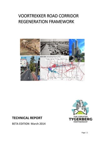
  • 1. Page | 1 TECHNICAL REPORT BETA EDITION March 2014 VOORTREKKER ROAD CORRIDOR REGENERATION FRAMEWORK
  • 2. Page | 2 Foreword by the Chairman, Dr Musa Shezi of the Greater Tygerberg Partnership I am pleased to release the “Beta Version” of the Greater Tygerberg Partnership’s Regeneration Framework for the Voortrekker Road Corridor for comment and input. The Beta Version is an invitation to join a public conversation with all stakeholders including the various authorities and those who live, work, learn, play, use public facilities or own businesses on the Corridor. I am proud that the production of this comprehensive and integrated “Beta” strategy for Cape Town’s economic engine room has been completed in record time, considering that the Partnership has only been operational with permanent staff since August 2013. I am especially pleased to report that this document reflects the outcomes of a process of extensive consultation through the Future Tyger public engagement programme. The Regeneration Framework embodies the action mandate that we seek from our partners, members and stakeholders which include local businesses, property owners and corporates, the University of the Western Cape, the University of Stellenbosch, the Cape Peninsula University of Technology, the Northlink College, PRASA, Transnet, the City of Cape Town, the Western Cape Government, National Government Departments and State owned Enterprises and local communities. Building partnerships is the core business of the Greater Tygerberg Partnership. Meaningful partnerships are not possible without focussed programmes, and the most impactful programmes inevitably require partnerships. We are particularly keen to hear how your organisation could become a partner in the regeneration of the Voortrekker Road Corridor. By commenting on the Beta Edition, you will help the Greater Tygerberg Partnership to facilitate a process of constant improvement for regeneration and improvement from today towards 2020 and beyond to 2040. We are especially grateful to Her Worship the Mayor Alderman Patricia de Lille for the funding provided to the Partnership from the Mayor’s Urban Regeneration Programme, which has made this work possible. And to Mr Tienie le Roux, Executive Director and chairman of the Business Development Committee under whose auspices this work has been directed. The baton is handed to Ms Lindsey Jones our newly appointed COO to translate these bold ideas into a practical programme of implementation through partnership. I look forward to working with all our partners, members and stakeholders in delivering on the inspiring vision outlined in this Regeneration Framework, which indeed will also be a milestone in implementing the Urban Network Strategy developed by National Treasury, the Integrated Development Plan and the City Development Strategy of the City of Cape Town and the One Cape 2040 vision for the Western Cape. Dr Musa Shezi Chairman of the Board Greater Tygerberg Partnership
  • 3. Page | 3 EXECUTIVE SUMMARY The release of this initial Beta Version1 of the Regeneration Framework by the Greater Tygerberg Partnership is the fourth step in the Future Tyger public conversation about the Voortrekker Road Corridor (VRC) and the Bellville Central Area, which is designated as Cape Town’s Second Metropolitan Node. The Regeneration Framework is a part of the City of Cape Town’s Mayoral Urban Regeneration Programme (MURP). The release of the Beta Version aims to trigger debate and input on an approach to regeneration, to frame next steps in the regeneration process and to identify projects and investigations into a framework for implementation aligned with the City’s Integrated Development Plan. The Regeneration Framework is a working document that is constantly revised. A flexible and responsive approach is essential because urban regeneration is a partnership-driven process that gives effects to the policies, strategies and investment programmes of the three spheres of government as well as those of key partners including local higher learning institutions, transport agencies and the business community. The ultimate goal is to generate a shared understanding and ongoing programme of action between the partners and the stakeholders who are involved in regenerating the Voortrekker Road Corridor and the Second Metropolitan Node. Setting the scene for urban regeneration is the theme of Chapter 2. Regeneration is presented in the context of the historical evolution of the VRC through seven transitions. It posits four scenarios for the future of the Corridor based on the insights of a diverse team of academics, specialists, developers and community leaders. The best case scenario entails a partnership driven approach with a focus on place making “Tyger Becomes Great”, whereas the worst case “Eish” scenario sees a level of deterioration comparable with most degraded African inner cities. Chapter 3 picks up the major findings and outlines the arguments for corridor development through Transit-Orientated Development or TOD. Perspectives and experiences in South African cities are considered, with a special focus on Cape Town. Spatial arguments consider the Metro’s growth options and the potential of TOD as a major driver/enabler for regeneration of the VRC. 1 To borrow the analogy of computer software release life cycle, the Beta Version denotes a product that is available for the first time outside the organisation who developed it. The Beta Version is used to test and monitor user acceptance.
  • 4. Page | 4 The Voortrekker Road Corridor and the Bellville Central Area have considerable investment potential. A mixed use medium-high intensity scenario for developing the 680 ha of underutilised public land and TOD development on the Voortrekker Spine could conservatively unlock some R 300 bn of investment. Chapter 4 analyses investment growth scenarios for the Metropolitan Node as developed by a respected property analyst. Some 550 000 m2 of additional retail is possible in a Bellville Decades scenario where correct preconditions for regeneration are put in place, the equivalent of 5 major regional malls and entailing investment of at least R 8bn and 250 000 m2 of office space in 20 years, an additional Century City office park. Another 250 000 people could be located in high density residential areas on the Spine. These estimates are to be regarded as no more than indicative prior to detailed work being done on major public land sites and in the four focus areas. Research must still be done on the large scale industrial development potential of the Bellville – Cape Town International Airport axis, but it is likely to be of regional significance. Seen in the light of these perspectives, the growth potential of the VRC such that it can take up a sizeable percentage of Cape Town’s development potential to 2040. In Chapter 5, we construct an analytical framework for long term (2040) medium term (2020) and short term (2014/15) planning. The 2040 vision proposed for the Corridor harmonises with the City of Cape Town’s 2040 City Development Strategy and the OneCape 2040 vision: By 2040 a regenerated and inter-connected Voortrekker Road Corridor will link Cape Town’s two metropolitan nodes with the city at large and it’s regional hinterland to play a dynamic role as an innovation and development powerhouse in Cape Town’s transition to achieving its 2040 vision of becoming “one of the world’s greatest cities in which to live and learn, work, invest and discover – a place of possibility” A step path from 2014 towards the 2040 Corridor vision is proposed, which builds on the OneCape 2040 step path and the City of Cape Town’s 2040 City Development Strategy. This is discussed in more detail in Annexure A. The following steps are indicated in the Step Path to 2040: STEP ONE: Creating the platform (2014-2019): This step sees the Metropolitan Node and Voortrekker Road Corridor undergoing an urban turnaround through the implementation of catalytic game changer projects and the creation of an infrastructural and institutional networked platform that sets in place a cycle of self-sustaining regeneration. The will accelerate a transition from urban decay, socio economic decline, urban fragmentation and disinvestment to urban regeneration, inter- connectivity, socio economic up-liftment, re-investment and renewal. STEP TWO: Implementation at scale (2020-2025): This steps sees he accelerated development of the Second Metropolitan Node and Voortrekker Road Corridor as a seamlessly managed interconnected corridor and a fast growing nucleus for innovation, job creation, youth development and high density urban lifestyles.
  • 5. Page | 5 STEP THREE: Accelerated improvement (2026-2033) This steps sees the creation of a distinctive identity and economic vibrance that renders the Second Metropolitan Node and the Voortrekker Road Corridor as leading destinations to live, produce, work, play, visit and do business in Cape Town. STEP FOUR: Sustained Performance (2034-2040): This step sees the phasing out of special measures to regenerate the Second Metropolitan Node and Voortrekker Road Corridor due to their seamless integration within the growth dynamics of the City of Cape Town and the Western Cape. The step path is centrally informed by local, provincial and national short, medium and long term planning. Chapter 5 extracts 2020 Outcomes as a basis for medium term planning on the basis of a performance framework of “Six Regeneration Imperatives” which the Framework proposes for the assessment of progress and development. Achieving Step One Creating the platform (2014-2019) will be achieved through progressive realisation of six regeneration imperatives to achieve the 2020 Outcomes identified. This time frame is important as it provides the basis for influencing the programmes of action for national and provincial government 2014 to 2019 and for the City of Cape Town’s IDP from 2015 to 2020. The following regeneration imperatives and Partnership Programmes are identified: 1. REGENERATION IMPERATIVE: GROWTH & INNOVATION GENERATING 1.1. Learning and Innovation Corridor: Synergising the knowledge and learning capacity of institutions located in the Corridor for maximum impact in regard to education, skills development and the application of innovation to business development 1.2. Production Corridor: Integrating the knowledge, air/ road/rail/ sea logistics and manufacturing capacity of the Corridor to drive “aerotropolis” development, ICT, green technology, bio technology and niche manufacturing and ensure the retention of existing manufacturing 1.3. Services Corridor: Developing clusters of office development, business process outsourcing, business tourism and retail development that couple large scale corporate businesses and complexes with small and informal business networks 2. REGENERATION IMPERATIVE: PEOPLE SERVING 2.1. Caring Corridor: Providing quality public facilities and over the counter services for the public at large and livelihood and support opportunities for vulnerable groups 2.2. Youth Corridor: Providing leadership development, career guidance, learning support, cultural, sport and recreation opportunities that capture the needs and aspirations of young people for whom the Corridor is the most accessible place to fulfil those needs and aspirations 3. REGENERATION IMPERATIVE: INTER CONNECTED 3.1. Ease of Movement Corridor: Modernising public transport, developing non-motorised transport and integrating both with development and private transport 3.2. Broadband Corridor: Extending quality affordable last mile broadband and access points in areas of highest need, density and footfall
  • 6. Page | 6 4. REGENERATION IMPERATIVE: FULLY DEVELOPED AND DENSIFIED 4.1. Accomplished Corridor: Developing vacant and underutilised public land 4.2. TOD Corridor: Coupling the growth of public transport and transit ridership and development that supports it through well designed transit precincts that achieve intensification, mixed use, densification and value capture 4.3. Vibrant Living Corridor: Promoting high density housing with an emphasis on social housing, gap market housing and student housing in transit precincts and the most accessible parts of the Corridor whilst protecting the integrity and liveability of lower density suburbs that attach to the Corridor 5. REGENERATION IMPERATIVE: ECO-LOGICAL 5.1. Green Building And Development: : Championing buildings and development that reduce carbon dioxide emissions and conserve consumption of energy, water, waste and materials 5.2. Riparian Corridor: Conserving, coupling and integrating streams, rivers, canals and wetlands and storm water systems within an open space network that proves green relief and amenity, protection of biodiversity, recreation, public access and flood protection 6. REGENERATION IMPERATIVE: WELL MANAGED 6.1. Partnership Corridor: Maintaining a visionary, cohesive and integrated programme of partnership action and investment marketing and facilitation to achieve economic, social and urban regeneration 6.2. Well Organised Corridor: Maintaining a seamlessly clean, safe and attractive urban and industrial environment that progressively integrates smart city technologies Going forward, the Partnership will play a facilitation role as co-manager of the regeneration conversation and will seek to integrate the outcomes and priorities of the conversation in the programmes of government, institutions, and corporate sector. This will involve a detailed process of further engagement and reworking of the Beta Edition. These activities will include: • Publicising and securing comment on the beta version of the Regeneration Framework with a view to later undertaking a comprehensive review • Developing an Implementation Framework including possible innovative tools such as land availability agreements, development vehicle(s), flexible rights granting mechanisms and a regional innovation ecosystem • Developing detailed regeneration plans, design and marketing collateral for each of the four focus areas and including these in the comprehensive review • Managing an international design competition as part of the World Design Capital 2014 programme in order to secure global best practice, planning and design thinking • Establishing effective coordination, communication and planning forums with all major government departments and state-owned enterprises in collaboration with the City of Cape Town • Establishing a membership model and funding framework to better engage the corporate sector and private investors in urban regeneration programmes in the context of a 5 year Strategic Plan for the Partnership • Setting up communication mechanisms with local property owners in each of the four focus areas with the view to participating in local precinct design, development entities, land packaging, and regeneration and urban acupuncture projects
  • 7. Page | 7 Contents 1. Introduction ....................................................................................................................... 13 Intention and status of the GTP’s Regeneration Framework ...............................................13 Introducing the Voortrekker Road Corridor and the Second Metropolitan Node ...............13 More about the Greater Tygerberg Partnership ..................................................................14 More about the Future Tyger public engagement process ..................................................15 Outline of the Regeneration Framework..............................................................................16 2. Regeneration as a Process of Transition .............................................................................. 18 Introduction ..........................................................................................................................18 The Broader Policy Context...................................................................................................18 Defining Regeneration ..........................................................................................................19 Seven regeneration transitions affecting the Voortrekker Road Corridor ...........................20 2.4.1. 1680 – 1840: Corridor birth ..........................................................................................20 2.4.2. 1840 – 1940: Urbanisation and Industrialisation..........................................................20 2.4.3. 1940 – 1980: City Integration .......................................................................................20 2.4.4. 1980 – 2020: Metro sprawl...........................................................................................21 2.4.5. 2020 – 2030: Metro Compaction..................................................................................21 2.4.6. 2030 - 2040: Africanisation...........................................................................................21 2.4.7. Post 2040: Regionalism.................................................................................................22 Scenarios for transition.........................................................................................................22 3. A Transit Orientated Development Corridor ........................................................................ 26 A Rationale for a Transit Orientated Development (TOD) approach to the VRC .................26 TOD in South African cities ...................................................................................................26 TOD in Cape Town.................................................................................................................27 TOD and the Voortrekker Road Corridor..............................................................................30 Exploring structuring elements of the VRC...........................................................................31 4. Growth Potential of the VRC To 2040 .................................................................................. 35 Population growth and residential development projections..............................................35 Retail take-up projections.....................................................................................................35 Commercial floorspace projections......................................................................................36 5. Building a Framework for Regeneration .............................................................................. 38 Introduction ..........................................................................................................................38 The 2040 Vision for the Voortrekker Road Corridor and the Second Metropolitan Node...38 A Step path to 2040 ..............................................................................................................38 5.3.1. STEP ONE: Creating the platform (2014-2019).............................................................38 5.3.2. STEP TWO: Implementation at scale (2020-2025)........................................................39
  • 8. Page | 8 5.3.3. STEP THREE: Accelerated improvement (2026-2033) ..................................................39 5.3.4. STEP FOUR: Sustained Performance (2034-2040) ........................................................40 A 2020 Programme of Partnership Action to achieve Regeneration....................................41 5.4.1. Imperative # 1: Growth & Innovation Generating........................................................42 5.4.2. Imperative # 2: People Serving .....................................................................................42 5.4.3. Imperative # 3: Inter Connected...................................................................................43 5.4.4. Imperative # 4: Fully Developed and Densified ............................................................43 5.4.5. Imperative # 5: Eco-logical:...........................................................................................44 5.4.6. Imperative # 6: Well managed:.....................................................................................44 6. Developing Regeneration Programmes ............................................................................... 46 Introduction ..........................................................................................................................46 Growth and Innovation Generating......................................................................................46 6.2.1. Regeneration Imperative ..............................................................................................46 6.2.2. Policy Context ...............................................................................................................47 6.2.3. Status quo analysis........................................................................................................47 6.2.4. How Partnership Programmes can deliver regeneration ............................................48 People serving.......................................................................................................................49 6.3.1. Regeneration Imperative ..............................................................................................49 6.3.2. Policy Context ...............................................................................................................49 6.3.3. Status quo analysis........................................................................................................49 6.3.4. How Partnership Programmes can deliver regeneration ............................................50 Inter Connected ....................................................................................................................50 6.4.1. Regeneration Imperative ..............................................................................................51 6.4.2. Policy Context ...............................................................................................................51 6.4.3. Status quo analysis........................................................................................................52 6.4.4. Regeneration Opportunity............................................................................................54 6.4.5. How Partnership Programmes can deliver regeneration .............................................55 Fully Developed and Densification........................................................................................56 6.5.1. Regeneration Imperative ..............................................................................................56 6.5.2. Policy Context ...............................................................................................................56 6.5.3. Status quo analysis........................................................................................................58 6.5.4. Regeneration Opportunity............................................................................................60 6.5.5. How Partnership Programmes can deliver regeneration ............................................61 Eco-logical .............................................................................................................................62 6.6.1. Regeneration Imperative ..............................................................................................62 6.6.2. Policy Context ...............................................................................................................62
  • 9. Page | 9 6.6.3. Status quo analysis........................................................................................................62 6.6.4. Regeneration Opportunity............................................................................................63 6.6.5. How Partnership Programmes can deliver regeneration ............................................63 Well managed .......................................................................................................................63 6.7.1. Regeneration Imperative ..............................................................................................63 6.7.2. Policy Context ...............................................................................................................63 6.7.3. Status quo analysis........................................................................................................64 6.7.4. Regeneration Opportunity............................................................................................65 6.7.5. How Partnership Programmes can deliver Regeneration.............................................66 7. Regeneration Focus Areas................................................................................................... 68 Approach and methodology .................................................................................................68 Eastern Regeneration Focus area .........................................................................................68 7.2.1. Demographic and development context ......................................................................68 7.2.2. Regeneration Opportunities .........................................................................................71 7.2.3. Regeneration Proposals................................................................................................73 Metro Node South Regeneration Focus area .......................................................................74 7.3.1. Demographic and development context ......................................................................74 7.3.2. Regeneration Opportunities .........................................................................................76 7.3.3. Regeneration Proposals................................................................................................77 Central Regeneration Focus area..........................................................................................78 7.4.1. Demographic and development context ......................................................................78 7.4.2. Regeneration Opportunities .........................................................................................80 7.4.3. Regeneration Proposals................................................................................................81 Western Regeneration Focus area........................................................................................82 7.5.1. Demographic and development context ......................................................................82 7.5.2. Regeneration Opportunities .........................................................................................84 7.5.3. Regeneration Proposals................................................................................................85 8. The Way Forward ............................................................................................................... 87 Introduction ..........................................................................................................................87 Accomplished Corridor .........................................................................................................87 Broadband Corridor ..............................................................................................................88 Caring Corridor......................................................................................................................88 Ease of Movement Corridor..................................................................................................89 Green Building and Development Corridor: .........................................................................90 Learning and Innovation Corridor.........................................................................................91 Partnership Corridor: ............................................................................................................92
  • 10. Page | 10 Production Corridor:.............................................................................................................93 Riparian Corridor...................................................................................................................94 Services Corridor...................................................................................................................95 TOD Corridor:........................................................................................................................95 Vibrant Living Corridor..........................................................................................................97 Well Organised Corridor: ......................................................................................................98 Youth Corridor.......................................................................................................................99 9. Ongoing Engagement to Improve the Regeneration Framework ........................................ 101 10. Conclusion........................................................................................................................ 102
  • 11. Page | 11 List of abbreviations BDM – Building Demand Management BEPP – Built Environment Performance Plan (2014/2014) CCT – City of Cape Town CTSDF – Cape Town Spatial Development Framework (2012) ECAMP – Economic Areas Management Programme GABS – Golden Arrow Bus Service GTP – Greater Tygerberg Partnerships ICDG – Integrated City Development Grant IDP – Integrated Development Plan (2012 – 2017) ITP – Integrated Transport Plan (2014 – 2018) MBT – Minibus Taxis MURP – Mayoral Urban Regeneration Programme MSDF - Municipal Spatial Development Framework (1996) PRASA – Passenger Rail Agency of South Africa PTI – Public Transport Interchange SETT – Socio-Economic Task Team SRA – Special Rating Area TOD – Transit Orientated Development TROSS – Tygerberg Riverine Open Space System UDZ – Urban Development Zone VRC – Voortrekker Road Corridor VRCID – Voortrekker Road Corridor Improvement District WCPG – Western Cape Provincial Government
  • 12. Page | 12 List of figures and tables (page numbers to be finalised in copy for print) Fig Description Page 1.1 GTP demarcation of the Broader impacted area, the Voortrekker Road corridor and the Bellville Central Area 2.1 Scenarios for the development of the VRC based on the Future Tyger “participlan” exercise 3.1 Concept of a development corridor 3.2 Assessed values for properties abutting Voortrekker Road 3.3 The urban core corridor and Voortrekker Road shown relative to economic activity 3.4 Structuring elements of the VRC graphically illustrated 3.5 Typical TOD neighbourhood economic activities 3.6 Walkability matrix applied to the corridor 6.1 Journey of Street Adult in Northern Suburbs 7.1 Eastern Focus Area demarcation 7.2 Bellville ECAMP Profile 7.3 The locational potential of the Southern Focus Area to become an internationally competitive “aerotropolis” urban-industrial activity corridor 7.4 Airport Industria ECAMP Profile 7.5 Sack’s Circle Industria ECAMP Profile 7.6 Central Focus Area demarcation 7.7 Parow - Goodwood ECAMP Profile 7.8 Western Focus Area Demarcation 7.9 Maitland ECAMP Profile Tables Table Description Page 2.1 Seven corridor transitions in a global development context 4.1 Potential density and population around Voortrekker Road 4.2 Balancing the extended catchment Area for transient shoppers 4.3 Cape Peninsula office stock (grades A and B) and vacancies by node as in Quarter 2 of 2014 4.4 A comparative view of the impact of the share-gain modelling on the base scenarios. 6.1 Overall economic activities on the Voortrekker Road corridor 6.2 Potential development yield of greenfield sites 6.3 Land uses developed through UDZ incentives in Bellville by category 6.4 Crimes reported per police district 6.5 Building plans passed for new buildings and improvements /extensions in the City of Cape Town and in the UDZ 6.6 Plans passed in the UDZ as a percentage of plans passed in City of Cape Town Text Boxes Text Box Description Page 3.1 The 5D’s of TOD (Bruce 2012) 3.2 Distinguishing activity routes and development routes 3.3 The “urban core” argument 6.1 The “Triple Helix” effect 6.2 A Cape Town contextual reading of “aerotropolis” 6.3 “Integration Zones” as per Integrated City Development Grant (ICDG) 6.4 Economic Areas Management Programme (ECAMP) 7.1 Urban Acupuncture Projects
  • 13. Page | 13 1. Introduction Intention and status of the GTP’s Regeneration Framework The release of this initial Beta Version2 of the Regeneration Framework by the Greater Tygerberg Partnership is the fourth step in the Future Tyger public conversation about the Voortrekker Road Corridor (VRC) and the Bellville Central Area, which is designated as Cape Town’s Second Metropolitan Node. The Regeneration Framework is a part of the City of Cape Town’s Mayoral Urban Regeneration Programme (MURP). The release of the Beta Version aims to trigger debate and input on an approach to regeneration, to frame next steps in the regeneration process and to identify projects and investigations into a framework for implementation aligned with the City’s Integrated Development Plan. The Regeneration Framework is a working document that is constantly revised. A flexible and responsive approach is essential because urban regeneration is a partnership-driven process that gives effects to the policies, strategies and investment programmes of the three spheres of government as well as those of key partners including local higher learning institutions, transport agencies and the business community. The ultimate goal is to generate a shared understanding and ongoing programme of action between the partners and the stakeholders who are involved in regenerating the Voortrekker Road Corridor and the Second Metropolitan Node. The Regeneration Framework document thus draws together multiple policies, programmes and plans into a coordinated and consolidated approach and regeneration programme for the Voortrekker Road Corridor and Cape Town’s Second Metropolitan Node. The Regeneration Framework therefore does not replace or eclipse any statutory, policy and strategic documents and positions held by the City, Provincial or National government. Introducing the Voortrekker Road Corridor and the Second Metropolitan Node The Voortrekker Road Corridor is the belt of intense urban development from the Salt River Circle in the west to the Stikland Bridge in the east. Cape Town’s Second Metropolitan Node overlays the Voortrekker Road Corridor and is the nucleus of intense urban development that includes the Tyger Valley precinct and the Bellville Central Area. The Bellville Central Area is located between the N1 in the North, up to an including the CPUT and UWC campuses in the South, the Parow business area to the West and the business and industrial areas flanking the R 300 to the East. 2 To borrow the analogy of computer software release life cycle, the Beta Version denotes a product that is available for the first time outside the organisation who developed it. The Beta Version is used to test and monitor user acceptance.
  • 14. Page | 14 Figure 1.1 Demarcation of the study area The Regeneration Framework is demarcated into four focus areas:  Western Focus Area: Salt River to Maitland;  Central Focus Area: Goodwood to Parow;  Eastern Focus Area: the Bellville Central Area between the N1 and the Northern rail line; and  Southern Focus Area: the Bellville Central Area South of the Northern rail line including Bellville South, the Transnet Marshalling Yard (Belcon site) and extending down to the campuses of the University of Western Cape and the Cape Peninsula University of Technology. The Voortrekker Road Corridor incorporates 21 ward councils and is home to a population of 708 061 (2011 census). Almost 100 000 students are registered in tertiary education institutions, colleges and further learning institutions within 5 km from the Bellville Central area. The Corridor is exceptionally well endowed with higher order services and facilities including more than ten public and private hospitals totalling 2,894 beds, the Medical Research Council, three universities, and many more colleges. The Bellville Public Transport Interchange (PTI) is the second busiest transport hub in Cape Town, recording 162,000 person trips every day (70,000 by train, 70,000 by taxi minibus, and 22,000 by bus). Some 178 bus and 348 taxi routes operate pn the Voortrekker Road Corridor. More about the Greater Tygerberg Partnership The Greater Tygerberg Partnership (GTP) is a public benefit organisation (PBO) registered with the Department of Social Development as a not-for-profit company in August 2012. The Partnership is supported by the City of Cape Town’s Mayoral Urban Regeneration Programme (MURP). The agreement between the City and the Partnership is linked to an approved business plan that
  • 15. Page | 15 requires the Partnership to develop a regeneration programme for the Voortrekker Road Corridor. The approved business plan can be found online at www.gtp.org.za. The GTP’s board composition reflects the diversity of stakeholders in the development of the sub- region. Representatives of organised business, City of Cape Town and Western Cape Provincial Government officials, councillors, and community organisations are well balanced on the board of directors. The vision of the GTP is to “inclusively and innovatively facilitate the creation and sustained existence of a vibrant thriving, desirable and value adding economically prosperous area” GTP business plan, adopted by the City of Cape Town More about the Future Tyger public engagement process Future Tyger was launched on 26 August 2014 as an inclusive conversation that aims to engage all stakeholders in the sub-region including government, business, academic institutions, local communities and city at large. The goal is to build an interactive community that is involved in the regeneration programme. The programme consists of six major phases: • Phase 1: Feeling the Temperature: Public meetings were arranged in August and September 2014 in Saltriver (Minor Hall), Kensington (Minor Hall), Parow (Town Hall), Goodwood (Town Hall), Ravensmead (Minor Hall), Belhar (Minor Hall), Bellville (CR Louw Auditorium, Sanlam), and UWC campus (Lecture Hall 3A). At these meetings, the GTP’s “initial spatial argument”, which is elaborated in this document, was presented to community organisations, rate payers associations, Municipal officials and councillors, investors and other interested stakeholders. This was paired with a questionnaire that “feels the temperature” on transport, city management and development issues on the Corridor. Dedicated social media channels (Facebook and Twitter pages) were also created where content was shared. These channels are still being utilised. • Phase 2: Imagining the Future: This phase entailed a two-day specialist seminars which took place on 2 and 3 October 2014 at the Bellville Civic Centre conference room. In attendance was a cross-sector mix of people including councillors, City and Provincial government officials, planners and urban designers, researchers, NGOS, built environment professionals, and members of the media. On Day 1, the theme of “Setting the scene for 2040” considered under the key drivers within the five themes of the project over the milestones of 2020, 2030 and 2040, and the key uncertainties so as to develop plausible scenarios. On Day 2, the Greater Tygerberg Partnership facilitated scenario planning in unpacking plausible scenarios, identifying the choices they imply and mapping development trajectories over the milestones. The seminars aimed to position the initial Future Tyger spatial arguments/scenarios and align to the National Development Plan 2030, the provincial One Cape 2040 strategy and Cape Town’s City Development Strategy. • Phase 3: Design the City: In Phase 3 a series of design sessions were facilitated between 11 and 15 November 2014 in which stakeholders were grouped by interest (1. Community- based organisations, 2. Ratepayers and Property owners, and 3. Government Planning) and by Regeneration Focus area. The goal of central participation in developing proposals for regeneration was achieved through a programme of stimulating, informing and interacting in focus group seminars by using a 3D spatial Model (customised Google Earth Pro). • Phase 4: Regeneration Framework: The production of the Regeneration Framework: Beta Version is a first attempt at packaging the main arguments, concepts, strategies and
  • 16. Page | 16 proposals for the regeneration of the Voortrekker Road corridor and the Metropolitan Second Node. This is a living document, and will be continually revisited and adjusted to fit the context as informed by core partners. • Phase 5: International Design Competition: The Future Tyger project has been accepted into the official World Design Capital 2014 programme under theme 2, “Bridging the Divide”. Running from April to September 2014, the Greater Tygerberg Partnership will launch an International Design Competition linked to the World Design Capital 2014 programme and the University of Stellenbosch’s 2014 Winelands Conference entitled “Innovation for the Urban Age”. The International Design Competition linked to World Design Capital 2014 creates a platform to attract leading local and international development practitioners, planners, designers and architects talent through an international design competition to generate innovative and sustainable urban development proposals. • Phase 6: The Implementation Framework: Working in close cooperation with core partners, the Greater Tygerberg Partnership will facilitate the regeneration process by: o Facilitating, aligning and integrating the programmes of its partners; o Establishing the institutional modalities (networks, partnerships, entities) needed to achieve regeneration; o Championing short term achievable Urban Acupuncture projects that set the platform for longer term urban regeneration; and o Constantly reviewing the Regeneration Framework as a direction setter for work in progress Outline of the Regeneration Framework This document aims to be a regeneration partnership programming framework with an explicit focus on the Voortrekker Road Corridor Setting the scene for urban regeneration is the theme of Chapter 2. Regeneration is presented as a process of transition. In this light, the chapter contextualises the Corridor within its historical evolution. It posits four scenarios for the future of the Corridor based on the insights of a diverse team of academics, specialists, developers and community leaders. Chapter 3 picks up the major findings and outlines the arguments for corridor development through Transit-Orientated Development. Perspectives and experiences in South African cities are considered, with a special focus on Cape Town. Spatial arguments consider the Metro’s growth options and the potential of creating a second Metropolitan Node in the Bellville Central Area. Chapter 4 analyses investment growth scenarios for the Corridor and Metropolitan Node. In Chapter 5, we construct an analytical framework for long term (2040) medium term (2020) and short term (2014/15) planning. The 2040 vision for the Corridor harmonises with the City of Cape Town’s City Development Strategy and the OneCape 2040 vision. A step path from 2014 towards the 2040 Corridor vision is proposed, which builds on the OneCape 2040 step path. This is discussed in more detail in Annexure A. The step path is centrally informed by local, provincial and national short, medium and long term planning. The chapter extracts 2020 Outcomes as a basis for medium term planning on the basis of a performance framework of “Six Regeneration Imperatives” which the Framework proposes for the assessment of progress and development. 13 Partnership Programmes are identified to deliver on the Regeneration Imperatives. It presents a practical programme development and implementation model aligned to the National Development Plan 2030, OneCape 2040, the City Development Strategy and Cape Town’s IDP.
  • 17. Page | 17 In Chapter 6, strategies and programmes for urban regeneration are presented, by considering for each of the six regeneration imperatives the policy context, an analysis of the status quo, regeneration opportunities and their applicability to the VRC and the Metropolitan Node. The strategies are categorised under the “Six Strategic Imperatives” introduced in Chapter 5. Taking a spatial perspective, regeneration opportunities in the four broadly demarcated regeneration focus areas are discussed in greater detail in Chapter 7. The four regeneration focus areas are profiled in their demographic and development contexts, followed by regeneration opportunities based on the “Six Strategic Imperatives”, and regeneration proposals are made in regard to public land repackaging, prime transit precincts, and urban acupuncture projects. Chapter 8 unpacks the 13 suggested programmes for corridor development. Under each of these programmes, detailed plans of action for the next 18 months for core stakeholders are presented. Chapters 9 and 10 conclude the major arguments for regenerating the Corridor.
  • 18. Page | 18 2. Regeneration as a Process of Transition Introduction In this Chapter we set the scene by outlining the broader policy context, suggesting a definition of “regeneration”, locate the Metropolitan Node and the VRC within a long term process of city transition 1680 – 2040, motivate the concept of Transit Orientated Development as the key spatial/transport/development driver of regeneration and explore the inter-connections that exist with the structure and functioning of the VRC in the context of Cape Town and the Western Cape. The Broader Policy Context Cities are increasingly seen as the drivers of regional and national economic growth. The prominence of the spatial economy has been recognised in both the National Spatial Development Perspective, adopted in 2003, and the National Planning Commission’s Diagnostic Report (2011) and the National Development Plan (2012). These documents indicate the central role cities will play in addressing economic growth and poverty alleviation. The spatial economy and associated impacts on infrastructure investment patterns should be aligned and coordinated between all three spheres of government. The Western Cape Provincial Government and City of Cape Town’s Spatial Development Frameworks also shed light on the particular focus of creating integrated, sustainable and inclusive urban growth patterns, with a special focus on mixed-use and medium to high density residential developments, as presented in this proposal. As a response to the National Development Plan, National Treasury has embarked on a new “Urban Network Strategy” (UNS) (National Treasury, 2014) that is directly applicable to the Voortrekker Road Corridor. The UNS is based on a spatial planning logic and network optimisation aimed at long term impact and value for money from public investments. This gives meaning to the NDP when it calls for “a proposed schema for spatial targeting that indicates where investment should be focused, and we identify elements of the existing broad consensus for transforming towns and cities”. The UNS is a strategy of identifying growth generating nodes which are linked together through development corridors. The UNS will be a guiding framework for the implementation of Rail, Roads, SME facilities, Public space & greening, Residential development, Community facilities, Bulk infrastructure such as Water, Electricity, Sewer and ICT. The City of Town Town’s planning strategies (e.g. IDP, SDF, BEPP, ITP) speak of focused public investment in infrastructure that aims to create a more equitable, sustainable, compact and accessible urban form. The City’s 5 year Integrated Development Plan (IDP) (2012 – 2017) rests on the five pillars of a caring city, an opportunity city, an inclusive city, a safe city, and a well-run city. Together with the IDP, the BEPP (page 78) prioritises investment in infrastructure to release the “high development and land use intensification potential to be harnessed” in Bellville and the Voortrekker Road Corridor. The City’s recently approved City Development Strategy (CDS)3 , generated through a consultative process with links to the OneCape 2040 strategy, is a strategic tool to direct future growth and development. The CDS identifies six goals to guide long term development: 3 The City’s briefing document understand the City Development Strategy (CDS) to “include an over-arching long-term collective vision, strategic levers and strategies and the identification of possible targeted interventions. Using the CDS, key stakeholders, both inside and outside of city government, act with deliberate intent and move forward in a consistent, deliberate direction in pursuit of the collective vision.” (CDS page 1)
  • 19. Page | 19  Goal 1: A healthy and vibrant life  Goal 2: Being educated and informed  Goal 3: Being connected  Goal 4: An inclusive and resilient economy  Goal 5: Building and celebrating Cape Town spirit  Goal 6: Being an eco-logical city region The 2040 vision proposed by the CDS is coupled to the VRC vision in the Regeneration Framework (see paragraph 5.2). The CDS takes into account the imperative to transition to a clime change resilient and sustainable growth path. The CDS identifies interventions pertaining to climate change resilience such as food, energy and water system analysis, align with knowledge-producing institutions to create the “MIT of Africa”, integrated public transport, becoming a world leader in “Blue Economy”4 , implementing zero-waste chain chains, and sourcing energy from renewable sources (Taylor, 2014). Defining Regeneration We define regeneration as a process to unlock socio-economic opportunity and urban investment in a strategic and sustainable manner through partnerships. As such it would need to deal with the long term spatial, social, economic and infrastructural forces that shape cities as well as the shorter term triggers, catalysts and/or “tipping points” for system-change or transition. As the regeneration of the VRC involves a very large part of the City of Cape Town and key elements of the Western Cape’s infrastructure it has to be long term in nature. In all cities processes of regeneration and “degeneration” (or creation and destruction) are long term: 10-20 years for property investment cycles, 20 -30 years for the lifespan of infrastructures, and 50 years (and even centuries) for the reshaping of city structure. Indeed the global economy itself goes through 30 – 40 4 Following the ground-breaking findings of the Club of Rome’s research, the “Blue Economy”, a term coined in a book by Gunter Pauli after assessing 2,231 peer-reviewed articles, refers to an action plan for 10 years - 100 innovations - 100 million jobs. A Blue Economy business model argues for a new industrial plan addressing environmental problems and transitioning to a zero-emissions growth path.
  • 20. Page | 20 year cycles of creation and destruction following waves of development and obsolescence of technology, capital investment and disinvestment and growth and contraction of economic activity (Swilling and Annecke 2010; Perez 2014). However regeneration also has to deal with much shorter time frames such as property leases and the project preparation cycle of 1-3 years. Perhaps most importantly, the 5 year election terms of national provincial and City government drive public budgets and investment cycles. The VRC is an example of transport-led transition past, present and future in the context of the seven transitions identified below. Seven regeneration transitions affecting the Voortrekker Road Corridor Cape Town has been shaped and reshaped over some 330 years through the major global transitions that have created the city we live in today. The City will be dramatically reshaped by the powerful global transitions that are inevitable by mid-century, and therefore it is imperative to set the scene for strategies that look to 2040 for Cape Town and the Western Cape region. We identify five global-through-local transitions that have shaped where the VRC is today and two that lie ahead and need to be anticipated and planned for in the regeneration process. These transitions are critically informed by revolutions in transport systems and technologies. This is illustrated in the summary Table 2.1. 2.4.1.1680 – 1840: Corridor birth The history of the Voortrekker Road has an undeniable influence of the present and future urban form of the corridor. Initially the road was a wagon path from what is known today as Salt River to Bellville. At a critical juncture in the path the wagons outspanned into an “uitspan” called “Hardekraaltjie” (“hard surface”). At this point the regional paths converged, creating a logical point for trade, services and the growth of a village. Bellville therefore evolved as a junction of the three most important routes between Cape Town and the Port with the agricultural hinterland: the Paarl route, the Stellenbosch/ Strand route and the Malmesbury route which is today the N7. The importance of Bellville as city-within-region and a connecting hub is as important today as it was 300 years ago. 2.4.2.1840 – 1940: Urbanisation and Industrialisation Coinciding with the Age of Steel, Electricity and Heavy Engineering (cf Perez 2014), the introduction of railways in the mid-19th century spurred the consolidation of high street residential occupation. By 1849 a hard road replaced the wagon path and by 1860 the railway line supported town growth at stations. The high street set the context for ribbon development that was supported by Voortrekker Road. Along the main road, town centres of Maitland, Goodwood, Parow and Bellville were formed. 2.4.3.1940 – 1980: City Integration Globally the post-War period was marked by the Age of Oil, Automobiles and Mass Production which started early in the 20th Century. In Cape Town, rapid industrialisation was spurred by locational opportunity and relatively low cost of land between Voortrekker Road and the railway and was ideal for factories. As the City grew towards the east, these town centres were characterised by town halls and civic precincts. Civic pride and competition reigned in the high years of apartheid, and spatial plans were introduced to reinforce the historical divides between the “bo-dorp” and “onder-dorp”. Bellville’s pre-eminence as the nexus of a sub-regional rail system released a new retail energy on
  • 21. Page | 21 Voortrekker Road, which was the primary location of retail and commercial high street life. In 1972 Parow shopping centre was constructed, one of the first sub-regional retail malls in the country. 2.4.4.1980 – 2020: Metro sprawl Forces of decentralisation coinciding with the Age of Information and Telecommunications resulted in city expansion. Increasingly development was based on relatively cheap oil, the emergence of global supply chains and the rise of the service economy. Cape Town’s growth was highly influenced by provisions made for the private motor car, suburban living for those who could afford it, and retail and office development packaged in malls and office parks. In South Africa the poor and the working class were located in ever larger townships located far away from economic opportunity and relying on an over capacitated public transport system and mini bus taxis to fill in accessibility gaps. This produced an ever more disintegrated and inequitable city with vast disparities. Prior to the N1 national highway construction, Voortrekker Road was the primary access road into the City centre. During this time, the city sprawled out towards the northern suburbs, and the outer- Cape Flats grew under the influence of rapid urbanisation as apart. But the urban boom met its challenge with the construction of the N1 national highway construction between 1960 and 1970. The development of shopping centres along the N1 “Super Corridor” such as Tygervalley Centre (1985), N1 City (1989), Canal Walk/ Century City (2000), and Cape Gate (2005) found ample vacant and relatively cheap land at busy intersections, and superior access to a continuous flow of willing and increasingly wealthy shoppers. This, coupled with major residential developments north of the new N1 Freeway, resulted in partial collapse of the Voortrekker Road corridor’s property values, economic decline and a change in the socio-economic composition. This was compounded with decline in use of the public transport system by the middle class. This growth, whether planned intentionally or not, places the corridor in a strategic location with the potential to integrate and compact the city. However Voortrekker Road has continued to be the most accessible service hub to the Central Cape Flats which accentuated the racial divide. This did however facilitate re-population of the corridor with migrants (often refugees) from other African countries which re-energised small retailing. 2.4.5.2020 – 2030: Metro Compaction The “Era of Turbulence”, to quote Alan Greenspan, previous chairman of the Federal Reserve Bank, following the global financial crisis can transition to a new Age of Biotechnology and Renewable Energy. Worldwide cities are seeking compaction, public transport and low carbon emission development as the global infrastructure is retooled for a sustainable planetary civilisation (Swilling and Annecke 2010).On the VRC an “urban turnaround” can take place and see the reintegration of the VRC and the emergence of a new Metropolitan Node as an equal but different partner to the Central City as parts of a bi-nodal urban core (discussed in more detail in Chapter 3). Urban transition in the period 2014 to 2025 will be driven by considerable investments in road, rail and bus infrastructure. The imminent roll out of the MyCiti Integrated Rapid Bus System with established public transport interchanges will render Voortrekker Road as an integrated rapid transport corridor. A modernised PRASA rail fleet and improvements to train stations will popularise public transport to the private car owning class. The construction of the North-South Blue Downs road-rail corridor linking Khayelitsha and Bellville will also escalate the importance of Bellville Station, possibly overtaking Cape Town station as the city’s busiest interchange. 2.4.6.2030 - 2040: Africanisation
  • 22. Page | 22 By 2040, African cities will absorb the majority of the second wave of urbanisation, said to be unique in its scale and size. This coincides with the “Age of Biotechnology and Renewable Energy” and this transition will drive an inevitable process of social, economic and urban “Africanisation” of Cape Town as the City becomes more deeply integrated in African growth and development dynamics. This will create both the technology and the economic muscle to drive the City’s transition to sustainability and competitiveness. The inherent efficiency, low carbon emissions and inclusivity of the Metropolitan Node and the VRC will cement their leading role in enabling Cape Town to achieve 2040 vision set out in the City Development Strategy. Considering the infrastructure limitations around water, sewerage and electricity infrastructure, the possibility of off-grid sustainable satellite cities on large publicly owned land such as Wingfield, Youngfield, Tygerberg hospital site, Belcon and Stikland hospital site becomes attainable as desired future mixed use large scale developments. 2.4.7.Post 2040: Regionalism In the possible “Golden Age” (Swilling and Annecke 2010, Perez 2014) of a sustainable, technologically connected world it is quite likely that there will be a return to the village, albeit set with a highly urban setting. The VRC would thus transition to a network of communities, each offering the communality and life cycle benefits of the traditional village but set within super connected ICT networks and local and international transport systems. Table 2.1 outlines the major transitions the corridor has evolved through, and those transitions that will have a positive, generative effect on the corridor. Corridor Transition Period World Transition Transport Driver Urban Response 1.Birth 1680 – 1840 Colonialism and the Age of Steel, Electricity & Heavy Engineering Sub-regional Wagon Route Outspan at Hardekraaltjie 2. Urbanisation and Industrialisation 1860 – 1940 Age of Steel, Electricity & Heavy Engineering Hard Road & Railway Line Country Villages & High Streets 3. City Integration 1940 – 1980 Age of Oil, Automobiles & Mass Production Commuter Rail / Bus Corridor Industrialisation Satellite Towns & Corridor Emergence 4. Metro Sprawl 1980 – 2020 Age of Information and Telecommunications N1 Sub-regional Motor Corridor, Mini Bus Taxi Corridor Decline 5. Metro Compaction 2020 – 2030 Era of Turbulence Bus Rapid Transit, New Trains, Smart Transport Systems Corridor Regeneration 6. Africanisation 2030 - 2040 Start of Age of Biotechnology and Renewable Energy? Fast Rail, Smart Vehicles Off Grid Satellite Towns 7. Regionalism 2040 + Golden Age and midpoint of Age of Biotech and Renewable Energy? Walking & Cycling Urban Villages Table 2.1 Seven corridor transitions in a global development context Scenarios for transition During Phase 2 of Future Tyger “Imagining the Future”, the GTP facilitated a “participlan” scenario planning exercise, in which conference attendees were asked for the most important consideration
  • 23. Page | 23 and ideas for development scenarios for the Voortrekker Road Corridor and Metropolitan Second Node into the future. Following the collection of the more than 100 ideas grouped into clusters of the most important themes which presented themselves, attendees were then asked to vote for:  Importance: 3 of the most important ideas or considerations  Influence: 3 of the ideas which the Greater Tygerberg Partnership could influence  A Composite Score: Importance x Influence The Composite Score was used to derive the two most important themes. These themes then formed the basis of a scenario matrix. The two key clusters or themes as voted for by the attendees were:  Collaborative Partnerships (score of 88): building partnerships with different sectors, institutions and people, as well as embedding a culture and value system of collaboration and partnership within the organisation  Placemaking (score of 72): working on those elements which are quick, cheap and easy, to make the area a better place to live, work and play in the short and medium term. The formation of the 2040 scenarios were based on the two extremes of these two themes, namely;  Related to collaborative partnerships: A highly isolated and silo’ed approach versus a highly collaborative partnership approach  Related to placemaking: A Grotty car based, fragmented , devastated Place experiencing neglect versus a dynamic, safe, attractive, vibrant, place The clusters and themes are represented below: Fig2.1 Scenarios for the development of the VRC based on the Future Tyger “participlan” exercise
  • 24. Page | 24 Four scenarios were unpacked: A status quo scenario maturing into the future characterised by an isolated silo approach which delivers fragmented spaces called “Eish! (Hillbrow scenario)”, compared to the ideal turn-around situation of highly collaborative partnerships delivering on dynamic places named “Tyger Becomes Great” In the “Eish! (Hillbrow scenario)” could be best described with reference to Phaswane Mpe’s 2001 novel Welcome to our Hillbrow. In his description of the crime ridden neighbourhood, entire buildings are run by international crime syndicates, networks and various operators. Level 1 operators are streetside cigarette sellers, level 2 operators are drug peddlers, and level 3 operators run prostitution rings. These networks double up as money launderers, who have international links to import guns, machinery, and drugs to entrench their hold on the community and purchase buildings with their ill-gotten wealth. Once entrenched within the community the trend is thus perpetuated. In the Latin American cities, suburbs that fell to crime syndicates took decades to stabilise and recover from a situation of economic decay where shops had closed down, slumlords ruled urban spaces, transport had degraded and knowledge bases deteriorated as students had moved away due to the aggressive nature of the territorial violence. For as Mpe recalls, “Hillbrow in Hillbrow. Hillbrow in Cape Town. Cape Town in Hillbrow […] Welcome to our All…” (pages 102-4). In the worst case scenario suburban destabilisation, a problem of the post-industrial buildings, continues to spread vastly. Housing is poorly managed, and in particular social housing, which could have a catalytic effect on regeneration, only causes further societal fragmentation. A lack of decent apartments, non- responsive government subsidy programmes, social housing, and student housing and in general new housing stock compound the housing crisis. Aside from a lack of diversity in the area, there is a poor understanding of how people interact with urban spaces, and their needs for certain facilities and services. The culture of ownership and love for the area is missing with uninspired young people, with no new visionaries emerging from the area. Ultimately, the characteristics, values and systems (including infrastructure) do not support the longevity, tenacity, permanence and resilience of the area towards 2040, but instead are characterised by weak cross-sector links, mistrust, an unsafe urban realm and high levels of pollution. Turning around this status quo scenario required bold thinking and planning. In the “Tyger Becomes Great” phase, characterised by strong links between government, business, academia and civil society, the concept of innovation, mixed-use development and green transport is embraced and delivered through the correct processes and programme modality. The value system is typified by openness and inclusiveness with a sense of integration and equity or ownership of the spaces and development of the broader area e.g. the support of culture, creativity, accommodating the elderly, promoting peace and tolerance, embracing diversity. The social interaction in the area is dynamic with regular conversations and dialogue which promote the area as a social and dynamic hub. The systems embedded in this scenario support learning and a culture is learning that is open and wide-spread, with supporting policy frameworks and participatory governance (horizontal and vertical). The urban environment is supported by a centralised retail management (supportive of open air malls) and an environmental or green pedestrian space network. Elements that form the structure of this network also include urban river management, dedicated walking and cycling lanes, integration between green and non-motorised
  • 25. Page | 25 transport routes, the formation of the “friends of the Elsies Kraal river” and the legal enforceability of spatial frameworks. Ultimately, the characteristics, values and systems (including infrastructure) support the longevity, tenacity, permanence and resilience of the area towards 2040. It is this best case scenario which forms the basis for the VRC Step Path outlined in Chapter 4.
  • 26. Page | 26 3. A Transit Orientated Development Corridor A Rationale for a Transit Orientated Development (TOD) approach to the VRC Transit Orientated Development (TOD) is development and land use response linked and shaped by mass or public transport systems and is planned to provide a synergistic relationship between the growth of public transport or transit ridership. TOD is a concept that developed in the United States in the late 20th Century but has now been applied through the world (Bruce: 2012). Text box 3.1 argues for “5 D’s of TOD” as suggested for Chinese cities. Text box 3.1: The 5D’s of TOD (Bruce 2012)  Density. Density not only refers to the chosen location’s population density, but also dwelling unit density and floor to area ratio.  Diversity. Diversity refers to the degree of land use mix. Land uses are divided into several different categories. When making an analysis, various levels of land uses between different areas are compared in relation to other aspects, such as the proportion of transit use. The elasticity between certain chosen categories and values can then be calculated.  Design. This refers to the design of the street network. A street network can be highly connected with straight streets, typical of a downtown area, to curved streets and culs-de-sacs usually found in suburban areas. It also refers to block sizes, number of four way intersections and number of intersections per area unit. Other urban design aspects are sidewalk coverage, building setbacks, street width, number of pedestrian crossings, presence of street trees, and more. It also includes the grid spacing of the pedestrian and bicycle network.  Distance to transit. This refers to the distance to transit. It measures the shortest routes from the home or workplace to the nearest transit stop, usually a rail station or bus stop. On a more regional scale it can measure number of stations per unit area or the distance between stops.  Destination accessibility. This refers to how accessible destinations are. More specifically it means the chosen locations distance, or ease of access, to the most common destinations. This can be both regional and local destinations. Regional accessibility can be the distance to downtown, or the number of jobs reachable within a certain specified travel time. Usually, being located near downtown means good destination accessibility. Local accessibility measures the amount of stores and services within a certain distance from the home. Source: Bruce, C. 2012. Transit-Oriented Development In China: Designing A New Transit-Oriented Neighbourhood In Hexi New Town, Nanjing, Based On Hong Kong Case Studies. Master Thesis for Urban Design Program | Bleking Institute of Technology & Nanjing Forestry University TOD in South African cities Safe, reliable, effective, efficient, and fully integrated transport operations and infrastructure was a strategic objective for the Department of Transport as described in the 1996 White Paper on National Transport Policy. Moving South Africa, first published in 1998, identified urban strategic challenges that confronted transport planners. The concept of TOD was introduced, and a number of interventions were introduced to facilitate economic growth as per RDP and GEAR macro-economic policies, increased trade in the SADC region, and ensure social integration. Land use was considered a key strategic lever, and Department proposes the focussing of investment, resources and high- density land uses in these linear corridors and nodes and, in so doing, providing the necessary thresholds for public transport” (Marrian 2001:3). In Cape Town, a number of TOD corridors were introduced with the 1996 Municipal Spatial Development Framework (MSDF) and the arguments were strengthened with the 2000 MSDF
  • 27. Page | 27 Handbook. Early readings in the formation of Cape Town’s structuring elements leads Warnich and Verster (2001) to the conclusion that Cape Town’s linear form is reinforced by its road and rail infrastructure, but a developing metropolitan corridors “present a particularly powerful and effective planning strategy for the purpose of restructuring the spatial inequity of the city, as well as initiating economic growth points in close proximity to low-income communities” (2001:344). In a recent World Bank study (2014), every 10% increase in infrastructure provision is paired with an increase of approximately 1% in output over the long term. The quality of infrastructure improvement in developing countries accounts for 30% of the growth attributed to infrastructure (cited in Ittmann et al 2014). Spatial targeting of such infrastructural developments has however been disjointed, and Todes et al (2010) found that spatial development frameworks developed in the late 1990s and early 2000s:  did not understand or engage sufficiently with the actual spatial dynamics in cities;  were poorly linked to infrastructure development;  and were even contradicted by the actual development by both the public and private sectors TOD in Cape Town In Cape Town the TOD concept has been subsumed within the rubric of what is loosely termed “Corridor” development. The City’s IDP and SDF, growth management planning, and identification of integration zones as per National Treasury’s 2014/13 Integrated City Development Grant (ICDG), reflected in its Built Environment Performance Plan (2014-2014), provide the mechanisms to begin to align budgets in favour of envisaged priority corridor development. Furthermore, the Integrated Transport Plan (2014 – 2018) argues “corridor level planning will further contribute to informing this level of alignment” (page 206). Despite the promotion of the “urban core” and Voortrekker Road corridor since 2006, a number of broader forces have worked against the realisation of the corridor’s development potential. Cape Town has struggled to give meaning to the spatial ideals of corridor and nodal development for the following reasons: It was difficult to argue that nodal and corridor demarcation has had any significant effect on patterns of new investment. Similarly, there were no measures in place to create incentives or controls to achieve a pattern of economic investment that relates more strongly to nodal and corridor development. The difficulty in altering patterns of investment through public incentives and controls (Wetton Lansdowne corridor) was however recognised (CTSDF, page 9 and 10). The Spatial Development Framework (CTSDF 2012:33) and the Integrated Transport Plan (2014 - 2018) makes strong cases for the concept of development corridor. Fig 3.1 demonstrates the interaction between urban nodes, civic precincts, land uses, and motorised and non-motorised transport systems and networks. The SDF further comments that “the combined operational capacity of the public and private transportation system supports a mix of land uses, and enables the development of medium and high levels of land use intensity” (ibid).
  • 28. Page | 28 Fig 3.1 Concept of a development corridor (CTSDF, page 30) The CTSDF makes the following observations about development corridors in general.  Development corridors exhibit dynamic roles and land uses, which influence the character of specific areas along the corridor. Development corridors display a strong relationship between transport systems and land uses.  Different nodes and corridors attract different kinds levels and types of private investment, which generate different types of formal and informal economic and social opportunities  Certain land uses are better suited to different environments, and the City must ensure that these needs are catered for.  Generally, more established corridors continue to attract investment. However, in some areas, corridors have changed form, with sections moving downmarket, losing chain retail stores to sub-regional commercial complexes (often located off the grid), serving more of a local convenience function. There may therefore be a need for public intervention in selected areas to retain opportunities provided by development corridors. The Integrated Transport Plan considers Transit Orientated Development to be a core strategy in its ambitions to create a more equitable and efficient urban form and movement system. The objectives of the ITP’s TOD strategy are (ITP pages 201-202):  To maximise the attractiveness of public transport by strategically encouraging supportive forms of development along the transit system. This must be done in a manner that maximises trip productions and attractions for all trip purposes and at extended periods of the day  To ensure a high quality, safe public environment around points of access to the transit system.  To support improved access to public transport, particularly for those who are dependent on it, by supporting the unlocking of proximate land for higher density development, with a particular focus on affordable housing. Monitoring and evaluating the performance of TOD corridors requires an assessment of land uses and market performance Fig 3.2 demonstrates the performance of the Voortrekker Road corridor at various key intersections.
  • 29. Page | 29 Figure 3.2 Assessed values for properties abutting Voortrekker Road (Source: Voortrekker Road Status Quo report, page 13) The arguments presented makes a strong case for a consolidating vision for the urban systems profiled. This should be tied to a performance management system that considers the multiple forces that shape the corridor. Within the City’s definition of corridors a distinction is made between activity routes and development routes. Text box 3.2 differentiates these routes in the context of transit orientated development and accessibility grids in metropolitan planning. A number of activity routes are anchored in Bellville central area. The Integrated Transport Plan (page 102) argues the following:  Durban Road is an extension of the Bellville node. Residential densities are low throughout these corridors save for a few medium-high density points.  The mature corridors (Main and Voortrekker) connect major attractor nodes while smaller- scale economic activity characterises the majority of the corridors’ length. The corridors are dotted with points of medium density between the major attractors. Text box 3.2: Distinguishing activity routes and development routes The primary accessibility grid incorporates: Activity routes: Activity routes are characterised by strip and/or nodal urban development along sections of the route. Activity routes are generally supported by a mix of land uses and higher density urban development. Activity routes are characterised by direct access and interrupted movement flows, especially at bus and taxi stops and traffic lights.
  • 30. Page | 30 Development routes: Development routes have a greater mobility function than activity routes. Mixed land use and higher- density development tend to be nodal, with access provided at intersections and generally linked to parallel and connecting side routes. Development routes may include short stretches of activity route- type development. (Source: CCT, Metropolitan Spatial Development Framework, page 31 TOD and the Voortrekker Road Corridor Our main proposition is that Cape Town has a bi-nodal core, unlike radial cities with a centre and a radial system around that centre. Cape Town Central developed around the Port and is linked via the Voortrekker Road Corridor to Bellville Central, to form bi-nodal nuclei in the “Urban Core”. The urban core, stretching between Central Cape Town and Bellville, accommodates 50% of formal employment and 85% of industrial employment. Text box 3.3 and Figure 3.3 outlines the CTSDF argument for the “urban core” corridor. Text Box 3.3: The “Urban Core” Argument Figure 3.3 The urban core corridor and Voortrekker Road shown relative to economic activity (Economic activity based on 2005 Sub-regional Service Council data indicating company turnover). The urban core corridor is the most accessible and mature corridor in the city. The urban core is concentrated along a broad band from Cape Town CBD to Bellville CBD, attracting a broad range of investment and development opportunities along its length, and accommodating a significant percentage of the city’s employment opportunities – with the potential to grow and intensify this role. Although the Cape Town CBD and Bellville CBD exhibit different attraction levels, and movement between them is not of equal magnitude, they play a pivotal role in the existing economic structure of the city, and the formation of the urban core area between them. The urban core is located in the physical centre of the municipal area, and therefore has the potential to balance the spatial distribution of economic activity, ‘integrating’ the southern and northern parts of the city. (CTSDF, page 34)
  • 31. Page | 31 The City of Cape Town’s Spatial Development Framework (CTSDF) calls for the intensification of mixed used development along the “urban core corridor”, (an alternative term for the VRC) spotlighting the opportunities for compacting and integrating the city. The CTSDF envisages Bellville as the location of a Metropolitan Second Node. Both Cape Town Central and Bellville Central have developed radial systems around them. Bellville Central developed at the centre of regional links to the North, East and South. Both nodes are important centres, the one city- driven and the other city-region driven Being constrained by mountain and sea, Cape Town Central is located in an ec-centric way, since it is at the North East corner of the metropole from a geographical point of view but developed historically as the primary government and business centre and became the main terminal of all connections, notwithstanding the difficulty of connecting with the bulk of the population living on the Cape Flats. This problem intensified with the development of the Metro South East (Mitchells Plain- Phillipi- Khayelitsha) where the bulk of the youngest and the poorest people in the City would have to live 30km – 40km away from the Cape Town Central. As Bellville Central is much closer to the Metro South East at 10 – 15 km and is essential to the integrity of the bi-polar system, the regeneration of the Voortrekker Road Corridor (VRC) and Bellville Central Area as the Metropolitan Second Node are vital to developing Cape Town as a more accessible, efficient and equitable city in the 21st Century. Exploring structuring elements of the VRC The N1 Super Corridor which connects Cape Town to Paarl and beyond to the Gauteng City Regions has become the primary location axis for motor car access based “big box” malls and gated office developments including N1 City, Century City, Tyger Valley, and extending eastwards to Brackenfell including Cape Gate. Studies by Rode and Associates, a private property consultancy, commissioned by the Greater Tygerberg Partnership, found that the rapid expansion and development along the sub-regional N1 corridor had an impact on the erosion of Bellville CBD as an economic hub. Since 1990, such developments have attracted the lion share of commercial, retail and residential development, leading to a decline in retail trade land use in Bellville from 42% in 1995 to 31% in 2006, while residential land uses have increased from 5% to 17%. The decline in active urban management has resulted in urban degradation and escalating crime. A balancing act is required for the continued sprawl enabled by the private motor car based N1 Super Corridor, and the stated rationale for intensifying mixed use development along the Voortrekker Road corridor. The City’s major statutory documents such as the IDP, CTSDF, Table Bay and Tygerberg District Plans, ITP and BEPP calls for the revitalisation of the urban core corridor, in which the Voortrekker Road corridor is nested. Public investment in infrastructure is dependent on sufficient demand, and the City calls for the formation of public-private partnerships to lead the revitalisation process. The consolidation and regeneration of Bellville, understood to be Cape Town’s Second Metropolitan Node, is paramount to the future growth of Cape Town. Within the Urban Core the Voortrekker Road Corridor (VRC) is a broad system of East-West arterial road connections (designated as “Development” and “Connector” Routes in the CTSDF) and railway lines around the Voortrekker Spine and the urban developments supported by this broader system. The VRC in turn is encased by the Central Cape Flats which is the area that is encased by the central Freeway wedge of the N1, R300, M5 and N2 including the Cape Town International Airport and provides a framework of national, international and regional access.
  • 32. Page | 32 Fig 3.4 Structuring elements of the VRC graphically illustrated The central most intensive connecting piece of the VRC is the East-West Voortrekker Spine that is composed of Voortrekker Road (designated as an “Activity Route” in the CTSDF) and the main railway line which together form a road-rail transit-orientated system that binds and connects the intense developments attached to the system. The Spine is what might be called an “open system” (in contradiction to the “closed” systems of modern gated development) and has demonstrated remarkable resilience, adaptability and capacity for the past hundred years. The Spine is able to support and integrate diverse higher order city functions along its length including civic nodes (Maitland, Goodwood, Parow, Bellville), industrial areas, shopping malls and strips, hospitals, universities, schools and colleges, blocks of flats, the massive Maitland Cemetery and to offer ease of access to train, motor car, bus and taxi transport. From a TOD perspective the key points on the Spine are Prime Transit Precincts: areas of up to 1km around stations with significant commercial development and/or potential and/or good North South connectivity and/or significant civic infrastructure including Stikland, Bellville – Tygerberg- Parow, Goodwood, Mutual and Maitland / Koeberg Road.
  • 33. Page | 33 Fig 3.5 Typical TOD neighbourhood economic activities Fig. 3.5 demonstrates a “walkability” matrix of 400m, which translates to a 10minute walk. Once this 400m walkability matrix is applied to corridor, especially interchanges and stations, the connections can be mapped out in possible TOD neighborhoods concentrated around public transport interchanges. A neighbourhood in a TOD plan will typically have a central public transport interchange (train, bus, metro, or light rail) surrounded by higher density development, within a 10- minute walking distance (up to 1km) from the next interchange. Fig 3.6 Walkability matrix applied to the corridor
  • 34. Page | 34 Within the broader supporting framework of the VRC arterial network, the spine also supports an array of residential suburbs that are able to attach to it to the North and South, as well as major industrial and freight logistics functions. A most important complement to this urban system is a natural system with immense potential that links the Tygerberg Hills with the watercourses of the Peninsula Mountain Chain. The proposed Tygerberg Riverine Open Space System (TROSS) follows the Elsieskraal River down from the Tygerberg Hills down into the Elsies River that follows the alignment of the Spine to eventually link into the Liesbeek River. The Black / Liesbeek river confluence at the Western end of the VRC marks an important transition to the inner city of Cape Town Central and is being developed in the context of the Two Rivers mega project. The Metropolitan Node anchors the Eastern end of the Voortrekker Road Corridor and is the nucleus of intense urban development that balances Central Cape Town and its inner city to the West. From a functional perspective the Node embraces a broad area of concentrated development from Tyger Valley in the North (that is also part of the N1 Super Corridor), the traditional Bellville “CBD”, the eastern part of the Spine in Parow, the Tygerberg Hospital Site and Stikland to the West. From the perspective of the Regeneration Framework we refer to the Bellville Central Area as the intensive urban activity located between the N1 in the North, up to an including the CPUT and UWC campuses in the South, the Parow business area to the West and the business and industrial areas flanking the R 300 to the East. It is subdivided into the Eastern Focus Area (North of the main rail line) and Southern Focus Area (South of the main rail line) The Bellville Prime Transit Precinct is the area of most intense development and connected urban spaces around Bellville Station that embraces Tygerberg Hospital in South West Corner, extends along PRASA land South of Bellville Station, north up Robert Sobukwe, east along the Voortrekker Spine to the Old Paarl Road / Strand Road split. The Northern Boundary of the inner core approximates a line from De Lange Road following commercial properties to the Old Paarl / Strand Split. Linking the Prime Transit Precinct to Tyger Valley is the Durban Road Spine which encloses a potential Durban Road Wedge: the area between Durban Road and the old railway line right of way to Tyger Valley that has been identified for commercial intensification. Anchoring the Node to the South is the CPUT / UWC Campus that extends the Symphony Way or North-South Corridor to the Metro South East or Outer Cape Flats. From a TOD Accessibility perspective the North- South routes and activity streets that bisect the VRC are very important “binders” to the Spine and link it with areas to the North of the N1 and the Central Cape Flats. These routes include the M5 (Black River Parkway), N7 (Vanguard Drive), Vasco Boulevard, Halt Road, Hugo Road, Giel Basson/35th Avenue, McIntyre Road, De La Rey Road, Mike Pienaar Drive, and Durban/Robert Sobukwe Road.
  • 35. Page | 35 4. Growth Potential of the VRC To 2040 The GTP appointed property economists and consultants Rode and Associates to project the demand for residential, retail and commercial floor space from current status quo trends towards 2020, 2030 and 2040. The next section outlines some of the main findings of the study. As a first step, the studies considered population growth to 2040. The following studies were considered as core informants to the projections: 1) City of Cape Town Census 2011 and the Community Survey of 2007, Professor Dorrington of UCT’s Centre for Actuarial Research LOW, MEDIUM AND HIGH projections, and 2014 Quantec Property Solutions research. Population growth and residential development projections It was estimated that the population growth of the City of Cape Town will remain at 7,2% of the population of South Africa (based on statistics from 2007 to 2014) based on the above sources. It is most likely that population of Cape Town will grow steady at 3.7% per annum, but declining by 2030. The most likely 2040 population of Cape Town will be close to 4.2 million people, an increase of 500,000 people over the next 35 years. The Voortrekker Road corridor (see definition in 2.3) has a total occupied area of 7,433ha and houses close to 10% of the City’s population or 300,000 people (the N1-N2-R300 bigger box houses 20% of the City’s population or 708 061 (2011 census)). Based on the same projection formula, the population growth of the Corridor is likely to peak by 5,000 people over the next 35 years to 305,000 people. However, if the corridor can be developed at an ambitious gross-base density of 50 dwelling units/ha the population will be 522 000 by 2040, doubling of the population and an increase of 221 995 people. Table 4.1 illustrates the development options for residential development along the corridor. (1) (2) (1) - (2) Buffer Area (ha) Potential du/ha Potential number of dwellings Estimated current number of dwellings Difference Household size Population Total 1 531 37 56 647 13 779 42 868 2,9 164 276 Total 1 531 50 76 550 13 779 62 771 2,9 221 995 Total 1 531 75 113 825 13 779 101 046 2,9 332 993 Table 4.1 Potential density and population around Voortrekker Road Retail take-up projections The Rode study suggest that in the residential development densification option the Corridor offers a mixed use environment. Spaces to live, work and play needs to be within walking distance. To this effect, the retail floor space projection on Bellville Central Area offer promising options. If the Extended Catchment Area (ECA) is considered for retail expenditure drawing on the buying power of the Khayelitsha and Mitchells Plain, 55% of the retail expenditure of the average household in the ECA is required to be spent in the Bellville CBD to explain actual retail space in the CBD (30 000 m2). Such a high share is excessive for such an extensive area while a range of alternative options are
  • 36. Page | 36 available. This means that the required additional expenditure can only come from an inflow from outside the ECA. We introduced 50 000 ‘unique persons’ who use the Bellville Transport Hub on a daily basis into the equation but the share still remained uncomfortably high. Intrinsically it assumes no overlap with residents of the ECA. Table 4.2. Balancing the extended catchment Area for transient shoppers The study notes that the competition for well-located retail centres is fierce. Regional shopping malls along the Voortrekker Road corridor such as the Parow Centre and Middestad Mall need to compete with lower-end merchandise flooding Bellville CBD, and other malls such as the Airport Centre, Zevenwacht Mall, Kenilworth and Kuilsriver Access Parks, Bonquebela Mall in Khayelitsha and Gugulethu Centre. On the other hand, the strength of market demand can be underestimated. Generally transport hubs like Bellville and Parow/Goodwood offer mere convenience products and services to transients. And while the range of products is typically very limited, the extent of apparel and furniture space, as well as indications of a banking and cash-loan hub, together with government service centres, indicate that Bellville CBD is serving the regional function of a CBD (i.e. the prime shopping precinct) for a more substantial section of the population across a far wider geography. Commercial floorspace projections Attracting business corporate headquarters, government services, small and medium enterprises back to the Voortrekker Road corridor is an imperative. Large corporate presence such as the headquarters of Sanlam and The Foschini Group have played an anchoring role, with major operations centres of Vodacom (Durban Road), Telkom (Durban Road) and Eskom (Voortrekker Road) contributing to the consolidation of the Corridor. As mentioned later in the study (See “Growth and Innovation Generating”, Chapter 4), Bellville has the highest concentration of economic activities along the corridor, followed by the more residential nature of Goodwood and Parow neighborhoods (also refered to as the Central Focus Area). In order to ascertain projections for commercial floorspace in Bellville, research reports such as The Bureau for Economic Research’s (BER) Economic Outlook (June 2014), Quantec, and South African Property Owners’ Association (SAPOA). Currently Bellville and Tygervalley precinct accounts for 25% of the Gross Lettable Area in Cape Town (see Table 2.3) Retail category Annual market size (R'000) Balancing share Annual turnover potential (R'000) Estimated warranted space (m2 ) Estimated actual space (m2 ) Food & Groceries 625.130 0,28 172.839 7.095 12.295 Clothing, footwear, textiles & accessories 197.868 0,46 91.178 6.030 10.320 Furniture & appliances 96.192 0,41 39.893 3.403 5.866 Fast food & restaurants 95.004 0,17 16.417 745 1.227 Total 1.572.792 32% 498.698 17.273 29.708
  • 37. Page | 37 Office node GLA (m2 ) Distribution of GLA (%) Vacancy rate (%) Bellville/Tygervalley area 525 920 25% 7,0% Cape Town CBD/V&A Waterfront area 888 543 42% 10,8% Century City 249 196 12% 4,2% Claremont 104 622 5% 19,4% Pinelands 228 425 11% 2,5% Rondebosch/Newlands 98 331 5% 5,9% Total 2 095 037 100% 8,4% Source of data: SAPOA Table 4.3 Cape Peninsula office stock (grades A and B) and vacancies by node as in Quarter 2 of 2014 Between September 2002 and June 2007 Bellville’s median share of the market for new office space outside of Bellville has been 36,7%. This growth needs to fulfil a number of preconditions to attract business and investment confidence such as: Vacant land, Highly educated workforce, Pre-existing wealth, Growth and urban consolidation, Anchored by a regional mall, Accessibility by private cars, Centrality & proximity, Prestige, and security, Safety and cleanliness. Structurally the old Bellville CBD does not comply with any of the pre-conditions for successful office decentralization. However, given the development potential of the corridor, three different scenarios were considered, plus a “Bellville Decades” wild card scenario assuming growth rates experienced in the late 1970s and 1980s. Building on a “base-case” scenario of take-up in the metro to average 30,000 m² per annum and in Bellville 12.000 m², the High-Road scenario, if realised, take-up rations in the Cape Peninsula could average about 59 000 m² per annum and in Bellville 20 000 m². The primary premise for the argument for a Wild Card scenario is that the supply of developable land is finite. As it is depleted developers will move to new pastures. Trends have shown that investors prefer green fields developments, even above the tax-break incentives offered through the extended Urban Development Zones (UDZ), open land in Bellville and Century City is particularly important (identified in Chapter 5, Regeneration Focus Areas). A “Bellville Decades” scenario will have a major impact on the consolidation of Bellville as Cape Town’s Second Metropolitan Node. See Table 2.4 for a comparative view. Table 4.4 A comparative view of the impact of the share-gain modelling on the base scenarios. Period to: Base-Case High Road Note that post share- gain positions are denoted by + Bellville: Peninsula Bellville: Peninsula 2014-2020 44% 36% 2021-2030 39% 33% 2031-2040 40% 50% Base-Case+ High-Road+ Bellville Decades Bellville+ : Peninsula Bellville+ : Bellville Bellville+ : Peninsula Bellville+ : Bellville Bellville+ : Peninsula Bellville+ : Bellville 2014-2020 48% 10% 40% 11% 41% 15% 2021-2030 52% 35% 44% 33% 48% 46% 2031-2040 60% 50% 49% 42% 53% 53%