sy souleymane poster_LMI_ECLAIRE_dakar_2014
•
0 j'aime•438 vues

Les changement d'occupation des sols: Quels impacts sur le climat actuel en Afrique de l'Ouest..

Recommandé
Contenu connexe
En vedette
En vedette (20)
Dernier
Dernier (20)
sy souleymane poster_LMI_ECLAIRE_dakar_2014
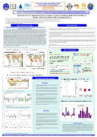
- 1. rica monsoon Introduction Results and Discussions Important variations of rainfall has occured in the Sahel since the 1950s at the interannual and decadal time scales . African populations are highly vulnerable to variations and climate change . For a better understanding of the strong variability of the climate in West Africa, it is necessary to understand which mechanism(s) are(is) at the origin of the drought which occured during the 70s and 80s in the Sahel (Fig 1) and its persistency during several years. Among mechanisms that have been investigated, sea surface temperature (SST) seems to explain a large share of the interannual variability of rain in the Sahel (Giannini and al 2003, Rodríguez-Fonseca and al 2011, Fontaine and al 2011). Interactions between vegetation and atmosphere play also an important role to explain such variations and particularly the recent drought over the Sahel (Charney (1975); Wang and Eltahir (2000); Clark and al. 2001; Taylor and al. 2002, Davin and Noblet-Ducoudré (2009)). This poster presents : 1. How important is an accurate representation of land-use for simulating historical variations of rainfall in West Afri- ca? 2. How to quantify the marginal effects of land-use changes and land cover change (LULCC) and SSTs on the West Af- *Contact: Souleymane SY, PhD Student at LPAOSF/ESP/UCAD and LOCEAN/IPSL/UPMC. Email: souleymane.sy@ucad.edu.sn ,Tel. (+221) 77 944 23 75 , BP 5085 Dakar Fann, Dakar-Sénégal Université Cheikh Anta DIOP de Dakar Ecole Supérieure Polytechnique Journée Porte Ouverte du Laboratoire Mixte International ECLAIRS (UCAD-IRD) 13 Décembre 2014 Dakar Sénégal Souleymane SY (1,2)*, Benjamin SULTAN (2), Amadou T. GAYE (1), Nathalie de NOBLET-DUCOUDRE (3), Ousmane NDIAYE (4), Malick WADE (1), Damien KUHN (5) (1)-Laboratoire de Physique de l’Atmosphère et de l’Océan -Siméon Fongang, Ecole Supérieure Polytechnique de l’Université Cheikh Anta Diop (UCAD) Dakar, Senegal (2)-Laboratoire d’Océanographie et du Climat: Expérimentation et Approches Numériques, Université Pierre et Marie Curie, Paris France (3)- Laboratoire de Science du Climat et de l’Environnement de l’Institut Pierre Simon Laplace, CEA-CNRS-UVSQ. Gif sur Yvette, France (4)- Agence Nationale de l'Aviation Civile et de la Météorologie du Sénégal (ANACIM), Sénégal (5)- KINOME, Montreuil sous Bois, France Discussion 2 For the validation of the Present-Day simulation of rainfall the Sahel, we can see that the mean rainfall in the observations is around 2.70 mm/day in summer. We simulate less rainfall in both simulations with PreIndustrial vegetation and with the present day vegetation, however the simu- lated mean rainfall is closer to the observations with the Present-day Vegetation fig(a). Fig (b) show the boxplots of observed and simulated rainfall. We can see that the median value of rainfall is closer with the Present day vegetation simulation. However both simulations underesti- mate the rainfall variability by a factor 2. These figures show a validation of the Present-Day simulation of rainfall the Sahel but for the va- riability. You have the correlation between observed and simulated rainfall on the left for each model and for the ensemble model mean. You have the root mean square error on the right. Cor- relations are higher with the present day vegetation up to 0.5 for the multi-model mean. You can also sea that root mean square errors are lower when using the Present-day vegetation. These results provide evidences that a realistic land cover map is necessary to accurately simulate historical variations of rainfall. These results show also the importance of the multi-model experi- ment where the multi-model mean shows the best skill with higher correlations and lower errors than individual models runs. We simulate less rainfall in both simulations with PreIndustrial vegetation and with the Present Day vegetation, however the simulated mean rainfall is closer to the observations with the Present -day Vegetation. Discussion 1 This fig1 shows the absolute changes from 1870 to 1992 with in yellow to red the areas where crop and pasture fraction has strongly increased. We can see that this fraction has strongly in- creased both in the Sahel and in Guinean Africa. In the fig2, we can see the differences (in fraction of the total area) between the PreIndustrial period and Present Day for different plant fonctional types (the coloured bars) and the different coupled models. Even if the same land cover change is prescribed to each coupled models. we can see also very different responses from one model to another, some models simulating drastic vegetation changes, some other very few changes. Such differences might be due to the paramatrization of the models and to the different ways they represent the plant functional ty- pes. Whereas the magnitude differs among models, the extension of cropped areas is reproduced in each simulation. The changes reach +3% in the Sahel and +5% in the Guinean Africa when we look the observation. The fraction of areas covered by forest has decreased (in green in the fig- ures), especially in the Guinean Zone. In the figure 3, we show the impacts of Land Use and Land cover changes on West African Climate and compare this impact to the one of SSTs and CO2. We choose to show on these two figures the impacts on Available water and the temperature in the Sahel and in Guinean Africa. Here are the changes in the simulated available water from 1870 to 1992 per season in response to SST/CO2 forcing (in light grey) and to LULCC forcing (in dark grey). In the Sahel, there is an opposite response between SST/CO2 effects with more available water and LULCC with less water in spring-summer-fall. This effect is different in the Guinean zone where more water is available from 1870 to 1992 especially in spring. But the signal remains weak. The temperaure anomaly show an opposite response between SST/CO2 forcing and Land use and land cover forcing with a strong signal in summer. Conclusion and outlook : To conclude we can say the extension of cropped areas and reduction of forests have been observed in the Sahel and in the Guinean Africa. A high dispersion of land use and land cover change varing from model to another. The historical variations of rain- fall in the Sahel are more accurately reproduced by the models with the accurate Land use. The opposite response between SST/CO2 forcing effects more water and Land use change forcing effects less water in the sahel. The effect of LULCC forcing is dif- ferent in the Guinean zone. The effect of land use and SST/CO2 forcing on the tem- perature are similary but a opposite sign. Data and Methods Fig2: Differences (in fraction of total area) between PD and PI simulations. Dashed black line represent the observation change of cropped areas Fig1: Absolute changes in crop and pasture fraction between the Preindustrial period (1870) and Present Day period (1992) fig3: Simulated available water changes (a) and Temperature anomaly (b) from 1870 to 1992 per season in response to SST/CO2 forcing and LULCC forcing Temperates regions Tropicals regions Sahel Guinea a.) b.) a.) b.) Impacts bioégeophysiques du changement d'usage des sols passé et présent sur le climat en Afrique de l'Ouest. Impacts bioégeophysiques du changement d'usage des sols passé et présent sur le climat en Afrique de l'Ouest. Les activités humaines ont de nos jours radicalement modifié la distribution du couvert végétal à la surface de la terre en réduisant la couverture arborée au profit de l'extension des surfaces cultivées. Le changement de l'occupation des sols qui en résulte a une influence importante sur le climat à l'échelle du continent de par les modifications des propriétés physiques de la surface. Le niveau de connaissance de ces impacts biogéophysiques est aujourd’hui insuffisant en raison de nombreux processus impliqués et des in- certitudes associées sur la représentation des processus de surface. Via l'intercomparaison de modèles de climat et d'autres outils développés, cette étude vise à identifier les signaux climatiques robustes liés au changement d'occupation des sols ainsi qu'à évaluer les incertitudes associées. Cette étude porte sur les premiers résultats des simulations du project Land Use and Climate, IDentifi- cation of Robust Impacts (LUCID) zoomé en Afrique de l'Ouest. LUCID est composé de sept modèles couplés surface- atmosphère avec des configurations expérimentales communes pour expliquer les impacts robustes et cohérents du changement d'occupation des sols passé (1870) et présent (1992). Des analyses statistiques faites dans cette étude ont permis d’évaluer les per- formances des modèles à simuler la variabilité interannuelle du climat actuel en Afrique de l’Ouest. Les résultats obtenus ont mon- tré que même si les modèles de climat représentent mal le climat actuel dans cette région avec beaucoup d'incertitude, leurs perfor- mances sont améliorées avec une carte d’occupation des sols plus réaliste. Les impacts biogéophysiques du changement d’occupa- tion des sols sont également comparés aux impacts de l'élévation des gaz à effet de serre résultant des changements de la températu- re de surface de l'Océan et de la concentration des extensions des glaces de mer. Basant notre analyse sur le Sahel et sur le golfe de Guinée, les études ont montré que pour un certain nombre de variable (eau disponible à la surface, température, énergie disponible etc), les impacts biogéophysiques du changement d’occupation des sols sont similaires à l'augmentation des gaz à effet de serre et du réchauffement des océans mais de signe opposé Mot clés: Variabilité Climatique, Impact, Sahel, Couvert végétal, Précipitation Abstract in French