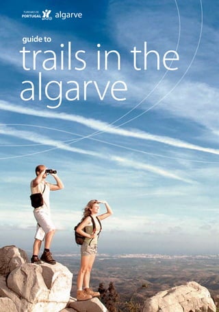
Guide to Trails in the Algarve
•
1 j'aime•6,194 vues

The “Guide to Trails in the Algarve”, which is the outcome of a partnership between the Algarve Tourism Board and the Algarve Regional Coordination and Development Commission, is a compendium of 33 trails with superb views which can be covered on foot or, in some cases by bicycle. O "Guia de Trilhos no Algarve", é o resultado de uma parceria entre o Turismo do Algarve e da Comissão de Coordenação e Desenvolvimento Regional do Algarve, é um compêndio de 33 trilhas com vistas soberbas que pode ser coberta em pé ou, em alguns casos de bicicleta.

Recommandé
Contenu connexe
Similaire à Guide to Trails in the Algarve
Similaire à Guide to Trails in the Algarve (20)
Dernier
Dernier (20)
Guide to Trails in the Algarve
- 1. trails in the guide to algarve
- 2. Thanks to The organisations responsible for the trails, for the information provided and support in the validation of the trails; The Portuguese Federation of Camping and Mountaineering for the information about the approval and signposting of the trails; To Coronel Rosa Pinto, for his help and readiness to share his knowledge of plant life and vegetation in the Algarve.
- 3. preface “Because the Algarve is a blend of distinct types “Tourism plays a key role in the Algarve, espe- of landscape – the coast, the hills of the “Serra” cially because of its capacity to act as an impe- and the “Barrocal” in between – with many tus to development and competitiveness in the corners still undiscovered, this publication aims region in a national and international context. precisely to raise the profile of the least known For tourism to become more sustainable, the natural sub-regions of the Algarve. protection and promotion of natural assets The “Guide to Trails in the Algarve”, which is the must be guaranteed, and these should not outcome of a partnership between the Algarve be regarded simply as a means of attracting Tourism Board and the Algarve Regional visitors and as an alternative to the familiar Coordination and Development Commission, “beach and sun” tourism, but also as having is a compendium of 33 trails with superb views major potential for the development of the which can be covered on foot or, in some cases region’s economy. by bicycle. This is a major challenge reflecting And it is in this context that this guide is being an approach which focuses on the observation published; it is part of the Action Plan on and understanding of the natural and Tourism and Development in the Algarve historical heritage of the municipalities in a which was the subject of an agreement in 2002 region which, through this publication, is between the Algarve Regional Coordination opening itself up to visitors as never before. and Development Commission, the Algarve The proposed trails, some of which are steeper Tourism Board, the Greater Metropolitan Area and others more accessible, are a source of of the Algarve and the Institute for Nature new interest in the segment of nature tourism, Conservation. It aims to promote and publicise which it is the intention of this guide to the natural assets of the Algarve and, more stimulate. And in this timely guide, we show specifically, to encourage people to go walking, readers some different places that can be which combines the enjoyment of nature and visited, described in more than 100 pages sporting activity.” of text and high quality images, which will certainly absorb the attention of those who venture on to them.” President of the Algarve Tourism Board President of the Algarve Regional Coordination and Development Commission
- 4. contents 03 Introduction 04 Description of the Region 06 Advice to walkers and cyclists 08 Map and Index 10 Trail Details Layout 11 Costa Vicentina – The West Coast 21 The South Coast 35 Barrocal 49 Serra 69 Guadiana 87 List of Species 88 Glossary 90 Useful contacts 95 Websites of interest Bibliographic references
- 5. 0 0 introduction The Algarve is the southernmost region in protecting natural and cultural resources, mainland Portugal, bounded to the west and promote the well-being and quality of and the south by the Atlantic Ocean, to the life of those who go walking. The activity is north by the Odeceixe river, the hills of the especially attractive from the points of view of Serra de Monchique and the Serra do education, science, recreation and tourism. Caldeirão and the Vascão river, and in the Providing an impetus to walking as a tourist east by the Guadiana river, which separates pursuit is the challenge for this publication, it from Spain. Its special location and the which, by familiarising people with new strong influence of the Mediterranean give trails in the Algarve also aims to set up new the region a unique environmental rich- thematic routes which have been somewhat ness, reflected in the marked diversity of its lacking in the nature tourism segment. scenery, to which natural assets and human The segment reinforces the affirmation of re- activity have added other special character- gional heritage that is of unparalleled value istics over the years. to both visitors and the resident population. In this regard, it is essential that the con- 33 trails have been included in the “Guide to ditions are created for the region’s most Trails in the Algarve”. The selection was made authentic values to be protected and for following a survey of existing trails in the these diverse and attractive landscapes to region and after numerous visits to the be preserved as areas of biocultural balance. countryside to validate them. The choice of These landscapes are necessary for the sus- routes was based on a number of criteria: tained development of the region, as they their condition, safety, the selection of at are places that attract visitors and lead to least one walk per municipality, the exist- a diversification of tourism in the Algarve, ence of publicity material and information something that is proved by the thousands panels and signposting, the proximity of of tourists who come to the region every major water resources, the presence of sig- year to explore the natural surroundings, nificant natural, scenic and cultural assets and to discover authentic traditions and and the existence of unusual features. different customs. The guide is organised into five areas: Walking enables people to be in close the Costa Vicentina (West Coast), the South contact with nature and can raise people’s Coast, the Barrocal, the Serra and the awareness about the importance of Guadiana.
- 6. 0 description of the region There is a wide range of different types of Two especially important sites for endemic landscape in the Algarve. The typical land- species are the southwest coast, in particular scape types in the region include: scrub and the Sagres promontory, and the higher part Mediterranean scrubland, woods of oak of the Serra de Monchique. trees and riverine forests in the upland areas As regards cultivated vegetation, there are of the Serra, karstic landscapes and dryland wide expanses of orchards, especially dryland orchards in the intermediate zone of the orchards with olive, carob, fig and almond Barrocal, and cliffs, dune and lagoon systems trees. In the upland areas there are woods of on the coast. oak trees and scrubland, as well as large plan- Much of the land is occupied by areas of tations of pine trees and eucalyptus. agriculture and forest. The vegetation cover There is a wide range of animal life in the as it exists today is the result of a change region, especially of vertebrates, owing to in the natural cover of this region, which the diversity of biotopes. Fish such as the consisted mainly of woods of oak trees, cork- “saramugo” (Anaecypris hispanica) and the “es- and holm-oaks, as a consequence of the calo-do-Arade” (Leuciscus aradensis), the rep- human activity carried out in the region over tiles Schreiber’s green lizard, the chameleon thousands of years, but mainly during the and the stripe-necked terrapin, the Cabrera last century. As regards the natural vegeta- vole and the wild cat (mammals) and birds tion, the Algarve has the typical elements such as the purple swamphen and Bonelli’s of Mediterranean vegetation, with some of eagle, are all names to be found on the list the species associated with this, such as cork- of species found in the Algarve, and some oaks, kermes oaks, rosemary, mastic trees, of these are only found in Portugal or the spurge flax, oleander, and strawberry trees. Iberian Peninsula. Alcoutim guadiana Aljezur Monchique serra Castro Marim barrocal Vila Real de Silves Santo António Loulé Portimão São Brás Lagoa de Alportel Tavira Lagos Vila do Bispo Albufeira Olhão Faro costa vicentina litoral sul N O E S 0 5 10km
- 7. 0 The wetland areas, especially estuarine areas Classified Sites of Rocha da Pena and Fonte and the lagoon systems known as “rias” (ria da Benémola. Including the 14 sites that are Formosa, ria de Alvor, Arade river, Guadiana part of Natura 2000 Network, some 38% of estuary), have an important function for ani- the total area of the Algarve has conserva- mal life as they sustain an important com- tion status, which testifies to its biological munity of fish which, together with other and scenic importance in European terms. wetland areas such as lakes, reed beds, rivers These protected areas and the ecological and streams, attract concentrations of bird corridors constitute the Regional Structure species of national and even international for the Protection and Enhancement of importance, as breeding locations, for win- the Environment, which is proposed by tering or during migration. Many of the main the Algarve Regional Land Regulation Plan, rivers and streams are also key ecological whose function is to define planning and corridors for the survival of fish, mammals, management guidelines which enable na- reptiles and amphibians, as they provide ture conservation and human activity to be interconnections between the natural areas harmonised, and which are conducive to the in the region. development of nature tourism. The protected areas in the Algarve are the Depending on their location and charac- Ria Formosa Natural Park, the Southwest teristics, the trails that have been selected Alentejo and Vicentina Coast Natural Park allow most of the above natural assets to be (part of which is in the region), the Nature observed. Reserve of the Castro Marim and Vila Real de Santo António Salt Marsh, in addition to the Protected area N O E Natura 2000 Network Site S Ecological Corridor 0 5 10km
- 8. 0 Vila do Bispo Parish advice to walkers and cyclists BEFORE SETTING OFF Equipment and clothing to consider taking Hat, sunglasses and sun cream. Footwear that is suitable for the walk to be done. Light clothing that is suitable for the season, including rainwear. A small, light bag for carrying water, light, energy-providing meals, a basic first aid kit, compass, torch (in case you are walking after nightfall), mobile phone (although the mobile communication network does not cover all parts of the interior) and the guide to trails. In order to get full benefit from the natural surroundings, it might be a good idea to take a camera, a pair of binoculars and even a magnifying glass.
- 9. 0 Other advice Find out what the weather forecast is. Check your departure time and confirm that you can complete the trail before it gets dark. For trails which are located in hunting zones, take care during the autumn and winter months, especially on Thursdays, weekends and public holidays. (For further information, please contact the “Núcleo Florestal do Algarve”, the Algarve Forestry Centre). Do not take unnecessary valuables with you. Never set off on a walk alone. IN THE COUNTRYSIDE Stick to the signposted trails. When going through inhabited and agricultural areas, respect people’s customs, traditions and property. Respect the rules which are in force in protected areas. Avoid making a noise: do not shout or speak loudly. Never go on to the dunes. And, for your own safety, do not drive or park on cliff tops. Do not gather plants or rocks, and do not disturb animals. If faced with an aggressive animal, do not run. Continue walking. Never light fires. It is advisable to stop from time to time for light snacks. Drink a little water each time, but sufficient to avoid becoming dehydrated. Do not leave any kind of rubbish behind. Take it with you and leave it where there is a rubbish collection service. Be alert to what is around you.
- 10. 0 map and index of trails Lisboa / Lisbon Lisboa / Lisbon Lisboa / Lisbon / Lisbon 13. Trail of Aromas 15. Trail of Tides 37. Sítio das Fontes Municipal Park Trail 17. Castelejo Environmental Trail 39. Paderne Castle Trail 21. At the whim of the tides 41. Cerro de São Vicente Trail 23. Rocha Delicada Trail 43. Rocha da Pena Trail 25. Praia Grande Interpretation Trail 45. Fonte Benémola Trail 27. São Lourenço Trail 47. A Walk to the Spring 29. Ilha da Culatra Trail 51. Discovering the Forest – Red Trail 31. Nature Discovery Trail of the 53. Discovering the Forest – Lilac Trail Marim Environmental Centre 55. Fóia Trail 33. Praia do Barril Trail 57. Lagoão Trail Note: The number of the trail corresponds to the number of the page where details can be found.
- 11. 0 Lisboa / Lisbon Lisboa / Lisbon mapa do algarve 59. Masmorra Trail 73. Ladeiras do Pontal Trail 61. D. Quixote Trail 75. Flow, flow ... Guadiana 63. Reserva Trail 77. Terras da Ordem Trail 65. Barranco das Lajes Trail 79. Amendoeira Trail 67. Between the Valleys, Springs and Memories 81. A Window on the Guadiana of the Serra do Caldeirão 83. Venta Moinhos Salt-marsh Trail 71. Uphill, downhill 85. Boa Vista Trail
- 12. 10 trail details layout Name Name of the trail. Signposted Whether there are signs on the trail, such as information panels Parish and signposts (in some cases, par- Municipality ticularly on beaches, only informa- Location Place where it is located. tion panels are provided). How to get there Indications about how to get there Special Features Here reference is made to any pe- and about the starting point.. culiarities of the trail, to any points Type Type of trail selected (On foot / of cultural interest or to any addi- by mountain bike / on horseback). tional information which could be Circular Trail Trail which starts and ends at the useful to walkers. same place and which, in most Natural interest This gives information about cases, only passes each point once. whether the walk passes through Distance Total distance to be covered includ- a Protected Area or a place that ing all the paths on the trail (reach- is part of Natura 2000 Network. It ing the starting point and returning also mentions different types of from the finishing point must be habitat that are of special natural added on non-circular trails). interest. Average Duration Calculated on the basis of the Description Brief description of what can be characteristics of the trail and on an seen on the route in terms of average speed of 3-3.5 kmph in the landscape, fauna, flora, or things case of walks. of cultural interest. The descrip- Ascent/Descent Based on the topographic profile. tion of the route follows the direc- Type of Path Roads, tracks and footpaths. tion suggested on the map. When to go? The best time to visit, bearing in Owners Whether the paths are public or mind weather conditions and the private. characteristics of the trail. Organisations Organisation(s) responsible for Approved Shows if the trail has been awarded Responsible the trail. the sign of approval by the Portu- Notes Additional information, such as guese Federation of Camping and whether the walk is in a hunting Mountaineering. zone. On “short routes” (PR), there are the following signs: “right way”, “wrong way” and “change of direction” (to the left or the right). change of direction right way wrong way to the left to the right
- 14. costa vicentina the west coast 13. Trail of Aromas 15. Trail of Tides 17. Castelejo Environmental Trail
- 15. 13 trail of aromas Name Trail of Aromas Parish Bordeira Municipality Aljezur Location Bordeira How to Get There Take the A22 motorway as far as Bensafrim, and continue on the EN 120 in the direction of Aljezur; after 14 km turn off towards Bordeira. The trail starts to the north of the Ribeira da Bordeiraw. Type Walk Circular Trail Yes Distance 14 km Average Duration 04h30 m Ascent/descent (See diagram of the topographic profile on the map of the trail) Type of Path Earth paths. When to Go? All year round, except on very hot days. Approved No Signposted Yes Natural Interest The trail is located in the Southwest Alentejo and Costa Vicentina Natural Park and in Natura 2000 Network (Costa Sudoeste site) Owners Public paths Org. Responsible Bordeira Parish Office Notes The trail is in a hunting zone.
- 16. 14 Kermes Oak The trail begins at the information panel changes and you come across areas of wild which is located to the north of the Ribeira olive and olive trees. On the way to Monte da Bordeira, near the village of Bordeira. Novo, you walk through an area of scrubland To begin with, you walk through a wooded with scattered pine trees. area, with eucalyptus, stone pines and some Pedra Ruiva is an excellent place for seeing cork-oaks. The shrubby vegetation consists a wide range of plant species: the dwarf mainly of cistus, Montpellier cistus, Spanish heath, the wrinkle-leaved Cistus, mastic trees, purple phlomis, spurge flax and narrow-leaved phillyrea, the Spanish heath, heather. And the fauna is varied: here can be camphor thyme, the large yellow restharrow found the typical species of Mediterranean and basil-like sunrose. scrubland – wild boar, the Iberian hare, the On the way back to the starting point of the European rabbit, the great tit, the common trail and as you pass through Bordalete, you quail, the red-legged partridge, the common will see a wide variety of plants which, as buzzard, the mongoose etc. throughout the walk, do full justice to the Between the Ribeira do Tacual and the sec- name of this trail. ond panel, you enter a valley. The landscape
- 17. C D E 200 B 0 0 7500 15000 topographic profile (m) A F 0 0,25 0,5 km 1 trail of aromas 1 A Ausgangspunkt Blick über das Tal D E Buschwerk Blick über das Meer B Ufervegetation F Blick über die Flur C Panoramablick Wanderweg
- 18. 15 trail of tides Name Trail of Tides Parish Bordeira Municipality Aljezur Location Carrapateira How to Get There Take the A22 motorway as far as Bensafrim, continue on the EN 120 in the direction of Aljezur and after 14 km turn off in the direction of Carrapateira. The trail starts next to the restaurant “O Sítio do Rio”, in Carrapateira. Type Walk/ Mountain bike / Horseback Circular Trail Yes Distance 19 km Average Duration 7h Ascent/descent (See diagram of the topographic profile on the map of the trail) Type of Path Earth paths and tarred road. When to Go? All year round except in the summer months and on very hot days. Approved No Signposted Yes Special Features There are earth paths with a certain amount of vehicular traffic. The coastal area can be very windy. Natural Interest The trail is located in the Southwest Alentejo and Costa Vicentina Natural Park and in Natura 2000 Network (Costa Sudoeste site). Owners Public paths Org. Responsible Bordeira Parish Office Notes The trail is located in a hunting zone.
- 19. 16 The trail begins in an area of dunes and In Vilarinha you can find a number of plant continues along the coast on the coastal pla- formations which indicate the existence of teau as far as the beach at Praia do Amado, a wetter environment associated with the through juniper trees, mastic trees, marram Ribeira da Carrapateira. This part of the trail grass and many other plants which have is particularly rich in vegetation. Alongside established themselves here and which have the wetland vegetation, there are also well made the dunes important places of biologi- developed formations that are typical of the cal and scenic diversity. Serra (e.g. areas of cork oaks or strawberry Along the coast you can see a number of trees). The fauna is also rich here and, in addi- aquatic birds that nest here or that pass tion to traces of the mammals that live here through here during migration. There are (wild boar, foxes etc), you may be surprised also a large number of nests of white storks by rabbits or hares in the areas of pasture, in the rocky cliffs, something that is unique scrubland or pine forest. This is also a very in the world. interesting part of the trail for observing From Praia do Amado, the trail continues birds, above all Passeriformes (such as black- towards the interior, and the landscape birds, the azure-winged magpie, the pied begins to change: gradually species such wagtail, the stonechat, the greenfinch, the as mastic trees, the white-leaved rockrose, great tit) and birds of prey (such as the short- the sage-leaf rockrose, cork-oaks and cistus toed eagle and the common buzzard). begin to appear.
- 20. B A 1 C E E D perfil topográfico 200 0 0,25 0,5 km 0 0 10000 20000 topographic profile (m) trail of the tides 1 A B Start of the trail View over the mouth of the Ribeira da Carrapateira Panoramic view D E F View over Praia do Amado Riverside vegetation Well-developed plant communities C Panoramic view Trail
- 21. 17 castelejo environmental trail Name Castelejo Environmental Trail Parish Vila do Bispo Municipality Vila do Bispo Location Castelejo Leisure Area How to Get There On arrival in Vila do Bispo, take road number 1265 which goes to the beach Praia do Castelejo. The trail starts in the Castelejo Leisure Area, which is located about halfway along this road, right in the middle of the Southwest Alentejo and Costa Vicentina Natural Park. Type Walk Circular Trail Yes Distance 3,5 km Average Duration 01h30 Ascent/descent (See diagram of the topographic profile on the map of the trail) Type of Path Earth path. When to Go? All year round. Approved No Signposted Yes Natural Interest The trail is located in the Southwest Alentejo and Costa Vicentina Natural Park and Natura 2000 Network Owners Public paths Org. Responsible Vila do Bispo Parish Office Notes There is a field guide available on CD.
- 22. 18 Stone Pine At the beginning of the trail, as far as the Then you enter an area covered mainly with warden’s house, you walk through an area of shrubs, especially cistus. pine trees (maritime and stone pines). On returning to the starting point of the trail, The shrubby vegetation mainly consists of you can see the Praia do Castelejo at certain Genista hirsuta gorse-heaths, mastic trees, points in the distance. The fauna that can cistus, white-leaved rockrose, Montpellier be seen here includes birds associated with cistus, lavender and strawberry trees. areas of pine trees and scrubland, such as The middle part of the trail continues mainly the great spotted woodpecker, the Eurasian through a gully wooded with stone pines jay and the great tit, certain reptiles and also and some eucalyptus. Here the trail runs signs of the presence of mammals such as along a small stream with the typical vegeta- wild boar, foxes and European rabbits. tion of such habitats on its banks, such as reed mace, tamarisk and giant reeds.
- 23. D 1 C B A 150 0 0,25 0,5 km 0 0 2000 4000 topographic profile (m) castelejo 1 A Start of the walk in the Castelejo leisure area environmental trail Pine wood B Small lake C View over the valley D Panoramic view Trail
- 25. the south coast 21. At the whim of the tides 23. Rocha Delicada Trail 25. Praia Grande Interpretation Trail 27. São Lourenço Trail 29. Ilha da Culatra Trail 31. Nature Discovery Trail of the Marim Environmental Centre 33. Praia do Barril Trail
- 26. 21 at the whim of the tides Name At the whim of the tides Freguesia Alvor Concelho Portimão Location The town of Alvor How to get there From Portimão, go to Alvor. In the riverside area, beside the fishing port, head for the beach. On the beach, turn right on to a path which leads through the salt-marsh. Tipo Walk Circular trail Yes Distance 5 km Average duration 2h Declive (See diagram of the topographic profile on the map of the trail) Type of path Earth and sand paths. When to go? All year round. Approved No Sinalizado Yes Natural interest Salt-marsh wetland area. Dunes. Birdlife. Natura 2000 Network (Ria de Alvor site). Owners Public paths Ent. responsável Portimão Municipal Council
- 27. 22 This is a very interesting trail for the detailed marsh. Here, typical species such as the pink- observation of aquatic birds, both along flowered shrub Limoniastrum monopetalum, the beach and in the dunes and the Ria de the glasswort Sarcocornia fruticosa and the Alvor. Birds such as the common tern, the shrubby sea-blite can be seen. dunlin, herons, plovers, the northern gannet, After walking for about 3 km as far as Medo amongst many other species, can be seen in Grande, you reach the beach, where the trail their different types of habitat. continues as far as a wooden construction, Outside the summer season, and especially where you turn inland and return to the during periods of migration and in the win- starting point. ter, this area is rich in birdlife. The trail starts in the riverside area of the Ria de Alvor, and follows a path along the salt-
- 28. A 1 B C 20 0 0 0,25 0,5 km 0 3000 6000 topographic profile (m) at the whim 1 A Start of the Trail Salt-marsh of the tides B Dune C Beach Trail
- 29. 23 rocha delicada trail Name Rocha Delicada Trail Parish Alvor Municipality Portimão Location Quinta da Rocha How to get there On the EN 125 in the direction of Lagos, go as far as Mexilhoeira Grande. The trail starts next to the railway station in this village. Type Walk Circular trail Yes Distance 7 km Average duration 2h Ascent/descent (See diagram of the topographic profile on the map of the trail) Type of path Earth path. When to go? All year round, except on very hot days. Approved No Signposted Natural interest Yes Salt-marsh wetland area. Dunes. Birdlife. Sítio da Special Features Natura 2000 Network (Ria de Alvor site). At Quinta da Rocha, the association “A Rocha” has a Owners Centre for the Study and Observation of Nature with Public paths regular activities (ringing birds and environmental Org. responsible education activities). Portimão Municipal Council
- 30. 24 The trail begins on a peninsula in the Ria de This diversity of landscapes, concentrated Alvor. To start with, you walk through fields, in a relatively small space, provides a high where vines and cereals are growing, degree of biodiversity, in particular birdlife, or cattle pasture, and there are some areas which varies significantly during the year. that are planted with dryland orchards (al- The best times for bird-watching are the win- mond and fig trees) and citrus. ter and the month of October, when large You then pass some fish-farming tanks, until numbers of limicoline birds and you reach a junction, and the trail continues Passeriformes can be seen. through a landscape of salt-marsh. In this Also of special interest are the birds of prey, habitat, interesting plant communities can most of which pass through the Ria de Alvor, be observed and a diversity of species associ- although species such as the peregrine ated with high, mid and low marsh zones. falcon, the common kestrel and the little owl Adjacent to the agricultural fields, there are are relatively common. extensive areas of pine trees and Mediterra- nean scrubland.
- 31. 1 A D 50 C 0 0 4000 8000 topographic profile (m) 0 0,25 0,5 km B rocha delicada trail 1 A Start of the trail Fish-farming tanks B Salt-marsh C Agricultural fields D Quinta da Rocha (Cruzinha) Trail
- 32. 25 praia grande interpretation trail Name Praia Grande Interpretation Trail Parish Pêra Municipality Silves Location Praia Grande How to get there From the A22 motorway, take the Algoz exit and head for Pêra, crossing the EN 125. After 300 m, turn left at the junction and, when you reach a roundabout, take the second exit. The trail begins on the right hand side of the road, where there are some windmills. Type Walk Circular trail No Distance 5,5 km Average duration 2h Ascent/descent (See diagram of the topographic profile on the map of the trail) Type of path Earth path and beach. When to go? All year round. Approved No Signposted Yes Special Features The return to the starting point can be done along the main road which provides access to the beach. Natural interest Salt-marsh wetland area and coastal lagoon. Birdlife. Dune system. Pine wood Owners Earth paths, except for the part in front of the dune system. Org. responsible CCDR-Algarve Notes There is another trail in the same area.
- 33. 26 cattle egret The trail begins in an area of dryland farming You then walk through the dunes which join with carob, almond and fig trees. the mouth of the Ribeira de Alcantarilha to Windmills and barns used some years ago the bar of the Salgados lagoon. This is the can still be seen. most interesting place to appreciate the After crossing these fields, you can see an dune vegetation, such as sea holly, European area of stone pines on a fossil cliff. sea rocket, cottonweed, sea medick, curry The undergrowth consists mainly of mastic plant, spiny thrift, coastal crucianella and trees, European fan-palms, spurge flax, white large yellow restharrow. asparagus and conehead thyme. When you reach the Salgados lagoon, on Continuing in the direction of the beach, the other side of the rush-bed, areas of giant you reach the salt-marsh of the Ribeira de cane and reed mace can be seen, especially Alcantarilha, where the different plant com- along the Ribeira de Espiche which flows out munities can be seen that flourish in here. There is a major birdlife community a wetland area: rush-beds, halophytic scrub here, with such interesting species as the and Mediterranean salt meadows, which, ferruginous duck, the purple swamphen, the together with the silt banks, are of great in- common spoonbill, the black-winged stilt, terest from the point of view of conservation. the purple heron and the little tern.
- 34. A 1 B C C D C E 50 F 0 0 3000 6000 topographic profile (m) 0 0,25 0,5 km praia grande 1 A Start of the trail Pine wood E Salgados lagoon; bird watching interpretation trail B Salt-marsh F Beach C Dune sistem Trail D View over fields
- 35. 27 são lourenço trail Name São Lourenço Trail Parish Almancil Municipality Loulé Location Quinta do Lago How to get there When you get to Almancil, turn off to Quinta do Lago and follow the signposts as far as the car park at Praia da Quinta do Lago. Type Walk Circular trail No Distance 3,4 km (there and back) Average duration 01h30 Ascent/descent (See diagram of the topographic profile on the map of the trail) Type of path Earth path When to go? All year round. Approved No Signposted Yes, marked with stakes painted with a blue bar. Special Features The trail can sometimes be submerged due to the fact that the salt-marsh is an area affected by tides. Be careful of stray balls when walking near the golf course. Natural interest Owners Salt-marsh wetland area and freshwater lakes. Birdlife. Public paths Trail located in the Ria Formosa Natural Park and Organisations responsible Natura 2000 Network (Site Ria Formosa/ Quinta do Lago, Loulé Municipal Council, PNRF Castro Marim). and Infraquinta
- 36. 28 Purple swamphen At the start of the trail, on the side of the ria, the São Lourenço golf course, where the the dune system, the lagoon and the salt- common reed, reed mace and rushes are the marsh can be seen. The trail runs alongside dominant species. At this artificial lake, there the golf course, next to an area of housing is an observatory for bird watching with a located in the pine wood. In these areas of wide range of aquatic birds, the main ones pine trees (stone pines and maritime pines) being the purple swamphen, the little bit- there are interesting animals such as the tern, the little grebe, different species of duck azure-winged magpie, and the chameleon, and the Eurasian coot. The lake can also be a reptile species which only exists in Portugal a good place to see the two species of ter- on the coastal strip of the Algarve. rapin that are native to Portugal. When you reach a small patch of pine trees, On the way to the Roman ruins, you once you can find other types of shrubby vegeta- again enter an area with a view of the salt- tion such as sage-leaved rockrose, Genista marsh, with an excellent view over the ria, hirsuta gorse-heaths and mastic trees. where birds including limicoline birds and A few metres further on, you get to a lake on colourful flamingos can regularly be seen.
- 37. 1 A E B C D topographic 50 0 0,25 0,5 km 0 0 1000 2000 topographic profile (m) são lourenço trail 1 A Start of the trail Salt-marsh and view over the dune system B Beginning of the pine wood C Freshwater lakes and observatory for bird watching D View over the ria and the salt-marsh E Roman ruins Trail
- 38. 29 ilha da culatra trail Name Ilha da Culatra Trail Parish Sé Municipality Faro Location Ilha da Culatra How to get there From Olhão, catch the boat at the quay; there is transport all year round to this island. Type Walk Circular trail No Distance 5,6 km (there and back) Average duration 2h Ascent/descent (See diagram of the topographic profile on the map of the trail) Type of path Wooden walkway and beach. When to go? All year round. Approved No Signposted Yes Natural interest Salt-marsh wetland area. Birdlife. Trail located in the Ria Formosa Natural Park and in Natura 2000 Network (Ria Formosa/ Castro Marim site). Owners Public paths Org.(s) responsible Ria Formosa Natural Park, Faro Municipal Council and Ambifaro
- 39. 30 Marram grass After crossing the ria and arriving in Culatra, When you reach the beach, the trail con- you enter the village where there is an in- tinues to the left. The remains of shells and formation panel for this trail. Take the main aquatic sea birds are some of the natural as- street towards the beach, where you will pects that can be observed, until you reach find a wooden walkway which leads walkers a path signposted with a tree trunk, leading through the dune system. to a walkway which ends at an inlet of the ria. The dune vegetation is of particular interest Here you will have a chance to observe the because of the way it has adapted to birds of the ria – such as the common red- demanding conditions in terms of tempera- shank, the Eurasian curlew, the dunlin, the ture, salinity and anchorage in the ground. little tern, the great cormorant, and the grey Plants such as seaside chamomile, heron, among many others – while you take Portuguese thyme, curry plant, marram grass, the chance to have a rest. sand couch-grass and sea holly are some of To return, you walk back along the same trail. the dune species that are most abundant.
- 40. 1 E D A B C topographic 50 0 0,25 0,5 km 0 0 1500 3000 topographic profile (m) ilha da culatra trail 1 A Start of the trail Salt-marsh vegetation B Dune vegetation C Beach D Dune vegetation E View over the Ria Formosa Trail
- 41. nature 31 discovery trail of the marim environmental centre Name Nature Discovery Trail of the Marim Environmental Centre Parish Quelfes Municipality Olhão Location Quinta de Marim How to get there Travelling on the EN 125 in the direction Faro–Vila Real de Santo António, turn right next to a filling station 1 km after Olhão. Here you will see a sign to the access road leading to the head office of the PNRF. The Marim Environmental Education Centre is where the trail takes place. Type Walk Circular trail Yes Distance 3 km Average duration Special Features 01h30 Interpretation Centre with equipment and facilities Ascent/descent for supporting environmental education activities. (See diagram of the topographic profile on Natural interest the map of the trail) Birdlife. Salt-marsh and freshwater and brackish water Type of path lakes. Pine wood. Salt pans. Trail located in the Ria For- Earth path and beach. mosa Natural Park (PNRF) and in Natura 2000 Network When to go? (Ria Formosa/ Castro Marim site). All year round. Owners Approved Institute for Nature Conservation (ICN) No Org. Responsible Signposted ICN (Ria Formosa Natural Park). Yes
- 42. 32 The trail starts in an area of pine trees at the Marim Environmental Education Centre (CEAM) and continues in the direction of the Interpretation Centre. The trail goes through a number of points of natural interest, such as pine woods, salt pans, areas of salt-marsh and reed-beds, a freshwater lake, an area of dunes and an- other of dryland orchards. In these types of habitat, you can see a wide range of animal life, especially birds. Species such as the white stork, the great tit, the black-winged stilt, the little egret and the coot are some of those that can be seen here. In addition, the vegetation associated with each zone of the CEAM is especially interesting and varied. The trail also includes other points of inter- est such as a tuna boat (a boat used for transporting tuna which was recovered by the PNRF), a tidal mill, observatories for bird-watching, Roman ruins (salting tanks), a centre for the rehabilitation of birds, a kennel which specialises in the Portuguese water- dog, a picnic site and the house of the poet João Lúcio. In the Interpretation Centre you can obtain publications, see exhibitions and get infor- mation connected with environmental issues and in particular with the Ria Formosa.
- 43. O M L P N 1 K A J B I C G H F D E 50 topographic 0 0,25 0,5 km 0 0 1500 3000 topographic profile (m) nature discovery 1 A Start of the trail Marim Interpretation I J Salt-marsh Freshwater lake and trail of the marim Centre observatory for bird watching environmental B C Pine wood Salt pans K L Salting tanks (Roman ruin) Dryland orchards centre D Fish-farming tanks M Centre for the rehabilitation E Tuna boat of birds F Rush-bed N Water-wheel G Dunes O Portuguese water-dog kennel H Tidal mill P Picnic site Trail
- 44. 33 praia do barril trail Name Praia do Barril Trail Parish Santa Luzia Municipality Tavira Location Pedras d’ El Rei How to get there On the EN 125, between Luz de Tavira and Tavira, follow the signpost to Pedras d’ El Rei. After you go through the tourist village, the trail starts near the walkway that crosses over the ria. Type Walk Circular trail No Distance 3 km (there and back, excluding the trail on the beach) Average duration 01h15 Ascent/descent (See diagram of the topographic profile on the map of the trail) Type of path Walkway and beach. When to go? All year round. Approved No Signposted Yes Natural interest Salt-marsh wetland area. Birdlife. The trail is located in the Ria Formosa Natural Park and in Natura 2000 Network (Ria Formosa/ Castro Marim site). Owners Public path Org.(s) responsible Tavira Municipal Council and ICN (Ria Formosa Natural Park)
- 45. 34 The Praia do Barril trail starts at the entrance here include limicoline birds (dunlins, plovers, to the beach, and goes through a wide area the red knot, the black-winged stilt, the of salt-marsh as far as the dunes and the old avocet), seagulls and terns, as well as herons. fishermen’s buildings, which have now been When you reach the beach, you can con- turned into beach support facilities. tinue the trail on either side: on the right, in This is an interesting trail for observing the the area where the dune system is being birds of the ria and the vegetation of the restored and is protected by a palisade, dunes and the salt-marsh, especially at low a variety of indigenous plant species can tide when a large area of mud flats is be seen; on the left, it is suggested that you uncovered where birds feed and interesting read the information panel to find out a bit species such as the fiddler crab live. more about the history surrounding the The main species of birds that can be seen “anchor cemetery”.
- 46. 1 A B D E C topographic 50 0 0,25 0,5 km 0 0 750 1500 topographic profile (m) praia do barril trail 1 A Start of the trail Salt-marsh B View over the northern side of the dune system C Dune D Fishermen’s buildings (turned into beach support facilities) E Cemitério de âncoras (anchor cemetery) Trail
- 47. 35 barrocal
- 48. barrocal 37. Sítio das Fontes Municipal Park Trail 39. Paderne Castle Trail 41. Cerro de São Vicente Trail 43. Rocha da Pena Trail 45. Fonte Benémola Trail 47. A Walk to the Spring
- 49. 37 sítio das fontes municipal park trail Name Sítio das Fontes Municipal Park Trail Parish Estômbar Municipality Lagoa Location Sítio das Fontes How to get there Follow the A22 motorway, take the exit to Silves and continue in the direction of the railway station. At the next roundabout, turn right and continue until you see a sign indicating the municipal park. The trail begins next to the car park. Type Walk Circular trail No Distance 1,2 km (there and back) Average duration 30 min. Ascent/descent Natural interest (See diagram of the topographic profile on the map There are facilities for visitors at the park (e.g. a Nature of the trail) Interpretation Centre, a picnic site, a training circuit Type of path and a playground). Earth path. Natural interest When to go? Springs. Different types of habitat. All year round. Natura 2000 Network (Arade/Odelouca site). Approved Owners No Public paths Signposted Org. responsible Yes Lagoa Municipal Council
- 50. 38 Mastic tree “Sítio das Fontes” (Place of Springs) is located Continuing along the signposted trail, you on the banks of a branch of the Rio Arade. reach the springs from which the park The site occupies a small area with a wide derives its name, as well as a weir and the range of environments, including areas of associated tidal mill. Near the mill in the area salt-marsh, marsh, Mediterranean scrubland, of salt-marsh can be seen a number of riverine vegetation and stretches of fresh, species that are typical of this habitat, such brackish and salt water. as saltwort and the sea rush. At the beginning of the trail, a water-wheel On the land around the trail, there are can be seen, which at one time was used dryland orchards and well-developed areas to irrigate agricultural fields and vegetable of mastic trees and scrubland. The whole plots that have since been abandoned. trail provides good opportunities for observ- You can also visit the Nature Interpretation ing the local fauna, especially aquatic birds and Centre (CIN), which is housed in an old birds associated with Mediterranean scrubland. restored rural building, and find out about a system for wastewater treatment using plants.
- 51. E D C A B 1 topographic 50 0 0,25 0,5 km 0 0 400 800 topographic profile (m) sítio das fontes 1 A Start of the trail Nature Interpretation Centre (CIN) municipal park trail B Springs C Weir and mill D Area of mastic trees E Panoramic View Trail
- 52. 39 paderne castle trail Name Paderne Castle Trail Parish Paderne Municipality Albufeira Location Around Paderne Castle How to get there Leave the A22 motorway in the direction of Albufeira, turn off to Ferreiras and follow the signs to Paderne. In Paderne, follow the road to the castle. This walk can begin on the way from Paderne or at the water-mill at the castle. Type Walk Circular trail Yes Distance 4,5 km Average duration 01h30 Ascent/descent (See diagram of the topographic profile on the map of the trail) Type of path Earth footpath. When to go? All year round. Approved No Signposted Yes Special Features Paderne castle. During the rainy season, the weir may become impassable which means that the walk would have to be done in the opposite direction to that in the description. Natural interest Riverine vegetation and juniper wood. Part of the Ribeira de Quarteira site of Natura 2000 Network. Owners Public and private paths Org. responsible CCDR-Algarve Notes There is another walk in the same area.
- 53. 40 strawberry tree The walk follows both banks of the Ribeira de to tradition) and from there you can con- Quarteira. If you begin the walk at the castle tinue along the left bank, along the valley water-mill, you cross the weir and continue where there is a narrow strip of flat land with along the right bank of the river. carob and olive trees. It is well worth climb- In this valley, with steep sides, you can see a ing up to the castle from where the view wide variety of plants such as purple phlomis, over the valley and the surrounding area is various species of Cistus, the European fan especially beautiful. palm, the mastic tree, Montpellier cistus, the As regards fauna, there have been sightings strawberry tree, the Kermes oak, spurge flax, of mammals such as the otter, the weasel, wild olives, juniper and narcissi. The banks of the lesser mouse-eared bat and the the river are dominated by reeds, tamarisk, European hedgehog, and it is easy to oleander and the narrow-leafed ash. observe some of the typical birds of Mediter- To reach the left bank of the river, cross the ranean woodland, aquatic birds and even a bridge (which is Roman in origin, according number of amphibians and reptiles.
- 54. 1 A 2 E B C D 100 100 topographic topographic 0 0,25 0,5 km 0 0 0 1250 2500 0 500 1000 topographic profile (m) topographic profile (m) paderne castle trail 1 2 Beginning of the trail, starting from the access to Paderne Beginning of the trail, starting from the water-mill A Water-mill and weir B Vegetation on the banks of the river C Roman bridge D Paderne Castle E Plain Trail
- 55. 41 cerro de são vicente trail Name Cerro de São Vicente Trail (PR2) Parish Paderne Municipality Albufeira Location Paderne How to get there Leave the A22 motorway in the direction of Albufeira, turn off to Ferreiras and then follow the signs to Paderne until you reach the Estádio João Campos. The walk begins next to the Chapel of Nossa Senhora ao Pé da Cruz. Type Walk Circular trail Yes Distance 11 km Average duration 03h30 Ascent/descent (See diagram of the topographic profile on the map of the trail) Type of path Rural paths and tarred road. When to go? All year round. Approved Yes Signposted Yes Special Features It might not be possible to cross the Ribeira de Algibre during the rainy season. Natural interest The walk is located in an area of Natura 2000 Network Org. responsible (Barrocal site). Albufeira Municipal Council Owners Notes Public paths Located in a hunting zone.
- 56. 42 Start near the Chapel of Nossa Senhora ao Pé da Cruz, and cross the Ribeira de Quarteira over the D. Carlos I bridge, also known as the Paderne bridge. As the Cerro de S. Vicente comes into view, you leave behind a landscape where there is a clear human presence. Before you begin to climb, the path is flanked by dryland orchards with fig, carob and almond trees. On the ascent, the landscape is dominated by agricultural smallholdings. Some of the shrubby vegetation already shows signs of typical Mediterranean vegetation, with species such as juniper, mastic trees, Kermes oak and lavender. At the top, you enter an area of Kermes oaks and carob trees. From here on, there is a panoramic view of the surrounding area, especially over Paderne, over areas of the typical scrubland of the Algarve Barrocal and even over the motorway, which has a major visual impact on the countryside. As you descend to the valley, the most com- monly seen species of typical Mediterranean vegetation are the white-leaved rockrose, pur- ple phlomis, the strawberry tree, Montpellier cistus, the Kermes oak, spurge flax, Ulex argen- teus and Genista hirsuta gorse-heaths. In the valley, the landscape consists of orchards of carob trees and citrus. The final part of the walk takes you through the plains of the Ribeira de Alte and the Ribeira de Algibre. In the latter, you can cross at the ford or over small stones. Fig trees, olive trees, vines and typical riverine vegetation can be seen alongside the walk until you get back to the starting point. In terms of vertebrates, the principal ones to be seen are aquatic fauna and those seen near rivers: the otter, the stripe-necked terrapin or fish such as the Hybrid minnow Rutilus albur- noides and the Iberian endemic Chondrostoma lemmingii. Kermes oak
- 57. E F 1 D C A B perfil topográfico 300 0 0,25 0,5 km 0 0 6000 12000 topographic profile (m) cerro de 1 Start of the Trail (Chapel of Nossa Senhora do Pé da Cruz) D E Valley with orchards Ribeira de Alte são vicente trail A B C Panoramic view Ruins of São Vicente mill Mediterranean vegetation F Ribeira de Algibre Trail
- 58. 43 rocha da pena trail Name Rocha da Pena Trail Parish Salir e Benafim Municipality Loulé Location Rocha da Pena How to get there From Loulé, go to Salir and take the EN 124 towards Alte. Before you reach the village of Pena, turn off to Rocha da Pena. The trail begins at Rocha. Type Walk Circular trail Yes Distance 6,4 km Average duration 2h Ascent/descent (See diagram of the topographic profile on the map of the trail) Type of path Stony path and footpaths. When to go? Not during the summer or on very hot days. Approved No Signposted Yes Special Features Huge rocky outcrop. Karstic landscape. Natural interest Scenery. Vegetation. Birdlife. The trail is located in the Rocha da Pena Classified Site and in the Barrocal site of Natura 2000 Network. Owners Public paths Org. responsible Loulé Municipal Council
- 59. 44 white-leaved rockrose The trail starts up a steep slope to the bats, which have an important hibernation plateau, which is 479 metres above sea level and breeding colony here. at the Talefe viewing point. During the trail you will be able to see a Rocha da Pena is located in a transitional significant number of the typical flora and area between the Barrocal and the Serra, fauna of the Algarve Barrocal and Serra. which means that it displays a high degree The view over the wide landscapes all of biodiversity. Mixed woods of holm-oaks around is another of this trail’s main attrac- and juniper trees, areas of Kermes oaks and tions. Also on the plateau, it is especially species such as rosemary, the Western peony, interesting to see the rock wall, which is the white-leaved rockrose and the European thought to date back to the Iron Age. fan palm contribute to the high degree of The trail then descends to the village of diversity in plant life in this classified site. In Penina, and from there to Rocha, on a path terms of fauna, the highlight is Bonelli’s eagle, from where most of the south-facing escarp- which nested here regularly in recent times, ment can be seen. as well as some species of cave-dwelling
- 60. B D C E A F G 1 500 200 0 3500 7000 topographic profile (m) 0 0,25 0,5 km rocha da 1 A Start of the trail Mediterranean vegetation E Talefe viewing point and panoramic view pena trail B Panoramic view (North) F Village of Penina C Panoramic view (South) G View over the escarpment D Rock wall Trail
- 61. 45 fonte benémola trail Name Fonte Benémola Trail Parish Querença Municipality Loulé Location Fonte Benémola How to get there From Loulé heading towards Salir, at the crossroads in Tôr turn towards Querença on the EM 524. After crossing the bridge over the Ribeira da Fonte Menalva, continue on the road along the river until you turn to the left on to a gravel road. Type Walk Circular trail Yes Distance 4,4 km Average duration 01h30 Ascent/descent (See diagram of the topographic profile on the map of the trail) Type of path Earth paths. When to go? All year round. Approved No Signposted Yes Special Features Springs Natural interest Riverine vegetation. Springs. The trail is located in the Fonte Benémola Classified Site and in the Barrocal site of Natura 2000 Network. Owners Public paths Org. responsible Loulé Municipal Council
- 62. 46 The trail begins at Fica Bem, and you walk along an earth path through a valley with a number of agricultural fields and orchards. On the slopes of the valley, the vegetation is typical for the Barrocal, although at the end of the walk there is an area of schistose soils dominated by cistus and cork-oaks. Along the Ribeira da Fonte Menalva the river- ine vegetation is dense and diverse, consisting of species such as narrow-leaved ash, tamarisk, white willow, oleander, laurustinus and European white poplar. The river is the habitat of some important species from a conservational point of view, such as terrapins, otters, and the common kingfisher, along with many species of verte- brates. The areas adjacent to the river are also of great importance as they contain a large number of Algarve species of flora and fauna. The Ribeira da Fonte Menalva flows all year round because of a number of springs. This is even the case in the summer, espe- cially downstream from Fonte Benémola. Stripe-necked terrapin There is also a picnic site on the trail.
- 63. F E D C B G A 1 200 0 0,25 0,5 km 100 0 2500 5000 topographic profile (m) fonte 1 A Start of the trail Lime kiln D E Riverside vegetation Springs benémola trail B Agricultural fields F Picnic area and orchards G Basket-maker C View over the plain of the and sales of handicrafts Ribeira da Fonte Menalva Trail
- 64. 47 a walk to the spring Name A Walk to the Spring Parish S. Brás de Alportel Municipality S. Brás de Alportel Location Starts and ends at Fonte da Mesquita. How to get there On arrival at S. Brás Alportel, take the EN 270 in the direction of Tavira and turn right at the crossroads to Fonte da Mesquita. The trail starts at the crossroads in Fonte Mesquita. Type Walk Circular trail Yes Distance 9 km Average duration 3h Ascent/descent (See diagram of the topographic profile on the map of the trail) Type of path Country paths and tarred road. When to go? All year round. Approved No (in the process of being approved) Signposted Yes Special Features There is a point of geological interest and a water-mill. Natural interest Different types of habitat. Landscape. Owners Public paths Org. responsible S. Brás de Alportel Municipal Council
- 65. 48 The trail starts on old rural paths flanked by of cork-oaks along the whole length of this fields. The descent on the path from Bugia stretch of the trail, which is covered on a road. leads to a place where there is a panoramic At Monte das Favas there is a panoramic view over countryside of great diversity. view over the adjacent valley and you can Between the typical dryland orchards which also see a wide range of species which are dominate the landscape, you can find areas typical of agricultural areas, especially pas- of the natural vegetation of the Barrocal, with seriform birds. the main species being western peonies, The trail continues as far as the point of geo- Kermes oaks, the white-leaved rockrose and logical interest, where there is an information conehead thyme. panel on which limestone breccia is high- When you reach the Ribeira do Bengado, a lighted, an ornamental rock of great beauty. number of pieces of hydraulic equipment At the end of the trail, you walk through an can be seen as well as a wide range of area where the traditional dryland orchards riverine vegetation. In the adjoining fields, gradually make way for areas of carob trees, much of the landscape is dominated by olive cork-oaks and holm-oaks. trees and by dryland orchards and vegetable plots. When you head south, there is an area
- 66. A B C 1 D E F 400 0 0,25 0,5 km 100 0 4500 9000 topographic profile (m) a walk 1 A Start of the trail Panoramic view D E Panoramic view Point of geological interest to the spring B Valley of the F Water-mill Ribeira do Bengado Trail C Sobreiral
- 67. 49 serra
- 68. serra 51. Discovering the Forest – Red Trail 53. Discovering the Forest – Lilac Trail 55. Fóia Trail 57. Lagoão Trail 59. Masmorra Trail 61. D. Quixote Trail 63. Reserva Trail 65. Barranco das Lajes Trail 67. Between the Valleys, Springs and Memories of the Serra do Caldeirão
- 69. 51 discovering the forest – red trail Name Discovering the forest – Red Trail Parish Barão de S. João Municipality Lagos Location Mata de Barão de São João How to get there Take the A22 motorway as far as Bensafrim. After driving through the town, turn right to Barão de São João. The trail begins near the Centro Cultural in this village. To the north there is an information panel produced by the Algarve Regional Agriculture Directorate. Type Walk Circular trail Yes Distance 12 km Average duration 4h Ascent/descent (See diagram of the topographic profile on the map of the trail) Type of path Earth paths. When to go? Not in the summer or on very hot days. Approved No Signposted Yes Natural interest Panoramic views. Natura 2000 Network (Costa Sudoeste site). Owners Public paths Org. responsible Lagos Municipal Council Notes Part of the trail is located in a hunting zone.
- 70. 52 Cistus From the beginning of the trail as far as the through an area of narrow gullies, and walk warden’s house, the landscape is dominated along the edge of small water courses. by acacia trees. Sporadically, at the edges The vegetation includes species such as the of this area, areas of pine and cistus can be mastic tree, the strawberry tree, purple found. Further ahead, the trail goes into an phlomis, wild olives, Kermes oaks, and differ- area where the vegetation changes to being ent species of Cistus, although Ulex argenteus dispersed, with the species of thyme Thymus gorse-heaths and lavender are more abundant. villosus, Ulex argenteus gorse-heaths, Portu- The mammals seen here in the forest include guese heath, cistus and some cork-oaks. Iberian hares and European rabbits, and In the middle section of the trail, which goes there are also signs of wild boar and carni- from Vinha Velha to Relvas, there are places vores such as genets and the mongoose Her- from where views over the serra can be pestes ichneumon. As regards birdlife, there enjoyed. is a wide range of Passeriformes, and birds From the southern edge of the forest back of prey such as the little owl, the common to the starting point of the trail, you pass buzzard and Bonelli’s eagle.
- 71. A 1 B C D perfil topográfico 300 0 0,25 0,5 km 0 0 7000 14000 topographic profile (m) discovering the forest – red trail 1 A B Start of the trail Mediterranean vegetation Panoramic view C D Panoramic view (trig point) Riverside vegetation Trail
- 72. 53 discovering the forest – lilac trail Name Discovering the Forest – Lilac Trail Parish Barão de São João Municipality Lagos Location Mata de Barão de São João (Woodland) How to get there Take the A22 motorway as far as Bensafrim. After driving through the town, turn right to Barão de São João. The trail begins near the Centro Cultural in this village. To the north there is an information panel produced by the Algarve Regional Agriculture Directorate. Type Earth paths. Circular trail Yes Distance 6 km Average duration 2h Ascent/descent (See diagram of the topographic profile on the map of the trail) Type of path Earth paths. When to go? Not in the summer or on very hot days. Approved No Signposted Yes Natural interest Landscape. Natura 2000 Network (Costa Sudoeste site). Owners Public paths Org. responsible Lagos Municipal Council
- 73. 54 From the beginning of the trail as far as the species of thyme Thymus villosus, the dwarf warden’s house, the landscape is dominated Spanish heath and lavender. by acacia trees. From the warden’s house, the From the northeast edge of the forest as far path goes round the picnic site which is set as Pedra Branca, the landscape is dominated in an area of stone pines. by pine trees, this time maritime pine. The path now follows a water course. At the top of Pedra Branca there is a menhir On the edges of the forest, the vegetation from the Palaeolithic period (Pedra de Galo), comprises scrub with cistus, strawberry trees, and this is a good spot to enjoy the view of Ulex argenteus gorse-heaths, purple phlomis, the hills of the serra. From here back to the narrow-leaved phillyrea and false yellowhead, starting point, acacias and pine trees are the along with a number of cork-oaks. main species. Once in the middle of the forest, you can In terms of fauna, the same species can be find other interesting species such as the seen as on the “Red Trail”.
- 74. D A B 1 C topographic 300 0 0,25 0,5 km 0 0 2500 5000 topographic profile (m) discovering the forest 1 A Start of the trail Pine wood and picnic site – lilac tour B Mediterranean vegetation C Mediterranean vegetation D Palaeolithic Menhir (Pedra do Galo) Trail
- 75. 55 fóia trail Name Fóia Trail Parish Monchique Municipality Monchique Location Fóia How to get there Leave Monchique on the EM 266-3 as far as the Fóia viewpoint, where the trail begins. Type Walk Circular trail Yes Distance 7 km Average duration 02h30 Ascent/descent (See diagram of the topographic profile on the map of the trail) Type of path Earth paths, footpaths and tarred road. When to go? Not in the summer, or on very hot or very cold days. Approved No Signposted Yes Natural interest Natura 2000 Network (Monchique site). Owners Public paths Org. responsible Monchique Municipal Council Notes The trail is located in a hunting zone.