Vilken riktning tar rekryteringen i närmaste framtid?
northsea
1. 1
EAGE 65th Conference & Exhibition — Stavanger, Norway, 2 - 5 June 2003
Z-99 Northern North Sea - A large gas province with good exploitation
potential
AUTHOR(S)
S-A. KRISTOFFERSEN
1
and C. MOGENSEN
2
Address
1
Ødegaard Norge AS, Prof. Olav Hanssensvei 13, 4068 Stavanger, Norway
2
Ødegaard A/S
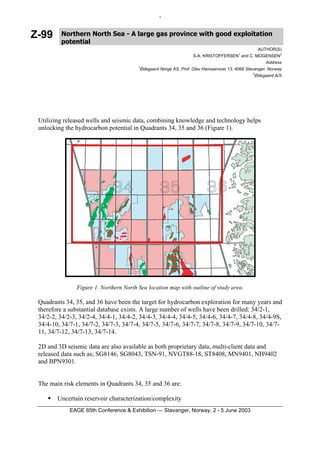
Utilizing released wells and seismic data, combining knowledge and technology helps
unlocking the hydrocarbon potential in Quadrants 34, 35 and 36 (Figure 1).
Figure 1. Northern North Sea location map with outline of study area.
Quadrants 34, 35, and 36 have been the target for hydrocarbon exploration for many years and
therefore a substantial database exists. A large number of wells have been drilled: 34/2-1,
34/2-2, 34/2-3, 34/2-4, 34/4-1, 34/4-2, 34/4-3, 34/4-4, 34/4-5, 34/4-6, 34/4-7, 34/4-8, 34/4-9S,
34/4-10, 34/7-1, 34/7-2, 34/7-3, 34/7-4, 34/7-5, 34/7-6, 34/7-7, 34/7-8, 34/7-9, 34/7-10, 34/7-
11, 34/7-12, 34/7-13, 34/7-14.
2D and 3D seismic data are also available as both proprietary data, multi-client data and
released data such as; SG8146, SG8043, TSN-91, NVGT88-18, ST8408, MN9401, NH9402
and BPN9301.
The main risk elements in Quadrants 34, 35 and 36 are:
Uncertain reservoir characterization/complexity
2. 2
Low energy depositional environment
Variable permeability
In combination with trap integrity and migration risk parameters these have made the area a
high-risk area with respect to hydrocarbon exploration.
The potential of the extensive well and seismic database is enhanced through attribute
estimation, neural networks and seismic inversion as well as quality control of the well
database in the area. By these means it is possible to lower some of the more critical risk
factors.
Thorough data re-examination and re-evaluation of undeveloped discoveries and their
surrounding areas, make it possible to reveal large upside potentials, which have been missed
previously.
The main focus has been the Upper Jurassic syn-rift sediments, and the Lower and Upper
Cretaceous post-rift sediments. These intervals exhibit a hydrocarbon potential. Various
exploration efforts have demonstrated this potetial, however not yet completely revealing it.
Several interesting areas have been identified for different play models, through use of the
integrated well log analysis and seismic study. Figure 2 below is a schematic description of
the different play models identified.
Figure 2. Outline of fields and North Sea 2002 Announced Blocks in Northern North Sea. The figure
illustrates outline of some hydrocarbon plays in this area, listed as play model 1-4. These play models
are of varying types and settings, which makes it a very interesting exploration area.
3. 3
To illustrate some examples of the identified plays, two cases are presented below.
Seismic data have been inverted and calibrated against key wells drilled in the region. The
seismic inversion results were interpreted using cross-plots of well log derived acoustic
impedance/Poisson’s ratio. The interpretation was then used to map the lithology and fluid
distribution enabling an evaluation of the hydrocarbon potential in the area, see Figure 3.
Figure 3. Cross plot of Acoustic Impedance and
Poisson’s Ratio, illustrating the potential to
differentiate between gas bearing sands and
water bearing sands together with shales.
Several large potential traps in area are revealed, defined as both water bearing sand intervals
and gas bearing intervals.
Figure 4. Cross section of a Lithology – Fluid section, illustrating the gas (red and green) - and water
bearing sand intervals in the Lower Cretaceous. The section illustrates an area of interesting likely
gas trap. Color scheme as Figure 3.
EAGE 65th Conference & Exhibition — Stavanger, Norway, 2 - 5 June 2003
4. 4
Figure 5. Acoustic impedance data illustrating two potential, high porosity sand channels trending
NW-SE. These two channels could hold several TCF of gas. High absolute acoustic impedance values
in grey for shale, and low values in red for sands.
In another part of the area absolute acoustic impedance data reveal lithology changes. Several
potential, high porosity sand intervals can be predicted from these data, making it easier to
risk evaluate both reservoir and trap potential for certain intervals. Figure 5 illustrates such a
case, where channel systems are mapped. The cross-plots of acoustic impedance/Poisson’s
ratio can be used to evaluate the chance of hydrocarbon bearing sands.