
Recommandé
Recommandé
Contenu connexe
Tendances
Tendances (11)
En vedette
Similaire à Extreme weather and the city
Similaire à Extreme weather and the city (20)
Plus de TU Delft Climate Institute
Plus de TU Delft Climate Institute (15)
Dernier
Dernier (20)
Extreme weather and the city
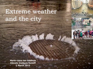
- 1. Extreme weather and the city March 2, 2012 1 Marie-claire ten Veldhuis Climate Institute Kickoff Climate Institute Kickoff 1 1 March 2012
- 4. Extreme rainfall in cities Delft, August 2010 March 2, 2012 Climate Institute Kickoff 4
- 5. Extreme rainfall in cities What exactly happened? How much rainfall? Capacity problem? Blockage? Human error? Delft, August 2010 March 2, 2012 Climate Institute Kickoff 5
- 6. Area effect Max precipitation P max Average rainfall area A1 Average rainfall area A2 Area size 1.200 1.000 0.800 rainfall [L/T] 0.600 0.400 0.200 0.000 0 2 4 6 8 10 12 14 16 A [L2] Climate Institute Kickoff 6
- 9. Extreme rainfall in the city: we do not have representative data Climate Institute Kickoff 9
- 10. Urban hydrology: High building density: fast runoff processes Rainfall peaks are crucial ! Climate Institute Kickoff 10
- 11. Rainfall radar: spatial rainfall distribution Prevailing Prevailing wind (~ 19 mph) wind (~ 19 mph) (~ 30 km/h) (~ 30 km/h) 5 km resolution 1 km resolution (15 min accumulation for Crug-y-Gorllwyn, 07-04-2009 (2130), courtesy MetOffice)11 Climate Institute Kickoff
- 12. Urban hydrology: High building density fast runoff processes Rainfall peaks are crucial ! Oranjepolder: 490 ha Prinsenbeek: 100 ha Climate Institute Kickoff 12
- 13. Climate Institute Kickoff 13
- 14. Extreme weather in the city: we need more representative and higher resolution data Climate Institute Kickoff 14
- 15. Urban hydrology Required data resolution << 1 km in space; < 5 min in time Oranjepolder: 490 ha Prinsenbeek: 100 ha Climate Institute Kickoff 15
- 16. RAINGAIN – high resolution rainfall data in cities Xband/Improved Cband radars in 4 Pilots: Rotterdam (NL) Leuven (B) Paris (F) London (UK) Climate Institute Kickoff 16
- 17. RAINGAIN – high resolution rainfall data in cities o WP1: Installation and testing of radars Lead: ParisTech o WP2: Fine-scale rainfall data acquisition and prediction Lead: KU Leuven o WP3:Urban pluvial flood modelling and prediction Lead: Imperial College of London o WP4:Implementation of fine-scale rainfall data, flood modelling and prediction into urban water management practice Lead: TU Delft Climate Institute Kickoff 17
- 18. RAINGAIN – high resolution rainfall data in cities Will rainfall radar work in urban area with high rise? What spatial and time resolutions do we need ? Interaction between rainfall and runoff processes ? High resolution data on flood occurrence ? Use of social media in collection of rainfall and flood data ? Climate Institute Kickoff 18
- 19. Extreme weather and the city Need for an investigative eye Heavy rainfall: high resolution data Storm: wind speeds near high buildings? Heat: Effect of green spaces and building shades on temperature ? Long-term trends ? Climate in megacities ? Climate Institute Kickoff 19
- 20. Extreme weather in cities: research environment for the future Climate Institute Kickoff 20