Estimated Recoverable Storage: What it does, doesn't and might mean for planning, Wade Oliver, Intera
•Télécharger en tant que PPTX, PDF•
2 j'aime•2,346 vues

![The “9 Factors” Districts Shall Consider When
Adopting Desired Future Conditions
Paraphrased Factors in Texas Water Code Sec. 36.108(d) :
1. Aquifer uses or conditions…
2. Water supply needs and management strategies…
3. Hydrological conditions, including for each aquifer in the
management area the total estimated recoverable storage
as provided by the executive administrator [of TWDB]…
4. Other environmental impacts
5. Impact on subsidence
6. Socioeconomic impacts
7. Impact on private property rights
8. Feasibility of achieving the DFC
9. Any other relevant information](data:image/gif;base64,R0lGODlhAQABAIAAAAAAAP///yH5BAEAAAAALAAAAAABAAEAAAIBRAA7)
Recommandé
Recommandé
Contenu connexe
Tendances
Tendances (20)
En vedette
Similaire à Estimated Recoverable Storage: What it does, doesn't and might mean for planning, Wade Oliver, Intera
Similaire à Estimated Recoverable Storage: What it does, doesn't and might mean for planning, Wade Oliver, Intera (20)
Plus de Texas Alliance of Groundwater Districts
Plus de Texas Alliance of Groundwater Districts (20)
Dernier
Dernier (20)
Estimated Recoverable Storage: What it does, doesn't and might mean for planning, Wade Oliver, Intera
- 1. Estimated Recoverable Storage What it does, doesn’t and might mean for planning Wade A. Oliver, P.G. Texas Alliance of Groundwater Districts Quarterly Meeting February 26, 2014 Disclaimer: The materials presented here were developed for informational purposes, are considered preliminary, and should not be used without consulting the author.
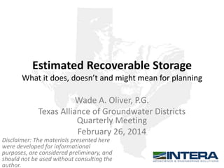
- 2. The “9 Factors” Districts Shall Consider When Adopting Desired Future Conditions Paraphrased Factors in Texas Water Code Sec. 36.108(d) : 1. Aquifer uses or conditions… 2. Water supply needs and management strategies… 3. Hydrological conditions, including for each aquifer in the management area the total estimated recoverable storage as provided by the executive administrator [of TWDB]… 4. Other environmental impacts 5. Impact on subsidence 6. Socioeconomic impacts 7. Impact on private property rights 8. Feasibility of achieving the DFC 9. Any other relevant information
- 3. Definition Total Estimated Recoverable Storage—The estimated amount of groundwater within an aquifer that accounts for recovery scenarios that range between 25% and 75% of the porosity-adjusted aquifer volume Texas Administrative Code Sec. 356.10
- 4. Estimated Recoverable Storage in the News From the Austin American Statesman In his remarks, [the county judge] cited the Texas Water Development Board’s recent survey indicating the Simsboro Aquifer contains some 50 million acre-feet of water, 25 percent of which, according to the board, is easily rechargeable and available for export without harming the aquifer. “There being more than 11 million exportable acre-feet of water available means the 45,000 acre-feet reserved by Hays County is but a small percentage — 0.04 percent — of the available water in Lee and Bastrop counties,” [he] said.
- 5. Estimated Recoverable Storage in the News GAM Task 13-035
- 6. Types of Aquifers Unconfined Aquifer Confining Unit Confined Aquifer Confining Unit
- 7. One Aquifer – Two Types Unconfined Confined Northwest Southeast Measured Water Level
- 8. Unconfined vs. Confined Storage Specific Yield > Storativity Takeaway: Each foot of drawdown yields much more water when an aquifer is unconfined than when it is confined. From Heath (1983)
- 9. Guidance from TWDB Typical County Example 30 miles x 30 miles 900 square miles 500 feet 576,000 acres 15%
- 10. Guidance from TWDB Typical County Example 30 miles x 30 miles 900 square miles 500 feet 576,000 acres 15% = 43.2 million acre-feet
- 11. Guidance from TWDB Typical County Example 30 miles x 30 miles 900 square miles 500 feet 15% = 576,000 acres 1000 feet 0.0001 = Unconfined Portion: Specific Yield Confined Portion: Storativity 43.2 million acre-feet 0.06 million acre-feet
- 12. Guidance from TWDB Total Estimated Recoverable Storage and Modeled Available Groundwater, Why They Are Different Presentation by TWDB available at: http://www.twdb.texas.gov/groundwater/docs/TotalEst imatedRecoverableStorage.pdf
- 18. MAGs and Storage by GMA Total Estimated Total MAG over Recoverable Storage MAG in 2060 50 Years Total MAG as GMA (million acre-feet) (million acre-feet) (million acre-feet) Percent of TERS 1 588 2.270 150 25% 2 968 1.344 94 10% 3 476 0.461 23 5% 4 160 0.207 10 6% 5 Not Defined Not Defined Not Defined Not Defined 6 180 0.422 22 12% 7 447 0.648 33 7% 8 1,628 0.386 19 1% 9 33 0.096 5 15% 10 46 0.100 5 11% 11 Not Defined 0.543 27 Not Defined 12 1,380 0.337 15 1% 13 2,756 0.485 24 1% 14 Not Defined 0.907 47 Not Defined 15 443 0.488 24 6% 16 2,205 0.358 18 1% Total 11,310 7.603 442 4% (excluding GMAs 5,11,14)
- 19. Sometimes Caveats Are Important • No consideration given to: – Aquifer water quality – Water levels dropping below pumps – Land surface subsidence – Degradation of water quality – Changes to surface water-groundwater interaction – Practicality/economics of development
- 21. Sometimes Caveats Are Important • No consideration given to: – Aquifer water quality – Water levels dropping below pumps – Land surface subsidence – Degradation of water quality – Changes to surface water-groundwater interaction – Practicality/economics of development
- 22. Example Depletion of Confined Aquifer Initial Water Level 500 feet of confined pressure head Confining Unit Fully Penetrating Well Partially Penetrating Well 500 feet of saturated thickness and well screen Aquifer 100-foot screen on partially penetrating well
- 23. Drawdown vs. Storage Volume in an Example Confined Aquifer Exact shape of curve is aquifer specific and depends on initial water levels, aquifer thickness, and storage properties (storativity and specific yield). Idealized curve developed using a 500 ft thick aquifer with 500 feet of confined head. Storativity set to 0.0001 and specific yield set to 0.15.
- 24. Confined vs. Unconfined Aquifer Response to Pumping Ogallala Unconfined Aquifer 6,000,000 ac-ft pumping 50 – 150 feet drawdown Trinity Confined Aquifer 200,000 ac-ft pumping 800 – 1000 feet drawdown Source: TWDB
- 25. Well Yield Decline with Aquifer Depletion Fully penetrating well Partially penetrating well Removal of water providing confining pressure. Depleted “available drawdown”. Draining of aquifer pore space. Exact shape of curve is aquifer specific and depends on initial water levels, aquifer thickness, and storage properties (storativity and specific yield). Idealized curve developed using a 500 ft thick aquifer with 500 feet of confined head. Storativity set to 0.0001 and specific yield set to 0.15.
- 26. Sometimes Caveats Are Important • No consideration given to: – Aquifer water quality – Water levels dropping below pumps – Land surface subsidence – Degradation of water quality – Changes to surface water-groundwater interaction – Practicality/economics of development
- 27. “Recoverable” is Aquifer Specific • The range of 25% - 75% is not an appropriate range for all aquifers. – Could be 55 -75% or more for highly productive, unconfined aquifers at the surface such as the Ogallala and Seymour. – Likely no more than 3 - 15% for most dipping, confined aquifers in Texas (Trinity, Carrizo-Wilcox, Gulf Coast, etc.). Recovery of anywhere close to 75% is physically impossible given current well depths and impacts to water levels, quality, existing wells, well yields, surface water, and subsidence. – For karst aquifers, total storage is practically irrelevant to aquifer planning and management long term (Edwards). Total storage is relatively small and fluctuates significantly over time due to recharge events.
- 28. Takeaways: The Meaning of Total Estimated Recoverable Storage • What it does mean: – How much water is in the aquifer • What it doesn’t mean: – That the water is available for production – That using small fractions of the total volume cannot seriously harm the aquifer and its users – That it is a useful tool in the planning and management of a particular aquifer • What it might mean: – That you’ll need to understand it well enough to explain to your boards, permit applicants, and the public if – and to what extent – it is relevant in your district
- 29. Contact: Wade A. Oliver, P.G. woliver@intera.com 512-425-2058
Notes de l'éditeur
- In this slide I’ll point out that TERS has been in the news and this is an example of how people are interpreting and using the numbers. My point is not to pick on the county judge or the journalist because, by the nature of the numbers and most people’s limited understanding of groundwater, many intelligent, college-educated people would come to the same conclusion. I bring this up because it illustrates the confusion that these numbers can cause. The sentence in the first paragraph reads like a bad game of telephone where TWDB put out a report, it was picked up by the county judge or one of their consultants, then relayed to a journalist, who then relayed it to the public. Not the point of this slide, but the math cited in the article is wrong. 45k acre-feet is 0.4 percent of the lower range 25 percent of total volume. Over 50 years it amounts to 20.5% of the lower range 25% of total volume.
- This is the TWDB report, GAM Task 13-035 referenced in the article where the total of Bastrop and Lee storage, at the 25% of total storage volume, is 11.5 million acre-feet.