OpenData Public Research, University of Toronto, Open Access Week, 25/11/2011
•
2 j'aime•5,971 vues

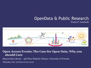
OpenData Public Research Open Access Events: The Case for Open Data, Why you should Care Map & Data Library - 5th Floor Robarts Library, University of Toronto Thursday, Oct. 25 from 10:00-12:00 Organized by Data and Map Librarians, Marcel Fortin and Berenica Vejvoda

Recommandé
Recommandé
Contenu connexe
Tendances
Tendances (20)
En vedette
Similaire à OpenData Public Research, University of Toronto, Open Access Week, 25/11/2011
Similaire à OpenData Public Research, University of Toronto, Open Access Week, 25/11/2011 (20)
Plus de Communication and Media Studies, Carleton University
Plus de Communication and Media Studies, Carleton University (20)
Dernier
Dernier (20)
OpenData Public Research, University of Toronto, Open Access Week, 25/11/2011
- 1. OpenData & Public Research Tracey P. Lauriault Open Access Events: The Case for Open Data, Why you should Care Map & Data Library - 5th Floor Robarts Library, University of Toronto Thursday, Oct. 25 from 10:00-12:00
- 3. Informed Decision Making 1. Citizen participation in decision-making is fundamental to democracy 2. Good decisions are made by informed citizens 3. Quality civic data and information are key to keeping citizens & public institutions informed; and 4. Citizen projects using civic data generate innovative solutions to social, economic and environmental problems. 5. We all benefit from better and more open consultations using public data.
- 4. Court Action - access to data Mine tailings near the abandoned Little Bay copper mine in north-central Newfoundland. (Photo courtesy DFO)
- 5. Citizen Action to Access a Report http://datalibre.ca/
- 7. RNCan / NRCan http://geogratis.cgdi.gc.ca/ http://www.geobase.ca http://geodiscover.cgdi.ca http://www.geoconnections.org/fr/resou rcelibrary/keyStudiesReports
- 8. IPY – Research funding and data management http://www.ipy-api.gc.ca/pg_IPYAPI_052-eng.html
- 9. Canadian Institute for Health Information Policy on Access to Research Outputs http://www.cihr-irsc.gc.ca/e/34846.html http://www.cihr-irsc.gc.ca/e/35664.html
- 10. Open Government http://www.infocom.gc.ca/fra/rp-pr-ori-ari_2010_1.aspx
- 11. Licenses CIPPIC has a dual mission: 1) to fill voids in public policy debates on technology law issues, ensure balance in policy and law-making processes, and provide legal assistance to under-represented organizations and individuals on matters involving the intersection of law and technology; and 2) to provide a high quality and rewarding clinical legal education experience to students of law. http://www.cippic.ca/open-licensing/
- 12. Global Sharing
- 13. Global Map ISCGM: http://www.iscgm.org/cgi-bin/fswiki/wiki.cgi Data Use Agreement: http://www.iscgm.org/agreement.html GCRC & Global Map: https://gcrc.carleton.ca/confluence/display/GCRCWEB/Global+Map
- 14. GEOSS – Global Earth Observation System of Systems GEOSS: http://www.earthobservations.org
- 15. Scientific Committee on Antarctic Research (SCAR) http://scadm.scar.org/
- 16. Open Data Inspires Research
- 17. GRCR Research Centre Funding • SSHRC • Initiative on the New Economy (INE) • Government of Canada Major Collaborative Initiative Grant HRSDC - Data Development Projects on • Image, Text, Sound and Technology Homelessness Program (ITST) Strategic Grant Heritage Canada - Gateway Fund • INE Outreach Grant & Standard Statistics Canada, Geography Division Research Grants Department of Foreign Affairs and • International Polar Year International Trade Grant Canada Natural Resources Canada • NSERC • Indian & Northern Affairs • Canada Foundation for • Canadian International Polar Year Innovation (CFI) Secretariat Office • Government of Nunavut • Scientific Committee on • Inuit Heritage Trust Antarctic Research • Kitikmeot Heritage Society • Inukshuk Wireless (NPO) https://gcrc.carleton.ca/confluence/display/GCRCWEB/Overview
- 19. Atlas of the Risk of Homelessness – Partnership Data Sharing Data & Software - Nunaliit Cybercartographic Atlas Framework ( BSD) - Data Liberation Intiative (DLI) Statistics Canada (Restricted use) - FCM QoLRS (Viewing only) - City Neighbourhood framework data files (Viewing only) - Toronto Community Housing (Viewing only) https://gcrc.carleton.ca/confluence/display/GCRCWEB/Atlases
- 20. ISIUOP – Participatory Data Collection Data & Software - Nunaliit Cybercartographic Atlas Framework (BSD) - Geogratis Framework & Topographic Data (Unrestricted terms of use) - Flow lines collected by different hunters (Shared rights) - More sensitive data – e.g. Bear Dens, sacred sites, environmentally sensitive data are for viewing & use by the community only - Data will become part of IPY Canada https://gcrc.carleton.ca/confluence/display/ISIUOP/Inuit+Sea+Ice+Use+and+Occupancy+Project+(ISIUOP)
- 21. Data – Uncertain & Restrictive Cybercartographic atlases are created with: • Restricted Data Library and Archives Canada – Maps & Photographs Statistics Canada, expensive due to Cost Recovery Policies also restrictive licencing • Uncertain Data Access • atlascine.org Film Canada Year Book • Alliance Atlantis • Cinemaclock https://gcrc.carleton.ca/confluence/display/GCRCWEB/Atlases
- 22. Data - Open and Semi Open Cybercartographic atlases are created with: • Data accessed from open access sources • GeoGratis (NRCan) - Landsat Mosaic - Unrestricted User License • GeoBase (NRCan) - Framework Data - Unrestricted User License • Scientific Committee on Antarctic Research (SCAR) - Antarctic Treaty System • Data from semi open access sources • Data Liberation Initiative, CU Library - Restricted to University • Google Maps - Open APIs, useable but under terms
- 23. Atlases Atlas of Arctic Bay - Nunaliit Cybercartographic Atlas Framework (New BSD) - Google API (Semi Open) Atlas of Arctic Bay - Nunaliit Cybercartographic Atlas Framework (New BSD) - Geogratis Framework Data (Unrestricted terms of use) - Statistics Canada Trade Division Data (Restricted use and $$$$$) https://gcrc.carleton.ca/confluence/display/GCRCWEB/Atlases
- 24. GCRC – Guiding Principles • Products produced w/public funds belong to the public Whenever possible open access comes first BSD License Use data from open access sources Creative Commons Share as much as possible Publish in Open Access Journals Create and use open source software, tools, widgets, etc. Design for open source browsers Participate in open access, open data, open source fora Encourage these principles in public consultations Education & Capacity building Adhere to interoperability standards and specifications
- 25. Public Health Research - Provinces
- 26. Espace montréalais d'information sur la santé http://emis.santemontreal.qc.ca/outils/atlas-sante-montreal/
- 27. EMIS Data Providers Provider Type of data AQPP Association québécoise des pharmaciens propriétaires Système d'information pour la gestion des organismes communautaires (SIGOC) Agence Inventaire des cliniques médicales Référentiel établissement de l'Agence de Montréal DSP Dossier client informatisé - Maladies infectieuses (DCIMI) CJM-Batshaw Fichier du centre jeunesse de Montréal et du centre jeunesse Batshaw CGTSIM Défavorisation scolaire (CGTSIM) DGA Contours des dépenses SRA Hébergement ISQ Projection de la population Recensement 2006 (Montréal) population totale selon l'âge et le sexe - territoires de CLSC Recensement 2006 (Qc) - profil semi-personnalisé de la population - RSS (Qc), territoires de CLSC (Mtl) Échantillon 100% Recensement 2006 (Qc) - profils semi-personnalisés cumulatifs - RSS (Qc), StatCan territoires de CLSC (Mtl), voisinage Échantillon 20% Recensement 2006 (RMR de Montréal) - profils standards cumulatifs - AD, SR et SDR de la RMR de Montréal Stratégie d'accès communautaire aux statistiques sociales - Liste des tableaux disponibles Intégration-CLSC RAMQ Banque des données jumelées Enquête sur la santé dans les collectivités canadiennes - Fichier de microdonnées à ESCC grande diffusion (FMGD) NIS Nationwide inpatient sample Ville de Montréal Géobase de la ville de Montréal CMM Orthophotos de la Communauté métropolitaine de Montréal Consommation et offre normalisées des services offerts par les médecins Découpage géographique - M34 Données sur la clientèle hospitalière Performance hospitalière Personnel du réseau : salariés et cadres Rapports financiers des établissements Rapports statistiques annuels des centres jeunesse Rapports statistiques des centres de réadaptation MSSS Rapports statistiques des centres hospitaliers et de soins de longue durée Registre de la salle d'urgence Relevé quotidien de la situation à l'urgence et au centre hospitalier Fichier des tumeurs
- 28. CommunityView Collaboration - Saskatoon http://www.communityview.ca/
- 30. Community Data Consortium https://communitydata-donneescommunautaires.ca
- 31. Community Data Canada http://cdc-dcc.info/mandate.php
- 32. Social Planning Council of Ottawa Data & Software - CIMS Infrastructure (Open Source) - Health Districts(Viewing only) - Community Social Data Strategy Data (Viewing only) - Geogratis Data (unrestricted use) - Ontario Ministry of Natural Resources (Viewing only) - Community created data sets (Viewing only) - City of Ottawa Ward Boundaries (OpenData) Using Population Health Data to Profile the Health and Well- Being of Children and Youth in Eastern Ontario http://www.cims-scic.ca/CYHNEO_atlas Community Information and Mapping System (CIMS) http://www.cims-scic.ca/
- 33. City of Winnipeg Source: Consortium Member – Social Planning Council of Winnipeg http://www.spcw.mb.ca
- 34. RM-Halton Geography Examples Report Card Partners • Halton Catholic District School Board • ROCK Reach Out Centre for Kids • Halton Children's Aid Society • Halton District School Board • Halton Region, Departments of Health and Social & Community Services • Halton Regional Police Services • Transitions for Youth Source: Consortium Members – Halton Region - Our Kids Our Community Report Card http://www.ourkidsnetwork.ca/about/partners.shtml
- 35. City of Hamilton Source: Consortium Member – Social Planning and Research Council of Hamilton http://www.sprc.hamilton.on.ca/CommunityMappingService.php
- 36. RM-Halton Geography Examples 0 Source: Consortium Member – Community Development Halton: Community Lens http://www.cdhalton.ca/lens/index.htm
- 37. Sault Ste. Marie Source: Consortium Member Sault Ste. Marie Innovation Centre presentation entitled 2009 United Way Donation and Socio-Demographic Maps
- 38. Civic Apps
- 39. Apps4 – Climate Change http://data.gov.bc.ca/index.html http://apps4climateaction.gov.bc.ca/
- 40. App de participation publique http://fixmystreet.ca/ http://apps4ottawa.ca/en/apps http://howdtheyvote.ca also see http://datalibre.ca/2011/03/29/tools-for-the-elections/
- 42. Random Hacks of Kindness http://www.rhok.org/
- 44. WeHub The Water and Environmental Hub (WEHUB) project is an open source web platform that aggregates, federates, and connects water data and information with users looking to download, analyze, model and interpret water and environmental-based information. By combining water expertise with an open web development approach and an entrepreneurial foundation, the project will spur economic diversification and benefit both public users and the private sector by improving the access to water data and tools for academia, government, industry, NGOs and the general public. http://www.waterenvironmentalhub.ca/
- 45. Ornithologists http://www.bsc-eoc.org/volunteer/cmmn/index.jsp?targetpg=index&lang=en
- 46. Waterly http://blog.gov.bc.ca/livingwatersmart/2010/09/23/waterly-winner-of-best-made-in-bc- apps-for-climate-action-contest-is-simply-watersmart/
- 47. SEAWA The SEAWA Watershed Planning and Advisory Council (WPAC) was built on a foundation set by the Citizens Water Study Group in 2006. This led to the establishment of the watershed stewardship group Prairie River Stewards, and then to the Initiator’s Group, and in turn to SEAWA. The South East Alberta Watershed Alliance (SEAWA) was formed in 2007, and incorporated as a non-profit Society in 2008. http://www.albertawater.com/seawa/
- 48. Openness The more open, accessible, interoperable, free and discoverable public data the more innovation we will see, the more stories we can tell about Canada from multiple points of view. Public policy can also become more intelligent as citizens, researchers, NGOs, business and other levels of government when they too have access to the data they need to inform it. These are the public's data after all! That is why open data and open government matters.