SlideShare une entreprise Scribd logo
1  sur  17
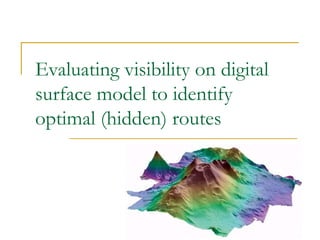
Evaluating visibility on digital surface model to identify optimal (hidden) routes   Presented By: Faizan Tayyab
Outline ,[object Object],[object Object],[object Object],[object Object],[object Object],[object Object],Presented By: Faizan Tayyab
Aims ,[object Object],[object Object],Presented By: Faizan Tayyab
Primary Objectives ,[object Object],[object Object],[object Object],Presented By: Faizan Tayyab
Secondary Objective ,[object Object],[object Object],Presented By: Faizan Tayyab
Data set ,[object Object],[object Object],Presented By: Faizan Tayyab
Proposed Methodology Presented By: Faizan Tayyab (Positions) Coordinates DSM based Visibility map  Calculations (Grid Based  Calculations) Routes Calculations Output Routes Position Change Y N
Hardware Considerations ,[object Object],[object Object],Presented By: Faizan Tayyab
Client Server Architecture Presented By: Faizan Tayyab Web Server HTTP HTTP
Proposed Software Consideration ,[object Object],[object Object],[object Object],[object Object],[object Object],[object Object],[object Object],[object Object],[object Object],Presented By: Faizan Tayyab
Software Calculations (DSM) Presented By: Faizan Tayyab B A
Graphical Hidden Routes Representation Presented By: Faizan Tayyab
Visibility Calculations  Presented By: Faizan Tayyab
Culture Effects ,[object Object],Presented By: Faizan Tayyab
Limitations and Considerations ,[object Object],[object Object],[object Object],[object Object],[object Object],[object Object],Presented By: Faizan Tayyab
Outcomes & Conclusions ,[object Object],[object Object],[object Object],Presented By: Faizan Tayyab
Feedback & Contact Details ,[object Object],[object Object],[object Object],Presented By: Faizan Tayyab

Contenu connexe

Similaire à Evaluating hidden routes using DSM visibility

FME User Stories from Around the World
FME User Stories from Around the WorldFME User Stories from Around the World
FME User Stories from Around the WorldSafe Software
 
Rod Adkins - Practical Online Map Delivery & Functionality – The Commercial P...
Rod Adkins - Practical Online Map Delivery & Functionality – The Commercial P...Rod Adkins - Practical Online Map Delivery & Functionality – The Commercial P...
Rod Adkins - Practical Online Map Delivery & Functionality – The Commercial P...British Cartographic Society
 
INAC Online Hazards Database App
INAC Online Hazards Database AppINAC Online Hazards Database App
INAC Online Hazards Database AppGerry James
 
Interactive Editing of Signed Distance Fields
Interactive Editing of Signed Distance FieldsInteractive Editing of Signed Distance Fields
Interactive Editing of Signed Distance FieldsMatthias Trapp
 
Bridging Between CAD & GIS - 8 Ways to Automate Your Data Integration.pdf
Bridging Between CAD & GIS - 8 Ways to Automate Your Data Integration.pdfBridging Between CAD & GIS - 8 Ways to Automate Your Data Integration.pdf
Bridging Between CAD & GIS - 8 Ways to Automate Your Data Integration.pdfSafe Software
 
Tran Duino - documentation
Tran Duino - documentationTran Duino - documentation
Tran Duino - documentationNandha Kumar
 
Rapid Laser Scanning the process
Rapid Laser Scanning the processRapid Laser Scanning the process
Rapid Laser Scanning the processSeeview Solutions
 
Investing in Cloud Integration at Microsoft IT
Investing in Cloud Integration at Microsoft ITInvesting in Cloud Integration at Microsoft IT
Investing in Cloud Integration at Microsoft ITBizTalk360
 
Remote Sensing Field Camp 2016
Remote Sensing Field Camp 2016 Remote Sensing Field Camp 2016
Remote Sensing Field Camp 2016 COGS Presentations
 
“COVID-19 Safe Distancing Measures in Public Spaces with Edge AI,” a Presenta...
“COVID-19 Safe Distancing Measures in Public Spaces with Edge AI,” a Presenta...“COVID-19 Safe Distancing Measures in Public Spaces with Edge AI,” a Presenta...
“COVID-19 Safe Distancing Measures in Public Spaces with Edge AI,” a Presenta...Edge AI and Vision Alliance
 
Energy Efficient Mobile Applications with Mobile Cloud Computing ( MCC )
Energy Efficient Mobile Applications with Mobile Cloud Computing ( MCC )Energy Efficient Mobile Applications with Mobile Cloud Computing ( MCC )
Energy Efficient Mobile Applications with Mobile Cloud Computing ( MCC )Anand Bhojan
 
高解析度面板瑕疵檢測
高解析度面板瑕疵檢測高解析度面板瑕疵檢測
高解析度面板瑕疵檢測CHENHuiMei
 
FME World Tour 2015 - Around the World - Ken Bragg
FME World Tour 2015 - Around the World - Ken BraggFME World Tour 2015 - Around the World - Ken Bragg
FME World Tour 2015 - Around the World - Ken BraggIMGS
 

Similaire à Evaluating hidden routes using DSM visibility (20)

FME User Stories from Around the World
FME User Stories from Around the WorldFME User Stories from Around the World
FME User Stories from Around the World
 
Soumyadip_Chandra
Soumyadip_ChandraSoumyadip_Chandra
Soumyadip_Chandra
 
ICRA Nathan Piasco
ICRA Nathan PiascoICRA Nathan Piasco
ICRA Nathan Piasco
 
Rod Adkins - Practical Online Map Delivery & Functionality – The Commercial P...
Rod Adkins - Practical Online Map Delivery & Functionality – The Commercial P...Rod Adkins - Practical Online Map Delivery & Functionality – The Commercial P...
Rod Adkins - Practical Online Map Delivery & Functionality – The Commercial P...
 
3D Watershed Celebes
3D Watershed Celebes3D Watershed Celebes
3D Watershed Celebes
 
INAC Online Hazards Database App
INAC Online Hazards Database AppINAC Online Hazards Database App
INAC Online Hazards Database App
 
Mahendran
MahendranMahendran
Mahendran
 
B Mahendar- CV
B Mahendar- CVB Mahendar- CV
B Mahendar- CV
 
Interactive Editing of Signed Distance Fields
Interactive Editing of Signed Distance FieldsInteractive Editing of Signed Distance Fields
Interactive Editing of Signed Distance Fields
 
Bridging Between CAD & GIS - 8 Ways to Automate Your Data Integration.pdf
Bridging Between CAD & GIS - 8 Ways to Automate Your Data Integration.pdfBridging Between CAD & GIS - 8 Ways to Automate Your Data Integration.pdf
Bridging Between CAD & GIS - 8 Ways to Automate Your Data Integration.pdf
 
Tran Duino - documentation
Tran Duino - documentationTran Duino - documentation
Tran Duino - documentation
 
Rapid Laser Scanning the process
Rapid Laser Scanning the processRapid Laser Scanning the process
Rapid Laser Scanning the process
 
Smart App@Pivotal by Dat Tran
Smart App@Pivotal by Dat TranSmart App@Pivotal by Dat Tran
Smart App@Pivotal by Dat Tran
 
Investing in Cloud Integration at Microsoft IT
Investing in Cloud Integration at Microsoft ITInvesting in Cloud Integration at Microsoft IT
Investing in Cloud Integration at Microsoft IT
 
EENA2019: Track2 session2 _Emergency Management : an approach to real time ma...
EENA2019: Track2 session2 _Emergency Management : an approach to real time ma...EENA2019: Track2 session2 _Emergency Management : an approach to real time ma...
EENA2019: Track2 session2 _Emergency Management : an approach to real time ma...
 
Remote Sensing Field Camp 2016
Remote Sensing Field Camp 2016 Remote Sensing Field Camp 2016
Remote Sensing Field Camp 2016
 
“COVID-19 Safe Distancing Measures in Public Spaces with Edge AI,” a Presenta...
“COVID-19 Safe Distancing Measures in Public Spaces with Edge AI,” a Presenta...“COVID-19 Safe Distancing Measures in Public Spaces with Edge AI,” a Presenta...
“COVID-19 Safe Distancing Measures in Public Spaces with Edge AI,” a Presenta...
 
Energy Efficient Mobile Applications with Mobile Cloud Computing ( MCC )
Energy Efficient Mobile Applications with Mobile Cloud Computing ( MCC )Energy Efficient Mobile Applications with Mobile Cloud Computing ( MCC )
Energy Efficient Mobile Applications with Mobile Cloud Computing ( MCC )
 
高解析度面板瑕疵檢測
高解析度面板瑕疵檢測高解析度面板瑕疵檢測
高解析度面板瑕疵檢測
 
FME World Tour 2015 - Around the World - Ken Bragg
FME World Tour 2015 - Around the World - Ken BraggFME World Tour 2015 - Around the World - Ken Bragg
FME World Tour 2015 - Around the World - Ken Bragg
 

Evaluating hidden routes using DSM visibility