1. Landslides of Murree and Kashmir
Region Pakistan
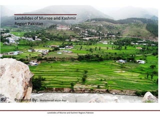
Prepared By: Muhammad ahsan Riaz
Landslides of Murree and Kashmir Regions Pakistan
2. North BalaKot: • KBT (2005 Earthquake)
• Kunar river comes from boshar lake.
• Riyasi is present in Indian Kashmir.
• Kunar river start from babusna.
• Kohistan arc 65MYA
• Fault scrap
• Metamorphic rocks are present.
• Abbottabad Dolomite
• Murre Red Shale.
Effect on Environment:
• Biodiversity.
• Underground living organisms.
• Aquatic life.
• Flora.
• Mangla dam siltation.
• Gravadava is 213m year old.
• Indian plate is moving toward kohistan arc.
• Name of plates:
• MKT
• PT
• KT
• MBT
Landslides of Murree and Kashmir Regions Pakistan
3. 3-Vegetation:
It was observed that the forests have served as a
barrier against the rolling stones, triggered by the
earthquake and instead were damaged to prevent
and reduce the velocities of the stones.
Mitigation:
1-Frame Work:
1. Rod building structure.
2. Bed rock construction.
2-Slop reduction:
Landslides of Murree and Kashmir Regions Pakistan
4. Thai Kot Landslide:
Area where major part give different ways.
It has igneous or compact rock.
No rock can be stable along this fault.
Fault is parallel to the rod.
It has crushed zone.
Zones are shear.
It is present in Abbottabad formation.
Dolomite is present.
It gives grey color.
Shale is also present.
Screed cone are also present. Effect on Environment:
Alluvial fan also present.
Biodiversity.
Older rock is upper above newer.
Flora.
Head ward erosion occurs.
Fauna
Catchment area is present.
Population.
Increase flood due to presence of alluvial fans.
Mitigation:
1. Slop reduction
2. Bypass.
3. Underpass.
Landslides of Murree and Kashmir Regions Pakistan
5. Gala Mar Landslids: Due to collision of from South to westward.
It thickness is about 2000-3000.
It is present in Murre formations.
It color is reddish Marion.
Causes of Land Slides:
MBT is called Murre fault in which land slides
occurs due to
Snow Melt.
Rainwater seepage.
Remedial Measures:
Bench formation.
Angle reductions.
Proper water drainage system.
Bypass.
Overheads.
Composition:
Sand stone and Silt stone And Shale.
Thickness is Varity area to area.
Landslides of Murree and Kashmir Regions Pakistan
6. Incompact rock connected with compact rock.
Root Wedging:
Doak Barsalan: Root wedging is basic destructive phenomena.
Root wedging increasing water seepage.
Fault is vertical.
MBT is away from it.
Landslides of Murree and Kashmir Regions Pakistan
7. When fault appear it is called is Daylight fault.
After 2006 Earthquake dolomite flow in
ground.
Displacement is about 5m in 2005 earthquake.
Ghazibad Formation Muzaffarbad: KBT is younger than MBT as MBT cut near
Balakot.
MBT goes in Murre formation due to which
energy absorbed in shale in 2005
Earthquake.KBT is also connected with Murre
formation.
Fault was present because rock of different age
combine.
Crushing of rock material from fault.
Fault move from balakot toward index
Kohistan.
Before 2005 earthquake this fault was called
Blind.
Landslides of Murree and Kashmir Regions Pakistan
8. Impact:
This fault effect the surface area of land to
much.
Fauna.
Flora.
Population.
Habitat.
Fault passes through the valley and crushed its
material.
Material like silt and clay and fine particle
enter in River Nelum due to which water is
changing its color from blue to gray.
Landslides of Murree and Kashmir Regions Pakistan