ArcLand Network
•Download as PPT, PDF•
1 like•570 views

The document describes ArchaeoLandscapes Europe, a network for archaeological remote sensing and surveying. The network aims to improve the use of remote sensing techniques in archaeology by sharing expertise between its 61 partner institutions across Europe. It organizes technical workshops, training schools, and conferences to advance the skills and knowledge of remote sensing. The network is supported by a 5-year, €5 million EU grant to facilitate collaboration and exchange of ideas between archaeologists on remote sensing methods.

Recommended
Recommended
More Related Content
Similar to ArcLand Network
Similar to ArcLand Network (20)
More from ArchaeoLandscapes Europe
Recently uploaded
Recently uploaded (20)
ArcLand Network
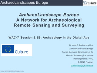
- 1. www.archaeolandscapes.eu ArchaeoLandscapes Europe ArchaeoLandscape Europe A Network for Archaeological Remote Sensing and Surveying WAC-7 Session 2.3B: Archaeology in the Digital Age Dr. Axel G. Posluschny M.A. ArchaeoLandscapes Europe Roman-Germanic Commission of the German Archaeological Institute Palmengartenstr. 10-12 D-60325 Frankfurt posluschny@rgk.dainst.de
- 2. Roman-Germanic Commission of the German Archaeological Institute www.archaeolandscapes.eu ArchaeoLandscapes Europe Content Remote Sensing & Surveying for Cultural Heritage Management Knowledge, Expertise and their Distribution ArchaeoLandscapes Europe Network introduction
- 3. Roman-Germanic Commission of the German Archaeological Institute www.archaeolandscapes.eu ArchaeoLandscapes Europe Landscape Archaeology & Invisible Sites introduction–RSforCHM&research http://www.ohiotraveler.com/images/serpent%20mound.jpghttp://www.ohiotraveler.com/images/serpent%20mound.jpg http://www.online-reisefuehrer.com/bilder-reisen/tuerkei/ephesos.jpghttp://www.online-reisefuehrer.com/bilder-reisen/tuerkei/ephesos.jpg http://www.zum.de/Faecher/G/BW/Landeskunde/w3/provence/vienne/augustus1.jpghttp://www.zum.de/Faecher/G/BW/Landeskunde/w3/provence/vienne/augustus1.jpg http://www.aegypten-spezialist.de/uploads/pics/gizeh-cheops-sphinx.jpghttp://www.aegypten-spezialist.de/uploads/pics/gizeh-cheops-sphinx.jpg
- 4. Roman-Germanic Commission of the German Archaeological Institute www.archaeolandscapes.eu ArchaeoLandscapes Europe Beyond the Fascination of the Visible introduction–RSforCHM&research
- 5. Roman-Germanic Commission of the German Archaeological Institute www.archaeolandscapes.eu ArchaeoLandscapes Europe The Archaeology Cliché introduction–RSforCHM&research
- 6. Roman-Germanic Commission of the German Archaeological Institute www.archaeolandscapes.eu ArchaeoLandscapes Europe Archaeology Today introduction–RSforCHM&research
- 7. Roman-Germanic Commission of the German Archaeological Institute www.archaeolandscapes.eu ArchaeoLandscapes Europe Geophysical Survey introduction–RSforCHM&research
- 8. Roman-Germanic Commission of the German Archaeological Institute www.archaeolandscapes.eu ArchaeoLandscapes Europe Magnetometric Survey introduction–RSforCHM&research
- 9. Roman-Germanic Commission of the German Archaeological Institute www.archaeolandscapes.eu ArchaeoLandscapes Europe Magnetometric Survey introduction–RSforCHM&research
- 10. Roman-Germanic Commission of the German Archaeological Institute www.archaeolandscapes.eu ArchaeoLandscapes Europe Aerial Archaeology introduction–RSforCHM&research
- 11. Roman-Germanic Commission of the German Archaeological Institute www.archaeolandscapes.eu ArchaeoLandscapes Europe Aerial Archaeology introduction–RSforCHM&research
- 12. Roman-Germanic Commission of the German Archaeological Institute www.archaeolandscapes.eu ArchaeoLandscapes Europe Satellite Imagery introduction–RSforCHM&research
- 13. Roman-Germanic Commission of the German Archaeological Institute www.archaeolandscapes.eu ArchaeoLandscapes Europe Satellite Imagery - Google Earth introduction–RSforCHM&research
- 14. Roman-Germanic Commission of the German Archaeological Institute www.archaeolandscapes.eu ArchaeoLandscapes Europe Satellite Imagery - Google Earth introduction–RSforCHM&research
- 15. Roman-Germanic Commission of the German Archaeological Institute www.archaeolandscapes.eu ArchaeoLandscapes Europe LiDAR /Airborne Laser Scanning (ALS) introduction–RSforCHM&research
- 16. Roman-Germanic Commission of the German Archaeological Institute www.archaeolandscapes.eu ArchaeoLandscapes Europe LiDAR /Airborne Laser Scanning (ALS) introduction–RSforCHM&research
- 17. Roman-Germanic Commission of the German Archaeological Institute www.archaeolandscapes.eu ArchaeoLandscapes Europe LiDAR /Airborne Laser Scanning (ALS) introduction–RSforCHM&research
- 18. Roman-Germanic Commission of the German Archaeological Institute www.archaeolandscapes.eu ArchaeoLandscapes Europe LiDAR /Airborne Laser Scanning (ALS) introduction–RSforCHM&research
- 19. Roman-Germanic Commission of the German Archaeological Institute www.archaeolandscapes.eu ArchaeoLandscapes Europe Visualisation – Public outreach & Lobby Building introduction–RSforCHM&research
- 20. Roman-Germanic Commission of the German Archaeological Institute www.archaeolandscapes.eu ArchaeoLandscapes Europe Expert Knowledge Remote Sensing needs expert knowledge RS is more than just pushing buttons RS is more than buying data or even worse, their interpretation Archaeologists often pay (technical) experts to do remote sensing for them What they get as a result/product is often a filtered interpretation, based on the technicians experience They don’t get nor want the real data and even if so, many archaeologists wouldn’t be able to deal with that Using only PDF reports and neglecting raw and metadata is simply waisting the potential of RS! DON‘T BURN YOUR MONEY! knowledge,expertise&distribution
- 21. Roman-Germanic Commission of the German Archaeological Institute www.archaeolandscapes.eu ArchaeoLandscapes Europe Knowledge and its Spread Expert knowledge about RS is not evenly distributed amongst archaeologists in Europe, nor world-wide Acquiring RS data as well as dealing with that data in a sufficient way is not being taught with the same intensity and on a regular basis at universities all over Europe There is still a lack of education in these methods in many parts of Europe and also in the rest of the world knowledge,expertise&distribution
- 22. Roman-Germanic Commission of the German Archaeological Institute www.archaeolandscapes.eu ArchaeoLandscapes Europe • Agreement Number: 2010-1486 • Start: 15th September 2010 • End: 14th September 2015 • EU Advancement: 2,5 Mio € • Total Budget: 5 Mio € • Partner Institutions: 61(at present) • Project Leadership: Roman-Germanic Commission of the German Archaeological Institute ArchaeoLandscape Europe is supported by the EU within the framework of the Culture 2007- 2013 programme ArchaeoLandscapesnetwork
- 23. Roman-Germanic Commission of the German Archaeological Institute www.archaeolandscapes.eu ArchaeoLandscapes EuropeArchaeoLandscapes Europe Coordinator/Project Leader 1. Roman-Germanic Commission, German Archaeological Institut (DE) Co-organisers: 1. In Flanders Fields Museum, Belgium (BE) 2. Cyprus Research and Education Foundation (STARC) (CY) 3. Holstebro Museum (DK) 4. State Heritage Service Baden-Württemberg (DE) 5. Institute for Mediterranean Studies (FORTH) (GR) 6. Baranya County Museum Authority (HU) 7. Institute of Archaeology (IS) 8. Discovery Programme (IE) 9. University College Dublin (IE) 10. University of Foggia (IT) 11. University of Salento (LabTAF), Lecce (IT) 12. University of Siena (LAP&T) (IT) 13. University of Klaipeda (LT) 14. University of Leiden (NL) 15. Norwegian Institute for Cultural Heritage Research (NIKU) (NO) 16. Adam Mickiewicz University, Pozna (PL)ń 17. Institute for Cultural Memory (CIMEC) (RO) 18. Institute of Archaeology (RS) 19. Slovak Academy of Sciences (SK) 20. Slovenian Academy of Sciences and Arts (ZRC SAZU) (SI) 21. University of Ljubljana (SI) 22. Instituto de Estudos Galeos Padre Sarmiento (ES) 23. English Heritage (UK) 24. University of Exeter (UK) 25. University of Glasgow (UK) 26. Royal Commission on the Ancient and Historical Monuments of Scotland (UK) Associated Partners: 1. University of Vienna (AT) 2. University of West Bohemia (CZ) 3. Estonian Heritage Society (EE) 4. Aalto University School of Science and Technology (FI) 5. National Museum of the Faroe Islands (FO) 6. Université de Franche Comté (FR) 7. University of Applied Sciences - i3mainz (DE) 8. University of Bamberg (DE) 9. University of Frankfurt (DE) 10. Aerial Archaeology Research Group (international) 11. Culture Lab - International Cultural Expertise (BE) 12. Dutch Expertise Centre for Archaeological Remote Sensing (NL/BE) 13. Dundalk Institute of Technology (IE) 14. Latvian Academy of Culture (LV) 15. University of Granada (ES) 16. University of Uppsala (SE) 17. University of Ulster (IE) 18. Landscape & Geophysical Services (IE) 19. Macquarie University, NSW (AU) 20. The DART Project - University of Leeds (UK) 21. Leuven University (BE) 22. Department of Earth and Environment of the Italian National Research Council (IT) 23. University of Zagreb (HR) 24. VU Amsterdam (NL) 25. Moesgaard Museum (DK) 26. The Rathcroghan Heritage Centre (IE) 27. The Landscape Research Centre (UK) 28. Polytechnic Institute of Tomar University (PT) 29. ArchaeoPhysica (UK) 30. University of Bologna (IT) 31. Norwegian University of Science and Technology (NO) 32. Szczecin University - Institute of History and International Relations, Department of Archaeology (PL) 33. University of California, Merced (USA) 34. Cyprus University of Technology (CY) ... 61 Project Partner from all over Europe and Beyond ArchaeoLandscapesnetwork
- 24. Roman-Germanic Commission of the German Archaeological Institute www.archaeolandscapes.eu ArchaeoLandscapes Europe A busy 5-year Programme ... Create a self-supporting ArchaeoLandscapes Network Europe Communicate the value of aerial survey, remote sensing and landscape studies Promote the pan-European exchange of people, skills and experience Enhance teaching in aerial survey, remote sensing and landscape studies Exploit existing air-photo archives more effectively Support aerial survey, remote sensing and landscape exploration Explore laser, satellite and other forms of remote sensing to a larger extent Provide technical guidance and advice on best practice ArchaeoLandscapesnetwork
- 25. Roman-Germanic Commission of the German Archaeological Institute www.archaeolandscapes.eu ArchaeoLandscapes Europe Addressing Laymen and Experts Travelling exhibition, starting on 8th May 2013 in Dublin Conference about RS & Community Archaeology as a starting event for the travelling exhibition (8th – 11th May 2013 in Dublin) Flyer, sticker Newspaper, radio & TV interviews Technical Workshops: LiDAR, Aerial Archaeology, Geophysics, Satellite Imagery, UAV, Integrated Data Analyses, … Aerial Archaeology Training Schools Final International Conference (2015 Frankfurt) Symposia, Workshops, Meetings, Conference Sessions, ... Publications (2 Monographs, Flyer, Conference Papers, Best Practices Guides, ...) Grants for Students and Young Researchers to participate in Workshops, Schools and Conferences Website http://www.archaeolandscapes.eu (the site will be updated continuously during the 3 coming years of the project) ArchaeoLandscapesnetwork
- 26. Symposia, Workshops, Meetings, Conference Sessions: CAA 2012, Southampton – ArcLand session EAA 2011, Oslo – ArcLand session EAA 2012, Helsinki – ArcLand session UNESCO Best Practice Conference 2012, Menorca – 3 ArcLand related papers ESOF – European Science Open Forum 2012, Dublin – ArcLand session … Publications (2 Monographs in print, Flyer, Conference Papers) Roman-Germanic Commission of the German Archaeological Institute www.archaeolandscapes.eu ArchaeoLandscapes Europe Previous Activities Technical Workshops: Bibracte/FR – LiDAR Slane/IE – Geophysics, kite photography, data integration Poznan/PL – satellite & aerial images Klaipeda/LT – geophysics Ljubljana/SL – 3D data Rethymno/GR – geophysics, satellite & aerial images Aerial Archaeology Training Schools: Kostolac/RS Velling/DK Merida/ES Pilsen/CZ Kocaeli/TR ArchaeoLandscapesnetwork
- 27. Roman-Germanic Commission of the German Archaeological Institute www.archaeolandscapes.eu ArchaeoLandscapes Europe Previous Activities Grants for Students and Young Researchers to participate in Workshops, Schools and Conferences 43 grants have been paid from ArcLand: 19 for aerial archaeological training schools 16 for technical workshops 6 exchange visits / mobility grants 2 conference grants ArchaeoLandscapesnetwork
- 28. Roman-Germanic Commission of the German Archaeological Institute www.archaeolandscapes.eu ArchaeoLandscapes Europe Future Activities Technical Workshops: Belgrade/RS – Archiving questions Bamberg/DE – Airphoto interpretation Rathcroghan/IE – Geophysics, LiDAR, data integration Esslingen/DE – LiDAR Montferrand/FR – LiDAR Aerial Archaeology Training Schools: Leuven/BE Pecs/HU Conferences: Dublin/IE 2013 Frankfurt/DE 2015 Travelling exhibition: starting in Dublin/IE in 2013, other places in Europe and beyond will follow ArchaeoLandscapesnetwork
- 29. Roman-Germanic Commission of the German Archaeological Institute www.archaeolandscapes.eu ArchaeoLandscapes Europe Resume ArchaeoLandscapesnetwork • Knowing that the use of all modern RS techniques and methods need skill, expertise and experience and being aware of the fact that these factors are not evenly distributed all over Europe (as well as in the rest of the world), the ArchaeoLandscapes Europe project, supported by the EU Culture 2007–2013 programme, aims for a better understanding and a more excessive use of modern archaeological surveying techniques as well as for an exchange of people, working in these fields, their expertise and of new ideas. • Moreover, we think that involving the public in various ways is an important aspect of our work, fostering an understanding as well as public support for archaeological remote sensing.
- 30. Roman-Germanic Commission of the German Archaeological Institute www.archaeolandscapes.eu ArchaeoLandscapes Europe Future • Europe shares the same problems with the rest of the world so the solutions should work world-wide! • And there is of course also knowledge and experience available all over the world! • Why not broaden the network beyond Europe‘s boarder after 2015? • Why not search for solutions world-wide? • Why not collaborate world-wide? ArchaeoLandscapesnetwork
- 31. Roman-Germanic Commission of the German Archaeological Institute www.archaeolandscapes.eu ArchaeoLandscapes Europe posluschny@rgk.dainst.de Thank you very much for your attention! If you want to know more about the project and the various (future) activities, opportunities and so on, visit our website www.archaeolandscapes.eu
- 32. Computer Applications & Quantitative Methods in Archaeology (CAA) Annual Conference 2013 Perth/AU, 25 – 28 March http://www.caa2013.org
Editor's Notes
- Dear colleagues, First of all I would like to thank the organisers of this session for the opportunity to present the ArcLand project that I am currently working for. Prospection in all its various forms, has always been one of the major sources for archaeological knowledge. Especially aerial archeology has been of greater importance since crop marks, soils marks and so on became recognized as hints to former human remains and landscape artifacts. These methods have been supplemented by the growing application of computer or otherwise technologically based prospection methods like geophysics, LiDAR or satellite imagery. For your better understanding: When I talk about Remote Sensing I include geophysics as well, though of course one could argue that these techniques are not remote at all but to make things a bit easier I define these contactless methods as remote as well
- My paper aims not to discuss technologies but to focus on modern technologies and their impact on the conservation, research and communication of cultural heritage. So I will give a very brief overview about RS for cultural heritage before I will talk about certain aspects of knowledge distribution which form the background for the introduction to the ArchaeoLandscapes Europe project.
- Before I started to work for ArcLand, I was involved in a number of landscape archaeological investigations – in fact I would call myself a landscape archaeologist. This is the background for my understanding of what I do now as well – seeing archaeological prospection and remote sensing as tools for landscape archaeology. But of course these things are also tools for site based research, conservation, documentation and so on – especially when we deal with all those invisible things that seem to be far less attractive or at least far less visible than the things that the general public thinks of when hearing the word “ archaeology ”
- Making things visible is one of the main aims of remote sensing but making things visible is not only necessary for archaeologists who investigate a site or a landscape or for cultural heritage managers who aim to protect sites and landscapes – it can also be crucial to raise awareness for a specific site or for cultural heritage in general amongst the public.
- When people hear about archaeology, they think of adventures, exotic countries, nice landscapes, treasures and bones. But to cite Indiana Jones: „Archaeology is the search for facts, not truth “ - and that is done by precise methods, by excavations and scientific measurements.While treasure hunting was only part of archaeology in former times or part of illegal looting nowadays, excavations and the resulting finds and structures are still an important source of archaeological knowledge. But the tool box of archaeologists has been expanded since a couple of centuries now.
- Things have changed since the first pictures of archaeological features have been taken from an airplane in the 1910s or 1920s. New techniques have been developed and adopted for archaeology, so it ‘ s not Indiana Jones representing modern archaeology but people working with sophisticated archaeological eqipment.
- Geophysical methods like geomagnetic surveying, ground penetrating radar and others show features that are buried in the soil.
- Let ‘ s use the example of a magnetometric survey: Everything that humans do with or in the soil leaves its marks there. Stones of an ancient wall are still in the ground, changing its texture. Ditches get refilled by ploughing after a while - again filled with soil of a different texture.In archaeology features that differ from their magnetic values from their surrounding can be detected. Stones, especially when burned, or the different soil in a former ditch have different magnetic values than their surrounding soils. These differences can be measured and can be represented in a plan that shows the magnetic values of a measured area.
- You can see here an example for a resulting plan of certain features that are hidden in the soil.This plan shows the result of a large scale geomagnetic survey in Slowakia with traces of a ditch fortified Bronze Age settlement, a Neolithic eathwork and houses and a Roman military camp.Archaeologists use these methods to detect unknown sunken features, but also to investigate an area before an excavation takes place to know where which kind of features can be expected when digging op the ground.
- Archaeologists soon discovered that known archaeological sites can be documented and even detected from the air.As already mentioned, buried structures leave marks in the soil which can be traced for a very long time, even for several thousands of years. Whereas a ditch usually provides a much more humid soil, the soil above a buried wall can be much dryer. Both result in different appearance of the soil itself or in a differing growth of plants.
- These features can be seen from above, and moreover they also can be seen in a context with other features, forming a picture which the archaeologists can interpret.The example shows various sunken features like pits and ditches that form a prehistoric settlement in the Czech Republic.
- Of course archaeologists also found out, that on satellite images not only tanks and missile bases could be seen, but also archaeological sites or landscapes and their use.The satellite image on the left hand side shows the development of an archaeological site in Sudan - images from different periods show the landscape and its change.While it was rather costly to buy these pictures in the past, existing images become more and more affordable and moreover, tools like GoogelEarth now allow the archaeologists as well as any interested laymen to depict archaeological features from an armchair - like the gigantic Bronze Age earthwork in Romania on the right hand side.
- The site has a number of large ditch systems. Some of them seem to be more or less straight lines, but most are circular ditches with gaps that might indicate entrances.
- From fieldwalking and smal excavation trenches we now know that this site dates to the Bronze Age, which makes it 3500 years old, or maybe even older.To give you an idea of the size of this site: the length of the red arrow you can see here is more than 2800 meters long!
- With the further developement of radar measurements it became possible to use satellites to measure a digital elevation model - a height model of the earth ‘ s surface - with a ground resolution of 25 m or even less.Measurements from an airplane or a helicopter can provide an even more detailled picture of the topography with a resolution of 20 cm or below.Small differences in height which can be caused by very shallow ditches and ramparts of a Celtic hillfort - like the one from Glauburg in Germany you can see here here on the right - are not visible from the ground but they become easily recognisable on a shaded relief image from a LiDAR scan
- LiDAR - short for „Light Detection and Ranging “ is measured from the air with radar like laser scans. With the help of a GPS device the coordinates of each measured point on the ground can be calculated with very high precision. One of the big advantages is the possibility to not only measure the surface of the ground in open areas but also in terrain that is covered by bushes or trees. Special filtering algorithms allow to digitally remove these features so that prehistoric grave mounds can be discovered by their height differences even in the woods as you can see on the grayscale picture.
- The picture here shows the LiDAR scan of a Celtic hillfort in the Czech Republic, densly covered with trees and bushes which you can see here as the darker areas.
- After a bit of advanced filtering the vegetation has been removed and the image impressively shows the ditch and rampart system of the hillfort as well as a number of other features.
- Geophysics, LiDAR and aerial images can be simply nice to see, but they can also be speaking – speaking also for those that are not archaeological experts. Remote sensing can do more than supporting archaeological research, remote sensing can produce aesthetic pictures which attract people, which combine 2 things that many people have a positive connotation with – archaeology and high tech. We can explain things that are hard to understand as they are not visible and we can make them even interesting – for our colleagues as well as for the public, for those that we collaborate with as well as for those that pay our wages with their taxes. And it ‘ s the public that we need if we want to raise awareness for our archaeological and cultural heritage and to protect sites and monuments from the various threats of modern times.
- The big problem is, that Remote Sensing needs a lot of expert knowledge. RS is more than just pushing buttons, moreover, it ’ s more than buying data or even worse, their interpretation. Archaeologists like me often pay (technical) experts to do remote sensing for them. What they get as a result/product is usually a filtered interpretation, based on the technicians experience. They don ’ t get, sometimes even don ‘ t want the real data and even if so, many archaeologists wouldn ’ t be able to deal with that. From all the geophysical investigations that 6 to 8 professional companies in the Netherlands undertook in the last years only 2 customers asked for the raw or the metadata. all the many others only wanted the final report in PDF format. this is simply waisting a lot of the potential that these new data sources provide for archaeologists!
- Expert knowledge about RS is not evenly distributed amongst archaeologists in Europe, nor world-wide. Acquiring RS data as well as dealing with that data in a sufficient way is usually not being taught with the same intensity and on a regular basis at universities. There is still a lack of education in these methods in many parts of Europe and also in the rest of the world.
- Based on the experience that the knowledge and the use of landscape archaeology in general and modern surveying techniques in particular are not evenly distributed all over Europe we have created the ArchaeoLandscapes Europe project, short ArcLand . With a budget of 5 Million Euros all in all (which more or less equals to 6.5 Million US Dollars) we aim to level these differences and to develop a self-sustaining network that will carry on with this task even beyond the project ’ s life span of 5 years.
- The project consortium so far consists of 61 partner institutions from all over Europe as well as one partner from Australia and one from the USA. These partners represent experts in various fields of remote sensing, geophysics, aerial archaeology, GIS and so on and also partners that act as network hubs in their country or region to act as a multiplicator of knowledge and expertise. It is also very important to mention that these partners represent all aspects of archaeological work: they come from universities, museums, research and heritage management institutions as well as from private companies.
- The project consist of a number of so-called actions or work packages. We want to … Create a self-supporting ArchaeoLandscapes Network Communicate the value of aerial survey, remote sensing and landscape studies Promote the pan-European exchange of people, skills and experience Enhance teaching in aerial survey, remote sensing and landscape studies Exploit existing air-photo archives more effectively Support aerial survey, remote sensing and landscape exploration Explore laser, satellite and other forms of remote sensing to a larger extent Provide technical guidance and advice on best practice
- ArcLand is a project both for the experts and for the interested laymen. As you can see there is a wide range of activities, including exhibitions, conferences, workshops, training schools, publications and of course our webpage.
- So far one of the main aspects of our work was teaching in various forms, especially with our workshops and aerial archaeology training schools. We have been visible and involved in a large number of conferences, workshops and meetings which besides supporting our outreach activities was also important to build up and widen our network and to stay in touch with the newest developments in archaeological remote sensing and surveying.
- Grants for Students and Young Researchers to participate in Workshops, Schools and Conferences also belong to our main work.
- We do plan of course more activities for the future, including more workshops and more aerial archaeology training schools as well as the aforementioned conference and exhibition, which either deal with or directly aim for a dialog with the broader public.
- Let me resume: Knowing that the use of all modern RS techniques and methods need skill, expertise and experience and being aware of the fact that these factors are not evenly distributed all over Europe (as well as in the rest of the world), the ArchaeoLandscapes Europe project, supported by the EU Culture 2007–2013 programme, aims for a better understanding and a more excessive use of modern archaeological surveying techniques as well as for an exchange of people, working in these fields, their expertise and of new ideas. Moreover, we think that involving the public in various ways is an important aspect of our work, fostering an understanding as well as public support for archaeological remote sensing.
- So far we are a European based and funded project, all the money goes to European grants and activities. But we should think beyond the year 2015 when the support of the EU comes to an end! We aim to build a self-sustaining network of experts and knowledge hubs - why not widen this network beyond the borders of Europe? The problems are the same all over the world, so why not search for world-wide solutions?
- Thank you very much for your attention, I am looking forward to your questions and hope we will have an interesting discussion!