Urban Land Cover Change Detection Analysis and Modelling Spatio-Temporal Growth Dynamics: "A Case Study of Dhaka, Bangladesh"
•
15 likes•3,520 views

This is my final Mater thesis presentation. The thesis defense was held on March' 07, 2011 at 15:30 in the seminar room of Universitat Jaume I (UJI), Castellón, Spain.

Recommended
Recommended
More Related Content
What's hot
What's hot (20)
Viewers also liked
Similar to Urban Land Cover Change Detection Analysis and Modelling Spatio-Temporal Growth Dynamics: "A Case Study of Dhaka, Bangladesh"
Similar to Urban Land Cover Change Detection Analysis and Modelling Spatio-Temporal Growth Dynamics: "A Case Study of Dhaka, Bangladesh" (20)
More from Bayes Ahmed
More from Bayes Ahmed (17)
Recently uploaded
Recently uploaded (20)
Urban Land Cover Change Detection Analysis and Modelling Spatio-Temporal Growth Dynamics: "A Case Study of Dhaka, Bangladesh"
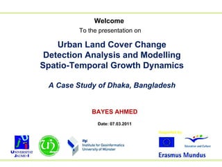
- 1. Welcome To the presentation on Urban Land Cover Change Detection Analysis and Modelling Spatio-Temporal Growth Dynamics A Case Study of Dhaka, Bangladesh BAYES AHMED Date: 07.03.2011
- 2. Study Area
- 3. Changing Patterns of Dhaka City and its Population Source: GIS division, Bangladesh Centre for Advanced Studies
- 6. Research Hypothesis What is absent in Dhaka City? CITY PLANNING
- 8. Methodology of the Research Data Collection Problem Identification Research Objectives Supervised Classification Selection of Study Area Accuracy Assessment (If Not) (If Accurate) Landsat Satellite Image (2009) Landsat Satellite Image (1999) Landsat Satellite Image (1989) Guide Map (2001) Guide Map (1995) Guide Map (1989)
- 9. Methodology of the Research Change Detection Simulated Map (2009) Model Calibration Model Validation Predicted Map (2019) Directions for Future Planning Model Selection (If Accurate) (If Valid) (If Not) Base Map (2009) Base Map (1999) Base Map (1989) (Best Fitted Model) Base Map (2009) Base Map (1999) Base Map (1989) MLP_Markov CA_Markov St_Markov
- 10. Landsat Satellite Images Path 137 Row 44 Map Projection: UTM-46 N Datum: WGS 84 Pixel Size: 30 meters
- 11. Image Classification Supervised Classification Land Cover Type Description Builtup Area Residential, Commercial and Industrial Areas Water Body River, Lakes, Ponds and Canals Vegetation Trees, Natural Vegetation, Parks and Playgrounds Low Land Wetlands, Marshy Land and Crop Fields Fallow Land Open Space, Bare and Exposed Soils
- 12. Base Maps
- 14. Accuracy Assessment Base Year Overall Accuracy Kappa Statistics 1989 85.20% 0.8054 1999 86.80% 0.8294 2009 91.60% 0.8821
- 15. Change Detection Increasing Decreasing
- 16. Markov Chain Analysis A Markov chain is a discrete random process with the property that the next state depends only on the immediately preceding state(s)
- 17. Stochastic Markov Model (St_Markov) Transition Areas Matrix (Cell) Transition Matrix (Probability) Builtup Area Water Body Vegetation Low Land Fallow Land Builtup Area 0.6649 0.0268 0.0533 0.0298 0.2252 Water Body 0.2125 0.1074 0.1030 0.1969 0.3802 Vegetation 0.1675 0.0853 0.3304 0.1173 0.2995 Low Land 0.0766 0.4006 0.0514 0.3446 0.1267 Fallow Land 0.4126 0.0144 0.2603 0.0199 0.2928 Builtup Area Water Body Vegetation Low Land Fallow Land Builtup Area 95476 3845 7658 4278 32332 Water Body 10034 5074 4865 9300 17953 Vegetation 17569 8945 34655 12302 31409 Low Land 4574 23914 3070 20572 7566 Fallow Land 57732 2009 36415 2789 40964
- 19. Stochastic Markov Model (St_Markov)
- 20. Cellular Automata (CA) A cellular automaton is a cellular entity that independently varies its new state based on its previous state and that of its immediate neighbors according to a specific rule von Neumann Moore
- 22. Preparing Suitability Images The basic assumption for preparing suitability images: a pixel closer to an existing land cover type has the higher suitability The images have been standardized to the same continuous suitability scale (0-255) using fuzzy set membership analysis process
- 24. 3×3 CA Contiguity Filter Cellular Automata Markov Model (CA_Markov) Markov Transition Area Matrix Suitability Images 0 1 0 1 1 1 0 1 0
- 26. Multi Layer Perceptron Markov Model (MLP_Markov)
- 28. Multi Layer Perceptron Markov Model (MLP_Markov) Builtup Area Water Body Vegetation Low Land Fallow Land Builtup Area 0.7823 0.0174 0.0347 0.0194 0.1463 Water Body 0.2079 0.1264 0.1008 0.1927 0.3721 Vegetation 0.1529 0.0779 0.3887 0.1071 0.2734 Low Land 0.0695 0.3634 0.0467 0.4054 0.1150 Fallow Land 0.3825 0.0133 0.2413 0.0185 0.3445
- 29. Model Validation Map Comparison : Simulated Map (2009) vs. Base Map (2009) St_Markov (2009) CA_Markov (2009) MLP_Markov (2009) Fraction Correct 0.50275 0.72558 0.91982 Kappa 0.29143 0.62578 0.88689
- 30. MLP_Markov Model Base Map 1999 Base Map 2009 Future Prediction (2019)
- 31. Outcome of the Research The outcome of this research will help the Decision Makers and Urban Planners to make DHAKA city much more : PLANNED and LIVEABLE
- 32. Thank You All QUESTIONS ?