Marel Q1 2024 Investor Presentation from May 8, 2024
Osm improvements
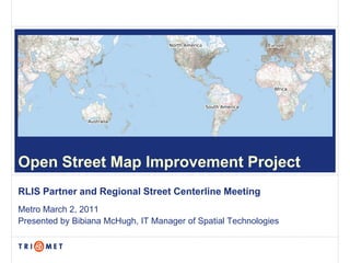
1. Open Street Map Improvement Project
RLIS Partner and Regional Street Centerline Meeting
Metro March 2, 2011
Presented by Bibiana McHugh, IT Manager of Spatial Technologies
10. OpenTripPlanner.org Project
Task 1. Project Management Plan
Project Initiation Workshop
July 15-17, 2009
Task 2. Develop and implement the software Jan 2011
Task 3. Evaluation Study May 2011
Task 4. Develop Final Report June 2011
Open Source Multi-Modal Trip Planner
15. OSM Regional
PostGIS Shapefiles Oracle
OpenStreetMap Data
Adapter Adapter Adapter Adapter Adapter
Data API
Address
Geocoding Routing
Normalizer Etc.
Service Service
Service
Web Services Client
API Application
Open Architecture
20. The
Intertwine
Project
Implementation of
OTP for Intertwine
Planning of multi-
modal trips including
biking and walking
to explore Intertwine
Sharing of
information between
users and
community
Trails.shp developed
for Intertwine
TheIntertwine.org
21. GTFS Data USGS National Street Data
Elevation
Dataset
Transit Trip Planning Routing attributes required
Datasets used to build OTP graph
22. Commercial RLIS Centerline Open Street
Products File Map
TeleAtlas or Navtech maintained by local originally imported from
jurisdictions and TIGER 2007 (without
integrated for regional addresses) and crowd-
distribution sourced
seamless coverage 3-county coverage area seamless coverage
worldwide worldwide
meets all requirements but designed for geocoding & designed for, and
costly other regional supports, multi- modal
requirements, not routing routing
no customization needed
for OTP,
not proprietary
OTP Street Data Options
23. Priority Phase I – Feb 18, 2011 thru Aug 18, 2011
1 Improve Geometry- make OSM linework coincident with RLIS
Add Additional Linework:
2
Trails.shp, bicycle.shp, pedestrian paths, major waterways
3 Verify Directionality for bicycle routing
4 Verify Turn Restrictions for bicycle routing
Priority Phase II
5 Turn restrictions – physical and legal for driving
Not Included
Addresses
Loc_Ids (only for segments we are editing, not all of them)
OSM Improvements
26. http://wiki.openstreetmap.org/wiki/Portland,_Oreg
Portland wiki page
on
Portland OpenStreetMap
http://www.meetup.com/OpenStreetMap-Portland/
group
Dave Hanson Local PDX user who imported Tiger data for US
Talk
Imports
Routing
OSM Mailing Lists
Announce
josm-dev
osmosis-dev
OSM Community
28. Shapefile OSM
Everything in one data model, more similar to
Point, Line or Polygon File
geodatabase
Point Node
Line Way
Polygon Closed Way (beg xy = end xy) or Relation
Attribute Tag
Layer file (point, line or poly) Relation (can include nodes and ways)
Edit Session Change Set
Copy of shapefile for editing Sandbox copy of OSM data for playing
Tools for Editing: ESRI Tools for Editing: ESRI ArcMap, JOSM, Potlatch,
ArcMap Merkaartor, MapZen, Quantum GIS, Osmosis
Topology Tools Validation Tools (JOSM)
OSM Glossary
29. Procedures to create coincidence linework between OSM and RLIS and
to bring in new linework including: streets, trails.shp, bicycle.shp,
pedestrian paths, major waterways
1. Create a DIFF File
a. In ArcMap, create 10’ buffer @ all RLIS streets and dissolve
b. Query for all OSM ways that are inside the buffer
c. Reverse selection and export to new DIFF shapefile
d. Convert shapefile to OSM for use in JOSM (ArcMap 10 OSM Editor has
bugs)
2. Create Reclass File
Create a new RLIS file with OSM attributes
OSM Editing Procedures
30. RLIS Attribute OSM Key OSM Values
localid RLIS:localid
leftadd1 DELETE
leftadd2 DELETE
rgtadd1 DELETE
rgtadd2 DELETE
fdpre name_direction_prefix
fname name_base
ftype name_type
fdsuf name_direction_suffix
name "fdpre fname ftype fdsuf"
lzip zip_left
rzip zip_right
lcity DELETE
rcity DELETE
lcounty DELETE
rcounty DELETE
cfcc DELETE
class DELETE
drct oneway yes if 2 or 3, no if 1, null if 0
flip_direction yes if drct was 3, no if drct was 2, otherwise null
leadzero DELETE
quirk DELETE
side DELETE
source DELETE
struc DELETE
subarea DELETE
type highway see types
createdate DELETE
updatedate DELETE
lowner DELETE
rowner DELETE
Shape_Leng DELETE
Create Reclass File
31. Type Description OSM Tags
Key 1 Value 1 Key 2 Value 2
1110 Freeway. highway motorway
1120 Ramps, interchanges and feeders. highway *_link oneway *
1121 On ramp (only). highway *_link oneway yes
1122 Off ramp (only). highway *_link oneway yes
1123 On/off ramp. highway *_link oneway no
5101 Freeway with rapid transit (i.e. MAX or streetcar). highway motorway railway light_rail
3100 Trail. highway footway
3200 Path. highway path
3210 Pedestrian walkway. highway pedestrian
3230 Stairway. highway steps
3250 Off street bikeway. highway cycleway cycleway track
Private Road with NO Valid Address Range or Street Name. (Portland
1760 only, subarea = 'P'). highway unclassified access private
1200 Highway. highway trunk
Local street to freeway/highway on ramp (only) (Portland only, subarea =
1221 'P'). highway motorway_link oneway yes
Freeway/Highway to local street off ramp (only) (Portland only, subarea =
1222 'P'). highway motorway_link oneway yes
Freeway/Highway to local street on/off ramp (combination) (Portland only,
1223 subarea = 'P'). highway motorway_link oneway no
1300 Primary arterial. highway primary
1400 Secondary arterial. highway secondary
1450 Major residential (cartographic). highway residential
1500 Minor residential (unclassified). highway residential
1521 Local street to local street connector (Portland only, subarea = 'P'). highway tertiary_link
Minor residential street (unclassified), named but without addresses
1550 (Clackamas Co. only, subarea = 'C') highway residential
Minor residential street (unclassified), unamed and without addresses
1560 (Clackamas Co. only, subarea = 'C') highway residential unnamed yes
Create Reclass File
32. Procedures to create coincidence linework between OSM and RLIS and to
bring in new linework (including: streets, trails, bike & ped paths, waterways)
A. Create a DIFF File
1. In ArcMap, create 10’ buffer @ all RLIS streets and dissolve
2. Query for all OSM ways that are inside the buffer
3. Reverse selection and export to new DIFF shapefile
4. Convert shapefile to OSM for use in JOSM (ArcMap 10 OSM Editor has bugs)
B. Create Reclass File
Create a new RLIS file with OSM attributes
C. Edit OSM File
In JOSM, bring in DIFF File, Reclass File, OSM File (1/4 County OSM files
downloaded nightly), and Aerials for reference
1. Copy RLIS attributes into OSM using “paste tags” tool
2. Copy OSM tags back into RLIS attributes to capture complete set
3. Copy RLIS feature and paste geometry (with attributes) into OSM File
4. Delete old OSM feature geometry and DIFF geometry to track progress
5. Merge nodes in OSM
6. Upload corrections to OSM
OSM Editing Procedures
33. Layer Name File
Diff Layer (contains only streets and trails from OSM
WashSE Diff.osm
that have been identified as inaccurate)
All Str ReClass.som RLIS Streets Layer
Washington-SE.osm OSM Data Layer
Trails_Wash.osm RLIS Trails
TM Aerials Aerial Imagery
Mapping Layers in JOSM
35. 1. Copy RLIS attributes into OSM using “paste tags” tool
2. Copy OSM tags back into RLIS attributes to capture complete set
36. 3. Copy RLIS feature and paste geometry (with attributes) into OSM File
Note that this way is
now red indicating
that it belongs to the
OSM Data Layer
37. 4. Delete old OSM feature geometry and DIFF geometry to track progress
38. 5. Merge nodes: connect the newly added ways to the existing OSM node network
39. TO DO LIST
Formalize and approve Tags for all RLIS features (Reclass Files)
Identify procedure for directionality and turn restrictions for bicycle
routing
Recruit community to assist with importing waterways
OSM Mapping Parties to test bicycle data and trips - four this summer
for each county
Formalize and document procedures to share with other jurisdictions
Prepare for OTP Beta release in Fall 2011
Intertwine Project
40. CONTACT:
Bibiana McHugh
Thank You! IT Manager of Spatial Technologies
McHughB@trimet.org
VISIT:
opentripplanner.org
theintertwine.org
OSM-PDX Google Group