SlideShare une entreprise Scribd logo
1  sur  22
Télécharger pour lire hors ligne
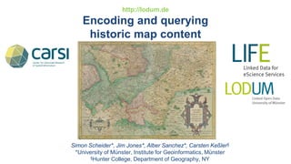
http://lodum.de
Encoding and querying
historic map content
Simon Scheider*, Jim Jones*, Alber Sanchez*, Carsten Keßler§
*University of Münster, Institute for Geoinformatics, Münster
§Hunter College, Department of Geography, NY
How can (we support) historians (in) find(ing)
(answers in) maps?
Question:
“What was the type of
landcover around Hildesheim
in the 19th century?”
1) Manual search
(through 20.000 maps?)
2) Text field search:
- title:
(“Gaußsche Landesaufnahme”
“Berghe Ducatus”,...)
- author:
(Gerhard Mercator, ...)
- year of production
(1680, 1839, ...)
-key words: (“topographic map”,
“Flurkarte”)
Sample from the map repository at ISTG
(Institute for comparative urban history),
Münster
How can (we support) historians (in) find(ing)
(answers in) maps?
Technical challenges:
1) Manual search
(through 20.000 maps?)
2) Text field search:
- title:
(“Gaußsche Landesaufnahme”
“Berghe Ducatius”,...)
- author:
(Gerhard Mercator, ...)
- year of production
(1680, 1839, ...)
-key words: (“topographic map”,
“Flurkarte”)
Not scalable!
Language?
How to pick the „right“
terms? (which correspond
to the answer?)
How to pick the „right“
place/space? („the area
around Hildesheim“)
How to pick the right time?
(„19th century“)
There are many
languages in maps (Latin, ...)!
Placenames are changing!
Historic maps are distorted and
lack CRS!
Terms are ambiguous!
There is too much content!
There is nameless content
(e.g. „landcover around Hildesheim“)!
How can (we support) historians (in) find(ing)
(answers in) maps?
More questions:
“What was the extent of Prussia?”
“Which territories were part of Prussia?”
“Which Prussian territories were acquired by Friedrich-Wilhelm of Brandenburg, the
great elector?“
Answer depends on time ...
and ambiguity of names ...
Prussia 1806
„Brandenburg“
(Prussia) 1688
How can (we support) historians (in) find(ing)
(answers in) maps?
A map answering detailed historical knowledge:
“How many people did Napoleon’s army have when soldiers arrived in Smolensk during
his 1812 campaign?“
“What were the
lowest temperatures
during Napoleon’s
campaign?”
“Which places did
Napoleon’s army
come across during the
1812 campaign?”
Minard’s map about Napoleon’s invasion of Russia 1812:
How can (we support) historians (in) find(ing)
(answers in) maps?
Research topics we addressed in the paper:
1) How to precisely
encode and query
- semantic,
- spatial and
- temporal
map contents?
2) How to deal with
- wealth of content
- language/naming
ambiguity?
Linked spatio-temporal data for historic maps
Linked spatio-temporal data enables
1. a simple und universal approach to describe
semantic contents of (map) documents
(namely, a graph)
2. complex content queries
(beyond text search) using diverse languages
3. logical expressions and reasoning for
approximate content descriptions/queries
4. linking to external resources (URI)
...and therefore: (re)-using resources and
crowdsourcing
5. using spatial (OGC simple feature) and
temporal references
Map
Berghe
Ducatus
Gerard
Mercator
is a
creator
coord
x: ….
y: ….
mapsArea
“1550”mapsTime
Berg
State
is a
Köln
maps
City
“1512”
birthDate
is a
Formally encoding map contents
Map contents can be treated as sets of assertions
that can be extracted by looking at the map:
In the Semantic Web,
- nameless content
- wealth of content
can be addressed by intensionality:
- logical quantification
- blank nodes
In linked data,
this translates into a
named graph:
Vocabularies we reused:
-For map area as well as content space:
GeoSPARQL ontology (prefix geo):
OWLtime (prefix time):
- For document properties:...
Vocabularies for historic map contents
Maps as documents (prefix maps) :
http://geographicknowledge.de/vocab/maps
Vocabularies for historic map contents
Content phenomena (prefix phen):
http://geographicknowledge.de/vocab/historicmapsphen [.rdf/.jpg]:
(reuse of
any
geographic/
historical
ontology,
such as: )
Encoding maps as linked data
For example, the map about Hildesheim 1840:
Document (graph) represents Content graph
(describing the map as document) (describing content assertions)
Georeferencing and annotating historic maps
http://data.uni-muenster.de/georeferencer/georef.html
1) Georeferencing
map image:
using
control points
(known locations
in Open Street Map)
Georeferencing and annotating historic maps
2) Determine
map window
Automatic
calculation
of
- map scale
- map area
Georeferencing and annotating historic maps
3) Describe
document:
- time
- creator
- size
- document
URL
…
Georeferencing and annotating historic maps
4) Describe contents
Automatically
suggested content
based on map area,
time window
Reuse of external
information recources
(e.g. the state Berg
at Dbpedia)
Different historians
can contribute to
the same map
Publishing maps and their contents
RESTful publication (accessible over http):
- As RDF files or KML files
- over SPARQL endpoint
- Can be accessed over the Web
for display or search
Display with Google Earth:
Querying historic map contents
Which maps contain information about ...
Querying historic map contents
Which maps contain information about ...
Querying historic map contents
Which maps contain information about ...
Conclusion
• Historic map contents =: named RDF graphs!
• ... allows the expression of map contents in a precise way as a set of
(triple) assertions
•... and the linking of maps as documents with their contents, reusing
published vocabularies and external links (Dbpedia)
• ... enables crowdsourcing of content descriptions
• ... makes possible intensional descriptions (using blank nodes) in
order to cope with the wealth of content, nameless content and content
approximation
• ... enables retrieval of maps that can answer historians‘ questions!
Future work
• Tools that help encoding map contents for non-trained
users (beyond georeferencer)?
• Tools that allow non-trained users to formulate (visual)
content based queries?
>SPEX (spatio-temporal content explorer)
(see https://github.com/lodum)
Dr. Simon Scheider
Institut für Geoinformatik der
Westfälischen Wilhelms-Universität
Heisenbergstraße 2, 48149 Münster
simon.scheider@uni-muenster.de
Tel.: 0251 I 83-30088
Thanks for your
attention!

Contenu connexe

Similaire à Encoding and querying historic map content

Maps soc soc_workshop2010final-web
Maps soc soc_workshop2010final-webMaps soc soc_workshop2010final-web
Maps soc soc_workshop2010final-webSLEvansBL
 
Real-time Visualisation of Cultural Heritage and Environmental Archaeology Da...
Real-time Visualisation of Cultural Heritage and Environmental Archaeology Da...Real-time Visualisation of Cultural Heritage and Environmental Archaeology Da...
Real-time Visualisation of Cultural Heritage and Environmental Archaeology Da...Marcus Smith
 
Geographical sources by Aman Kr Kushwaha
Geographical sources by Aman Kr KushwahaGeographical sources by Aman Kr Kushwaha
Geographical sources by Aman Kr KushwahaAMAN KUMAR KUSHWAHA
 
Rodriguez geo maps
Rodriguez geo mapsRodriguez geo maps
Rodriguez geo mapsLuisRRodr
 
Rodriguez - Geo maps V2
Rodriguez - Geo maps V2Rodriguez - Geo maps V2
Rodriguez - Geo maps V2LuisRRodr
 
OKCon 2013 Moodboards
OKCon 2013 MoodboardsOKCon 2013 Moodboards
OKCon 2013 Moodboardsthuesing
 
The Forgotten Majority: Mapping the Civilian Fatalities of the 1916 Rising
The Forgotten Majority: Mapping the Civilian Fatalities of the 1916 RisingThe Forgotten Majority: Mapping the Civilian Fatalities of the 1916 Rising
The Forgotten Majority: Mapping the Civilian Fatalities of the 1916 RisingHannah Smyth
 
Introduction to Mapping the 19th-Century City
Introduction to Mapping the 19th-Century CityIntroduction to Mapping the 19th-Century City
Introduction to Mapping the 19th-Century Citygtritchroman
 
Finding Meaning in the Data Avalanche: The Ethical Dangers & Community Value ...
Finding Meaning in the Data Avalanche: The Ethical Dangers & Community Value ...Finding Meaning in the Data Avalanche: The Ethical Dangers & Community Value ...
Finding Meaning in the Data Avalanche: The Ethical Dangers & Community Value ...Ashley M. Richter
 
New Discovery Tools for Digital Humanities and Spatial Data (Summary of the J...
New Discovery Tools for Digital Humanities and Spatial Data (Summary of the J...New Discovery Tools for Digital Humanities and Spatial Data (Summary of the J...
New Discovery Tools for Digital Humanities and Spatial Data (Summary of the J...Micah Altman
 
Martha Kellogg Smith
Martha Kellogg SmithMartha Kellogg Smith
Martha Kellogg Smithvonjobi
 
What are data and information, why they matter (v. ITA 2020)
What are data and information, why they matter (v. ITA 2020)What are data and information, why they matter (v. ITA 2020)
What are data and information, why they matter (v. ITA 2020)Frieda Brioschi
 
Selective information from Historical Geographers: the case of the Dutch area...
Selective information from Historical Geographers: the case of the Dutch area...Selective information from Historical Geographers: the case of the Dutch area...
Selective information from Historical Geographers: the case of the Dutch area...Sophie Visser
 
Semantic annotation of digital libraries. A model for science communication
Semantic annotation of digital libraries. A model for science communicationSemantic annotation of digital libraries. A model for science communication
Semantic annotation of digital libraries. A model for science communicationFrancesca Di Donato
 

Similaire à Encoding and querying historic map content (20)

Maps soc soc_workshop2010final-web
Maps soc soc_workshop2010final-webMaps soc soc_workshop2010final-web
Maps soc soc_workshop2010final-web
 
Real-time Visualisation of Cultural Heritage and Environmental Archaeology Da...
Real-time Visualisation of Cultural Heritage and Environmental Archaeology Da...Real-time Visualisation of Cultural Heritage and Environmental Archaeology Da...
Real-time Visualisation of Cultural Heritage and Environmental Archaeology Da...
 
SFScon 21 - Marco Montanari - Open history Map
SFScon 21 - Marco Montanari - Open history MapSFScon 21 - Marco Montanari - Open history Map
SFScon 21 - Marco Montanari - Open history Map
 
Geographical sources by Aman Kr Kushwaha
Geographical sources by Aman Kr KushwahaGeographical sources by Aman Kr Kushwaha
Geographical sources by Aman Kr Kushwaha
 
Rodriguez geo maps
Rodriguez geo mapsRodriguez geo maps
Rodriguez geo maps
 
Rodriguez - Geo maps V2
Rodriguez - Geo maps V2Rodriguez - Geo maps V2
Rodriguez - Geo maps V2
 
OKCon 2013 Moodboards
OKCon 2013 MoodboardsOKCon 2013 Moodboards
OKCon 2013 Moodboards
 
Cataloging maps
Cataloging mapsCataloging maps
Cataloging maps
 
The Forgotten Majority: Mapping the Civilian Fatalities of the 1916 Rising
The Forgotten Majority: Mapping the Civilian Fatalities of the 1916 RisingThe Forgotten Majority: Mapping the Civilian Fatalities of the 1916 Rising
The Forgotten Majority: Mapping the Civilian Fatalities of the 1916 Rising
 
Introduction to Mapping the 19th-Century City
Introduction to Mapping the 19th-Century CityIntroduction to Mapping the 19th-Century City
Introduction to Mapping the 19th-Century City
 
Old maps in Moravian Library
Old maps in Moravian LibraryOld maps in Moravian Library
Old maps in Moravian Library
 
Finding Meaning in the Data Avalanche: The Ethical Dangers & Community Value ...
Finding Meaning in the Data Avalanche: The Ethical Dangers & Community Value ...Finding Meaning in the Data Avalanche: The Ethical Dangers & Community Value ...
Finding Meaning in the Data Avalanche: The Ethical Dangers & Community Value ...
 
New Discovery Tools for Digital Humanities and Spatial Data (Summary of the J...
New Discovery Tools for Digital Humanities and Spatial Data (Summary of the J...New Discovery Tools for Digital Humanities and Spatial Data (Summary of the J...
New Discovery Tools for Digital Humanities and Spatial Data (Summary of the J...
 
Martha Kellogg Smith
Martha Kellogg SmithMartha Kellogg Smith
Martha Kellogg Smith
 
What are data and information, why they matter (v. ITA 2020)
What are data and information, why they matter (v. ITA 2020)What are data and information, why they matter (v. ITA 2020)
What are data and information, why they matter (v. ITA 2020)
 
History of cartography
History of cartographyHistory of cartography
History of cartography
 
Selective information from Historical Geographers: the case of the Dutch area...
Selective information from Historical Geographers: the case of the Dutch area...Selective information from Historical Geographers: the case of the Dutch area...
Selective information from Historical Geographers: the case of the Dutch area...
 
Semantic annotation of digital libraries. A model for science communication
Semantic annotation of digital libraries. A model for science communicationSemantic annotation of digital libraries. A model for science communication
Semantic annotation of digital libraries. A model for science communication
 
2013 05-23-knowledge triangle
2013 05-23-knowledge triangle2013 05-23-knowledge triangle
2013 05-23-knowledge triangle
 
The Hungarian National Archives’ online portal on medieval charters
The Hungarian National Archives’ online portal on medieval chartersThe Hungarian National Archives’ online portal on medieval charters
The Hungarian National Archives’ online portal on medieval charters
 

Plus de Carsten Keßler

Geoprivacy Talk @ UJI Castellòn
Geoprivacy Talk @ UJI CastellònGeoprivacy Talk @ UJI Castellòn
Geoprivacy Talk @ UJI CastellònCarsten Keßler
 
Privacy-preserving contagious disease tracking
Privacy-preserving contagious disease trackingPrivacy-preserving contagious disease tracking
Privacy-preserving contagious disease trackingCarsten Keßler
 
Central Places in Wikipedia
Central Places in WikipediaCentral Places in Wikipedia
Central Places in WikipediaCarsten Keßler
 
GIS for the Masses: Volunteered Geographic Information
GIS for the Masses: Volunteered Geographic InformationGIS for the Masses: Volunteered Geographic Information
GIS for the Masses: Volunteered Geographic InformationCarsten Keßler
 
Linked Data and Time – Modeling Researcher Life Lines by Events
Linked Data and Time – Modeling Researcher Life Lines by EventsLinked Data and Time – Modeling Researcher Life Lines by Events
Linked Data and Time – Modeling Researcher Life Lines by EventsCarsten Keßler
 
Trust as a Proxy Measure for the Quality of VGI in the Case of OSM
Trust  as a Proxy Measure for the Quality of VGI in the Case of OSMTrust  as a Proxy Measure for the Quality of VGI in the Case of OSM
Trust as a Proxy Measure for the Quality of VGI in the Case of OSMCarsten Keßler
 

Plus de Carsten Keßler (7)

Geoprivacy Talk @ UJI Castellòn
Geoprivacy Talk @ UJI CastellònGeoprivacy Talk @ UJI Castellòn
Geoprivacy Talk @ UJI Castellòn
 
Privacy-preserving contagious disease tracking
Privacy-preserving contagious disease trackingPrivacy-preserving contagious disease tracking
Privacy-preserving contagious disease tracking
 
Central Places in Wikipedia
Central Places in WikipediaCentral Places in Wikipedia
Central Places in Wikipedia
 
GIS for the Masses: Volunteered Geographic Information
GIS for the Masses: Volunteered Geographic InformationGIS for the Masses: Volunteered Geographic Information
GIS for the Masses: Volunteered Geographic Information
 
Linked Data and Time – Modeling Researcher Life Lines by Events
Linked Data and Time – Modeling Researcher Life Lines by EventsLinked Data and Time – Modeling Researcher Life Lines by Events
Linked Data and Time – Modeling Researcher Life Lines by Events
 
Trust as a Proxy Measure for the Quality of VGI in the Case of OSM
Trust  as a Proxy Measure for the Quality of VGI in the Case of OSMTrust  as a Proxy Measure for the Quality of VGI in the Case of OSM
Trust as a Proxy Measure for the Quality of VGI in the Case of OSM
 
LODUM @ SWIB11
LODUM @ SWIB11LODUM @ SWIB11
LODUM @ SWIB11
 

Dernier

Connaught Place, Delhi Call girls :8448380779 Model Escorts | 100% verified
Connaught Place, Delhi Call girls :8448380779 Model Escorts | 100% verifiedConnaught Place, Delhi Call girls :8448380779 Model Escorts | 100% verified
Connaught Place, Delhi Call girls :8448380779 Model Escorts | 100% verifiedDelhi Call girls
 
Human & Veterinary Respiratory Physilogy_DR.E.Muralinath_Associate Professor....
Human & Veterinary Respiratory Physilogy_DR.E.Muralinath_Associate Professor....Human & Veterinary Respiratory Physilogy_DR.E.Muralinath_Associate Professor....
Human & Veterinary Respiratory Physilogy_DR.E.Muralinath_Associate Professor....muralinath2
 
300003-World Science Day For Peace And Development.pptx
300003-World Science Day For Peace And Development.pptx300003-World Science Day For Peace And Development.pptx
300003-World Science Day For Peace And Development.pptxryanrooker
 
High Class Escorts in Hyderabad ₹7.5k Pick Up & Drop With Cash Payment 969456...
High Class Escorts in Hyderabad ₹7.5k Pick Up & Drop With Cash Payment 969456...High Class Escorts in Hyderabad ₹7.5k Pick Up & Drop With Cash Payment 969456...
High Class Escorts in Hyderabad ₹7.5k Pick Up & Drop With Cash Payment 969456...chandars293
 
GBSN - Biochemistry (Unit 1)
GBSN - Biochemistry (Unit 1)GBSN - Biochemistry (Unit 1)
GBSN - Biochemistry (Unit 1)Areesha Ahmad
 
module for grade 9 for distance learning
module for grade 9 for distance learningmodule for grade 9 for distance learning
module for grade 9 for distance learninglevieagacer
 
GBSN - Microbiology (Unit 2)
GBSN - Microbiology (Unit 2)GBSN - Microbiology (Unit 2)
GBSN - Microbiology (Unit 2)Areesha Ahmad
 
Call Girls Ahmedabad +917728919243 call me Independent Escort Service
Call Girls Ahmedabad +917728919243 call me Independent Escort ServiceCall Girls Ahmedabad +917728919243 call me Independent Escort Service
Call Girls Ahmedabad +917728919243 call me Independent Escort Serviceshivanisharma5244
 
SAMASTIPUR CALL GIRL 7857803690 LOW PRICE ESCORT SERVICE
SAMASTIPUR CALL GIRL 7857803690  LOW PRICE  ESCORT SERVICESAMASTIPUR CALL GIRL 7857803690  LOW PRICE  ESCORT SERVICE
SAMASTIPUR CALL GIRL 7857803690 LOW PRICE ESCORT SERVICEayushi9330
 
Forensic Biology & Its biological significance.pdf
Forensic Biology & Its biological significance.pdfForensic Biology & Its biological significance.pdf
Forensic Biology & Its biological significance.pdfrohankumarsinghrore1
 
Molecular markers- RFLP, RAPD, AFLP, SNP etc.
Molecular markers- RFLP, RAPD, AFLP, SNP etc.Molecular markers- RFLP, RAPD, AFLP, SNP etc.
Molecular markers- RFLP, RAPD, AFLP, SNP etc.Silpa
 
Dubai Call Girls Beauty Face Teen O525547819 Call Girls Dubai Young
Dubai Call Girls Beauty Face Teen O525547819 Call Girls Dubai YoungDubai Call Girls Beauty Face Teen O525547819 Call Girls Dubai Young
Dubai Call Girls Beauty Face Teen O525547819 Call Girls Dubai Youngkajalvid75
 
Vip profile Call Girls In Lonavala 9748763073 For Genuine Sex Service At Just...
Vip profile Call Girls In Lonavala 9748763073 For Genuine Sex Service At Just...Vip profile Call Girls In Lonavala 9748763073 For Genuine Sex Service At Just...
Vip profile Call Girls In Lonavala 9748763073 For Genuine Sex Service At Just...Monika Rani
 
Bacterial Identification and Classifications
Bacterial Identification and ClassificationsBacterial Identification and Classifications
Bacterial Identification and ClassificationsAreesha Ahmad
 
❤Jammu Kashmir Call Girls 8617697112 Personal Whatsapp Number 💦✅.
❤Jammu Kashmir Call Girls 8617697112 Personal Whatsapp Number 💦✅.❤Jammu Kashmir Call Girls 8617697112 Personal Whatsapp Number 💦✅.
❤Jammu Kashmir Call Girls 8617697112 Personal Whatsapp Number 💦✅.Nitya salvi
 
Pests of cotton_Borer_Pests_Binomics_Dr.UPR.pdf
Pests of cotton_Borer_Pests_Binomics_Dr.UPR.pdfPests of cotton_Borer_Pests_Binomics_Dr.UPR.pdf
Pests of cotton_Borer_Pests_Binomics_Dr.UPR.pdfPirithiRaju
 
FAIRSpectra - Enabling the FAIRification of Spectroscopy and Spectrometry
FAIRSpectra - Enabling the FAIRification of Spectroscopy and SpectrometryFAIRSpectra - Enabling the FAIRification of Spectroscopy and Spectrometry
FAIRSpectra - Enabling the FAIRification of Spectroscopy and SpectrometryAlex Henderson
 
GBSN - Microbiology (Unit 3)
GBSN - Microbiology (Unit 3)GBSN - Microbiology (Unit 3)
GBSN - Microbiology (Unit 3)Areesha Ahmad
 

Dernier (20)

Connaught Place, Delhi Call girls :8448380779 Model Escorts | 100% verified
Connaught Place, Delhi Call girls :8448380779 Model Escorts | 100% verifiedConnaught Place, Delhi Call girls :8448380779 Model Escorts | 100% verified
Connaught Place, Delhi Call girls :8448380779 Model Escorts | 100% verified
 
Human & Veterinary Respiratory Physilogy_DR.E.Muralinath_Associate Professor....
Human & Veterinary Respiratory Physilogy_DR.E.Muralinath_Associate Professor....Human & Veterinary Respiratory Physilogy_DR.E.Muralinath_Associate Professor....
Human & Veterinary Respiratory Physilogy_DR.E.Muralinath_Associate Professor....
 
300003-World Science Day For Peace And Development.pptx
300003-World Science Day For Peace And Development.pptx300003-World Science Day For Peace And Development.pptx
300003-World Science Day For Peace And Development.pptx
 
High Class Escorts in Hyderabad ₹7.5k Pick Up & Drop With Cash Payment 969456...
High Class Escorts in Hyderabad ₹7.5k Pick Up & Drop With Cash Payment 969456...High Class Escorts in Hyderabad ₹7.5k Pick Up & Drop With Cash Payment 969456...
High Class Escorts in Hyderabad ₹7.5k Pick Up & Drop With Cash Payment 969456...
 
GBSN - Biochemistry (Unit 1)
GBSN - Biochemistry (Unit 1)GBSN - Biochemistry (Unit 1)
GBSN - Biochemistry (Unit 1)
 
module for grade 9 for distance learning
module for grade 9 for distance learningmodule for grade 9 for distance learning
module for grade 9 for distance learning
 
GBSN - Microbiology (Unit 2)
GBSN - Microbiology (Unit 2)GBSN - Microbiology (Unit 2)
GBSN - Microbiology (Unit 2)
 
Call Girls Ahmedabad +917728919243 call me Independent Escort Service
Call Girls Ahmedabad +917728919243 call me Independent Escort ServiceCall Girls Ahmedabad +917728919243 call me Independent Escort Service
Call Girls Ahmedabad +917728919243 call me Independent Escort Service
 
SAMASTIPUR CALL GIRL 7857803690 LOW PRICE ESCORT SERVICE
SAMASTIPUR CALL GIRL 7857803690  LOW PRICE  ESCORT SERVICESAMASTIPUR CALL GIRL 7857803690  LOW PRICE  ESCORT SERVICE
SAMASTIPUR CALL GIRL 7857803690 LOW PRICE ESCORT SERVICE
 
Forensic Biology & Its biological significance.pdf
Forensic Biology & Its biological significance.pdfForensic Biology & Its biological significance.pdf
Forensic Biology & Its biological significance.pdf
 
Molecular markers- RFLP, RAPD, AFLP, SNP etc.
Molecular markers- RFLP, RAPD, AFLP, SNP etc.Molecular markers- RFLP, RAPD, AFLP, SNP etc.
Molecular markers- RFLP, RAPD, AFLP, SNP etc.
 
Dubai Call Girls Beauty Face Teen O525547819 Call Girls Dubai Young
Dubai Call Girls Beauty Face Teen O525547819 Call Girls Dubai YoungDubai Call Girls Beauty Face Teen O525547819 Call Girls Dubai Young
Dubai Call Girls Beauty Face Teen O525547819 Call Girls Dubai Young
 
+971581248768>> SAFE AND ORIGINAL ABORTION PILLS FOR SALE IN DUBAI AND ABUDHA...
+971581248768>> SAFE AND ORIGINAL ABORTION PILLS FOR SALE IN DUBAI AND ABUDHA...+971581248768>> SAFE AND ORIGINAL ABORTION PILLS FOR SALE IN DUBAI AND ABUDHA...
+971581248768>> SAFE AND ORIGINAL ABORTION PILLS FOR SALE IN DUBAI AND ABUDHA...
 
Vip profile Call Girls In Lonavala 9748763073 For Genuine Sex Service At Just...
Vip profile Call Girls In Lonavala 9748763073 For Genuine Sex Service At Just...Vip profile Call Girls In Lonavala 9748763073 For Genuine Sex Service At Just...
Vip profile Call Girls In Lonavala 9748763073 For Genuine Sex Service At Just...
 
Bacterial Identification and Classifications
Bacterial Identification and ClassificationsBacterial Identification and Classifications
Bacterial Identification and Classifications
 
❤Jammu Kashmir Call Girls 8617697112 Personal Whatsapp Number 💦✅.
❤Jammu Kashmir Call Girls 8617697112 Personal Whatsapp Number 💦✅.❤Jammu Kashmir Call Girls 8617697112 Personal Whatsapp Number 💦✅.
❤Jammu Kashmir Call Girls 8617697112 Personal Whatsapp Number 💦✅.
 
Pests of cotton_Borer_Pests_Binomics_Dr.UPR.pdf
Pests of cotton_Borer_Pests_Binomics_Dr.UPR.pdfPests of cotton_Borer_Pests_Binomics_Dr.UPR.pdf
Pests of cotton_Borer_Pests_Binomics_Dr.UPR.pdf
 
FAIRSpectra - Enabling the FAIRification of Spectroscopy and Spectrometry
FAIRSpectra - Enabling the FAIRification of Spectroscopy and SpectrometryFAIRSpectra - Enabling the FAIRification of Spectroscopy and Spectrometry
FAIRSpectra - Enabling the FAIRification of Spectroscopy and Spectrometry
 
Site Acceptance Test .
Site Acceptance Test                    .Site Acceptance Test                    .
Site Acceptance Test .
 
GBSN - Microbiology (Unit 3)
GBSN - Microbiology (Unit 3)GBSN - Microbiology (Unit 3)
GBSN - Microbiology (Unit 3)
 

Encoding and querying historic map content

  • 1. http://lodum.de Encoding and querying historic map content Simon Scheider*, Jim Jones*, Alber Sanchez*, Carsten Keßler§ *University of Münster, Institute for Geoinformatics, Münster §Hunter College, Department of Geography, NY
  • 2. How can (we support) historians (in) find(ing) (answers in) maps? Question: “What was the type of landcover around Hildesheim in the 19th century?” 1) Manual search (through 20.000 maps?) 2) Text field search: - title: (“Gaußsche Landesaufnahme” “Berghe Ducatus”,...) - author: (Gerhard Mercator, ...) - year of production (1680, 1839, ...) -key words: (“topographic map”, “Flurkarte”) Sample from the map repository at ISTG (Institute for comparative urban history), Münster
  • 3. How can (we support) historians (in) find(ing) (answers in) maps? Technical challenges: 1) Manual search (through 20.000 maps?) 2) Text field search: - title: (“Gaußsche Landesaufnahme” “Berghe Ducatius”,...) - author: (Gerhard Mercator, ...) - year of production (1680, 1839, ...) -key words: (“topographic map”, “Flurkarte”) Not scalable! Language? How to pick the „right“ terms? (which correspond to the answer?) How to pick the „right“ place/space? („the area around Hildesheim“) How to pick the right time? („19th century“) There are many languages in maps (Latin, ...)! Placenames are changing! Historic maps are distorted and lack CRS! Terms are ambiguous! There is too much content! There is nameless content (e.g. „landcover around Hildesheim“)!
  • 4. How can (we support) historians (in) find(ing) (answers in) maps? More questions: “What was the extent of Prussia?” “Which territories were part of Prussia?” “Which Prussian territories were acquired by Friedrich-Wilhelm of Brandenburg, the great elector?“ Answer depends on time ... and ambiguity of names ... Prussia 1806 „Brandenburg“ (Prussia) 1688
  • 5. How can (we support) historians (in) find(ing) (answers in) maps? A map answering detailed historical knowledge: “How many people did Napoleon’s army have when soldiers arrived in Smolensk during his 1812 campaign?“ “What were the lowest temperatures during Napoleon’s campaign?” “Which places did Napoleon’s army come across during the 1812 campaign?” Minard’s map about Napoleon’s invasion of Russia 1812:
  • 6. How can (we support) historians (in) find(ing) (answers in) maps? Research topics we addressed in the paper: 1) How to precisely encode and query - semantic, - spatial and - temporal map contents? 2) How to deal with - wealth of content - language/naming ambiguity?
  • 7. Linked spatio-temporal data for historic maps Linked spatio-temporal data enables 1. a simple und universal approach to describe semantic contents of (map) documents (namely, a graph) 2. complex content queries (beyond text search) using diverse languages 3. logical expressions and reasoning for approximate content descriptions/queries 4. linking to external resources (URI) ...and therefore: (re)-using resources and crowdsourcing 5. using spatial (OGC simple feature) and temporal references Map Berghe Ducatus Gerard Mercator is a creator coord x: …. y: …. mapsArea “1550”mapsTime Berg State is a Köln maps City “1512” birthDate is a
  • 8. Formally encoding map contents Map contents can be treated as sets of assertions that can be extracted by looking at the map: In the Semantic Web, - nameless content - wealth of content can be addressed by intensionality: - logical quantification - blank nodes In linked data, this translates into a named graph:
  • 9. Vocabularies we reused: -For map area as well as content space: GeoSPARQL ontology (prefix geo): OWLtime (prefix time): - For document properties:... Vocabularies for historic map contents Maps as documents (prefix maps) : http://geographicknowledge.de/vocab/maps
  • 10. Vocabularies for historic map contents Content phenomena (prefix phen): http://geographicknowledge.de/vocab/historicmapsphen [.rdf/.jpg]: (reuse of any geographic/ historical ontology, such as: )
  • 11. Encoding maps as linked data For example, the map about Hildesheim 1840: Document (graph) represents Content graph (describing the map as document) (describing content assertions)
  • 12. Georeferencing and annotating historic maps http://data.uni-muenster.de/georeferencer/georef.html 1) Georeferencing map image: using control points (known locations in Open Street Map)
  • 13. Georeferencing and annotating historic maps 2) Determine map window Automatic calculation of - map scale - map area
  • 14. Georeferencing and annotating historic maps 3) Describe document: - time - creator - size - document URL …
  • 15. Georeferencing and annotating historic maps 4) Describe contents Automatically suggested content based on map area, time window Reuse of external information recources (e.g. the state Berg at Dbpedia) Different historians can contribute to the same map
  • 16. Publishing maps and their contents RESTful publication (accessible over http): - As RDF files or KML files - over SPARQL endpoint - Can be accessed over the Web for display or search Display with Google Earth:
  • 17. Querying historic map contents Which maps contain information about ...
  • 18. Querying historic map contents Which maps contain information about ...
  • 19. Querying historic map contents Which maps contain information about ...
  • 20. Conclusion • Historic map contents =: named RDF graphs! • ... allows the expression of map contents in a precise way as a set of (triple) assertions •... and the linking of maps as documents with their contents, reusing published vocabularies and external links (Dbpedia) • ... enables crowdsourcing of content descriptions • ... makes possible intensional descriptions (using blank nodes) in order to cope with the wealth of content, nameless content and content approximation • ... enables retrieval of maps that can answer historians‘ questions!
  • 21. Future work • Tools that help encoding map contents for non-trained users (beyond georeferencer)? • Tools that allow non-trained users to formulate (visual) content based queries? >SPEX (spatio-temporal content explorer) (see https://github.com/lodum)
  • 22. Dr. Simon Scheider Institut für Geoinformatik der Westfälischen Wilhelms-Universität Heisenbergstraße 2, 48149 Münster simon.scheider@uni-muenster.de Tel.: 0251 I 83-30088 Thanks for your attention!