
Recommandé
Recommandé
Contenu connexe
Similaire à It's Grim Up North
Similaire à It's Grim Up North (20)
Plus de chippy
Plus de chippy (20)
Dernier
Dernier (20)
It's Grim Up North
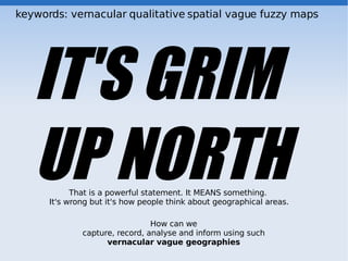
- 1. keywords: vernacular qualitative spatial vague fuzzy maps IT'S GRIM UP NORTH That is a powerful statement. It MEANS something. It's wrong but it's how people think about geographical areas. How can we capture, record, analyse and inform using such vernacular vague geographies
- 2. Vernacular Geography up north down town the shops in the centre dog shit alley Hyde Park is a high crime area the bad side of town the posh neighbourhoods Are used much much much more than the coordinates and scientifically defined variables beloved of most professional analysts, websites and web maps. the use of descriptors like ‘Downtown’ or ‘the grim area down by the station’ allows us to communicate geographical references that often include information on associated environmental, socio-economic, and architectural data These vernacular geographical terms are not simply indicative – they often represent psychogeographical areas in which we constrain our activities, and they convey to members of our immediate socio-linguistic community that this constraint should be added to their shared knowledge and acted upon
- 3. Neogeography Paleogeography by professionals. Official. lines, polygons, top down, powerful, heavy on the science defined. discrete Neogeography is about people using and creating their own maps, on their own terms and by combining elements of an existing toolset Volunteered Geographic Information geocodr.net Finds places / events from people's Flickr photos. The text people use when describing their snapshots. Ordnance.S. - vernacular placenames OpenStreetMap loc_name and old_name “dog shit alley” “the Giant Bench”
- 4. vernacular areas bit confusing this bit.... Indifference Continuousness Multivariate classification transition between soils, rough area, binned into classes Sorites Unbounded areas town centre and not dont care mantle Definitional disagreement Poor precision high crime for a norweigan Averaging and a mancunian there is a line, but we seaside, hill, dont know how to define, measure it most people think LA is a high crime area’ boundary is average but have no idea how ‘LA’ or ‘high crime’ are being used. 1. Vernacular areas, often fall into all of these. Ask people to outline and justify areas where they think crime levels are high, most people will draw on a slew of continuous and discrete variables at differing scales of detail, historical experiences, urban morphology and mythology, as well as introducing linguistic vagueness 2. Internal variations High crime areas, for example, often have zones of greater or lesser danger. Overlaid on this will be a variation in the familiarity with areas or confidence with which people assign an area to a term
- 5. So. Why can't people think like my computer??!! Pain to capture using traditional discrete mapping tools, and even if you did, it wouldn't make much sense within those models. Geo data is good because computers can do stuff with it, but people dont think in geo terms meet people halfway, somehow? Treating areas as having diffuse boundaries, internal variations
- 6. methods already out there or, in academia, perhaps Fuzzy sets / logic a coordinate might be 80% ‘High Crime’, for example. The use is clearest when there are contrasting classes, even if these are implicit: 80% ‘High Crime’ also suggests a 20% membership of a ‘Low Crime’ class. Fuzzy Logic ‘if CRIME is HIGH, INVEST = MORE’. Statistical and probabilistic approaches perceived areas as surfaces across which a membership level varies we Mereotopological calculi Mereological Algebras, those that deal with parts and wholes, have developed to cope with three-part logics – that is, logical problems dealing with true, false and indeterminate questions Egg Model. Yoke = true, White = indeterminate, fryingpan = false vector. spatial relationships, does one overlap, within etc Supervaluation semantics multiple people hold multiple spatial and aspatial definitions.multiple definitions of an area can be overlapped to construct a mereotopological entity in which the yolk is areas everyone agrees are ‘Downtown’, the white is where there is some agreement, and the pan areas where everyone agrees no definition holds
- 7. Problems Fitness for purpose both with reference to an individual (can data collected from a person for one purpose be used for another?) and the group (are two people’s data comparable?) define the question, increase the specificity of the problems i.e. “where are the areas you mean when you say “you are going to the shops” ? vs “define the areas where you shop, and rate them according to how often you go there in a week.” Precision and accuracy the instrument is the mind, can we gauge the accuracy and confidence. Qualify depending on user-confidence in their own judgement or familiarity with the area?
- 8. Aims An intuitive system to record, capture analyse and inform using vague vernacular geographies Benefits Datasets that are rich in information. Comparable with empirical data. Personally & group comparable. Applied to anything where there is folk vague geographies e.g. Best shopping areas in Leeds Smelliest streets best beaches percieved highest crime areas favourite part of the Dales Which areas around the town are more important for you, before we create a bypass. Where are the terrorists? ask an American, then ask an Irishman.
- 9. Points to consider Ease of use – meet people half way Capture vague borders Intra and inter variations Linquistic component? Comparison Outputs
- 10. Tell Tim to stop here! Then discussion then he will tell you about his methodology
- 11. tagger
- 13. So far, some applications: Where do you think has more crime? Where are you most familiar with? Where is wilderness in the UK? on Indian Reservation: Which areas are more important for you when thinking about hunting Which places are more important for sensitive cultural practices