Soumettre la recherche
Mettre en ligne
TexelTek - Andrew Levine - Hadoop World 2010
•
2 j'aime
•
1,149 vues
Cloudera, Inc.
Suivre
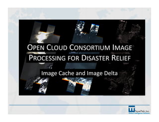
Hadoop Image Processing for Disaster Relief Andrew Levine TexelTek
Lire moins
Lire la suite
Technologie
Art & Photos
Signaler
Partager
Signaler
Partager
1 sur 16
Recommandé
AHM 2014: The Flow Simulation Tools on VHub
EarthCube
DISCOVERY DAY 2017: MAKE IT HAPPEN!
FAO
IMED 2018: An intro to Remote Sensing and Machine Learning
Louisa Diggs
The UAE solar Atlas
The UAE solar Atlas
IRENA Global Atlas
Using deep learning in remote sensing
Mohamed Yousif
2017 esa gep_overview
ESA
2017 01-12 esa-gep_overview
ESA
The Seismic Hazard Modeller’s Toolkit: An Open-Source Library for the Const...
Global Earthquake Model Foundation
IMED 2018: Innovations and Challenges in the Use of Open-source Remote Sensin...
Louisa Diggs
Time, Change and Habits in Geospatial-Temporal Information Standards
George Percivall
Mapping the Tohoku 2011 Tsunami event with a remote sensing satellite constel...
Peter Löwe
Mapping the Tohoku 2011 Tsunami event with a remote sensing satellite constel...
Peter Löwe
EMME Earthquake Model of Middle East
Global Earthquake Model Foundation
Big Data, Data and Information Mining for Earth Observation
Pier Giorgio Marchetti
Scientific Knowledge from Geospatial Observations
George Percivall
Common Approach for UAS Data Geoprocessing
George Percivall
Rs
Rs
Samarthi Praveen
Remote sensing & Gis
gopichand's
EMME project_OQRelease
Global Earthquake Model Foundation
GEM Risk: main achievements during the first implementation phase
Global Earthquake Model Foundation
GEM’s hazard products: outcomes and applications
Global Earthquake Model Foundation
Tracking emerging diseases from space: Geoinformatics for human health
Markus Neteler
Satellite Image Processing Projects Research Help
Matlab Simulation
Introduction to remote sensing and gis
Mohsin Siddique
International Refereed Journal of Engineering and Science (IRJES)
irjes
Using GEM’S Tools and Datasets for Calculating Hazard Across the Globe
Global Earthquake Model Foundation
Big Data for Local Context
George Percivall
Basic remote sensing and gis
SatGur Masters Academy
Gigapixel resolution imaging for near-remote sensing and phenomics
TimeScience
GEO Expert Advisory Group - ESA Thematic Exploitation Platforms - Geohazards
terradue
Contenu connexe
Tendances
IMED 2018: Innovations and Challenges in the Use of Open-source Remote Sensin...
Louisa Diggs
Time, Change and Habits in Geospatial-Temporal Information Standards
George Percivall
Mapping the Tohoku 2011 Tsunami event with a remote sensing satellite constel...
Peter Löwe
Mapping the Tohoku 2011 Tsunami event with a remote sensing satellite constel...
Peter Löwe
EMME Earthquake Model of Middle East
Global Earthquake Model Foundation
Big Data, Data and Information Mining for Earth Observation
Pier Giorgio Marchetti
Scientific Knowledge from Geospatial Observations
George Percivall
Common Approach for UAS Data Geoprocessing
George Percivall
Rs
Rs
Samarthi Praveen
Remote sensing & Gis
gopichand's
EMME project_OQRelease
Global Earthquake Model Foundation
GEM Risk: main achievements during the first implementation phase
Global Earthquake Model Foundation
GEM’s hazard products: outcomes and applications
Global Earthquake Model Foundation
Tracking emerging diseases from space: Geoinformatics for human health
Markus Neteler
Satellite Image Processing Projects Research Help
Matlab Simulation
Introduction to remote sensing and gis
Mohsin Siddique
International Refereed Journal of Engineering and Science (IRJES)
irjes
Using GEM’S Tools and Datasets for Calculating Hazard Across the Globe
Global Earthquake Model Foundation
Big Data for Local Context
George Percivall
Basic remote sensing and gis
SatGur Masters Academy
Tendances
(20)
IMED 2018: Innovations and Challenges in the Use of Open-source Remote Sensin...
Time, Change and Habits in Geospatial-Temporal Information Standards
Mapping the Tohoku 2011 Tsunami event with a remote sensing satellite constel...
EMME Earthquake Model of Middle East
Big Data, Data and Information Mining for Earth Observation
Scientific Knowledge from Geospatial Observations
Common Approach for UAS Data Geoprocessing
Rs
Rs
Remote sensing & Gis
EMME project_OQRelease
GEM Risk: main achievements during the first implementation phase
GEM’s hazard products: outcomes and applications
Tracking emerging diseases from space: Geoinformatics for human health
Satellite Image Processing Projects Research Help
Introduction to remote sensing and gis
International Refereed Journal of Engineering and Science (IRJES)
Using GEM’S Tools and Datasets for Calculating Hazard Across the Globe
Big Data for Local Context
Basic remote sensing and gis
Similaire à TexelTek - Andrew Levine - Hadoop World 2010
Gigapixel resolution imaging for near-remote sensing and phenomics
TimeScience
GEO Expert Advisory Group - ESA Thematic Exploitation Platforms - Geohazards
terradue
Landmap CETIS 2012
Landmap CETIS 2012
Bharti Gupta
Integration for Planet Satellite Imagery
Safe Software
sevt
sevt
Iryna Rozum
From gigapixel timelapse cameras to unmanned aerial vehicles to smartphones: ...
TimeScience
TraitCapture: NextGen Monitoring and Visualization from seed to ecosystem
TimeScience
From pixels to point clouds - Using drones,game engines and virtual reality t...
ARDC
Goal andga oct01
Goal andga oct01
Clifford Stone
TRIDEC Cloud @ Tsunami Decision Support Systems 2015, 2-3 July 2015, Ispra, I...
Martin Hammitzsch
GWT 2014: Emergency Conference - 03 la gestione del processo di acquisizione ...
Planetek Italia Srl
Processing Real-Time Volcano Seismic Measurements Through Redis: David Chaves
Redis Labs
Gigapixel imaging, ESA Australia, Dec 2012
TimeScience
CL#21-0488.pdf
CL#21-0488.pdf
KaderGomatique
Collect earth & earth map
FAO
EODN-IDMS A distributed storage service for open access to Landsat data for n...
US-Ignite
Zhang UAV at USCID
Zhang UAV at USCID
Joseph Yu Zhang, E.I.T.
Harmonization of Data Formats for Tsunami Simulation Products
streamspotter
Explanatory material of NIED Disaster Information Sharing System
Tadashi Ise
Collaborative Geo-information Capturing To Support Emergency Response
UN-SPIDER
Similaire à TexelTek - Andrew Levine - Hadoop World 2010
(20)
Gigapixel resolution imaging for near-remote sensing and phenomics
GEO Expert Advisory Group - ESA Thematic Exploitation Platforms - Geohazards
Landmap CETIS 2012
Landmap CETIS 2012
Integration for Planet Satellite Imagery
sevt
sevt
From gigapixel timelapse cameras to unmanned aerial vehicles to smartphones: ...
TraitCapture: NextGen Monitoring and Visualization from seed to ecosystem
From pixels to point clouds - Using drones,game engines and virtual reality t...
Goal andga oct01
Goal andga oct01
TRIDEC Cloud @ Tsunami Decision Support Systems 2015, 2-3 July 2015, Ispra, I...
GWT 2014: Emergency Conference - 03 la gestione del processo di acquisizione ...
Processing Real-Time Volcano Seismic Measurements Through Redis: David Chaves
Gigapixel imaging, ESA Australia, Dec 2012
CL#21-0488.pdf
CL#21-0488.pdf
Collect earth & earth map
EODN-IDMS A distributed storage service for open access to Landsat data for n...
Zhang UAV at USCID
Zhang UAV at USCID
Harmonization of Data Formats for Tsunami Simulation Products
Explanatory material of NIED Disaster Information Sharing System
Collaborative Geo-information Capturing To Support Emergency Response
Plus de Cloudera, Inc.
Partner Briefing_January 25 (FINAL).pptx
Cloudera, Inc.
Cloudera Data Impact Awards 2021 - Finalists
Cloudera, Inc.
2020 Cloudera Data Impact Awards Finalists
Cloudera, Inc.
Edc event vienna presentation 1 oct 2019
Cloudera, Inc.
Machine Learning with Limited Labeled Data 4/3/19
Cloudera, Inc.
Data Driven With the Cloudera Modern Data Warehouse 3.19.19
Cloudera, Inc.
Introducing Cloudera DataFlow (CDF) 2.13.19
Cloudera, Inc.
Introducing Cloudera Data Science Workbench for HDP 2.12.19
Cloudera, Inc.
Shortening the Sales Cycle with a Modern Data Warehouse 1.30.19
Cloudera, Inc.
Leveraging the cloud for analytics and machine learning 1.29.19
Cloudera, Inc.
Modernizing the Legacy Data Warehouse – What, Why, and How 1.23.19
Cloudera, Inc.
Leveraging the Cloud for Big Data Analytics 12.11.18
Cloudera, Inc.
Modern Data Warehouse Fundamentals Part 3
Cloudera, Inc.
Modern Data Warehouse Fundamentals Part 2
Cloudera, Inc.
Modern Data Warehouse Fundamentals Part 1
Cloudera, Inc.
Extending Cloudera SDX beyond the Platform
Cloudera, Inc.
Federated Learning: ML with Privacy on the Edge 11.15.18
Cloudera, Inc.
Analyst Webinar: Doing a 180 on Customer 360
Cloudera, Inc.
Build a modern platform for anti-money laundering 9.19.18
Cloudera, Inc.
Introducing the data science sandbox as a service 8.30.18
Cloudera, Inc.
Plus de Cloudera, Inc.
(20)
Partner Briefing_January 25 (FINAL).pptx
Cloudera Data Impact Awards 2021 - Finalists
2020 Cloudera Data Impact Awards Finalists
Edc event vienna presentation 1 oct 2019
Machine Learning with Limited Labeled Data 4/3/19
Data Driven With the Cloudera Modern Data Warehouse 3.19.19
Introducing Cloudera DataFlow (CDF) 2.13.19
Introducing Cloudera Data Science Workbench for HDP 2.12.19
Shortening the Sales Cycle with a Modern Data Warehouse 1.30.19
Leveraging the cloud for analytics and machine learning 1.29.19
Modernizing the Legacy Data Warehouse – What, Why, and How 1.23.19
Leveraging the Cloud for Big Data Analytics 12.11.18
Modern Data Warehouse Fundamentals Part 3
Modern Data Warehouse Fundamentals Part 2
Modern Data Warehouse Fundamentals Part 1
Extending Cloudera SDX beyond the Platform
Federated Learning: ML with Privacy on the Edge 11.15.18
Analyst Webinar: Doing a 180 on Customer 360
Build a modern platform for anti-money laundering 9.19.18
Introducing the data science sandbox as a service 8.30.18
Dernier
Architecting Cloud Native Applications
WSO2
Apidays New York 2024 - The Good, the Bad and the Governed by David O'Neill, ...
apidays
Strategies for Landing an Oracle DBA Job as a Fresher
Remote DBA Services
Polkadot JAM Slides - Token2049 - By Dr. Gavin Wood
Juan lago vázquez
+971581248768>> SAFE AND ORIGINAL ABORTION PILLS FOR SALE IN DUBAI AND ABUDHA...
?#DUbAI#??##{{(☎️+971_581248768%)**%*]'#abortion pills for sale in dubai@
Cloud Frontiers: A Deep Dive into Serverless Spatial Data and FME
Safe Software
Apidays New York 2024 - Scaling API-first by Ian Reasor and Radu Cotescu, Adobe
apidays
Emergent Methods: Multi-lingual narrative tracking in the news - real-time ex...
Zilliz
DBX First Quarter 2024 Investor Presentation
Dropbox
Corporate and higher education May webinar.pptx
Rustici Software
Web Form Automation for Bonterra Impact Management (fka Social Solutions Apri...
Jeffrey Haguewood
Connector Corner: Accelerate revenue generation using UiPath API-centric busi...
DianaGray10
EMPOWERMENT TECHNOLOGY GRADE 11 QUARTER 2 REVIEWER
MadyBayot
Apidays New York 2024 - The value of a flexible API Management solution for O...
apidays
presentation ICT roal in 21st century education
jfdjdjcjdnsjd
FWD Group - Insurer Innovation Award 2024
The Digital Insurer
Powerful Google developer tools for immediate impact! (2023-24 C)
wesley chun
Exploring the Future Potential of AI-Enabled Smartphone Processors
debabhi2
AXA XL - Insurer Innovation Award Americas 2024
The Digital Insurer
Automating Google Workspace (GWS) & more with Apps Script
wesley chun
Dernier
(20)
Architecting Cloud Native Applications
Apidays New York 2024 - The Good, the Bad and the Governed by David O'Neill, ...
Strategies for Landing an Oracle DBA Job as a Fresher
Polkadot JAM Slides - Token2049 - By Dr. Gavin Wood
+971581248768>> SAFE AND ORIGINAL ABORTION PILLS FOR SALE IN DUBAI AND ABUDHA...
Cloud Frontiers: A Deep Dive into Serverless Spatial Data and FME
Apidays New York 2024 - Scaling API-first by Ian Reasor and Radu Cotescu, Adobe
Emergent Methods: Multi-lingual narrative tracking in the news - real-time ex...
DBX First Quarter 2024 Investor Presentation
Corporate and higher education May webinar.pptx
Web Form Automation for Bonterra Impact Management (fka Social Solutions Apri...
Connector Corner: Accelerate revenue generation using UiPath API-centric busi...
EMPOWERMENT TECHNOLOGY GRADE 11 QUARTER 2 REVIEWER
Apidays New York 2024 - The value of a flexible API Management solution for O...
presentation ICT roal in 21st century education
FWD Group - Insurer Innovation Award 2024
Powerful Google developer tools for immediate impact! (2023-24 C)
Exploring the Future Potential of AI-Enabled Smartphone Processors
AXA XL - Insurer Innovation Award Americas 2024
Automating Google Workspace (GWS) & more with Apps Script
TexelTek - Andrew Levine - Hadoop World 2010
1.
OPEN CLOUD CONSORTIUM IMAGE PROCESSING FOR DISASTER RELIEF Image Cache and Image Delta
2.
GOALS FOR PROCESSING MAP IMAGERY • Make imagery available for Disaster Relief workers over the web • Provide a mechanism for large scale image processing Satellite/Map Imagery •
Provide image deltas for temporally different and geospaJally idenJcal image sets
3.
• Source imagery can be very large – New image formats can be ~2G – Compare image sets easily • New data daily – NASA E01 mission tasking for fires and floods •
Pass over areas about every 3rd day • High availability for results HaiJ image: 18,878px by 34,782px TOOLS AND THE PROCESSING PLATFORM MOTIVATION FOR CLOUD IMPLEMENTATION
4.
USE CASES FOR THIS FRAMEWORK • Disasters – Fires – Floods – Earthquakes – DeforestaJon – Drought – War/Refugees – Tornados • Other Processing – Medical Imagery – Anomaly DetecJon – Full MoJon Video – Tracking – Digital Cinema
5.
TOOLS AND THE PROCESSING PLATFORM • OCCTestbed pla^orm – Resources for processing large data –
Testbed of mulJple clouds – UIC cloud is 32 nodes • Quad Core, 16GB RAM, GigE, HDFS on 256GB • Apache Hadoop: MapReduce and HBase – Algorithm adheres to MapReduce framework – hcp://hadoop.apache.org/ • OCC Image Processing tools (open source) – hcp://code.google.com/p/matsu‐project/ – Image comparison
6.
INTERFACING WITH RESULTS • Open GeospaJal ConsorJum Web Map Service – Images available through OGCWMS open specificaJon –
hcp://www.opengeospaJal.org/ • OCC WMS Servlet (open source) – hcp://code.google.com/p/matsu‐project/ • Various Map Viewing Tools – OpenLayers, Google Maps, others
7.
ARAL SEA 1989 AND 2008
8.
ZOOM LEVELS / BOUNDS Zoom Level 1: 4 images Zoom Level 2: 16 images Zoom Level 3: 64 images Zoom Level 4: 256 images
9.
Mapper Input Key: Bounding Box Mapper Input Value: Mapper Output Key: Bounding Box Mapper Output Value: Mapper resizes and/or cuts up the original image into pieces to output Bounding Boxes (minx = ‐135.0 miny = 45.0 maxx = ‐112.5 maxy = 67.5) Step 1: Input to Mapper Step 2: Processing in Mapper Step 3: Mapper Output Mapper Output Key: Bounding Box Mapper Output Value: Mapper Output Key: Bounding Box Mapper Output Value: Mapper Output Key: Bounding Box Mapper Output Value: Mapper Output Key: Bounding Box Mapper Output Value: Mapper Output Key: Bounding Box Mapper Output Value: Mapper Output Key: Bounding Box Mapper Output Value: Mapper Output Key: Bounding Box Mapper Output Value: Build Tile Cache in the Cloud ‐ Mapper
10.
Reducer Key Input: Bounding Box (minx = ‐45.0 miny = ‐2.8125 maxx = ‐43.59375 maxy = ‐2.109375) Reducer Value Input: Step 1: Input to Reducer … Step 2: Reducer Output Assemble Images based on bounding box • Output to HBase • Builds up Layers for WMS for various datasets Build Tile Cache in the Cloud ‐ Reducer
11.
Mapper Input Key: Bounding Box Mapper Input Value: Mapper Output Key: Bounding Box Mapper Output Value: Mapper resizes and/or cuts up the original image into pieces to output Bounding Boxes (minx = ‐135.0 miny = 45.0 maxx = ‐112.5 maxy = 67.5) Step 1: Input to Mapper Step 2: Processing in Mapper Step 3: Mapper Output Mapper Output Key: Bounding Box Mapper Output Value: Mapper Output Key: Bounding Box Mapper Output Value: Mapper Output Key: Bounding Box Mapper Output Value: Mapper Output Key: Bounding Box Mapper Output Value: Mapper Output Key: Bounding Box Mapper Output Value: Mapper Output Key: Bounding Box Mapper Output Value: Mapper Output Key: Bounding Box Mapper Output Value: + Timestamp + Timestamp + Timestamp + Timestamp + Timestamp + Timestamp + Timestamp + Timestamp + Timestamp Image Processing in the Cloud ‐ Mapper
12.
Reducer Key Input: Bounding Box (minx = ‐45.0 miny = ‐2.8125 maxx = ‐43.59375 maxy = ‐2.109375) Reducer Value Input: Step 1: Input to Reducer … … Step 2: Process difference in Reducer Assemble Images based on Jmestamps and compared Result is a delta of the two Images Step 3: Reducer Output All images go to different map layers set of images for display in WMS Timestamp 1 Set Timestamp 2 Set Delta Set Image Processing in the Cloud ‐ Reducer
13.
GULF OIL SPILL Day 115 Day 128 Delta
14.
SAMPLES / FLOODS IN PAKISTAN 2010 day 197 2010 day 263 Delta
15.
SAMPLES / FLOODS IN PAKISTAN 2010 day 197 2010 day 263 Delta
16.
HBASE TABLES • OGC WMS Query translates to HBase scheme – Layers, Styles, ProjecJon, Size • Table name: WMS Layer – Row ID: Bounding Box of image ‐Column Family: Style Name and ProjecJon ‐Column Qualifier: Width x Height ‐Value: Buffered Image