Soumettre la recherche
Mettre en ligne
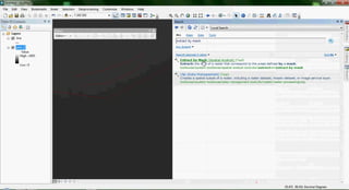
Extract raster value by line
•
0 j'aime
•
971 vues
Gis Cbs
Suivre
Signaler
Partager
Signaler
Partager
1 sur 25
Télécharger maintenant
Télécharger pour lire hors ligne
Recommandé
Arc map arcscene gis shp to cad cad to shp arc gis 10
Arc map arcscene gis shp to cad cad to shp arc gis 10
Gis Cbs
Topographic map - topografik harita
Topographic map - topografik harita
Gis Cbs
Arc map arcscene gis interpolation kriging method mono lake arcmap 10
Arc map arcscene gis interpolation kriging method mono lake arcmap 10
Gis Cbs
Create, Distribute, and Manage GIS Services
Arcgis for Server
Arcgis for Server
Esri
Qgis - arc gis osm open street maps
Qgis - arc gis osm open street maps
Gis Cbs
ArcGis map - harita
ArcGis map - harita
Gis Cbs
ArcGIS - Araclarin Ozellestirilmesi
ArcGIS - Araclarin Ozellestirilmesi
Gis Cbs
Arc gis arcmap hacim hesaplama - volume calculation
Arc gis arcmap hacim hesaplama - volume calculation
Gis Cbs
Hyperlink arc gis & google earth
Hyperlink arc gis & google earth
Gis Cbs
Arc map arcscene gis arcgis 10 hyperlink
Arc map arcscene gis arcgis 10 hyperlink
Gis Cbs
Arcgis arcmap point density
Arcgis arcmap point density
Gis Cbs
Arcgis 10.1 dem to contour
Arcgis 10.1 dem to contour
Gis Cbs
Dem to aspect & slope dem eğim & bakı
Dem to aspect & slope dem eğim & bakı
Gis Cbs
Georefrencing in Arcgis 9.2
Georefrencing in Arcgis 9.2
luqman321
Insert 3 d buildings to arcscene 3d binaların arcscene eklenmesi
Insert 3 d buildings to arcscene 3d binaların arcscene eklenmesi
Gis Cbs
ArcGIS programının açık ocak planlamasında kullanılmasının sağlayacağı kolaylıkların kısa bir özeti.
ArcGIS ile Madencilik
ArcGIS ile Madencilik
Kerem Kapar
Specialized GIS Tools for Enhanced Productivity and Advanced Analysis
ArcGIS Extensions
ArcGIS Extensions
Esri
Model builder in arcgis
Model builder in arcgis
Ashok Peddi
Arc map arcscene gis arcgis 10 tutorial - animation
Arc map arcscene gis arcgis 10 tutorial - animation
Gis Cbs
Arc gis generate buffer tampon alan olusturma
Arc gis generate buffer tampon alan olusturma
Gis Cbs
arc gis basics
Arcgis training day_2
Arcgis training day_2
yashasweesharma
StreetMap Premium for ArcGIS
StreetMap Premium for ArcGIS
StreetMap Premium for ArcGIS
Esri
Arc map arcscene gis esri maps for office arcgis
Arc map arcscene gis esri maps for office arcgis
Gis Cbs
See how ArcGIS for Transportation Analytics can help your business grow.
ArcGIS for Transportation Analytics
ArcGIS for Transportation Analytics
Esri
arc gis basics
Arcgis training day_1
Arcgis training day_1
yashasweesharma
An introductory tutorial for Esri's ArcGIS version 10.1. This tutorial covers some basic concepts and tasks.
Introduction to ArcGIS
Introduction to ArcGIS
Kate Dougherty
The Wisconsin Department of Natural Resources directly produces the state’s Digital Flood Insurance Rate Maps (DFIRMs) under FEMA’s Map Modernization Program. This presentation will discuss how we use an ArcMap 9.2 extension, Flood Map Desktop 9™ (FMD), to create FEMA-compliant DFIRM data, metadata, and map deliverables. The FMD tool has greatly improved our program’s work flow and efficiency. As we demonstrate the FMD structure and FMD toolbars, we will discuss geodatabase creation and management, topology, domain tables, formatting style files, symbology, label creation and storage, data exporting, and project settings which form the base templates for our maps.
Floodmap Desktop for ArcGIS
Floodmap Desktop for ArcGIS
ewug
Network Analysis in ArcGIS
Network Analysis in ArcGIS
John Reiser
Contenu connexe
En vedette
Hyperlink arc gis & google earth
Hyperlink arc gis & google earth
Gis Cbs
Arc map arcscene gis arcgis 10 hyperlink
Arc map arcscene gis arcgis 10 hyperlink
Gis Cbs
Arcgis arcmap point density
Arcgis arcmap point density
Gis Cbs
Arcgis 10.1 dem to contour
Arcgis 10.1 dem to contour
Gis Cbs
Dem to aspect & slope dem eğim & bakı
Dem to aspect & slope dem eğim & bakı
Gis Cbs
Georefrencing in Arcgis 9.2
Georefrencing in Arcgis 9.2
luqman321
Insert 3 d buildings to arcscene 3d binaların arcscene eklenmesi
Insert 3 d buildings to arcscene 3d binaların arcscene eklenmesi
Gis Cbs
ArcGIS programının açık ocak planlamasında kullanılmasının sağlayacağı kolaylıkların kısa bir özeti.
ArcGIS ile Madencilik
ArcGIS ile Madencilik
Kerem Kapar
Specialized GIS Tools for Enhanced Productivity and Advanced Analysis
ArcGIS Extensions
ArcGIS Extensions
Esri
Model builder in arcgis
Model builder in arcgis
Ashok Peddi
Arc map arcscene gis arcgis 10 tutorial - animation
Arc map arcscene gis arcgis 10 tutorial - animation
Gis Cbs
Arc gis generate buffer tampon alan olusturma
Arc gis generate buffer tampon alan olusturma
Gis Cbs
arc gis basics
Arcgis training day_2
Arcgis training day_2
yashasweesharma
StreetMap Premium for ArcGIS
StreetMap Premium for ArcGIS
StreetMap Premium for ArcGIS
Esri
Arc map arcscene gis esri maps for office arcgis
Arc map arcscene gis esri maps for office arcgis
Gis Cbs
See how ArcGIS for Transportation Analytics can help your business grow.
ArcGIS for Transportation Analytics
ArcGIS for Transportation Analytics
Esri
arc gis basics
Arcgis training day_1
Arcgis training day_1
yashasweesharma
An introductory tutorial for Esri's ArcGIS version 10.1. This tutorial covers some basic concepts and tasks.
Introduction to ArcGIS
Introduction to ArcGIS
Kate Dougherty
The Wisconsin Department of Natural Resources directly produces the state’s Digital Flood Insurance Rate Maps (DFIRMs) under FEMA’s Map Modernization Program. This presentation will discuss how we use an ArcMap 9.2 extension, Flood Map Desktop 9™ (FMD), to create FEMA-compliant DFIRM data, metadata, and map deliverables. The FMD tool has greatly improved our program’s work flow and efficiency. As we demonstrate the FMD structure and FMD toolbars, we will discuss geodatabase creation and management, topology, domain tables, formatting style files, symbology, label creation and storage, data exporting, and project settings which form the base templates for our maps.
Floodmap Desktop for ArcGIS
Floodmap Desktop for ArcGIS
ewug
Network Analysis in ArcGIS
Network Analysis in ArcGIS
John Reiser
En vedette
(20)
Hyperlink arc gis & google earth
Hyperlink arc gis & google earth
Arc map arcscene gis arcgis 10 hyperlink
Arc map arcscene gis arcgis 10 hyperlink
Arcgis arcmap point density
Arcgis arcmap point density
Arcgis 10.1 dem to contour
Arcgis 10.1 dem to contour
Dem to aspect & slope dem eğim & bakı
Dem to aspect & slope dem eğim & bakı
Georefrencing in Arcgis 9.2
Georefrencing in Arcgis 9.2
Insert 3 d buildings to arcscene 3d binaların arcscene eklenmesi
Insert 3 d buildings to arcscene 3d binaların arcscene eklenmesi
ArcGIS ile Madencilik
ArcGIS ile Madencilik
ArcGIS Extensions
ArcGIS Extensions
Model builder in arcgis
Model builder in arcgis
Arc map arcscene gis arcgis 10 tutorial - animation
Arc map arcscene gis arcgis 10 tutorial - animation
Arc gis generate buffer tampon alan olusturma
Arc gis generate buffer tampon alan olusturma
Arcgis training day_2
Arcgis training day_2
StreetMap Premium for ArcGIS
StreetMap Premium for ArcGIS
Arc map arcscene gis esri maps for office arcgis
Arc map arcscene gis esri maps for office arcgis
ArcGIS for Transportation Analytics
ArcGIS for Transportation Analytics
Arcgis training day_1
Arcgis training day_1
Introduction to ArcGIS
Introduction to ArcGIS
Floodmap Desktop for ArcGIS
Floodmap Desktop for ArcGIS
Network Analysis in ArcGIS
Network Analysis in ArcGIS
Télécharger maintenant