

Recommandé
Contenu connexe
En vedette
Similaire à Wayfinding Paper 2004
Similaire à Wayfinding Paper 2004 (20)
Plus de Bob Jacobson
Plus de Bob Jacobson (9)
Wayfinding Paper 2004
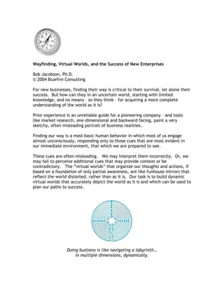
- 1. Wayfinding, Virtual Worlds, and the Success of New Enterprises Bob Jacobson, Ph.D. © 2004 Bluefire Consulting For new businesses, finding their way is critical to their survival, let alone their success. But how can they in an uncertain world, starting with limited knowledge, and no means – so they think – for acquiring a more complete understanding of the world as it is? Prior experience is an unreliable guide for a pioneering company – and tools like market research, one-dimensional and backward facing, paint a very sketchy, often misleading portrait of business realities. Finding our way is a most basic human behavior in which most of us engage almost unconsciously, responding only to those cues that are most evident in our immediate environment, that which we are prepared to see. These cues are often misleading. We may interpret them incorrectly. Or, we may fail to perceive additional cues that may provide context or be contradictory. The “virtual worlds” that organize our thoughts and actions, if based on a foundation of only partial awareness, are like funhouse mirrors that reflect the world distorted, rather than as it is. Our task is to build dynamic virtual worlds that accurately depict the world as it is and which can be used to plan our paths to success. Doing business is like navigating a labyrinth… in multiple dimensions, dynamically.
- 2. No wonder so many new companies die before they know what hit them. Not able to find their way, they stagger in circles, burn cash, lose team members, and expire from exhaustion or walk off a cliff. There is an answer. Wayfinding is a methodology for understanding the world and getting around in it. It has other names that may be more familiar. Wayfinding at sea or in the air is called navigation. In nature, competitive wayfinding is known as orienteering. Polynesians for hundreds of years have been expert oceanic wayfinders. Employed by geographers, architects, environmental designers, and others whose focus is on spatial awareness, wayfinding helps individuals to discover where they’re at and how to get where they want to go. Wayfinding describes how people perceive and orient themselves to landmarks and other features in the environment. It prescribes how to facilitate this process using natural and artificial devices. The most obvious manifestation of contemporary wayfinding is the layout of public places to manage crowd flow, and the signage that enables visitors to quickly discover their location and destination. A typical geographic wayfinding map.
- 3. In business, however, there are no designers and no signs to show the way. So how is wayfinding valuable to the founder/CEO and his or her shareholders? Because the executive who employs this most powerful innate skill – the ability to perceive, understand, and act in the world around us – has a distinctive competitive advantage over executives who are still struggling to make sense of things based only on reports and spreadsheets. The fact is, the ability to wayfind has been part of human experience since the first hominid migrations. Before there were compasses and sea-going clocks (for telling latitude), Polynesian navigators were crossing vast ocean reaches literally by the seat of their muumuus. Sensing the tides under their keels, learning to navigate by the stars when they were visible and the wind and clouds when they were not, and paying special attention to the behavior of seabirds and sea creatures, these explorers in their open canoes settled the entire South Pacific – no mean feat! We inherently know how to find our way. We just need to look for the right environmental cues. We do business constantly invoking spatial metaphors. The spatial metaphors we use for getting around in the physical world are powerful tools for expressing relationships in the business environment. Unconsciously, they guide us in what to look for, to find our way. Spatial metaphors express our world. A simple example is the concept of the business “field,” meaning a virtual “place” where companies contend with one another for supremacy and success. When we talk about the “competitive landscape” and “defensible” IP, we imply a system of virtual ramparts and moats whose strength and integrity will be tested in the “field.” A complete list of spatial metaphors used in
- 4. business (with new ones being invented all of the time) would be lengthy – and speak volumes about the current state of the business mind. Linguists tell us that 80 percent of all spatial metaphors – phrases like, “over the hill” – are shared by cultures across the board, because our human experiences are fundamentally alike. Because cultures vary, however, the remaining 20 percent of spatial metaphors are quite different. The Inuit have dozens of words for snow, for example. We have one. In the Arctic, without a guide, despite an abundance of resources, we would die. The same is true of business cultures. Company leaders must be aware of the unique, even idiosyncratic metaphors characteristic of their business. These metaphors shape how they think about business. Being aware of this bias may enable the company to “out-wayfind” competitors in its niche. Not all business metaphors are spatial. For example, in investment parlance, to “ratchet down” is a mechanical metaphor. The inevitable allusion to the thumbscrew is not far off the mark. But for the purposes of wayfinding, it’s our ability to use spatial metaphors that matters. Here’s how it’s done. Our goal is to compose an accurate interior virtual world that is a reliable basis for decisionmaking – and not a singular vision, but rather a dynamic model that can be employed by anyone in the company, keeping everyone informed and aligned. According to Senge, the virtual world is also a place wherein the company can assimilate information, test assumptions, and become a true learning organization. With wayfinding methods we can compose this rich model and use it to direct the enterprise. 1 1 Urban design theoreticians and practitioners have contributed the most to our understanding of wayfinding, its relation to the real and virtual environments, and the convergence of the two in design prescriptions for desirable real world solutions. Wayfinding is most thoroughly described in the work of Canadians Arthur Frank and Romedi Passini, especially in their summary treatise, Wayfinding: People, Signs, and Architecture (McGraw-Hill 1992). Kevin Lynch’s groundbreaking Images of the City (MIT Press 1964) laid out a methodology for capturing the emotionally salient features of a place, incorporated in mental maps; R.M. Downs and David Stea explored cognitive filters associated with mental maps in Images and Environment (Aldine 1973). Christopher Alexander and his student team compiled A Pattern Language (Oxford University Press 1977), the first of several schemas proposed for ideal, human-centric environments. Each of these pioneering works has engendered a growing corpus of work, some of it – like this paper – veering from conventional urban design into other fields, like business cognition. Three contemporary geographers – Max Egenhofer (U of Maine), Andrew Frank (Tech U of Vienna), and David Mark (SUNY Buffalo) are leaders in this “new geography,” exploring such topics as
- 5. A virtual world, like real world, has multiple dimensions; it comprises multiple “strata,” or layers, of phenomena, populated by a variety of features (organizations, technologies, events, environmental conditions, and so forth). In the case of business, features in the virtual world may have geospatial referents; but they may also exist in non-geographical spaces that do not correspond to earthly locations – “places in the mind.” It’s our job to discover how these features constitute a virtual world, and choose the most important among them, so that we can map our way to success. Strata in the physical world. The following strata (and more) are relevant to wayfinding in a business environment. I’ve listed these because they’re categorically representative: • The competitive landscape • Technology trends and developments • Company internal happenings • The financial market and capital flows • Politico-economic trends and fault lines • The industrial ether • Fusion events (synergistic or “nova” moments) These strata are dynamic; their features interact. Some strata, like the competitive landscape, are easily defined and densely packed with discrete features. Others, like the “industrial ether,” are almost gaseous, hints of occurrence that may be far off or diffuse, whose reverberations are felt weakly or are yet to be encountered. “vernacular geography,” realistic GIS (geographical information systems), and the geospatial origins of knowledge generally.
- 6. Our passage among these strata is directional: we move forward, but also sometimes sideways, with time. To correctly survey the strata and find our way, we can use these parameters to characterize and evaluate their features (again, this is an indicative, not exhaustive, list): • Salience and significance • Distance and proximity • Volatility (velocity of change) • Duration and temporality • Affordability (can we affect the feature?) • Consequence (the feature’s meaning) As we set about the process of mapping a virtual world that represents the real world (in this case, the real world of business), it’s easy to appreciate how weak spreadsheets and published reports are as representations of the real world. This is true even within the thin slices of reality – for example, company and suppliers’ inventories – that typical real-time information systems purport to accurately represent. For our virtual-world building and wayfinding to be highly effective, we require multidimensional surveying and analytical tools, and displays that can richly portray the results of their calculations. Such tools will make wayfinding in virtual worlds a highly scalable management activity. In some cases, their development is in progress. But building virtual worlds on which we can rely, even without optimal tools, is useful for two reason: 1. It raises our awareness of the environment and disciplines our ability to detect strata and react to their features. 2. Even an imperfect virtual world, so long as its limitations are known, is more useful for wayfinding than no virtual world at all, or one thoughtlessly constructed, is better than no virtual world. For now, one-off representations built on poster paper, spreadsheets, and flat- screen displays are adequate. When we have the tools we need, wayfinding within virtual worlds will become the next-generation management paradigm. The combination of wayfinding/virtual worlds methodologies with scenario analysis and Boolean algebra – the rule of intuitive statistics – we will define the 21st Century’s first new management paradigm. To build our virtual world, we first define the terrain, the underlying economic situation in which our business must operate. This terrain, like a physical terrain, is dynamic, though often at a pace and in dimensions that elude human detection. Fortunately, we have tools for describing the economic terrain just as geographers can map tectonic movements in the physical world.
- 7. We next determine the strata for which this terrain is the foundation and the objects that populate each stratum: companies, technologies, political events, and so forth. We characterize these objects in terms of the features described above and also their interaction. It’s important to quantify these relationships, even if they are subjectively perceived, so that our experiential map is an accurate representation of the business environment. Using a multidimensional “spreadsheet,” we can then create a cockpit with charts, graphs, “radar,” and controls for manipulating the virtual world we are building and navigating. This cockpit need not be literal. We can work at a computer and input variables with more conventional outputs available to us, as we do in scenario analysis. But constructing an actual virtual world offers us a chance to use our full sensorium to determine where we’re at and where we intend to be going. Then it’s a matter of plotting an optimal path, with as few hazards and pitfalls as possible. As we move along the path, variables that relate the objects in the virtual world change to reflect business rules that embody our understanding of how things work, to the best of our knowledge. Today’s business planning environment… …And tomorrow’s!
- 8. Business wayfinding is an art informed by science. As computer-based tools for wayfinding improve, the practice will become rationalized and easier to teach and learn. For now, however, executives can employ wayfinding specialists to help them find their way in an ever more complex, potentially confusing business environment. Wayfinding is a new paradigm for business strategy and management: powerful, exciting to implement, and well worth the effort.