S out 13_1555-design_and_access_statement-409727
•
1 j'aime•2,313 vues

The outline planning application proposes a sustainable urban extension comprising: - Up to 2,380 homes, 2,500 sqm of employment space, and mixed-use local centres. - Land for a primary school, community/sports facilities, and sheltered accommodation. - Extensive green infrastructure including formal sports pitches, informal open space, and SuDS features. - The proposals have been informed by and are in accordance with the vision and principles set out in the draft Swindon Borough Local Plan and supplementary planning documents for the New Eastern Villages and South Marston. The design and access statement demonstrates how the development will create a high-quality and sustainable new community.

Recommandé
Recommandé
Contenu connexe
Tendances
Tendances (20)
En vedette
Similaire à S out 13_1555-design_and_access_statement-409727
Similaire à S out 13_1555-design_and_access_statement-409727 (20)
Plus de Donald Jones
Plus de Donald Jones (20)
Dernier
Dernier (20)
S out 13_1555-design_and_access_statement-409727
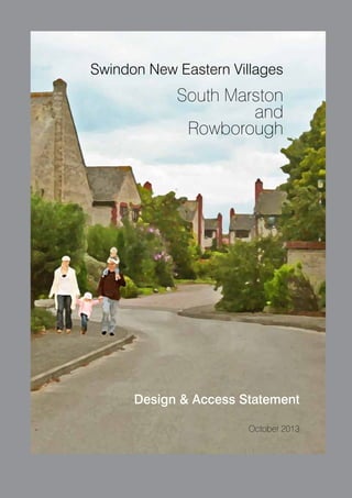
- 1. Swindon New Eastern Villages South Marston and Rowborough Design & Access Statement October 2013 1
- 2. 2
- 3. Contents 01 Introduction 02 Vision and Development 03 Context Appraisal 04 Design Evolution 05 Design and Access 06 The Illustrative Master Plan 4 8 12 38 42 66 3
- 4. 01 Introduction 1 This Design and Access Statement (DAS) accompanies an outline planning application for the development of the initial phase of the Swindon New Eastern Villages sustainable urban extension. The outline application is submitted on behalf of Hallam Land Management Limited, Hannick Homes & Developments Limited and Taylor Wimpey UK Limited (HHT) by a project team comprising David Lock Associates (town planning and master planning), Brookbanks Consultanting (transportation, infrastructure, hydrology and ground conditions), FPCR Environment & Design (landscape and ecology), and CgMs (archaeology and historic environment). A further consultant is Land Research Consulting (agriculture and soil resources). The project team has worked with key stakeholders, in particular Swindon Borough Council but also South Marston Parish Council and Village Expansion Group, drawing on local knowledge. The resulting proposals set out a robust scheme for a sustainable urban extension, one that supports the overarching strategic housing objectives of the Borough as set out in the Emerging Local Plan and draft Supplementary Planning Documents for the Eastern Villages and for South Marston. The proposal also reflects a strong commitment by the applicant to the delivery of a high quality environment, informed by the character of the area. 4
- 5. New Eastern Villages: Proposal Summary Proposals for the New Eastern Villages sustainable urban extension have evolved alongside the preparation of the Swindon Borough Local Plan 2026: Submission Document (2013). The Local Plan allocates land for a strategic extension site to the east of Swindon comprising the New Eastern Villages, which includes Rowborough and the expansion of South Marston. Draft Policy SD2 sets out the development strategy for Swindon, allocating a number of strategic expansion areas which include the New Eastern Villages. Draft Policy NC3 sets out the site specific policy requirements for the New Eastern Villages to accommodate a mixed use development comprising 8,000 homes. Of this, about 6,000 dwellings are allocated on land south of the A420, about 1,500 dwellings at Rowborough and 500 dwellings at South Marston. Within this context the outline planning application is being submitted for development comprising: • up to 2,380 residential dwellings (class C3); • up to 2,500 sqm of employment floor space (class B1); • mixed use space for local retail and other services • • • • • • • • comprising up to 2,500 sqm of Use Class A1; with provision also and in addition for A2, A3, A4, and A5 uses. two form entry primary school (class D1); community and sport buildings (classes D1 and D2) ; sheltered accommodation (class C2) ; green infrastructure including formal pitches, informal open space, landscape areas and children’s play spaces; sustainable urban drainage systems including balancing ponds and drainage channels; connections to the surrounding highway, footpath and bridleway network; infrastructure and utilities provision including car parking; and ground remodelling, engineering works and demolition. 2,380 homes 2,500 m2 employment Mixed Use Centres Land for primary school Land for community & sports Green Infrastructure SUDs & Balancing ponds The outline planning application seeks detailed approval for the means of access to the development. All other matters are reserved. Notwithstanding this, the application includes a Development Framework Plan and illustrative master plan to demonstrate the nature of development proposed. 5
- 6. Role and Structure of the Design and Access Statement The Design and Access Statement is prepared in accordance with the requirements of Article 8 of the Town and Country Planning (Development Management Procedure) (England) Order 2010. It draws on, and reflects, relevant guidance set out in “Guidance on Information Requirements and Validation” (DCLG, 2010). The document aims to set out the context and characteristics of the site and its surroundings (including the site constraints), and relevant development plan and national planning policies and design guidance. In particular it explains how the context for the proposals has been evaluated and how this has informed the development of design principles for the proposals and the development of the application proposals themselves. It articulates how the various concerns and aspirations for the site, including those expressed in consultations, have been addressed. The DAS deals with the principles, concepts, strategic pattern, amounts, locations, scale and appearance including design characteristics of the proposed development. It also addresses access. Detailed design and the siting of buildings are reserved for future approval but the parameters in this statement provide the basis for developing the proposals further prior to implementation. The detailed design will be guided as appropriate by the overall design approach set out in this DAS and in any additional appropriate mechanism as may be agreed with the local planning authority. It is intended that the local authority and promoters will work together using the DAS as the basis for the preparation of detailed schemes and the implementation of the proposals. The Development Framework Plan to which this DAS relates will be approved as part of any outline planning permission, thereby defining the key design elements of the proposal. 6 Fig 001 : Illustrative Perspective
- 7. Timing of the Application The outline application is submitted in the context of the National Planning Policy Framework, and its key presumption in favour of sustainable development. The Framework requires Local Planning Authorities to ‘boost significantly’ the supply of housing and stresses the importance of delivering a wide choice of high quality homes which meets local needs, delivered through high quality and inclusive design. The emerging Local Plan provides a robust policy framework with which to plan the development of Swindon‘s New Eastern Villages. The application has been informed by and prepared alongside the emerging local planning policy and objectives, and as such is capable of early implementation. The applicants, HHT, are committed to the long-term strategic delivery of this initial phase of development of the New Eastern Villages at Rowborough and South Marston. 7
- 8. 02 Vision and Development Policy NC3 of the draft Local Plan allocates land at the New Eastern Villages, including Rowborough and South Marston Village Expansion. The Borough Council has also produced draft Supplementary Planning Documents (SPDs), for the Eastern Villages and South Marston,to provide additional guidance on the type and quality of development for the area, including a guiding Vision: The Eastern Villages Vision The Eastern Villages development will create sustainable well-designed places where people want to live, work and spend time. The SPD seeks that the development will: • be a high quality, sustainable development with strategic infrastructure that benefits Swindon as a whole; • sensitively and positively respond to the existing landscape context, natural and historic assets and the character and identity of the surrounding villages as well as enhancing biodiversity and green infrastructure; • comprise new distinct villages with individual identities and characters linked together by green spaces that integrate with the existing urban area and wider landscape setting; • provide the facilities and services required for the new communities and opportunities for existing communities to benefit from the development and, • form a new eastern gateway to Swindon that improves the image of the Town and maximises benefits to the wider economy including connections to the Town Centre. 8
- 9. In order to achieve the Vision the following key development principles have also been described in the SPD: Key Principles • Create vibrant, attractive places that are functional, durable and capable of adapting to accommodate changing lifestyles in line with sustainable communities; • Ensure the timely delivery of necessary facilities to support these sustainable communities; • Conserve and enhance natural systems, watercourses, biodiversity and landscape settings, including integration with green infrastructure to help mitigate and facilitate adaptation to climate change; • Conserve and enhance Swindon’s historic assets and cultural heritage, allowing their use and enjoyment without harming them for future generations; • Ensure the development becomes part of the wider town and supports the physical, social and economic regeneration of East Swindon. • Respect and support the existing character and setting of surrounding villages; • Contribute to and not harm the Town Centre regeneration and support the broader Swindon economy with new employment and investment opportunities; • Contribute to an improved strategic transport network for Swindon and facilitate public transport priority for journeys into the Town Centre; • Encourage walking and cycling, within the development and ensure high levels of accessibility and connectivity within and beyond the new Eastern Villages; and, • Enhance the image of Swindon by maximising place-making opportunities particularly around key nodes, gateways and frontages. 9
- 10. 10
- 11. Because of the particular character of South Marston, and the active role taken by South Marston Parish Council and the Village Expansion Group in considering the growth and expansion of the village, a supplementary planning document has been prepared, to provide a detailed planning framework which sets out the requirements for development at South Marston, including addressing existing traffic, land use and community issues. The South Marston SPD also includes a guiding vision : South Marston should be a high quality, integrated village with an enhanced sense of community, activity and safety within a distinctive form that builds on the existing character and features in a sustainable manner. The delivery of the Vision for South Marston is anticipated in the SPD to involve the: • development of housing and other proposal sites in broad accordance with Policy NC3 – New Eastern Villages including Rowborough and South Marston Village Expansion (as amplified by the EV SPD) and Policy RA3 - South Marston, of the Submission Draft Local Plan 2026, with the incorporation of additional brownfield sites for housing delivery of mixed housing types and tenures, • delivery of new or improved community (such as a new village hall and recreation centre) and educational facilities, • improvement of existing, and provision of new highway infrastructure, including resolving issues of through-traffic, Pound Corner, the absence of road-side paths, access onto the A420 and off-site provisions to ensure free movement along the A420 • improvement of existing, and provision of new pedestrian and cycle links, • provision of new green open space • identification of green infrastructure land that will be safeguarded (potentially through the transfer of land into a “village trust” or similar arrangement) to ensure that the village retains its clear separation from“ Rowborough” and other parts of the new Eastern Villages development. Application proposals for Rowborough and South Marston have been drawn up having close regard to the Vision and principles established through the draft Local Plan and draft SPDs for the Eastern Villages and South Marston. 11
- 12. 03 Context Appraisal 3 Scope of the Context Appraisal The context appraisal describes the physical, social, economic and policy contexts that have influenced the design proposals for South Marston and Rowborough. It sets out and summarises key findings and conclusions from the technical studies that accompany the application. The assessment also considers the site and relationship with its wider landscape and built environment context. Planning Policy Context Legislation places a statutory duty on decision makers to determine planning applications in accordance with the development plan unless material considerations indicate otherwise. This section provides a brief overview of the current and emerging planning policy context for the site which is relevant to the design of the development and the identification of appropriate uses on the site; further detail is provided in the Planning Statement which accompanies the application. National Planning Policy The National Planning Policy Framework (NPPF, 2012) outlines the purpose and role of the planning system and replaces the raft of former Planning Policy Statements and Planning Policy Guidance that previously made up the national tier of planning policy, supported by some technical guidance. The NPPF requires planning authorities to ‘boost significantly’ the supply of housing and stresses the importance of delivering a wide choice of high quality homes which meets local needs, delivered through high quality and inclusive design. In accordance with the NPPF, the applicant recognises the importance of good design in sustainable development and the overall benefits it confers in terms of establishing a new community. The Design and Access Statement demonstrates how the scheme has been designed to achieve high design standards and establish a strong sense of place. Details of architecture, urban design and landscaping will be taken forward at reserved matters stage in accordance with the principles set out in the application proposals and Design and Access Statement. 12
- 13. National Design Guidance In respect of the principles of sustainable development and best practice in urban design, the application has been prepared in light of the following national design and sustainability guidance: • By Design: Urban Design in the Planning System-Towards Better Practice (2000) DETR and CABE The document outlines the urban design objectives derived from the study of common characteristics of successful places, and explores mechanisms for achieving these in new developments. The Code aims to improve the environmental performance of new homes and came into force in April 2007. It provides an environmental assessment method and uses a sustainability rating system which assesses nine design categories including energy and water consumption, materials, waste and ecology. • Planning and Design for Outdoor Play (2008) published by the Fields in Trust (formerly the National Playing Fields Association) The document sets out clear guidance on the level of open space required in new developments and how outdoor play areas are best distributed and designed. • The Urban Design Compendium (2000) and Compendium 2 (2007) by English Partnerships and The Housing Corporation The document examines a spectrum of core design issues through different stages of the development process, from concept to detailed design. • Manual for Streets (2007) and Manual for Streets 2 (2010) by the Department for Transport The documents provide guidance for practitioners involved in the planning, design, provision and approval of new residential streets, and modifications to existing ones. They aim to increase the quality of life through good design which creates more people- orientated streets. • Safer Places: The Planning System and Crime Prevention (2004) The document focuses on seven attributes of sustainability that are particularly relevant to crime prevention. • Code for Sustainable Homes (2007) by the Department for Communities and Local Government (DCLG) and the Building Research Establishment (BRE) 13
- 14. Regional Planning Policy The Regional Spatial Strategy (RSS) for the South West was until recently part of the statutory development plan covering the application site. Section 109 of the Localism Act, which received Royal Assent in November 2011, gave the Secretary of State the power to revoke Regional Strategies, and on 20 May 2013, the RSS for the South West was revoked. Local Planning Policy: Swindon Borough Local Plan 2011(2006) The Swindon Borough Local Plan 2011 was adopted in 2006 and sets out Swindon Borough Council (SBC)’s policies and proposals for development and land use for the period until 2011. In 2009, the Secretary of State directed that certain of its policies are ‘saved’ and retained, until replaced by Local Development Framework policies (the draft Swindon Borough Local Plan 2026). The saved policies include: The Site 14 Policy DS6 on design standards for development. Policy DS7 on principles for good urban design. Policy DS8 on meeting infrastructure needs arising from development. Policy DS9 on making the most efficient use of land setting minimum density standards of 30 dwellings per hectare. Policy ENV2 requires development to preserve and enhance the character, appearance and settings of listed buildings. Policy ENV5 seeks to ensure development does not damage archaeological remains of acknowledged importance or their settings. Policy ENV10 requires the protection and enhancement of the character and quality of the environment.
- 15. Policy ENV18 requires the protection, enhancement or mitigation of features of intrinsic nature conservation value. Policy ENV19 seeks to ensure development does not prejudice the implementation of the Great Western Community Forest. Policy H10 requires a target provision of 30% affordable housing on sites providing over 15 dwellings or sites of 0.5 hectares or more. Policy H11 requires proposals for 50 dwellings or more to include at least 2% of units that are suitable for occupation by wheelchair users. Policy T1 seeks to ensure development proposals provide access that is appropriate to their scale, type and location, without detriment to highway safety, traffic movement and the local environment. Policy T2 requires developments to cater for, and provide potential to maximize, bus travel within the site and also connections with existing developed areas. Policy T5 requires developments to ensure safe and convenient pedestrian and cycle access. Policy R6 requires development of 25 houses or more to make adequate provision for open space in accordance with the Borough Council’s adopted standards. 15
- 16. Draft Swindon Borough Local Plan 2026: Submission Document (2013) The draft Swindon Borough Local Plan (2026) provides the local policy framework to deliver sustainable growth in Swindon to 2026 and beyond. The draft Swindon Borough Local Plan 2026: Submission Document (2013) was submitted to the Secretary of State on 28 June 2013. Policy NC3 of the submitted Plan allocates the Site as part of a mixed use urban extension of about 8,000 new homes with associated retail, employment, education and leisure uses to the east of Swindon, known as the New Eastern Villages (NEV), including Rowborough and the South Marston Village Expansion. The 8,000 dwellings are to be provided with a design led approach to housing density leading to an overall average density of 40 dwellings and distribution comprising: • about 6,000 dwellings at the New Eastern Villages (south of the A420); • about 1,500 dwellings at Rowborough (north of the A420); and • 500 dwellings at South Marston. The application site comprises all of the allocated land north of the A420, which includes the allocation at Rowborough and the expansion of South Marston. The policy requirements for the NEV as a whole include: • provision of a high quality public realm including outdoor civic public space; • sustainable transport links; • green infrastructure that maximises opportunities for habitat connectivity and enhanced biodiversity; • sports and leisure facilities; • employment land (B use classes) that complements a mixed use District Centre; • retail and complementary uses to be distributed across the District Centre and three new Local Centres and within the expanded South Marston; • a new learning campus; • primary schools; • community facilities; • a health care facility with GP dentist and , pharmacy at the District Centre; and • safeguarded land for a fire station. Policy RA3 seeks to ensure expansion of South Marston contributes towards the creation of an integrated village with a distinct rural and separate identity from Swindon and the NEV. The policy requires development at South Marston to provide: • housing at an average density of 30 dwellings per hectare and affordable housing at no more than 20%; • community and recreation facilities and retail provision of an appropriate scale, as part of the village centre; • green infrastructure; • an extended recreation ground; • protection of historical landscape features, archaeological assets and existing green infrastructure; and • a new road connection between Thornhill Road and Old Vicarage Lane. 16
- 17. Policy SD1 sets out the sustainable development principles that govern all development proposals, which include: high quality design; promotion of health; safe and inclusive communities; respect, conservation and enhancement of the natural, built and historic environments; provision of accessibility for walking, cycling and/or public transport; and use of land and resources in an efficient and sustainable way. Policy SD2 sets out SBC’s Sustainable Development Strategy and allocates the NEV including Rowborough and the expanded South Marston (the Site) as a strategic urban extension. The policy also sets out the required quantum of growth within the Borough over the Plan period up to 2026 of 22,000 dwellings and 119.5 hectares of employment (B-class) land. Policy SD3 sets out the presumption in favour of sustainable development and, within significant development areas, requires the adoption of Design Codes or Framework Plans or an appropriate alternative mechanism; and sets out a requirement for Supplementary Planning Documents to be adopted for the NEV (including Rowborough) and separately for South Marston. Policy DE1 requires high standards of design address the objectives of sustainable development and the principles of place making. Proposals are to be assessed with reference to their context and character; layout, form and function; and the amenity and quality of the public realm. Policy DE2 sets out a requirement for the adoption of sustainable methods of construction through the layout and design of development and the orientation and design of buildings. Policy HA1 sets out a requirement for housing developments to be design-led, ensuring that densities, house types and sizes respect the character of the surrounding area and ensuring a good mix of housing to meet local needs as identified within the Swindon Strategic Housing Market Assessment and in line with the Swindon Borough Housing Strategy The policy also requests that for larger development proposals, consideration should be given to the contribution self-build can make to the mix and type of development. Policy HA2 sets a requirement for developments of 15 homes or more, or on sites larger that 0.5 hectares and subject to economic viability assessment to provide an affordable housing target of 30% affordable homes on site, and where it can be robustly demonstrated as appropriate, a proportionate contribution to be provided towards affordable homes off-site where on-site provision is not suitable. Where affordable homes are provided on site, they should be integrated within the design and layout of a development with a mix and tenure that reflects current need. 17
- 18. Policy TR1 supports a reliable and efficient transport network; improvements to safety, security and healthy lifestyles; equality of opportunity to access services and facilities; and reduction of emissions. Policy TR2 requires new development to be located and designed to reduce the need to travel and encourage the use of sustainable transport alternatives. Access must be appropriate to the scale, type and location of development without detriment to highway safety and local amenity; and retain or where this is not possible replace existing rights of way. The policy also requires submission of Transport Assessments to support development that is likely to have a significant transport and related environmental impact. Parking provision is to include secure cycle and motorcycle parking in line with SBC’s adopted parking standards. Policy CM1 sets out a requirement to meet the long-term primary and secondary school place provision of 11 new primary schools (or 22 forms of entry in total), 3 new secondary schools and expansion of existing schools (or 22 new forms of entry in total). New schools should be sited within the heart of the communities they serve and be designed to provide safe walking and cycling access. Policy CM2 promotes active, healthy and safe lifestyles by increasing opportunities to walk and cycle and encouraging more sustainable travel choices, increasing access to green spaces, designing out crime and designing in health and provision of open space, leisure and sport facilities, and cultural, health, fire, police, faith and multi-use community facilities. Policy CM3 promotes local and integrated service delivery through flexible multi-use buildings in public and community ownership, and co-location of sports centres and playing pitches with schools, including an agreement to use schools and other public buildings for community use. Policy EN1 seeks to protect and enhance green infrastructure and assets in accordance with those identified at Appendix 5 of the Local Plan and 18 provides for the protection and integration of visually or ecologically important existing trees, hedges and woodlands. Development should also design in green infrastructure with existing green corridors identified on the Proposals Maps to maximise connections and multifunctionality. Policy EN3 requires developments to provide or contribute towards public open space at a standard of 3.2 Ha per 1000 population. The open space provision is sub-divided into 4 categories: children’s and teenagers’ play areas; outdoor sports facilities; general recreation areas; and allotments. Policy EN4 requires development to avoid direct and indirect negative impacts upon biodiversity and geodiversity sites. Damage or disturbance to local sites is only permitted in exceptional circumstances where it is demonstrated that such impacts are unavoidable, reduced as far as possible and compensation measures are secured. Policy EN5 requires the intrinsic character, diversity and local distinctiveness of landscape to be protected, conserved and enhanced and for the design of development and the materials used to be sympathetic to the surrounding environment. Unacceptable impacts upon the landscape should be avoided, and where considered unavoidable they should be successfully mitigated Policy EN6 directs development to areas with the lowest probability of flooding, ensuring that all new development addresses the effective management of all sources of flood risk. Development proposals must be assessed against the Swindon Surface Water Management Plan (2011). All development is required to provide a drainage strategy, incorporating sustainable drainage systems ensuring that run-off rates are attenuated to greenfield levels. Policy EN10 requires the setting and significance of historic environment assets to be sustained and enhanced.
- 19. Eastern Villages Draft Supplementary Planning Document (2013) South Marston Draft Supplementary Planning Document (2013) The draft Eastern Villages Draft Supplementary Planning Document (2013) provides guidance for and direction to the delivery of development in the NEV, in accordance with Policy NC3 of the emerging Swindon Borough Local Plan 2026. It sets the framework for delivery of economic growth through a mixed use development and guides the timely implementation of required infrastructure and transport objectives. The draft South Marston Draft Supplementary Planning Document (2013) provides a detailed planning framework setting out the requirements for development at South Marston, including addressing existing traffic, land use and community issues. It has been prepared in partnership with South Marston Parish Council. The document sets out the Eastern Villages Vision, which is to create well-designed places where people want to live, work and spend time. The development will: • be a high quality, sustainable development with strategic infrastructure that benefits Swindon as a whole; • sensitively and positively respond to the existing landscape context, natural and historic assets and the character and identity of the surrounding villages as well as enhancing biodiversity and green infrastructure; • comprise new distinct villages with individual identities and characters linked together by green spaces that integrate with the existing urban area and wider landscape setting; • provide the facilities and services required for the new communities and opportunities for existing communities to benefit from the development, and • form a new eastern gateway to Swindon that improves the image of the town and maximises benefits to the wider economy including connections to the Town Centre. The SPD sets out a number of key development principles which include a requirement to: • maintain and visually enhance the separation of the village from the Swindon urban area, and any future development, by providing a gap of open amenity space; • maintain an open and rural feel by providing public open space accessible to the existing and future residents with green corridors that safeguard views from the village to the North Wessex Downs Area of Outstanding Natural Beauty, the church and surrounding countryside; • enhance a sense of belonging to a single village by providing modern facilities with adequate shared parking; • ensure integrated, safe and convenient road, footpath and cycleway layouts that embrace the ‘Walkable Neighbourhood’ concept; • control both traffic volume and speed, particularly at Pound Corner; and • maintain the village character by adopting a design-led approach and reflecting the existing overall mix of housing types, with a bias towards detached family homes and a distinctive design aesthetic, an average housing density of 30 dwellings per hectare and 20% affordable housing. Phase 1 of the NEV includes land to the north of the A420, which comprises the application site. 19
- 20. Site Evaluation and Physical Context Site Description and Surroundings The application site forms part of the wider New Eastern Villages area located to the east of the main urban area of Swindon, as defined by the emerging Swindon Borough Local Plan. The broader area of the New Eastern Villages is a predominantly flat and open landscape, rising gently until it reaches the escarpment of the North Wessex Downs Area of Outstanding Natural Beauty to the south. There is a pattern of field boundaries and hedgerows across the site reflecting its current agricultural use. The area is bisected by a network of watercourses, including the River Cole and its various tributaries. There are also a number of archaeological sites within the broader area including the Roman town of Durocornovium, which is a Scheduled Ancient Monument. Archaeological remains have also been identified at South Marston Farm, Earlscourt Manor and Moor Leaze Farm, as set out in the emerging Swindon Borough Local Plan. The application site at South Marston and Rowborough is located within the northern most part of the wider New Eastern Villages area and comprises an area of land approximately 162 hectares in size. The site is bounded to the south by the A420 and Great Western mainline railway. To the west lies the urban edge of Swindon with the major employment areas of the Honda works, the South Marston Industrial Estate and Keypoint. Oxleaze Wood, an area of community woodland, immediately adjoins part of the south west corner of the site. The village of South Marston defines the north western edge of the application site. The remainder of the northern and eastern boundaries of the site are defined by open countryside, with a substantial area of community woodland at Nightingale Wood immediately north and east of the site. The River Cole runs to the immediate south eastern edge of the site. 20 Fig 002 : Site Location
- 21. 21
- 22. Vehicular access is from the A420 via Thornhill Road to the west and Old Vicarage Lane towards the centre of the site. Highworth Road provides access from the north. Rowborough Lane and Nightingale Lane provide local access only from Old Vicarage Lane eastwards. Nightingale Lane defines part of the northern boundary of the site. A number of footpaths and bridleways also cross the site. The application site is currently predominantly in agricultural use with areas of grassland, woodland, and hedgerows. There are two principal groups of farm buildings associated with Manor Farm to the west, which is outside the application site boundary, and Rowborough Farm to the east. South Marston A key location defining the context of the application site is the village of South Marston. Policy RA3 of the Swindon Local Plan requires the character and identity of South Marston to be protected. Originally an early medieval village, it comprises a small nucleated settlement with a number of outlying farmsteads. The village is typical of a linear settlement with two main routes, Highworth Road/Thornhill Road and Old Vicarage Lane, forming the spine of the village. The routes meet at Pound Corner around which some of the oldest properties are located. A number of listed buildings, including the medieval church of Saint Mary Magdalene and the 17th century Church Farmhouse, contribute significantly to the overall character of South Marston. The village has experienced gradual growth, particularly during the post war period, and now totals around 315 houses. In terms of local and community facilities there is a primary school, 2 public houses, an hotel, church, village hall and outdoor recreational facilities the latter being owned and managed by the Parish Council. There are also two local employment areas, Crown Timber and Thornhill Industrial Estate, at the western end of the village accessed from Thornhill Road. The South Marston draft SPD prepared by Swindon Borough Council and South Marston Parish Council seeks to encourage residential re-development of both industrial areas in order to improve the visual and physical environment of the village with assistance given in the relocation of existing operations to more appropriate locations. This does not form part of this application and falls outside the application boundary. 22
- 23. 23
- 24. Topography The topography of the site is gently undulating and characterised by the shallow valley of a tributary to the River Cole which broadly bisects the site east of South Marston running south east before turning to the east. Site levels vary from approximately 88m AOD in the tributary valley to 100m AOD at the far western and north eastern edges. The land form rises more prominently to the east around the site of Rowborough. The lower lying land is subject to flooding around the tributary to the River Cole, the South Marston Brook. Design Responses. Proposals work with the topography of the site providing opportunities for establishing different character areas particularly around Rowborough. Development proposals avoids areas of flooding, and areas of more level land provide natural opportunities for the siting of formal recreation pitches minimising the need for extensive land re-contouring. 24
- 25. Fig 003 : Topography 25
- 26. Landscape Character A landscape appraisal has been undertaken to assess the character, value and sensitivity of the Site and the surrounding landscape. This has been formulated through fieldwork and by analysing published landscape characterisation that has already been completed at a national and local level. Detailed findings are set out in Chapter 8 of the Environmental Statement that supports the application. The site lies within the Midvale Ridge Landscape Character Area as defined by the Swindon Borough Council Landscape Areas SPG. It is not situated within a landscape that it is afforded any statutory landscape quality protection or designation at an international, national, regional or local scale. The site is some distance away from the landscapes of the North Wessex Downs AONB and the Cotswolds AONB and does not play an intrinsic role within these landscapes. The site lies within the lower lying landscape of the River Cole valley and is largely flat in its character. It is intensively farmed landscape of grazing fields, sub-divided by well treed hedgerows, footpaths, lanes, roads and scattered farmsteads. It includes a number of field ponds, wet ditches and the narrow South Marston Brook. 26 The wider landscape is strongly influenced by urban elements that extend around the eastern part of Swindon. This includes the main transport routes of the A420, A419 and the Great Western Railway main line, and large scale employment and industrial buildings (e.g. South Marston Industrial Estate and Keypoint Railfreight Interchange). The site’s landscape character is influenced to varying degrees by its intervisibility with urban components such as passing trains on the elevated railway line and the urban edge of South Marston, which includes industrial buildings off Thornhill Road. Design Responses. The site is well contained within the wider landscape and there is limited inter-visibility between the surrounding character areas. Features of local landscape value within the site are the South Marston Brook and its associated corridor, and the network of hedgerows and mature trees and existing ponds. Where important these are worthy of conservation and enhancement and form part of the proposed Green Infrastructure framework for the site.
- 27. 27
- 28. Geology, Hydrology, Flood Risk and Ground Condition Geology. A number of different geological strata cross the application site. To the south and west the Site is predominantly underlain by Ampthill Clay formation mudstone with an outcrop of Ferruginous limestone on the western corner. To the north and east general ground conditions consist of a mix of sandstone and limestone. Superficial deposits are limited to a thin band of alluvium passing through the site, generally along the line of the South Marston Brook. Hydrology and Flood Risk. A hydro-geological assessment confirms that the site lies within the catchment of the South Marston Brook, a tributary of the River Cole (see Appendix 12.1 of the Environmental Statement). A Flood Risk Assessment (FRA) has been carried out. In terms of fluvial flood risk, the large majority of the Site lies within Flood Zone 1; being an area of Low Probability of flooding, however the South Marston Brook, passing through the Site, is identified to flood during both the 1 in 100 (1% AEP) and 1 in 1,000 (0.1% AEP) year events. The site lies in an area that has a Low Probability of flooding from other sources such as ground water, sewer and artificial water bodies. Ground Conditions. Landfill sites identified in the south east corner of the application site, appear to be consistent with inert construction waste (see Appendix 13.1 of the Environmental Statement). Design Responses. The FRA concludes that the site is suitable for development from a flood risk viewpoint. Development proposals avoid areas of known flooding. A drainage strategy incorporating the principles of Sustainable Urban Drainage (SUDs) will accommodate both future need and address existing areas of local flooding, particularly around South Marston. 28
- 29. Fig 005 : Geology, Hydrology, Floodrisk and Ground Conditions 29
- 30. Biodiversity, Trees and Hedgerows Biodiversity. A range of habitats are present within the site and are typically heavily influenced by the current agricultural management of the site. The site is currently in agricultural use and largely comprises arable fields with some improved pasture for cattle grazing divided by hedgerows. The field pattern is typical of the wider landscape with fields being generally irregular in shape and predominantly small in scale, although there are some bigger fields to the east near Rowborough Farm. There are occasional species-poor, semi-improved grasslands present in association with field boundaries and areas of less intensive management. The narrow South Marston Brook (a tributary of the River Cole) runs through the eastern part of the Site. It is heavily shaded along much of its length by adjacent trees and scrub. As well as some wet ditches associated with hedge lines, there are some small field ponds within the site. Broad leaved plantation woodland occurs in the form of recently planted, willow dominated, woodland. Some coniferous planting also occurs particularly in the area of Rowborough. In terms of statutory and non-statutory designated wildlife sites there are no statutory designated sites within 10km of the site boundary. Furthermore there are no nonstatutory designated sites within the application site, although three County Wildlife Sites are located within 1km. These comprise the River Cole; River Cole Meadow; and Pits north of South Marston. 30 Trees. There are a number of mature trees mainly associated with hedgerows and the South Marston Brook. The dominant species within hedgerows is ash along with oak and some field maple. Pollarded crack willow is located along the course of the Brook and around ponds, ditches and drains. There are five mature trees considered to be “Category A - high quality” in arboricultural terms and this includes a single Veteran Tree (ash) located towards the east of the site (see the full Arboricultural Assessment in Appendix 8.5 of the Environmental Statement). Hedgerows. Hedgerows vary in their condition, quality and biodiversity dependant on agricultural practices. Many of the hedges on the site are tall and thick containing a number of mature trees, although some are variable in quality, largely due to current management practices. A number of the site hedgerows are identified as being “important” under the Hedgerow Regulations. Design Responses: the location and nature of habitats, trees and hedgerows within the application site informs the layout of development parcels and, importantly, the landscape and green infrastructure strategy. Key areas of interest will be retained within the landscape and open space network across the expansion of South Marston and around Rowborough, with connections incorporated to areas of adjoining countryside and community woodland to establish wildlife corridors.
- 31. A I A I I A A A A A A I SI A SI SI I A A I SI I I I SI SI I I I A SI/I A Fig 006 : Biodiversity,Trees and Hedgerows 31
- 32. Archaeology and Historic Environment Designated Heritage Assets. There are no scheduled monuments, registered parks and gardens, battlefields or conservation areas within the application site. There are four listed buildings in close proximity. These are: • Priory Farmhouse. Grade II. Mid 17th century. • Manor Farmhouse. Grade II. Late 17th/early 18th century. • The Red House. Grade II. Early 19th century. • Nightingale Farmhouse. Grade II. Early 19th century. Non-Designated Heritage Assets. A detailed geophysical survey of the areas of the site considered to have the highest potential for archaeological remains has been undertaken. The survey recorded a set of anomalies of archaeological origin around South Marston Farm. This is in the broad location of an area identified within the draft Swindon Local Plan as a significant unscheduled archaeological feature. Anomalies have also been identified south of Nightingale Lane. Design Response. The archaeological remains recorded within the application site are all in arable fields and are subject to regular ploughing. A programme of appropriate investigations will inform how remains may best be recorded as part of the overall development of the application site. Layout proposals around South Marston mainly avoid those areas identified in the draft Swindon Local Plan. 32
- 33. Fig 007 : Archaeology and Historic Environment 33
- 34. Local Development Character The local development character of the area around South Marston and Rowborough is derived from a number of key elements that together inform design proposals. Settlements such as South Marston, Shrivenham, Wanborough and Bourton all share many of these elements which comprise: Development edges – the established character around settlements including South Marston comprises a strong landscape framework with hedgerow field boundaries and areas of woodland accommodating existing buildings within a rural setting. In places buildings ‘back’ onto adjoining fields and areas of close boarded fencing create a less high quality environment. This approach will be avoided, with new development often fronting onto areas of public space and a generous landscape treatment, establishing and maintaining a soft development edge appropriate for a rural setting. Streets – access to and from South Marston and other settlements makes an important contribution to the character of rural and built-up areas. Streets generally have a differing nature and character dependent on location, rather than a uniform or overly engineered appearance. This includes: • rural approaches and lanes which have strongly defined adjoining hedgerows affording glimpses across adjoining fields and limited frontage development towards the immediate edges of the villages; • main village streets fronted by development with trees and well landscaped front garden areas defined by boundary treatments that include hedges and low stone built boundary walls with simple wooden or metal gates; and • residential streets that include narrower street widths, some informal shared surface spaces and cul-de-sacs, and frontage development accommodated behind attractive front garden and landscaped areas. These street types will inform the master plan and design approach to the detailed layout of development proposals. 34
- 35. 35
- 36. Village Centre – the village centre is a key place, housing a number of commercial and community facilities in a central and accessible location. These locations are distinguished through more dense forms of development with short stretches of terraced building frontages that are positioned close to the back edge of the street footway, with minimal front garden or private amenity space. A widening of the street to establish a square or multi-use space is also common, as at Shrivenham or Highworth for example. Here an element of shared space providing accommodation for events, such as fetes or markets, together on-street parking, wider pedestrian footways, and formal tree planting are common features. In addition, small areas of green space are also common, usually formed at the three-way intersection of streets as at Upper Wanborough and Bourton. These design elements will be carefully considered as part of the design and layout of development, in particular at Rowborough where a new local centre is proposed, and at South Marston where new village facilities will also be accommodated potentially around the existing recreation area and Old Vicarage Lane. 36 Built Form – the design and layout of buildings makes an important contribution to the general character of the development context. Generally buildings are two storeys in height with a mix of modest terraced houses and cottages, farmsteads, larger detached and semi-detached period houses and cottages, and more modern post war detached and semi-detached housing. Key buildings such as churches, village halls, schools and public houses are generally more distinguished in form, scale and decoration, and establish local landmarks in central locations adjoining main streets and spaces. In South Marston and other settlements building materials generally comprise a mix of pale grey/ buff stone, white or cream render, slate and red clay tile roofs. A limited number of thatched buildings add local variety. Some buildings also utilise red/brown brick and concrete roof-tiles. A suitable palette of materials that complement the texture, tone and colour of existing development will be established ensuring that proposals reflect their context.
- 37. 37
- 38. 04 Design Evolution The design of proposals for the South Marston village expansion and Rowborough have been developed over a number of years in conjunction with the wider development area now called the Swindon New Eastern Villages. An important part of the design evolution has been the need to maintain a clear identity for South Marston, ensuring that the village retains its strong landscape setting with an area of separation between Rowborough to the east and the remainder of the New Eastern Villages to the south. Preliminary Concepts – Eastern Development Area Preliminary concepts for the Eastern Development Area focused on accommodating key assets and constraints including significant field boundaries, areas of known archaeology and flood plain associated with the River Cole. North of the A420 and the railway line the preliminary concepts clearly identify two main areas of development – one around South Marston and another around Rowborough Farm with a new street linking the two and establishing a framework of open space. Development parcels, then, were closely related to the district centre south of the railway line and A420. The concepts were refined and developed to include a greater degree of separation from the railway line and establishing a stronger area of open space between South Marston and the remainder of the Eastern Development Area. Development is closely related to the edge of South Marston providing a new edge to an expanded settlement. At Rowborough development is focused on the higher ground above the tributary to the River Cole, and providing for a greater degree of separation with South Marston. Overall, the amount of development north of the railway line is reduced taking account of issues including the flood plain and the need to retain a strong setting for South Marston. 38
- 39. South Marston Village Working Group The South Marston community has been proactive in shaping the future of the village, identifying opportunities through a working group and effectively engaging residents. The role and function of open space providing a clear degree of separation between the existing village, the expansion area and Rowborough and linkages to the countryside were important issues, as was the distribution of discreet development parcels around the village drawing on the established layout and character of South Marston. The potential for flood attenuation incorporated as part of the open space network is also an important issue, as is alleviation of vehicular and pedestrian conflict through Pound Corner. Initial Illustrative Master Plan The initial illustrative master plan was informed by preliminary studies of site opportunities and constraints particularly landscape, biodiversity and drainage and this helped refine the built form parcels, landscape and open space framework. It also drew on the issues, identified by South Marston Parish Council and the working group, allowing for a stronger degree of separation between the existing village and the rest of the expansion area, with a greater emphasis given to an open space and landscape framework between the railway line, South Marston and Rowborough. At South Marston an area of new open space is identified providing a shared facility between existing and new residents. An additional connection from Rowborough to the A420 via Old Vicarage Lane is proposed. 39
- 40. Fig 007 : Illustrative Master Plan 40
- 41. Illustrative Master Plan The illustrative master plan refines the concepts established through the design process to date. Key features of the illustrative master plan comprise: • Open Space and Green Infrastructure framework providing a setting for South Marston and for the new development of the village expansion and Rowborough. • Clear linkages to the open countryside and areas of community woodland including retention of key areas of hedgerows and trees and a new valley park around the South Marston Brook. • Areas of formal and informal open space and pitch provision, including allotment gardens. • A Main Street or streets providing access to the new development areas which will also support public transport provision. The main street will be designed as a street within a landscape setting. • A mixed-use neighbourhood hub in Rowborough providing a community focus and new school and other facilities. A secondary mixed use area at Rowborough helps establish a gateway from the south east. • Complementarity with enhanced community provision at South Marston • Discrete development parcels providing an opportunity for different character areas to be establish providing a strong identity for the South Marston village expansion and Rowborough. • Provision for flood attenuation and drainage as part of the open space network. 41
- 42. 05 Design and Access This section sets out the key design and access elements of the development proposals for South Marston and Rowborough. The Development Framework plan has been prepared in order to fix the key design and access elements of the scheme in the outline permission. The key design and access elements comprise: • Amount covering the mix and quantum of land uses; • Layout of the application proposals; • Scale of development in terms of height and density; • Landscape framework and components; • Appearance of the development having regard to local context; • Access to the existing highway and footpath network; and • Sustainability strategy for the site. Amount The application proposals comprise a residential led scheme together with a mixed use ‘hub’ comprising supporting community, health, employment, education and local retail uses, and formal and informal open space provision. The amount of proposed development is set out in Table 1, and shown on the Development Framework Plan. The strategy relating to the built land uses is also described below. • up to 2,380 residential dwellings (class C3); • up to 2,500 sqm of employment floor space (class B1); • mixed use space for local retail and other services comprising up to 2,500 sqm of Use Class A1; with provision also and in addition for A2, A3, A4, and A5 uses. • two form entry primary school (class D1); • community and sport buildings (classes D1 and D2) ; • sheltered accommodation (class C2) ; • green infrastructure providing formal open space (9.5 ha) to include sports pitch provision, and informal open space (60 ha) • sustainable urban drainage systems including balancing ponds and drainage channels; • connections to the surrounding highway, footpath and bridleway network; • infrastructure and utilities provision including car parking; and • ground remodelling, engineering works and demolition. Table 1 : Amount 42
- 43. Residential The application proposals accommodate up to 2,380 new dwellings as part of the wider allocation for the Swindon New Eastern Villages. Provision will be made for affordable housing as part of the proposals. The amount, type and tenure of affordable housing will be subject to agreement with Swindon Borough Council. Draft Local Plan policy HA2 of the Local Plan seeks a target of up to 30% affordable housing. For South Marston Draft Local Plan policy RA3 seeks a target of no more than 20% affordable housing. 43
- 44. Employment The Proposed Development will include small scale retail/community uses within the local centre and area of mixed use in Rowborough, providing a small element of local employment. Community Uses A 1FE extension to the South Marston Village school is also planned. The applicants anticipate making contributions towards the provision of additional school places, presently envisaged to be through the expansion of the existing school. Provision is also made for recreation/community use at South Marston – adjacent to the proposed/existing playing fields areas. It is recognised that proposals for education and community uses are being developed in respect of the South Marston primary school and the adjoining land owned by the Parish Council. The proposals within this application are intended to be complementary to such proposals and to provide flexibility for the delivery of appropriate community facilities for the existing and new community at South Marston. Retail Mixed Use space for local retail and other services comprising up to 2,500 sqm class A1 (retail); with provision also and in addition for A2 ( financial and professional services); A3 (cafes and restaurants); A4 (drinking establishments), and A5 (hot food takeaways). These uses will predominantly serve the new resident population of Rowborough and South Marston and complement facilities proposed within the mixed-use District Centre to the south of the A420. 44
- 45. Open Space A generous landscape and open space Green Infrastructure Framework is a key part of the proposals for South Marston and Rowborough. The framework is structured around important landscape features, including key hedgerows, watercourses and tree groups, and has been designed to ensure convenient accessibility for future residents to both formal and informal open space and playspaces. In South Marston the main area of formal open space and pitch provision is centrally located between the existing village and the proposed village extension. At Rowborough the primary area of formal open space and pitch provision Category of Open Space Draft Swindon Borough Plan 2026 is located to the south, with a secondary area to the west close to the mixed-use neighbourhood centre or ‘hub’. Open space requirements from the emerging Local Plan together with the proposed open space provision are set out in the table below. The figures are based on the housing numbers proposed in the outline application (1800 for Rowborough and 580 for South Marston). They are multiplied by the average household size for Swindon of 2.35 persons per household (as published in the Swindon Borough Interim Household Projects, April 2013). This equates to a population of 4,230 for Rowborough and 1,363 for South Marston (total 5,593). Requirements Proposed 3.2 ha / 1000 population 17.9 ha South Marston: 3.8ha Rowborough: 14.1 ha 73 ha (approximately) Children / Teen Play Areas 0.3 Ha /1000 population (to include NEAP , LEAP and LLA (Local , Landscape Area) 1.7 ha South Marston: 0.4 ha Rowborough: 1.3 ha 1.7 ha (Included as part of overall Outdoor Sports Facilities 1.6 Hectares /1000 population (of which 1.2 Hectares /1000 population are formal pitches) 8.9 ha (6.7 ha formal pitches) South Marston: 1.9 ha (1.4 ha formal pitches) Rowborough: 7.1 ha (5.3 ha formal pitches) 9.5 ha 1 ha / 1000 population (of which 0.5 ha/1000 should be suitable for children’s informal play) 5.6 ha (2.8 ha children’s informal play) South Marston: 1.2 ha (0.6ha children’s informal play) Rowborough:4.4 ha (2.2 ha children’s informal play) 62 ha (approximately) 0.3 ha / 1000 population 1.7 ha South Marston:0.4 ha Rowborough:1.3 ha 1.7 ha Open Space (overall) General Recreation Areas Allotments South Marston:27 ha Rowborough: 46 ha general recreation areas) South Marston: 0.4 ha Rowborough: 1.3 ha South Marston:2.5 ha Rowborough:7.0 ha South Marston: 24 ha Rowborough: 38 ha South Marston:0.4 ha Rowborough:1.3 ha 45
- 46. Layout The Proposed Development comprises of two parts, the expansion of South Marston and a development of a new neighbouring community to the east, at Rowborough. Each area will have its own distinct identity and a strong landscape and Green Infrastructure Framework will define and shape the development of Rowborough and South Marston as individual settlements. Clear linkages will be provided connecting Rowborough to the wider Eastern Villages, south of the A420. Some 1,800 dwellings are proposed at Rowborough to form one of the larger new villages within the NEV allocation. Rowborough is designed with its school and local centre at its heart, with streets, footpaths and green spaces radiating out towards the edges. The stream valley area provides a strategic landscape corridor which will remain undeveloped, punctuated by retained hedgerows and trees. The landscape corridor will provide attractive informal amenity space and reinforce separation between South Marston and Rowborough. Some 580 dwellings are proposed at South Marston and will build on the existing village character and improve links to the surrounding countryside. The layout comprises of a series of residential land parcels developed on a connected network of routes, which integrate with the existing village. The existing school will be extended and an area of land safeguarded to provide recreation and community facilities for the expanded village. Open land between the expanded village and railway line maintains and enhances the physical separation of the village. The development layout and structure as a whole has been influenced by the landscape context and topographical features of the site. The arrangement of land parcels their associated uses, form and type of open space and route ways seek to reinforce the established and important physical features within the site. 46 The Development Framework Plan defines the built development components, areas of formal and informal open space, and the alignment of the key streets running through the application site and location of access points. Key layout principles are embedded within the Development Framework Plan, and illustrated through the illustrative master plan: • Development will be comprised of walkable residential neighbourhoods around distinct character areas. Each neighbourhood benefits from access to key areas of formal and informal open space. • An accessible and central ‘Mixed-Use Neighbourhood Hub’, created through colocation of community facilities, will form the focus of activity for Rowborough and is located on the main through street. A mixed use area is also located in the south eastern part of Rowborough, well related to the access into the site. • Providing opportunities for strategic footpath/ cycle linkages into the wider network, connecting adjoining locations within the wider Swindon Eastern Villages to the application site. • Promoting legibility by ensuring there is a positive relationship between buildings, streets and spaces, with buildings fronting onto and providing opportunities for overlooking and surveillance. In addition, ensuring there is a strong definition of public (streets, open spaces) and private spaces (back gardens, private driveways) making the layout legible and safe.
- 47. • A variety of landscape and development responses to the existing character of the site, including provision of a robust landscape framework to the edges of the site including a network of useable formal and informal open spaces, and the creation of sports pitches located in convenient and accessible locations. At South Marston pitches are located to provide recreation opportunities for the wider community. • Establish a rich and diverse green infrastructure strategy incorporating existing trees and hedgerows of value and connecting parks, play areas, formal sports pitches, and wildlife habitats. Fig 008 : Development Framework Plan 47
- 48. Scale Scale is generally informed by two key factors – Building Heights and Density. The scale of the application proposals have careful regard to the existing context of the site, its relationship to the local and wider landscape, its gentle topography, views and the nature of existing development, in particular South Marston and other small settlements and villages in the area. The existing development context is generally domestic in scale. Building heights generally range from between one and a half and two and a half storeys in height with some 3 storey, but the majority being two storeys. Development densities are generally low in South Marston. Lower densities are found towards the edges of the settlements, with predominantly detached dwellings such as those along Thornhill Road, Manor Park, Ash Gardens and Chapel Lane. Higher densities are found towards the centre, with a mix of small runs of terraced and semi-detached houses and cottages at Pound Corner and along Highworth Road. In terms of proposed building heights development will be up to 12.5 metres to ridge height, with the majority of buildings across the application site being 2 to 2.5 storeys in height albeit with the potential for some three storeys. Building height would be measured against AOD across the application site. 12.5 metres would also accommodate the more substantial floor to ceiling heights required by community and commercial development in the mixed-use neighbourhood centre at Rowborough. 48 Development density will average some 30 dwellings per hectare in South Marston, and some 40 dwellings per hectare in Rowborough, in accordance with the emerging Local Plan and draft supplementary guidance for South Marston and the East Swindon Villages. As part of the expansion of South Marston it is envisaged that development densities will be lower to the western part of the application site around Manor Farm and along the edges of the main open space corridors running through the centre and along the south of the site. This will provide an appropriate interface with the rural edges of the village and approaches into it. Higher densities will be accommodated around Old Vicarage Lane. At Rowborough development densities will be highest around the centrally located mixed-use neighbourhood centre or ‘hub’, and along the street running through the development. Lower densities are proposed around the rural edges of the development, particularly to the north and east where there is an open countryside edge, and also along the tributary valley of the River Cole.
- 49. Fig 010 : Indicative Development Density 49
- 50. Landscape and Green Infrastructure An inter-connected, multi-functional network of landscape and green infrastructure is proposed. This would be based on existing environmental assets within the area, including watercourses (the River Cole and its tributaries), woodlands and community woodlands (including Nightingale Wood), and key hedgerows and trees. Within this network, environmental enhancement, outdoor recreation, pedestrian, cycle and bridleway access, flood management, surface water attenuation and allotments may be provided for. The network will integrate with green corridors running east/west across the site, and provide visual and physical linkages to the adjacent countryside. In addition, the landscape and green infrastructure framework will also help maintain the separate identities of South Marston and Rowborough. Proposed Green Infrastructure Framework The provision and approach to Green Infrastructure (GI) is in accordance with ‘A Green Infrastructure Strategy for Swindon 2010-2026’ and the initiatives of the Great Western Community Forest. It also accords with established guidance from Natural England in terms of accessibility to greenspace for new communities and delivering multifunctional landscapes. The development proposals and illustrative masterplan have been shaped by the natural assets with the site including the South Marston Brook, hedgerows and mature trees of value, and rights of way. Proposals have also been carefully devised to take into account surrounding landscape features such as the interface with Nightingale Wood and the context and setting of nearby residential properties and farmsteads. Proposals respond to the landscape character by conserving many of the features of value within the site (watercourses and ponds, hedgerows and mature trees) within areas or corridors of new greenspace. They are an important and integral part of the illustrative masterplan proposals and the GI framework for the site. The development proposals seek to minimise landscape impact that may result from new development. At the same time the proposals have sought to mitigate for disruption in landscape character to include for example, new hedgerow and tree planting to compensate for the removal of vegetation, and at the same time to maximise opportunities for landscape enhancement by providing a comprehensive and substantial GI framework across the development that will deliver long term landscape, ecological and recreational benefits. 50
- 51. Fig 011 : Indicative Landscape and Green Infrastructure 51
- 52. There are 10 guiding objectives for the development’s GIF: 1 2 3 4 5 52 To embrace the principles and aspirations that are set out within A Green Infrastructure Strategy for Swindon 2010-2026, the Great Western Community Forest and Natural England’s Green Infrastructure Guidance. To ensure that the GIF is multifunctional in its design so that it delivers long term landscape, biodiversity, recreation and sustainability benefits. To minimise impacts on landscape character and biodiversity by retaining existing landscape features of value, such as hedgerows and mature trees, and to strengthen these habitats with new broadleaved planting to provide net gains overall. To deliver a varied GIF which includes existing habitats, as well as the creation of swales, basins, ponds and wetland areas; species rich hedgerows; broadleaved woodland; native trees and shrub planting; and grassland meadows. To develop a mix of species (to be finalised at the detailed stage) which will be based upon an appropriate range of native species that can be found within the local and wider landscape of the Midvale Ridge Character Area. 6 7 8 9 To ensure that the GIF is interconnected so that it provides greenspace and wildlife corridors that permeate within and around the development, with connections to South Marston Brook and Nightingale Wood. To create a GIF that is publicly accessible so that all residents can easily access an area of greenspace for walking and cycling, as well as play, sport and informal recreation. To deliver new sports provision, equipped play, pocket parks and large areas of open space for active sport and play and healthy active living. To retain and/or divert the Site’s rights of way and create new multipurpose recreational routes within the GIF for walking and cycling, which provide access around the Proposed Development as well as delivering improved access to the wider landscape. 10 To minimise the impact of the Proposed Development on the existing community of South Marston and surrounding properties that lie in close proximity through a wellconsidered masterplan and GIF.
- 53. The GIF framework equates to some 70 ha or over 40% of the site. It includes the following components: 1) The creation of a large multifunctional landscape habitat within the Proposed Development. Although this will be perceived as a single extensive and connected area of greenspace offering a variety of habitats, it is, separated into three areas to aid explanation (see the accompanying Green Infrastructure Framework (GIF) - Guiding Principles, for locations): • Zone 1: South Marston Park. This is located to the west of Old Vicarage Lane. It encompasses retained trees, hedges and rights of way, together with new habitat creation in the form of new broadleaved planting of woodland copses, hedges and trees, and grassland meadows and SUDS (basins and swales). The park will include new sports pitches (alongside the existing recreation ground) and areas of equipped play. • Zone 2: Rowborough Park. This lies to the east of Old Vicarage Lane and is broadly defined by South Marston Brook. It encompasses the Brook and its associated tree cover and floodplain, as well as retained trees, hedgerows and rights of way. It also includes new sports pitches, equipped play areas and habitat creation in the form of new broadleaved planting, SUDS and grassland meadows. • Zone 3: Nightingale Park. This lies in the south eastern part of the Site and comprises new sports pitches, allotments and habitat creation which include SUDS. 2) “Greenways” and “Pocket Parks”. These are defined corridors or areas of natural greenspace that essentially connect with the three parks. They contain existing hedgerows and trees and deliver opportunities for habitat creation in the form of new planting, as well providing for informal recreation to include walking, cycling and natural play. 3) Retained mature trees within the development parcels, which provide an opportunity in which to deliver feature spaces within the detailed layout. 4) New street trees and pockets of incidental greenspace and planting within development parcels, in addition to private gardens. Fig 012: Indicative Landscape and Green Infrastructure 53
- 54. Appearance The appearance of a building or space is a product of a number of overlapping elements including the building type, materials, decoration, lighting, colour, texture and landscape. The detailed appearance of the development will be established at reserved matters stage, but it is important to establish the over-riding principle for the appearance of the built form which is that the buildings are ‘of their time and place’ and provide an appropriate design response. Proposals should respond positively to the site’s context in particular landscape setting, local vernacular form including locally relevant building materials, while also meeting contemporary needs and demands for efficient, well-appointed and sustainable development. This will help to ensure that development has a reference point that is locally recognisable with a clear sense of place. This is particularly important for the expansion of South Marston but also for ensuring that Rowborough has its own distinctive identity referencing design influences found in the locality. Built form details, construction materials, decorative detailing, entrances and doorways all help re-enforce the image of place. They assist in making a place legible, familiar and distinctive. As a result particular attention should be paid to the design and detailing of these aspects of the appearance of a building. As part of the consideration of appearance a number of elements have been identified which are characteristic of the locality. These are outlined below. 54
- 55. 55
- 56. Built Form Building Details Buildings within the area tend to be of traditional, domestic scale with pitched roofs. Prominent gable ends are also a feature of some buildings with main elevations addressing the adjoining street. Building types include short runs of terraced houses and cottages, detached and semi-detached houses, and more prominent local landmarks including schools, churches, rectories, larger farm houses, and pubs. Many of the older and rural buildings and cottages have clean lines with simple detailing which is also reflected in some of the more modern housing. Covered porches, pitch roof dormers and bay windows are also characteristic of many buildings. There is also use of more decorative elements included fretwork on decorative barge boards, tile hanging, and differentiated quoins defining corners, doorways and entrances. These more decorative features tend to be used sparingly. It will be important that application proposals provide a mix of appropriate built form variety accommodating different housing types and other community functions. Service elements such as bin and recycling stores should be carefully integrated ensuring that they are unobtrusive yet convenient. 56
- 57. Materials and Texture Palette It is imperative that the materials used are appropriate, not only in terms of their aesthetic qualities, but also their function and durability. The palette of materials will be selected to take account of the local vernacular. The diversity of materials also creates a variety of different textures and appearances which would contribute to establishing a local character for the development. Within the locality there is prominent use of red/brown brick, pale grey/buff coloured stone, and light painted render. Roof material include slate and red/brown tiles. These materials and colours will inform the palette to be used throughout the application site. 57
- 58. Access The national and local transport policy context is provided in more detail in the Environmental Statement and Transport Assessment that accompanies the outline application. It demonstrates how the proposal supports and reinforces each tier of transport policy. The Proposed Development adopts the approach to transport promoted in the NPPF that people should be given a real choice about how they travel, designing a transport system that reflects the thrust towards sustainable transport modes. With reference to national and local transport policy, the key principles for the access and movement strategy for the proposed development will be to: • integrate existing and proposed transport and land uses to minimise travel distances. • provide environmentally friendly forms of transport as a viable alternative to private car travel; and • support the creation of places for people within the proposed development with an attractive and safe environment where the car does not dominate. The illustrative master plan includes best practice urban design principles that will inherently promote sustainable transport. In relation to transport policy the proposed development accords with national and local transport, and land-use policies. These support Swindon Borough Council’s aim to promote sustainable development that seeks to ensure wider travel choices in the form of more sustainable forms of transport and thus reduce the use of the private car particularly for single person use. The development provides leisure, employment, shopping and education site uses with new homes close to South Marston village in Swindon, thereby reducing the need to travel. 58 A Framework Travel Plan has also been prepared for the Proposed Development (see Appendix 5.2 of the Environmental Statement). A Framework Travel Plan provides measures to encourage more sustainable patterns of movement and travel by working in partnership with local schools and businesses. The Framework Travel Plan identifies both ‘hard’ and ‘soft’ measures to encouraging sustainable travel choices. ‘Hard’ measures include, for example, the provision of safe cycling routes. ‘Soft’ measures include, for example, marketing and information packs to help inform travel decision-making. Access Strategy Overview The development proposes three points of access into the site. From the west a compact roundabout on Thornhill Road will be provided. The second access point will be from Old Vicarage Lane to be reconfigured by a new priority junction(s). The third will be via a signalised junction on the A420 towards the eastern end of the site with a new access road established under the Great Western main line. These accesses are consistent with arrangements that can help to facilitate bus services. Nightingale Lane and Rowborough Lane will be retained. Design of the transport and highway proposals is considerate to the specific concerns of the local South Marston community. The access strategy has been considered to specifically limit the increase in traffic through South Marston. The selection of a roundabout junction on Thornhill Road provides a direct link into the development to reduce any need to travel through South Marston. Proposals for Old Vicarage Lane include the alteration of the priority such that traffic generated by the development is encouraged through the development. Access from Rowborough is proposed onto Old Vicarage Lane at two points and provides access to the A420. By this means traffic generated from
- 59. within Rowborough will employ the access(es) to the A420 to the south rather than find its way to Thornhill Road and Gablecross roundabout via Thornhill Road. As development progresses a connection through South Marston and connections at Rowborough will be provided the routes of which have been identified by the masterplan to connect to the external public highway. As such the transport strategy route provides an equitable and effective route choice for this development. The proposed link between Old Vicarage Lane and Thornhill Road is not intended to perform a southern bypass role for the South Marston area. Indeed the link has been designed with Manual for Streets philosophy in mind and will be experienced as a street within the landscape setting or context of South Marston rather than as a highly engineered road. The impact on South Marston will therefore be limited by: • Discouraging the use of new highway links north of the A420 and south of South Marston being used in preference to the A420. • Discouraging vehicles using South Marston village. Fig 013 : Indicative Access 59
- 60. Consideration has also been given to the wider objectives in relation to transport in South Marston as set out in the Draft SPD. The objective of a 20 MPH speed limit throughout the village is supported in principle and in practice through the design of most streets within the development areas in accordance with such speeds. Rowborough and Nightingale Lanes are retained. The aspiration in Policy RA3 of the emerging Local Plan to secure traffic management measures in the expanded and existing village (for instance at Pound Corner) are also capable of being supported through the application proposals. Improvements are also proposed to the existing movement network as follows: • A420 / Old Vicarage Lane: Shuttle signals to operate at the railway underbridge on Old Vicarage Lane linked to a signal controlled junction between Old Vicarage Lane and A420, together with a change of priorities leading into the development on the eastern side of Old Vicarage Lane with Old Vicarage Lane becoming the minor road. • New Access onto A420: New signal controlled junction at the east end of phase one to provide access from the A420 • Police HQ Signals: - Retain the existing layout on A420, with minor changes to the signal timings. Consider an option to open the secondary exit point onto Thornhill Road, should the Police desire • Gablecross Roundabout: Localised widening on approach arms • White Hart interchange: Partial signalisation of the eastern side of the interchange The Proposed Development will ensure good connections to the rest of the NEV, as well as to Swindon town centre. 60 Public Transport The role of public transport is integral to the pursuit of sustainable forms of travel. In order to maximise accessibility to the public transport route, the location of bus stops through the site will be designed to maximise the number of passengers within a 400 metre walk of a bus stop. The Proposed Development will deliver a series of sustainable transport options providing viable and realistic alternatives to use of the private car. A high quality, frequent and reliable public transport system is important in supporting and enhancing sustainable travel patterns. Central to the public transport component of the transport strategy will be the expansion of current bus services and their rerouting into the Site. The bus service 65 is a route managed by Stagecoach and operates between Swindon and Faringdon, Monday to Saturday. The first bus leaves Swindon Bus Station at 10:50 calling at South Marston at 11:03. For trips towards Swindon, the first bus calls at South Marston at 10:26 with a journey time of 15 minutes. This service operates typically four times daily. Footpaths and Cycling Pedestrian and cyclist interconnectivity is a key aim of the movement strategy. The site has been designed to actively encourage walking and cycling aided by a permeable network of streets providing logical linkages to the existing walking and cycling network. The Master plan responds to the need to ensure that adequate pedestrian and cycle infrastructure will be provided, in accordance with the key desire lines. Residents will have the opportunity to work within walking distance of their new homes and key facilities such as the primary school, mixed-use Neighbourhood Hub and facilities in Rowborough will be located centrally to maximise walking and cycling. Connections will also encourage access to South Marston Village Centre.
- 61. A series of interconnected footpath and cycle ways will be provided through the development which connects to key locations. Leisure connections are also provided through a network of open space. The Green Infrastructure, Landscape and Open Space Framework includes a series of walking routes which link into the existing PROWs. The routes are of varying distances and orientate around key landscape features within the development. Parking As the application is in outline, the details of parking arrangements will be fixed through reserved matters applications. However, the parking strategy for the South Marston village expansion and Rowborough will reflect the primary focus of the transport strategy which targets mode shift away from private car use. The following principles will apply: • adopting a flexible approach to parking design and provision, focusing on the optimum design and layout of parking solutions to meet the needs of residents, pedestrians and cyclists; • using a wide variety of parking solutions in any one area (for example, designing a mix of on-street, on-plot, garage court and individual garages to meet requirements); • reducing the dominance of the car in the street scene by careful design of individual plots and street design, with appropriate boundary treatments and unobtrusive garaging; and • exploring the ways in which parking can be managed within mixed use areas to allow a range of users to use the same spaces at different times. Parking provision will take account of relevant guidance on parking standards as set out in the NPPF and local plan standards, adopting a pragmatic and flexible approach that has been agreed with Swindon Borough Council to ensure that parking provision meets the needs of its users in an appropriate and practical way. Emergency Access – all properties will be served off an access identified as acceptable including in relation to emergency access. The road layout will facilitate access to all parts of the site and turning movements as required. Disabled Access – the scheme will be designed to be inclusive of disabled users and considerationwill be given to access to the proposed properties and the ease of use taking account of advice set out in “Planning and Access for Disabled People” (ODPM 2004), “The Principles of Inclusive Design” (Cabe 2006), “Inclusive Mobility: A Guide to Best Practice” (2002). Detailed design will require careful attention to be paid to topography and levels where possible. Where access is from a public footpath, footpaths will be level up to the front door with no steps and will allow ease of access for wheelchair users and the ambulant disabled. Dropped kerbs will be provided where required. All buildings will comply with Part M of the Building Regulations in relation to provision of easy access for all people. 61
- 62. Movement Hierarchy and Typical Street Typologies Main Streets The main streets that run through the South Marston village expansion and Rowborough will provide the principal points of access and are important structuring elements for each development. The main streets will support public transport use and accommodate the needs of cyclists and pedestrians. Tree and landscape planting will be an important feature of sections of the main streets, particularly on the approaches into development at South Marston and Rowborough to reinforce the transition from rural edge to built village. Secondary Streets The secondary streets are fed from the main streets and serve each residential parcel, offering a legible and connected movement network. The streets will accommodate some tree planting, where appropriate, which will assist in orientation and legibility within the development, but also create an attractive character that frames the street scene and provides a strong setting for development. Sections of on-street parking will be provided to avoid over dominance of vehicles within the overall street scene. Tertiary Streets and Shared Surface Tertiary streets will provide connections to and between each residential parcel and are generally narrower than the secondary streets, reinforcing their character and assisting in making development more legible. Some of the tertiary streets in the South Marston village expansion will be designed as a shared surface space contributing to the village character of the development. 62 Typical Indicative Street Sections
- 63. 63
- 64. Sustainability The National Planning Policy Framework (NPPF) defines the overarching aims of the Government’s sustainable development strategy. The NPPF stresses the need to ensure sustainable forms of development in accessible locations that promote economic growth, support regeneration, and provide housing. Conservation and enhancement of valuable natural and historic environments are also addressed. The NPPF also stresses the importance of sustainability in new developments through ensuring that during construction and operation the development poses no significant environmental impact. The environmental impact of new construction projects should be limited through the reduction of CO2 emissions and resource minimisation. 64
- 65. enhancements to public transport running through the site will support sustainable patterns of movement. Provision of local education and community facilities will also reduce the need for residents to travel, particularly by car. Sustainability is a key design and development aspiration in terms of the physical, economic and social dimensions of the master plan. The layout of the development, the mix of uses that are proposed, the incorporation of sustainable drainage systems and the enhancement of natural site features all form a key part of the master plan design. A connected network of streets, footpaths and cycleways, and A Sustainability Statement accompanies the outline planning application. The report sets out the sustainability aims for the development and the potential range of mechanisms to deliver these. It reviews technologies and systems that will ensure the development delivers an appropriate sustainable development. It is intended that the proposed residential units, meet the relevant standards for code Level 3 as set out in the Code for Sustainable Homes. This approach establishes a robust baseline of nationally recognised standards. 65
- 66. 06 The Illustrative Master Plan This section of the DAS elaborates on the design and access principles and spatial parameters as set out in the Development Framework Plan and the preceding section of the DAS. It illustrates one way in which the development of an expanded South Marston and the new village of Rowborough can be taken forward. This includes an illustrative master plan for each village and consideration of discrete Character Areas. The illustrative master plan also shows how key hedgerows and trees have been retained, and incorporated into the landscape framework, and accessible green corridors suitable for informal recreation purposes as well as habitat creation and enhanced biodiversity. The corridors also provide connections between key watercourses and areas of community woodland. Rowborough Rowborough will be a new village with a distinctive identity drawn particularly from its strong landscape setting. The framework provides a clear separation from South Marston and incorporates linkages to Nightingale Wood to the east and the South Marston Brook valley to the south and west, an important green amenity space and landscape corridor in the new village. Retained hedgerows will form structuring elements of a green infrastructure framework providing a setting for development within Rowborough. A mixed-use ‘neighbourhood hub’ will form the centre of Rowborough providing a focus for residents through the co-location of community facilities including a new primary school and local retail as well as an important point of arrival into Rowborough from new streets connecting to Old Vicarage Lane. The facilities will complement rather than replicate facilities at neighbouring South Marston. From the neighbourhood hub streets, footpaths and green spaces will radiate 66 out towards the edge of the village providing visual and physical linkages to the countryside beyond as well as the other settlements forming part of the New Eastern Villages. The southern most part of Rowborough will contribute towards establishing a gateway into the village. Residential development will have a varying density from the centre of the village toward the edges, and a number of discreet character areas will also contribute to the identity of Rowborough. South Marston The expanded South Marston will capitalise on the established rural character and community identity of the village. At the heart of the master plan will be multi-function ribbons of open space connecting the existing settlement with new areas of development and the countryside beyond. The open spaces will have an important formal and informal recreation function providing a high quality setting for new homes as well as ensuring that the existing village retains its separate identity and does not coalesce with Swindon or Rowborough. The master plan identifies discreet parcels of development within the open space corridor, connected via a new street(s) that will provide access. Proposals will build on the existing village character in both form and design, with a mix of frontage development along the street, and more informal areas of housing set within a robust landscape framework. In particular the area adjoining Manor Farm will provide a visual and functional interface with the existing village through the location of shared recreation facilities including sports pitches and a cricket green. Although outside the application site boundary an important part of proposals at South Marston will be their complementarity with the expansion of village facilities to accommodate the needs of
- 67. existing and future residents. It will be important to ensure that the inclusion of additional facilities, such as a multi-use community building, extended school and new sports pitches, consider issues around Pound Corner. This may include provision made for adequate and well designed parking facilities to support the facilities in the proposed village centre. In addition vehicular, pedestrian and cycle access to the proposed sports pitches should be provided as part of the layout of the village expansion area. Fig 014 : Illustrative Master Plan 67
- 68. Character Areas The site, in particular its land form, topography, landscape framework, relationship to the existing urban edge of Swindon and the remainder of the proposed Eastern Villages area, provides a significant opportunity to create a master plan layout that establishing a strong sense of identity. In particular, the identity of South Marston provides an important design and character ‘benchmark’ which informs the layout of the expanded village as well as the master plan for Rowborough. The characteristics of the site suggest discrete land areas which have informed the illustrative master plan generating a number of potential character areas that are differentiated through particular design responses. The character areas are suggested by their location, proposed land use, broad density, urban form and open space framework. They comprise: Rowborough: • Neighbourhood Hub • Eastside • Valley View • Rowborough Gate South Marston: • Manor Green • Nightingale Corner • Marston Gate 68 As part of each of the character areas there are key places and areas of landscape and open space that provide both a functional role, in terms of formal and informal recreation and sustainable drainage for example, as well as an aesthetic role, providing a setting for development and contributing towards the overall character of the New Eastern Villages. These key places will have a strong bearing on the quality and character of place making and represent some of the most prominent components of each character area and the development as a whole. They will act as centres and corridors of public activity, linking character areas, and creating a sense of place within the new community. The potential design components of each suggested character area for Rowborough and South Marston are described and illustrated on the following pages.
- 69. Fig 015 : Character Areas 69
- 70. Neighbourhood Hub Rowborough Character Areas The mixed-use Neighbourhood Hub will support a mix of education, local retail and community uses. It is centrally located in Rowborough on the main through street in order to provide reasonable walkable catchments for the majority of future residents and to maximise accessibility and support patronage of local services and facilities. Co-location of facilities will establish a focal point for the wider development. Residential development will include some higher density housing. An area of public realm will form a focus at the centre of the Hub. The space, located on the main street through Rowborough, could take the form of a widening of the street with active building frontages providing opportunities for overlooking, on-street parking and formal tree planting provided to help define the space. It will be a contemporary interpretation of a village centre, establishing a meeting place within Rowborough. The approaches to the Neighbourhood Hub from Old Vicarage Lane will have a green character, reinforcing the sense of approaching a village through rural edge and ensuring appropriate separation from South Marston across the Marston Brook corridor. Retained hedgerows will form part of the wider landscape framework radiating out from the Neighbourhood Hub alongside the primary school playing fields, to ensure connections between the river corridor and Nightingale Wood. 70
- 71. Eastside Character Areas Rowborough The Eastside character area will define the north-eastern development edge of Rowborough overlooking open countryside and Nightingale Wood. This is also the highest point of Rowborough with land falling gently to the south and west towards the river corridor. As such a more informal development character will prevail. Development densities are likely to be lowest at the edge of the character area with dispersed groupings of principally detached houses providing an appropriate boundary to the village. Playspaces will be accommodated within the landscape framework as well as opportunities for informal recreation and habitat creation. 71