CH.3: POPULATION AND TERRITORY
•Télécharger en tant que DOC, PDF•
0 j'aime•346 vues

The document discusses population and territorial data about Crete encoded on the Phaistos Disc, including the total population of Crete in 1458 BC as 140,000 people. It provides population numbers for areas around the major palaces and temples on the island from that time period. The disc also appears to encode information about the length, width, and surface area of Crete as well as distances between important locations, consistent with known geographical features of the island.

Recommandé
Contenu connexe
Similaire à CH.3: POPULATION AND TERRITORY
Similaire à CH.3: POPULATION AND TERRITORY (17)
Plus de PHAISTOS DISC
Plus de PHAISTOS DISC (12)
Dernier
Dernier (20)
CH.3: POPULATION AND TERRITORY
- 1. CHAPTER 3 POPULATION AND TERRITORY OF CRETE 3.1 POPULATION OF CRETE 3.2 POPULATION AROUND PALACES AND TEMPLES 3.3 TERRITORY Dr. R.M. de Jonge ©, drsrmdejonge@hotmail.com SUMMARY The Phaistos Disc indicates Crete had a total population of 140,000 at the time the disc was made, c.1458 BC. Population numbers are provided for the areas around the 2 palaces and the 4 temples on the island. Both palaces have been dated, the Palace of Knossos to 2007 BC, and the Palace of Phaistos to 1976 BC. The disc also encodes several important data about its territory, like the length and average width of the island, and the heights of the three mountains on Crete. 3.1 POPULATION OF CRETE The Phaistos Disc deals with the government of the people of Crete (Chs.1,5). It dates from c.1458 BC (Ch.2), as indicated on the disc, so it will deal with the government around this year in particular, which is just before the civil war, which marks the end of the Palace Culture (c.2007-1458 BC). We may expect, that an important fact like the size of the population around this date is somewhere indicated on the disc (Refs.1-4). In the first paragraph on the front side (Fig.2.1), the symbol of the "ordinary man" (Fig.2.3, #3), is mentioned twice. He is placed in the center of passages A1 and A4. This may mean there were 140,000 people on Crete, because a factor 10 smaller or greater would be in both cases unprobable, in view of the size of the island. In passage A2 is a "messenger" (#1), who might confirm the 2 numbers (1 and 4), and in passage A6 is a "messenger", and even a "King", who may confirm this number has to be written down in 6 figures. At this stage, this reasoning has the status of an hypothesis, which has to be confirmed. So, somewhere on the disc, we have to look for confirmation of this quantity. On the back side (Fig.2.2), the first "messenger" (#1) is found in passage B14, apparently confirming the population of Crete of 140,000 men. In the next or 2nd passage B15 is a "Queen", who may confirm the 2 numbers (1 and 4), and in passage B19 is a "messenger", who might confirm this number should be written down in 19-13= 6 figures. It looks like we have found the needed confirmation. However, note, that passage B19 does not have a "King". However, in this case this symbol is not needed, because, in a juridical sense, the last King among the people of Crete appeared to be absent. It was the real cause of the civil war, which started c.1458 BC (Ch.2). It seems to confirm the mentioned population number refers to this very date. When the total number of ordinary people on the disc is considered (Table 2.2), the "messenger" is counted 11x, the "(ordinary) man" 2x, and the "prisoner" (#4) 1x, so in total 11+2+1= 14 ordinary men, again confirming this population: 140,000 men. In this calculation the symbols of “King", "Queen", and "Royal Child" (#5) are not included, of course. This means the total population of Crete, c.1458 BC, has been mentioned three
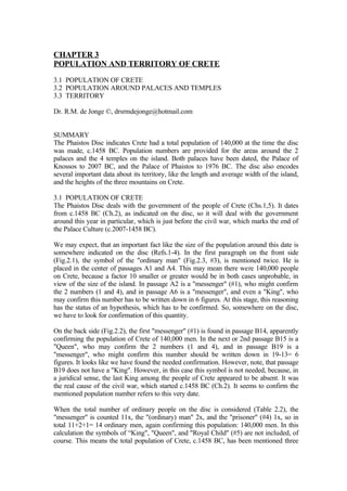
- 2. times on the Phaistos Disc. We consider this as a proof of the whole procedure. We simply suppose this number is correct. A better source than one of the authorities of the Palace of Phaistos, who designed the disc, is hardly conceivable. Finally, we would like to add that this information is very exceptional. Accurate data about population numbers and population densities from 3.5 millennia ago, anywhere in the world, are extremely rare! The eldest reliable figure for the population of Crete in historical times seems to be 270,000, in the year of 1574 AD (Ref.2). Recently, there were about 480,000 people on Crete (1961 AD), which is about 3.4 times the value at the end of the Palace Culture. In c.1458 BC the average population density was 140,000/8331= 17 men per km2, compared to 32 men per km2 in 1574 AD, and 58 men per km2 in 1961 AD. Fig.3.1 General view of the ruins of the Palace of Knossos towards SE (Crete, c.1458 BC, Courtesy A. Kofoú, Ref.18). 3.2 POPULATION AROUND PALACES AND TEMPLES Palaces (#14) are rare on the disc, as in reality. On the front side, an apparently important palace is visible in passage A9. This number may also be related to history. The biggest unit of time on the disc is the double generation of 61 years (the 31+30= 61 passages). So, it appears to be a palace on Crete, dated from 9 double generations ago, or 9x61= 549 years ago, which is from 1458+549= 2007 BC. Probably, it is the Palace of Knossos (Fig.1.1), the biggest of Crete, built at the very start of the Old Palace Culture. Here, it is
- 3. dated slightly earlier than usually reported in the literature (c.1900 BC, Ref.2). Previous passage A6 contains a "messenger", apparently indicating a present population around Knossos of 60,000, because a factor 10 less or more would be unprobable, in relation to the total population of Crete (140,000). The "King" in passage A6 confirms the single number (6), and the "King" in passage A10 confirms the number has to be written down in 10-5= 5 figures. After the excavations around Knossos, archaeologists estimated that in the high-days the maximum number of inhabitants around the site may have amounted to 50,000 (Ref.6). This number is now more or less confirmed by the disc. These days were for sure around 1458 BC (Table 3.1). The second palace is shown in passage B17 on the back side. This side is slightly less important, like the corresponding palace. The number may be related to geography. The inner part of side A has 18 passages, so this palace is located on Crete, indeed, at 18+17= 35°N. Probably, it is Phaistos, half the size of Knossos, but geographically very well indicated (Ch.2), because here the famous Phaistos Disc was made. However, the number may also be related to history. A smaller time unit of the disc is the generation of 30.5 years (the 31/30 passages on the sides). So, the palace dates from 17 generations ago, or 17x30.5= 518 years ago, which is from 1458+518= 1976 BC. It is the Palace of Phaistos, later built than Knossos, according to the literature, c.1800 BC (Refs.2,6). Previous passage B16 contains a "messenger", indicating a present population around Phaistos of 16,000, because a factor 10 less or more would be unprobable. The "Palace of Phaistos" in the next or 2nd passage B17 confirms the 2 numbers (1 and 6), and the "King" in passage B20 confirms the number has to be written down in 20-15= 5 figures. In total, the disc contains 6 "temples" (#24), obviously representing 6 temples of Crete. Passage B6 contains a temple, apparently confirming their number. As suggested from the archaeological literature, these temples appear to be Malia, Hagia Triada and Pyrgos near the Palace of Phaistos, Zakros, Kydonia (or Chania), and Tylissos (Fig.1.1) (Refs.-1,2). The temple in passage A30 on the front side represents Malia, not far from the Palace of Knossos (29km), shown in passage A9. Both sites appear to be related to each other, as suggested by their position on the disc. A30 is situated on the edge, indicating Malia is located at the coast, which is correct. Previous passage A27 contains a "prisoner" (#4), in this case suggesting a population around Malia of 27,000, because a factor 10 less or more would be unprobable. The symbol of the “prisoner” confirms the strong dependence of Malia from the Palace of Knossos. The "King" in the same passage A27 only confirms the first number (2). The next and 2nd passage A28 does not have a King, so the 2nd number (7) is not confirmed. The "King" in passage A31 confirms the number has to be written down in 31-26= 5 figures. So, the population around Malia is reported to be 20,000 men, instead of 27,000 men. Passage B18 on the back side contains two temples, probably Hagia Triada and Pyrgos, which are located close to the Palace of Phaistos, shown in previous passage B17. On the disc they are placed near the lower edge (Fig.2.2), and in reality they are located in the south center of the island, near the coast. The population around these sites near Phaistos has already been calculated: 16,000 men. Passage B21 shows the temple of Zakros. On the disc it is placed at the right edge, and in
- 4. reality the site is located at the east coast of Crete. Previous passage B19 contains a "messenger", encoding a population around the site of 19,000 men. The next and 2nd passage B20 has a "King", confirming the 2 numbers (1 and 9). Passage B23 does not contain a "King". Instead it has a "messenger", because the passage encodes the holy Tropic of Cancer, at 23°N, symbol of the Egyptian Sunreligion (Refs.7-12). It confirms the number has to be written down in 23-18= 5 figures. Passage B26 shows the temple of Kydonia (Chania). On the disc it is placed at the left edge, and in reality the site is located at the north coast, in the west of Crete. Previous passage B24 contains a "messenger", suggesting a population around the site of 24,000. The next and 2nd passage B25 does not contain a king, so only the first number (2) is confirmed. Passage B28 has a "King", confirming the number has to be written down in 28-23= 5 figures. So, the population around Kydonia is 20,000 men, instead of 24,000 men. Passage B6 shows the temple of Tylissos, located in the neighborhood of Knossos (may be the center of the disc), at a distance of 13km. Both on the disc and in reality it is situated north of the Palace of Phaistos, shown in passage B17. A "messenger" is lacking here. However, the passage number B6 and the 3 passages of the paragraph behind it suggest a population around the site of 6,000 men. In view of the amount of encodings on the disc, these particular circumstances should not surprise anyone, but the quantity can be verified. The total number of people around all sacred sites mentioned so far amounts to 60+16+20+19+20= 135 thousand men, respectively. The population of the whole of Crete is shown to be about 140,000 men. So, the population around the temple of Tylissos must be the difference: about 5,000 men, which is approximately correct. Probably, the first mentioned number will be the most accurate one, so our final conclusion is: 6,000 men (Table 3.1). TABLE 3.1 POPULATION DATA OF CRETE, c.1458 BC, ACCORDING TO THE PHAISTOS DISC 140,000 Crete (from disc) 60,000 Knossos (2007 BC) (50,000 estimated*) 16,000 Phaistos (1976 BC), Hagia Triada, and Pyrgos 20,000 Malia 19,000 Zakros 20,000 Kydonia (Chania) 6,000 Tylissos (about 5,000) 141,000 Crete (total and check) 270,000 Crete, 1574 AD* 480.000 Crete, 1961 AD * According to archaeological research 3.3 TERRITORY OF CRETE The Phaistos Disc deals with the government of the people of Crete, so we may expect some data about the territory of the island are encoded on the disc (Table 3.2). The number of symbols may be related to geography. Along the spirals on both sides are a total of 123+119= 242 symbols (Table 2.1), corresponding to the length of the island, 242
- 5. centi-moiras or 242x1,11= 269km (167 miles). A moira is an ancient Egyptian unit of length, corresponding to a degree of latitude, and a centi-moira equals 0,01 moira= 0,01° = 1,11km (Refs.10-21). The official length of the island equals 260km, which is a devia- tion of only 3%. The front side consists of 31 passages, corresponding to the northern Nile Delta in Egypt, at 31°N. This side has 123 symbols, encoding the distance from Phaistos to the east coast of the island, 123 centi-moiras or 123x1,11= 137km (85 miles). This is the start of the shortest route from Phaistos to the northern Nile Delta, when sailing from the SE Cape of Crete to Egypt (Refs.7-12). In a religious way, the back side of the disc symbolizes the “underworld”, which is the Realm of the Dead in the west. This side has 119 symbols, encoding the distance from Phaistos to the west coast, 119 centi-moiras or 119x1,11= 132km (82 miles). Both calculated distances are approximately correct. The real distance to the west coast is slightly less than to the east coast, indeed. These results confirm our previous conclusion, the disc is not only descended from Crete, but designed and probably even made in the Palace of Phaistos, itself (Ch.2). The number of passages may be related to geogaphy, too. On both sides the disc possesses about 30 passages, corresponding to the average width of the island, 30 centi- moiras or 30x1,11= 33km (20 miles). The official average width amounts to 32km, which is a deviation of only 3%. The c.30 passages at each side contain together 242 symbols. So, according to the Phaistos Disc, the surface area of Crete is 242x30x1,11x- 1,11= 8945 km2. The official surface area amounts to 8331 km2, which is a deviation of 7%. The first number may encode the larger real surface area, taking into account the hills and valleys, while the second number is the geometric surface area. In our opinion, the distance from the ancient port of Kommos in the south, via the important centra of Phaistos and Knossos, to the north coast of Crete, near the old harbor of Herakleion, is indicated, too. Along the spirals of the disc are 61 passages, corresponding to this distance of about 61 centi-moiras or 61x1,11= 68km (42 miles). The diameter / thickness ratio of the disc (Chs.1,2) equals the length / width ratio of the island of Crete, 162mm:20mm= 260km:32km= 8:1. This surprising fact strongly con- firms the Cretan provenance of the disc (Ch.2). It may be one of the reasons that all walls of the Palace of Phaistos point 8°NNE or 8°WNW (Fig.1.3). The latter direction, 8°WNW, points in the direction of the length-axis of the island (Fig.1.1). These data show that right from the beginning, the Palace of Phaistos had a national meaning, important for the whole island of Crete. It may be one of the reasons the "flower" or "rosette" (#38) has 8 petals. It appears to be a national symbol of Crete. The United Egyptian Empire, at 27°N, the focus of the Egyptian government, is located halfway the holy Tropic of Cancer, at 23°N, and the northern Nile Delta, at 31°N. The angle of 8° also correspond with the location of Crete, 8° above the center of the United Egyptian Empire, at 27+8= 35°N (Refs.1-9). Because of its characteristic shape, the symbol of the "cover" (Fig.2.3, #7) is also the symbol for "mountain". It occurs 3 times on the edge of the front side, encoding the 3 mountains of Crete. The paragraph-line of the "mountain" in passage A29 points to the very edge of the disc. So, the edge appears to be important in encoding the height of the mountains, using the unit of the milli-moira= 0.001°= 111m. Both passages and paragraphs may contribute to the height. Passage A21 at the right side, in paragraph 1 of the edge, shows Mount Dhikti Ori in the
- 6. east. The 19 passages of the inner part and paragraph 1 of the edge form together 19+1= 20 units, encoding its height of 20x111= 2222m. In reality the height equals 2148m, a deviation of only 3%. Passage A26 in paragraph 2, in the center of the edge, shows Mount Idhi Oros in the center of the island. The 19 passages of the inner part and paragraph 2 of the edge form together 19+2= 21 units, encoding its height of 21x111= 2333m. In reality the height is 2456m, a deviation of only 5%. Finally, passage A29 in paragraph 3, at the left side on the edge, shows Mount Theodoro in the west. The 19 passages of the inner part and the 3 paragraphs of the edge form together 19+3= 22 units, encoding its height of 22x111= 2444m. In reality the height equals 2452m, which is about correct. The symbol of the "waterway" (#45) occurs 6 times on the disc, because of the 6 important sailing routes around Crete. On side A the "waterway" occurs twice, corresponding to the two most important sailing routes to the Peloponnesus (Greece) in the north-west, and to Turkey in the north-east. On side B the "waterway" occurs 4 times, corresponding to the routes to the island group of the Cyclades in the north, to Egypt in the south-east, to the Gulf of Sydra in the south-west, and to the Strait of Messina due west. TABLE 3.2 TERRITORIAL DATA OF CRETE, c.1458 BC, ACCORDING TO THE PHAISTOS DISC East to West Coast : 242 symbols= 242x1.11= 269km (260km*) Phaistos to East C. : 123 symbols= 123x1.11= 137km Phaistos to West C. : 119 symbols= 119x1.11= 132km South C. to North C. : c.30 passages= 30x1,11= c.33km (32km*) Kommos to Herakleion: 61 passages= 61x1,11= 68km L/W (Disc)= L/W (island of Crete)= 8 All walls of Palace of Phaistos: 8°NNE or 8°WNW Location Crete 8° above United Egyptian Empire, at 27+8= 35°N Rosette with 8 petals: the national symbol of Crete Mount Dhikti Ori (E): 20x111= 2222m (2148m*) Mount Idhi Oros (C): 21x111= 2333m (2456m*) Mount Theodoro (W): 22x111= 2444m (2452m*) * Geographic information LITERATURE (Ch.3) 1. Godart, L., The Phaistos Disc, The Enigma of an Aegean Script, Editions Itanos, 1995 (ISBN 960-7549-02-3). 2. Willetts, R.F., The Civilization of Ancient Crete, Phoenix Press, New York (1976) (ISBN 1-84212-746-2). 3. Herberger, C.F., The Minoan Cultural Response: the Feminine Emphasis, Midwestern Epigraphic Journal, Vol.18/9, pgs. 47-55, 2004-5 (ISSN 1932-5703). 4. Bayley, H., The Lost Language of Symbolism, Citadel Press 1990 reprint (ISBN 0-8065-1100-1). 5. Old World Civilizations, The Rise of Cities and States, The Illustrated History of Humankind, Weldon Owen Pty Limited, McMahons Point, Australia (1995). 6. Zwart, A.H. e.a., De Oude Grieken, 7000 Jaar Wereldgeschiedenis, Lekturama, Rotterdam, 1977.
- 7. (Dutch) 7. Breasted, J.H., Ancient Records of Egypt, Vol.2: The Eighteenth Dynasty, London, 1988. 8. Siliotti, A., Egypt, Temples, People and Gods, Bergamo, Italy, 1997. 9. Kemp, B.J., Ancient Egypt, Anatomy of a Civilization, London, Routledge, 1991. 10. De Jonge, R.M., and Wakefield, J.S, How the Sungod Reached America, A Guide to Megalithic Sites, MCS Inc., 2002 (ISBN 0-917054-19-9). Available: MCS Inc., Box 3392, Kirkland, Wa 98083-33-92, also on CD. 11. De Jonge, R.M., and IJzereef, G.F., Exhibition: The Megalithic Inscriptions of Western Europe, 1996. 12. De Jonge, R.M., and IJzereef, G.F., De Stenen Spreken, Kosmos Z&K, Utrecht/Antwerpen, 1996 (ISBN 90-215-2846-0). (Dutch) 13. De Jonge, R.M., and Wakefield J.S., The Discovery of the Atlantic Islands, Migration & Diffusion, Vol.3, No.11, pgs.69-109 (2002). 14. De Jonge, R.M., and Wakefield J.S., The Three Rivers Petroglyph, A Guidepost for River Travel in America, Migration & Diffusion, Vol.3, No.12, pgs.74-100 (2002). 15. De Jonge, R.M., and Wakefield J.S., “A Nautical Center for Crossing the Ocean”, America’s Stone- henge, New Hampshire, c.2200 BC, Migration & Diffusion, Vol.4, No.15, pgs.60-100 (2002). 16. De Jonge, R.M., and Wakefield, J.S., Ancient American, “Germany’s Bronze Age Disc Reveals Trans-atlantic Seafaring”, Vol.9, No.55, pgs.18-20 (2004). 17. De Jonge, R.M., and Wakefield, J.S., The Embden Dragon Petroglyph, A Copper Trading Route of the Bronze Age, Midwestern Epigraphic Journal, Vol.18/9, pgs. 56-82, 2004-5 (ISSN 1932-5703). 18. Kofoú, A., Kreta, met alle musea en archeologische opgravingen, Ekdotike Athenon, Athene, 1994 (ISBN 960-213-060-1). (Dutch) 19. De Jonge, R.M., Website: www.slideshare.net/rmdejonge 20. De Jonge, R.M., Minoan Pendant (Cleveland, Ohio, c.1690 BC), Ref.19. 21. De Jonge, R.M., The Phaistos Disc Decoded, Website: www.slideshare.net/drsrmdejonge