Planning for Charlotte's Future
•Télécharger en tant que PPTX, PDF•
1 j'aime•958 vues

This is the slide deck accompanying the presentation by urban planner Garet Johnson in our AP Environmental Science class on 1/11/2013.

Recommandé
Contenu connexe
En vedette
Similaire à Planning for Charlotte's Future
Similaire à Planning for Charlotte's Future (20)
Dernier
Dernier (20)
Planning for Charlotte's Future
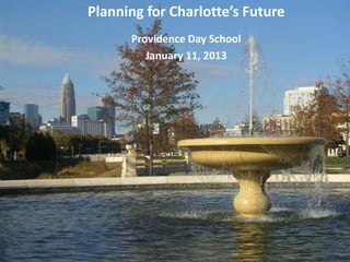
- 1. Planning for Charlotte’s Future Providence Day School January 11, 2013
- 2. Presentation Overview Land Use Planning Growth Trends Growth Framework Group Activity Outcomes
- 3. Planning Department Work with the community in planning for Charlotte’s future growth and development Land Use/Policy Guidance Rezoning Ordinance & Administration Subdivision Ordinance Historic Districts Regulations Annexation Coordination of Transportation Planning Research Urban Design Review Coordination of Capital Planning
- 4. Land Use Planning What is Land Use Planning? Tool to manage how and where we grow in the community Guide for what types of development go where (ie. commercial, residential, industrial) to best meet people’s needs over time Types of Land Uses Residential – single family, duplexes, apartments, town homes, condos Office – dentist, insurance, tax preparers Retail – stores, banks, restaurants Institutional – churches, schools, hospitals Industrial – warehouses, distribution center
- 7. Land Use Planning Some things to think about: Land use plans provide guidance – they are not law Some of the implementation tools, however, are law such as: Zoning and Subdivision Ordinances Tree Ordinance, Stormwater and Erosion Control Ordinances Private sector, not the government, does most of the development/building – happens incrementally, over a long time Market (you and me) also plays a big part of what, when and where development occurs - land use plans and regulations can influence market
- 8. Growth Trends How many people live in Charlotte? Hints: New York, NY - 8,391,881 San Francisco, CA - 815,358 2012 Boston, MA - 645,169 Denver, CO - 610,345 743,000 Raleigh , NC- 405,197 Columbia, SC – 129,539 Rock Hill, SC - 69,213
- 9. Growth Trends Charlotte’s population more than doubled in 30 years 731,000 540,000 396,000 315,000 2012 743,000 1980 1990 2000 2010 Population is more diverse and older Hispanic population increased from 7.4% in 2000 to 13.1% in 2010 Median age increased from 32.7 in 2000 to 33.2 years in 2010
- 10. Developed Land 1976 Charlotte
- 11. Developed Land 1985 Charlotte
- 12. Developed Land 1996 Charlotte
- 13. Developed Land 2006 Charlotte
- 14. Growth Trends Mecklenburg County 1976 1976: 12.5% Developed 2006 Mecklenburg County 2006: ???% Developed 57.6% Developed
- 15. Growth Trends TODAY (2012) 743,000 people 618,000 jobs TOMORROW (2035) +309,000 more people; and +298,000 more jobs Where will these people and jobs go?
- 16. Growth Framework Centers, Corridors and Wedges Long-term growth strategy Five primary transportation and development corridors Focus growth in Activity Centers and Growth Corridors Maximize use of transportation system, infrastructure & services Encourage redevelopment &
- 17. Growth Framework Rapid Transit Planning Light Rail Transit Bus Rapid Transit (Curitiba) Streetcar/Trolley Commuter Rail
- 18. Environmental Sustainability Use land efficiently – compact development, shared facilities, infill & redevelopment Balance & integrate land uses – range of housing, employment, service, leisure & educational opportunities; mix of uses Connect uses & provide transportation choices – sidewalks, bikeways, transit, connectivity Provide infrastructure to support development – schools, sewer, water, fire, police, transportation, libraries Respect the natural and social environment – trees, streams, wetlands, floodplains, habitats, green space, historic properties, neighborhoods Design for quality – details, site layout Plan for the long term – quality, function, change, re-use
- 19. Group Activity #1: Photo Game
- 20. Group Activity The Good, The Bad and The Right Location 1. What’s good about it? 2. What’s not so good? 3. Where would be the most appropriate location for it? Why? • Examples of locations: Activity Center, Wedge, Corridor, On a Major Highway, along a greenway, near a school, . . .
- 21. The Good, The Bad and The Right Location 1. What’s good about it? 2. What’s not so good? 3. Where would be the most appropriate location for it? Why?
- 22. The Good, The Bad and The Right Location 1. What’s good about it? 2. What’s not so good? 3. Where would be the most appropriate location for it? Why?
- 23. The Good, The Bad and The Right Location 1. What’s good about it? 2. What’s not so good? 3. Where would be the most appropriate location for it? Why?
- 24. The Good, The Bad and The Right Location 1. What’s good about it? 2. What’s not so good? 3. Where would be the most appropriate location for it? Why?
- 25. The Good, The Bad and The Right Location 1. What’s good about it? 2. What’s not so good? 3. What’s improved?
- 26. The Good, The Bad and The Right Location 1. What’s good about it? 2. What’s not so good? 3. Where would be the most appropriate location for it? Why?
- 27. The Good, The Bad and The Right Location 1. What’s good about it? 2. What’s not so good? 3. Where would be the most appropriate location for it? Why?
- 28. The Good, The Bad and The Right Location 1. What’s good about it? 2. What’s not so good? 3. Where would be the most appropriate location for it? Why?
- 29. The Good, The Bad and The Right Location 1. What’s good about it? 2. What’s not so good? 3. What’s improved?
- 30. The Good, The Bad and The Right Location 1. What’s good about it? 2. What’s not so good? 3. Where would be the most appropriate location for it? Why?
- 31. The Good, The Bad and The Right Location 1. What’s good about it? 2. What’s not so good? 3. Where would be the most appropriate location for it? Why?
- 32. Group Activity #2: Map Exercise
- 33. Group Activity (15 mins) You are an urban planner, planning for the future of 2 sites in Charlotte Your job is to help accommodate some of the growth that is coming, but also to mitigate the negative impacts that can come along with this growth Here are the 2 sites you will be planning for:
- 34. Group Activity (15 mins) Site 2 Site 1
- 35. Group Activity (15 mins) Site #1 Site #2 512 mostly vacant acres near the 47 acres that was previously Interchange of I-485 & Providence developed, but has now been cleared Road Within the South Growth Corridor Partly in a Mixed-Use Activity Center along the Lynx light rail line, about ¾ Several creeks, some steep topography miles from the Sharon Road Station and a lot of trees Branch of one creek, mostly flat and Surrounding area is mostly developed few trees with single family homes and a golf Surrounding area is mostly developed course across the road with industrial and office type uses; residential nearby
- 36. Group Activity (15 mins) Break up into groups & get some icons & a map sheet Work with your group to place the icons where you think that type of development should go. Be sure to use as many of the icons as possible. Remember, we have a lot of growth to accommodate somewhere! • Institutional - schools, daycares, places of worship, post offices, libraries, jails • Parks/Open Space • Employment – Industries, Warehouses, Offices, Business Parks • Retail – mall, drug store, grocery, shopping center • Residential – single-family, apartments, townhomes, high/mid-rise apartments It’s ok to write or draw on the maps Be ready to tell us why you placed the icons in a particular location
- 38. Outcomes: Streetscape & Land Use
- 39. Outcomes: Streetscape & Land Use
- 40. Outcomes: Streetscape & Land Use
- 41. Outcomes: Streetscape & Land Use
- 42. Planning for Charlotte’s Future www.charlotteplanning.org
Notes de l'éditeur
- As a planner, we go through a similar process as you just have of determining where various types of development will be located throughout the city. Roads and transit play a big role in decided where to located different land uses and the city actually has a framework called Centers, Corridors and Wedges that determines how and where to accommodate growth throughout the City of Charlotte.
- As a planner, we go through a similar process as you just have of determining where various types of development will be located throughout the city. Roads and transit play a big role in decided where to located different land uses and the city actually has a framework called Centers, Corridors and Wedges that determines how and where to accommodate growth throughout the City of Charlotte.
- Break students up into groups (count off) and have them work together on a base map to talk through and decide where they think various types of development should go. Have them circle or color in these areas with the colors that represent the different uses then go around the room and have them briefly discuss their rationale.
- Break students up into groups (count off) and have them work together on a base map to talk through and decide where they think various types of development should go. Have them circle or color in these areas with the colors that represent the different uses then go around the room and have them briefly discuss their rationale.
- Break students up into groups (count off) and have them work together on a base map to talk through and decide where they think various types of development should go. Have them circle or color in these areas with the colors that represent the different uses then go around the room and have them briefly discuss their rationale.
- Break students up into groups (count off) and have them work together on a base map to talk through and decide where they think various types of development should go. Have them circle or color in these areas with the colors that represent the different uses then go around the room and have them briefly discuss their rationale.
- Break students up into groups (count off) and have them work together on a base map to talk through and decide where they think various types of development should go. Have them circle or color in these areas with the colors that represent the different uses then go around the room and have them briefly discuss their rationale.
- Major next steps for the project include Utility Relocation, ROW Acquisition and Final Design.Construction is scheduled to begin next fall with operations to begin in the spring of 2017.
- Break students up into groups (count off) and have them work together on a base map to talk through and decide where they think various types of development should go. Have them circle or color in these areas with the colors that represent the different uses then go around the room and have them briefly discuss their rationale.
- Break students up into groups (count off) and have them work together on a base map to talk through and decide where they think various types of development should go. Have them circle or color in these areas with the colors that represent the different uses then go around the room and have them briefly discuss their rationale.
- Break students up into groups (count off) and have them work together on a base map to talk through and decide where they think various types of development should go. Have them circle or color in these areas with the colors that represent the different uses then go around the room and have them briefly discuss their rationale.
- Break students up into groups (count off) and have them work together on a base map to talk through and decide where they think various types of development should go. Have them circle or color in these areas with the colors that represent the different uses then go around the room and have them briefly discuss their rationale.