SlideShare une entreprise Scribd logo
1  sur  25
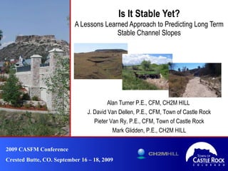
Is It Stable Yet? A Lessons Learned Approach to Predicting Long Term Stable Channel Slopes 2009 CASFM Conference Crested Butte, CO. September 16 – 18, 2009 Alan Turner P.E., CFM, CH2M HILL  J. David Van Dellen, P.E., CFM, Town of Castle Rock Pieter Van Ry, P.E., CFM, Town of Castle Rock Mark Glidden, P.E., CH2M HILL
Objectives ,[object Object],[object Object],[object Object],[object Object]
Master Planning in Castle Rock ,[object Object],[object Object],[object Object],[object Object],[object Object],[object Object],[object Object]
Goals of Castle Rock Master Planning ,[object Object],[object Object],[object Object],[object Object],[object Object]
Available Methodologies for  Stream Stability   ,[object Object],[object Object],[object Object],[object Object],[object Object],[object Object],[object Object],[object Object],[object Object]
Traditional Permissible Velocity Analysis ,[object Object],[object Object],[object Object],[object Object],[object Object],[object Object]
Revised Permissible Velocity Analysis ,[object Object],[object Object],[object Object],[object Object],[object Object],[object Object],[object Object],[object Object],[object Object],[object Object]
Required Data
Revised Permissible Velocity Methodology ,[object Object],[object Object],[object Object],[object Object],[object Object],[object Object]
 
Permissible Velocity Values *  Fortier and Scobey (1926) **  Known et all (1977) *** SCS (1954) and UDFCD (2006) 6.8 6.0 5.5 5.3 5.0 3.8 SC  Hilly gravelly land and pits gravel and Stony rough land Hg, GP, Su Graded Loam to Cobbles 6.8 4.9 4.6 3.9 2.5 - 3.5 1.75 - 2.0 SC  Peyton Pring Crowfoot and Kutch Sandy Loams and Complex PpE, PrE2, KtE Sandy Loam 6.8 4.9 4.6 3.9 3.5 - 5 2.0 - 3.8 CL Loamy Alluvial Land, Sandy wet Alluvial Land, and Sampson Loam Lo, Lu, SE, Sd, Se, St Alluvial Silt 6.8 6.0 5.5 5.3 5.0 3.4 CL Kutch Clay Loam, Jarre Brusset and Fondis Kutch Association, Fondis Clay Loam and Pits Clay KuD, Jb, Fu, CP, FoD Stiff Clay 6.8 4.9 4.6 3.9 2.7 - 3.5 1.7 - 2.5 SC-SM  Bresser, Bresser Truckton, Crawfoot Tomah, and Newlin Sandy Loams BrD, Bte, BrB Cre, NeE Ordinary Firm Loam Grass Lined *** Flow Depth 8 to 10 feet** Flow Depth 5 to 8 feet** Flow Depth 3 to 5 feet** Water Transporting Colloidal Silt* Clear Water* USCS NRCS Soil Description NRCS Soil Type Applied  Permissible Velocities (fps) Soil Types within Study Area Soil Description Fortier and Scobey (1926)  
Revised Permissible Velocity Results 0.041 Clay, Sandy Loams 4 Westfield 0.012 Firm Loams 2,3 Westfield 0.006 Firms Loams, Silt 1 Westfield 0.018 Firm Loams, Sandy Loams, Gravel 4,5,IT1 Industrial 0.004 Firm Loams 1,2,3 Industrial 0.013 Clay, Firm Loams, Sandy Loams 1,2 Tributary to Omni 0.015 Sandy Loams, Clay 6 Omni 0.010 Firm Loams 3,4,5 Omni 0.004 Alluvial Silt, Firm Loams 1,2 Omni Stable Slope (ft/ft) Soil Type Reaches Tributary 0.020 Stiff Clay, Firm Loams, Sandy Loams 6.7 South Dawson 0.007 Firm Loams 1,2,3,4,5 South Dawson 0.004 Alluvial Silt, Firm Loams 1,2,3 North Dawson Stable Slope (ft/ft) Soil Type Reaches Tributary
Revised Permissible Velocity Results 0.018 0.018 Gravel 0.041 0.013 Clay 0.041 0.013 Sandy Loams 0.02 0.004 Firm Loams 0.006 0.004 Alluvial Silt Maximum Slope Ft/ft Minimum Slope ft/ft Soil Type
Revised Permissible Velocity  Reality Check
Case Studies  ,[object Object],[object Object],[object Object],[object Object],[object Object],[object Object],[object Object],[object Object]
6400 Tributary  Master Plan Results 0 0.004 Stony Rough Land  0.041 Reach 4 6400 West Tributary 9 0.004 Renohill-Manzanola Clay Loams 0.053 Reach 3 6400 West Tributary 13 0.004 Loamy Alluvial Land 0.041 Reach 2 6400 West Tributary 4 0.004 Loamy Alluvial Land 0.037 Reach 1 6400 West Tributary 0 0.004 Stony Rough Land 0.049 Reach 7 6400 East Tributary 9 0.004 Fondis-Kutch Association 0.059 Reach 6 6400 East Tributary 0 0.004 Loamy Alluvial Land 0.053 Reach 5 6400 East Tributary 6 0.004 Loamy Alluvial Land 0.058 Reach 4 6400 East Tributary 0 0.004 Loamy Alluvial Land 0.029 Reach 3 6400 East Tributary 2 0.004 Loamy Alluvial Land 0.036 Reach 2 6400 East Tributary 2 0.004 Loamy Alluvial Land 0.033 Reach 1 6400 East Tributary 0 0.004 Fondis-Kutch Association 0.059 Reach 5 6400 South Tributary 7 0.004 Loamy Alluvial Land 0.050 Reach 4 6400 South Tributary 12 0.004 Bresser Sandy Loam 0.056 Reach 3 6400 South Tributary 0 0.004 Englewood Clay Loam 0.039 Reach 2 6400 South Tributary 9 0.004 Newlin Gravely Sandy Loam 0.028 Reach 1 6400 South Tributary Required Drops Master Plan  Slope ft/ft Soil Type Existing Slope ft/ft Reach Stream
6400 Tributary  Revised Permissible Velocity 0   0.041 Stony Rough Land  0.041 Reach 4 6400 West Tributary 0 0.053 Renohill-Manzanola Clay Loams 0.053 Reach 3 6400 West Tributary 11 0.009 Loamy Alluvial Land 0.041 Reach 2 6400 West Tributary 2 0.007 Loamy Alluvial Land 0.037 Reach 1 6400 West Tributary 0 0.05 Stony Rough Land 0.049 Reach 7 6400 East Tributary 5 0.037 Fondis-Kutch Association 0.059 Reach 6 6400 East Tributary 0 0.007 Loamy Alluvial Land 0.053 Reach 5 6400 East Tributary 5 0.005 Loamy Alluvial Land 0.058 Reach 4 6400 East Tributary 0 0.005 Loamy Alluvial Land 0.029 Reach 3 6400 East Tributary 1 0.005 Loamy Alluvial Land 0.036 Reach 2 6400 East Tributary 2 0.004 Loamy Alluvial Land 0.033 Reach 1 6400 East Tributary 0 0.02 Fondis-Kutch Association 0.059 Reach 5 6400 South Tributary 5 0.009 Loamy Alluvial Land 0.050 Reach 4 6400 South Tributary 11 0.005 Bresser Sandy Loam 0.056 Reach 3 6400 South Tributary 0 0.006 Englewood Clay Loam 0.039 Reach 2 6400 South Tributary 9 0.004 Newlin Gravely Sandy Loam 0.028 Reach 1 6400 South Tributary Required  Drops Permissible Velocity Slope ft/ft Soil Type Existing Slope ft/ft Reach Stream
6400 Tributary Results Comparison ,[object Object],[object Object],[object Object],[object Object],[object Object],[object Object],[object Object],[object Object]
Implementation Philosophy ,[object Object],[object Object],[object Object],[object Object]
Implementation Philosophy ,[object Object],[object Object],[object Object]
Implementation Philosophy ,[object Object],[object Object],[object Object],[object Object]
Prioritizing Improvements  ,[object Object],[object Object],[object Object],[object Object],[object Object],[object Object],[object Object],[object Object],[object Object]
Phased Cost Approach ,[object Object],[object Object],[object Object],[object Object],[object Object],[object Object],[object Object],[object Object],[object Object],[object Object]
Conclusion  ,[object Object],[object Object],[object Object],[object Object],[object Object],[object Object],[object Object]
Questions?

Contenu connexe

Tendances

1.43.3.1 2009-hartland-landfill-groundwater-surface-water-and-leachate-monito...
1.43.3.1 2009-hartland-landfill-groundwater-surface-water-and-leachate-monito...1.43.3.1 2009-hartland-landfill-groundwater-surface-water-and-leachate-monito...
1.43.3.1 2009-hartland-landfill-groundwater-surface-water-and-leachate-monito...Adrian Frantescu
 
DSD-INT 2020 Forecasting the Mississippi River During Hurricane Season
DSD-INT 2020 Forecasting the Mississippi River During Hurricane SeasonDSD-INT 2020 Forecasting the Mississippi River During Hurricane Season
DSD-INT 2020 Forecasting the Mississippi River During Hurricane SeasonDeltares
 
Permitting and Hydraulic Fracturing, Leslie Savage
Permitting and Hydraulic Fracturing, Leslie SavagePermitting and Hydraulic Fracturing, Leslie Savage
Permitting and Hydraulic Fracturing, Leslie SavageTXGroundwaterSummit
 
Solutions for Compensatory Mitigation in the Mining Industry And Challenges o...
Solutions for Compensatory Mitigation in the Mining Industry And Challenges o...Solutions for Compensatory Mitigation in the Mining Industry And Challenges o...
Solutions for Compensatory Mitigation in the Mining Industry And Challenges o...Ray Ewing
 
The Use of Nutrient Credits in Virginia
The Use of Nutrient Credits in Virginia The Use of Nutrient Credits in Virginia
The Use of Nutrient Credits in Virginia CleanH2O
 
Desired Future Condition (DFC) Presentation
Desired Future Condition (DFC) PresentationDesired Future Condition (DFC) Presentation
Desired Future Condition (DFC) Presentationhtgcd
 
Arkansas Oil and Gas Commission Update
Arkansas Oil and Gas Commission UpdateArkansas Oil and Gas Commission Update
Arkansas Oil and Gas Commission UpdateAIPRO
 
What it takes to manage Lake Okeechobee
What it takes to manage Lake OkeechobeeWhat it takes to manage Lake Okeechobee
What it takes to manage Lake OkeechobeeChristin Erazo
 
Report on the dynamic ground water resources of Maharashtra (2008-2009)
Report on the dynamic ground water resources of Maharashtra  (2008-2009)Report on the dynamic ground water resources of Maharashtra  (2008-2009)
Report on the dynamic ground water resources of Maharashtra (2008-2009)People's Archive of Rural India
 
Aldergrove Aquifer Issues
Aldergrove Aquifer IssuesAldergrove Aquifer Issues
Aldergrove Aquifer Issuesjgabateman
 

Tendances (20)

Panola County GCD DFC Evaluations
Panola County GCD DFC EvaluationsPanola County GCD DFC Evaluations
Panola County GCD DFC Evaluations
 
Na wai eha order 4 17-14
Na wai eha order 4 17-14Na wai eha order 4 17-14
Na wai eha order 4 17-14
 
1.43.3.1 2009-hartland-landfill-groundwater-surface-water-and-leachate-monito...
1.43.3.1 2009-hartland-landfill-groundwater-surface-water-and-leachate-monito...1.43.3.1 2009-hartland-landfill-groundwater-surface-water-and-leachate-monito...
1.43.3.1 2009-hartland-landfill-groundwater-surface-water-and-leachate-monito...
 
8. Flow and Form
8. Flow and Form8. Flow and Form
8. Flow and Form
 
DSD-INT 2020 Forecasting the Mississippi River During Hurricane Season
DSD-INT 2020 Forecasting the Mississippi River During Hurricane SeasonDSD-INT 2020 Forecasting the Mississippi River During Hurricane Season
DSD-INT 2020 Forecasting the Mississippi River During Hurricane Season
 
Permitting and Hydraulic Fracturing, Leslie Savage
Permitting and Hydraulic Fracturing, Leslie SavagePermitting and Hydraulic Fracturing, Leslie Savage
Permitting and Hydraulic Fracturing, Leslie Savage
 
Solutions for Compensatory Mitigation in the Mining Industry And Challenges o...
Solutions for Compensatory Mitigation in the Mining Industry And Challenges o...Solutions for Compensatory Mitigation in the Mining Industry And Challenges o...
Solutions for Compensatory Mitigation in the Mining Industry And Challenges o...
 
Mwrra.regulation.pptx
Mwrra.regulation.pptxMwrra.regulation.pptx
Mwrra.regulation.pptx
 
Water Talks: New Challenges, New Supplies
Water Talks: New Challenges, New SuppliesWater Talks: New Challenges, New Supplies
Water Talks: New Challenges, New Supplies
 
9 greg mc carty-svi_choptank
9   greg mc carty-svi_choptank9   greg mc carty-svi_choptank
9 greg mc carty-svi_choptank
 
The Use of Nutrient Credits in Virginia
The Use of Nutrient Credits in Virginia The Use of Nutrient Credits in Virginia
The Use of Nutrient Credits in Virginia
 
2004 02 Nhcrwa Speaker Notes
2004 02 Nhcrwa Speaker Notes2004 02 Nhcrwa Speaker Notes
2004 02 Nhcrwa Speaker Notes
 
Desired Future Condition (DFC) Presentation
Desired Future Condition (DFC) PresentationDesired Future Condition (DFC) Presentation
Desired Future Condition (DFC) Presentation
 
Arkansas Oil and Gas Commission Update
Arkansas Oil and Gas Commission UpdateArkansas Oil and Gas Commission Update
Arkansas Oil and Gas Commission Update
 
GCD's - Joint and Regional Planning_Velma Danielson
GCD's - Joint and Regional Planning_Velma DanielsonGCD's - Joint and Regional Planning_Velma Danielson
GCD's - Joint and Regional Planning_Velma Danielson
 
What it takes to manage Lake Okeechobee
What it takes to manage Lake OkeechobeeWhat it takes to manage Lake Okeechobee
What it takes to manage Lake Okeechobee
 
Report on the dynamic ground water resources of Maharashtra (2008-2009)
Report on the dynamic ground water resources of Maharashtra  (2008-2009)Report on the dynamic ground water resources of Maharashtra  (2008-2009)
Report on the dynamic ground water resources of Maharashtra (2008-2009)
 
Metz Lateral Conservation Project
Metz Lateral Conservation ProjectMetz Lateral Conservation Project
Metz Lateral Conservation Project
 
Aldergrove Aquifer Issues
Aldergrove Aquifer IssuesAldergrove Aquifer Issues
Aldergrove Aquifer Issues
 
H063771
H063771H063771
H063771
 

En vedette

Them hlek kat_c_hmer_no_1106
Them hlek kat_c_hmer_no_1106Them hlek kat_c_hmer_no_1106
Them hlek kat_c_hmer_no_1106ireportergr
 
Brug alumni bedrijfskunde sessie | B2B marketing & sales | klantbrein ontrafe...
Brug alumni bedrijfskunde sessie | B2B marketing & sales | klantbrein ontrafe...Brug alumni bedrijfskunde sessie | B2B marketing & sales | klantbrein ontrafe...
Brug alumni bedrijfskunde sessie | B2B marketing & sales | klantbrein ontrafe...Paul Hassels Mönning
 
Them ist kat_c_hmer_no_1106
Them ist kat_c_hmer_no_1106Them ist kat_c_hmer_no_1106
Them ist kat_c_hmer_no_1106ireportergr
 
Exwfylla 2 05 2010
Exwfylla 2 05 2010 Exwfylla 2 05 2010
Exwfylla 2 05 2010 ireportergr
 
Exwfylla 9 01 2010
Exwfylla 9 01 2010 Exwfylla 9 01 2010
Exwfylla 9 01 2010 ireportergr
 
Funjet Social Media Marketing
Funjet Social Media MarketingFunjet Social Media Marketing
Funjet Social Media MarketingFunjet Vacations
 

En vedette (7)

Them hlek kat_c_hmer_no_1106
Them hlek kat_c_hmer_no_1106Them hlek kat_c_hmer_no_1106
Them hlek kat_c_hmer_no_1106
 
Brug alumni bedrijfskunde sessie | B2B marketing & sales | klantbrein ontrafe...
Brug alumni bedrijfskunde sessie | B2B marketing & sales | klantbrein ontrafe...Brug alumni bedrijfskunde sessie | B2B marketing & sales | klantbrein ontrafe...
Brug alumni bedrijfskunde sessie | B2B marketing & sales | klantbrein ontrafe...
 
Rachelle Zoromski
Rachelle ZoromskiRachelle Zoromski
Rachelle Zoromski
 
Them ist kat_c_hmer_no_1106
Them ist kat_c_hmer_no_1106Them ist kat_c_hmer_no_1106
Them ist kat_c_hmer_no_1106
 
Exwfylla 2 05 2010
Exwfylla 2 05 2010 Exwfylla 2 05 2010
Exwfylla 2 05 2010
 
Exwfylla 9 01 2010
Exwfylla 9 01 2010 Exwfylla 9 01 2010
Exwfylla 9 01 2010
 
Funjet Social Media Marketing
Funjet Social Media MarketingFunjet Social Media Marketing
Funjet Social Media Marketing
 

Similaire à CASFM 2009 Presentation On Stream Stability

TL_Cons_present_Kishanpur_20[1].08.09.ppt
TL_Cons_present_Kishanpur_20[1].08.09.pptTL_Cons_present_Kishanpur_20[1].08.09.ppt
TL_Cons_present_Kishanpur_20[1].08.09.pptAshokKumar561399
 
Tom Clark, SRBC, “AMD Restoration Protection Through Delisting and Reclassifi...
Tom Clark, SRBC, “AMD Restoration Protection Through Delisting and Reclassifi...Tom Clark, SRBC, “AMD Restoration Protection Through Delisting and Reclassifi...
Tom Clark, SRBC, “AMD Restoration Protection Through Delisting and Reclassifi...Michael Hewitt, GISP
 
Deep drainge under irrigated cotton in central queensland
Deep drainge under irrigated cotton in central queenslandDeep drainge under irrigated cotton in central queensland
Deep drainge under irrigated cotton in central queenslandJack McHugh
 
Managing Perceived and Real Natural Environmental Risks During Pipeline Insta...
Managing Perceived and Real Natural Environmental Risks During Pipeline Insta...Managing Perceived and Real Natural Environmental Risks During Pipeline Insta...
Managing Perceived and Real Natural Environmental Risks During Pipeline Insta...David Lehmann
 
Team #7 Geotechnical Report (2)
Team #7 Geotechnical Report (2)Team #7 Geotechnical Report (2)
Team #7 Geotechnical Report (2)Genaro Contreras
 
Flood resilient presentation 05.16.12
Flood resilient presentation 05.16.12Flood resilient presentation 05.16.12
Flood resilient presentation 05.16.12Christopher Hayes
 
Rationalizing the 1962-2006 Drop in Water Levels of Lakes Michigan and Huron
Rationalizing the 1962-2006 Drop in Water Levels of Lakes Michigan and HuronRationalizing the 1962-2006 Drop in Water Levels of Lakes Michigan and Huron
Rationalizing the 1962-2006 Drop in Water Levels of Lakes Michigan and HuronMoin Syed
 
Observed Impacts of Marcellus Shale Drilling on Agricultural Lands
Observed Impacts of Marcellus Shale Drilling on Agricultural LandsObserved Impacts of Marcellus Shale Drilling on Agricultural Lands
Observed Impacts of Marcellus Shale Drilling on Agricultural LandsGeorge_Frantz
 
2015 Broken Hill Resources Investment Symposium - Heathgate Resources - Brett...
2015 Broken Hill Resources Investment Symposium - Heathgate Resources - Brett...2015 Broken Hill Resources Investment Symposium - Heathgate Resources - Brett...
2015 Broken Hill Resources Investment Symposium - Heathgate Resources - Brett...Symposium
 
Spring Green 2008 Flooding and Flood Control Options
Spring Green 2008 Flooding and Flood Control OptionsSpring Green 2008 Flooding and Flood Control Options
Spring Green 2008 Flooding and Flood Control OptionsMatthew Hahm
 
Rosemont Project Hydrogeology & Water Supply
Rosemont Project Hydrogeology & Water SupplyRosemont Project Hydrogeology & Water Supply
Rosemont Project Hydrogeology & Water SupplyHudbay Minerals Inc.
 
The Emerging Rogersville Shale Play: Hurry up and Wait
The Emerging Rogersville Shale Play: Hurry up and WaitThe Emerging Rogersville Shale Play: Hurry up and Wait
The Emerging Rogersville Shale Play: Hurry up and WaitDexter Marsh
 
Cdw sed tank_tech_memo1111
Cdw sed tank_tech_memo1111Cdw sed tank_tech_memo1111
Cdw sed tank_tech_memo1111Mazen Alqadi
 
Gold Sluices And Their Application
Gold Sluices And Their ApplicationGold Sluices And Their Application
Gold Sluices And Their ApplicationWyatt Yeager
 

Similaire à CASFM 2009 Presentation On Stream Stability (20)

July 29-330-Joel Brown
July 29-330-Joel BrownJuly 29-330-Joel Brown
July 29-330-Joel Brown
 
TL_Cons_present_Kishanpur_20[1].08.09.ppt
TL_Cons_present_Kishanpur_20[1].08.09.pptTL_Cons_present_Kishanpur_20[1].08.09.ppt
TL_Cons_present_Kishanpur_20[1].08.09.ppt
 
Tom Clark, SRBC, “AMD Restoration Protection Through Delisting and Reclassifi...
Tom Clark, SRBC, “AMD Restoration Protection Through Delisting and Reclassifi...Tom Clark, SRBC, “AMD Restoration Protection Through Delisting and Reclassifi...
Tom Clark, SRBC, “AMD Restoration Protection Through Delisting and Reclassifi...
 
Deep drainge under irrigated cotton in central queensland
Deep drainge under irrigated cotton in central queenslandDeep drainge under irrigated cotton in central queensland
Deep drainge under irrigated cotton in central queensland
 
Managing Perceived and Real Natural Environmental Risks During Pipeline Insta...
Managing Perceived and Real Natural Environmental Risks During Pipeline Insta...Managing Perceived and Real Natural Environmental Risks During Pipeline Insta...
Managing Perceived and Real Natural Environmental Risks During Pipeline Insta...
 
Team #7 Geotechnical Report (2)
Team #7 Geotechnical Report (2)Team #7 Geotechnical Report (2)
Team #7 Geotechnical Report (2)
 
James riverpartnership2003
James riverpartnership2003James riverpartnership2003
James riverpartnership2003
 
Flood resilient presentation 05.16.12
Flood resilient presentation 05.16.12Flood resilient presentation 05.16.12
Flood resilient presentation 05.16.12
 
Massachusetts' Rivers Response to Tropical Storm Irene
Massachusetts' Rivers Response to Tropical Storm IreneMassachusetts' Rivers Response to Tropical Storm Irene
Massachusetts' Rivers Response to Tropical Storm Irene
 
Rationalizing the 1962-2006 Drop in Water Levels of Lakes Michigan and Huron
Rationalizing the 1962-2006 Drop in Water Levels of Lakes Michigan and HuronRationalizing the 1962-2006 Drop in Water Levels of Lakes Michigan and Huron
Rationalizing the 1962-2006 Drop in Water Levels of Lakes Michigan and Huron
 
Observed Impacts of Marcellus Shale Drilling on Agricultural Lands
Observed Impacts of Marcellus Shale Drilling on Agricultural LandsObserved Impacts of Marcellus Shale Drilling on Agricultural Lands
Observed Impacts of Marcellus Shale Drilling on Agricultural Lands
 
2015 Broken Hill Resources Investment Symposium - Heathgate Resources - Brett...
2015 Broken Hill Resources Investment Symposium - Heathgate Resources - Brett...2015 Broken Hill Resources Investment Symposium - Heathgate Resources - Brett...
2015 Broken Hill Resources Investment Symposium - Heathgate Resources - Brett...
 
Bob Reedy BEG - Mining Water Use in Texas.pptx
Bob Reedy BEG - Mining Water Use in Texas.pptxBob Reedy BEG - Mining Water Use in Texas.pptx
Bob Reedy BEG - Mining Water Use in Texas.pptx
 
Spring Green 2008 Flooding and Flood Control Options
Spring Green 2008 Flooding and Flood Control OptionsSpring Green 2008 Flooding and Flood Control Options
Spring Green 2008 Flooding and Flood Control Options
 
Rosemont Project Hydrogeology & Water Supply
Rosemont Project Hydrogeology & Water SupplyRosemont Project Hydrogeology & Water Supply
Rosemont Project Hydrogeology & Water Supply
 
The Emerging Rogersville Shale Play: Hurry up and Wait
The Emerging Rogersville Shale Play: Hurry up and WaitThe Emerging Rogersville Shale Play: Hurry up and Wait
The Emerging Rogersville Shale Play: Hurry up and Wait
 
Evaluating ephemeral gully erosion
Evaluating ephemeral gully erosionEvaluating ephemeral gully erosion
Evaluating ephemeral gully erosion
 
Overliner or Landfill Mining?
Overliner or Landfill Mining?Overliner or Landfill Mining?
Overliner or Landfill Mining?
 
Cdw sed tank_tech_memo1111
Cdw sed tank_tech_memo1111Cdw sed tank_tech_memo1111
Cdw sed tank_tech_memo1111
 
Gold Sluices And Their Application
Gold Sluices And Their ApplicationGold Sluices And Their Application
Gold Sluices And Their Application
 

CASFM 2009 Presentation On Stream Stability

  • 1. Is It Stable Yet? A Lessons Learned Approach to Predicting Long Term Stable Channel Slopes 2009 CASFM Conference Crested Butte, CO. September 16 – 18, 2009 Alan Turner P.E., CFM, CH2M HILL J. David Van Dellen, P.E., CFM, Town of Castle Rock Pieter Van Ry, P.E., CFM, Town of Castle Rock Mark Glidden, P.E., CH2M HILL
  • 2.
  • 3.
  • 4.
  • 5.
  • 6.
  • 7.
  • 9.
  • 10.  
  • 11. Permissible Velocity Values * Fortier and Scobey (1926) ** Known et all (1977) *** SCS (1954) and UDFCD (2006) 6.8 6.0 5.5 5.3 5.0 3.8 SC Hilly gravelly land and pits gravel and Stony rough land Hg, GP, Su Graded Loam to Cobbles 6.8 4.9 4.6 3.9 2.5 - 3.5 1.75 - 2.0 SC Peyton Pring Crowfoot and Kutch Sandy Loams and Complex PpE, PrE2, KtE Sandy Loam 6.8 4.9 4.6 3.9 3.5 - 5 2.0 - 3.8 CL Loamy Alluvial Land, Sandy wet Alluvial Land, and Sampson Loam Lo, Lu, SE, Sd, Se, St Alluvial Silt 6.8 6.0 5.5 5.3 5.0 3.4 CL Kutch Clay Loam, Jarre Brusset and Fondis Kutch Association, Fondis Clay Loam and Pits Clay KuD, Jb, Fu, CP, FoD Stiff Clay 6.8 4.9 4.6 3.9 2.7 - 3.5 1.7 - 2.5 SC-SM Bresser, Bresser Truckton, Crawfoot Tomah, and Newlin Sandy Loams BrD, Bte, BrB Cre, NeE Ordinary Firm Loam Grass Lined *** Flow Depth 8 to 10 feet** Flow Depth 5 to 8 feet** Flow Depth 3 to 5 feet** Water Transporting Colloidal Silt* Clear Water* USCS NRCS Soil Description NRCS Soil Type Applied Permissible Velocities (fps) Soil Types within Study Area Soil Description Fortier and Scobey (1926)  
  • 12. Revised Permissible Velocity Results 0.041 Clay, Sandy Loams 4 Westfield 0.012 Firm Loams 2,3 Westfield 0.006 Firms Loams, Silt 1 Westfield 0.018 Firm Loams, Sandy Loams, Gravel 4,5,IT1 Industrial 0.004 Firm Loams 1,2,3 Industrial 0.013 Clay, Firm Loams, Sandy Loams 1,2 Tributary to Omni 0.015 Sandy Loams, Clay 6 Omni 0.010 Firm Loams 3,4,5 Omni 0.004 Alluvial Silt, Firm Loams 1,2 Omni Stable Slope (ft/ft) Soil Type Reaches Tributary 0.020 Stiff Clay, Firm Loams, Sandy Loams 6.7 South Dawson 0.007 Firm Loams 1,2,3,4,5 South Dawson 0.004 Alluvial Silt, Firm Loams 1,2,3 North Dawson Stable Slope (ft/ft) Soil Type Reaches Tributary
  • 13. Revised Permissible Velocity Results 0.018 0.018 Gravel 0.041 0.013 Clay 0.041 0.013 Sandy Loams 0.02 0.004 Firm Loams 0.006 0.004 Alluvial Silt Maximum Slope Ft/ft Minimum Slope ft/ft Soil Type
  • 15.
  • 16. 6400 Tributary Master Plan Results 0 0.004 Stony Rough Land  0.041 Reach 4 6400 West Tributary 9 0.004 Renohill-Manzanola Clay Loams 0.053 Reach 3 6400 West Tributary 13 0.004 Loamy Alluvial Land 0.041 Reach 2 6400 West Tributary 4 0.004 Loamy Alluvial Land 0.037 Reach 1 6400 West Tributary 0 0.004 Stony Rough Land 0.049 Reach 7 6400 East Tributary 9 0.004 Fondis-Kutch Association 0.059 Reach 6 6400 East Tributary 0 0.004 Loamy Alluvial Land 0.053 Reach 5 6400 East Tributary 6 0.004 Loamy Alluvial Land 0.058 Reach 4 6400 East Tributary 0 0.004 Loamy Alluvial Land 0.029 Reach 3 6400 East Tributary 2 0.004 Loamy Alluvial Land 0.036 Reach 2 6400 East Tributary 2 0.004 Loamy Alluvial Land 0.033 Reach 1 6400 East Tributary 0 0.004 Fondis-Kutch Association 0.059 Reach 5 6400 South Tributary 7 0.004 Loamy Alluvial Land 0.050 Reach 4 6400 South Tributary 12 0.004 Bresser Sandy Loam 0.056 Reach 3 6400 South Tributary 0 0.004 Englewood Clay Loam 0.039 Reach 2 6400 South Tributary 9 0.004 Newlin Gravely Sandy Loam 0.028 Reach 1 6400 South Tributary Required Drops Master Plan Slope ft/ft Soil Type Existing Slope ft/ft Reach Stream
  • 17. 6400 Tributary Revised Permissible Velocity 0   0.041 Stony Rough Land  0.041 Reach 4 6400 West Tributary 0 0.053 Renohill-Manzanola Clay Loams 0.053 Reach 3 6400 West Tributary 11 0.009 Loamy Alluvial Land 0.041 Reach 2 6400 West Tributary 2 0.007 Loamy Alluvial Land 0.037 Reach 1 6400 West Tributary 0 0.05 Stony Rough Land 0.049 Reach 7 6400 East Tributary 5 0.037 Fondis-Kutch Association 0.059 Reach 6 6400 East Tributary 0 0.007 Loamy Alluvial Land 0.053 Reach 5 6400 East Tributary 5 0.005 Loamy Alluvial Land 0.058 Reach 4 6400 East Tributary 0 0.005 Loamy Alluvial Land 0.029 Reach 3 6400 East Tributary 1 0.005 Loamy Alluvial Land 0.036 Reach 2 6400 East Tributary 2 0.004 Loamy Alluvial Land 0.033 Reach 1 6400 East Tributary 0 0.02 Fondis-Kutch Association 0.059 Reach 5 6400 South Tributary 5 0.009 Loamy Alluvial Land 0.050 Reach 4 6400 South Tributary 11 0.005 Bresser Sandy Loam 0.056 Reach 3 6400 South Tributary 0 0.006 Englewood Clay Loam 0.039 Reach 2 6400 South Tributary 9 0.004 Newlin Gravely Sandy Loam 0.028 Reach 1 6400 South Tributary Required Drops Permissible Velocity Slope ft/ft Soil Type Existing Slope ft/ft Reach Stream
  • 18.
  • 19.
  • 20.
  • 21.
  • 22.
  • 23.
  • 24.