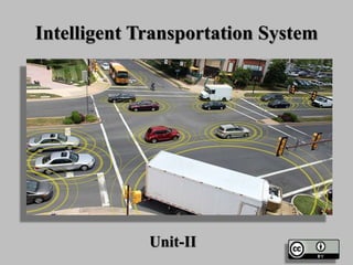
Intelligent Transportation System
•Download as PPTX, PDF•
104 likes•43,947 views

Intelligent transportation systems (ITS) use advanced technologies like electronics, computers, communications and sensors to provide travellers with important information and improve transportation safety and efficiency. ITS applications range from basic systems like car navigation to more advanced integrated systems. Technologies involved in ITS include sensors for vehicle detection, GPS for location data, wireless communications for information sharing, and computational methods for data analysis. The benefits of ITS include safety improvements from incident detection and emergency response, increased productivity from traffic management, and reduced environmental impacts from optimized traffic flow.

Recommended
Recommended
More Related Content
What's hot
What's hot (20)
Similar to Intelligent Transportation System
Similar to Intelligent Transportation System (20)
More from GAURAV. H .TANDON
More from GAURAV. H .TANDON (20)
Recently uploaded
Recently uploaded (20)
Intelligent Transportation System
- 2. Introduction ITS is the integrated application of advanced Technologies using electronics, computers, communications, and advanced sensors. These applications provide travellers with important information while improving the safety and efficiency of the transportation system.
- 4. Intelligent Transportation System • Intelligent transportation systems (ITS) are advanced applications which, without embodying intelligence as such, aim to provide innovative services relating to different modes of transport and traffic management and enable various users to be better informed and make safer, more coordinated, and 'smarter' use of transport networks.
- 6. Intelligent Transportation System • Although ITS may refer to all modes of transport, EU Directive 2010/40/EU defines ITS as systems in which information and communication technologies are applied in the field of road transport, including infrastructure, vehicles and users, and in traffic management and mobility management, as well as for interfaces with other modes of transport
- 8. Intelligent Transportation System • Intelligent transport systems vary in technologies applied, from basic management systems such as car navigation; traffic signal control systems; container management systems; variable message signs; automatic number plate recognition or speed cameras to monitor applications, such as security CCTV systems; and to more advanced applications that integrate live data and feedback from a number of other sources, such as parking guidance and information systems; weather information; bridge de-icing (US deicing) systems; and the like. Additionally, predictive techniques are being developed to allow advanced modeling and comparison with historical baseline data.
- 11. Intelligent transport technologies Computational Technologies • Recent advances in vehicle electronics have led to a move towards fewer, more capable computer processors on a vehicle. A typical vehicle in the early 2000s would have between 20 and 100 individual networked microcontroller/Programmable logic controller modules with non-real-time operating systems. • The current trend is toward fewer, more costly microprocessor modules with hardware memory management and Real-Time Operating Systems. • The new embedded system platforms allow for more sophisticated software applications to be implemented, including model-based process control, artificial intelligence, and ubiquitous computing. Perhaps the most important of these for Intelligent Transportation Systems is artificial intelligence.
- 13. Intelligent Transportation System Floating car data/floating cellular data • "Floating car" or "probe" data collection is a set of relatively low-cost methods for obtaining travel time and speed data for vehicles travelling along streets, highways, motorways (freeways), and other transport routes. Broadly speaking, three methods have been used to obtain the raw data:
- 16. Intelligent Transportation System • Triangulation method. In developed countries a high proportion of cars contain one or more mobile phones. The phones periodically transmit their presence information to the mobile phone network, even when no voice connection is established. As a car moves, so does the signal of any mobile phones that are inside the vehicle. By measuring and analyzing network data using triangulation, pattern matching or cell-sector statistics (in an anonymous format), the data was converted into traffic flow information. An advantage of this method is that no infrastructure needs to be built along the road; only the mobile phone network is leveraged. But in practice the triangulation method can be complicated, especially in areas where the same mobile phone towers serve two or more parallel routes (such as a motorway (freeway) with a frontage road, a motorway (freeway) and a commuter rail line, two or more parallel streets, or a street that is also a bus line).
- 19. Intelligent transport technologies • Vehicle Re-identification. Vehicle re-identification methods require sets of detectors mounted along the road. In this technique, a unique serial number for a device in the vehicle is detected at one location and then detected again (re-identified) further down the road. Travel times and speed are calculated by comparing the time at which a specific device is detected by pairs of sensors. This can be done using the MAC addresses from Bluetooth or other devices, or using the RFID serial numbers from Electronic Toll Collection (ETC) transponders (also called "toll tags")
- 22. GPS based methods GPS based methods. An increasing number of vehicles are equipped with in-vehicle satnav/GPS (satellite navigation) systems that have two-way communication with a traffic data provider. Position readings from these vehicles are used to compute vehicle speeds. Modern methods may not use dedicated hardware but instead Smartphone based solutions using so called Telematics 2.0 approaches.
- 25. Smartphone-Based Rich Monitoring. • Smartphone-based rich monitoring. Smartphones having various sensors can be used to track traffic speed and density. The accelerometer data from smartphones used by car drivers is monitored to find out traffic speed and road quality. Audio data and GPS tagging of smartphones enables identification of traffic density and possible traffic jams.
- 26. Sensing Technologies Sensing Technologies • Technological advances in telecommunications and information technology, coupled with ultramodern/state-of- the-art microchip, RFID (Radio Frequency Identification), and inexpensive intelligent beacon sensing technologies, have enhanced the technical capabilities that will facilitate motorist safety benefits for intelligent transportation systems globally. Sensing systems for ITS are vehicle- and infrastructure-based networked systems, i.e., Intelligent vehicle technologies. Infrastructure sensors are indestructible (such as in-road reflectors) devices that are installed or embedded in the road or surrounding the road (e.g., on buildings, posts, and signs), as required, and may be manually disseminated during preventive road construction maintenance or by sensor injection machinery for rapid deployment.
- 28. Sensing Technologies • Vehicle-sensing systems include deployment of infrastructure-to-vehicle and vehicle-to- infrastructure electronic beacons for identification communications and may also employ video automatic number plate recognition or vehicle magnetic signature detection technologies at desired intervals to increase sustained monitoring of vehicles operating in critical zones.
- 30. Inductive loop detection Inductive Loop Detection • Saw cut loop detectors for vehicle detection buried in the pavement at this intersection as seen by the rectangular shapes of loop detector sealant at the bottom part of this picture. • Inductive loops can be placed in a roadbed to detect vehicles as they pass through the loop's magnetic field. The simplest detectors simply count the number of vehicles during a unit of time (typically 60 seconds in the United States) that pass over the loop, while more sophisticated sensors estimate the speed, length, and class of vehicles and the distance between them. Loops can be placed in a single lane or across multiple lanes, and they work with very slow or stopped vehicles as well as vehicles moving at high-speed.
- 34. Video vehicle detection Video Vehicle Detection • Traffic-flow measurement and automatic incident detection using video cameras is another form of vehicle detection. Since video detection systems such as those used in automatic number plate recognition do not involve installing any components directly into the road surface or roadbed, this type of system is known as a "non-intrusive" method of traffic detection. Video from cameras is fed into processors that analyse the changing characteristics of the video image as vehicles pass. The cameras are typically mounted on poles or structures above or adjacent to the roadway. • A single video detection processor can detect traffic simultaneously from one to eight cameras, depending on the brand and model. The typical output from a video detection system is lane-by-lane vehicle speeds, counts, and lane occupancy readings. Some systems provide additional outputs including gap, headway, stopped-vehicle detection, and wrong-way vehicle alarms.
- 38. Bluetooth Detection • Bluetooth is an accurate and inexpensive way to measure travel time and make origin and destination analysis. Bluetooth is a wireless standard used to communicate between electronic devices like mobile phones, smart phones, headsets, navigation systems, computers etc. Bluetooth road sensors are able to detect Bluetooth MAC addresses from Bluetooth devices in passing vehicles. If these sensors are interconnected they are able to calculate travel time and provide data for origin and destination matrices.
- 39. Bluetooth Detection • Compared to other traffic measurement technologies, Bluetooth measurement has some differences: • Accurate measurement points with absolute confirmation to provide to the second travel times. • Is non-intrusive, which can lead to lower-cost installations for both permanent and temporary sites. • Is limited to how many Bluetooth devices are broadcasting in a vehicle so counting and other applications are limited. • Systems are generally quick to set up with little to no calibration needed. • Since Bluetooth devices become more prevalent on board vehicles and with more portable electronics broadcasting, the amount of data collected over time becomes more accurate and valuable for travel time and estimation purposes.
- 42. Audio Detection Audio Detection • It is also possible to measure traffic density on a road using the Audio signal that consists of the cumulative sound from tire noise, engine noise, engine-idling noise, honks and air turbulence noise. • A roadside-installed microphone picks up the audio that comprises the various vehicle noise and Audio signal processing techniques can be used to estimate the traffic state.
- 43. Audio Detection
- 44. Information fusion from multiple traffic sensing modalities • Information fusion from multiple traffic sensing modalities • The data from the different sensing technologies can be combined in intelligent ways to determine the traffic state accurately. A Data fusion based approach that utilizes the road side collected acoustic, image and sensor data has been shown to combine the advantages of the different individual methods
- 45. Information fusion from multiple traffic sensing modalities
- 46. Intelligent transport applications Intelligent Transport Applications • Emergency vehicle notification systems • The in-vehicle eCall is generated either manually by the vehicle occupants or automatically via activation of in- vehicle sensors after an accident. When activated, the in- vehicle eCall device will establish an emergency call carrying both voice and data directly to the nearest emergency point (normally the nearest E1-1-2 Public- safety answering point, PSAP). The voice call enables the vehicle occupant to communicate with the trained eCall operator. At the same time, a minimum set of data will be sent to the eCall operator receiving the voice call. • The minimum set of data contains information about the incident, including time, precise location, the direction the vehicle was traveling, and vehicle identification.
- 49. Automatic Road Enforcement Automatic Speed Enforcement Gantry • A traffic enforcement camera system, consisting of a camera and a vehicle-monitoring device, is used to detect and identify vehicles disobeying a speed limit or some other road legal requirement and automatically ticket offenders based on the license plate number. Traffic tickets are sent by mail. Applications include: • Speed cameras that identify vehicles traveling over the legal speed limit. Many such devices use radar to detect a vehicle's speed or electromagnetic loops buried in each lane of the road. • Red light cameras that detect vehicles that cross a stop line or designated stopping place while a red traffic light is showing.
- 51. Automatic Road Enforcement • Bus lane cameras that identify vehicles traveling in lanes reserved for buses. In some jurisdictions, bus lanes can also be used by taxis or vehicles engaged in car pooling. • Level crossing cameras that identify vehicles crossing railways at grade illegally. • Double white line cameras that identify vehicles crossing these lines. • High-occupancy vehicle lane cameras that identify vehicles violating HOV requirements. • Turn cameras at intersections where specific turns are prohibited on red. This type of camera is mostly used in cities or heavy
- 53. Variable Speed Limits • Recently some jurisdictions have begun experimenting with variable speed limits that change with road congestion and other factors. Typically such speed limits only change to decline during poor conditions, rather than being improved in good ones. Speed limits combined with automated enforcement have been in force since 1995. Initial results indicated savings in journey times, smoother-flowing traffic, and a fall in the number of accidents, so the implementation was made permanent in 1997.
- 56. Collision Avoidance Systems • Japan has installed sensors on its highways to notify motorists that a car is stalled ahead.
- 57. Dynamic Traffic Light Sequence RFID for dynamic traffic light sequences. • It circumvents or avoids problems that usually arise with systems that use image processing and beam interruption techniques. • RFID technology with appropriate algorithm and database were applied to a multi-vehicle, multi-lane and multi-road junction area to provide an efficient time management scheme. • A dynamic time schedule was worked out for the passage of each column. The simulation showed the dynamic sequence algorithm could adjust itself even with the presence of some extreme cases. The system could emulate the judgment of a traffic police officer on duty, by considering the number of vehicles in each column and the routing proprieties
- 58. Dynamic Traffic Light Sequence
- 59. Dynamic Traffic Light Sequence
- 60. Cooperative Systems On The Road Cooperative systems on the road • Communication cooperation on the road includes car-to-car, car-to-infrastructure, and vice versa. Data available from vehicles are acquired and transmitted to a server for central fusion and processing. These data can be used to detect events such as rain (wiper activity) and congestion (frequent braking activities). The server processes a driving recommendation dedicated to a single or a specific group of drivers and transmits it wirelessly to vehicles. The goal of cooperative systems is to use and plan communication and sensor infrastructure to increase road safety.
- 61. Cooperative Systems On The Road
- 62. Cooperative Systems On The Road
- 63. Cooperative Systems On The Road • "Road operators, infrastructure, vehicles, their drivers and other road users will cooperate to deliver the most efficient, safe, secure and comfortable journey. The vehicle-vehicle and vehicle-infrastructure co- operative systems will contribute to these objectives beyond the improvements achievable with stand-alone systems
- 64. Cooperative Systems On The Road
- 65. Intelligent Transportation Applications Electronic Toll Collection Today, most toll roads are equipped with an electronic toll-collection system, like E-ZPass, that detects and processes tolls electronically. E-ZPass uses a vehicle- mounted transponder that is activated by an antenna on a toll lane. Your account information is stored in the transponder. The antenna identifies your transponder and reads your account information. The amount of the toll is deducted and you're allowed through.
- 67. Emergency Management Services When an incident occurs, the nearest emergency service vehicle is located electronically and dispatched to the scene. Highway managers then alert other drivers of the incident through dynamic message signs. These services reduce response times, help save lives, and reduce the occurrence of secondary incidents. Emergency Management Services are greatly enhanced by traffic control centers that continually monitor roadway conditions.
- 69. • Time Savings • Better emergency response times and services • Reduced Crashes and Fatalities • Cost Avoidance • Increased Customer Satisfaction • Energy and Environmental Benefits • Decreasing of probability of congestion occurrence Benefits of ITS
- 70. Benefits of Intelligent Transport Systems • Intelligent Transport Systems (ITS) have the potential to provide three key benefits
- 71. Benefits of Intelligent Transport Systems • Safety—Road crashes cause suffering and loss of life as well as costing the nation in the order of billion a year. Many collisions occur due to the stop-start nature of traffic in congested areas. ITS technologies can be used to smooth traffic flows, reduce congestion and hence reduce certain types of accidents. • In the future, Cooperative-ITS, which involves communications between vehicles and road-side infrastructure, could be used to improve safety by providing warnings on heavy braking or potential collisions at intersections. Information provided through ITS can also be used to direct traffic away from accidents and alert emergency services as soon as an incident occurs.
- 72. Benefits of Intelligent Transport Systems
- 73. Benefits of Intelligent Transport Systems • Productivity—Congestion lowers productivity, causes flow-on delays in supply chains and increases the cost of business. ITS can increase productivity by finding innovative ways to increase the capacity of our current infrastructure. • Environmental performance— • ITS that reduce congestion and stop-start driving can also reduce fuel consumption and greenhouse gas emissions compared with normal driving conditions.
- 74. Benefits of Intelligent Transport Systems
- 75. Benefits of Intelligent Transport Systems
- 76. Accident Cost Savings (44%) Time Savings (41%) Emissions/Fuel (6%) Operating Cost Savings (5%) Agency Cost Savings (4%) Other (< 1%) ITS Infrastructure Benefits
- 77. References • http://deity.gov.in/content/intelligent-transportation- system-its • http://www.itsindia.org/ • https://coeut.iitm.ac.in/ITS_synthesis.pdf • https://www.usenix.org/system/files/conference/nsdr1 2/nsdr12-final2.pdf • http://india.smartcitiescouncil.com/ • http://www.cpted.net/
- 78. "A developed country is not a place where the poor have cars. Its where the rich use public transportation"