Hawaii Pacific GIS Conference 2012: Application Development - A Global 3D/4D PC Based GIS Tool for Interactively Visualizing and Fusing Large Time-Varying Volumetric, Elevation, Imagery, and LiDAR Data Sets
•
4 likes•780 views


Recommended
More Related Content
What's hot
What's hot (20)
Viewers also liked
Similar to Hawaii Pacific GIS Conference 2012: Application Development - A Global 3D/4D PC Based GIS Tool for Interactively Visualizing and Fusing Large Time-Varying Volumetric, Elevation, Imagery, and LiDAR Data Sets
Similar to Hawaii Pacific GIS Conference 2012: Application Development - A Global 3D/4D PC Based GIS Tool for Interactively Visualizing and Fusing Large Time-Varying Volumetric, Elevation, Imagery, and LiDAR Data Sets (20)
More from Hawaii Geographic Information Coordinating Council
More from Hawaii Geographic Information Coordinating Council (20)
Recently uploaded
Recently uploaded (20)
Hawaii Pacific GIS Conference 2012: Application Development - A Global 3D/4D PC Based GIS Tool for Interactively Visualizing and Fusing Large Time-Varying Volumetric, Elevation, Imagery, and LiDAR Data Sets
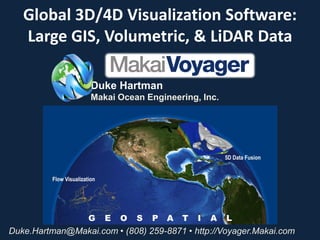
- 1. Global 3D/4D Visualization Software: Large GIS, Volumetric, & LiDAR Data Duke Hartman Makai Ocean Engineering, Inc. Duke.Hartman@Makai.com • (808) 259-8871 • http://Voyager.Makai.com
- 2. Who is Makai? • Located on Oahu, Hawaii • Est. 1973; ~29 persons • Specialties: – Submarine Cable Planning & Installation – OTEC / Deep Water Pipes – Deep Water Marine Design – Visualization Software OTEC Cable Visualization .
- 3. Makai Voyager Software • Big goal: “Google Earth + Scientific Data” • 3D/4D Scientific Visualization: – Volume, flow, LIDAR, graphing, analysis, etc. with GIS backdrop. • Developed over last 5 years with funding from: – ONR (Office of Naval Research) – CEROS (National Defense Center of Excellence for Research in Ocean Sciences) – HTDV (Hawaii Technology Development Venture) • Makai is starting to commercialize the software: – http://voyager.makai.com – Downloadable demo on Windows, Linux, Mac (150 Mb) – Stream data from Makai servers.
- 4. Product Goals Global geo-referenced Dynamic geo-referenced GIS (vector & raster data) Imagery & Terrain/Bathy Iso-surfaces & Volumes & KML Objects + + Multiple layers / fuse and analyze data Multi-variable data fusion & analysis > 150 different formats Common Operating Picture: advanced scientific visualization, GIS, and graphing, into common view. Global Geo-referenced View Speed: Operate on standard PC at interactive rates; Platform Independent: Windows, Linux, OSX; Large Data: Handle large volumetric grids (> 5123) with multiple variables and with potentially unlimited time-steps; Web-Enabled: Web-app for remote visualization. Images + Terrain + Volume + Flow + Time
- 5. What’s the problem? First off: what is “4D”? 3D volumetric data: x, y, z, with some attribute (e.g., temperature, wind speed, etc.) 2D: Each pixel is a data sample 4D = 3D + time Displaying 4D data can be challenging: Data and scene management Georeferencing Speed Status Quo? Volumetric data not handled adequately by: Leading interactive 3D imagery/terrain software (Google Earth) Leading GIS software (… you know who)
- 6. Who Cares? Anyone dealing with complex 3D & GIS data. This includes: Disaster Management Ocean / Earth / Atmosphere Science 2D: Each pixel is a data sample Geology / Mining / Oil & Gas Environmental / Hydro Engineers Military - Tactical Displays for Situational Awareness GIS Professionals with complicated 3D problems … hopefully you!
- 7. Technical Challenge Understanding large 4D data sets Traditionally visualized using single 2D layers Images & terrain are associated with pixels (X, Y → elevation/color) – i.e., 2D images 4D data are associated with voxels (X, Y, Z, time → multiple variables) 2D VIEWS 3D VIEWS
- 8. Render, faster, better: Interactivity is achieved for very large data using: Data tiling for time-varying 2D and 3D data (similar to what GE does for terrain); Efficient compression algorithms; Accelerated GPU rendering; and, Multi-threading capabilities of modern processors.
- 9. Makai Voyager Main Screen Tools Drag-n-Drop Navigation Interface Controls Loaded Data 3D View Visualizations Legends Mouse Coordinate Simulation Clock / Status bar
- 10. What type of data can it handle? Imagery Terrain (Topos & Bathymetry) 3D Objects LiDAR Typical GIS formats (150+) Web Maps Volumetric, iso-surface & time varying data Real-time streaming sensor & GPS data
- 11. Web Map Services (WMS) WMS streaming over internet (OpenStreetMaps data) US Navy ocean model - surface elevation data for ocean (with contours).
- 12. Disaster Modeling Tsunami, Hurricane, Earthquake, Flood, Fire Contamination Plume, etc. Tsunami model shows actual surface elevation – plot intersection with terrain for inundation analysis. Chile Tsunami, 2010 NOAA Tsunami Warning Center Data
- 13. Analysis Tools Triple slice graphs for simultaneous graphing of all major axes of a data set Measurement, probing, cropping, graphing, snapshot & movie export tools
- 14. Massive LiDAR Point clouds visualized using level-of-detail. Photo colored points or height coloring.
- 15. Data Fusion Georeferenced LiDAR city scan over WMS maps & terrain data
- 16. Hydrodynamic / Hydrological Plumes Hydro plume models such as outfalls, toxic waste, oil spills, etc. Realistic KML geometries, bathymetry, etc. for context.
- 17. Real-time Streaming of Sensor Data NOAA NDBC weather station observational data viewed in same 3D platform. Live streaming over the internet using WMS.
- 18. Web Application Program opens within web browser on low powered laptop, tablet (e.g. iPad) Server renders 3D visualizations, then sends images to client app.
- 19. Disaster Management Processes, Integrates and Visualizes Real-time Data Sensors Public Data Streamed GIS • Legacy and real-time sensor data: (land, air, underwater) in space & time in common view. Situational Feedback • Increase surveillance efficiency: reduce op 3D manpower – consolidate 2D flat views in a true 3D/4D Awareness Viewer visual environment. For Field Units • Data fusion from multi-sources: reducing decision-making and response time. • Open architecture: can be expanded and customized easily. • Simulation: threat situations for training of emergency responders
- 20. Tactical Display: Integration with P3 Anti-submarine warfare: In summer/fall 2010 Makai worked with Lockheed to integrate 4D Visualization technology in the acoustic subsystem for the P3-C Orion aircraft
- 21. Integrated acoustic propagation algorithms w/ 4D environmental data. Application for ocean, but could easily be modified for land sound abatement analysis.
- 24. Thank you! Questions? Duke Hartman Makai Ocean Engineering, Inc. Duke.Hartman@Makai.com • (808) 259-8871 http://Voyager.Makai.com