SlideShare une entreprise Scribd logo
1  sur  12
Télécharger pour lire hors ligne
"Building Resilient Communities“
                                          Henry B Wolter
USGS NSDI Liaison Hawaii and the Pacific Basin Territories
                     HIGICC Data Discovery Afternoon
HIGICC Data Discovery Afternoon
          September
           25, 2009               Henry Wolter
                                  hwolter@usgs.gov
Update on products and projects 
for Hawaii
 Honolulu NGA/USGS  133 Cities refresh is complete. 
 Expected  delivery in October 2009.
 Planning for the 2010 NGA HNL refresh has started .
 1ft NC , USNG tiles, Public Domain
 NOAA  Topo/Bathy complete
Example of main 8 Elevation 
coverage
USGS Products URL’s
 HBGN/HIGICC/USGS “Native Names Website, 
 http://hawaii.gov/debedt/gis/temp1/place_names/
 USGS/Sate of Hawaii NHD info, 
 http://nhd.usgs.gov/index.html/ & 
 http://streamstats.usgs.gov
 Ridge to Reef Project (Integrated Science) 
 http://pubs.usgs.gov/sir/2007/5101/
 Partnership/Grants http://www.fgdc.gov/grants
 National Geospatial Program 
 http://www.usgs.gov.gov/ngpo/
Hawaiian Islands
                                              September 2009


- All outstanding DOQQ’s for Hawaii (Big Island)
have been delivered.

- All islands have .6 Meter Resolution, Four Band
Orthoimagery data except Oahu (1 Ft., Natural
Color).

- Hawaii (Big Island) dataset is around 250 GB.

- Leica GeoSystems is working with the USDA-
NRCS to produce a tone matched mosaic using
new mosaic technology.
USDA-NRCS/USGS-Hawaii has PDF/ESRI-Shapefiles
Orthoimagery Acquisition Dates for all DigitalGlobe
Satellite data in the Hawaiian Islands.
Imagery for the Nation
            Hawaii Islands Projected Funding Requirements
                       Area in Square Kilometers

Major Hawaiian Islands total including extra shoreline/water         17,750 Sq. K


                  Projected Costs (3 Year Cycle)

1) Oahu (u133, NGA/USGS), 1 ft. GSD, 4 Band, etc…                      $ 400,000

2) All Other Islands, .6 Meter or better GSD, 16 bit, 4 Band, $ 595,000
1:12 K Orthoimagery, 2 Product (Pan Sharpened and RAW),
Enterprise Premium Level License, Assumes 100-300K
Purchased per year discount. NDOP Technical
Specifications. (8/2009)

                                          Totals               $ 995,000
DigitalGlobe Enterprise Premium License Exclusions

- The only exclusion in broad terms of the Enterprise Premium License is that
DigitalGlobe QuickBird Imagery data itself could not be used by
public/individuals engaged in using the product for “Commercial Exploitation
or Commercial Purposes”. Essentially, the data cannot be re-sold in any way.

- All Products or Derivative Works must contain the following copyright notice
conspicuously displayed: “© DigitalGlobe, Inc. All Rights Reserved” for the
Product, and “Includes copyrighted material of DigitalGlobe, Inc., All Rights
Reserved” for Derivative Works.

- Full Enterprise Premium License information will be made available when
USDA releases the DigitalGlobe Satellite data
Zeke says, Mahalo for your time!


  Any Questions?

Contenu connexe

Similaire à USGS Updates

Deepwater Activity Statistics - New Discoveries Worldwide Driving Deepwater E...
Deepwater Activity Statistics - New Discoveries Worldwide Driving Deepwater E...Deepwater Activity Statistics - New Discoveries Worldwide Driving Deepwater E...
Deepwater Activity Statistics - New Discoveries Worldwide Driving Deepwater E...ReportsnReports
 
Geospatial Data Insfrastructures, Cybercartography and Open Data: The Need f...
Geospatial Data Insfrastructures, Cybercartography and Open Data:  The Need f...Geospatial Data Insfrastructures, Cybercartography and Open Data:  The Need f...
Geospatial Data Insfrastructures, Cybercartography and Open Data: The Need f...ProgCity
 
ITEM 5. IUSS WG Global Soil Map & GloSIS Fine Resolution Soil Grid Specificat...
ITEM 5. IUSS WG Global Soil Map & GloSIS Fine Resolution Soil Grid Specificat...ITEM 5. IUSS WG Global Soil Map & GloSIS Fine Resolution Soil Grid Specificat...
ITEM 5. IUSS WG Global Soil Map & GloSIS Fine Resolution Soil Grid Specificat...ExternalEvents
 
The work of ((o))eco Lab - projects of Data Journalism, Interactive Maps, Geo...
The work of ((o))eco Lab - projects of Data Journalism, Interactive Maps, Geo...The work of ((o))eco Lab - projects of Data Journalism, Interactive Maps, Geo...
The work of ((o))eco Lab - projects of Data Journalism, Interactive Maps, Geo...Gustavo Faleiros
 
Multiagency Virtual Marine GeoData Centre Metadata Project. Dr Brad Ilg, July...
Multiagency Virtual Marine GeoData Centre Metadata Project. Dr Brad Ilg, July...Multiagency Virtual Marine GeoData Centre Metadata Project. Dr Brad Ilg, July...
Multiagency Virtual Marine GeoData Centre Metadata Project. Dr Brad Ilg, July...Brad Ilg
 
Open Data Meetups - Auckland and Christchurch
Open Data Meetups - Auckland and ChristchurchOpen Data Meetups - Auckland and Christchurch
Open Data Meetups - Auckland and Christchurchenotsluap
 
WE2.L10.1: LANDSAT DATA PRODUCTS, FREE AND CLEAR
WE2.L10.1: LANDSAT DATA PRODUCTS, FREE AND CLEARWE2.L10.1: LANDSAT DATA PRODUCTS, FREE AND CLEAR
WE2.L10.1: LANDSAT DATA PRODUCTS, FREE AND CLEARgrssieee
 
Open Source based GIS devlopment cases by Gaia3D_20150417
Open Source based GIS devlopment cases by Gaia3D_20150417Open Source based GIS devlopment cases by Gaia3D_20150417
Open Source based GIS devlopment cases by Gaia3D_20150417BJ Jang
 
geotourismFinalReportJun112106
geotourismFinalReportJun112106geotourismFinalReportJun112106
geotourismFinalReportJun112106Paresh Parikh
 
Af sis midterm_review_consortium_presentation_v3
Af sis midterm_review_consortium_presentation_v3Af sis midterm_review_consortium_presentation_v3
Af sis midterm_review_consortium_presentation_v3Bob MacMillan
 
Afsismidtermreviewconsortiumpresentationv2 110203031825-phpapp02
Afsismidtermreviewconsortiumpresentationv2 110203031825-phpapp02Afsismidtermreviewconsortiumpresentationv2 110203031825-phpapp02
Afsismidtermreviewconsortiumpresentationv2 110203031825-phpapp02FridaKa
 
Information Resources from the US Geological Survey, August 2012
Information Resources from the US Geological Survey, August 2012Information Resources from the US Geological Survey, August 2012
Information Resources from the US Geological Survey, August 2012Richard Huffine
 

Similaire à USGS Updates (20)

Usda nrcs tkimmet_april2011_higicc_final
Usda nrcs tkimmet_april2011_higicc_finalUsda nrcs tkimmet_april2011_higicc_final
Usda nrcs tkimmet_april2011_higicc_final
 
USDA-NRCS: Digital Globe / WorldView2 Orthoimagery for the Hawaiian Islands
USDA-NRCS: Digital Globe / WorldView2 Orthoimagery for the Hawaiian IslandsUSDA-NRCS: Digital Globe / WorldView2 Orthoimagery for the Hawaiian Islands
USDA-NRCS: Digital Globe / WorldView2 Orthoimagery for the Hawaiian Islands
 
GIS Expo 2014: Hawaiian Islands Orthoimagery Update
GIS Expo 2014: Hawaiian Islands Orthoimagery UpdateGIS Expo 2014: Hawaiian Islands Orthoimagery Update
GIS Expo 2014: Hawaiian Islands Orthoimagery Update
 
Deepwater Activity Statistics - New Discoveries Worldwide Driving Deepwater E...
Deepwater Activity Statistics - New Discoveries Worldwide Driving Deepwater E...Deepwater Activity Statistics - New Discoveries Worldwide Driving Deepwater E...
Deepwater Activity Statistics - New Discoveries Worldwide Driving Deepwater E...
 
Hawaii and Pacific Basin Update
Hawaii and Pacific Basin UpdateHawaii and Pacific Basin Update
Hawaii and Pacific Basin Update
 
Geospatial Data Insfrastructures, Cybercartography and Open Data: The Need f...
Geospatial Data Insfrastructures, Cybercartography and Open Data:  The Need f...Geospatial Data Insfrastructures, Cybercartography and Open Data:  The Need f...
Geospatial Data Insfrastructures, Cybercartography and Open Data: The Need f...
 
Geospatial Data Insfrastructures, Cybercartography and Open Data: The Need f...
Geospatial Data Insfrastructures, Cybercartography and Open Data:  The Need f...Geospatial Data Insfrastructures, Cybercartography and Open Data:  The Need f...
Geospatial Data Insfrastructures, Cybercartography and Open Data: The Need f...
 
GIS-Based Approach to Shoreline Access Mapping
GIS-Based Approach to Shoreline Access MappingGIS-Based Approach to Shoreline Access Mapping
GIS-Based Approach to Shoreline Access Mapping
 
ITEM 5. IUSS WG Global Soil Map & GloSIS Fine Resolution Soil Grid Specificat...
ITEM 5. IUSS WG Global Soil Map & GloSIS Fine Resolution Soil Grid Specificat...ITEM 5. IUSS WG Global Soil Map & GloSIS Fine Resolution Soil Grid Specificat...
ITEM 5. IUSS WG Global Soil Map & GloSIS Fine Resolution Soil Grid Specificat...
 
The work of ((o))eco Lab - projects of Data Journalism, Interactive Maps, Geo...
The work of ((o))eco Lab - projects of Data Journalism, Interactive Maps, Geo...The work of ((o))eco Lab - projects of Data Journalism, Interactive Maps, Geo...
The work of ((o))eco Lab - projects of Data Journalism, Interactive Maps, Geo...
 
Multiagency Virtual Marine GeoData Centre Metadata Project. Dr Brad Ilg, July...
Multiagency Virtual Marine GeoData Centre Metadata Project. Dr Brad Ilg, July...Multiagency Virtual Marine GeoData Centre Metadata Project. Dr Brad Ilg, July...
Multiagency Virtual Marine GeoData Centre Metadata Project. Dr Brad Ilg, July...
 
Remote Sensing Analysis (OPERA) Overview
Remote Sensing Analysis (OPERA) OverviewRemote Sensing Analysis (OPERA) Overview
Remote Sensing Analysis (OPERA) Overview
 
CLIM Program: Remote Sensing Workshop, Satellites and Stovepipes - Jay Morris...
CLIM Program: Remote Sensing Workshop, Satellites and Stovepipes - Jay Morris...CLIM Program: Remote Sensing Workshop, Satellites and Stovepipes - Jay Morris...
CLIM Program: Remote Sensing Workshop, Satellites and Stovepipes - Jay Morris...
 
Open Data Meetups - Auckland and Christchurch
Open Data Meetups - Auckland and ChristchurchOpen Data Meetups - Auckland and Christchurch
Open Data Meetups - Auckland and Christchurch
 
WE2.L10.1: LANDSAT DATA PRODUCTS, FREE AND CLEAR
WE2.L10.1: LANDSAT DATA PRODUCTS, FREE AND CLEARWE2.L10.1: LANDSAT DATA PRODUCTS, FREE AND CLEAR
WE2.L10.1: LANDSAT DATA PRODUCTS, FREE AND CLEAR
 
Open Source based GIS devlopment cases by Gaia3D_20150417
Open Source based GIS devlopment cases by Gaia3D_20150417Open Source based GIS devlopment cases by Gaia3D_20150417
Open Source based GIS devlopment cases by Gaia3D_20150417
 
geotourismFinalReportJun112106
geotourismFinalReportJun112106geotourismFinalReportJun112106
geotourismFinalReportJun112106
 
Af sis midterm_review_consortium_presentation_v3
Af sis midterm_review_consortium_presentation_v3Af sis midterm_review_consortium_presentation_v3
Af sis midterm_review_consortium_presentation_v3
 
Afsismidtermreviewconsortiumpresentationv2 110203031825-phpapp02
Afsismidtermreviewconsortiumpresentationv2 110203031825-phpapp02Afsismidtermreviewconsortiumpresentationv2 110203031825-phpapp02
Afsismidtermreviewconsortiumpresentationv2 110203031825-phpapp02
 
Information Resources from the US Geological Survey, August 2012
Information Resources from the US Geological Survey, August 2012Information Resources from the US Geological Survey, August 2012
Information Resources from the US Geological Survey, August 2012
 

Plus de Hawaii Geographic Information Coordinating Council

Plus de Hawaii Geographic Information Coordinating Council (20)

Web based Data and Tools for Coastal Management
Web based Data and Tools for Coastal ManagementWeb based Data and Tools for Coastal Management
Web based Data and Tools for Coastal Management
 
Ecosystem Vulnerability and Cumulative Impacts on th eOceans of hawaii
Ecosystem Vulnerability and Cumulative Impacts on th eOceans of hawaiiEcosystem Vulnerability and Cumulative Impacts on th eOceans of hawaii
Ecosystem Vulnerability and Cumulative Impacts on th eOceans of hawaii
 
Using GIS to Connect Communities
Using GIS to Connect CommunitiesUsing GIS to Connect Communities
Using GIS to Connect Communities
 
Assessing Reef Health Using a Low Altitude Sensing Platform
Assessing Reef Health Using a Low Altitude Sensing PlatformAssessing Reef Health Using a Low Altitude Sensing Platform
Assessing Reef Health Using a Low Altitude Sensing Platform
 
Hawaii DOT Monitoring Stations Versus National Performance Measurement Resear...
Hawaii DOT Monitoring Stations Versus National Performance Measurement Resear...Hawaii DOT Monitoring Stations Versus National Performance Measurement Resear...
Hawaii DOT Monitoring Stations Versus National Performance Measurement Resear...
 
Use of GIS Technology to Inform Planning Efforts Through Visualization of Com...
Use of GIS Technology to Inform Planning Efforts Through Visualization of Com...Use of GIS Technology to Inform Planning Efforts Through Visualization of Com...
Use of GIS Technology to Inform Planning Efforts Through Visualization of Com...
 
Expanding GIS Access to Technical and Non-Technical Users to Enhance Project ...
Expanding GIS Access to Technical and Non-Technical Users to Enhance Project ...Expanding GIS Access to Technical and Non-Technical Users to Enhance Project ...
Expanding GIS Access to Technical and Non-Technical Users to Enhance Project ...
 
STEMworks: K12 Education in Hawaii in Science Technology Engineering and Math
STEMworks: K12 Education in Hawaii in Science Technology Engineering and MathSTEMworks: K12 Education in Hawaii in Science Technology Engineering and Math
STEMworks: K12 Education in Hawaii in Science Technology Engineering and Math
 
Planning for Technological Change
Planning for Technological ChangePlanning for Technological Change
Planning for Technological Change
 
Now & the Future of geodesy in Hawaii for the GIS Users
Now & the Future of geodesy in Hawaii for the GIS UsersNow & the Future of geodesy in Hawaii for the GIS Users
Now & the Future of geodesy in Hawaii for the GIS Users
 
314 woods- uav mapping history
314   woods- uav mapping history314   woods- uav mapping history
314 woods- uav mapping history
 
314 smith 2015 higicc-final
314  smith 2015 higicc-final314  smith 2015 higicc-final
314 smith 2015 higicc-final
 
Real Time Corrections for GNSS Receivers
Real Time Corrections for GNSS ReceiversReal Time Corrections for GNSS Receivers
Real Time Corrections for GNSS Receivers
 
Honolulu Board of Water Supply: Enterprise GIS
Honolulu Board of Water Supply: Enterprise GISHonolulu Board of Water Supply: Enterprise GIS
Honolulu Board of Water Supply: Enterprise GIS
 
State of Hawaii Digital Leveling Project
State of Hawaii Digital Leveling ProjectState of Hawaii Digital Leveling Project
State of Hawaii Digital Leveling Project
 
Urban Tree Canopy Change Assessment for Southern Oahu
Urban Tree Canopy Change Assessment for Southern OahuUrban Tree Canopy Change Assessment for Southern Oahu
Urban Tree Canopy Change Assessment for Southern Oahu
 
The Evolving GIS Enterprise
The Evolving GIS EnterpriseThe Evolving GIS Enterprise
The Evolving GIS Enterprise
 
Successes of the Certificate Competence in GIS in Ecosystem Management Program
Successes of the Certificate Competence in GIS in Ecosystem Management ProgramSuccesses of the Certificate Competence in GIS in Ecosystem Management Program
Successes of the Certificate Competence in GIS in Ecosystem Management Program
 
using ArcGIS Online to Assist in Mapping Hawaii's Agricultural Footprint
using ArcGIS Online to Assist in Mapping Hawaii's Agricultural Footprintusing ArcGIS Online to Assist in Mapping Hawaii's Agricultural Footprint
using ArcGIS Online to Assist in Mapping Hawaii's Agricultural Footprint
 
GIS at the Oahu invasive Species Committee
GIS at the Oahu invasive Species CommitteeGIS at the Oahu invasive Species Committee
GIS at the Oahu invasive Species Committee
 

Dernier

AUDIENCE THEORY -CULTIVATION THEORY - GERBNER.pptx
AUDIENCE THEORY -CULTIVATION THEORY -  GERBNER.pptxAUDIENCE THEORY -CULTIVATION THEORY -  GERBNER.pptx
AUDIENCE THEORY -CULTIVATION THEORY - GERBNER.pptxiammrhaywood
 
Daily Lesson Plan in Mathematics Quarter 4
Daily Lesson Plan in Mathematics Quarter 4Daily Lesson Plan in Mathematics Quarter 4
Daily Lesson Plan in Mathematics Quarter 4JOYLYNSAMANIEGO
 
Integumentary System SMP B. Pharm Sem I.ppt
Integumentary System SMP B. Pharm Sem I.pptIntegumentary System SMP B. Pharm Sem I.ppt
Integumentary System SMP B. Pharm Sem I.pptshraddhaparab530
 
ECONOMIC CONTEXT - PAPER 1 Q3: NEWSPAPERS.pptx
ECONOMIC CONTEXT - PAPER 1 Q3: NEWSPAPERS.pptxECONOMIC CONTEXT - PAPER 1 Q3: NEWSPAPERS.pptx
ECONOMIC CONTEXT - PAPER 1 Q3: NEWSPAPERS.pptxiammrhaywood
 
How to Add Barcode on PDF Report in Odoo 17
How to Add Barcode on PDF Report in Odoo 17How to Add Barcode on PDF Report in Odoo 17
How to Add Barcode on PDF Report in Odoo 17Celine George
 
Inclusivity Essentials_ Creating Accessible Websites for Nonprofits .pdf
Inclusivity Essentials_ Creating Accessible Websites for Nonprofits .pdfInclusivity Essentials_ Creating Accessible Websites for Nonprofits .pdf
Inclusivity Essentials_ Creating Accessible Websites for Nonprofits .pdfTechSoup
 
USPS® Forced Meter Migration - How to Know if Your Postage Meter Will Soon be...
USPS® Forced Meter Migration - How to Know if Your Postage Meter Will Soon be...USPS® Forced Meter Migration - How to Know if Your Postage Meter Will Soon be...
USPS® Forced Meter Migration - How to Know if Your Postage Meter Will Soon be...Postal Advocate Inc.
 
How to do quick user assign in kanban in Odoo 17 ERP
How to do quick user assign in kanban in Odoo 17 ERPHow to do quick user assign in kanban in Odoo 17 ERP
How to do quick user assign in kanban in Odoo 17 ERPCeline George
 
Full Stack Web Development Course for Beginners
Full Stack Web Development Course  for BeginnersFull Stack Web Development Course  for Beginners
Full Stack Web Development Course for BeginnersSabitha Banu
 
4.16.24 Poverty and Precarity--Desmond.pptx
4.16.24 Poverty and Precarity--Desmond.pptx4.16.24 Poverty and Precarity--Desmond.pptx
4.16.24 Poverty and Precarity--Desmond.pptxmary850239
 
4.16.24 21st Century Movements for Black Lives.pptx
4.16.24 21st Century Movements for Black Lives.pptx4.16.24 21st Century Movements for Black Lives.pptx
4.16.24 21st Century Movements for Black Lives.pptxmary850239
 
Music 9 - 4th quarter - Vocal Music of the Romantic Period.pptx
Music 9 - 4th quarter - Vocal Music of the Romantic Period.pptxMusic 9 - 4th quarter - Vocal Music of the Romantic Period.pptx
Music 9 - 4th quarter - Vocal Music of the Romantic Period.pptxleah joy valeriano
 
What is Model Inheritance in Odoo 17 ERP
What is Model Inheritance in Odoo 17 ERPWhat is Model Inheritance in Odoo 17 ERP
What is Model Inheritance in Odoo 17 ERPCeline George
 
Grade 9 Quarter 4 Dll Grade 9 Quarter 4 DLL.pdf
Grade 9 Quarter 4 Dll Grade 9 Quarter 4 DLL.pdfGrade 9 Quarter 4 Dll Grade 9 Quarter 4 DLL.pdf
Grade 9 Quarter 4 Dll Grade 9 Quarter 4 DLL.pdfJemuel Francisco
 
ENGLISH 7_Q4_LESSON 2_ Employing a Variety of Strategies for Effective Interp...
ENGLISH 7_Q4_LESSON 2_ Employing a Variety of Strategies for Effective Interp...ENGLISH 7_Q4_LESSON 2_ Employing a Variety of Strategies for Effective Interp...
ENGLISH 7_Q4_LESSON 2_ Employing a Variety of Strategies for Effective Interp...JhezDiaz1
 
Field Attribute Index Feature in Odoo 17
Field Attribute Index Feature in Odoo 17Field Attribute Index Feature in Odoo 17
Field Attribute Index Feature in Odoo 17Celine George
 
4.18.24 Movement Legacies, Reflection, and Review.pptx
4.18.24 Movement Legacies, Reflection, and Review.pptx4.18.24 Movement Legacies, Reflection, and Review.pptx
4.18.24 Movement Legacies, Reflection, and Review.pptxmary850239
 

Dernier (20)

AUDIENCE THEORY -CULTIVATION THEORY - GERBNER.pptx
AUDIENCE THEORY -CULTIVATION THEORY -  GERBNER.pptxAUDIENCE THEORY -CULTIVATION THEORY -  GERBNER.pptx
AUDIENCE THEORY -CULTIVATION THEORY - GERBNER.pptx
 
Daily Lesson Plan in Mathematics Quarter 4
Daily Lesson Plan in Mathematics Quarter 4Daily Lesson Plan in Mathematics Quarter 4
Daily Lesson Plan in Mathematics Quarter 4
 
Integumentary System SMP B. Pharm Sem I.ppt
Integumentary System SMP B. Pharm Sem I.pptIntegumentary System SMP B. Pharm Sem I.ppt
Integumentary System SMP B. Pharm Sem I.ppt
 
YOUVE_GOT_EMAIL_PRELIMS_EL_DORADO_2024.pptx
YOUVE_GOT_EMAIL_PRELIMS_EL_DORADO_2024.pptxYOUVE_GOT_EMAIL_PRELIMS_EL_DORADO_2024.pptx
YOUVE_GOT_EMAIL_PRELIMS_EL_DORADO_2024.pptx
 
ECONOMIC CONTEXT - PAPER 1 Q3: NEWSPAPERS.pptx
ECONOMIC CONTEXT - PAPER 1 Q3: NEWSPAPERS.pptxECONOMIC CONTEXT - PAPER 1 Q3: NEWSPAPERS.pptx
ECONOMIC CONTEXT - PAPER 1 Q3: NEWSPAPERS.pptx
 
How to Add Barcode on PDF Report in Odoo 17
How to Add Barcode on PDF Report in Odoo 17How to Add Barcode on PDF Report in Odoo 17
How to Add Barcode on PDF Report in Odoo 17
 
YOUVE GOT EMAIL_FINALS_EL_DORADO_2024.pptx
YOUVE GOT EMAIL_FINALS_EL_DORADO_2024.pptxYOUVE GOT EMAIL_FINALS_EL_DORADO_2024.pptx
YOUVE GOT EMAIL_FINALS_EL_DORADO_2024.pptx
 
Inclusivity Essentials_ Creating Accessible Websites for Nonprofits .pdf
Inclusivity Essentials_ Creating Accessible Websites for Nonprofits .pdfInclusivity Essentials_ Creating Accessible Websites for Nonprofits .pdf
Inclusivity Essentials_ Creating Accessible Websites for Nonprofits .pdf
 
USPS® Forced Meter Migration - How to Know if Your Postage Meter Will Soon be...
USPS® Forced Meter Migration - How to Know if Your Postage Meter Will Soon be...USPS® Forced Meter Migration - How to Know if Your Postage Meter Will Soon be...
USPS® Forced Meter Migration - How to Know if Your Postage Meter Will Soon be...
 
How to do quick user assign in kanban in Odoo 17 ERP
How to do quick user assign in kanban in Odoo 17 ERPHow to do quick user assign in kanban in Odoo 17 ERP
How to do quick user assign in kanban in Odoo 17 ERP
 
Full Stack Web Development Course for Beginners
Full Stack Web Development Course  for BeginnersFull Stack Web Development Course  for Beginners
Full Stack Web Development Course for Beginners
 
4.16.24 Poverty and Precarity--Desmond.pptx
4.16.24 Poverty and Precarity--Desmond.pptx4.16.24 Poverty and Precarity--Desmond.pptx
4.16.24 Poverty and Precarity--Desmond.pptx
 
Raw materials used in Herbal Cosmetics.pptx
Raw materials used in Herbal Cosmetics.pptxRaw materials used in Herbal Cosmetics.pptx
Raw materials used in Herbal Cosmetics.pptx
 
4.16.24 21st Century Movements for Black Lives.pptx
4.16.24 21st Century Movements for Black Lives.pptx4.16.24 21st Century Movements for Black Lives.pptx
4.16.24 21st Century Movements for Black Lives.pptx
 
Music 9 - 4th quarter - Vocal Music of the Romantic Period.pptx
Music 9 - 4th quarter - Vocal Music of the Romantic Period.pptxMusic 9 - 4th quarter - Vocal Music of the Romantic Period.pptx
Music 9 - 4th quarter - Vocal Music of the Romantic Period.pptx
 
What is Model Inheritance in Odoo 17 ERP
What is Model Inheritance in Odoo 17 ERPWhat is Model Inheritance in Odoo 17 ERP
What is Model Inheritance in Odoo 17 ERP
 
Grade 9 Quarter 4 Dll Grade 9 Quarter 4 DLL.pdf
Grade 9 Quarter 4 Dll Grade 9 Quarter 4 DLL.pdfGrade 9 Quarter 4 Dll Grade 9 Quarter 4 DLL.pdf
Grade 9 Quarter 4 Dll Grade 9 Quarter 4 DLL.pdf
 
ENGLISH 7_Q4_LESSON 2_ Employing a Variety of Strategies for Effective Interp...
ENGLISH 7_Q4_LESSON 2_ Employing a Variety of Strategies for Effective Interp...ENGLISH 7_Q4_LESSON 2_ Employing a Variety of Strategies for Effective Interp...
ENGLISH 7_Q4_LESSON 2_ Employing a Variety of Strategies for Effective Interp...
 
Field Attribute Index Feature in Odoo 17
Field Attribute Index Feature in Odoo 17Field Attribute Index Feature in Odoo 17
Field Attribute Index Feature in Odoo 17
 
4.18.24 Movement Legacies, Reflection, and Review.pptx
4.18.24 Movement Legacies, Reflection, and Review.pptx4.18.24 Movement Legacies, Reflection, and Review.pptx
4.18.24 Movement Legacies, Reflection, and Review.pptx
 

USGS Updates

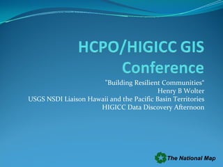
  • 1. "Building Resilient Communities“ Henry B Wolter USGS NSDI Liaison Hawaii and the Pacific Basin Territories HIGICC Data Discovery Afternoon
  • 2.
  • 3. HIGICC Data Discovery Afternoon September 25, 2009 Henry Wolter hwolter@usgs.gov
  • 4.
  • 5. Update on products and projects  for Hawaii Honolulu NGA/USGS  133 Cities refresh is complete.  Expected  delivery in October 2009. Planning for the 2010 NGA HNL refresh has started . 1ft NC , USNG tiles, Public Domain NOAA  Topo/Bathy complete
  • 7. USGS Products URL’s HBGN/HIGICC/USGS “Native Names Website,  http://hawaii.gov/debedt/gis/temp1/place_names/ USGS/Sate of Hawaii NHD info,  http://nhd.usgs.gov/index.html/ &  http://streamstats.usgs.gov Ridge to Reef Project (Integrated Science)  http://pubs.usgs.gov/sir/2007/5101/ Partnership/Grants http://www.fgdc.gov/grants National Geospatial Program  http://www.usgs.gov.gov/ngpo/
  • 8. Hawaiian Islands September 2009 - All outstanding DOQQ’s for Hawaii (Big Island) have been delivered. - All islands have .6 Meter Resolution, Four Band Orthoimagery data except Oahu (1 Ft., Natural Color). - Hawaii (Big Island) dataset is around 250 GB. - Leica GeoSystems is working with the USDA- NRCS to produce a tone matched mosaic using new mosaic technology.
  • 9. USDA-NRCS/USGS-Hawaii has PDF/ESRI-Shapefiles Orthoimagery Acquisition Dates for all DigitalGlobe Satellite data in the Hawaiian Islands.
  • 10. Imagery for the Nation Hawaii Islands Projected Funding Requirements Area in Square Kilometers Major Hawaiian Islands total including extra shoreline/water 17,750 Sq. K Projected Costs (3 Year Cycle) 1) Oahu (u133, NGA/USGS), 1 ft. GSD, 4 Band, etc… $ 400,000 2) All Other Islands, .6 Meter or better GSD, 16 bit, 4 Band, $ 595,000 1:12 K Orthoimagery, 2 Product (Pan Sharpened and RAW), Enterprise Premium Level License, Assumes 100-300K Purchased per year discount. NDOP Technical Specifications. (8/2009) Totals $ 995,000
  • 11. DigitalGlobe Enterprise Premium License Exclusions - The only exclusion in broad terms of the Enterprise Premium License is that DigitalGlobe QuickBird Imagery data itself could not be used by public/individuals engaged in using the product for “Commercial Exploitation or Commercial Purposes”. Essentially, the data cannot be re-sold in any way. - All Products or Derivative Works must contain the following copyright notice conspicuously displayed: “© DigitalGlobe, Inc. All Rights Reserved” for the Product, and “Includes copyrighted material of DigitalGlobe, Inc., All Rights Reserved” for Derivative Works. - Full Enterprise Premium License information will be made available when USDA releases the DigitalGlobe Satellite data