SlideShare une entreprise Scribd logo
1  sur  18
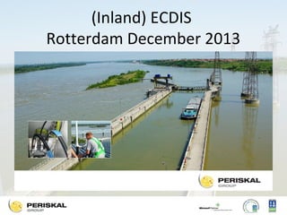
(Inland) ECDIS
Rotterdam December 2013
Overzicht
•
•
•
•
•
•

Korte voorstelling
Regelgeving
Overzicht binnenvaart in Europa
Gebruik van Inland ECDIS
Conclusies
Kritische noot
Periskal at a glance
• Software company, head office Belgium, sister
companies in the Netherlands, Serbia, Rumania and
Ukraine
• Since 1990, focus on Inland ECDIS systems and RIS
technology, 5000 customers – inland barges- in Europe,
32 employees
• Main products/core business:
– Inland ECDIS Viewer and Periskal Radar Overlay
– Software components for River Information Services
– Hardware components & complete AIS Base Stations networks

• Certified:
– DNV ISO 9001 -2008
– DNV ISO 14001
Inland ECDIS regulatoren
• CCR/ZKR, Donau commissie, Sava commissie
en UN-ECE
• Belangrijkste actor EU, commission regulation
909/2013 van 10/9/2013
• Expert groep Inland ECDIS en Inland ENC
Harmonisation Group die voorstellen maakt
voor nieuwe standaarden.
Verplichting in de Rijnvaart
CCR zal vanaf 1/1/2015 volgende verplichting
invoeren in de Rijnvaart:
“an Inland ECDIS in information mode or a
similar chart display system which has to be
connected to the Inland AIS and has to be
used with electronic inland navigation charts”
Verplichting op de Donau
• Per 1/1/2015 wordt het gebruik van Inland
ECDIS verplicht op de Donau in Servie.
• Gebruik van Inland AIS is reeds verplicht in
Oostenrijk, Hongarije en Croatische havens.
• Inland AIS wordt verplicht in Slowakije en
Servie per 1/1/2014
(non) Compatibility with Maritime
• Based on the same software specifications
• Different feature catalogues, Lookup tables,
Symbol Libraries and conditional Symbology
procedures.
• Two operation modi, information modus and
navigation modus
Informatie Modus
• Aanbevelingen
• Software oplossing, gekoppeld aan GPS en
Inland AIS
• Zogenaamde viewer van Inland ENC’s
• Incorporeert meestal ook de functionaliteiten
van Notices to Skipper, Electronice Reporting
en Vessel Tracking en Tracing Standaard.
Informatie modus aan boord
Navigatie Modus
• Verplicht kader
• Type keur bij FVT Koblenz
• Zeer gefocust op de Rijn Rivierradar
standaard
• Hardware beperkt gereguleerd
• Voorligging via map matching of GPS kompas
Periskal Radar Overlay
Vloot
• West Europa 8500 schepen
• Oost Europa – zonder Rusland - 1500 schepen
• Totaal van +/- 10000 commerciële
vrachtschepen en grote passagiersschepen.
• Daarbij nog vele werkschepen, sleepboten,
kleine passagiersvaart, grote en kleine
pleziervaart.
Inland ECDIS Ship applications
• Inland ECDIS information modus
used on more than 8500 commercial vessels
5000 Periskal and 3500 Tresco Engeering

• Inland ECDIS navigation modus
used on more than 1100 commercial vessels
150 Periskal, 250 Tresco Eng and 700 IN.
Status
•
•
•
•

Inland ECDIS is zeer verspreid
Algemeen aanvaard
Nuttig in gebruik
Groot verschil in prijs en opzet tussen
informatie en navigatie modus
• Succes door samenwerking overheid en
industrie
Kritische noot
• Vrijheden van Inland ECDIS informatie modus
• Afwijkend opzet van Navigatie modus
• Grote verschillen in Solas ECDIS met Inland
ECDIS
• Bizarre regelgeving die van kracht wordt
• Regels in mixed gebieden zoals
Westerschelde, Eems, Elbe, Kustvaart ?
Thank you for your attention.
Marc Persoons
Periskal group
www.periskal.com

Contenu connexe

Plus de Hydrographic Society Benelux

Toepassing van seismiek voor bepaling van de nautische bodem en detectie van ...
Toepassing van seismiek voor bepaling van de nautische bodem en detectie van ...Toepassing van seismiek voor bepaling van de nautische bodem en detectie van ...
Toepassing van seismiek voor bepaling van de nautische bodem en detectie van ...Hydrographic Society Benelux
 
Sedimentologisch en nautisch achtergrondonderzoek ten behoeve van baggerplann...
Sedimentologisch en nautisch achtergrondonderzoek ten behoeve van baggerplann...Sedimentologisch en nautisch achtergrondonderzoek ten behoeve van baggerplann...
Sedimentologisch en nautisch achtergrondonderzoek ten behoeve van baggerplann...Hydrographic Society Benelux
 
Innovative hydrographic data management: now and in the future
Innovative hydrographic data management: now and in the futureInnovative hydrographic data management: now and in the future
Innovative hydrographic data management: now and in the futureHydrographic Society Benelux
 
Drivers and uncertainties in past and future sea level changes
Drivers and uncertainties in past and future sea level changesDrivers and uncertainties in past and future sea level changes
Drivers and uncertainties in past and future sea level changesHydrographic Society Benelux
 
Opportunities for the Hydrographic Sector Using Satellite Observation Services
Opportunities for the Hydrographic Sector Using Satellite Observation ServicesOpportunities for the Hydrographic Sector Using Satellite Observation Services
Opportunities for the Hydrographic Sector Using Satellite Observation ServicesHydrographic Society Benelux
 
Advantages of a combined sonar data acquisition system for AUVs and ASVs
Advantages of a combined sonar data acquisition system for AUVs and ASVsAdvantages of a combined sonar data acquisition system for AUVs and ASVs
Advantages of a combined sonar data acquisition system for AUVs and ASVsHydrographic Society Benelux
 
The unmanned system in hydrographic applications (Z-Boat)
The unmanned system in hydrographic applications (Z-Boat)The unmanned system in hydrographic applications (Z-Boat)
The unmanned system in hydrographic applications (Z-Boat)Hydrographic Society Benelux
 
Enabling RTK-like positioning offshore using the global VERIPOS GNSS network
Enabling RTK-like positioning offshore using the global VERIPOS GNSS networkEnabling RTK-like positioning offshore using the global VERIPOS GNSS network
Enabling RTK-like positioning offshore using the global VERIPOS GNSS networkHydrographic Society Benelux
 
Gemini – Wind farm positioning beyond the horizon
Gemini – Wind farm positioning beyond the horizonGemini – Wind farm positioning beyond the horizon
Gemini – Wind farm positioning beyond the horizonHydrographic Society Benelux
 
Galileo 6 satellieten gelanceerd. Een statusoverzicht.
Galileo 6 satellieten gelanceerd. Een statusoverzicht.Galileo 6 satellieten gelanceerd. Een statusoverzicht.
Galileo 6 satellieten gelanceerd. Een statusoverzicht.Hydrographic Society Benelux
 

Plus de Hydrographic Society Benelux (20)

Toepassing van seismiek voor bepaling van de nautische bodem en detectie van ...
Toepassing van seismiek voor bepaling van de nautische bodem en detectie van ...Toepassing van seismiek voor bepaling van de nautische bodem en detectie van ...
Toepassing van seismiek voor bepaling van de nautische bodem en detectie van ...
 
Sedimentologisch en nautisch achtergrondonderzoek ten behoeve van baggerplann...
Sedimentologisch en nautisch achtergrondonderzoek ten behoeve van baggerplann...Sedimentologisch en nautisch achtergrondonderzoek ten behoeve van baggerplann...
Sedimentologisch en nautisch achtergrondonderzoek ten behoeve van baggerplann...
 
Slibvaren
SlibvarenSlibvaren
Slibvaren
 
Innovative hydrographic data management: now and in the future
Innovative hydrographic data management: now and in the futureInnovative hydrographic data management: now and in the future
Innovative hydrographic data management: now and in the future
 
Hydrographic and marine software Solutions
Hydrographic and marine software SolutionsHydrographic and marine software Solutions
Hydrographic and marine software Solutions
 
Software for the Hydrographic ocean
Software for the Hydrographic oceanSoftware for the Hydrographic ocean
Software for the Hydrographic ocean
 
Software for survey and engineering at sea
Software for survey and engineering at seaSoftware for survey and engineering at sea
Software for survey and engineering at sea
 
Drivers and uncertainties in past and future sea level changes
Drivers and uncertainties in past and future sea level changesDrivers and uncertainties in past and future sea level changes
Drivers and uncertainties in past and future sea level changes
 
Opportunities for the Hydrographic Sector Using Satellite Observation Services
Opportunities for the Hydrographic Sector Using Satellite Observation ServicesOpportunities for the Hydrographic Sector Using Satellite Observation Services
Opportunities for the Hydrographic Sector Using Satellite Observation Services
 
Advantages of a combined sonar data acquisition system for AUVs and ASVs
Advantages of a combined sonar data acquisition system for AUVs and ASVsAdvantages of a combined sonar data acquisition system for AUVs and ASVs
Advantages of a combined sonar data acquisition system for AUVs and ASVs
 
The unmanned system in hydrographic applications (Z-Boat)
The unmanned system in hydrographic applications (Z-Boat)The unmanned system in hydrographic applications (Z-Boat)
The unmanned system in hydrographic applications (Z-Boat)
 
Current developments in underwater autonomy
Current developments in underwater autonomyCurrent developments in underwater autonomy
Current developments in underwater autonomy
 
Positioning challenges on fallpipe vessels
Positioning challenges on fallpipe vesselsPositioning challenges on fallpipe vessels
Positioning challenges on fallpipe vessels
 
Enabling RTK-like positioning offshore using the global VERIPOS GNSS network
Enabling RTK-like positioning offshore using the global VERIPOS GNSS networkEnabling RTK-like positioning offshore using the global VERIPOS GNSS network
Enabling RTK-like positioning offshore using the global VERIPOS GNSS network
 
Gemini – Wind farm positioning beyond the horizon
Gemini – Wind farm positioning beyond the horizonGemini – Wind farm positioning beyond the horizon
Gemini – Wind farm positioning beyond the horizon
 
G2+ worldwide positioning services
G2+ worldwide positioning servicesG2+ worldwide positioning services
G2+ worldwide positioning services
 
Positioning the Solitaire
Positioning the SolitairePositioning the Solitaire
Positioning the Solitaire
 
GPS Status en Evolutie
GPS Status en EvolutieGPS Status en Evolutie
GPS Status en Evolutie
 
Galileo 6 satellieten gelanceerd. Een statusoverzicht.
Galileo 6 satellieten gelanceerd. Een statusoverzicht.Galileo 6 satellieten gelanceerd. Een statusoverzicht.
Galileo 6 satellieten gelanceerd. Een statusoverzicht.
 
Made in China: BEIDOU.
Made in China: BEIDOU. Made in China: BEIDOU.
Made in China: BEIDOU.
 

(Inland) ECDIS, stand van zaken

  • 2. Overzicht • • • • • • Korte voorstelling Regelgeving Overzicht binnenvaart in Europa Gebruik van Inland ECDIS Conclusies Kritische noot
  • 3. Periskal at a glance • Software company, head office Belgium, sister companies in the Netherlands, Serbia, Rumania and Ukraine • Since 1990, focus on Inland ECDIS systems and RIS technology, 5000 customers – inland barges- in Europe, 32 employees • Main products/core business: – Inland ECDIS Viewer and Periskal Radar Overlay – Software components for River Information Services – Hardware components & complete AIS Base Stations networks • Certified: – DNV ISO 9001 -2008 – DNV ISO 14001
  • 4. Inland ECDIS regulatoren • CCR/ZKR, Donau commissie, Sava commissie en UN-ECE • Belangrijkste actor EU, commission regulation 909/2013 van 10/9/2013 • Expert groep Inland ECDIS en Inland ENC Harmonisation Group die voorstellen maakt voor nieuwe standaarden.
  • 5. Verplichting in de Rijnvaart CCR zal vanaf 1/1/2015 volgende verplichting invoeren in de Rijnvaart: “an Inland ECDIS in information mode or a similar chart display system which has to be connected to the Inland AIS and has to be used with electronic inland navigation charts”
  • 6. Verplichting op de Donau • Per 1/1/2015 wordt het gebruik van Inland ECDIS verplicht op de Donau in Servie. • Gebruik van Inland AIS is reeds verplicht in Oostenrijk, Hongarije en Croatische havens. • Inland AIS wordt verplicht in Slowakije en Servie per 1/1/2014
  • 7. (non) Compatibility with Maritime • Based on the same software specifications • Different feature catalogues, Lookup tables, Symbol Libraries and conditional Symbology procedures. • Two operation modi, information modus and navigation modus
  • 8. Informatie Modus • Aanbevelingen • Software oplossing, gekoppeld aan GPS en Inland AIS • Zogenaamde viewer van Inland ENC’s • Incorporeert meestal ook de functionaliteiten van Notices to Skipper, Electronice Reporting en Vessel Tracking en Tracing Standaard.
  • 10.
  • 11.
  • 12. Navigatie Modus • Verplicht kader • Type keur bij FVT Koblenz • Zeer gefocust op de Rijn Rivierradar standaard • Hardware beperkt gereguleerd • Voorligging via map matching of GPS kompas
  • 14. Vloot • West Europa 8500 schepen • Oost Europa – zonder Rusland - 1500 schepen • Totaal van +/- 10000 commerciële vrachtschepen en grote passagiersschepen. • Daarbij nog vele werkschepen, sleepboten, kleine passagiersvaart, grote en kleine pleziervaart.
  • 15. Inland ECDIS Ship applications • Inland ECDIS information modus used on more than 8500 commercial vessels 5000 Periskal and 3500 Tresco Engeering • Inland ECDIS navigation modus used on more than 1100 commercial vessels 150 Periskal, 250 Tresco Eng and 700 IN.
  • 16. Status • • • • Inland ECDIS is zeer verspreid Algemeen aanvaard Nuttig in gebruik Groot verschil in prijs en opzet tussen informatie en navigatie modus • Succes door samenwerking overheid en industrie
  • 17. Kritische noot • Vrijheden van Inland ECDIS informatie modus • Afwijkend opzet van Navigatie modus • Grote verschillen in Solas ECDIS met Inland ECDIS • Bizarre regelgeving die van kracht wordt • Regels in mixed gebieden zoals Westerschelde, Eems, Elbe, Kustvaart ?
  • 18. Thank you for your attention. Marc Persoons Periskal group www.periskal.com