
Recommended
More Related Content
What's hot
What's hot (20)
Similar to Chapter 6 Section 3 (maps)
Similar to Chapter 6 Section 3 (maps) (20)
More from Mr. Motuk
More from Mr. Motuk (20)
Recently uploaded
Recently uploaded (20)
Chapter 6 Section 3 (maps)
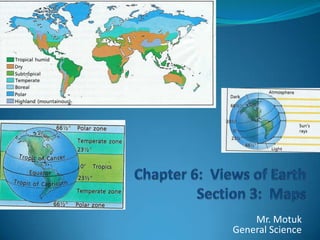
- 1. Chapter 6: Views of EarthSection 3: Maps Mr. MotukGeneral Science
- 2. How are Maps Used? Maps are used to model the Earth’s Surface. Maps are made using projections. Making a map of the Earth is difficult because you are placing a round sphere on flat paper. All maps have some type of distortion. Either distorted shape or distorted area.
- 3. Types of Map Projections Mercator Projection Represents continental shapes correctly. Areas of distortion: Polar regions get stretched out. Forms a grid of parallel lines of latitude and longitude. Mainly used for navigation. Airplanes and Boats.
- 4. Robinson Projection: Accurate continental shapes and areas. Distorts Polar region only. Displays Earth as a flat top and bottom oval.
- 5. Conic Projection: Used to project maps of small areas. Mainly used for Roads and Weather maps. Produced by projecting latitude and longitude onto a cone. Distorts latitudinal lines. (They arc)
- 6. Topographic Maps Map showing detailed elevations for an area. Project height onto a flat page using contour lines. Contour lines: connect different areas of equal elevation. Contour interval: difference between contour lines. Index contours: lines marked with an elevation.
- 7. Using Contour Maps Contour lines never cross!!!! Contour lines close around hills, basins, or depressions. Contour lines form V’s that point upstream. A MAP LEGEND tells common symbols. A MAP SCALE tells ratios for determining distance.
- 9. TOPOGRAPHIC MAP: HARRISBURG
- 10. Landsat Satellites Detect different wavelengths of energy reflected or emitted. Use mirrors with detectors to measure intensity. Produce digital image of surface features. Examples: Landsat Image from NASA
- 12. Topex Poseidon Satellites Topex= Topographical Experiment Uses RADAR to detect underwater ocean features. Develop maps of the ocean floor. Uses remote sensing under water. a. “Sea Beam” uses sonar to map the ocean floor.
Editor's Notes
- Presentation slide for courses, classes, lectures et al.