SlideShare une entreprise Scribd logo
1  sur  24
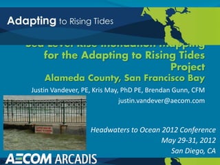
Justin Vandever, PE, Kris May, PhD PE, Brendan Gunn, CFM
                              justin.vandever@aecom.com


                   Headwaters to Ocean 2012 Conference
                                       May 29-31, 2012
                                         San Diego, CA
Project Team
 Project Management Team
  o MTC: Ashley Nguyen, Brenda Dix
  o BCDC: Wendy Goodfriend, Joe LaClair, Lindy Lowe
  o Caltrans: Stephen Yokoi, Richard Fahey
 Consultant Team
  o AECOM: Claire Bonham-Carter, Yanna Badet, Marcia
    Tobin, Sarah Heard, Jeff Chan, Ryan Park, Kris
    May, Justin Vandever, Brendan Gunn, Bob Fish, Stan
    Kline
  o Arcadis: Peter Wijsman, Lucas Paz
  o Geografika: Megan Gosch
  o 3D Visions: Kate Gillespie
ART and FHWA Background
Adapting to Rising Tides Project
 Partnership between SF Bay Conservation and
  Development Commission (BCDC) and NOAA
  Coastal Services Center
 Increase preparedness and resilience of Bay Area
  communities to sea level rise
 Evaluate shoreline impacts,
  vulnerabilities and risks,
  identify adaptation strategies
  and planning tools
ART and FHWA Background
Federal Highway Administration Risk Assessment
 Conceptual Model
   MTC, Caltrans, and BCDC collaborated on
    subregional planning pilot project
   Provides a framework for conducting risk and
    vulnerability assessments
   Test Federal Highway Administration (FHWA)
    conceptual Risk Assessment model to assess SLR
    risks to transportation infrastructure
   Portion of Alameda County shoreline selected for
    study area
Pilot Study: Alameda County
 One of Several Pilot
                             Bay
  Studies to test the FHWA   Bridge
  Conceptual Model                                         Previous
  (Vulnerability of                                        USGS/BCDC
                               Alameda                     Maps
  Transportation Assets to     Island
  Climate Change)
 Alameda County: Diverse                Airport
  Range of Shore
  Protection and
  Transportation Assets
 Project Extent:                           San Mateo
                                            Bridge
  Emeryville to Union City                         Salt
                                                   Ponds
Federal Highway
Administration
Vulnerability and
Risk Assessment
Conceptual Model
1. Data Asset Inventory

2. Asset Screening and
   Prioritization

3. Climate and Shoreline
   Information

4. Vulnerability Assessment

5. Risk Assessment

6. Next Steps/ Adaptation
   Strategies
Transportation Asset Inventory
Roads
Transit
Facilities
Bike/Pedestrian


Map: Geografika
Shoreline Asset Inventory
    Identify the topographic feature that controls
     inundation landward of shoreline (e.g., levee, road
     embankment, beach, etc)
    May not be the true “shoreline” (e.g., MHW, etc)
    Shoreline Categories
    1.   Engineered Flood Protection Structures
    2.   Engineered Shoreline Protection Structures
    3.   Non-Engineered Berms
    4.   Wetlands
    5.   Natural Shorelines (Non-Wetland)
    Shoreline delineation will be used later to determine
     vulnerability to inundation
Shoreline Asset Categories
                                                     Engineered Shoreline Protection
    Flood Protection Levee


                             Natural Shoreline (non-wetland)


Non-Engineered Berm              Images: Google Earth            Wetland Shoreline
Shoreline Categorization Maps

Wetland


                                          Berms
Engineered
Shoreline
Protection Natural


             Engineered
             Flood
             Protection
                          Maps: Arcadis
Sea Level Rise Scenarios for
  Inundation Mapping
 Sea Level Rise
   o 16” (high-end 2050)
   o 55” (mid-range 2100)
 Inundation Map Scenarios
   o MHHW + 16”
   o MHHW + 55”
   o 100-yr SWL + 16”
   o 100-yr SWL + 55”
   o 100-yr SWL + 16” + wind/wave
   o 100-yr SWL + 55” + wind/wave Map: Geografika
 Include depth of inundation and hydraulic connectivity
Inundation Scenarios
 MHHW – Mean Higher High Water. Typical daily high tide.
  Frequent inundation.
 100-yr Stillwater Level (SWL) – Extreme high tide. Very rare
  event. Also, the 1%-annual-chance tide level. No wave or local
  meteorological effects.
 100-yr SWL + wind and wave effects. Includes wind setup and
  wave setup at the shoreline. Includes wave height effects (but
  not wave runup or overtopping). Extreme coastal flood event.
               wind/wave
Inundation Mapping Inputs
 Topography: 2m Digital Elevation Model (DEM) using 2010 CA
 Coastal LIDAR (USGS)
 Daily and extreme tide levels – USGS TRIM2D (Knowles, 2009)

 Storm wave scenarios – FEMA MIKE21 hydrodynamic model:
 wind setup, wave setup, wave height (DHI, 2010)
 Hydraulic Connectivity – resolved using NOAA CSC
 methodology (Marcy et al., 2011)
 Depth of Inundation grids – depth
 along shoreline and at transportation
 assets
Ocean Protection Council LIDAR
                      USGS 2010
                      Complete Coverage
                       to 10 m Contour
                      2 m DEM used for
                       inundation
                       mapping
                      Resolves Levees
USGS TRIM2D Modeling
      Hydrodynamic Model
      Extraction Points
                            100-yr Water Level Time Series
                            (Detrended = SLR trend removed)


Estimate MHHW and 100-yr SWL at each extraction point
FEMA MIKE21 Modeling
                        DHI (2010) for
                           FEMA
                          32-year
                           Continuous
                           Hindcast
                          Water Levels
   Swell
                           (MIKE21 HD)
                          Wind Waves
                           (MIKE21 SW)
                          Ocean Swell
                           (MIKE21 SW)
NOAA Methodology
 Sea Level Rise Viewer (Marcy et al, 2011)
 Hydraulic Connectivity
 Inputs:
  o Water Surface
    Elevation (DEM)
    at Shoreline
  o Transect Definition
  o DEM (at a resolution
    that resolves
    shoreline features)
Mid Century (16” SLR)
MHHW              100-yr SWL


                 Maps: Geografika
Mid Century (16” SLR)
100-yr SWL         Shoreline
                   Overtopping
                   Potential


Maps: Geografika
End of Century (55” SLR)
          Maps: Geografika


MHHW                         100-yr SWL
End of Century (55” SLR)

                   Shoreline
                   Overtopping
                   Potential


100-yr SWL         Maps: Geografika
Maps Help Quantify Exposure
 Overlay Transportation
  Assets with 6 Inundation
  Maps
 Assess for each Asset,
  for each Scenario:
  o Is it Inundated?
  o Max Depth of
    Inundation?
 Distance from asset to
  overtopped shoreline
 Percent of shoreline
  overtopped
Risk Profiles
 Road Networks
   o Interstates/Freeway
   o Bridges/Tubes
   o Local Streets
 Transit
   o Bus Routes
   o Bart Alignments
   o Rail Corridors
 Facilities
 Bike & Pedestrian Paths
Wrap-up
 Download the report online:
  http://www.mtc.ca.gov/planning/climate/
    Completed in Nov. 2011
    Briefing Book
    Full Report
 Thank you


Justin Vandever, PE
AECOM
Oakland, CA
justin.vandever@aecom.com

Contenu connexe

Tendances

Shoreline Change in Urban Massachusetts, Time for Retreat?
Shoreline Change in Urban Massachusetts, Time for Retreat?Shoreline Change in Urban Massachusetts, Time for Retreat?
Shoreline Change in Urban Massachusetts, Time for Retreat?Lisa Granquist
 
Erosion As Pollution: The net economic and shoreline effects of coastal struc...
Erosion As Pollution: The net economic and shoreline effects of coastal struc...Erosion As Pollution: The net economic and shoreline effects of coastal struc...
Erosion As Pollution: The net economic and shoreline effects of coastal struc...Lisa Granquist
 
Chapter 1 introduction to coastal engineering and management strategies
Chapter  1 introduction to coastal engineering and management strategiesChapter  1 introduction to coastal engineering and management strategies
Chapter 1 introduction to coastal engineering and management strategiesMohsin Siddique
 
TUREK SALT MARSH RESTORATION FINAL 12 09 14
TUREK SALT MARSH RESTORATION FINAL 12 09 14TUREK SALT MARSH RESTORATION FINAL 12 09 14
TUREK SALT MARSH RESTORATION FINAL 12 09 14Turek James ("Jim")
 
OMONIYI_2008_B.TECH_PROJECT
OMONIYI_2008_B.TECH_PROJECTOMONIYI_2008_B.TECH_PROJECT
OMONIYI_2008_B.TECH_PROJECTOmoniyi Itamuko
 
R.sres final
R.sres finalR.sres final
R.sres finalrpsresov
 
Beach surf zone morphodynamics muy bueno
Beach surf zone morphodynamics muy buenoBeach surf zone morphodynamics muy bueno
Beach surf zone morphodynamics muy buenoEdgar Bernabe
 
River Medina restoration report
River Medina restoration reportRiver Medina restoration report
River Medina restoration reportJoshua Day
 
Annals of Limnology and Oceanography
Annals of Limnology and OceanographyAnnals of Limnology and Oceanography
Annals of Limnology and Oceanographypeertechzpublication
 
Municipal Adaptations to Create Resilient Beach Communities
Municipal Adaptations to Create Resilient Beach CommunitiesMunicipal Adaptations to Create Resilient Beach Communities
Municipal Adaptations to Create Resilient Beach CommunitiesSMRPC
 
Sustainable periodic-navigation-channel-assessment
Sustainable periodic-navigation-channel-assessmentSustainable periodic-navigation-channel-assessment
Sustainable periodic-navigation-channel-assessmentOladokun Sulaiman Olanrewaju
 
Structural controls on turbidity current evolution and factors affecting rese...
Structural controls on turbidity current evolution and factors affecting rese...Structural controls on turbidity current evolution and factors affecting rese...
Structural controls on turbidity current evolution and factors affecting rese...Ben Thomas
 

Tendances (16)

Shoreline Change in Urban Massachusetts, Time for Retreat?
Shoreline Change in Urban Massachusetts, Time for Retreat?Shoreline Change in Urban Massachusetts, Time for Retreat?
Shoreline Change in Urban Massachusetts, Time for Retreat?
 
Erosion As Pollution: The net economic and shoreline effects of coastal struc...
Erosion As Pollution: The net economic and shoreline effects of coastal struc...Erosion As Pollution: The net economic and shoreline effects of coastal struc...
Erosion As Pollution: The net economic and shoreline effects of coastal struc...
 
Chapter 1 introduction to coastal engineering and management strategies
Chapter  1 introduction to coastal engineering and management strategiesChapter  1 introduction to coastal engineering and management strategies
Chapter 1 introduction to coastal engineering and management strategies
 
TUREK SALT MARSH RESTORATION FINAL 12 09 14
TUREK SALT MARSH RESTORATION FINAL 12 09 14TUREK SALT MARSH RESTORATION FINAL 12 09 14
TUREK SALT MARSH RESTORATION FINAL 12 09 14
 
OMONIYI_2008_B.TECH_PROJECT
OMONIYI_2008_B.TECH_PROJECTOMONIYI_2008_B.TECH_PROJECT
OMONIYI_2008_B.TECH_PROJECT
 
R.sres final
R.sres finalR.sres final
R.sres final
 
Beach surf zone morphodynamics muy bueno
Beach surf zone morphodynamics muy buenoBeach surf zone morphodynamics muy bueno
Beach surf zone morphodynamics muy bueno
 
Final presentation
Final presentationFinal presentation
Final presentation
 
River Medina restoration report
River Medina restoration reportRiver Medina restoration report
River Medina restoration report
 
Poster Presentation
Poster PresentationPoster Presentation
Poster Presentation
 
Annals of Limnology and Oceanography
Annals of Limnology and OceanographyAnnals of Limnology and Oceanography
Annals of Limnology and Oceanography
 
Municipal Adaptations to Create Resilient Beach Communities
Municipal Adaptations to Create Resilient Beach CommunitiesMunicipal Adaptations to Create Resilient Beach Communities
Municipal Adaptations to Create Resilient Beach Communities
 
ENV 101 Ch05 lecture ppt_a
ENV 101 Ch05 lecture ppt_aENV 101 Ch05 lecture ppt_a
ENV 101 Ch05 lecture ppt_a
 
ENV 101 Ch06 lecture ppt_a
ENV 101 Ch06 lecture ppt_aENV 101 Ch06 lecture ppt_a
ENV 101 Ch06 lecture ppt_a
 
Sustainable periodic-navigation-channel-assessment
Sustainable periodic-navigation-channel-assessmentSustainable periodic-navigation-channel-assessment
Sustainable periodic-navigation-channel-assessment
 
Structural controls on turbidity current evolution and factors affecting rese...
Structural controls on turbidity current evolution and factors affecting rese...Structural controls on turbidity current evolution and factors affecting rese...
Structural controls on turbidity current evolution and factors affecting rese...
 

Similaire à Sea Level Rise Inundation Mapping for the ART Project

Lecture by Prof. Salvatore Manfreda
Lecture by Prof. Salvatore ManfredaLecture by Prof. Salvatore Manfreda
Lecture by Prof. Salvatore ManfredaSalvatore Manfreda
 
Farms, Floods And Fluvial Geomorphology: Making The Most of Our Natural Resou...
Farms, Floods And Fluvial Geomorphology: Making The Most of Our Natural Resou...Farms, Floods And Fluvial Geomorphology: Making The Most of Our Natural Resou...
Farms, Floods And Fluvial Geomorphology: Making The Most of Our Natural Resou...National Institute of Food and Agriculture
 
Slovinsky Coastal Resiliency
Slovinsky Coastal ResiliencySlovinsky Coastal Resiliency
Slovinsky Coastal ResiliencyWellsReserve
 
Short Version of Wet Area Mapping CANNOR
Short Version of Wet Area Mapping CANNORShort Version of Wet Area Mapping CANNOR
Short Version of Wet Area Mapping CANNORGustavo Moran
 
Sea level rise and storm surge tools and datasets supporting Municipal Resili...
Sea level rise and storm surge tools and datasets supporting Municipal Resili...Sea level rise and storm surge tools and datasets supporting Municipal Resili...
Sea level rise and storm surge tools and datasets supporting Municipal Resili...GrowSmart Maine
 
SWOT_Fu_2011_IGARSS.ppt
SWOT_Fu_2011_IGARSS.pptSWOT_Fu_2011_IGARSS.ppt
SWOT_Fu_2011_IGARSS.pptgrssieee
 
Coastal Urban DEM project - Mapping the vulnerability of Australia's Coast
Coastal Urban DEM project - Mapping the vulnerability of Australia's CoastCoastal Urban DEM project - Mapping the vulnerability of Australia's Coast
Coastal Urban DEM project - Mapping the vulnerability of Australia's CoastFungis Queensland
 
13ArjanBraamskamp_NICHI_BusinessSummit
13ArjanBraamskamp_NICHI_BusinessSummit13ArjanBraamskamp_NICHI_BusinessSummit
13ArjanBraamskamp_NICHI_BusinessSummitNICHI_USA
 
Projected Climate Change Impacts for Rhode Island’s Coast: A Summary of the S...
Projected Climate Change Impacts for Rhode Island’s Coast: A Summary of the S...Projected Climate Change Impacts for Rhode Island’s Coast: A Summary of the S...
Projected Climate Change Impacts for Rhode Island’s Coast: A Summary of the S...riseagrant
 
DSD-INT 2016 Modelling of morphodynamic impacts on coasts during extreme even...
DSD-INT 2016 Modelling of morphodynamic impacts on coasts during extreme even...DSD-INT 2016 Modelling of morphodynamic impacts on coasts during extreme even...
DSD-INT 2016 Modelling of morphodynamic impacts on coasts during extreme even...Deltares
 
ASFPM 2016: The History of Coastal Flood Hazard Assessments in the Great Lakes
ASFPM 2016: The History of Coastal Flood Hazard Assessments in the Great LakesASFPM 2016: The History of Coastal Flood Hazard Assessments in the Great Lakes
ASFPM 2016: The History of Coastal Flood Hazard Assessments in the Great LakesCDM Smith
 
The History of Coastal Flood Hazard Assessments in the Great Lakes
The History of Coastal Flood Hazard Assessments in the Great LakesThe History of Coastal Flood Hazard Assessments in the Great Lakes
The History of Coastal Flood Hazard Assessments in the Great LakesDaryl Shepard
 
DHI UK & Ireland Symposium 2017 Programme
DHI UK & Ireland Symposium 2017 ProgrammeDHI UK & Ireland Symposium 2017 Programme
DHI UK & Ireland Symposium 2017 ProgrammeStephen Flood
 
Climate change preparedness and engagement in southwest florida 10 21-19
Climate change preparedness and engagement in southwest florida 10 21-19Climate change preparedness and engagement in southwest florida 10 21-19
Climate change preparedness and engagement in southwest florida 10 21-19David Silverberg
 
Investigations on the Effectiveness of Coastal Vegetation in Tsunami Impact M...
Investigations on the Effectiveness of Coastal Vegetation in Tsunami Impact M...Investigations on the Effectiveness of Coastal Vegetation in Tsunami Impact M...
Investigations on the Effectiveness of Coastal Vegetation in Tsunami Impact M...Global Risk Forum GRFDavos
 

Similaire à Sea Level Rise Inundation Mapping for the ART Project (20)

Lecture by Prof. Salvatore Manfreda
Lecture by Prof. Salvatore ManfredaLecture by Prof. Salvatore Manfreda
Lecture by Prof. Salvatore Manfreda
 
Farms, Floods And Fluvial Geomorphology: Making The Most of Our Natural Resou...
Farms, Floods And Fluvial Geomorphology: Making The Most of Our Natural Resou...Farms, Floods And Fluvial Geomorphology: Making The Most of Our Natural Resou...
Farms, Floods And Fluvial Geomorphology: Making The Most of Our Natural Resou...
 
Slovinsky Coastal Resiliency
Slovinsky Coastal ResiliencySlovinsky Coastal Resiliency
Slovinsky Coastal Resiliency
 
Short Version of Wet Area Mapping CANNOR
Short Version of Wet Area Mapping CANNORShort Version of Wet Area Mapping CANNOR
Short Version of Wet Area Mapping CANNOR
 
Climate change and Coastal India
Climate change and Coastal IndiaClimate change and Coastal India
Climate change and Coastal India
 
Sea level rise and storm surge tools and datasets supporting Municipal Resili...
Sea level rise and storm surge tools and datasets supporting Municipal Resili...Sea level rise and storm surge tools and datasets supporting Municipal Resili...
Sea level rise and storm surge tools and datasets supporting Municipal Resili...
 
SWOT_Fu_2011_IGARSS.ppt
SWOT_Fu_2011_IGARSS.pptSWOT_Fu_2011_IGARSS.ppt
SWOT_Fu_2011_IGARSS.ppt
 
Coastal Urban DEM project - Mapping the vulnerability of Australia's Coast
Coastal Urban DEM project - Mapping the vulnerability of Australia's CoastCoastal Urban DEM project - Mapping the vulnerability of Australia's Coast
Coastal Urban DEM project - Mapping the vulnerability of Australia's Coast
 
13ArjanBraamskamp_NICHI_BusinessSummit
13ArjanBraamskamp_NICHI_BusinessSummit13ArjanBraamskamp_NICHI_BusinessSummit
13ArjanBraamskamp_NICHI_BusinessSummit
 
Wisconsins Great Lakes Shoreline Viewer
Wisconsins Great Lakes Shoreline ViewerWisconsins Great Lakes Shoreline Viewer
Wisconsins Great Lakes Shoreline Viewer
 
Projected Climate Change Impacts for Rhode Island’s Coast: A Summary of the S...
Projected Climate Change Impacts for Rhode Island’s Coast: A Summary of the S...Projected Climate Change Impacts for Rhode Island’s Coast: A Summary of the S...
Projected Climate Change Impacts for Rhode Island’s Coast: A Summary of the S...
 
DSD-INT 2016 Modelling of morphodynamic impacts on coasts during extreme even...
DSD-INT 2016 Modelling of morphodynamic impacts on coasts during extreme even...DSD-INT 2016 Modelling of morphodynamic impacts on coasts during extreme even...
DSD-INT 2016 Modelling of morphodynamic impacts on coasts during extreme even...
 
ASFPM 2016: The History of Coastal Flood Hazard Assessments in the Great Lakes
ASFPM 2016: The History of Coastal Flood Hazard Assessments in the Great LakesASFPM 2016: The History of Coastal Flood Hazard Assessments in the Great Lakes
ASFPM 2016: The History of Coastal Flood Hazard Assessments in the Great Lakes
 
The History of Coastal Flood Hazard Assessments in the Great Lakes
The History of Coastal Flood Hazard Assessments in the Great LakesThe History of Coastal Flood Hazard Assessments in the Great Lakes
The History of Coastal Flood Hazard Assessments in the Great Lakes
 
Landscape Visualizations
Landscape VisualizationsLandscape Visualizations
Landscape Visualizations
 
DHI UK & Ireland Symposium 2017 Programme
DHI UK & Ireland Symposium 2017 ProgrammeDHI UK & Ireland Symposium 2017 Programme
DHI UK & Ireland Symposium 2017 Programme
 
11. Further Catchment Characterisation
11. Further Catchment Characterisation 11. Further Catchment Characterisation
11. Further Catchment Characterisation
 
Climate change preparedness and engagement in southwest florida 10 21-19
Climate change preparedness and engagement in southwest florida 10 21-19Climate change preparedness and engagement in southwest florida 10 21-19
Climate change preparedness and engagement in southwest florida 10 21-19
 
WRDSeminar_rmartyr
WRDSeminar_rmartyrWRDSeminar_rmartyr
WRDSeminar_rmartyr
 
Investigations on the Effectiveness of Coastal Vegetation in Tsunami Impact M...
Investigations on the Effectiveness of Coastal Vegetation in Tsunami Impact M...Investigations on the Effectiveness of Coastal Vegetation in Tsunami Impact M...
Investigations on the Effectiveness of Coastal Vegetation in Tsunami Impact M...
 

Dernier

Dev Dives: Streamline document processing with UiPath Studio Web
Dev Dives: Streamline document processing with UiPath Studio WebDev Dives: Streamline document processing with UiPath Studio Web
Dev Dives: Streamline document processing with UiPath Studio WebUiPathCommunity
 
New from BookNet Canada for 2024: BNC CataList - Tech Forum 2024
New from BookNet Canada for 2024: BNC CataList - Tech Forum 2024New from BookNet Canada for 2024: BNC CataList - Tech Forum 2024
New from BookNet Canada for 2024: BNC CataList - Tech Forum 2024BookNet Canada
 
Tampa BSides - Chef's Tour of Microsoft Security Adoption Framework (SAF)
Tampa BSides - Chef's Tour of Microsoft Security Adoption Framework (SAF)Tampa BSides - Chef's Tour of Microsoft Security Adoption Framework (SAF)
Tampa BSides - Chef's Tour of Microsoft Security Adoption Framework (SAF)Mark Simos
 
TeamStation AI System Report LATAM IT Salaries 2024
TeamStation AI System Report LATAM IT Salaries 2024TeamStation AI System Report LATAM IT Salaries 2024
TeamStation AI System Report LATAM IT Salaries 2024Lonnie McRorey
 
The Role of FIDO in a Cyber Secure Netherlands: FIDO Paris Seminar.pptx
The Role of FIDO in a Cyber Secure Netherlands: FIDO Paris Seminar.pptxThe Role of FIDO in a Cyber Secure Netherlands: FIDO Paris Seminar.pptx
The Role of FIDO in a Cyber Secure Netherlands: FIDO Paris Seminar.pptxLoriGlavin3
 
DSPy a system for AI to Write Prompts and Do Fine Tuning
DSPy a system for AI to Write Prompts and Do Fine TuningDSPy a system for AI to Write Prompts and Do Fine Tuning
DSPy a system for AI to Write Prompts and Do Fine TuningLars Bell
 
The Fit for Passkeys for Employee and Consumer Sign-ins: FIDO Paris Seminar.pptx
The Fit for Passkeys for Employee and Consumer Sign-ins: FIDO Paris Seminar.pptxThe Fit for Passkeys for Employee and Consumer Sign-ins: FIDO Paris Seminar.pptx
The Fit for Passkeys for Employee and Consumer Sign-ins: FIDO Paris Seminar.pptxLoriGlavin3
 
How to write a Business Continuity Plan
How to write a Business Continuity PlanHow to write a Business Continuity Plan
How to write a Business Continuity PlanDatabarracks
 
Gen AI in Business - Global Trends Report 2024.pdf
Gen AI in Business - Global Trends Report 2024.pdfGen AI in Business - Global Trends Report 2024.pdf
Gen AI in Business - Global Trends Report 2024.pdfAddepto
 
Take control of your SAP testing with UiPath Test Suite
Take control of your SAP testing with UiPath Test SuiteTake control of your SAP testing with UiPath Test Suite
Take control of your SAP testing with UiPath Test SuiteDianaGray10
 
Developer Data Modeling Mistakes: From Postgres to NoSQL
Developer Data Modeling Mistakes: From Postgres to NoSQLDeveloper Data Modeling Mistakes: From Postgres to NoSQL
Developer Data Modeling Mistakes: From Postgres to NoSQLScyllaDB
 
Nell’iperspazio con Rocket: il Framework Web di Rust!
Nell’iperspazio con Rocket: il Framework Web di Rust!Nell’iperspazio con Rocket: il Framework Web di Rust!
Nell’iperspazio con Rocket: il Framework Web di Rust!Commit University
 
How AI, OpenAI, and ChatGPT impact business and software.
How AI, OpenAI, and ChatGPT impact business and software.How AI, OpenAI, and ChatGPT impact business and software.
How AI, OpenAI, and ChatGPT impact business and software.Curtis Poe
 
Anypoint Exchange: It’s Not Just a Repo!
Anypoint Exchange: It’s Not Just a Repo!Anypoint Exchange: It’s Not Just a Repo!
Anypoint Exchange: It’s Not Just a Repo!Manik S Magar
 
The State of Passkeys with FIDO Alliance.pptx
The State of Passkeys with FIDO Alliance.pptxThe State of Passkeys with FIDO Alliance.pptx
The State of Passkeys with FIDO Alliance.pptxLoriGlavin3
 
"ML in Production",Oleksandr Bagan
"ML in Production",Oleksandr Bagan"ML in Production",Oleksandr Bagan
"ML in Production",Oleksandr BaganFwdays
 
Use of FIDO in the Payments and Identity Landscape: FIDO Paris Seminar.pptx
Use of FIDO in the Payments and Identity Landscape: FIDO Paris Seminar.pptxUse of FIDO in the Payments and Identity Landscape: FIDO Paris Seminar.pptx
Use of FIDO in the Payments and Identity Landscape: FIDO Paris Seminar.pptxLoriGlavin3
 
Training state-of-the-art general text embedding
Training state-of-the-art general text embeddingTraining state-of-the-art general text embedding
Training state-of-the-art general text embeddingZilliz
 
Merck Moving Beyond Passwords: FIDO Paris Seminar.pptx
Merck Moving Beyond Passwords: FIDO Paris Seminar.pptxMerck Moving Beyond Passwords: FIDO Paris Seminar.pptx
Merck Moving Beyond Passwords: FIDO Paris Seminar.pptxLoriGlavin3
 
Time Series Foundation Models - current state and future directions
Time Series Foundation Models - current state and future directionsTime Series Foundation Models - current state and future directions
Time Series Foundation Models - current state and future directionsNathaniel Shimoni
 

Dernier (20)

Dev Dives: Streamline document processing with UiPath Studio Web
Dev Dives: Streamline document processing with UiPath Studio WebDev Dives: Streamline document processing with UiPath Studio Web
Dev Dives: Streamline document processing with UiPath Studio Web
 
New from BookNet Canada for 2024: BNC CataList - Tech Forum 2024
New from BookNet Canada for 2024: BNC CataList - Tech Forum 2024New from BookNet Canada for 2024: BNC CataList - Tech Forum 2024
New from BookNet Canada for 2024: BNC CataList - Tech Forum 2024
 
Tampa BSides - Chef's Tour of Microsoft Security Adoption Framework (SAF)
Tampa BSides - Chef's Tour of Microsoft Security Adoption Framework (SAF)Tampa BSides - Chef's Tour of Microsoft Security Adoption Framework (SAF)
Tampa BSides - Chef's Tour of Microsoft Security Adoption Framework (SAF)
 
TeamStation AI System Report LATAM IT Salaries 2024
TeamStation AI System Report LATAM IT Salaries 2024TeamStation AI System Report LATAM IT Salaries 2024
TeamStation AI System Report LATAM IT Salaries 2024
 
The Role of FIDO in a Cyber Secure Netherlands: FIDO Paris Seminar.pptx
The Role of FIDO in a Cyber Secure Netherlands: FIDO Paris Seminar.pptxThe Role of FIDO in a Cyber Secure Netherlands: FIDO Paris Seminar.pptx
The Role of FIDO in a Cyber Secure Netherlands: FIDO Paris Seminar.pptx
 
DSPy a system for AI to Write Prompts and Do Fine Tuning
DSPy a system for AI to Write Prompts and Do Fine TuningDSPy a system for AI to Write Prompts and Do Fine Tuning
DSPy a system for AI to Write Prompts and Do Fine Tuning
 
The Fit for Passkeys for Employee and Consumer Sign-ins: FIDO Paris Seminar.pptx
The Fit for Passkeys for Employee and Consumer Sign-ins: FIDO Paris Seminar.pptxThe Fit for Passkeys for Employee and Consumer Sign-ins: FIDO Paris Seminar.pptx
The Fit for Passkeys for Employee and Consumer Sign-ins: FIDO Paris Seminar.pptx
 
How to write a Business Continuity Plan
How to write a Business Continuity PlanHow to write a Business Continuity Plan
How to write a Business Continuity Plan
 
Gen AI in Business - Global Trends Report 2024.pdf
Gen AI in Business - Global Trends Report 2024.pdfGen AI in Business - Global Trends Report 2024.pdf
Gen AI in Business - Global Trends Report 2024.pdf
 
Take control of your SAP testing with UiPath Test Suite
Take control of your SAP testing with UiPath Test SuiteTake control of your SAP testing with UiPath Test Suite
Take control of your SAP testing with UiPath Test Suite
 
Developer Data Modeling Mistakes: From Postgres to NoSQL
Developer Data Modeling Mistakes: From Postgres to NoSQLDeveloper Data Modeling Mistakes: From Postgres to NoSQL
Developer Data Modeling Mistakes: From Postgres to NoSQL
 
Nell’iperspazio con Rocket: il Framework Web di Rust!
Nell’iperspazio con Rocket: il Framework Web di Rust!Nell’iperspazio con Rocket: il Framework Web di Rust!
Nell’iperspazio con Rocket: il Framework Web di Rust!
 
How AI, OpenAI, and ChatGPT impact business and software.
How AI, OpenAI, and ChatGPT impact business and software.How AI, OpenAI, and ChatGPT impact business and software.
How AI, OpenAI, and ChatGPT impact business and software.
 
Anypoint Exchange: It’s Not Just a Repo!
Anypoint Exchange: It’s Not Just a Repo!Anypoint Exchange: It’s Not Just a Repo!
Anypoint Exchange: It’s Not Just a Repo!
 
The State of Passkeys with FIDO Alliance.pptx
The State of Passkeys with FIDO Alliance.pptxThe State of Passkeys with FIDO Alliance.pptx
The State of Passkeys with FIDO Alliance.pptx
 
"ML in Production",Oleksandr Bagan
"ML in Production",Oleksandr Bagan"ML in Production",Oleksandr Bagan
"ML in Production",Oleksandr Bagan
 
Use of FIDO in the Payments and Identity Landscape: FIDO Paris Seminar.pptx
Use of FIDO in the Payments and Identity Landscape: FIDO Paris Seminar.pptxUse of FIDO in the Payments and Identity Landscape: FIDO Paris Seminar.pptx
Use of FIDO in the Payments and Identity Landscape: FIDO Paris Seminar.pptx
 
Training state-of-the-art general text embedding
Training state-of-the-art general text embeddingTraining state-of-the-art general text embedding
Training state-of-the-art general text embedding
 
Merck Moving Beyond Passwords: FIDO Paris Seminar.pptx
Merck Moving Beyond Passwords: FIDO Paris Seminar.pptxMerck Moving Beyond Passwords: FIDO Paris Seminar.pptx
Merck Moving Beyond Passwords: FIDO Paris Seminar.pptx
 
Time Series Foundation Models - current state and future directions
Time Series Foundation Models - current state and future directionsTime Series Foundation Models - current state and future directions
Time Series Foundation Models - current state and future directions
 

Sea Level Rise Inundation Mapping for the ART Project

  • 1. Justin Vandever, PE, Kris May, PhD PE, Brendan Gunn, CFM justin.vandever@aecom.com Headwaters to Ocean 2012 Conference May 29-31, 2012 San Diego, CA
  • 2. Project Team  Project Management Team o MTC: Ashley Nguyen, Brenda Dix o BCDC: Wendy Goodfriend, Joe LaClair, Lindy Lowe o Caltrans: Stephen Yokoi, Richard Fahey  Consultant Team o AECOM: Claire Bonham-Carter, Yanna Badet, Marcia Tobin, Sarah Heard, Jeff Chan, Ryan Park, Kris May, Justin Vandever, Brendan Gunn, Bob Fish, Stan Kline o Arcadis: Peter Wijsman, Lucas Paz o Geografika: Megan Gosch o 3D Visions: Kate Gillespie
  • 3. ART and FHWA Background Adapting to Rising Tides Project  Partnership between SF Bay Conservation and Development Commission (BCDC) and NOAA Coastal Services Center  Increase preparedness and resilience of Bay Area communities to sea level rise  Evaluate shoreline impacts, vulnerabilities and risks, identify adaptation strategies and planning tools
  • 4. ART and FHWA Background Federal Highway Administration Risk Assessment Conceptual Model  MTC, Caltrans, and BCDC collaborated on subregional planning pilot project  Provides a framework for conducting risk and vulnerability assessments  Test Federal Highway Administration (FHWA) conceptual Risk Assessment model to assess SLR risks to transportation infrastructure  Portion of Alameda County shoreline selected for study area
  • 5. Pilot Study: Alameda County  One of Several Pilot Bay Studies to test the FHWA Bridge Conceptual Model Previous (Vulnerability of USGS/BCDC Alameda Maps Transportation Assets to Island Climate Change)  Alameda County: Diverse Airport Range of Shore Protection and Transportation Assets  Project Extent: San Mateo Bridge Emeryville to Union City Salt Ponds
  • 6. Federal Highway Administration Vulnerability and Risk Assessment Conceptual Model 1. Data Asset Inventory 2. Asset Screening and Prioritization 3. Climate and Shoreline Information 4. Vulnerability Assessment 5. Risk Assessment 6. Next Steps/ Adaptation Strategies
  • 8. Shoreline Asset Inventory  Identify the topographic feature that controls inundation landward of shoreline (e.g., levee, road embankment, beach, etc)  May not be the true “shoreline” (e.g., MHW, etc)  Shoreline Categories 1. Engineered Flood Protection Structures 2. Engineered Shoreline Protection Structures 3. Non-Engineered Berms 4. Wetlands 5. Natural Shorelines (Non-Wetland)  Shoreline delineation will be used later to determine vulnerability to inundation
  • 9. Shoreline Asset Categories Engineered Shoreline Protection Flood Protection Levee Natural Shoreline (non-wetland) Non-Engineered Berm Images: Google Earth Wetland Shoreline
  • 10. Shoreline Categorization Maps Wetland Berms Engineered Shoreline Protection Natural Engineered Flood Protection Maps: Arcadis
  • 11. Sea Level Rise Scenarios for Inundation Mapping  Sea Level Rise o 16” (high-end 2050) o 55” (mid-range 2100)  Inundation Map Scenarios o MHHW + 16” o MHHW + 55” o 100-yr SWL + 16” o 100-yr SWL + 55” o 100-yr SWL + 16” + wind/wave o 100-yr SWL + 55” + wind/wave Map: Geografika  Include depth of inundation and hydraulic connectivity
  • 12. Inundation Scenarios  MHHW – Mean Higher High Water. Typical daily high tide. Frequent inundation.  100-yr Stillwater Level (SWL) – Extreme high tide. Very rare event. Also, the 1%-annual-chance tide level. No wave or local meteorological effects.  100-yr SWL + wind and wave effects. Includes wind setup and wave setup at the shoreline. Includes wave height effects (but not wave runup or overtopping). Extreme coastal flood event. wind/wave
  • 13. Inundation Mapping Inputs  Topography: 2m Digital Elevation Model (DEM) using 2010 CA Coastal LIDAR (USGS)  Daily and extreme tide levels – USGS TRIM2D (Knowles, 2009)  Storm wave scenarios – FEMA MIKE21 hydrodynamic model: wind setup, wave setup, wave height (DHI, 2010)  Hydraulic Connectivity – resolved using NOAA CSC methodology (Marcy et al., 2011)  Depth of Inundation grids – depth along shoreline and at transportation assets
  • 14. Ocean Protection Council LIDAR  USGS 2010  Complete Coverage to 10 m Contour  2 m DEM used for inundation mapping  Resolves Levees
  • 15. USGS TRIM2D Modeling Hydrodynamic Model Extraction Points 100-yr Water Level Time Series (Detrended = SLR trend removed) Estimate MHHW and 100-yr SWL at each extraction point
  • 16. FEMA MIKE21 Modeling  DHI (2010) for FEMA  32-year Continuous Hindcast  Water Levels Swell (MIKE21 HD)  Wind Waves (MIKE21 SW)  Ocean Swell (MIKE21 SW)
  • 17. NOAA Methodology  Sea Level Rise Viewer (Marcy et al, 2011)  Hydraulic Connectivity  Inputs: o Water Surface Elevation (DEM) at Shoreline o Transect Definition o DEM (at a resolution that resolves shoreline features)
  • 18. Mid Century (16” SLR) MHHW 100-yr SWL Maps: Geografika
  • 19. Mid Century (16” SLR) 100-yr SWL Shoreline Overtopping Potential Maps: Geografika
  • 20. End of Century (55” SLR) Maps: Geografika MHHW 100-yr SWL
  • 21. End of Century (55” SLR) Shoreline Overtopping Potential 100-yr SWL Maps: Geografika
  • 22. Maps Help Quantify Exposure  Overlay Transportation Assets with 6 Inundation Maps  Assess for each Asset, for each Scenario: o Is it Inundated? o Max Depth of Inundation?  Distance from asset to overtopped shoreline  Percent of shoreline overtopped
  • 23. Risk Profiles  Road Networks o Interstates/Freeway o Bridges/Tubes o Local Streets  Transit o Bus Routes o Bart Alignments o Rail Corridors  Facilities  Bike & Pedestrian Paths
  • 24. Wrap-up  Download the report online: http://www.mtc.ca.gov/planning/climate/  Completed in Nov. 2011  Briefing Book  Full Report  Thank you Justin Vandever, PE AECOM Oakland, CA justin.vandever@aecom.com