2. There are three Ordnance Surveys in
the British Isles
• Ordnance Survey - Great Britain
– www.ordnancesurvey.co.uk
• Ordnance Survey - Northern Ireland
– www.osni.gov.uk
• Ordnance Survey - Ireland
– www.osi.ie
3. What does the OS GB do?
• Accurate survey of Great Britain
• Creation of fundamental digital database of all
survey information collected
• Publication of digital (computer) maps
• Publication of paper maps; now based on
digital database
• Collection of historical OS mapping
5. Ordnance survey datum level and
bench marks
OS public bench mark OS
fundamental
bench mark
Levelled height
survey
Newlyn:
OS tidal
station
6. The National grid
• Every feature on an Ordnance survey map is
located by use of National Grid references.
• These are geometrical coordinates measured
from a point to the south west of the Scilly
Isles
• All OS maps use the national grid to define
location
7. North North
The National Grid for Great Britain
Base map projected
using a “Universal
transverse mercator”
(UTM) projection. Grid
laid over projected map.
Only the central
meridian of each grid
points North. Meridians
aren’t parallel, so the
two national grids are
not parallel
8. North North
The National Grid for Great Britain
Base map projected
using a “Universal
transverse mercator”
(UTM) projection. Grid
laid over projected map.
Only the central
meridian of each grid
points North. Meridians
aren’t parallel, so the
two national grids are
not parallel
9. North North
The National Grid for Great Britain
Base map projected
using a “Universal
transverse mercator”
(UTM) projection. Grid
laid over projected map.
Only the central
meridian of each grid
points North. Meridians
aren’t parallel, so the
two national grids are
not parallel
10. National grid reference: measured
from False Origin:
Harnhill Manor farmhouse
Six figure reference
(1000m precision):
407200
E N
Eight figure
reference
(100m precision):
40712004
E N
Ten figure
reference
(10m precision):
4071220041
E N
11. National Grid reference measured within local 100km
grid square (six figure reference here is precise to
100m)
12. OS Topographic maps
• The OS publishes topographic maps at a range
of scales, from 1:1,250 (the largest scale) to
1:1,000,000 (the smallest scale they produce)
• They also produce a range of tourist and
motorist thematic maps. These are not
relevant to this topic.
20. OS Digital maps: digital maps in two
base formats: raster or vector
Raster map: images used
as backdrops
21. OS Digital maps: vector maps
Vector map: Features drawn as coordinates
(points on a graph) joined by lines
22. OS Digital maps: A complete new range of digital maps was
launched in 2001 called “MasterMap” which will be the core of digital OS maps
Landline and SuperPLan digital
maps, being superseded by…
Features digitised as graphical
features: Lines and dots
MasterMap digital maps
Features digitised as “topographic
identifiers” TOIDS: buildings, property
boundaries, roads
23. Historical mapping from the OS
• Historical maps can be found as
paper maps in libraries, county
archives and surveyor’s offices.
• Increasingly the OS is digitising
its historical collection, which
will allow it to be integrated with
modern map products
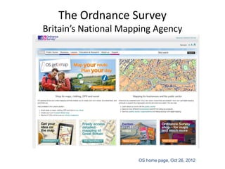
25. OS on line
• All OS products can be bought from local agents. The full
range can be seen on their web site which is the best source
of information on OS products
• Digital maps can be purchased and downloaded online if you
have suitable software to view them
http://www.ordnancesurvey.co.uk
• For educational use, OS maps are available from the Digimap
service for all students
http://digimap.edina.ac.uk/
26. Digimap (managed by the EDINA service)
• See the Gateway
page for details of
how to access
Digimap
• You must have an
ATHENS username
and password
• It will take up to 24
hours to be allowed
into Digimap for the
first time
28. Confirm your institution
Royal Agricultural College
When you revisit
the site, you will
see the College
listed here and
can just click on it
to continue
The first time you
login, type Royal
Agricultural
College here and
press continue
button
29. Confirm your ATHENS details
You must enter
your ATHENS
details every time
you use DIGIMAP
Then click
Login>>
31. Viewing and printing OS maps
Use the
Roam option
to view and
print high
quality OS
maps online
Don’t use
Carto, it
doesn’t work.
It is to be
replaced
32. Using OS maps in your own GIS
Download
raw data or
Mastermap
data to use in
your GIS
Download
boundary
data, such as
postcodes and
constituencies
for your own
applicaitons