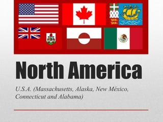
2. North America
• North America is a
subcontinent of America.
• It starts in the North with
Alaska and Greenland and
it ends with Mexico in the
south.
• Its formed by Greenland,
Saint-Pierre i Miquelon,
Bermuda, Canada, U.S.A.
and Mexico.
• Its overlooking the Pacific
ocean, the Atlantic ocean
and the Arctic ocean.
3. U.S.A
• The United States of America are formed
by 50 states, 48 continentals and 2
non-continentals.
• Its more than 9’38 millions of km².
• It has very important deserts like the Mojavi desert, mountains
like the McKinley mount and volcanos in the islands.
• In the U.S.A. there are earthquakes, tornados and hurricanes,
but there aren’t tsunamis.
6. Massachusetts , is a U.S. state in the New England region of the
northeastern United States of America. It is bordered by Rhode Island
and Connecticut to the south, New York to the west, and Vermont and
New Hampshire to the north; at its east lies the Atlantic Ocean.
10. Area
- Total 10,555 square miles
(27,336 km
2
)
- Width 183 miles (295 km)
- Length 113 miles (182 km)
- % water 25.7
- Latitude 41° 14′ North to 42° 53′ North
- Longitude 69° 56′ West to 73° 30′ West
Area
11. Symbols
Nicknames: The Bay State, The Old
Colony State, The Codfish State
Motto: Ense petit placidam sub libertate
quietem
12.
13. Alaska it is between Russia
and Canada in the northern
part of the globe
14. Area
Area of Alaska
Total 663,268 square
miles (1,717,854
km2)
Width 2,261 miles
(3,639 km)
Length 1,420 miles
(2,285 km)
% water 13’77 %
Latitude 51°20'North to
71°50'North
Longitude 130°West to
172°East
15. Rivers
• Firth River – 125
miles (201 km)
• Kongakut River –
110 miles (180 km)
• Aichilik River –
75 miles (121 km)
17. Mountains
• McKinley (6.194 m) - It’s the highest mountain of North
America
• Foraker (5.304 m)
• Hunter (4.442 m)
• Hayes (4.216 m)
• Silverthrone (4.029 m)
• Deborah (3.761 m)
• Huntington (3.730 m)
• Russell (3.557 m)
18. Oceans
• It is surrounded by two oceans, the Arctic and the Pacific
Oceans.
19. Climate
The climate presents different types,
depending on the region. The western
coast has an oceanic climate, while
the rest of the State has a continental
and Arctic climate. The climate in the
interior of Alaska is truly extreme.
Summers can accommodate up to
30 ° C, while in winter temperatures
plunge to - 20 ° C.
20. In Alaska, there are tornadoes, avalanches, gravity waves, convection, island waves, dense
fog… And there are Northern Lights, too.
The Aurora Boreal or Northern Lights are formed when the solar wind is attracted by the
Magnetic Field of the Earth.
http://www.youtube.com/watch?v=R-NkRy4y5_s
The Northern Lights
21. National Monuments
Misty Fjords National Monument
Aniakchak National Monument
Admiralty Island National Monument
Cape Krusenstern National Monument
24. The state of New Mexico is the
fifth state largest in the U.S.
There are two important
language, English and Spanish.
Spanish:28.5%
English:64.0%
The capital of New Mexico is
Santa Fe, but the largest city is
Albuquerque and the largest
metro area is the Albuquerque
Metropolitan Area.
25. New Mexico is a state in the south
Of the U.S.A.(United States of America).
Border, in the North with Colorado and Utah, in the South with Mexico, in
the East with Oklahoma and Texas and in the west with Arizona.
26. Area
Area of New Mexico
Total 121,589miles
(315,194 km2)
Width 342 miles (550
km)
Length 370 miles (595
km)
% water 0,2 %
Latitude 31° 20′ North to
37° North
Longitude 103° West to
109° 3′ West
27. Climate
The climate in New Mexico is mainly arid, dry and cold in winter.
The winter are cold and when the few times it rains it does in the form of snow in
the highlands as the city of Santa Fe. The temperature is very low, can even
reach eight below zero.
In the summer the temperature are very high, are the wettest months of the year
but at night the climate changes much and the temperature are lower and It’s
cold.
28. RIVERS
• Bravo River: He has 3.034 km long, passes by various states, for example: By
Colorado, Texas, Chihuahua, Coahuila, New Lion, Tamaulipas and New
Mexico.
• Canadian River: He has1.216 km long, passes by various states, for example:
By Colorado, Texas Oklahoma and New Mexico.
• Cimarron River: He has 1.123 km long, passes by various states, for example:
By Oklahoma, Colorado, Kansas and New Mexico.
• Gila River: He has 1.044 km long, passes by various states, for example: By
Arizona and New Mexico.
• Pecos River: He has 1.450 km long, passes by various states, for example: By
Texas and New Mexico.
Bravo River
29. Lakes
• Horse Lake: Is at 16 miles (26 km ) south of Truth.
• Concha's Lake: Is a lake artificial of 25 miles (40 km) at the Northeast of
New Mexico.
• Maloya Lake: It cover 120 acres (0,49 square km) of park 3.600 acres (15
square km).
Horse Lake
Concha´s lake
Mayola Lake
30. Mountains
The maximum height in New Mexico is of miles (4.011 meters).
This longitude is of the mountain that is called Wheeler Peak.
Belongs whit the range of Taos Mountains.
Wheeler’s coordinates is:
Latitude:36º33’25’’North.
Longitude:105º25’01’’West.
Wheeler Peak
31. Mountains
Approximate there are 40 Mountains in all the state of New Mexico.
For example, Aden Crater, Baldy Mountain, Black Mountain, Big Hatchet
Peak, Cathey Peak, Chicoma Mountain, Eagle Peak…
Black Mountain
Eagle Peak
32. Deserts
The white desert is the largest desert in the word plaster, his real name is
the White Sands.
Unlike others deserts is that the White desert have white sands
33. National monuments
Capulin Volcano National Monument
White Sands National Monument
Petroglyph National Monument
Bisti Wilderness Area
Wild Rivers Recreation Area
Route 66
Capulin Volcano
White Sands
Route 66
Bisti Wilderness
Wild Rivers
Pretroglyph
34. National Monuments
Capulin Volcano National Monument:
White Sands National Monument:
Petroglyph National Monument:
Bisti Wilderness Area:
Wild Rivers Recreation Area:
Route 66:
It is an example of an extinct cinder
cone volcano that is part of the Raton-
Clayton Volcanic Field.
Is a U.S. National Monument located
about 25 km, southwest of Alamogordo
in western Otero County and north-
eastern Doña Ana County in the state of
New Mexico.
Is a 45,000-acre (18,000 ha) wilderness
area located in San Juan County in the
U.S. state of New Mexico.
Is a short, perennial river that flows down
the north slope of Mount Wheeler in the
Sangre de Cristo Mountains, flows west past
the towns of Red River and Questa.
Also known as the Will Rogers Highway and
colloquially known as the Main Street of
America or the Mother Road, was one of the
original highways within the U.S. Highway
System.
Stretches 17 miles (27 km) along
Albuquerque, New Mexico's West Mesa,
a volcanic basalt escarpment that
dominates the city’s western horizon.
36. (First verse)
Under a sky of azure,
Where balmy breezes blow,
Kissed by the golden sunshine,
Is Nuevo Mejico.
Land of the Montezuma,
With firey hearts aglow,
Land of the deeds historic,
Is Nuevo Mejico.
(Chorus)
O, Fair New Mexico,
We love, we love you so,
Our hearts with pride o'reflow,
No matter where we go.
O, Fair New Mexico,
We love, we love you so,
The grandest state to know
New Mexico.
(Second verse)
Rugged and high sierras,
With deep canyons below,
Dotted with fertile valleys,
Is Nuevo Mejico.
Fields full of sweet alfalfa,
Richest perfumes bestow,
State of apple blossoms,
Is Nuevo Mejico.
(Chorus)
O, Fair New Mexico,
We love, we love you so,
Our hearts with pride o'reflow,
No matter where we go.
O, Fair New Mexico,
We love, we love you so,
The grandest state to know
New Mexico.
(Third verse)
Days that are full of heart-dreams,
Nights when the moon hangs low;
Beaming its benedictions,
O'er Nuevo Mejico.
Land with its bright manana,
Coming through weal and woe;
State of esperanza,
Is Nuevo Mejico.
(Chorus)
O, Fair New Mexico,
We love, we love you so,
Our hearts with pride o'reflow,
No matter where we go.
O, Fair New Mexico,
We love, we love you so,
The grandest state to know
New Mexico.
O FAIR NEW MEXICO
37.
38. Location
• Connecticut is bordered on the
south by Long Island Sound, on the
west by New York State, on the
north by Massachusetts, and on the
east by Rhode Island.
• The state capital and third largest
city is Hartford.
• There are 169 incorporated towns in
Connecticut.
39. Rivers and forests
• The main river that runs
through the state is the
Connecticut River, and
has about a thousand lakes,
but all are of small size, the
vast majority of these lakes
were formed by ancient
glaciers melted thousands
of years ago.
• Forests cover over 60% of the
state.
40. Weather
• Interior portions of
Connecticut have a humid
continental climate.
• The Connecticut shoreline
(the state's southern four
counties) has a borderline
humid subtropical climate
(sometimes statistically
meeting this climate's
criteria, sometimes not) with
seasonal extremes tempered
by proximity to the Atlantic
Ocean.
41. Temperatures
• Summer is hot and humid with average highs in New London of
81 °F ( 27 °C) and 87 °F (31 °C) in Windsor Locks. Although
summers are quite sunny in Connecticut, summer thunderstorms
often bring thunder and lighting.
• Winters are generally cold, with average temperatures ranging
from 38 °F (3 °C) in the maritime influenced southeast to 29 °F
(−2 °C) in the northwest in
January.
• The average yearly snowfall
ranges from about 50–60" in
the higher elevations of the
northern portion of the state
to only 20-25" along the
southeast coast of Connecticut.
44. Alabama
• Alabama is an U.S.A. state.
• Is in the south-eastern region of the country.
• Its subdivided in 67 counties.
• It is bordered by Tennessee to the north, Georgia to the
east, Florida and the Gulf of Mexico to the south, and
Mississippi to the west.
• The capital is Montgomery, but the largest city is
Birmingham.
45. Area
Area of Alabama
Total 52,419 square
miles (135,765
km2)
Width 190 miles (305
km)
Length 330 miles (531
km)
% water 3’20 %
Latitude 30°11′ North to
35° North
Longitude 84°53′ West to
88°28′ West
Width
Lenght
46. Natural parks
• Little River Canyon National
Preserve near Fort Payne
• Russell Cave National Monument
in Bridgeport.
47. Weather and temperature
• The average annual
temperature is about 18
Cº, with 26 Cº in July and
7 Cº in January.
• The annual precipitation
is about 1420 ml for m².
• Because Alabama’s
position, is exposed to
hurricanes.
48. Rivers and lakes
• The main systems are the Warrior-Tombidge
formed by the rivers Coos, Tallapoosa,
Alabama and Mobile.
• In Alabama there are also important rivers as
the Tennessee and the Chattahoochee.
• Alabama’s hasn’t got natural lakes, but there
are artificial lakes, like the Guntersville,
Wheeler and Wilson (River Tennesse), Weiss
(River Coos) and Walter F. George reserve
(River Chattahoochee).
49. Mountains
• The principal
mountains are the
Appalachian
mountains.
• There are plateaus,
like Piedmont plateau
and Cumberland
plateau.
• There are also a strip
of very fertile soil
called black Belt.
Appalachian mountains
50. Important natural
disasters
• Hurricanes are the
commonest natural
disasters.
• Hurricanes are several
storms that are being
formed in the sea and
often cause winds with
speeds exceeding 120
km/h.